Date: March 12, 2024
Location/Route Map: Grande Cache
Elevation: 1987 m
Elevation Gain: 920 m
Distance: 10.3 km
Round Trip Time: 2 hrs
Rating: Class 1 - On-trail hike
Notes: If, like me, you think you're too cool for microspikes, expect to have your life flash before your eyes at least a couple times as you slip-slide your way down steep, mud n' ice slopes in early Spring 😂. Otherwise this is a no brainer, easy hike up a cut-line.
GPS Track: Download
The 2023/24 winter season has definitely been a weird one! It's felt like Spring on at least three separate occasions before temperatures plummet for another few weeks, and with the snow repeatedly starting to melt away, it's never felt like we've really had a winter at all! Thanks to this yo-yo weather, I've already spent a lot of time thinking ahead to summer and getting into mountain running this year. Unfortunately I live in YEG and hate running in the stinky, polluted city air, so there isn't really any way for me to start training. When my parents where going to check out some properties in Grande Cache though, I saw an opportunity, and was happy to tag along and see how much I could punish myself, running up one of the mountains in the area with no prior training, not having gone running in many years (well, aside from that one random 8 km run I did a few months ago that had me limping around for a week 😂)...


Being the total newb that I am, I obviously pushed myself way too hard out of the gates and after a few climbs I was doubled over against a tree, coughing away and gasping for air, wondering what I had gotten myself into...A couple minutes later, however, I had semi-recovered and continued on - this time at a much more controlled pace.
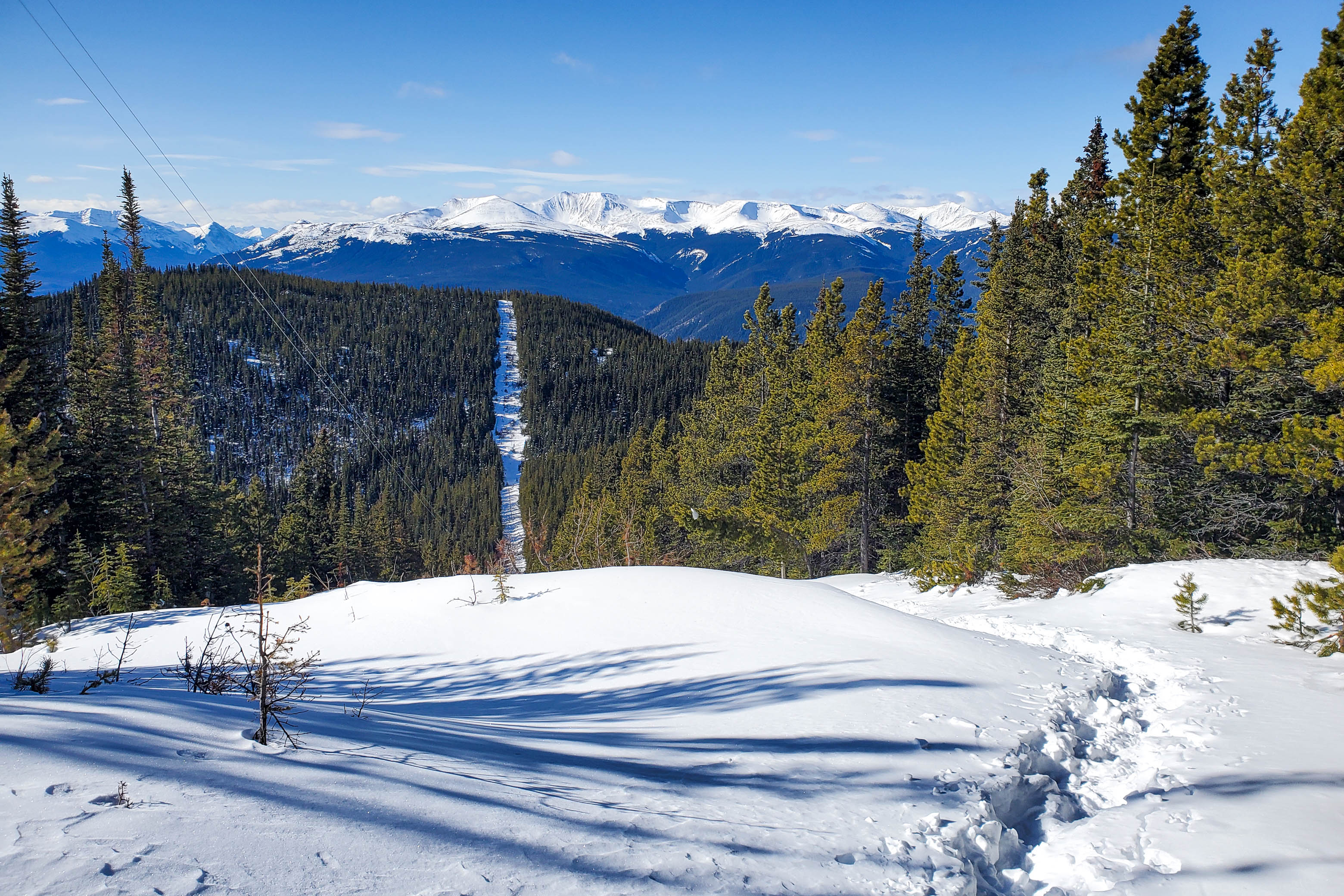
To be completely honest, this "more controlled pace" involved a lot of power hiking and not a lot of actual running, but I was still making good progress and soon intercepted a major cut-line leading steeply up the mountain. (This cut-line can also be followed right from the start if you so choose.) You wouldn't expect it, but running (fast-hiking) up this cut-line actually proved to be a little bit of a challenge...With any sunny section being a gooey, slippery, muddy mess and any shaded section being slick with ice, let's just say that staying on my two feet and not flat on my face wasn't all that easy! But hey, this was much much better than postholing in knee-deep snow, so I wasn't complaining!


I couldn't believe how warm it was as I powered my way up the very sunny (and therefore very muddy!) cut-line and was really starting to enjoy myself as I started to find my groove in the beautiful spring-like weather. Birds were chirping happily from the tree tops while a light breeze kept me from overheating and I started wondering why I'd avoided running for so many years...
Just as I thought I was nearing the summit, I instead arrived at the "false summit" and disheartingly gazed across a significant dip separating me from the telecommunication towers standing out atop Grande Mountain's very flat summit plateau. Instead of giving myself a chance to get discouraged, I immediately continued jogging, losing 70 m of elevation to the bottom of the dip in no time and starting the final ~ 240 m push to the summit on the opposite side.


About halfway up this final steep climb, out of breath with legs like jello, I was reminded why I've avoided this sport for so long...Running is hard 😂! Luckily for me, it would soon become a little bit less so as the slope eased off significantly and I approached the summit.

It's impossible to tell what the true highest point of Grande's extensive summit field is (yeah, it's literally a field) and I spent a few minutes aimlessly running around from high(ish) point to high(ish) point only to look back and find that the one I'd just came from now looked ever-so-slightly higher! Eventually, when I'd convinced myself that there was absolutely no way that I hadn't touched the summit, I headed back to the communication towers and discovered a "summit mailbox" with a register inside.
Later, when exploring the town, I learned that this is part of Grande Cache's Passport to the Peaks program. 21 different peaks surrounding the town each hold one of these unique mailboxes, complete with a stamp inside which can be used to stamp your "Passport" (purchased at the visitor centre for $60). Some peaks are easy and accessible, like Grande Mountian here, while others are deep in the Wilmore Wilderness and require multiple day expeditions. Upon completing all 21 you are rewarded with a distinctive pin and get your name on a plaque.

Standing around, outside the shelter of the trees, the warm sun was no longer strong enough to counteract the effects of a bitter wind and I was soon running for cover back in the cut-line...And let me tell you, running down a mountain is waaaay easier than running up it! I had to be careful not to get too carried away as I slip-slided my way down the mud and slush fest that was the now completely sun exposed cut-line, but once I left the cut-line I was having an absolute blast, feeling almost weightless as I flew through the lower forest, once again wondering why I've avoided a sport that can cause this much joy 😂.


On a different note, while I don't think I'll be coughing up 60 whole dollars(!) for a passport book, it was cool to learn about this local program, and I'd be lying if I told you it hasn't added a few more peaks to my never-ending list...1 down, 20 to go! 😉
Photo Gallery


Disclaimer