
Date: June 24, 2021
Location/Route Map: Banff
Elevation: 2554 m
Elevation Gain: 1155 m (+ 530 m for all of our "extensions" - round trip)
Distance: 9.2 km
Rating: Class 3 - Moderate
Notes: A few steps of moderate scrambling on solid rock add interest to the longer south ridge. Norquay can also be ascended more directly via the ski resort, but this route requires some difficult scrambling and a steep snow couloir on Norquay's east face might put a halt to early season ascents without the right equipment.
GPS Track: Download
Mount Norquay is overshadowed by the loftier Cascade Mountain to the east and Mount Cory to the west, and although Norquay isn't one of the famous Banff scrambles, it's quite an enjoyable outing itself and doesn't deserve to be overlooked! After just finishing highschool, and the last couple days being reserved for (drive thru...😑) grad, I was immediately off to the mountains, with celebration plans of my own!

Mount Norquay Route Map (see link in desciption - or click here - for interactive version).

After missing the gate granting access to Norquay's south ridge, we were forced to continue down the highway until we could loop back around and try again. When we finally figured out where to start (lol), we were quickly gaining elevation on a faint trail up the ridge, with moody views opening up behind us! Mount Rundle rises center, in the low, scattered clouds!

The low clouds offered some unique views...but they weren't very nice, and also tried to soak us! Luckily we were still below the tree line, and took shelter as we waited for the rain to die down.

Luckily it did, and we were back on our way, accompanied by these amazing views of Mount Cory (center) and the multiple impressive peaks of Mount Edith (right)!

Following a good scree trail past the treeline.

So many layers of clouds!

Looking ahead, as we prepare to enter the clouds!

Not much to see inside!

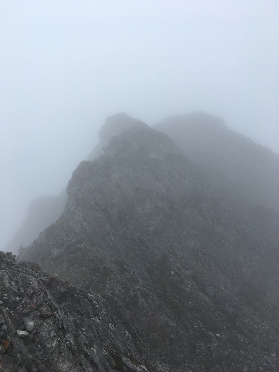
Continuing along Norquay's south ridge (we think...). Photo credit: Dad

Although we couldn't see where we were going, the ridge was quite enjoyable, with short sections of scrambling on solid rock to keep us interested!

Wonder where that goes...
Looking back at a short downclimb in the ridge.

At times, we had to drop off the crest, on scree to climber's left.

My dad checks his GPS to make sure we haven't wandered off track. Even with the cloudy situation we were in, route finding was generally very straightforward, simply following along the ridge crest.

These conditions are so spooky! Photo credit: Dad

Approaching the summit!...Although we didn't know it yet.

Summit selfie!...Good thing we have GPS, or we might have just kept walking ;)!

Comfortable? My dad built a shelter and took a nap while we waited, hoping for the clouds to dissipate.

Everytime I spotted any sort of movement of the clouds, I jumped up, desperate for some views! Here, the clouds parted slightly to reveal the valley below! It may not look like much, but this was incredible after being stuck inside clouds for hours!

Our first view back down the south ridge, as the clouds continue to rise!

Mount Norquay's East Peak is revealed!

Summit pano! Mount Norquay kinda forms a horseshoe, with the summit near the curve at the end, and two ridges branching off towards the highway. Norquay Ski Resort lies on the other side of the left-hand ridge.

He's still chillin'.

Taking in a unique view, from the summit of Mount Norquay! Photo credit: Dad

Tired of sitting around on the summit, but still hoping the clouds might dissipate even more, we decided to explore down the ridge to the north.

A short, moderate downclimb, leads down the north side of the summit!

Following down the (at times exposed) ridge. Photo credit: Dad

Just a slight drop off the east side... Photo credit: Dad

A brief opening towards Mount Edith's lower slopes!

Looking back up the ridge, engulfed by clouds again.

Our brief adventure down the north ridge soon came to an end, as we realized that we weren't really going anywhere exept down the mountain. Rather than follow this ridge to the valley below, only to have to reascend it on return, my dad had the idea of exploring towards Norquay's East Peak while in the area!

Heading back up the ridge, towards the summit.

Just below the summit block we branched off to the left. Although the terrain on this east side of Norquay consists mainly of steep rock faces, a lucky scree bench traverses through (to the south), granting access to the tame ridge that leads down to the col.

Unfortunately it couldn't all be that easy, and we had to traverse this steep, snow gully along the way...Extreme caution was crucial here, as we didn't have any traction gear, and a slip would likely be fatal!

The approximate route of our extension, down to the col and up to the east peak (left) as well as another slightly lower peak (center) down the ridge!

Looking up at the sheer drop down from the north ridge, which we explored.

At the col, looking back. We thought we might get cliffed out right before the col, but luckily it was just steep scree, rather than a sheer rock face!

Norquay's south ridge (our ascent route).

Typical terrain leading up to the east peak.

Some slabby rock near the top. Although the slope leading up to the east peak looks quite steep from afar, it turns out to be surprisingly simple, and we were standing on the summit in no time!

Looking back to Norquay's summit (center), and our approximate route down to the col.

My dad stands proudly with the summit cairn on Norquay's East Peak!

Gazing back up to Mount Norquay's true summit, which is surprisingly only 100m higher than this peak! Photo credit: Dad

Looking over to the next peak down the ridge. Looks pretty close...Why not hit that one too!?

The closer we got, the easier it looked! Even looks like a full on trail leading up it...

Apart from a couple sections of moderate downclimbing, reaching this extra peak was quite straightforward, and offered this unique view down to the ski resort! Stoney Lookout Mountain is the treed hump to the right.

Hey! It kinda looks like the clouds are forming a heart window! ♡

Cascade Mountain's rarely seen, tamer backside is revealed for the first time!

My dad and I, with Norquay Ski Resort a long ways below!

Wow, those clouds sure move in quick!

Looks like this is where the via ferrata tours go...I guess that's why there was such a good trail for the final short section!

My dad (a tiny speck on the wall) traverses a narrow crack, as he reascends one of the moderate sections, back up to the east peak.

Ascending the last stretch, before heading back down to the col. Photo credit: Dad

Retracing our steps down the ridge, with Norquay's intimidating summit cliffs looming beyond! You'd never guess that an easy route leads through from this view!

Looking down the lush, densely forested valley to the north!

Approaching Norquay's daunting summit cliffs.

Down to the south of the col, lies a valley between Norquay's parallel ridges. We considered this as an alternate descent route, but ultimately decided we didn't feel like walking along the highway to end our day.

This angle does a better job of representing the exposure on the snow gully! NO SLIP ZONE!!

Not to mention the steep downclimb, just to get onto it! Photo credit: Dad

A good chunk of Mount Edith has been revealed, as we reach the ridge.

Reascending the summit block. Photo credit: Dad

More to see on the summit this time! Mount Louis is the sharp, impressive peak to the right of Mount Edith!

The sun finally breaks through the thick clouds, as we look back down to the east peak from the true summit!

Following back down the (now visible!) south ridge. Photo credit: Dad

I guess it was worth gaining the extra elevation to return the way we came...because I seriously feel like I've never been here before!!

I kind of remember this... Photo credit: Dad

Looking back.

Who knew this ridge was so scenic!?...not me!

Looking down to Sulphur Mountain, with its own mini cloud formation, as we continue down what feels like unexplored territory!

Comprehensive view of all the peaks we visited!

Mounts Inglismaldie and Girouard make their first appearance in the scattered clouds (distant-center)! Both are rarely visited due to their long, rugged approaches, but for some reason that draws me to them even more!!

Mount Rundle rises above Vermilion Lakes, still covered by cloud, as it has been all day!

The clouds lift briefly, to uncover snowy Mount Cory towering beyond Edith's slabby form!

One last look up a very enjoyable ridge, before starting the not-so-enjoyable grind through the trees, down to the highway.

Ooh, rainbow!
Disclaimer