Date: August 29/30, 2023
Location/Route Map:Siffleur Wilderness Elevation: 3063 m
Elevation Gain: 1600 m
Distance: 40 km (from camp in Loudon's southern hanging valley, to summit, and exit to Siffleur Falls Staging Area)
Rating: Class 2 - Easy
Notes: If you can get to the base of this mountain, then you should have no trouble reaching its summit. It's the approach rather than the ascent that's the crux on this one! This route also requires a ford of the Siffleur River, which could present some problems earlier in the season.
GPS Track:Download
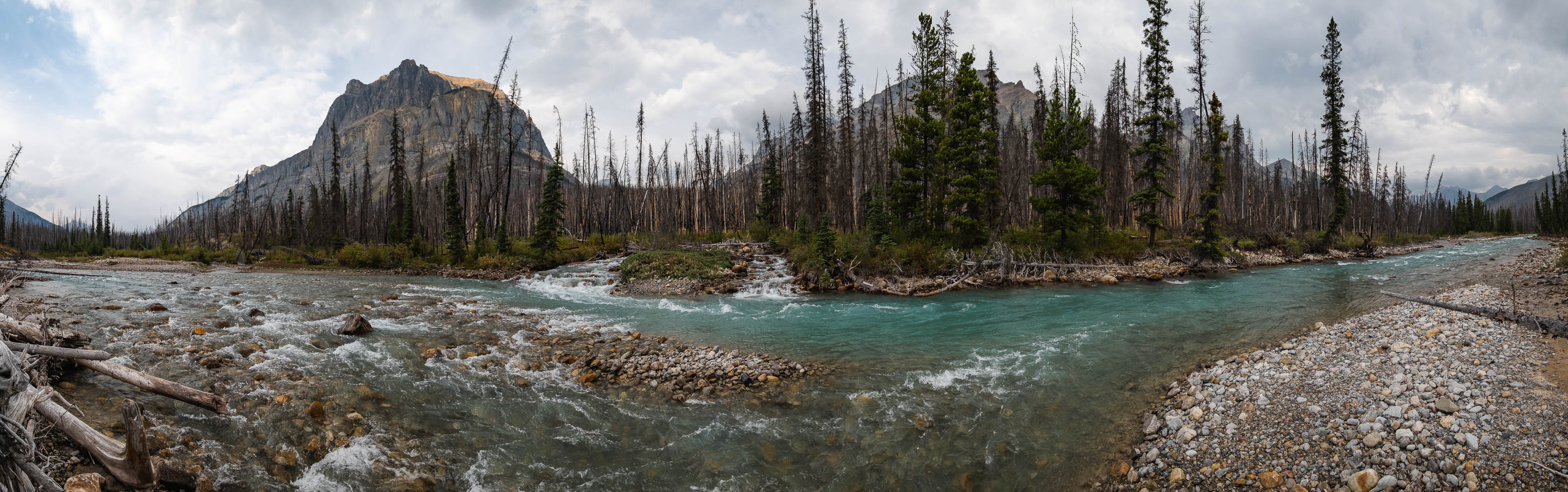
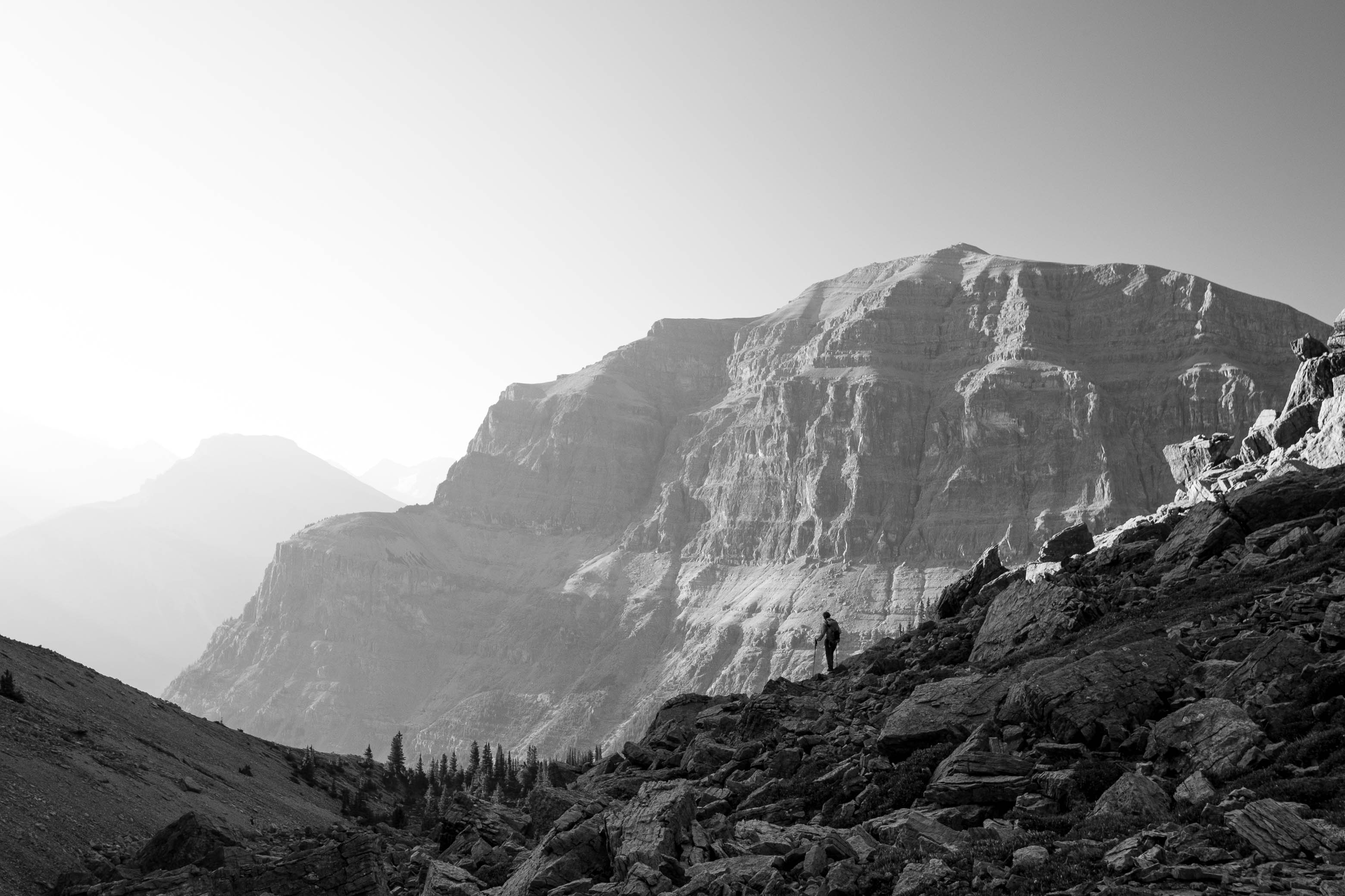
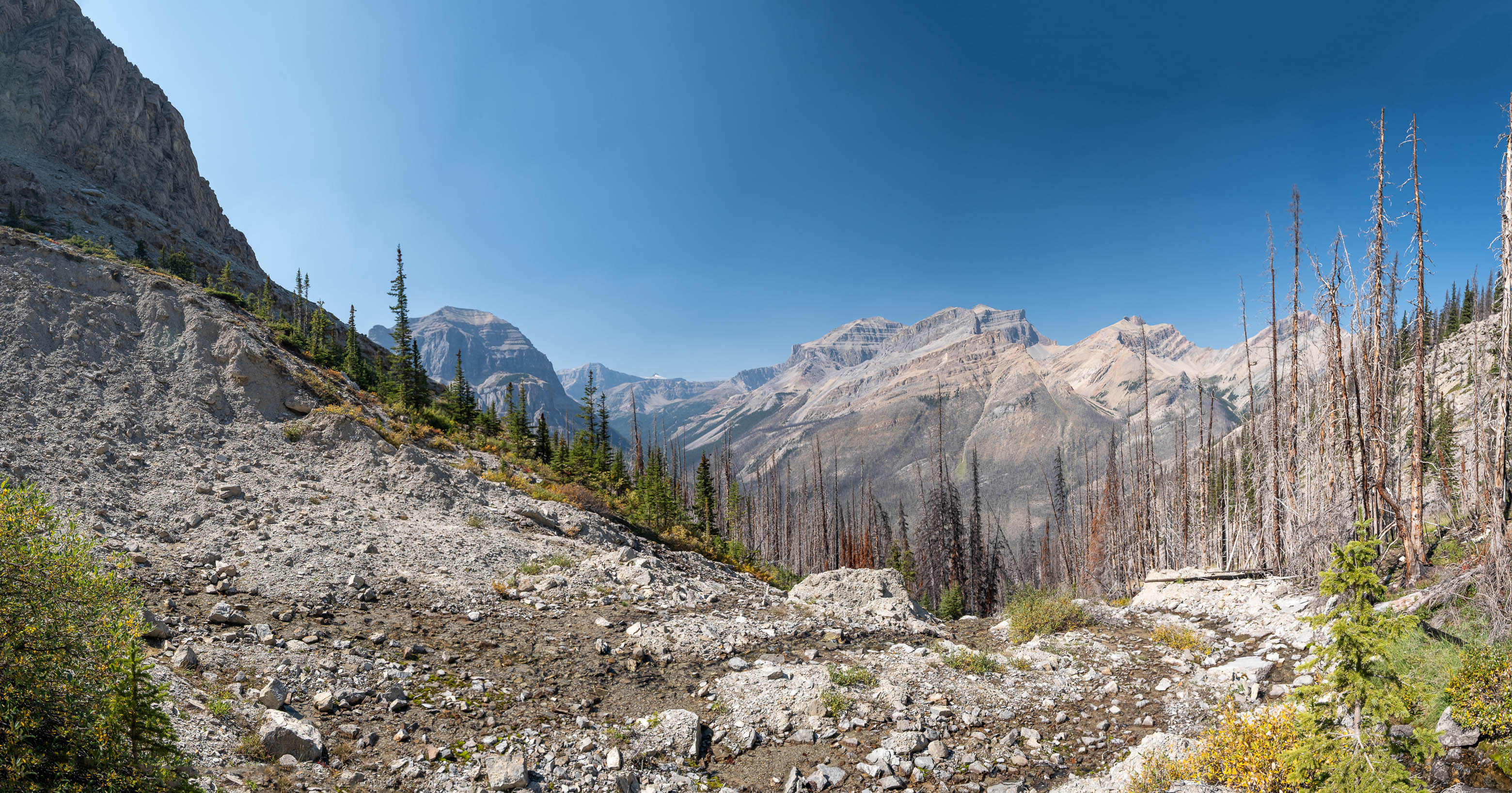
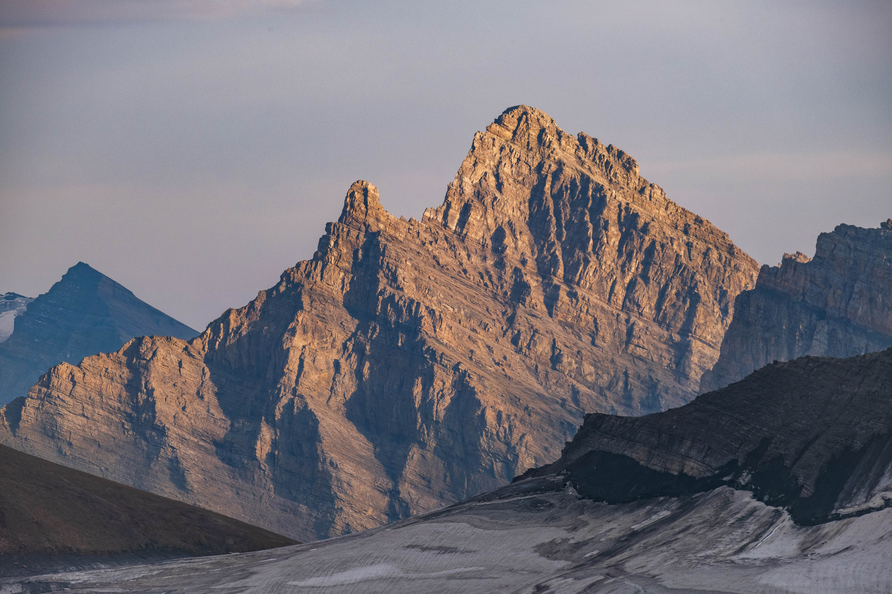
Prior to planning a trip up the Siffleur River - with sights set on climbing Siffleur Mountain and Mount Loudon - I had honestly never heard of Mount Fuhrer before. Sitting deep in the heart of the Siffleur Wilderness Area and rising to 3063 meters, Fuhrer isnβt quite tall enough to stand out strictly from a numbers perspective, and when viewed from surrounding peaks is almost always overshadowed by the much loftier Abstruse Peak (Mount Perren) - rising to nearly 3300 meters, immediately up a southern connecting ridge. With that being said, Fuhrer definitely deserves more attention than it gets! It's a mighty impressive peak in its own right, with that imposing NE face looming over the innocent scree mounds that are Mount Heinrich and Erudite Peak, but what really sold me on Mount Fuhrer was its location, sitting directly across the valley from my two main objectives (i.e. It would've been silly not to tag it!) and overlooking the four beautiful Fuhrer Lakes, providing a unique birds-eye view of this seldomly visited area.
Overview map of our trip deep up the Siffleur River, with ascents of Siffleur Mountain, Mount Loudon, and Mount Fuhrer (see link in description - or click here - for interactive version).
Detail map of our trip deep up the Siffleur River.
Day 3 route map - Camp in Loudon's southern hanging valley, to summit of Mount Fuhrer, to camp in Fuhrer's southern hanging valley.
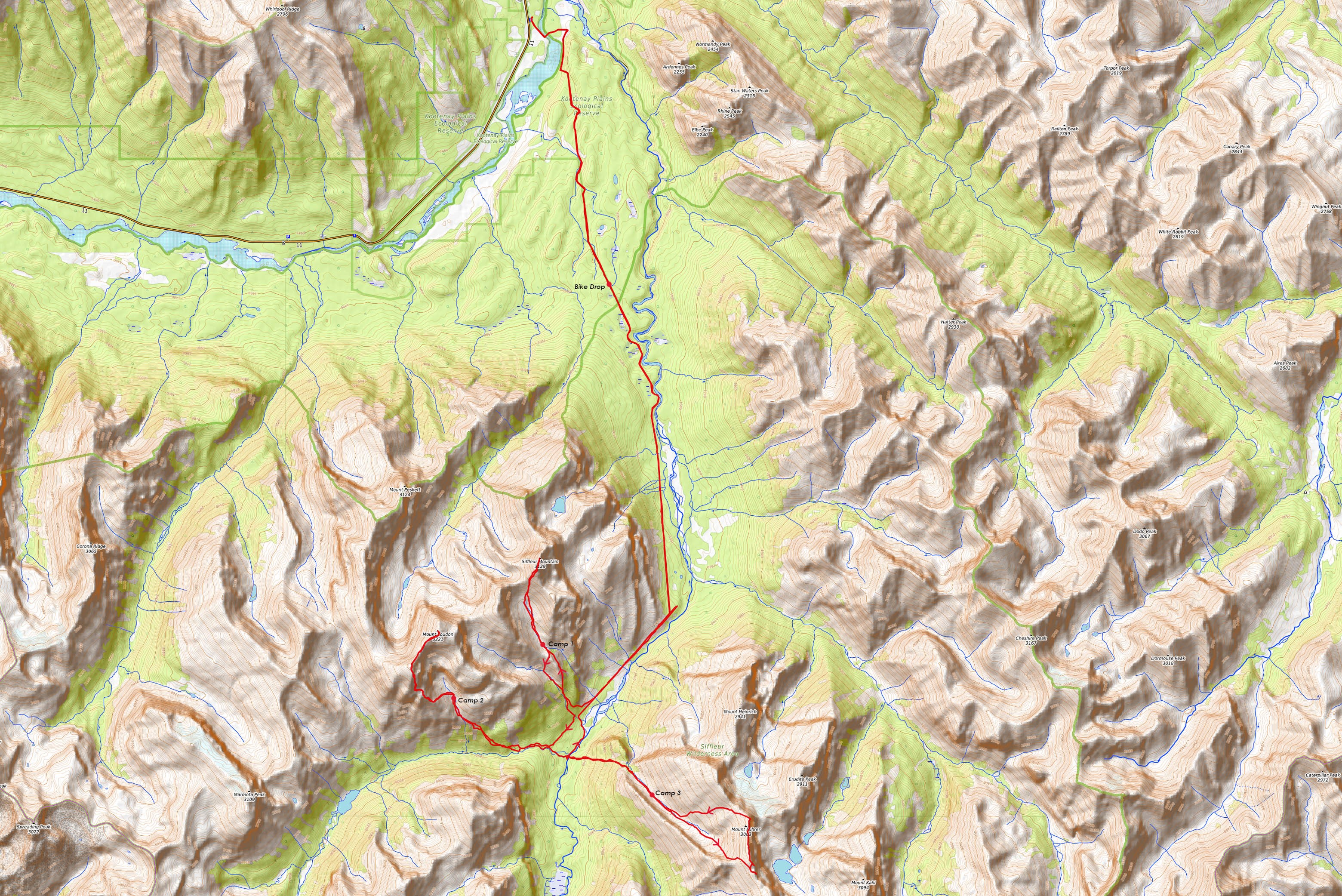
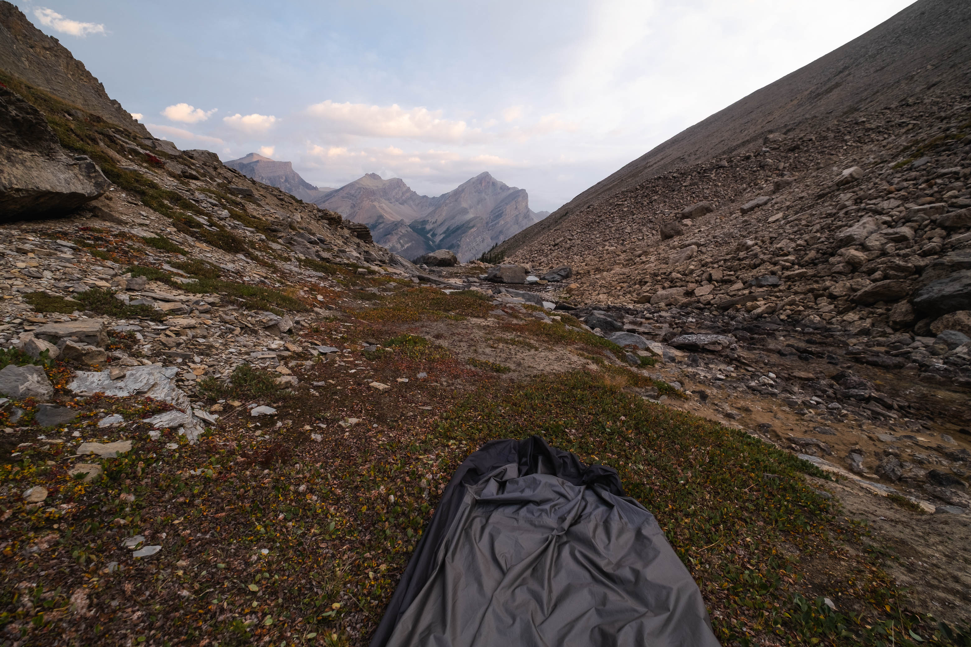
We were feeling just a tad exhausted after successfully reaching the summits of Siffleur Mountain and Mount Loudon on the first two days of our trip up the Siffleur River and slept pretty darn good during our second night in the bivy bags. I didn't bother setting an alarm after stumbling into our camp in Loudon's southern hanging valley in the dark the previous evening and was more than happy to let the sun naturally wake us up around 08:00.
Navigating our way back through Loudon's massive boulder field as we set off from camp on day three.
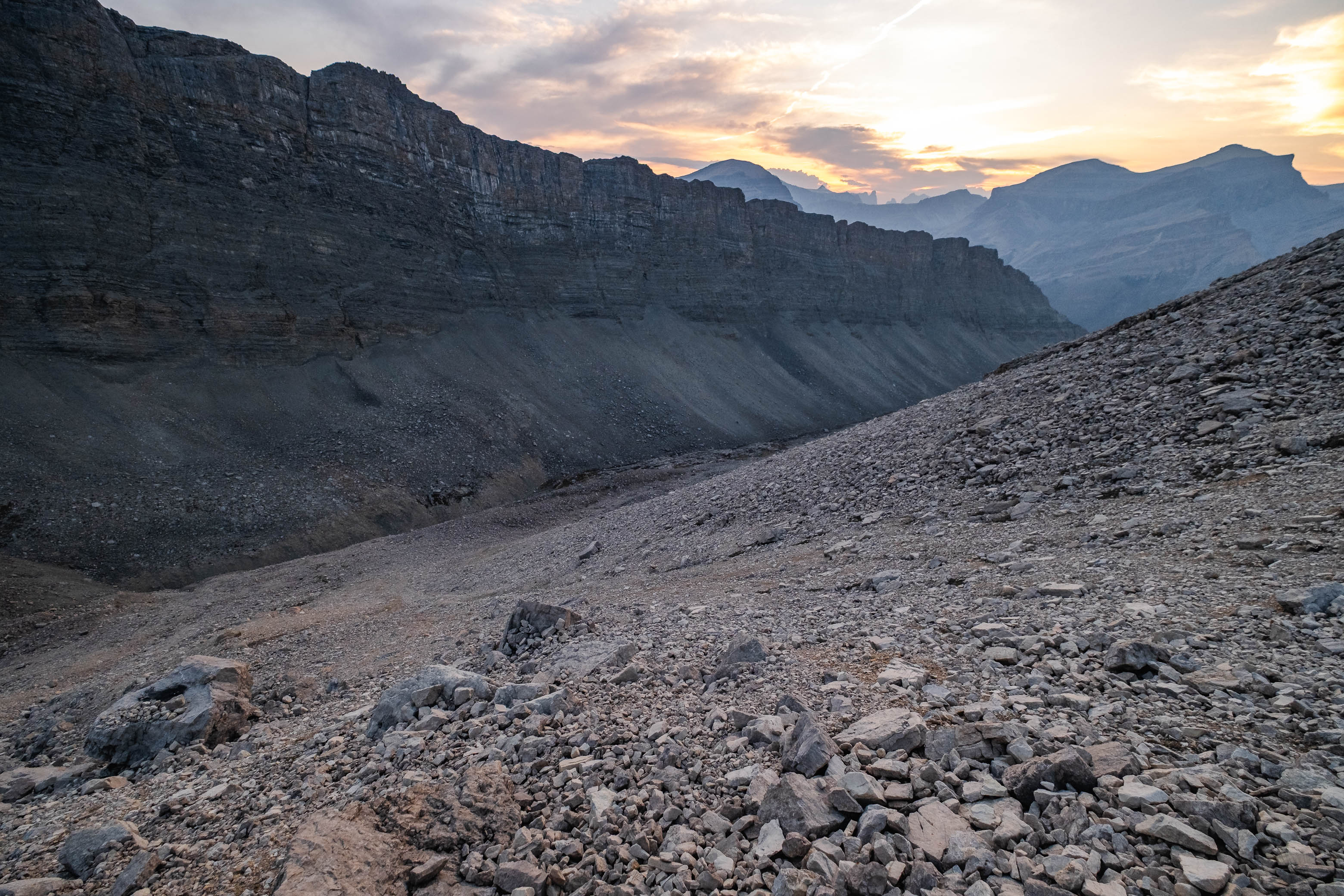
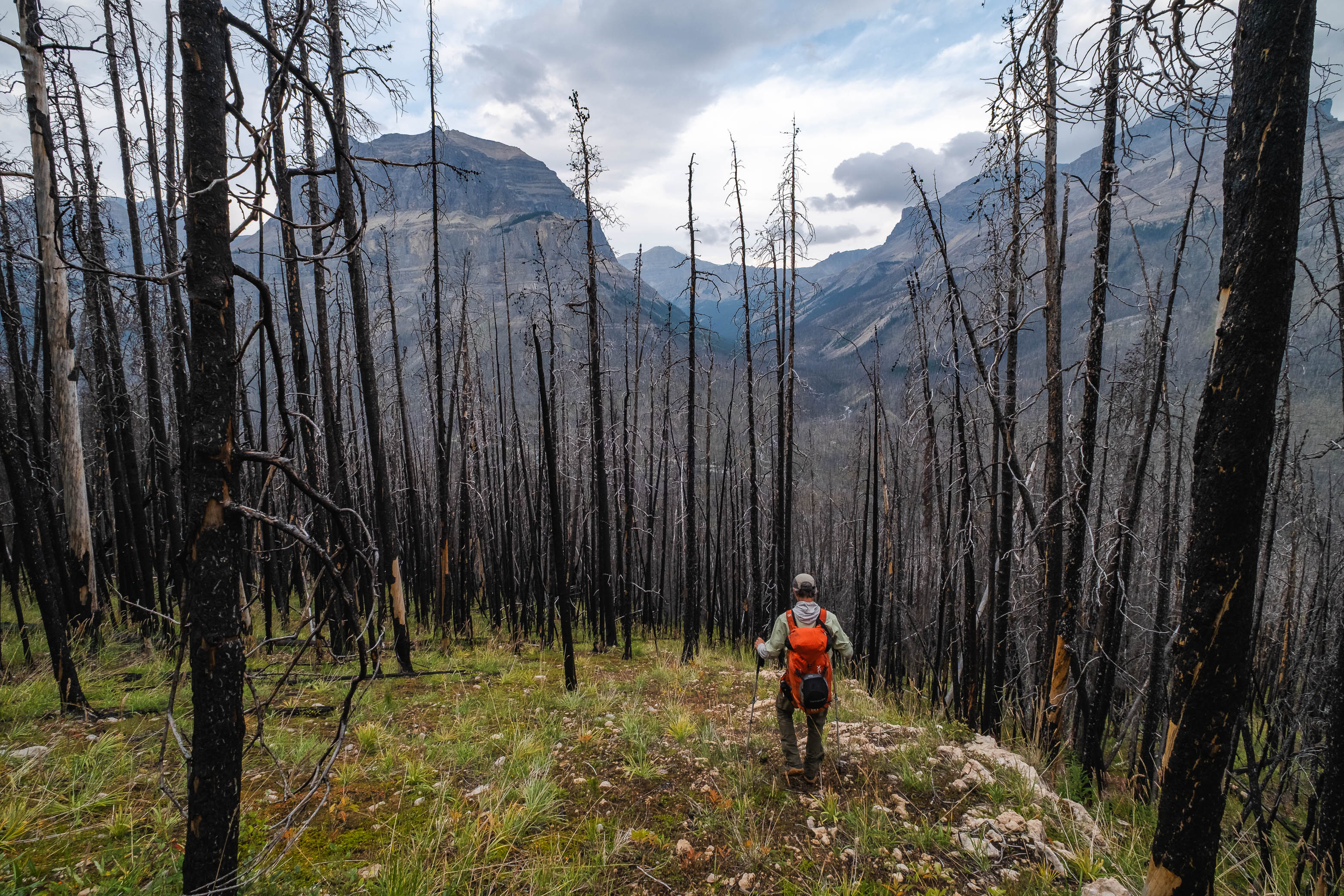
Half an hour later, we were packed up and exiting the valley through the big boulder field, enjoying our third straight gorgeous summer morning in this remote corner of the Rockies.
An outlier of Quill towers over Porcupine Creek, with Noyes, Iceface, and Marmota rising over Porcupine Lake (distant right) as we exit Loudon's hanging valley.
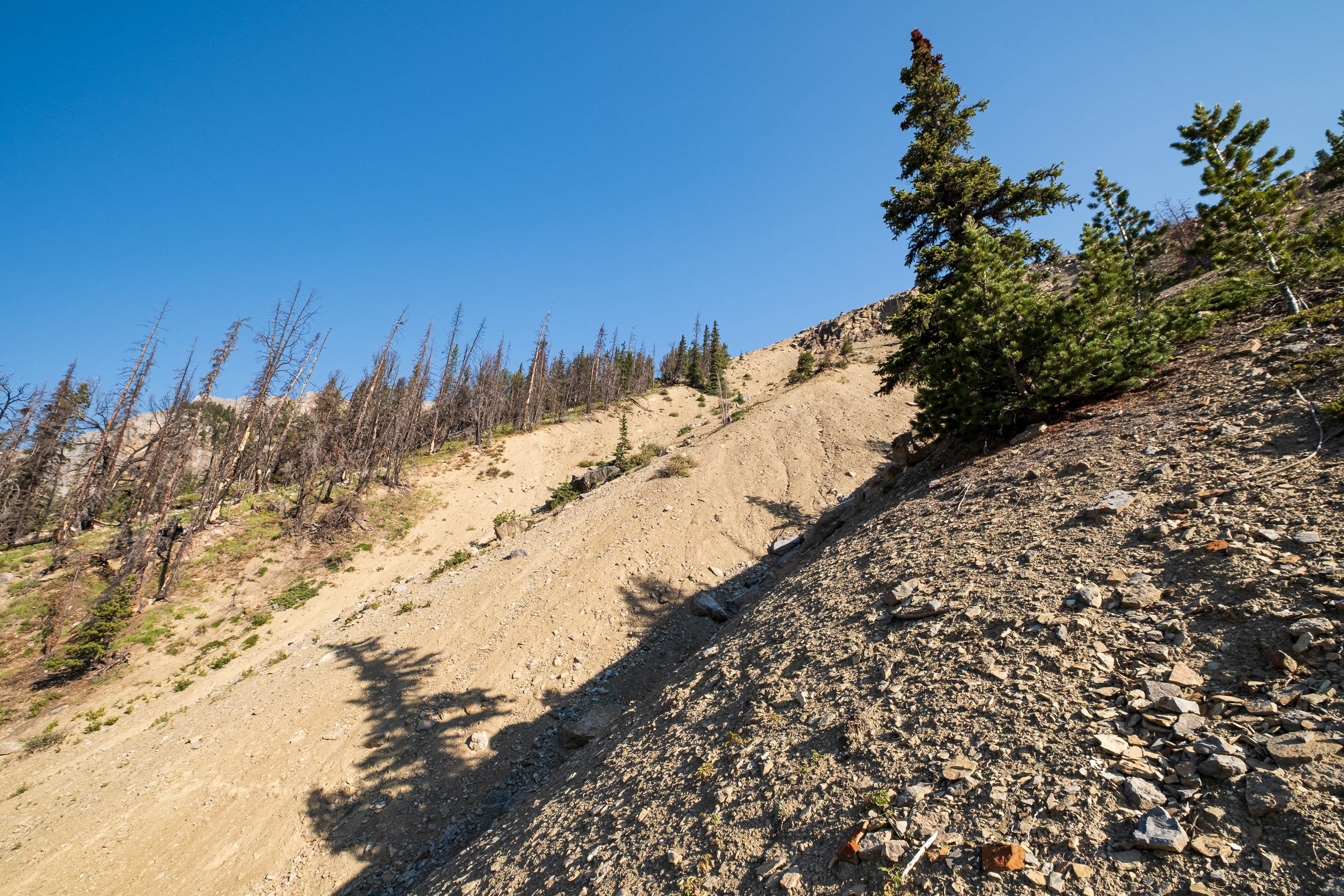
For some silly reason, as we started our descent back down to Porcupine Creek, we once again chose to make a highline traverse of the steep, hard-packed, cheese-grater slope (that we were "forced" to cross during our ascent the previous afternoon), rather than first descending in the burn and crossing the drainage when it eventually narrowed. I guess our logic was that we knew for certain that this route "worked" while the alternative was a complete unknown, but I was soon questioning this logic...
Ah yes, the long, concrete traverse...What a perfect way to start the morning! 😂
Descending a lightly vegetated rib until a goat "trail" bailed us out and granted us access to the opposite side of the gully.
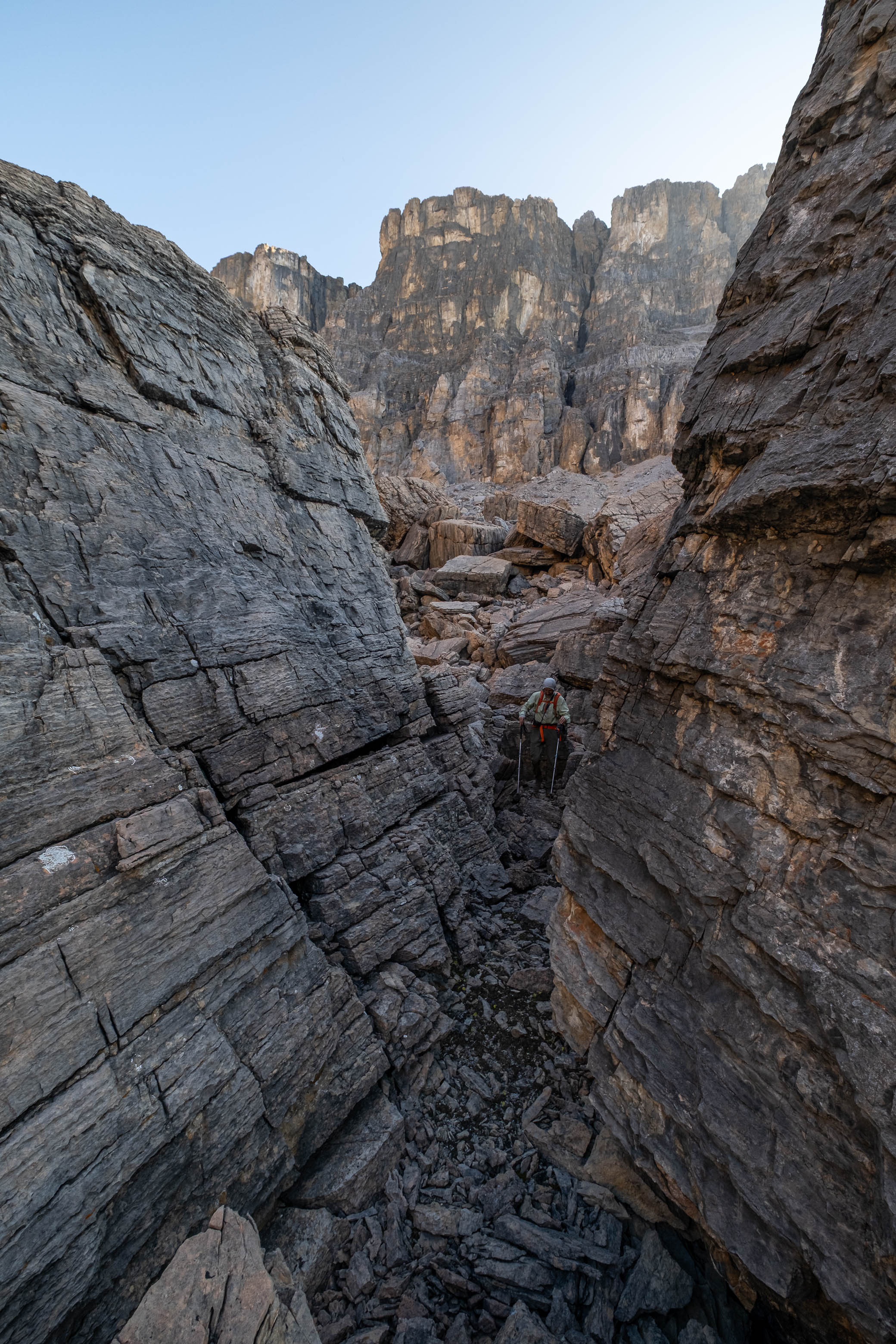
I don't know if we somehow ended up on a steeper line, or if it just felt sketchier facing downhill instead of uphill, but we eventually reached a point where we simply couldn't commit to traversing the terrain that lay before us and were forced to bail down a lightly vegetated rib, hoping that we'd find an easier crossing below.
Lucky for us, we did in the form of a goat "trail", its small hoof prints hammered into the slope, providing us with footholds to balance the edges of our boots on and an escape to Loudon's southern burnt slopes. The remainder of our angling descent in the burn went without difficulties and it wasn't until we neared Porcupine Creek that we consciously strayed from our ascent line, staying high on a raised bench, to skier's left, to hopefully avoid some of the gnarly travel conditions along the creek that we encountered the previous day.
Easily retracing our steps down the open burn on Loudon's southern slopes.
Avoiding the nasty deadfall along the creek by staying high to skier's left.
Looking back up Porcupine Creek from the raised bench. This is the route you'll want to take if you value your sanity!
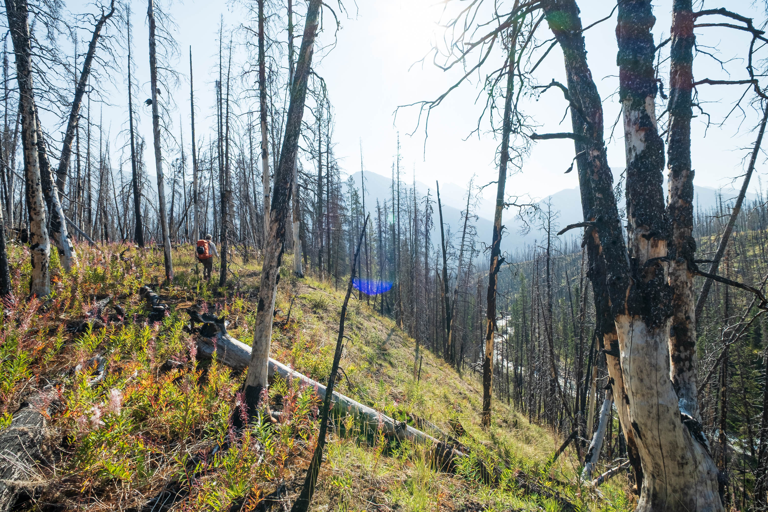
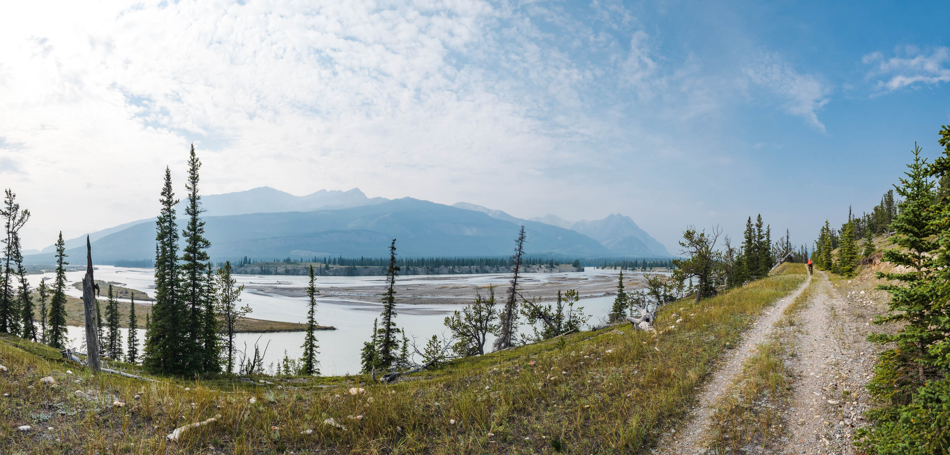
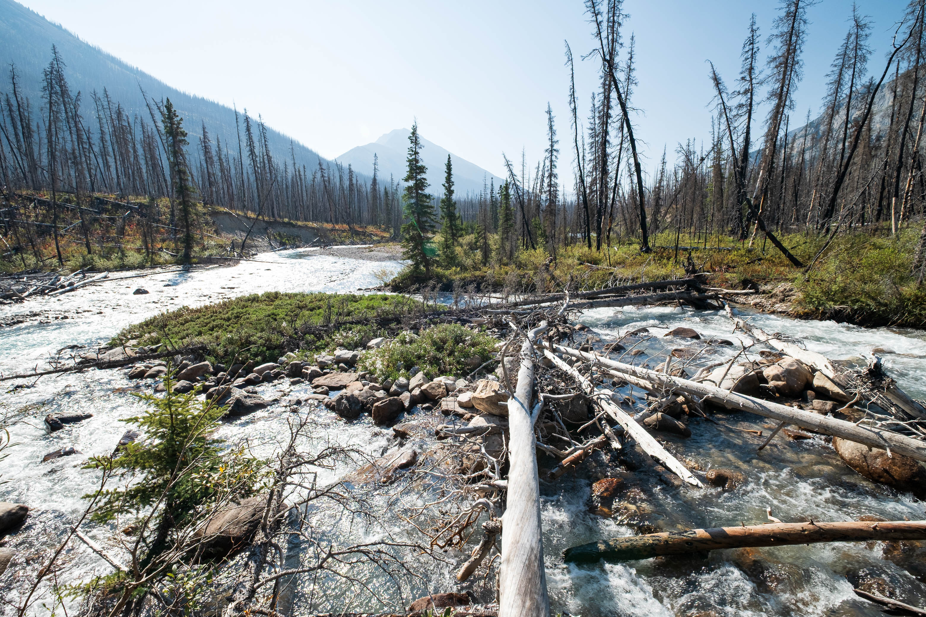
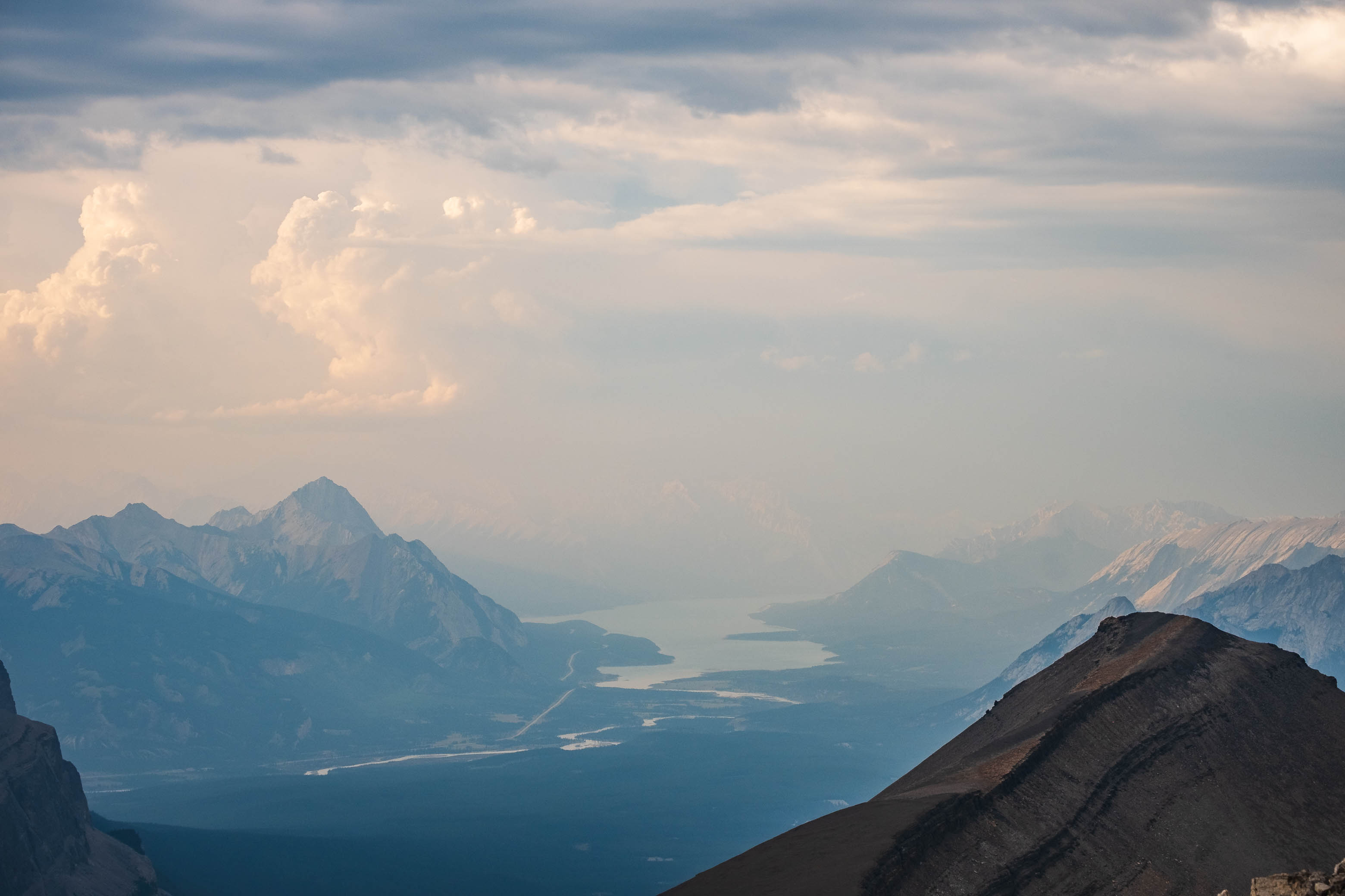
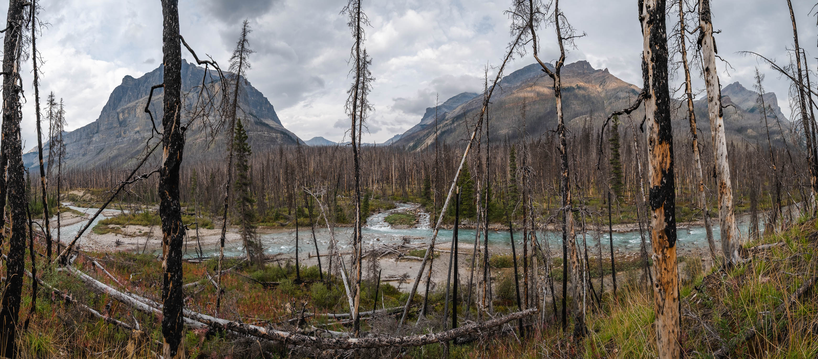
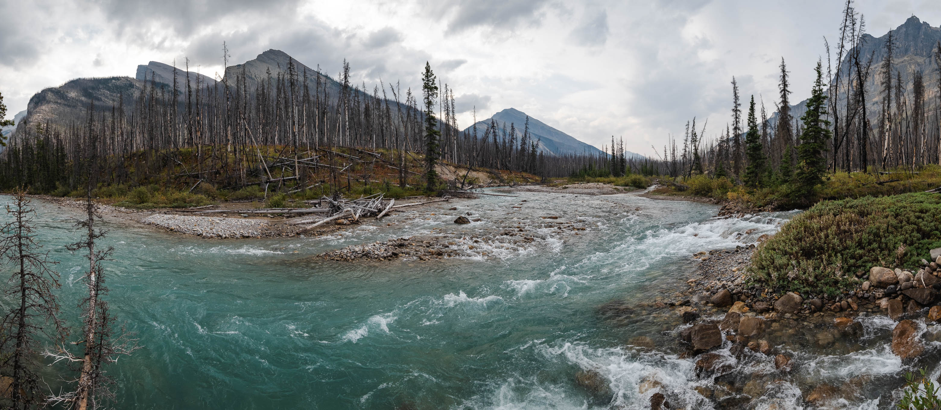
This worked surprisingly well (you'll definitely want to follow our descent track on this one!), and we were soon crossing to the east side of the Siffleur River Trail (cutline), following Porcupine Creek downstream until we arrived at the edge of the Siffleur River.
A fast flowing Porcupine Creek leads the way down to the Siffleur River.
A couple fallen trees provided convenient "bridges" for us to cross to the south side of Porcupine Creek.
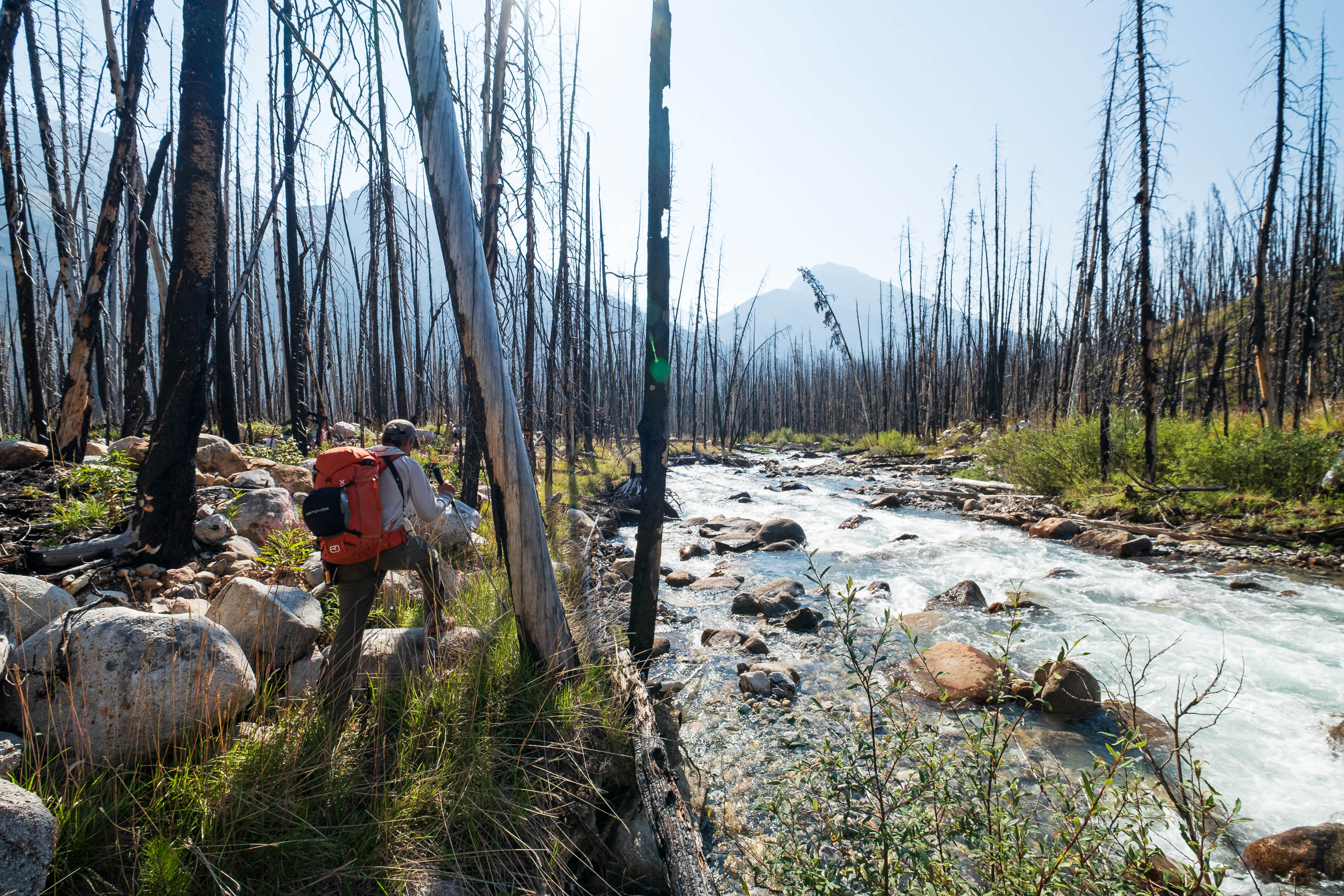
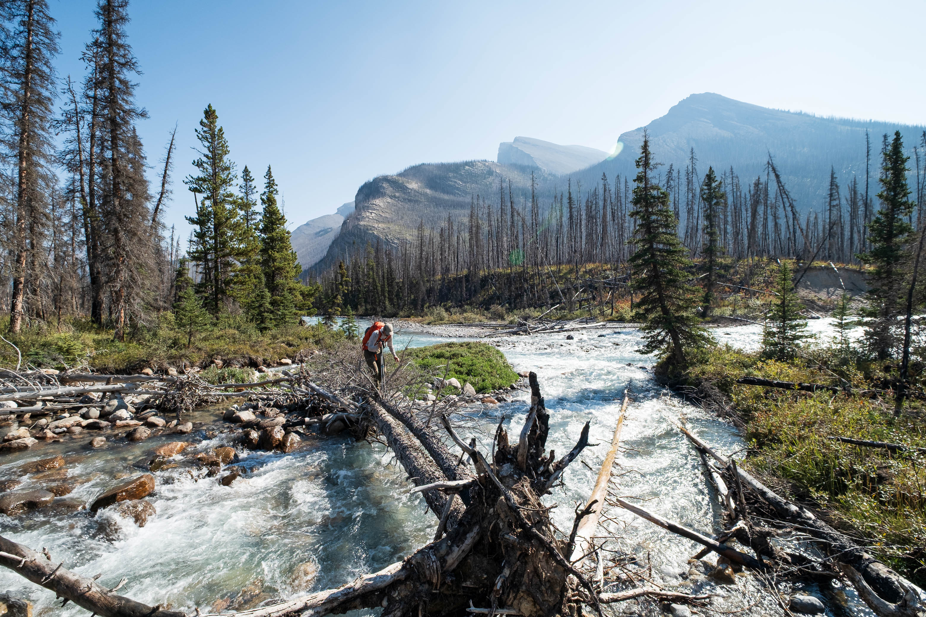
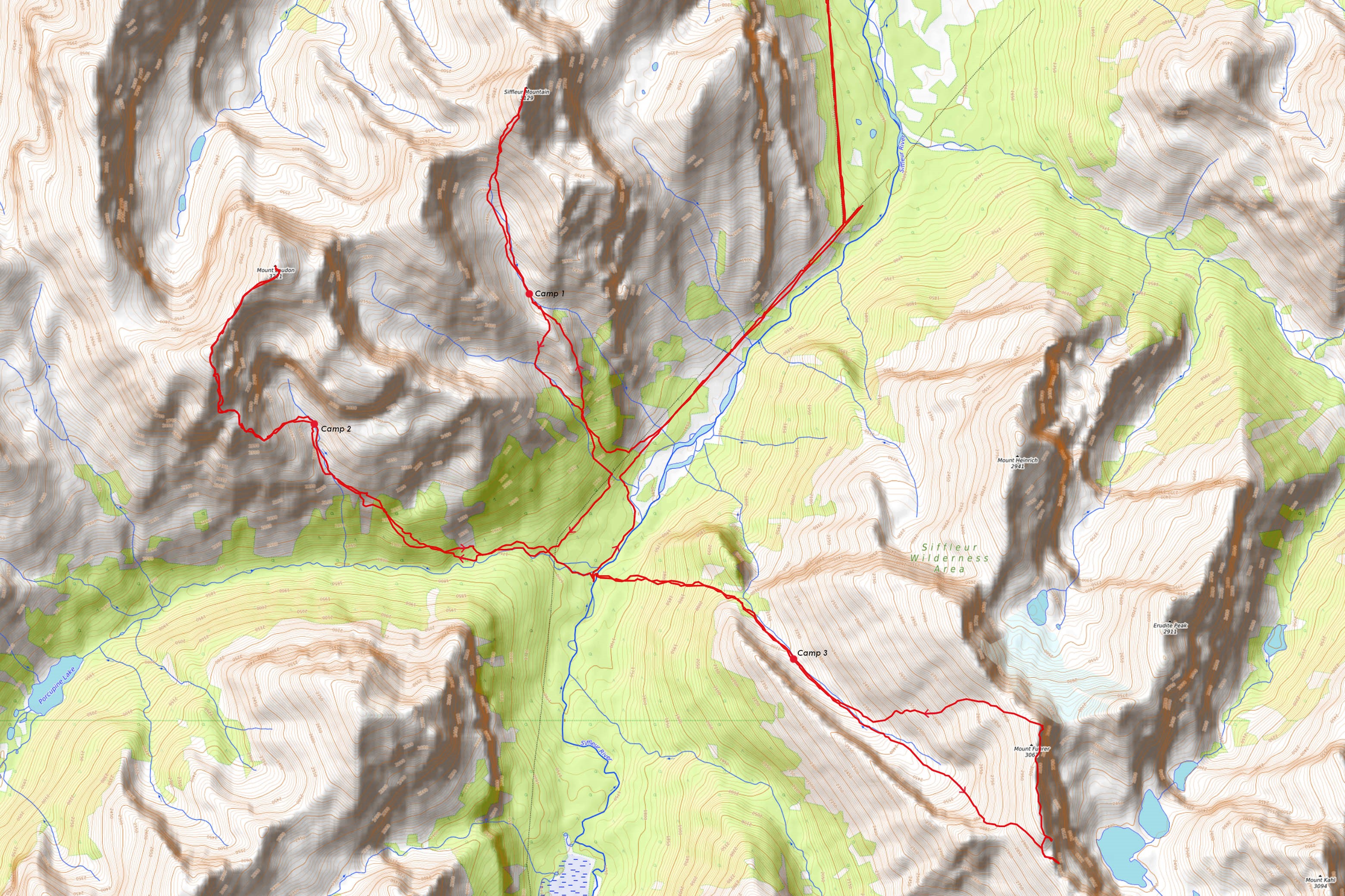
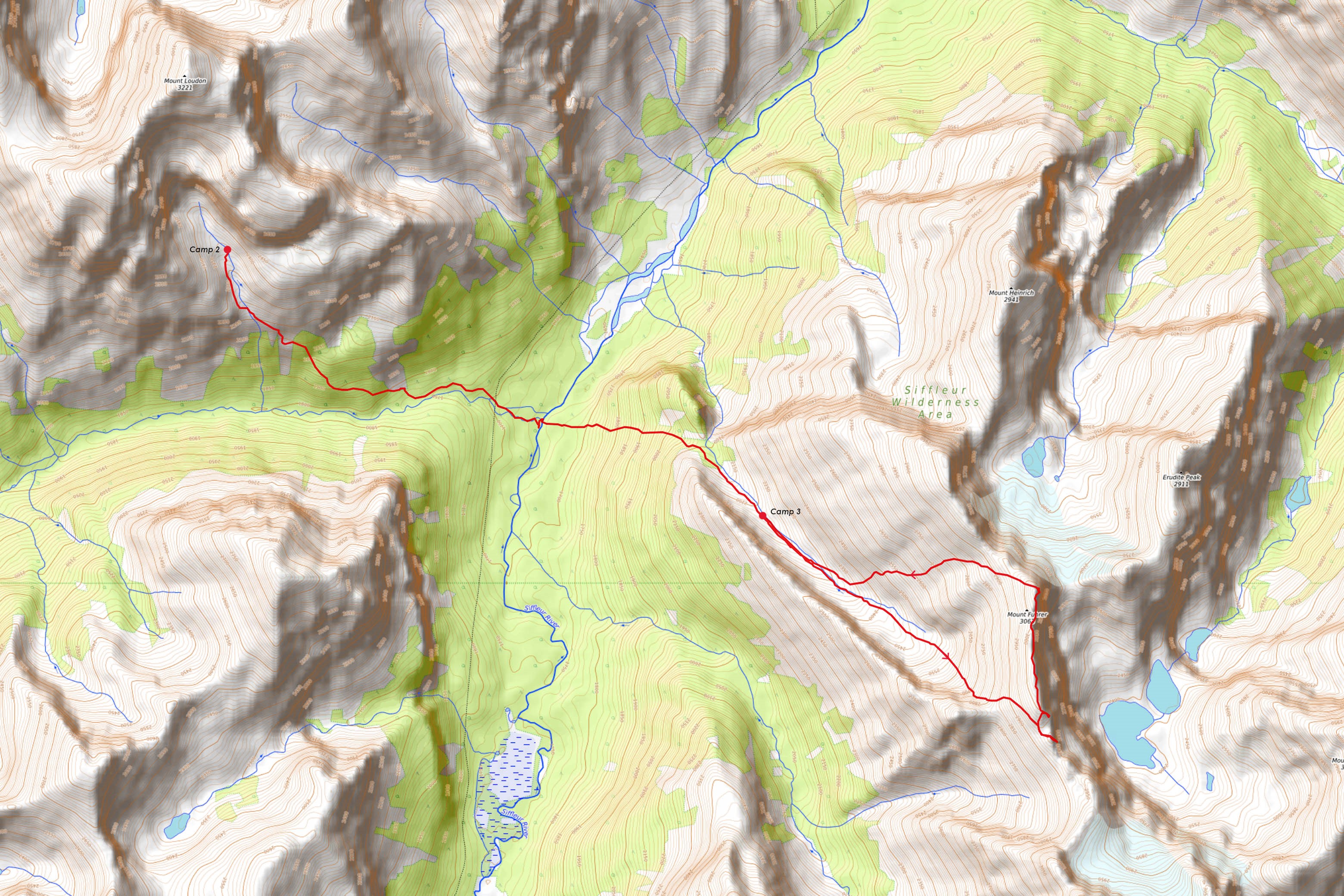
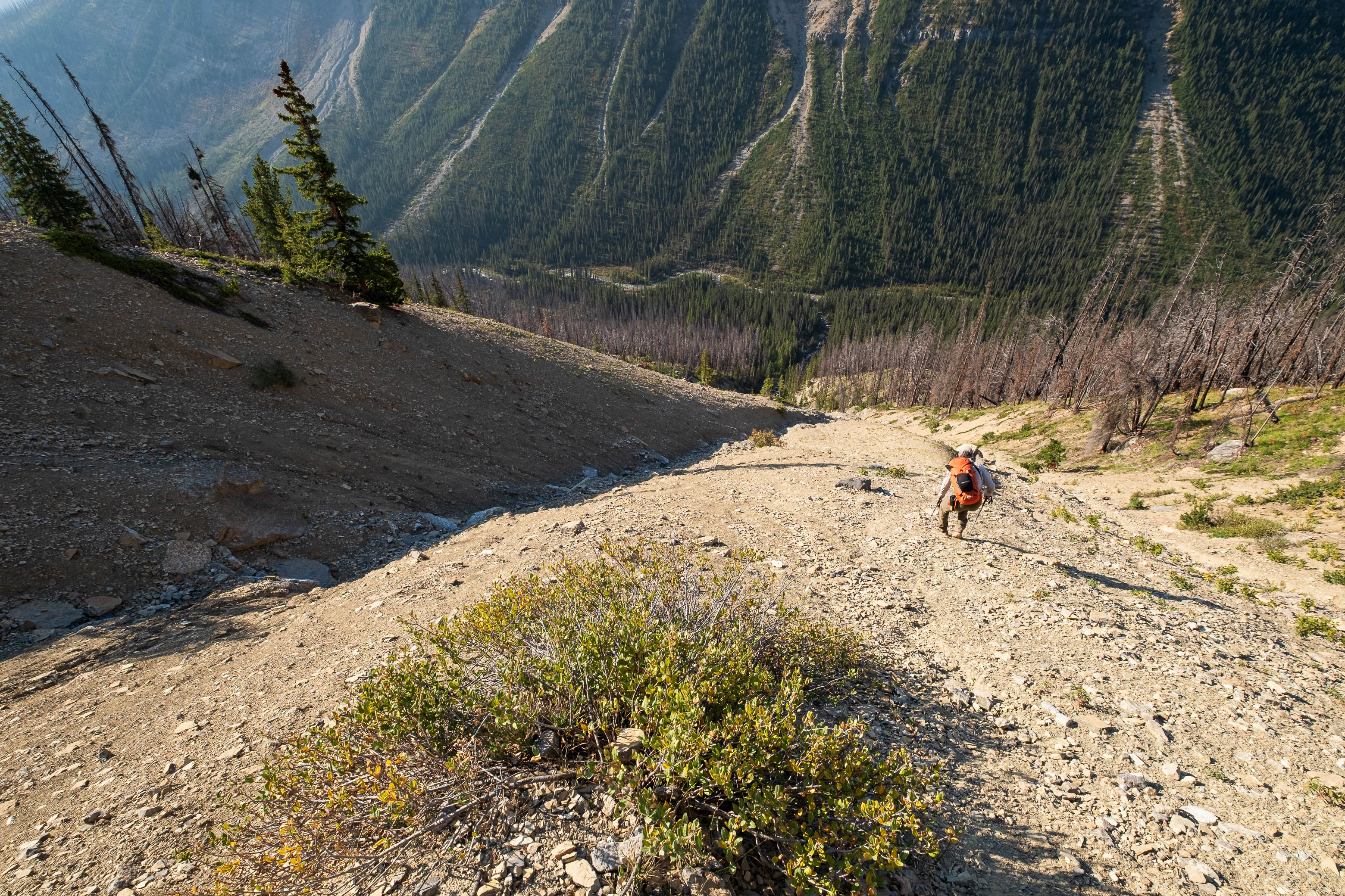
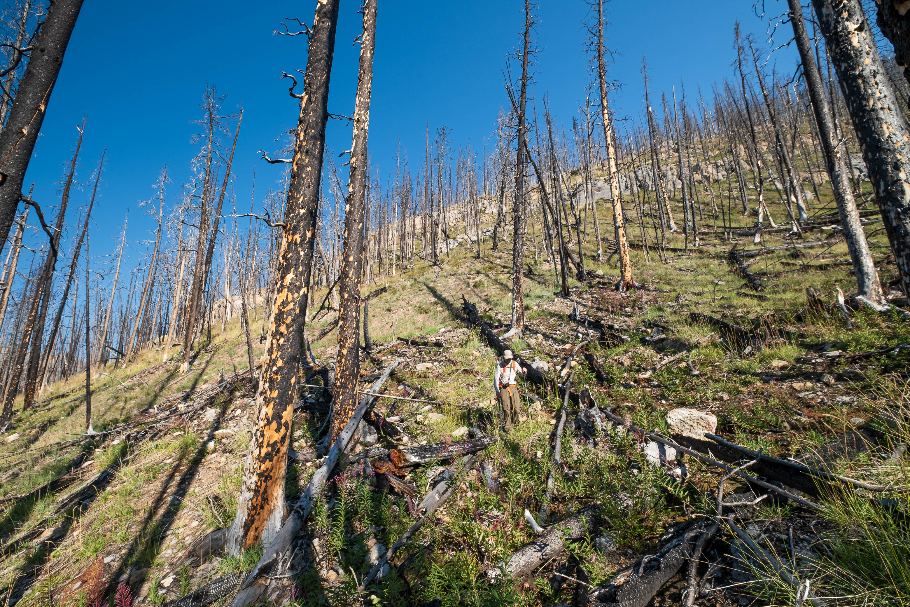
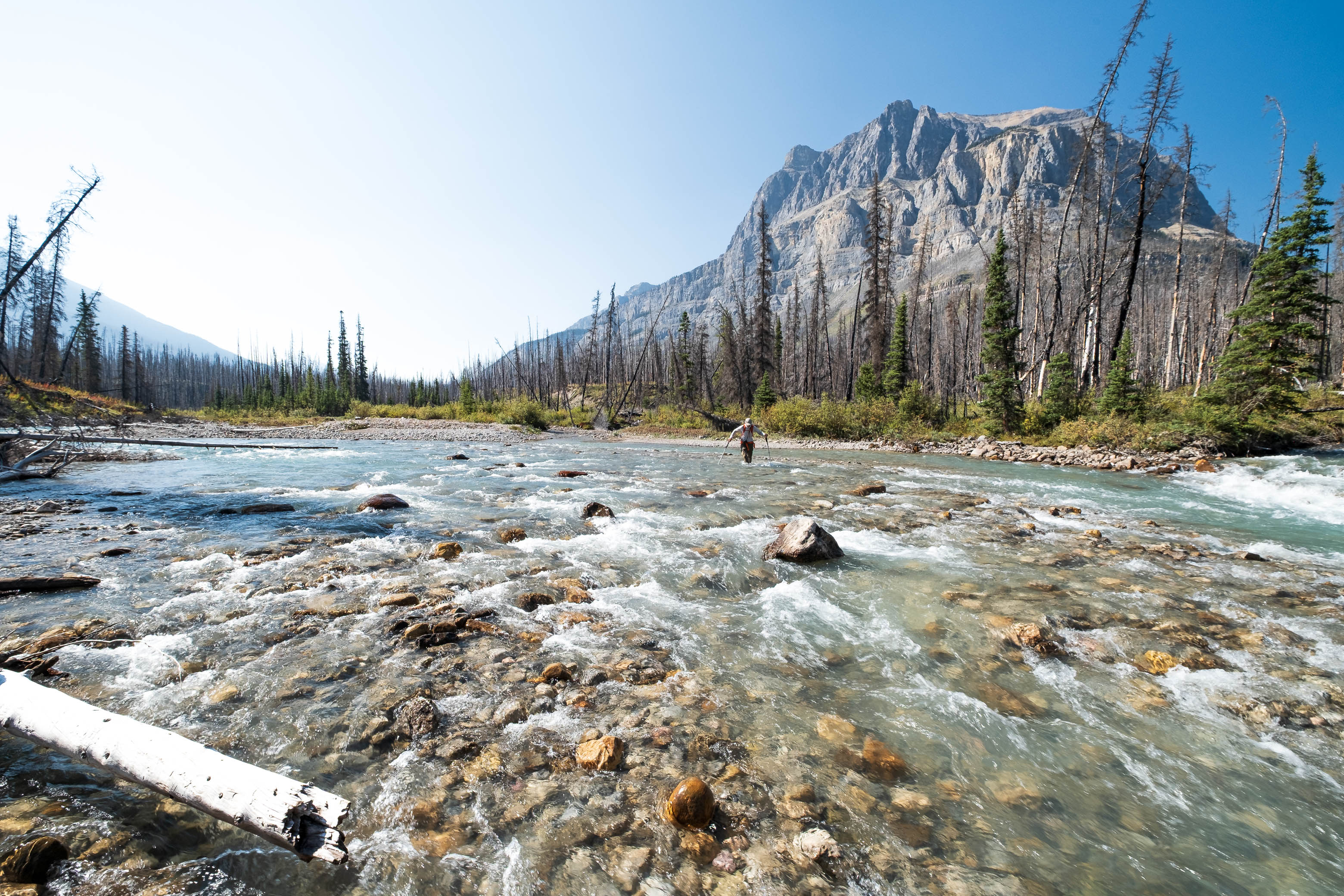
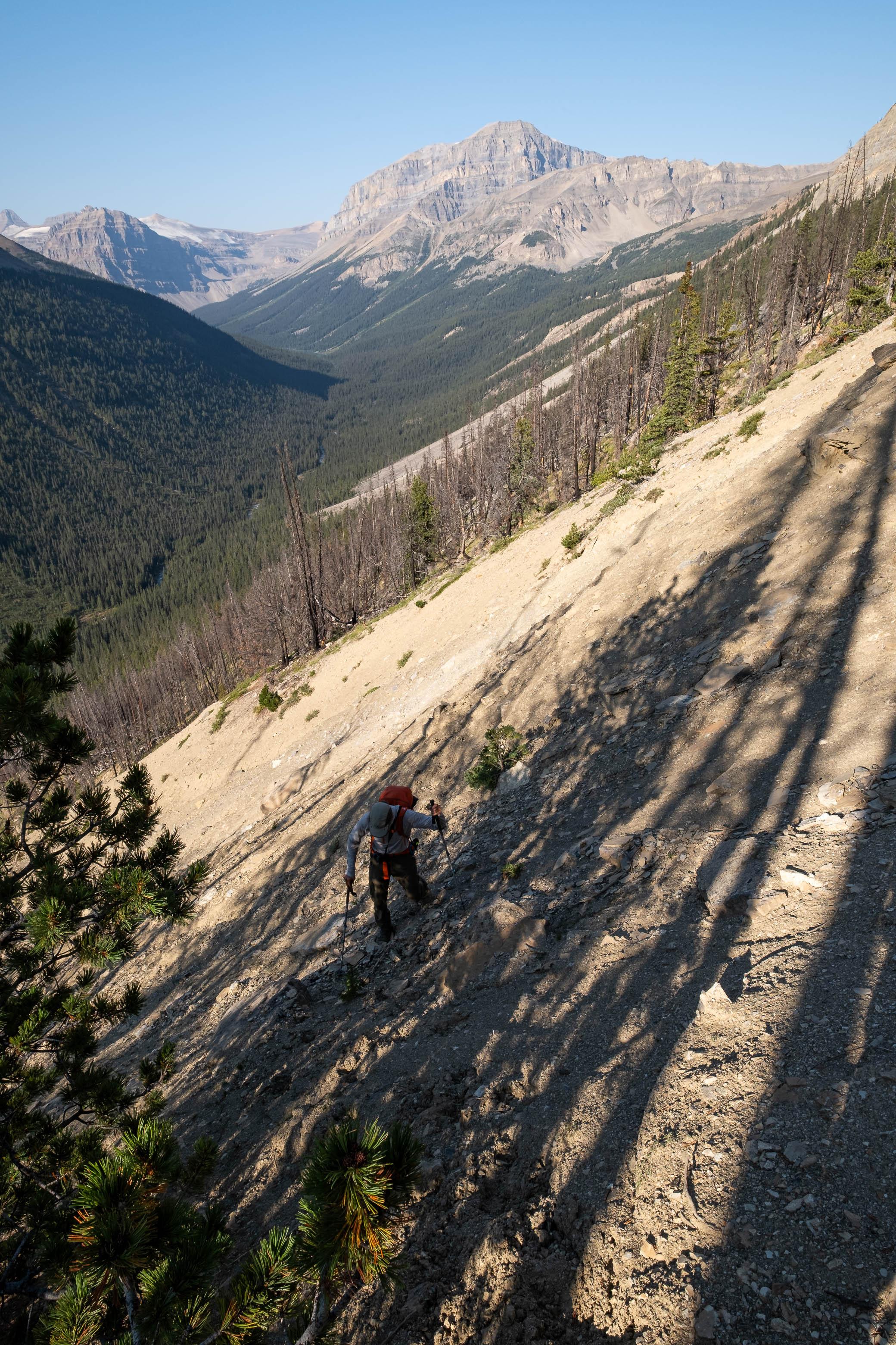
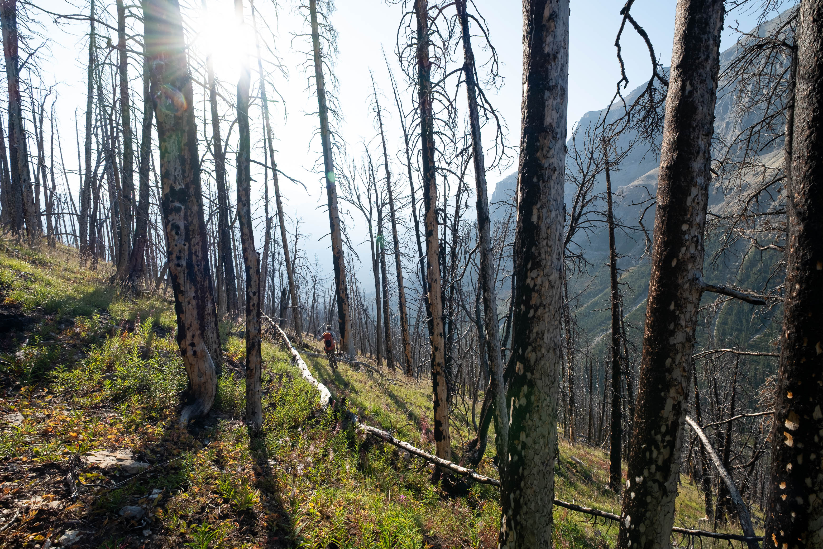
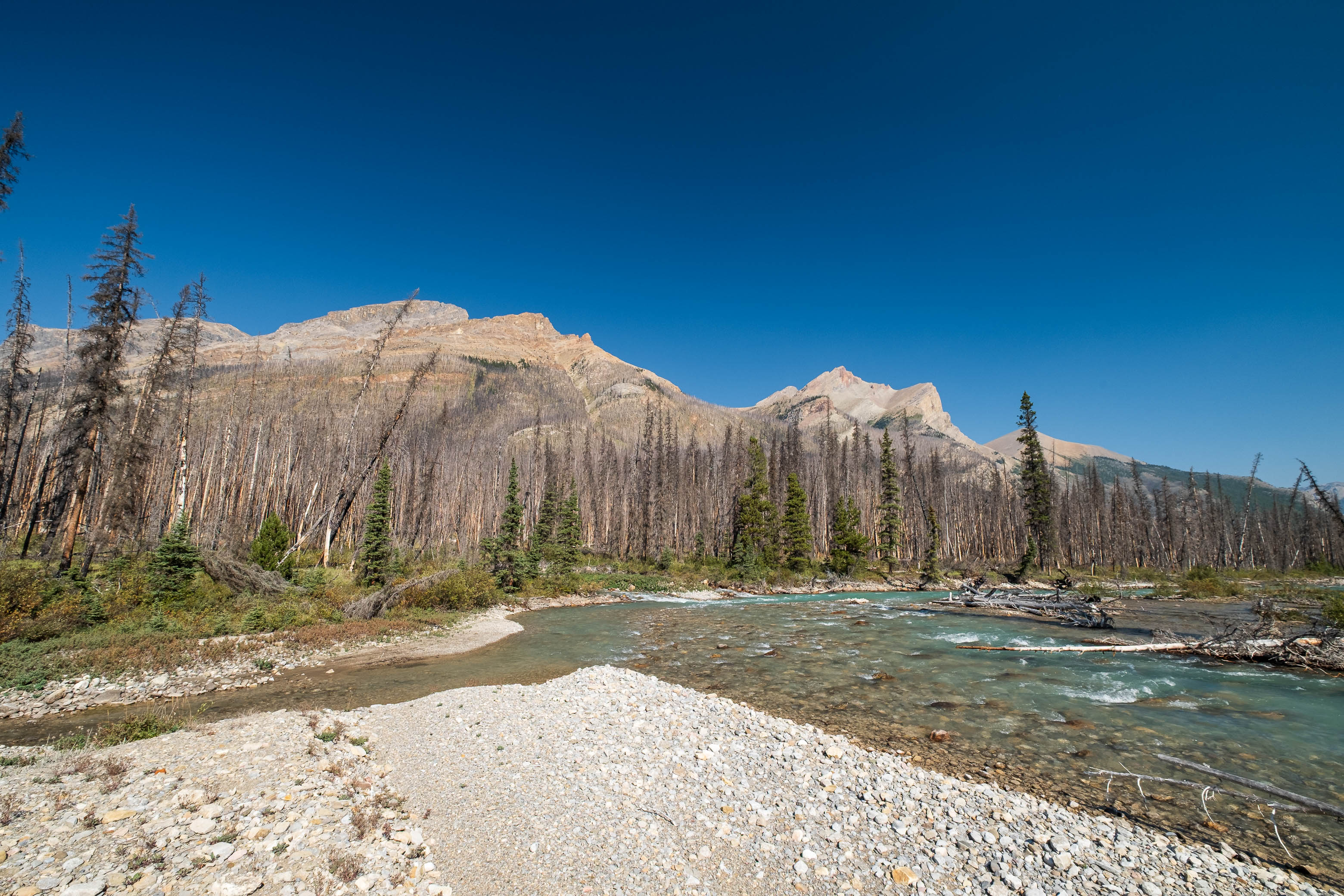
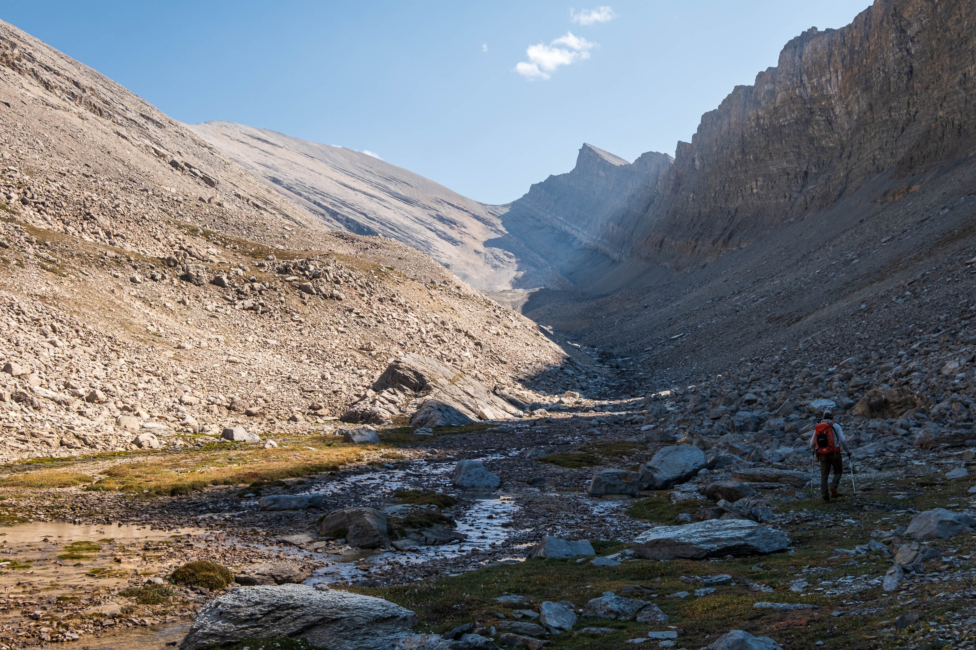
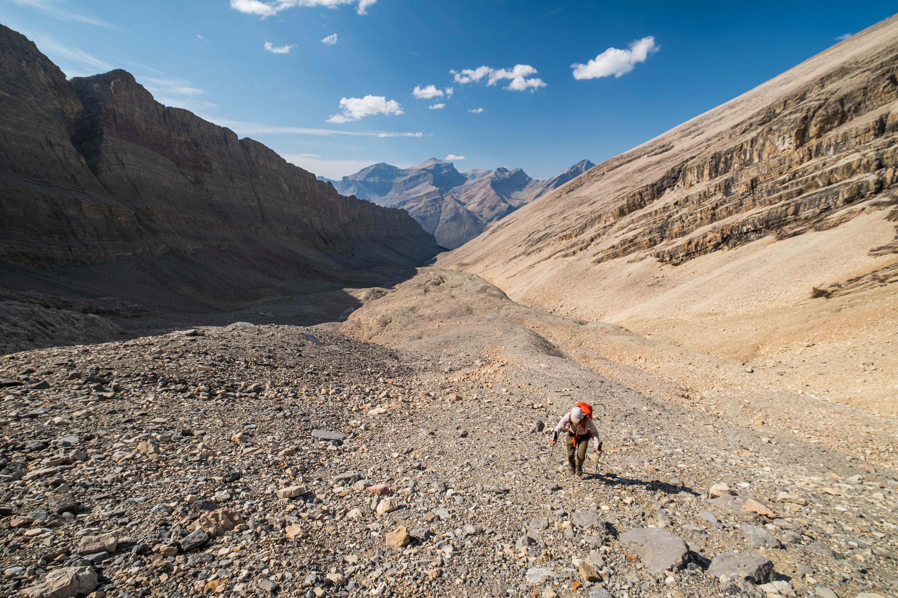
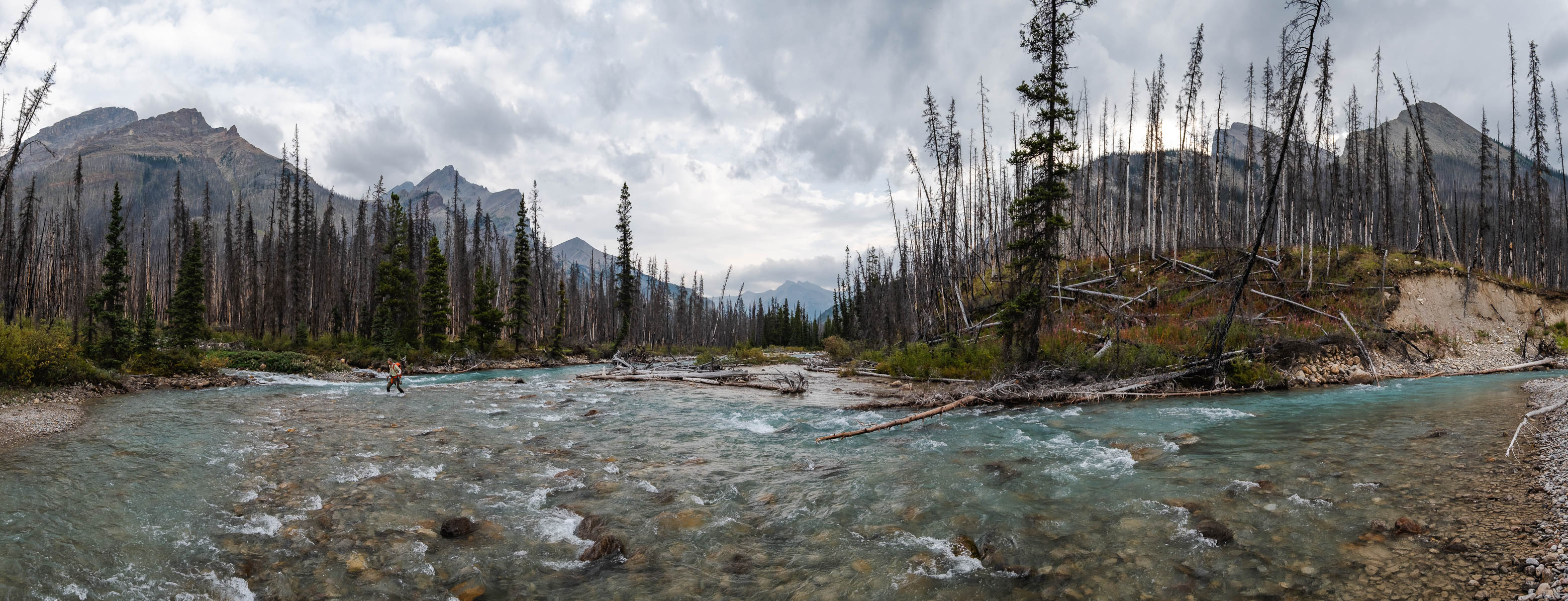
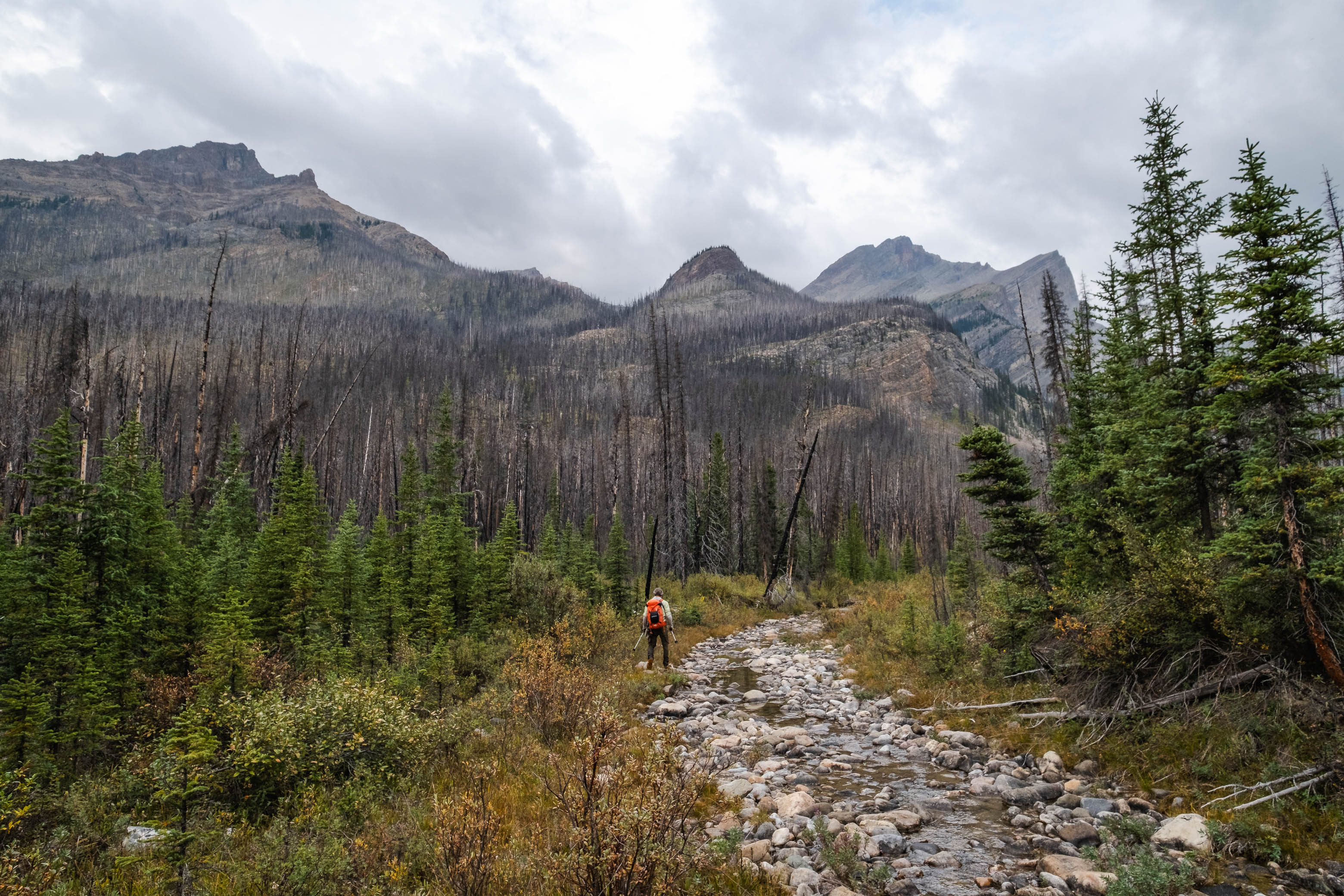
We took the added flow from Porcupine Creek out of the equation by first crossing to its south side on a couple of fallen trees, before tackling the Siffleur where it widened upstream. Setting an "L" shaped trajectory to make use of as much "raised ground" beneath the water as possible, we had absolutely no trouble wading across the river's at most knee-deep waters, and were soon starting our ascent up burnt, forested slopes to Fuhrer's upper hanging valley (aka "Chortling Marmots Creek" Valley).
Crossing the Siffleur River was a breeze this late in the summer! We made it even easier by wading downstream along a raised "ridge" of rocks before cutting across a short section of deeper water near the big boulder (C-R).
Ascending yet another steep burn to access "Chortling Marmots Creek" Valley.
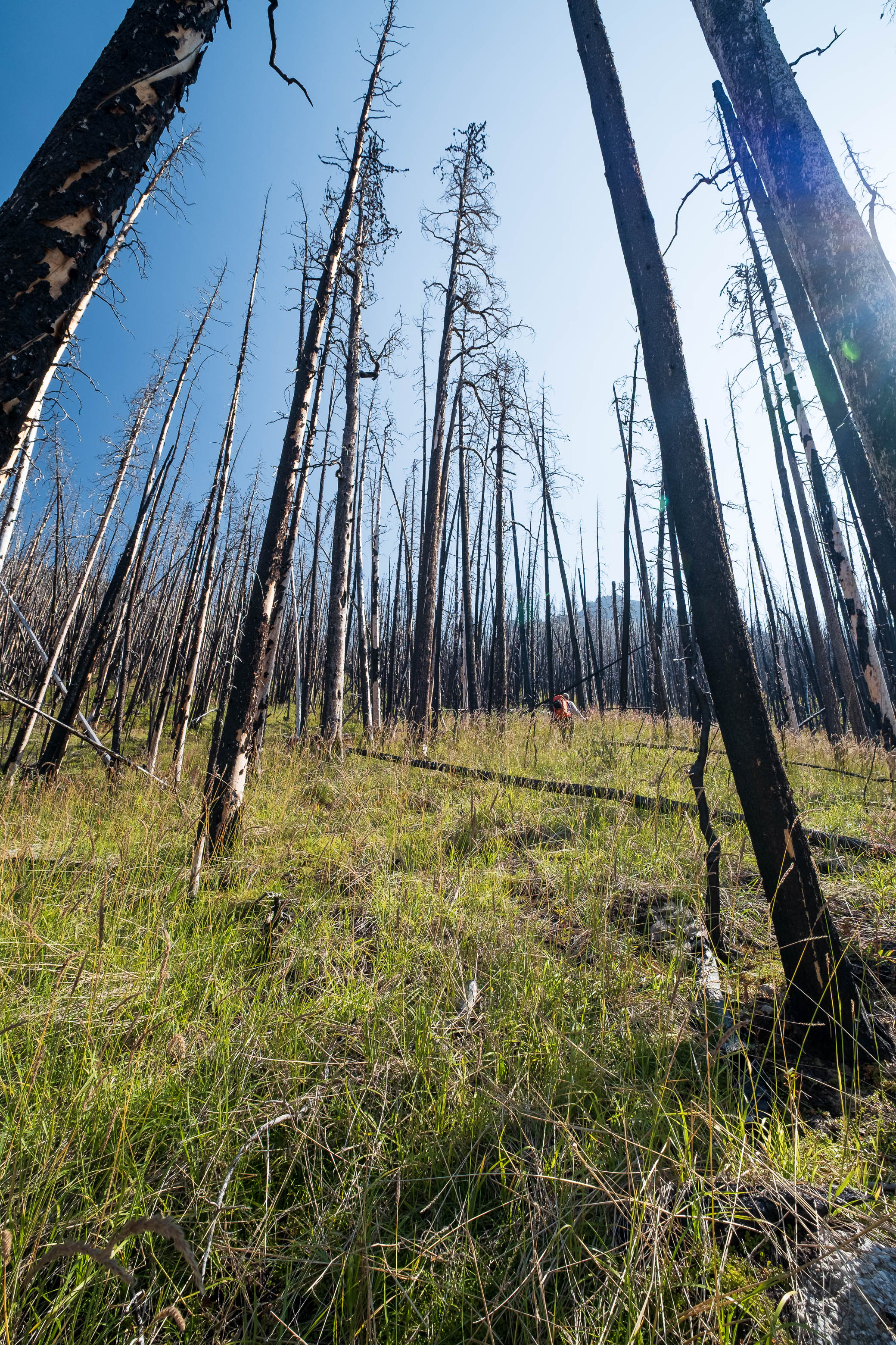
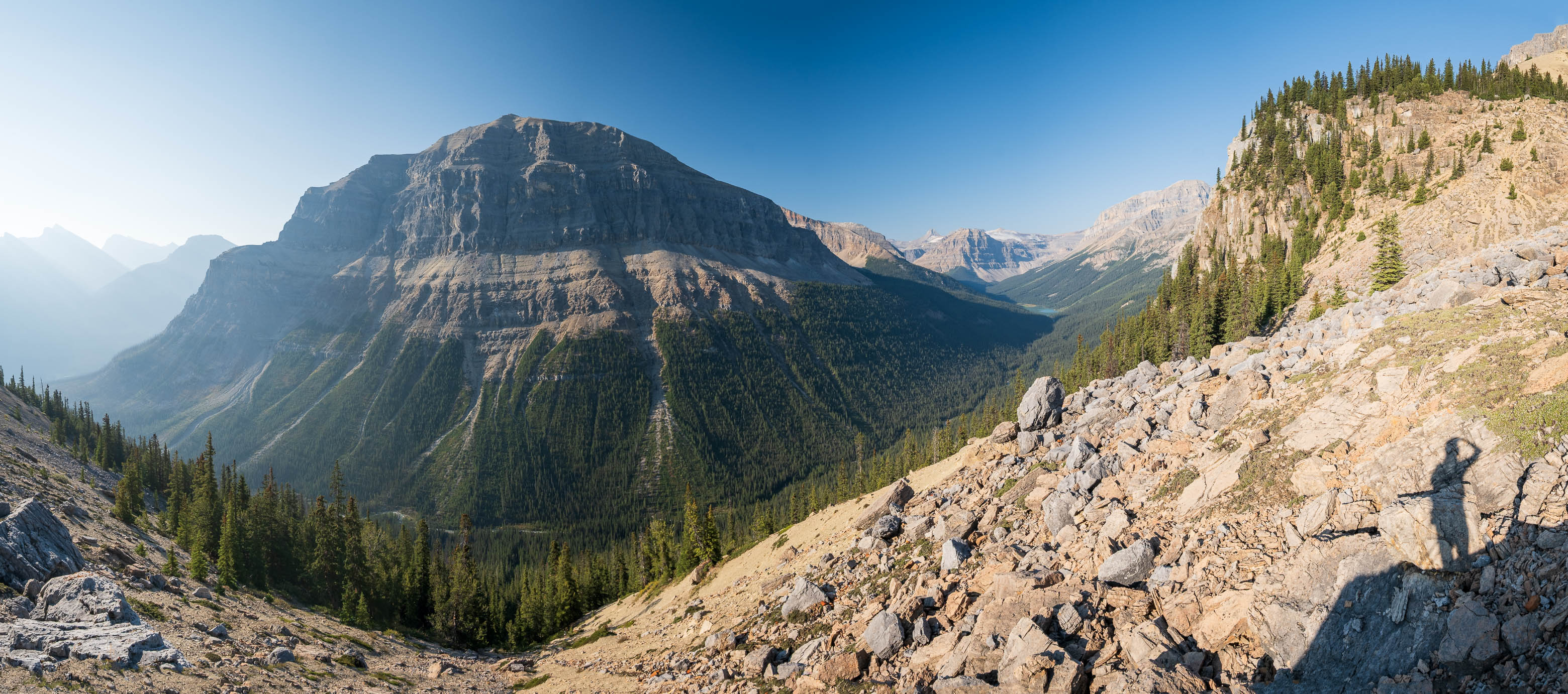
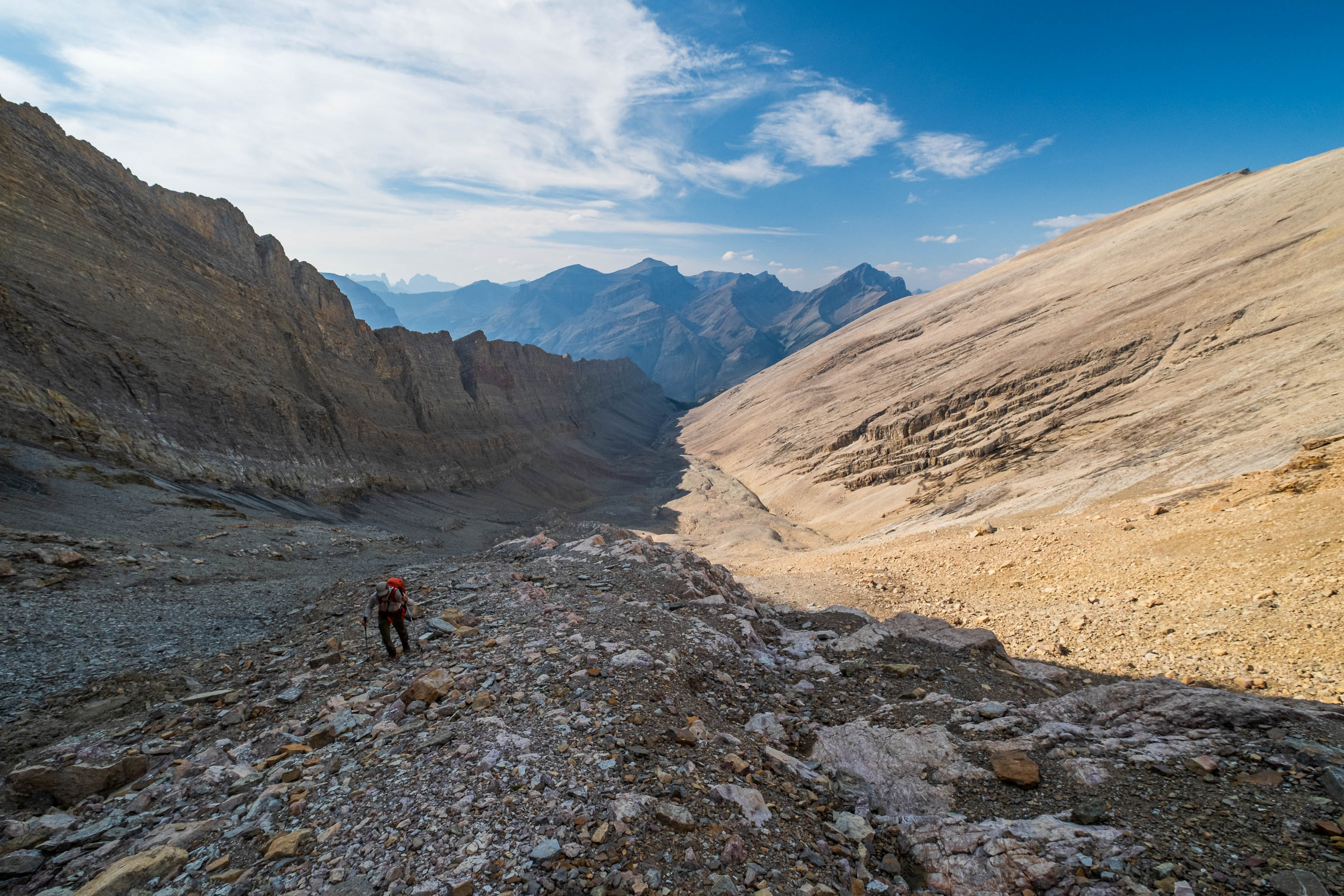
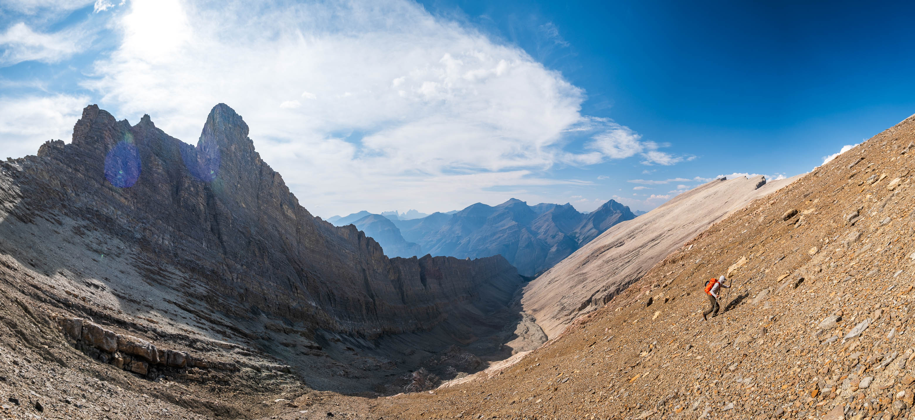
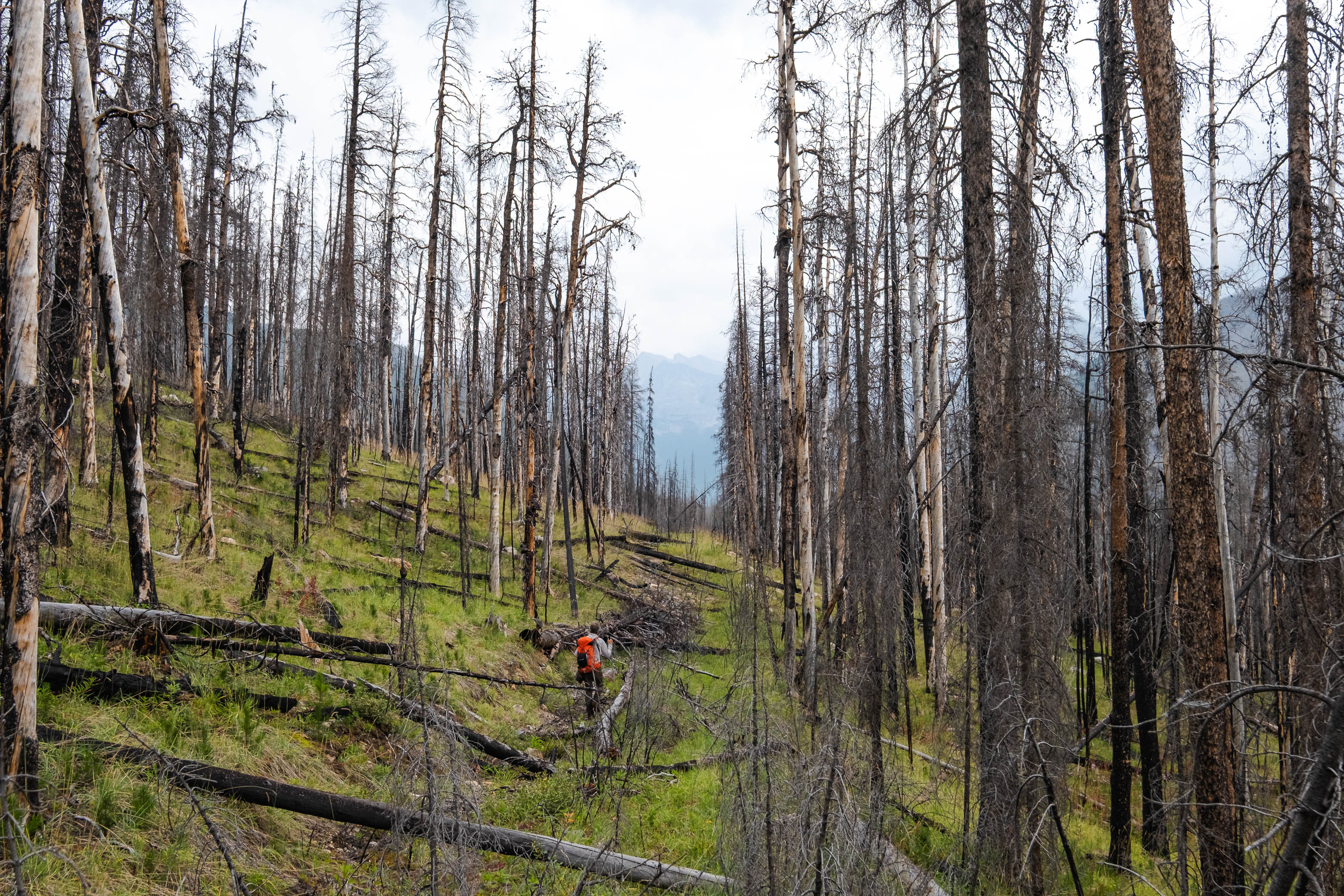
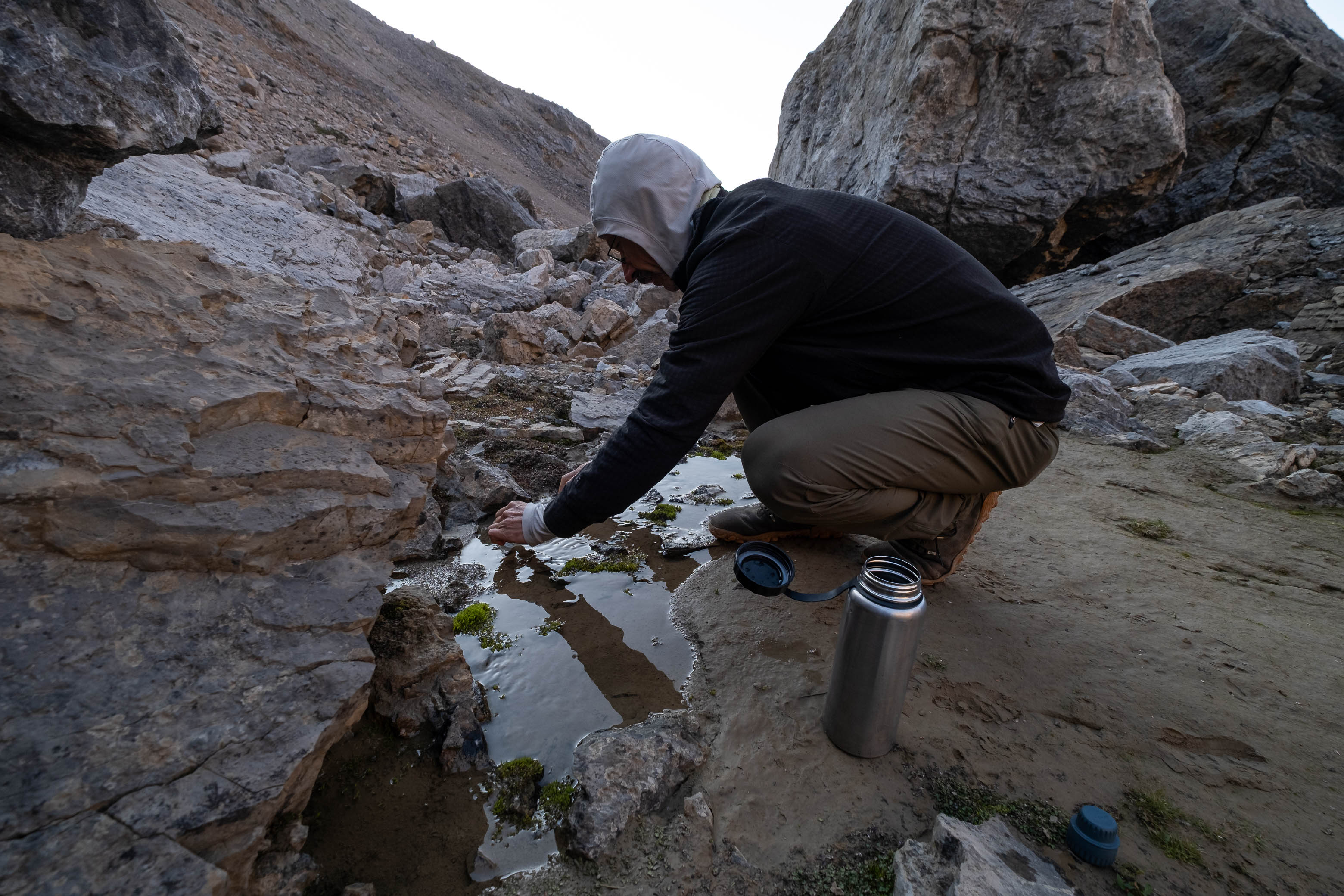
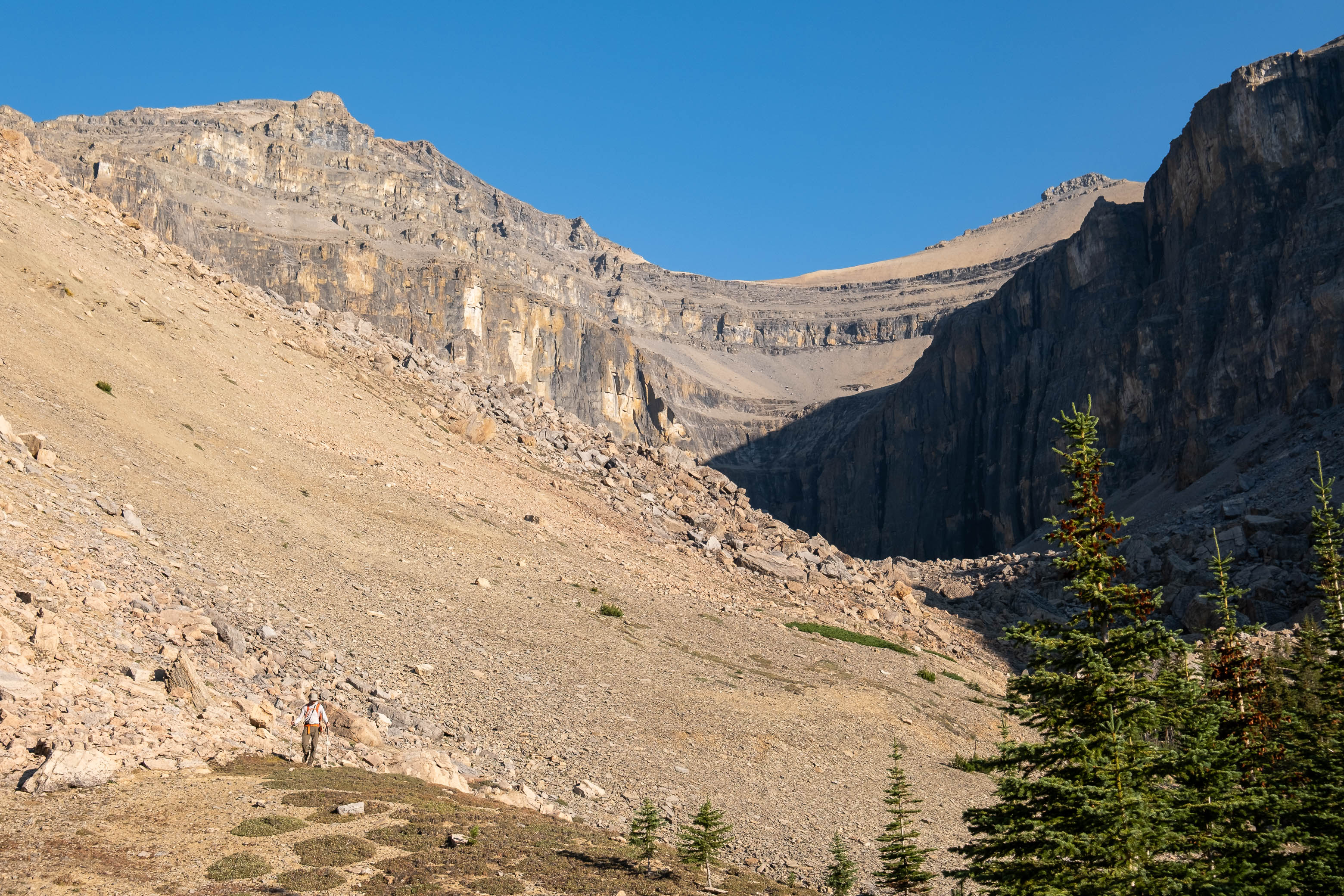
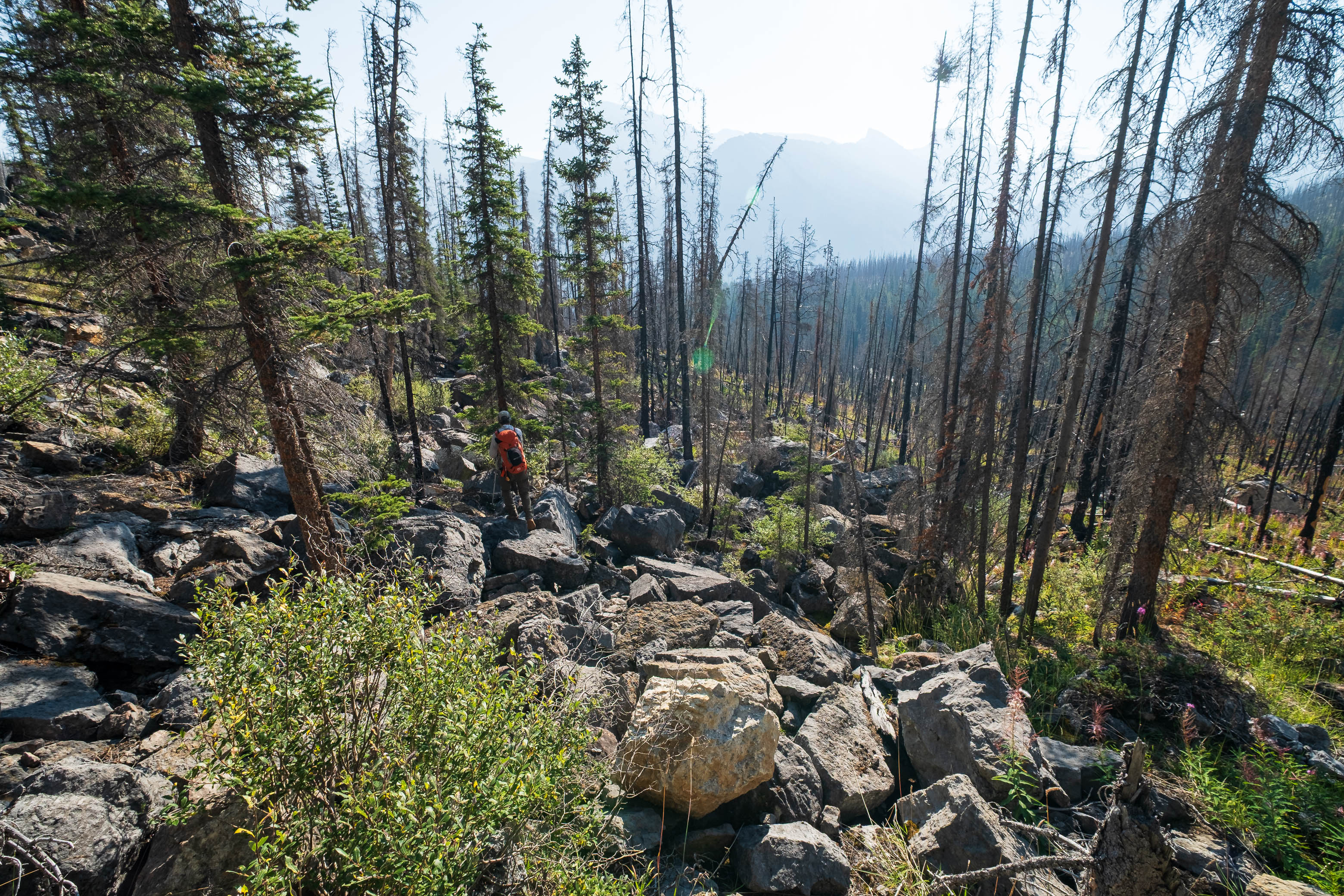
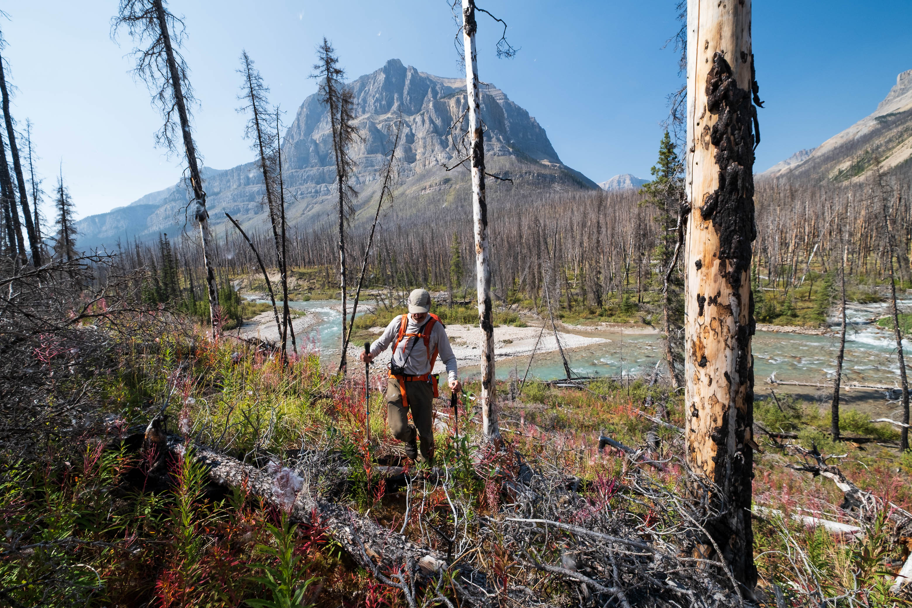
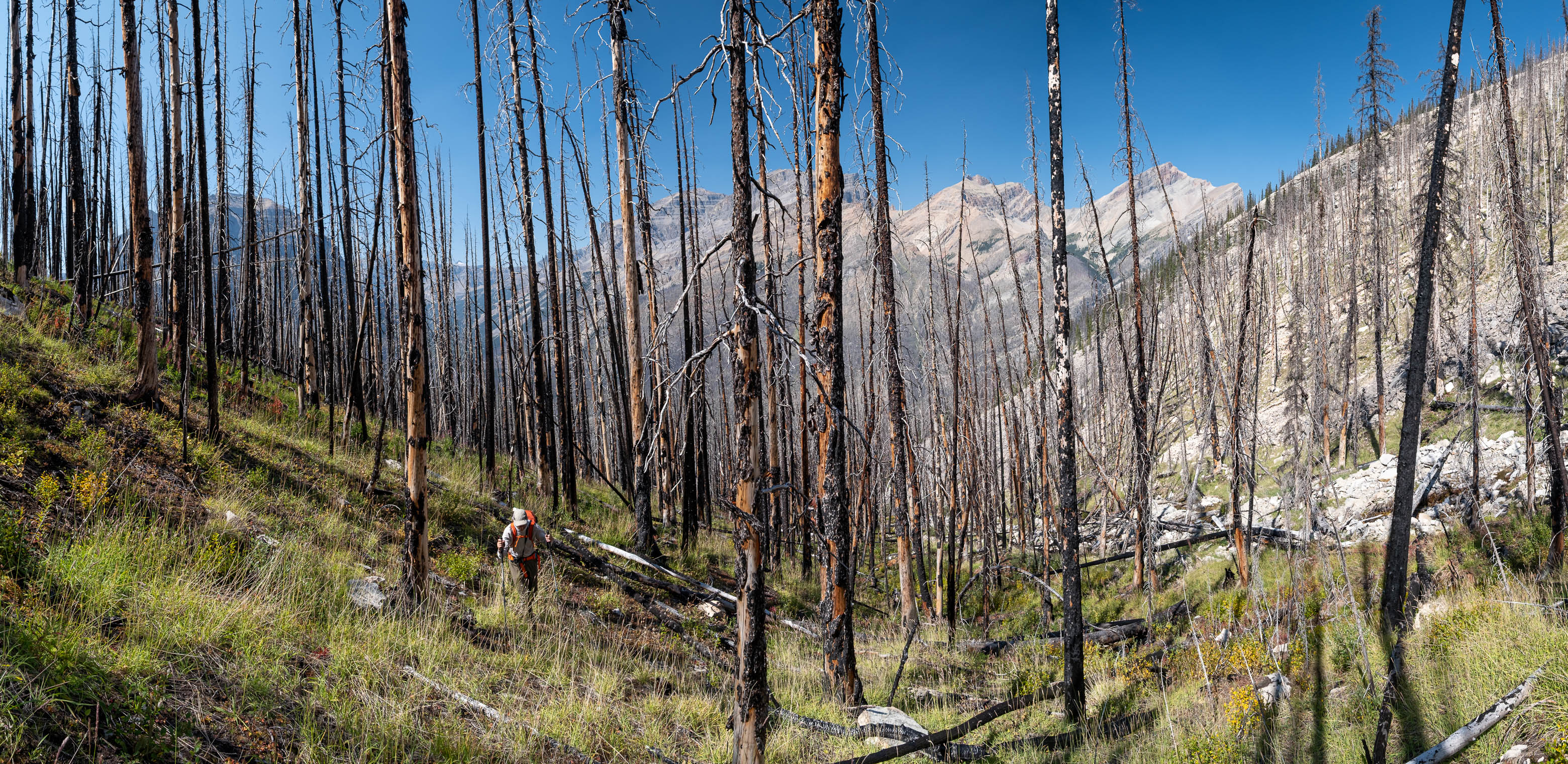
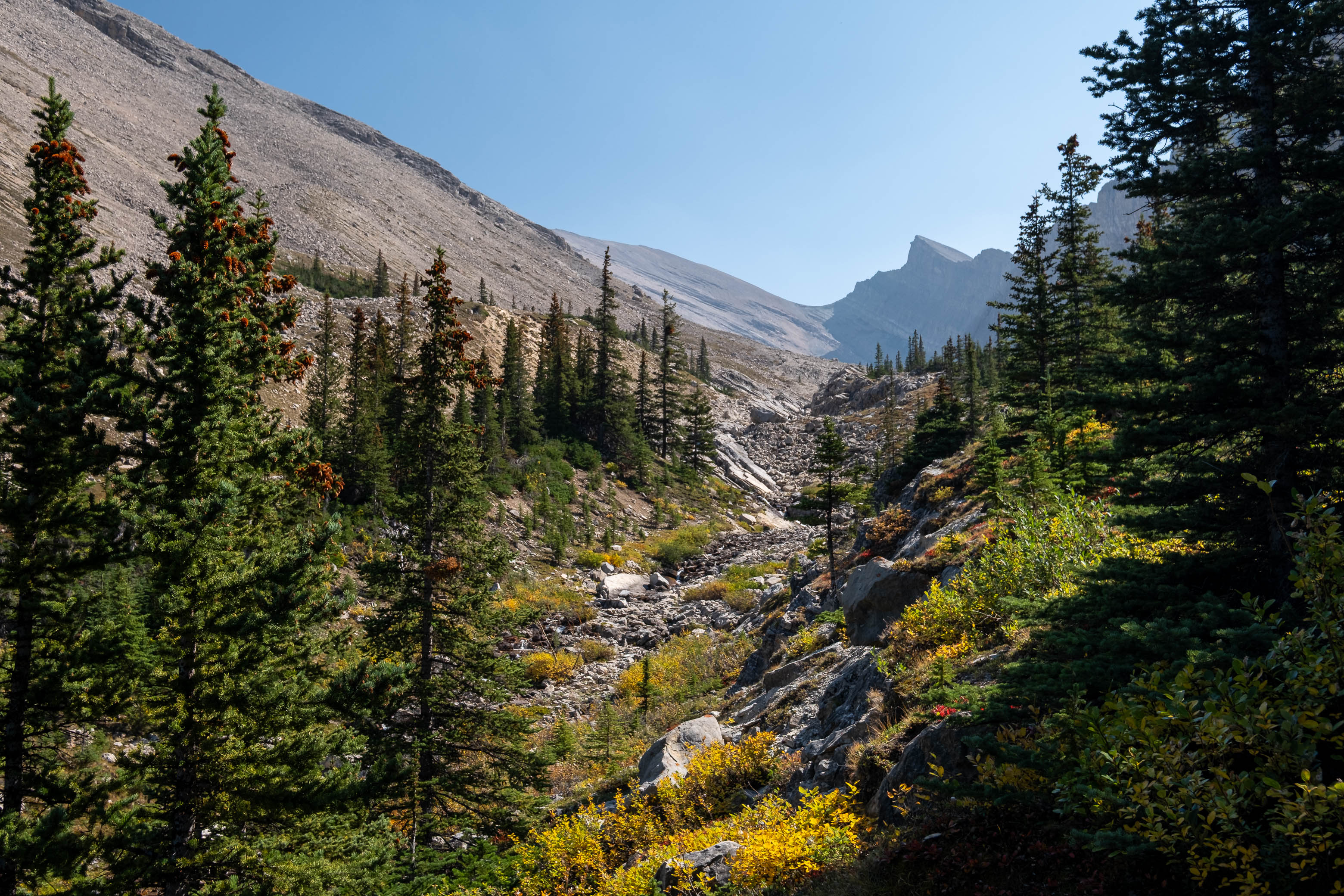
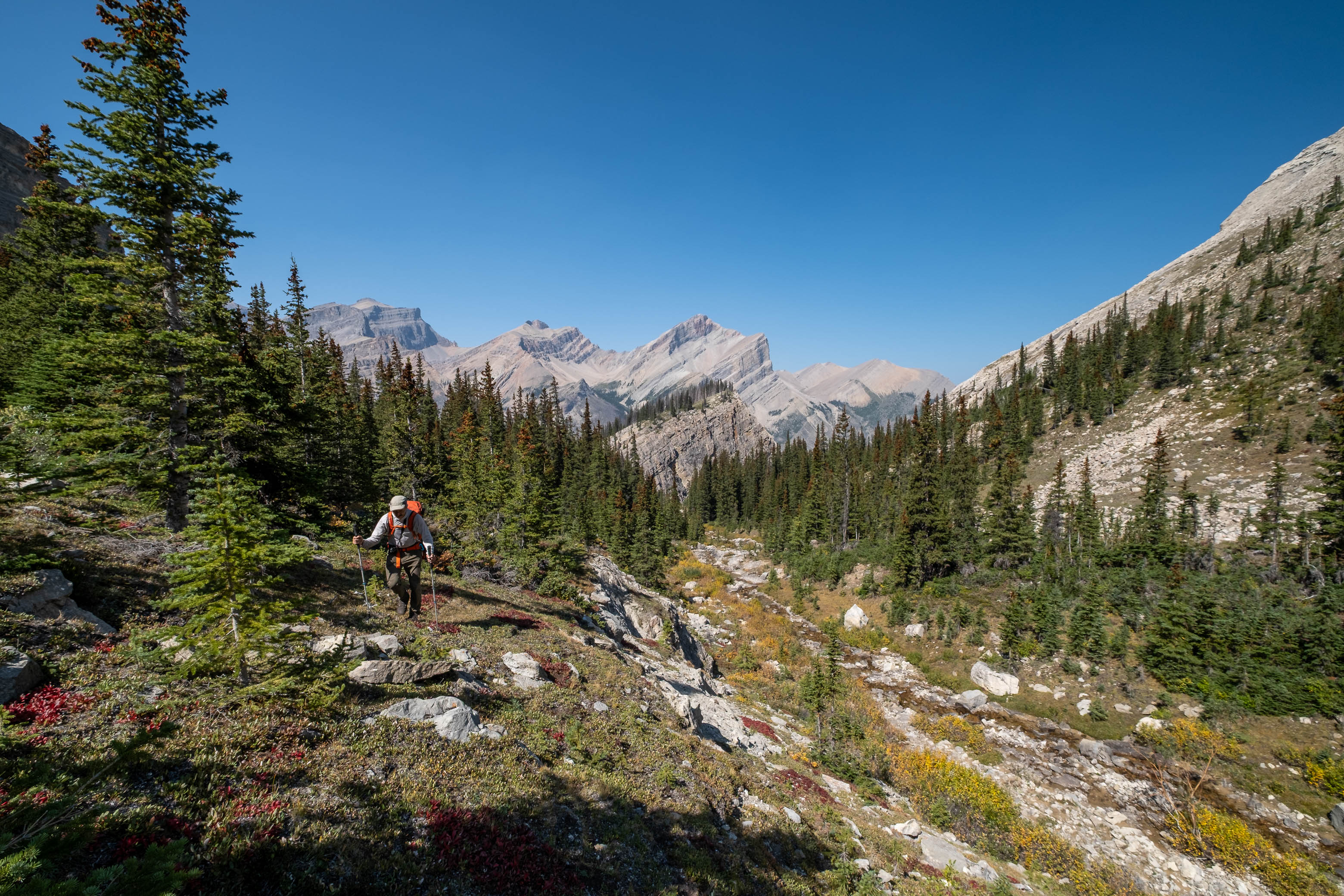
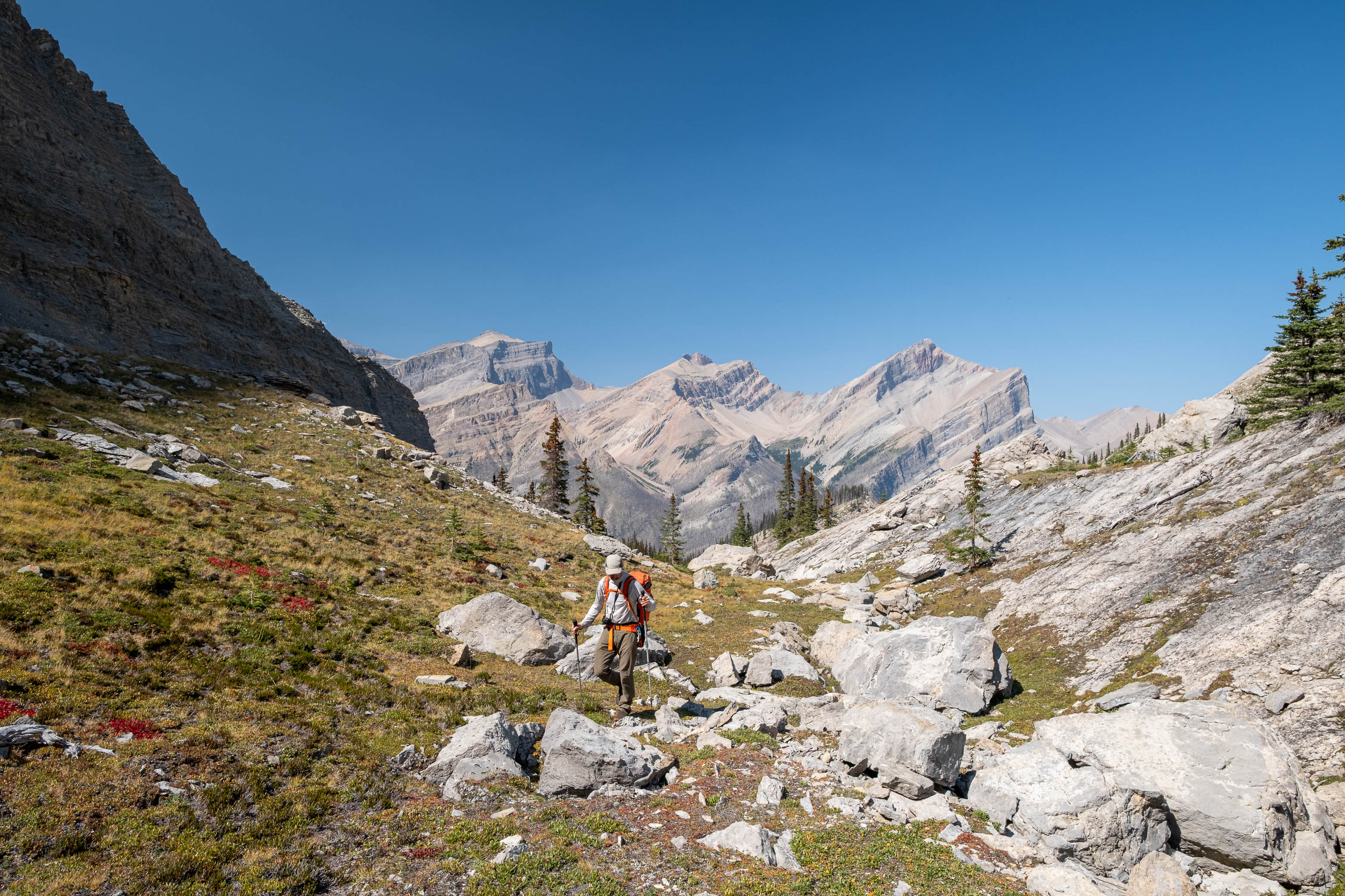
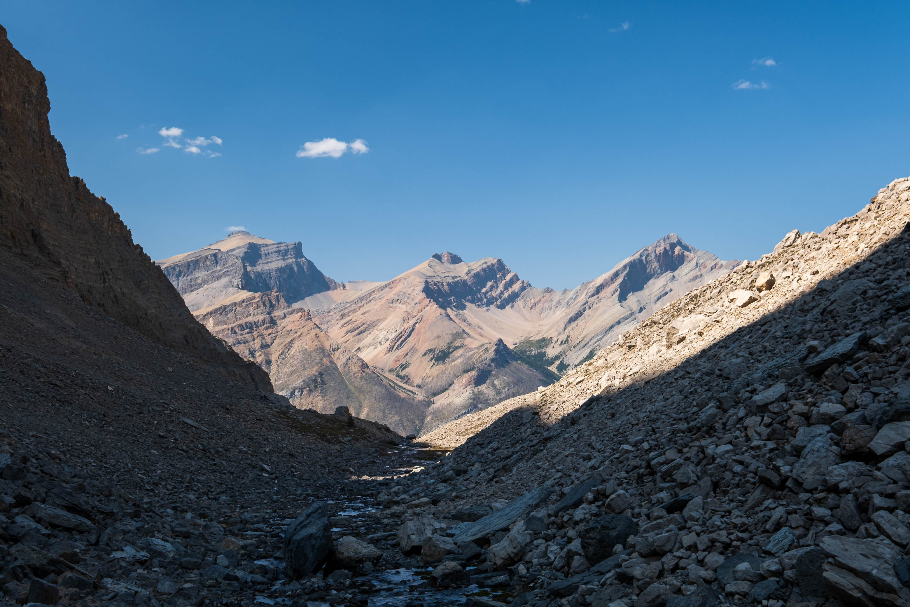
After steeply gaining about 350 m in the open burn, the slope eased off as we entered the hanging valley, alongside Chortling Marmots Creek. We were relieved to find water flowing in this minor drainage (a luxury we didn't have the previous day!), and were soon topping up our bottles and dropping our camp supplies at the last "grassy patch", before continuing up the long rubble valley to a distant col between Fuhrer and an impressive, but unnamed, outlier to the SW.
Wandering up the long, rubbly, "Chortling Marmots Creek" Valley. Fuhrer rises out of sight at left, with the distant col we're aiming for straight ahead (C-R).
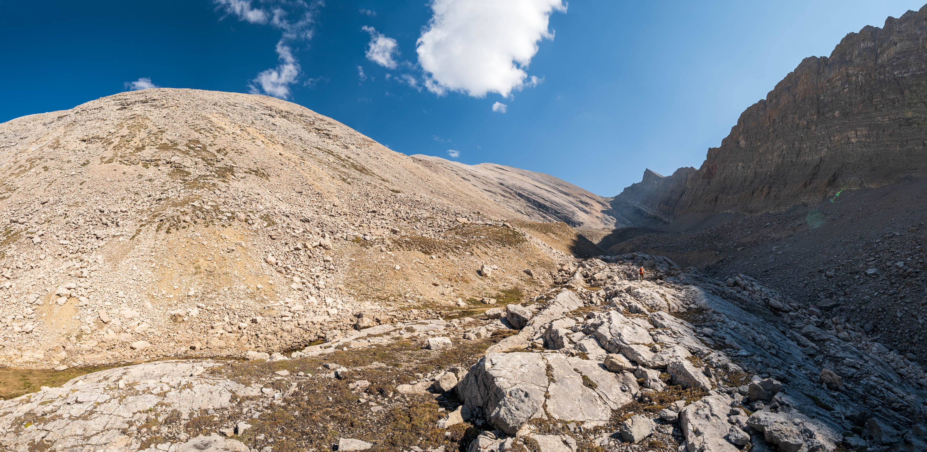
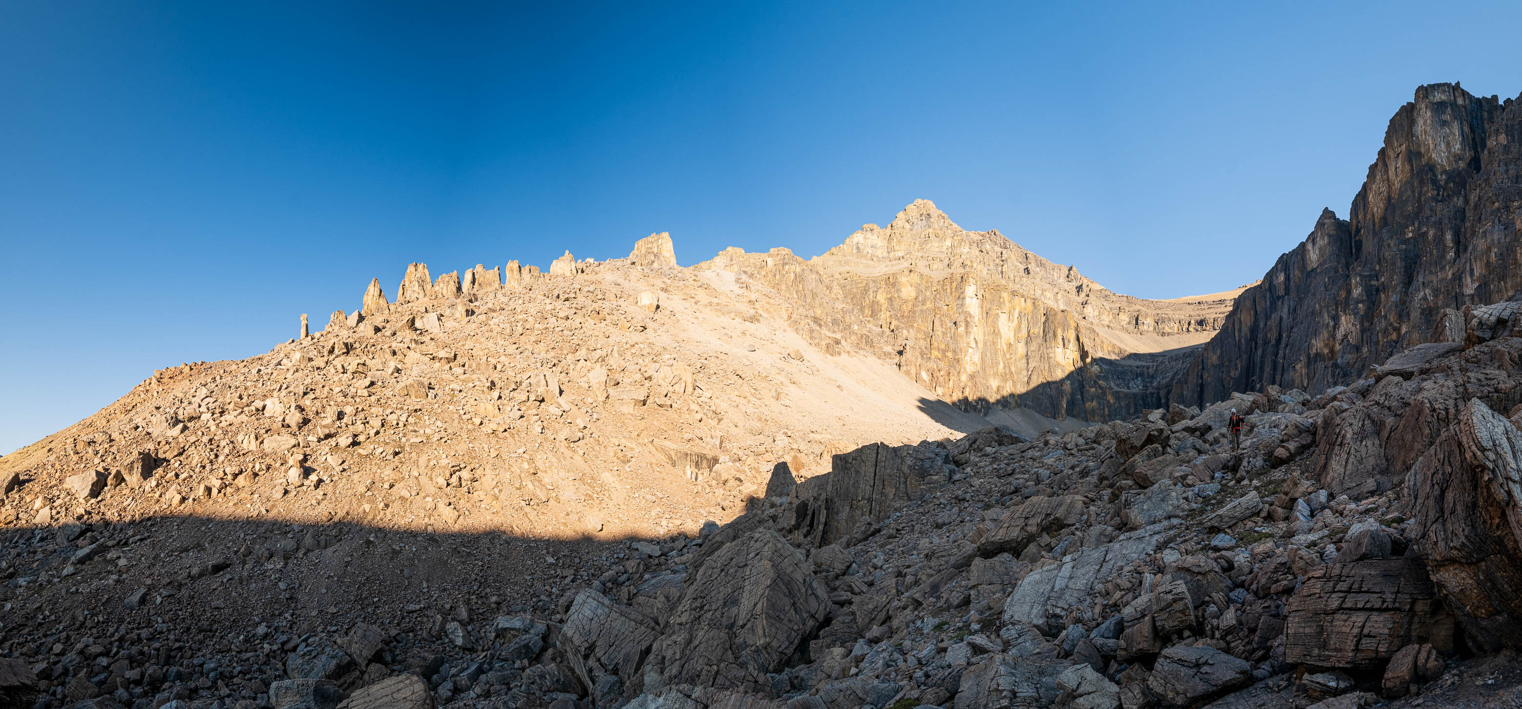
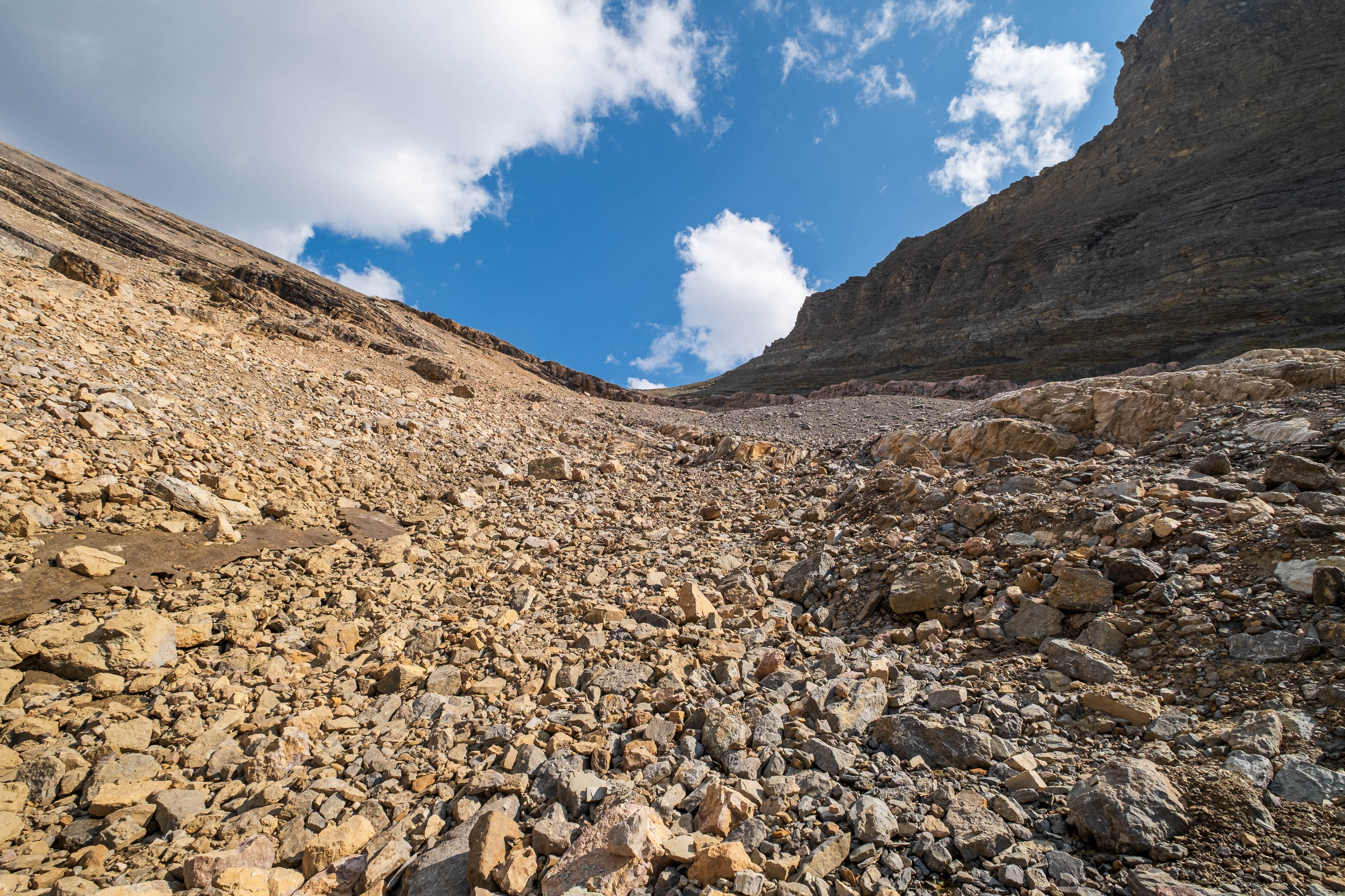
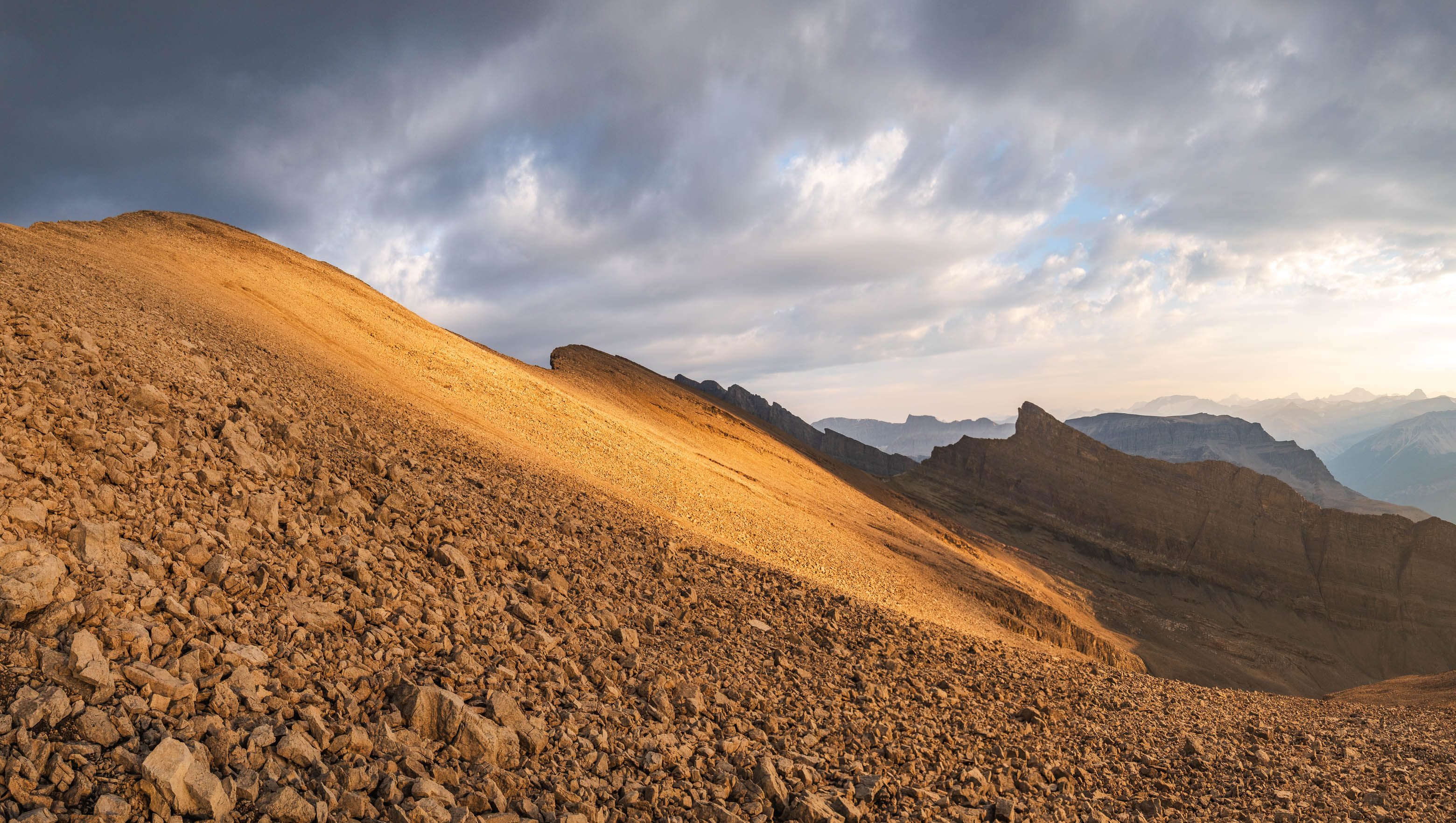
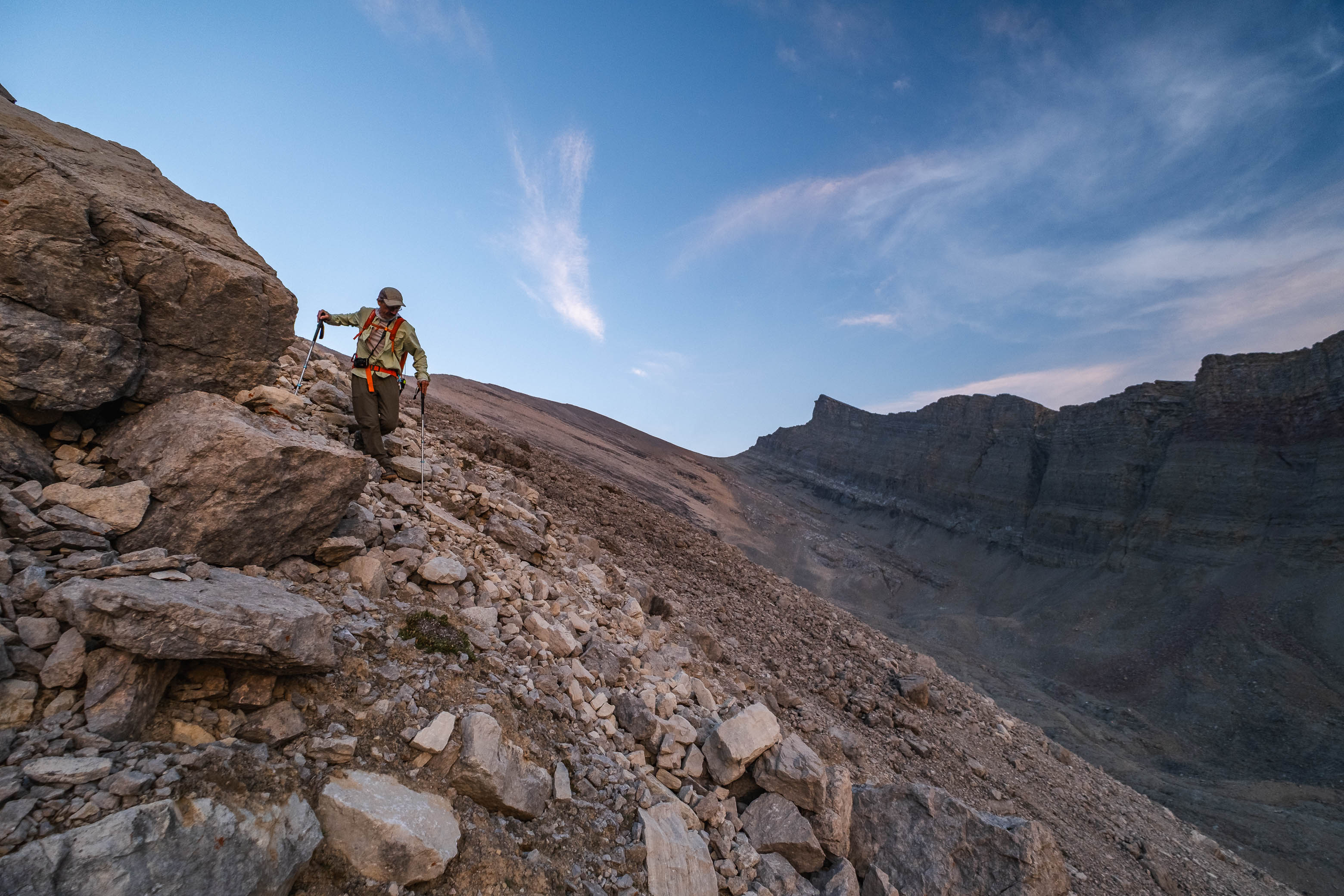
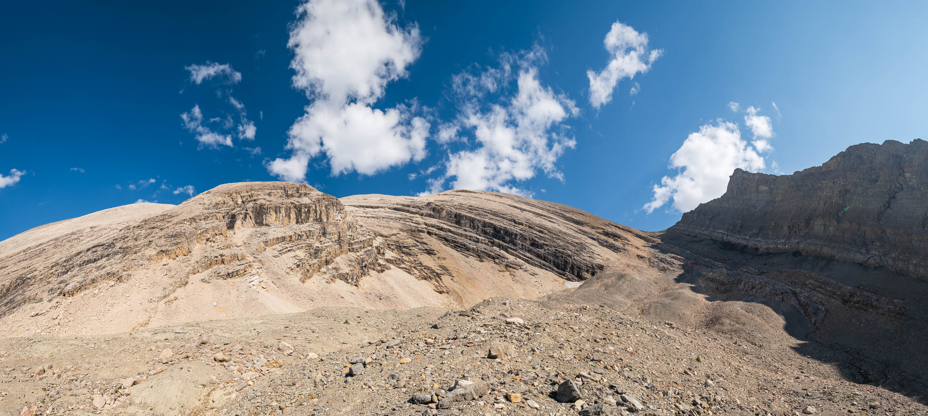
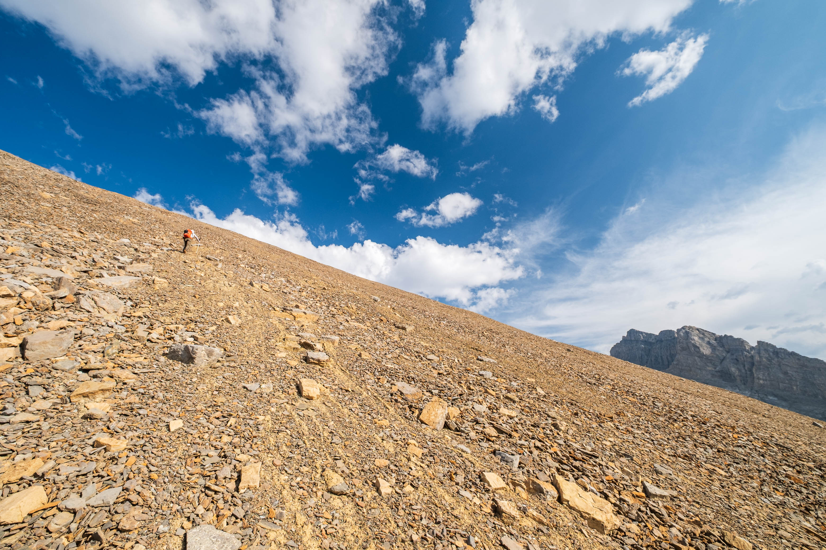
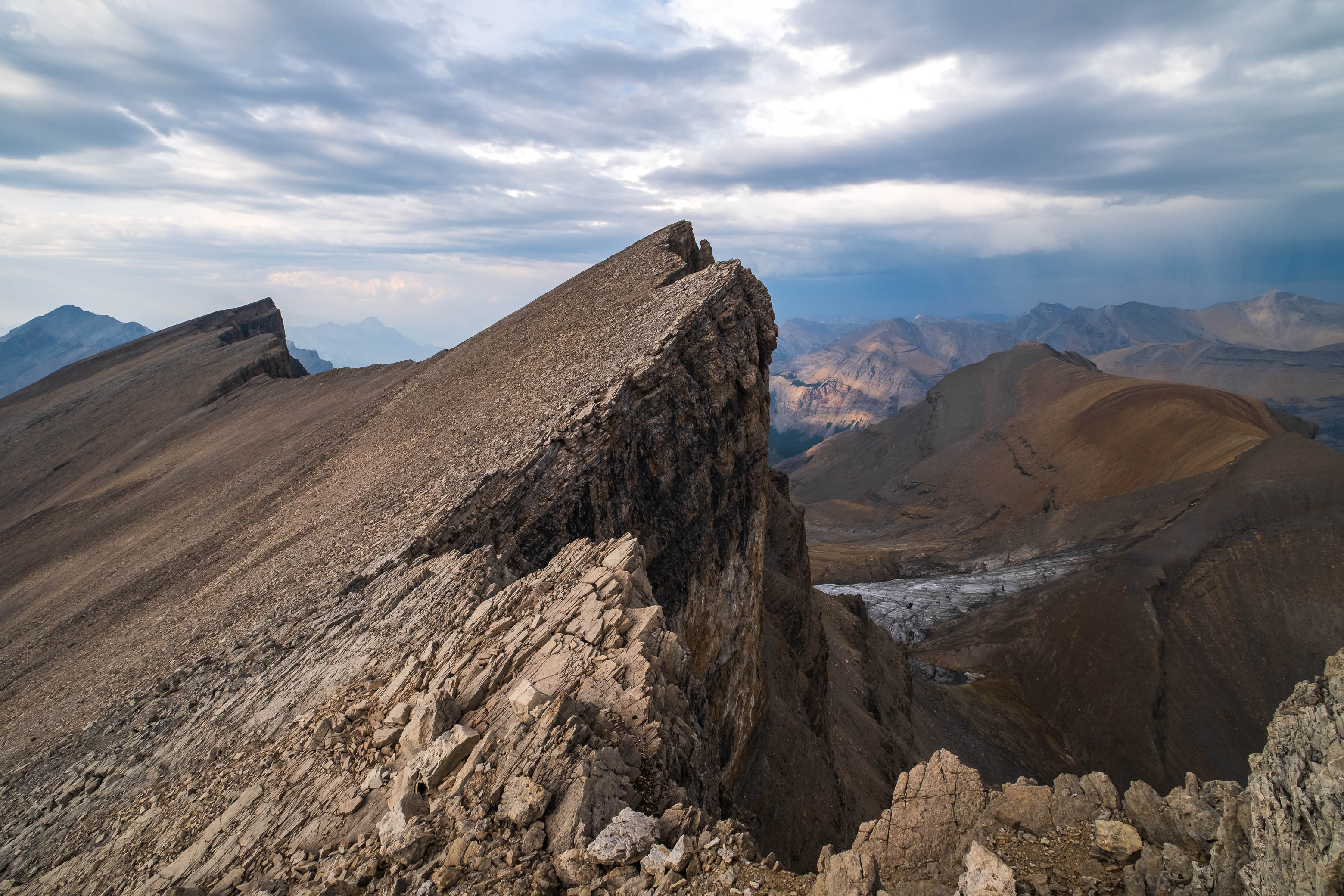
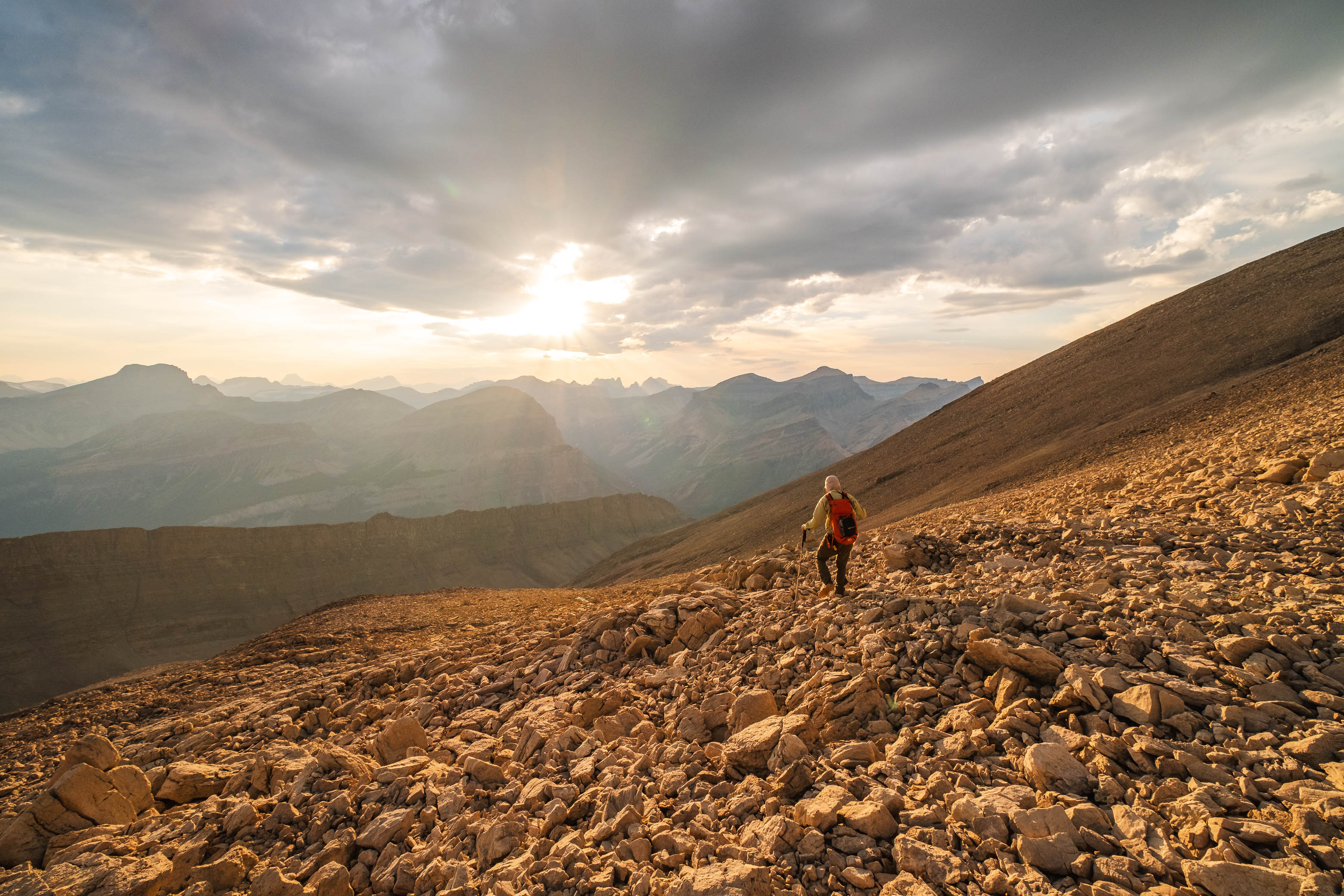
The actual ascent of Furher is no more than class 2 from a technical standpoint and we easily plodded up scree slopes, angling left as we neared the col to gain Fuhrer's south ridge. It was on this slope that my dad had the most random boost of energy and practically started running up the mountain! After painfully watching him grunt through knee pain the last two days, this was so far out of left field that I couldn't help but laugh. Some things just can't be explained in the mountains I guess! π
Rubble slopes lead easily up to the col.
Looking back down the long, hanging valley we just ascended, with Loudon and Siffleur rising beyond.
An impressive, unnamed outlier towers over us as we near the col and start angling up scree slopes towards Fuhrer's southern summit ridge.
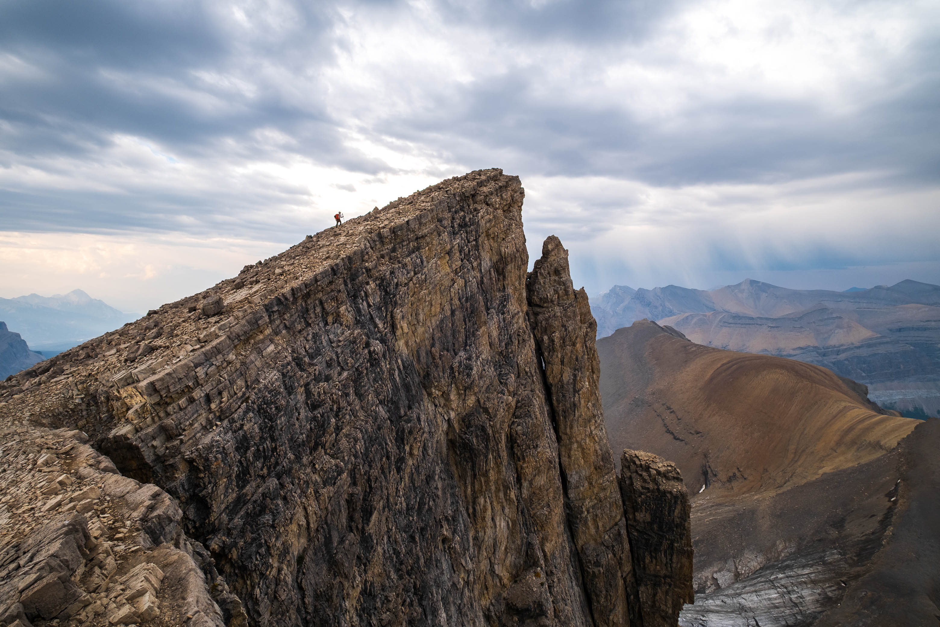
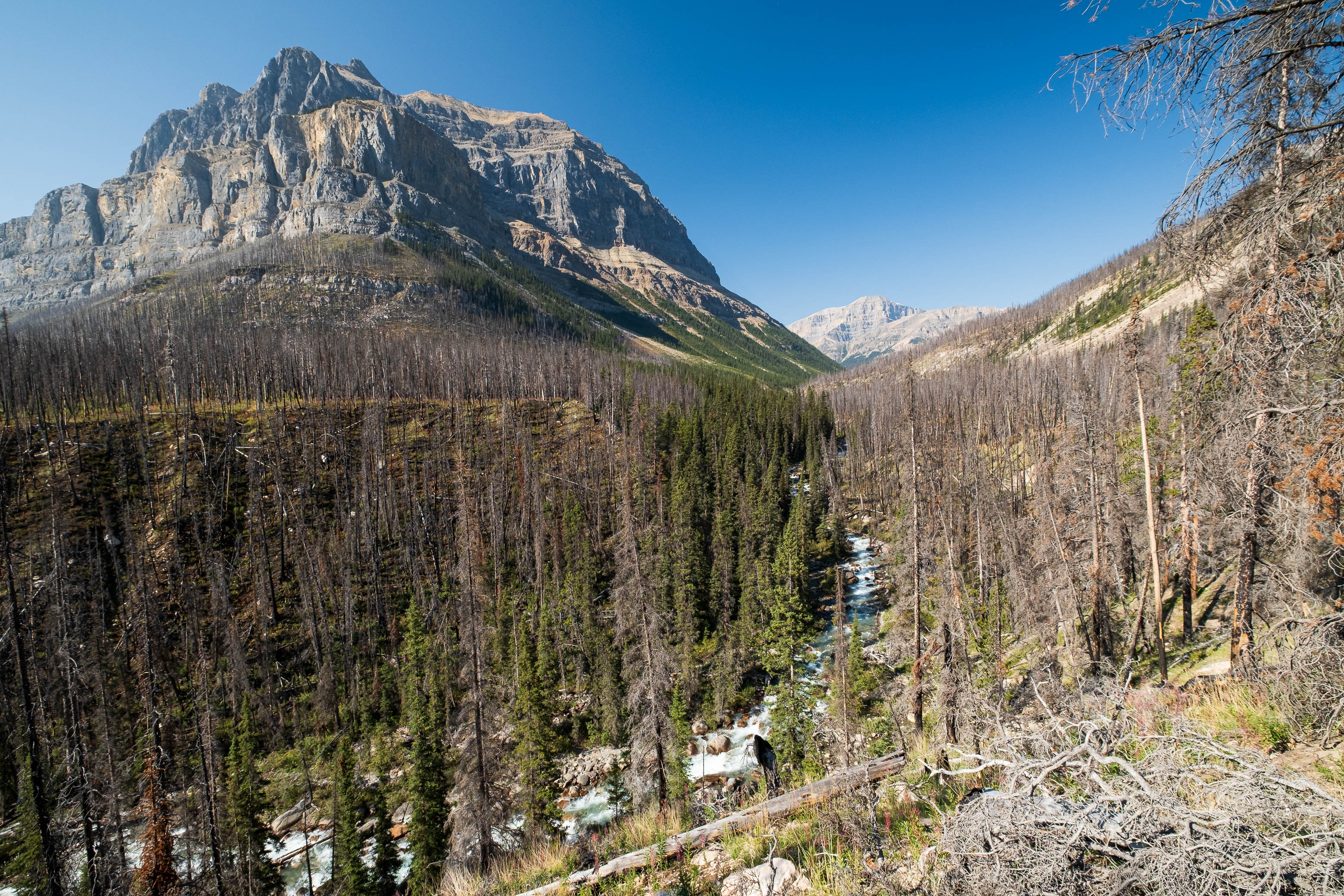
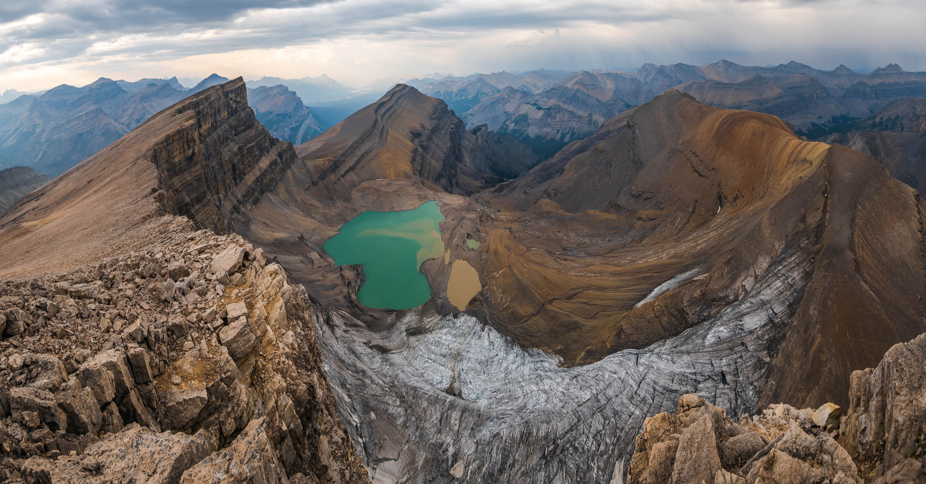
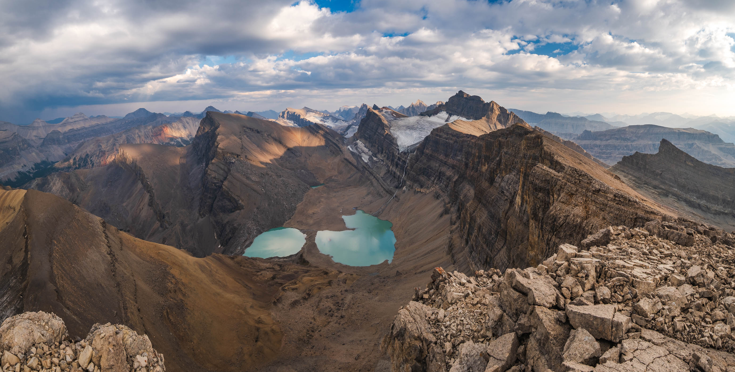
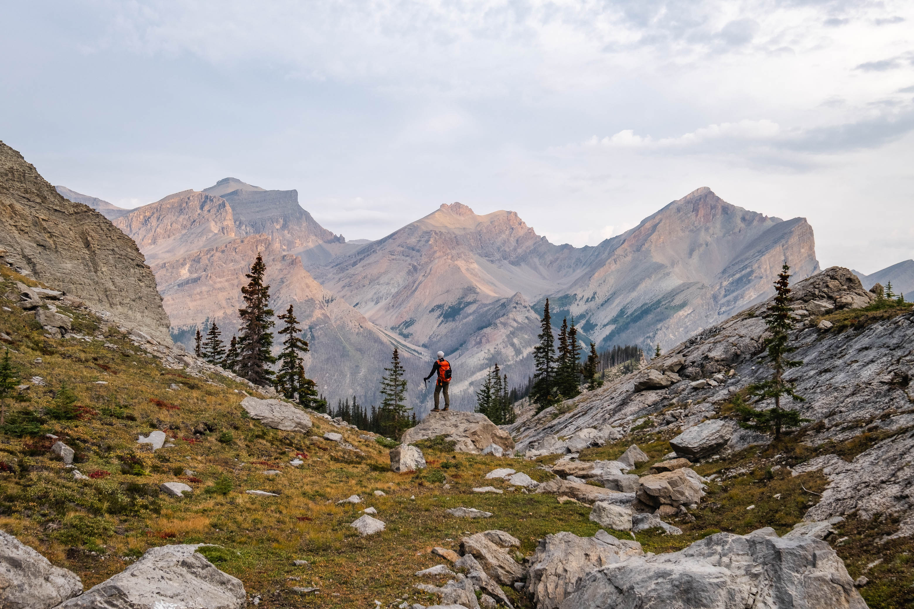
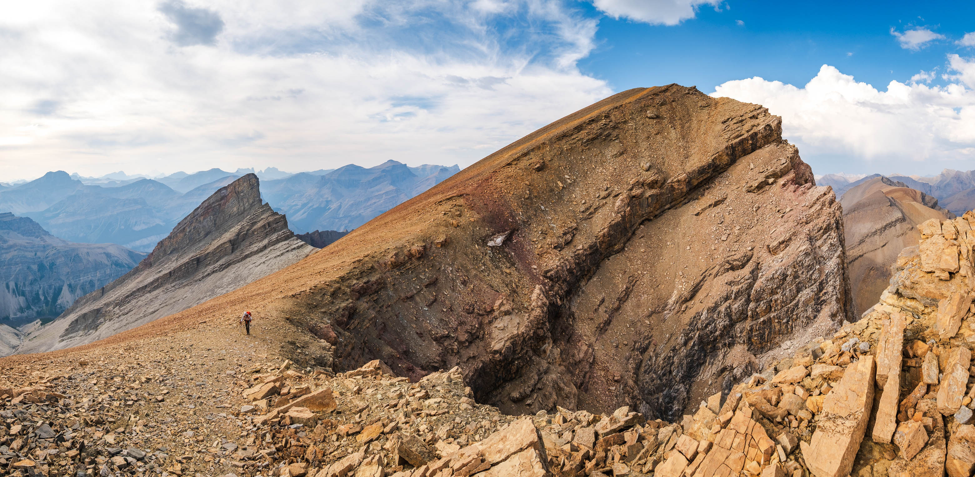
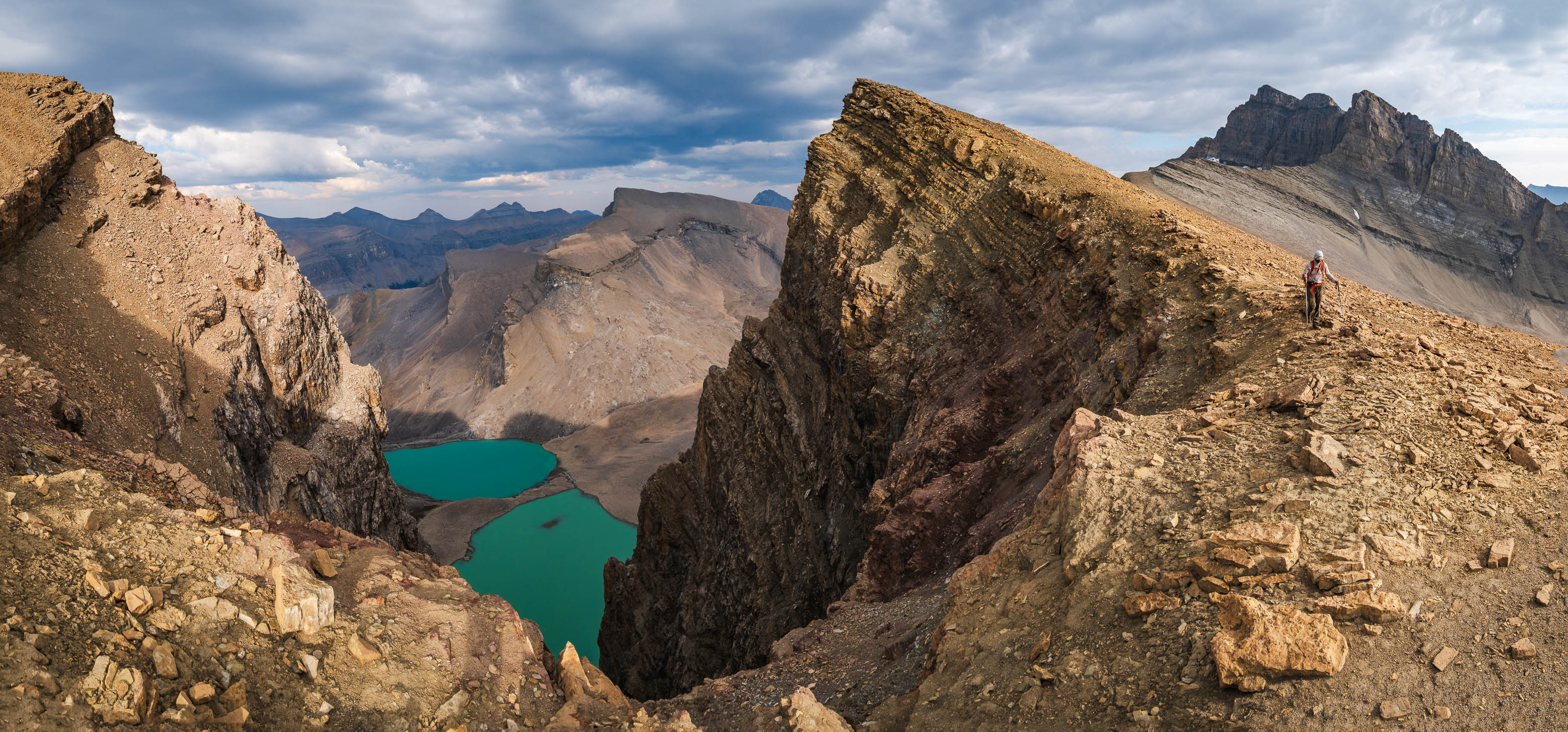
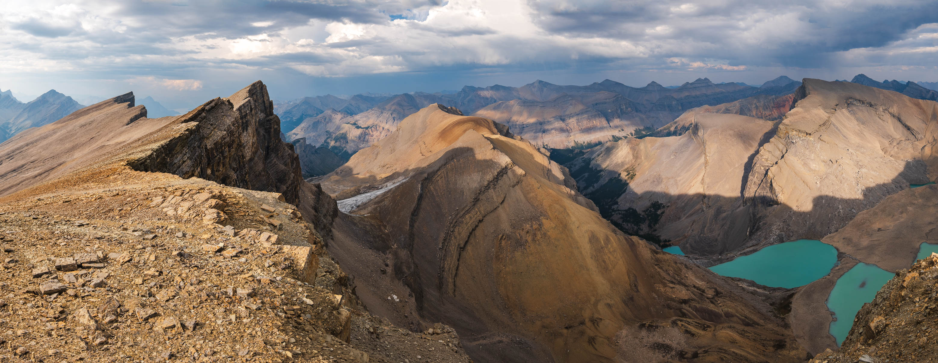
Hoping to get a view of all four Fuhrer Lakes - quietly tucked away in the remote valley below Fuhrer's incredible east face - we angled to climber's right (yes, away from the summit) as we approached the ridge. This took us to a small, rocky outcrop near the low col between Furher and Abstruse, and let me tell you, the scene that awaited us upon topping out at this viewpoint was absolutely jaw-dropping!
Stunning views await, as we top out on the ridge! Fuhrer, Erudite, Kahl, and Abstruse (Perren), with all four Fuhrer Lakes visible below!
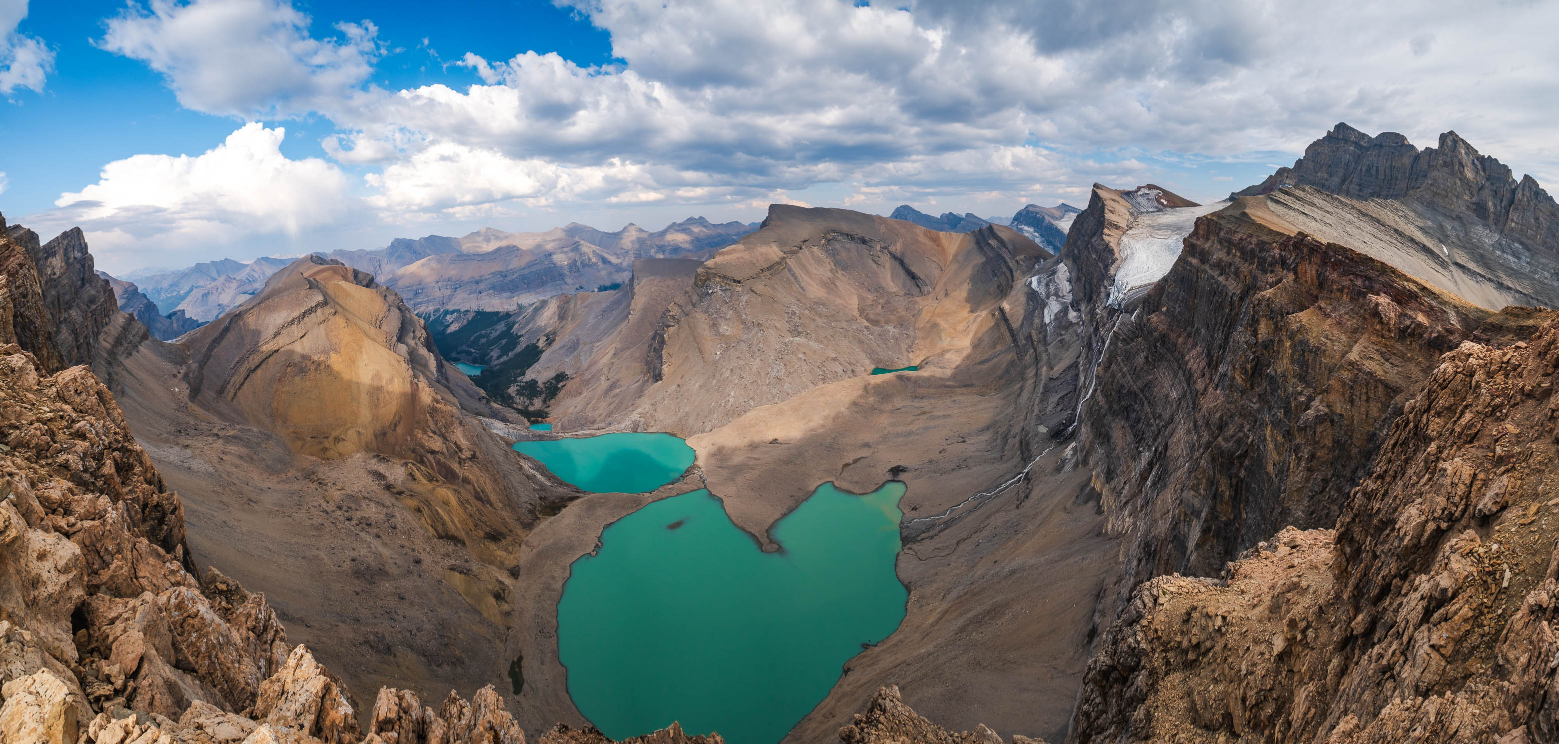
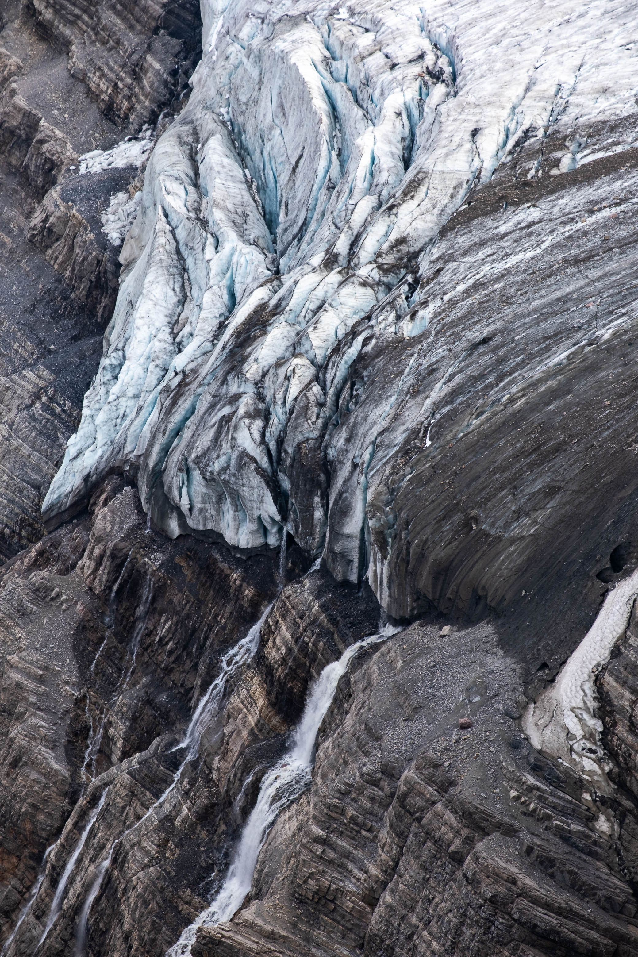
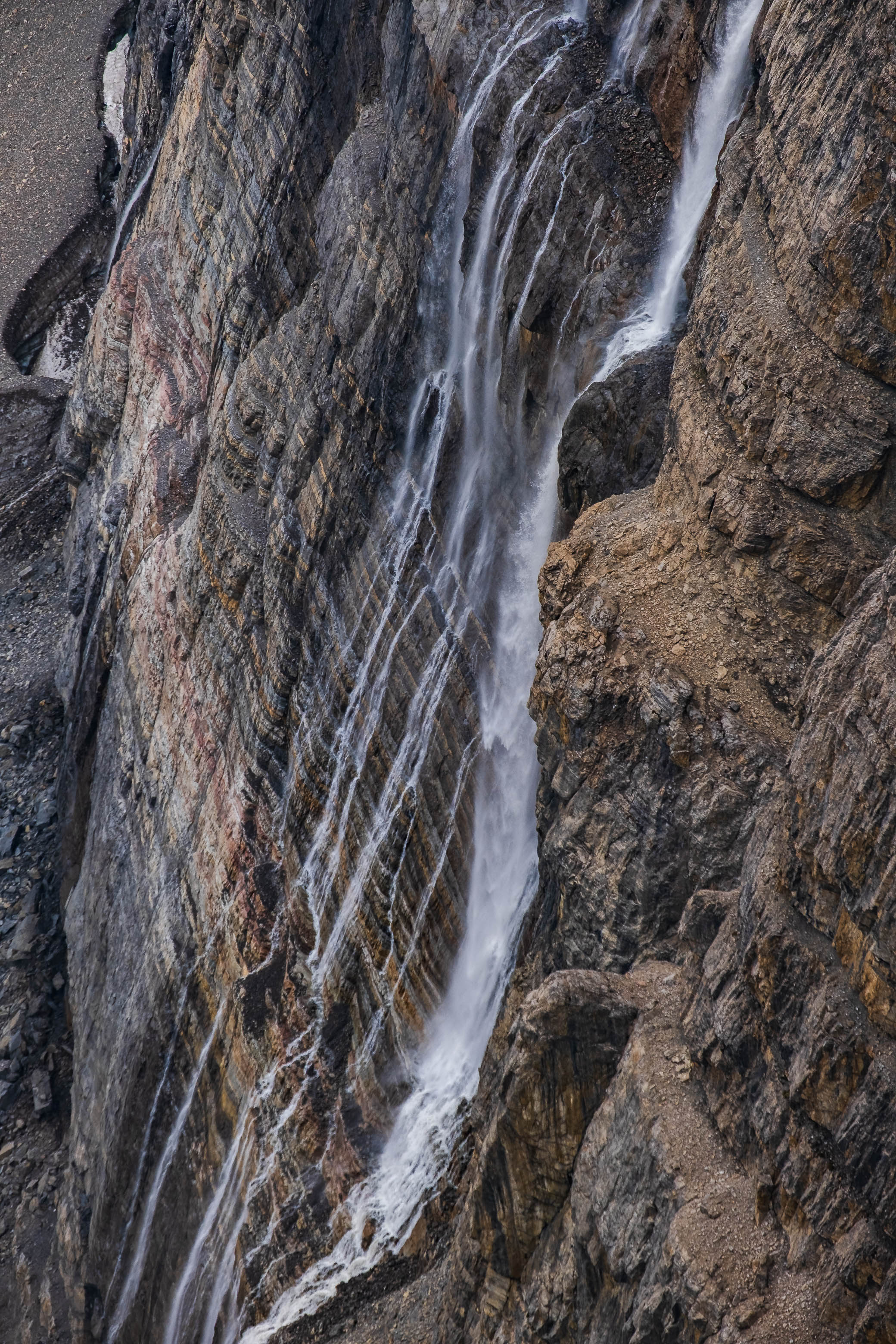
Abstruse Peak's near 11,000 ft form towered above, with an incredible waterfall coming off its NE glacier and plunging hundreds of meters down the vertical face to feed the deep turquoise waters of all four Fuhrer Lakes. I wonder how many people have experienced this view! Probably not very many!
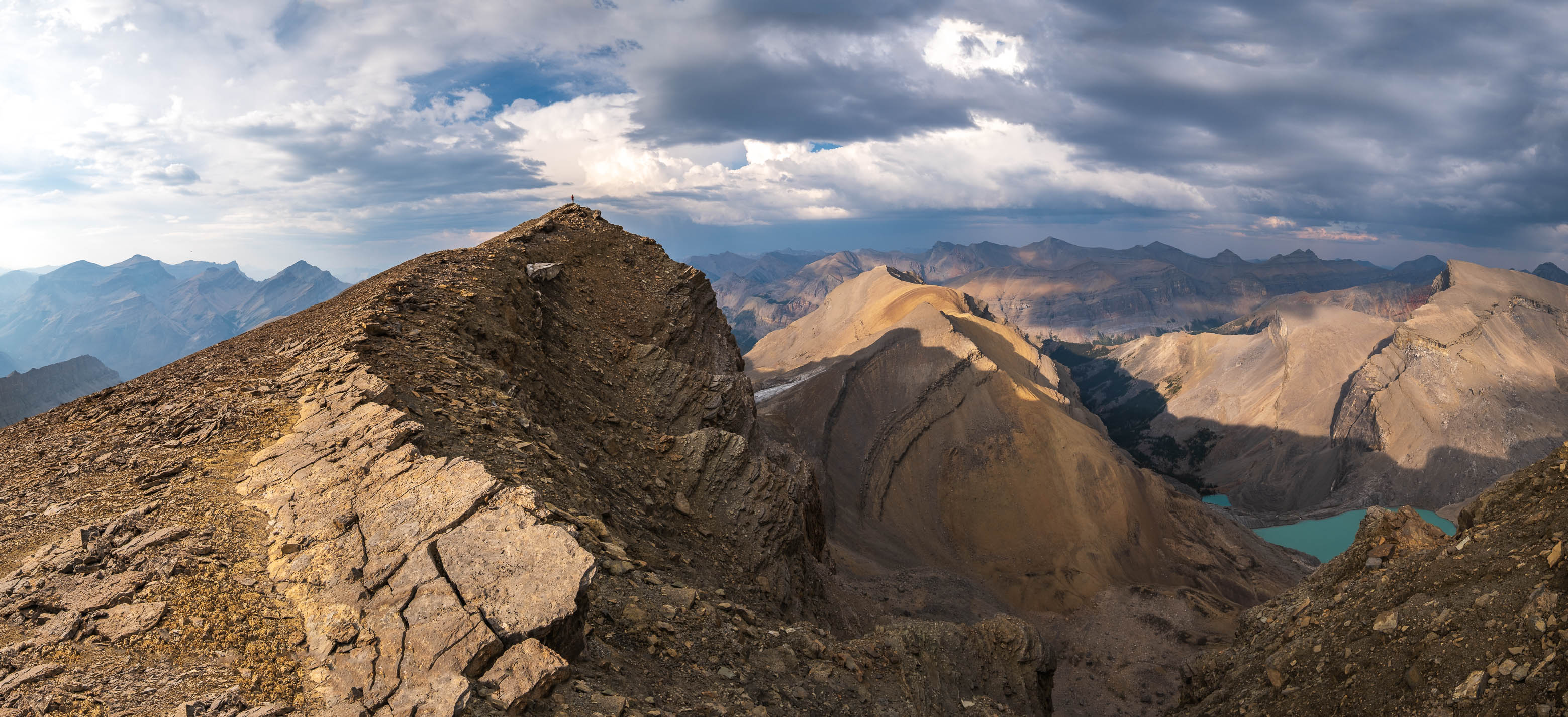
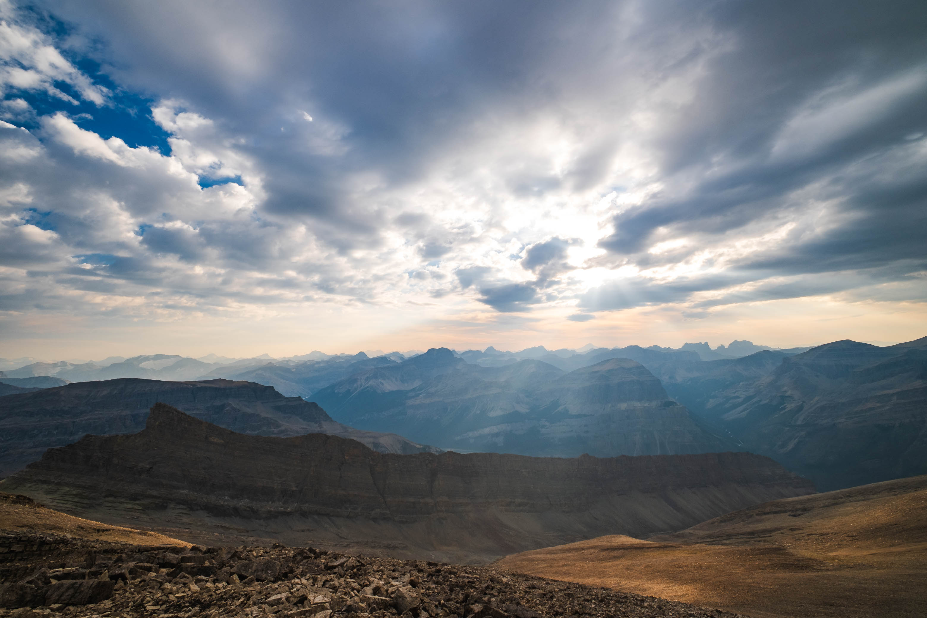
After spending way too much time "oohing" and "ahhing" over the stupendous scene that lay before us, I reluctantly pried myself away and started the final ridgewalk towards Fuhrer's apex, still about a 1.5 km away.
Making the final steps to the summit of Mount Fuhrer over the incredible wall of rock that is its east face!
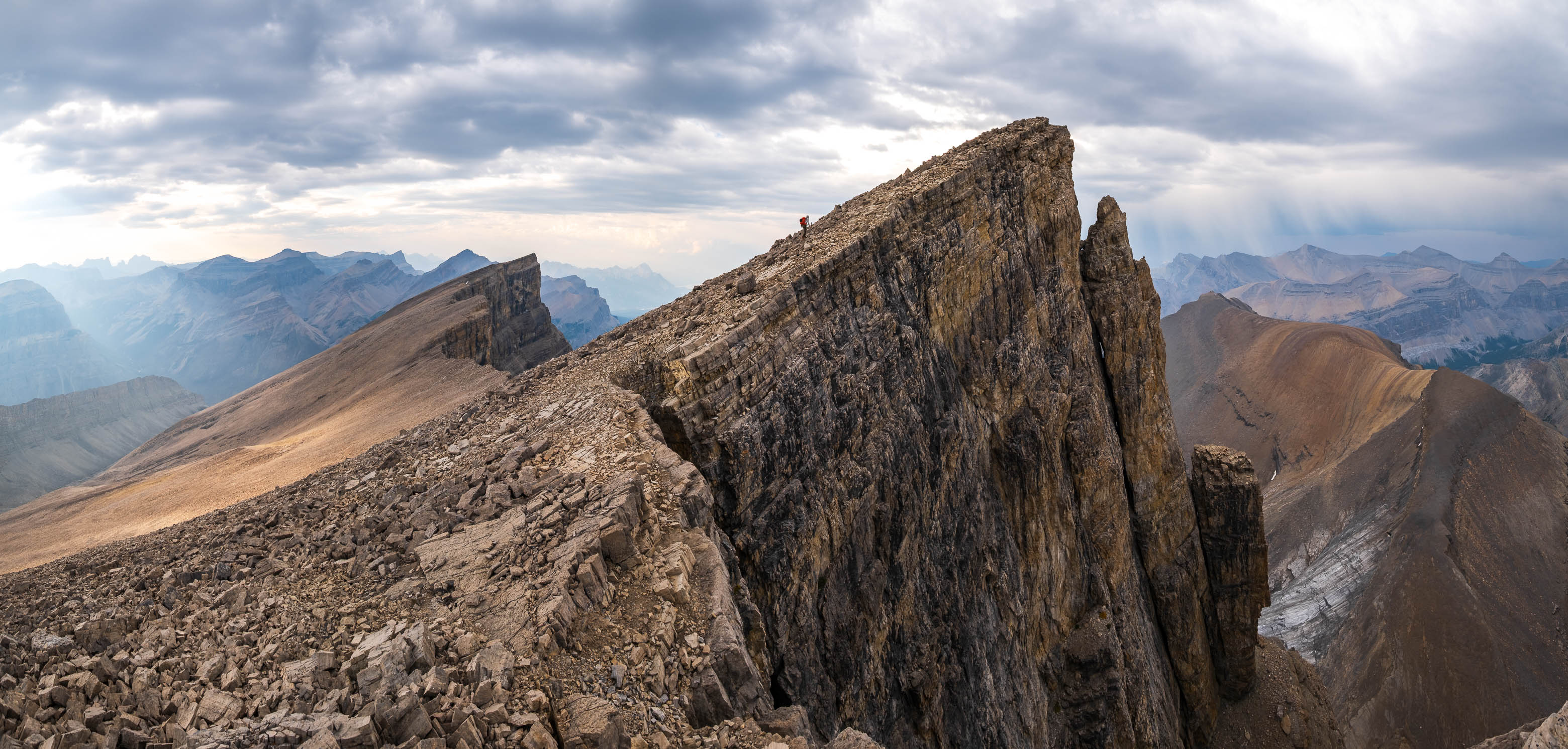
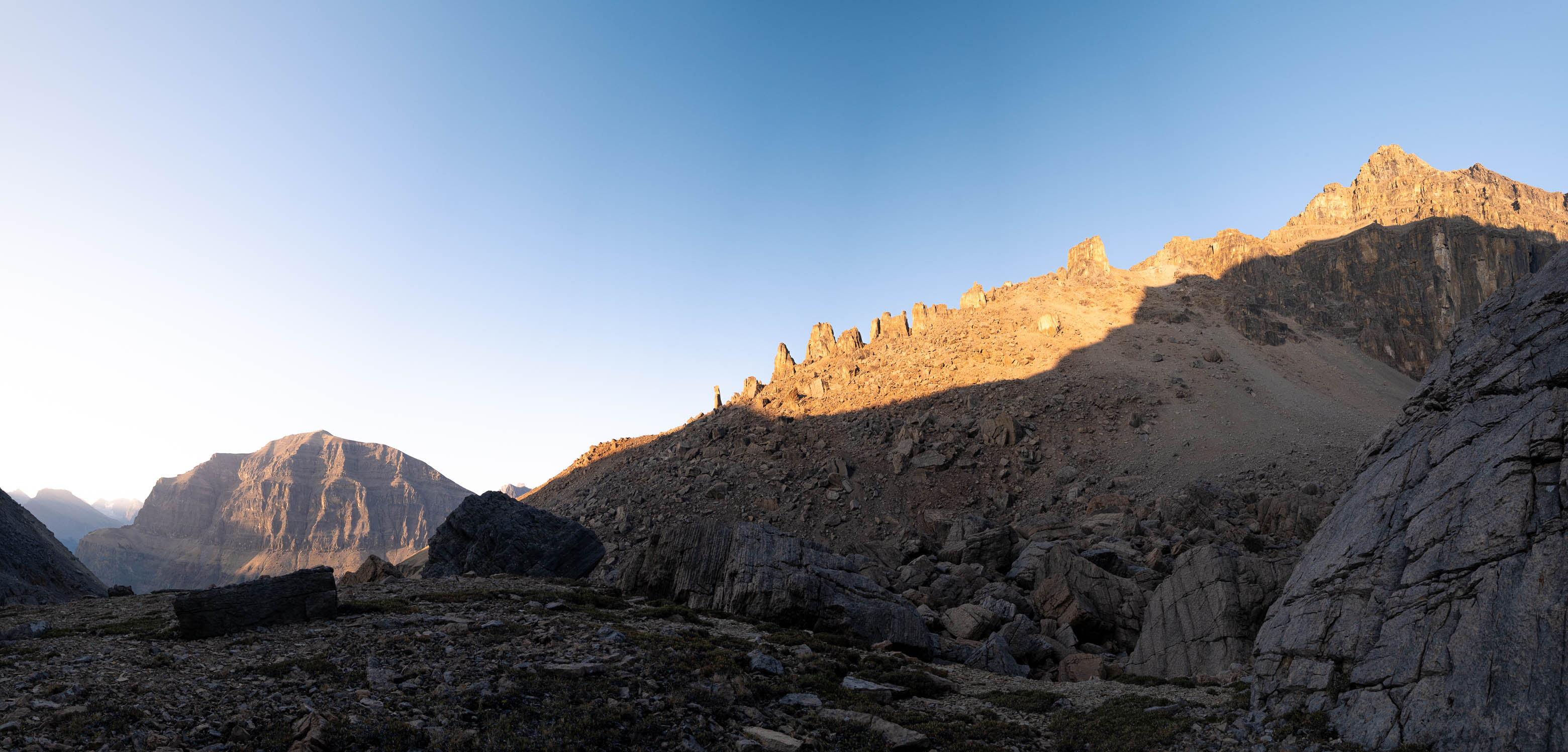
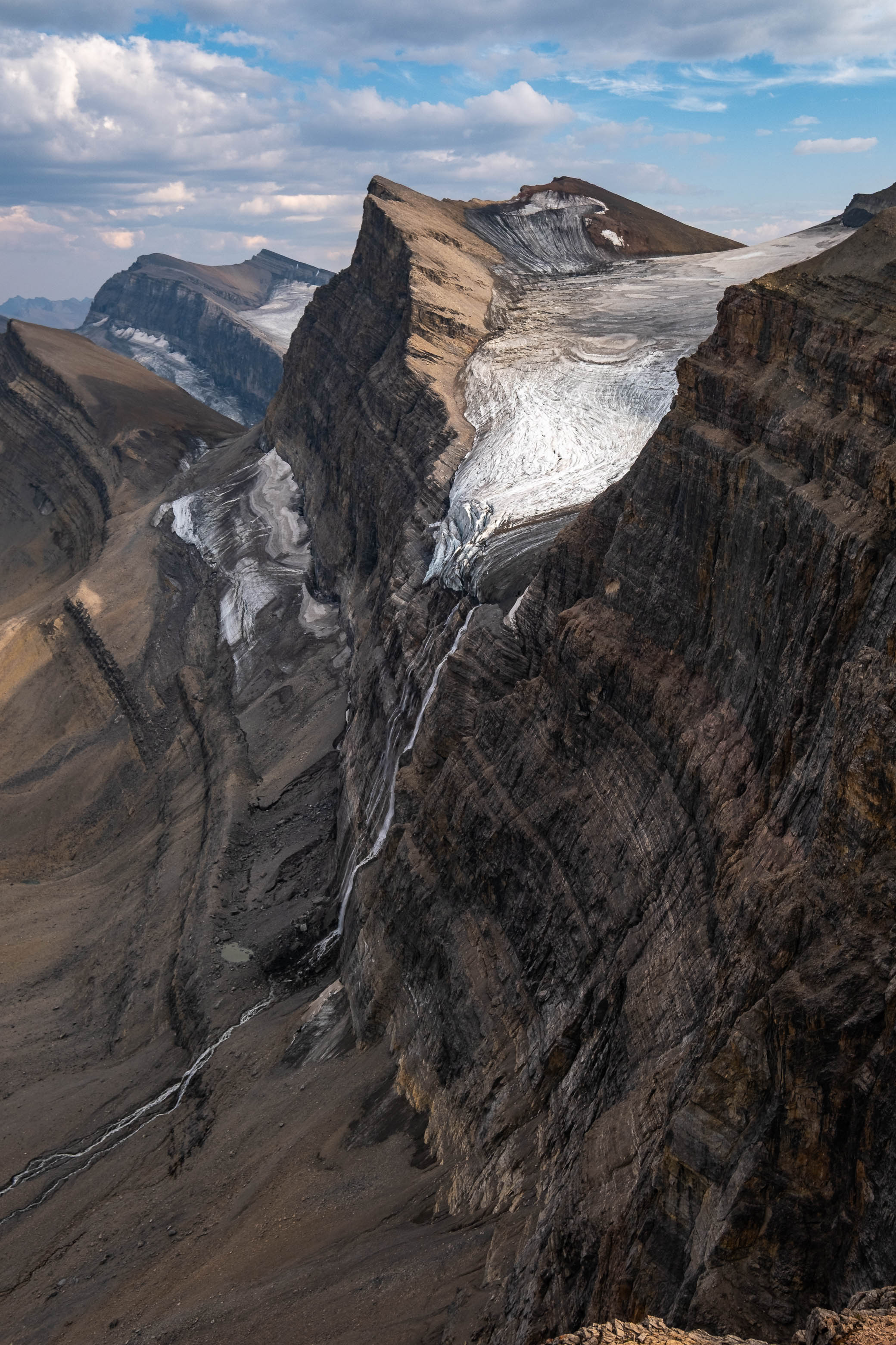
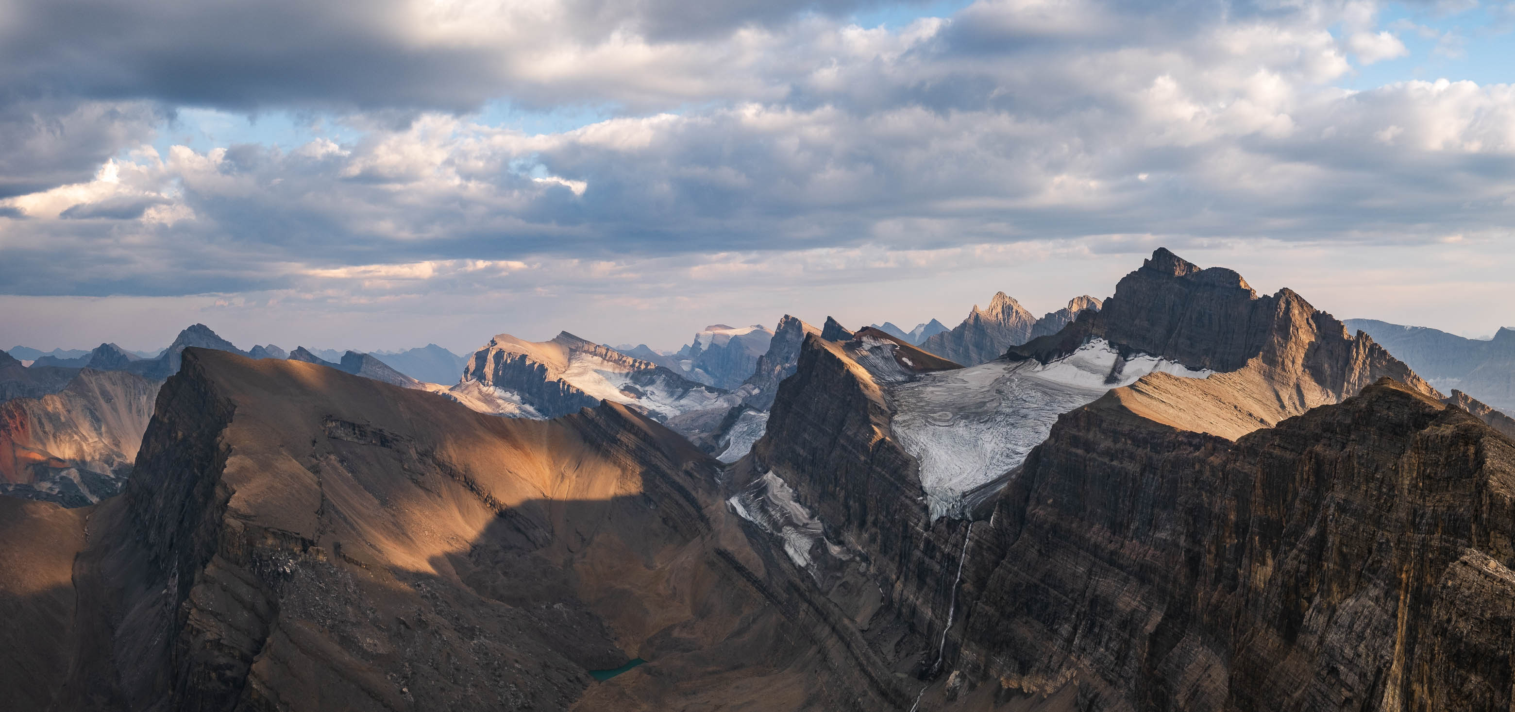
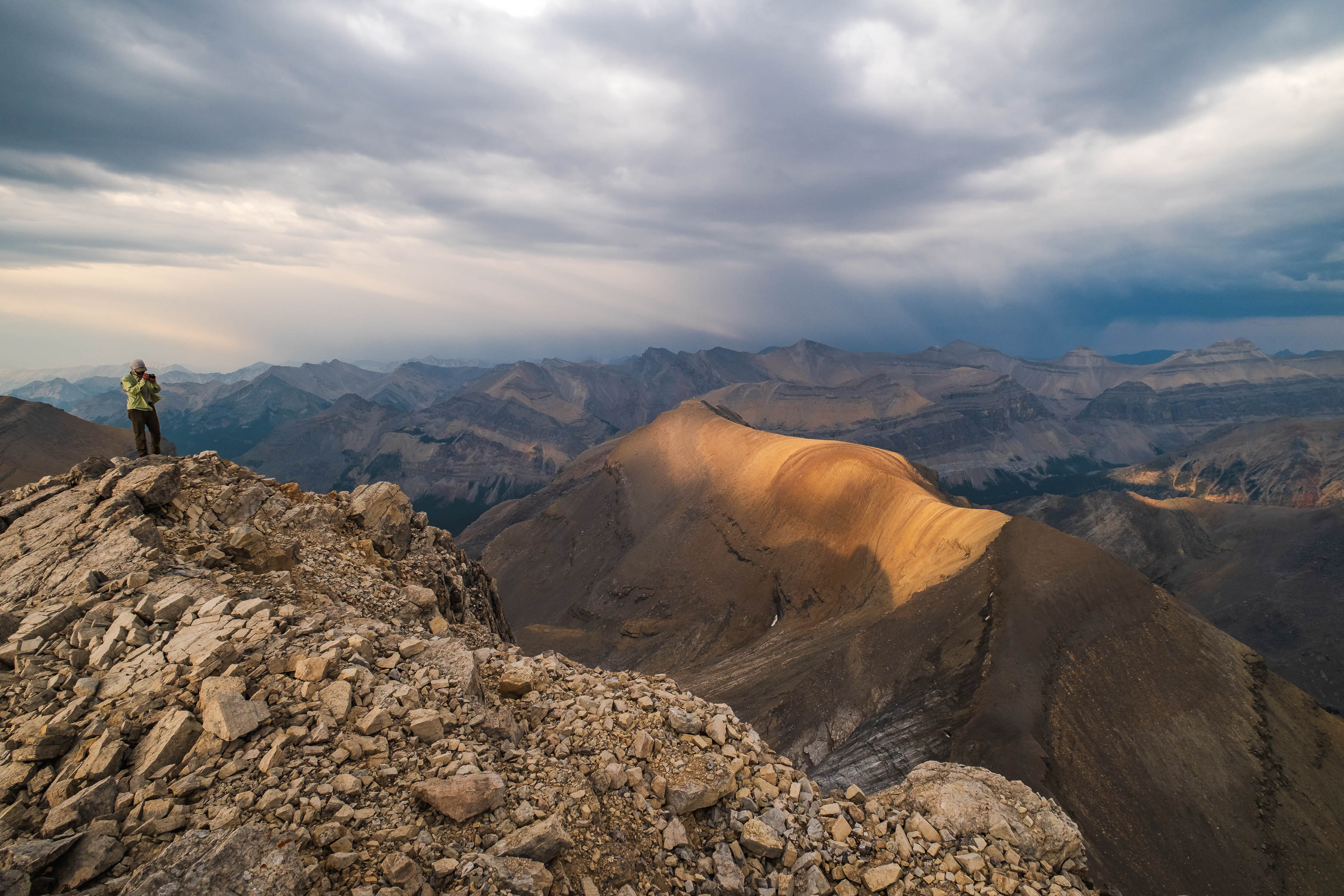
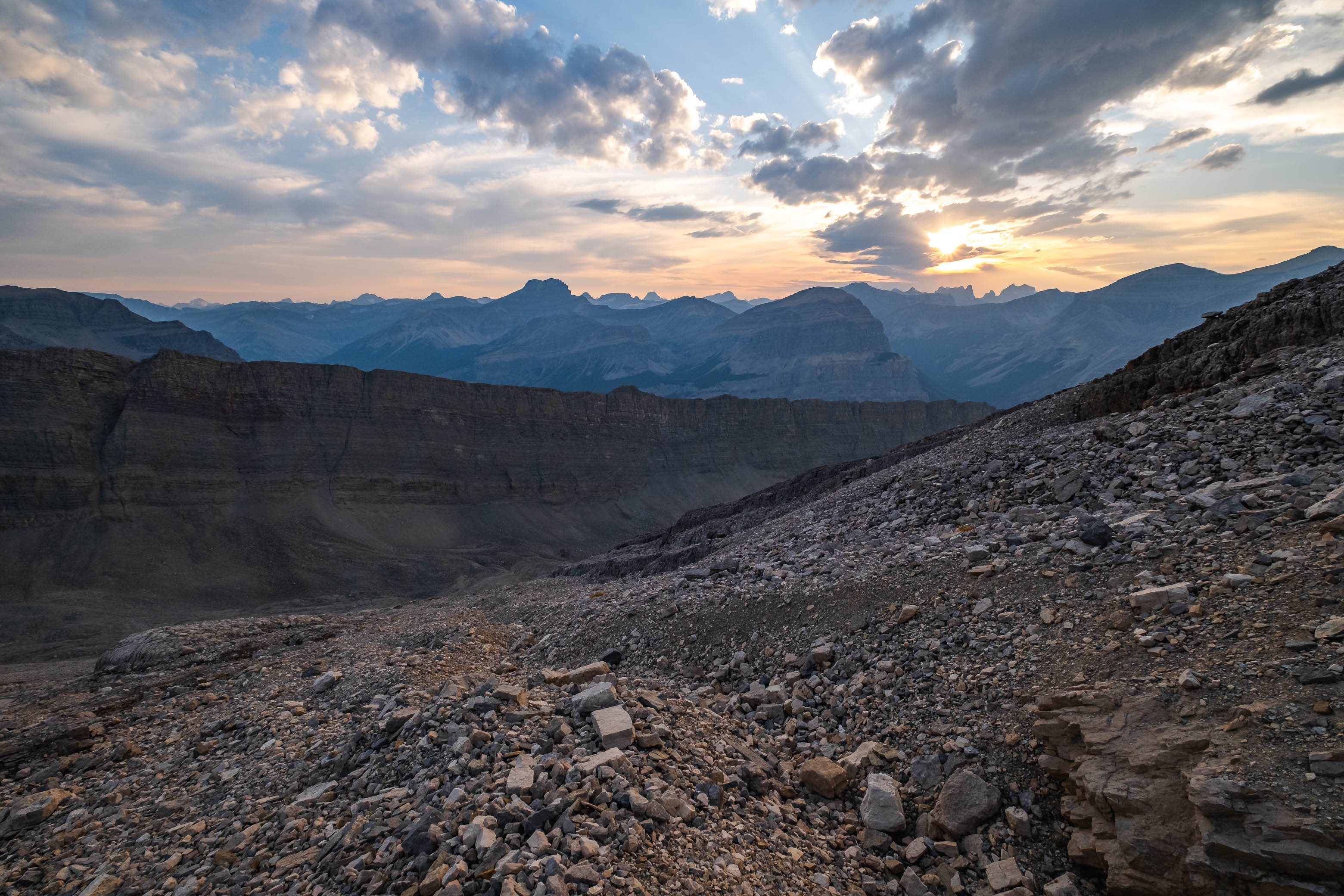
A thick layer of cloud rolled in as we climbed these final 100 vertical meters, but views were still incredible as we traversed directly above Fuhrer's sheer east face. A few minor ups and downs later, we found ourselves at the small summit cairn built by Vern and Wietse just one month prior, accompanied by yet another magnificent summit panorama to reward us for our efforts. The lower two Fuhrer Lakes were blocked out from this angle, but the views we gained off Fuhrer's NE face easily made up for it, with a small hidden glacier feeding a couple more colourful tarns, 500 meters directly below us!
A small, dying glacier sits tucked away below Fuhrer's NE face, with Fuhrer's slightly lower NW summit, Mount Heinrich, and Erudite Peak rising over a couple colourful alpine tarns fed by said glacier.
Views back along Fuhrer's southern summit ridge include, Mamen, Icefall, Kahl, Harris, Antevs, Recondite, and Abstruse, with two out of four Fuhrer Lakes still visible below.
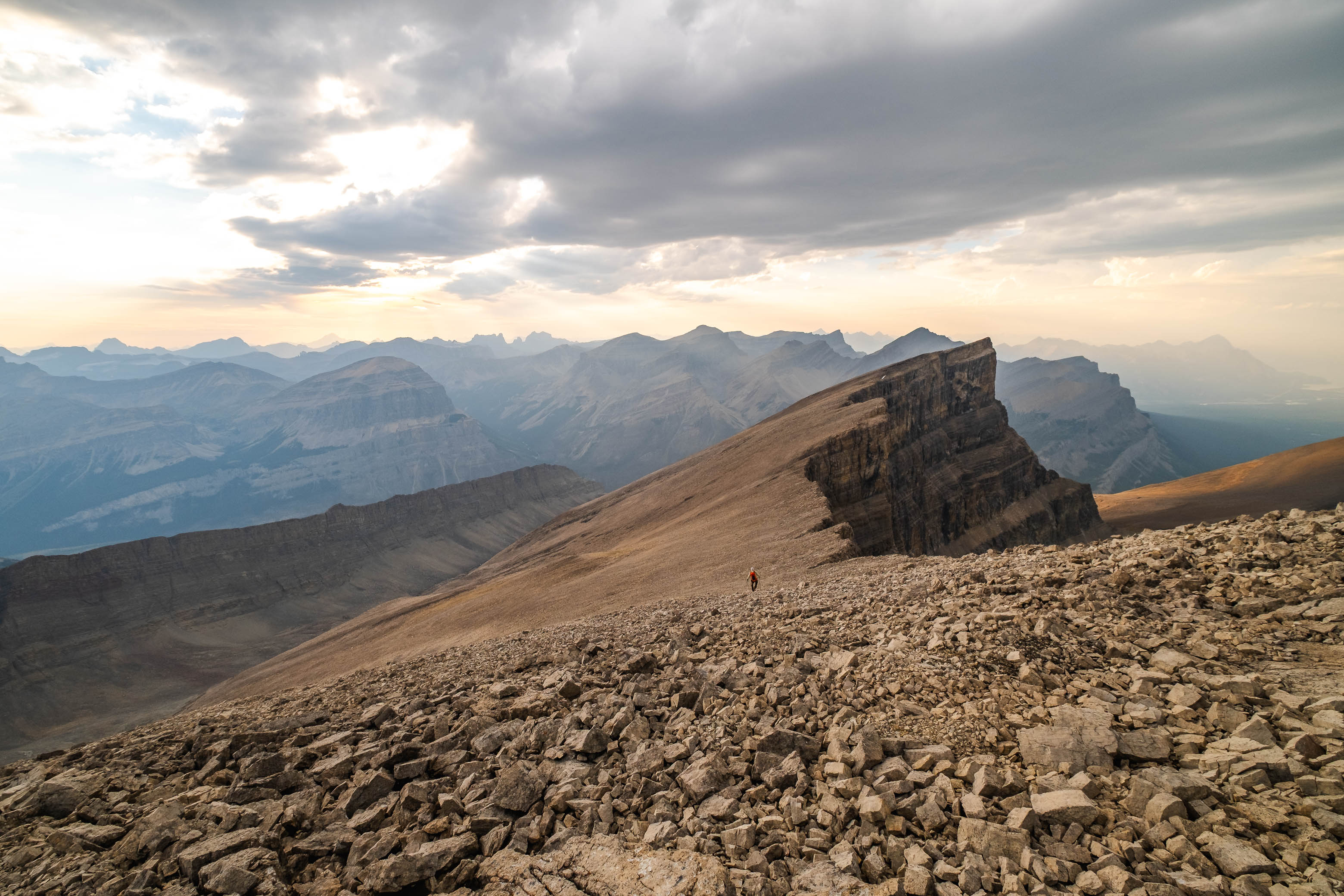
Having traversed the summit ridge at a very leisurely pace (the views were just a little bit distracting...), and with dark t-storms brewing ominously to the east, we didn't have much time to waste. After leaving a small film canister summit register (I meant to add in Rick Collier's 2000 ascent and Vern and Wietse's July 29, 2023 ascent, but it totally slipped my mind in the moment!), and snapping a few more pictures, we continued to follow in Vern and Wietse's footsteps - taking a more direct line back to camp by continuing down the ridge to the NW before angling down steep, western rubble slopes back to Chortling Marmots Creek.
The sun finally breaks through the clouds, illuminating the mountainside in beautiful evening light, as we descend a direct line back to camp.
Picking our way down Fuhrer's western slopes. The target col we utilized on our ascent is visible at right.
Steep, rubble slopes lead back down to Chortling Marmots Creek.
We noticed some pretty major cliffs lining the southern half of these slopes while hiking below them a few hours earlier, and made sure to angle quite significantly to skier's right so we didn't risk ending up in a sticky ("cliffy") situation. π The solid nature of the rubble made for a somewhat slow descent, but our chosen line went without difficulties, and we arrived back at our stashed camp supplies and small grassy "bivy patch" just as darkness fell.
Exit to Siffleur Falls Staging Area
Thanks to some sporadic rain showers throughout the night, our final sleep in the backcountry was definitely more restless than the first two had been. When the sun finally rose around 07:00, I was more than a little bit eager to say goodbye to the claustrophobic confines of my bivy bag, and quickly packed up for a long exit back to the Siffleur Falls Staging Area.
Waking up to the peaceful trickle of "Chortling Marmots Creek" for our fourth and final day in the Siffleur Wilderness.
Exiting the hanging "Chortling Marmots Creek" valley, with Loudon and Siffleur rising across the much larger Siffleur River valley.
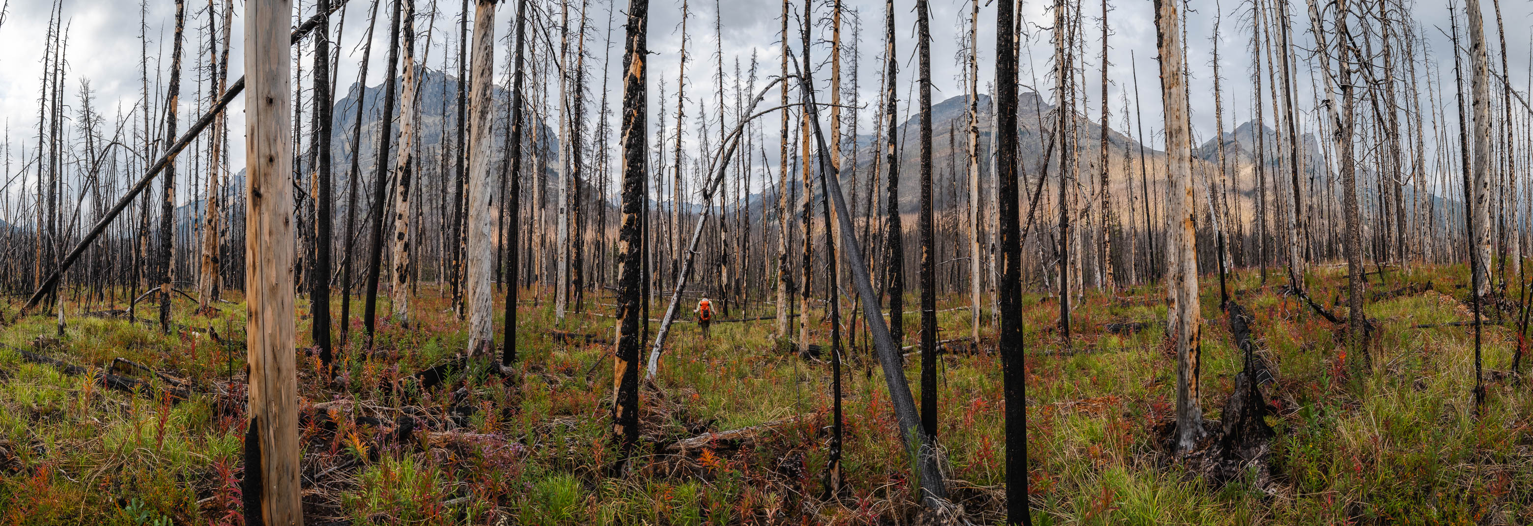
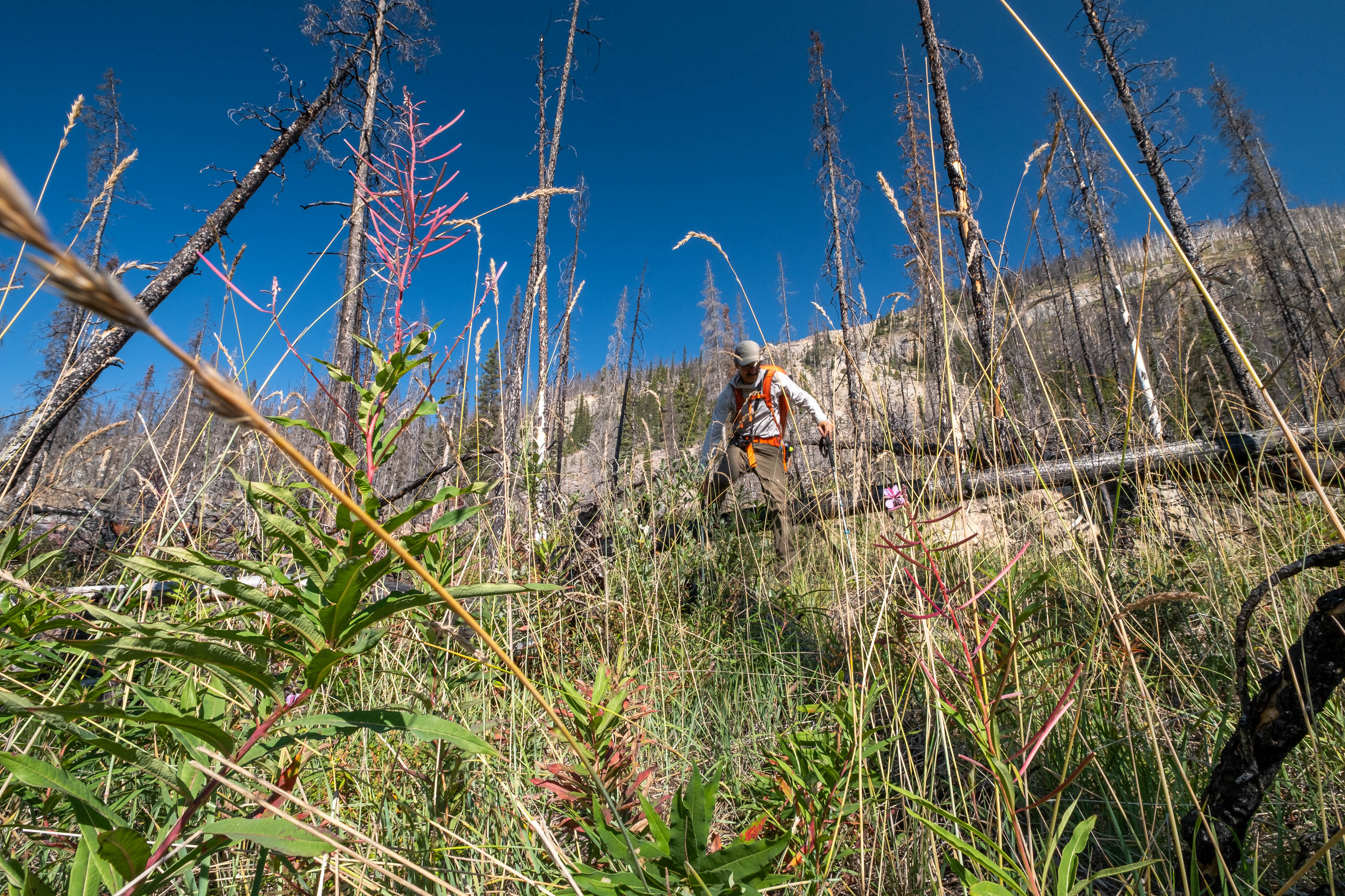
As we left the hanging valley and started back down the burn towards the Siffleur River, we quickly realized that the steep, grassy slopes would demand a little bit of respect this time around (rain + grass = SLIP CITY!), but even so, this would still be one of the easier parts of our day!
Hiking back down to the Siffleur River through burnt, open forest. Smooth sailing right now, but I can't imagine what this will be like when all these trees eventually topple over!
Wading across the Siffleur River felt significantly colder on this cool, dreary morning, but I didn't mind. After three long days of tough wilderness travel my feet could honestly use the numbing! π Since our feet were already cold and wet after crossing back to the west side of the Siffleur, we didn't bother wasting time and energy by balancing across Porcupine Creek's log "bridges" and simply continued trudging straight through its short, but powerful, outlet rapids.
Note how much deeper the water is on the right compared to the left. This is thanks to the added flow from Porcupine Creek (center), which we avoided by angling upstream to cross the Siffleur, before tackling Porcupine Creek separately.
Crossing Porcupine Creek's powerful outlet rapids.
Starting the long exit along the Siffleur River.
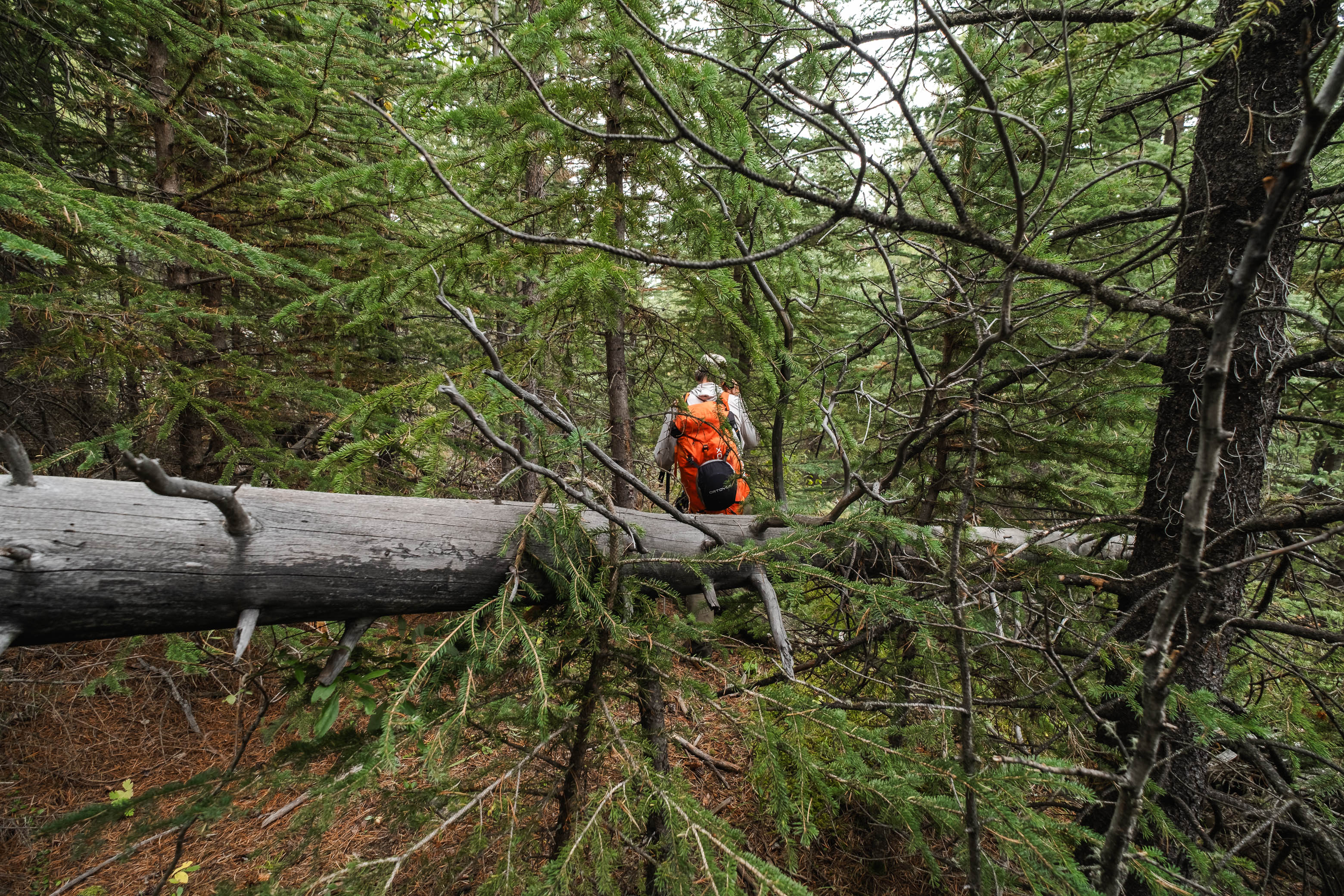
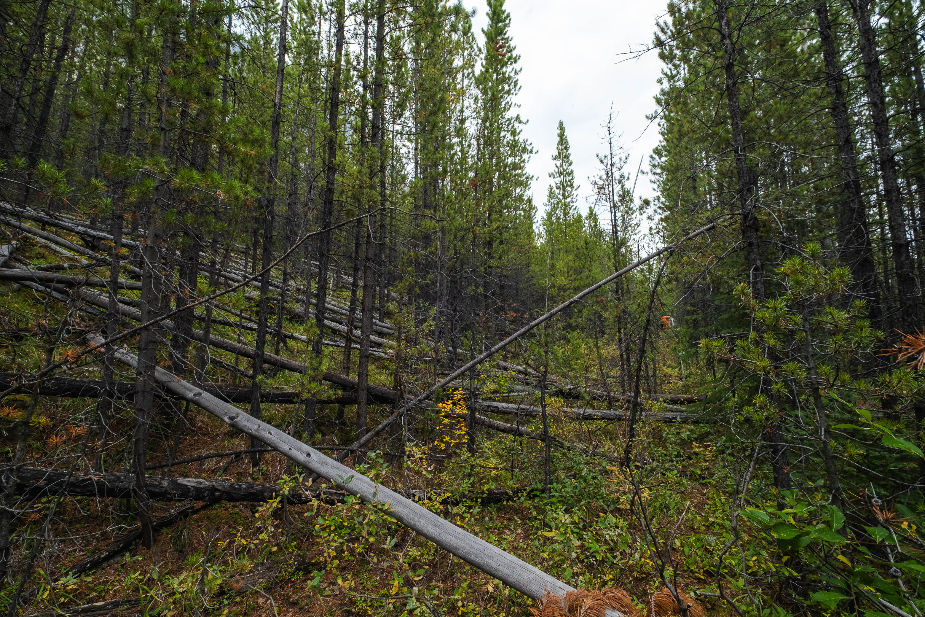
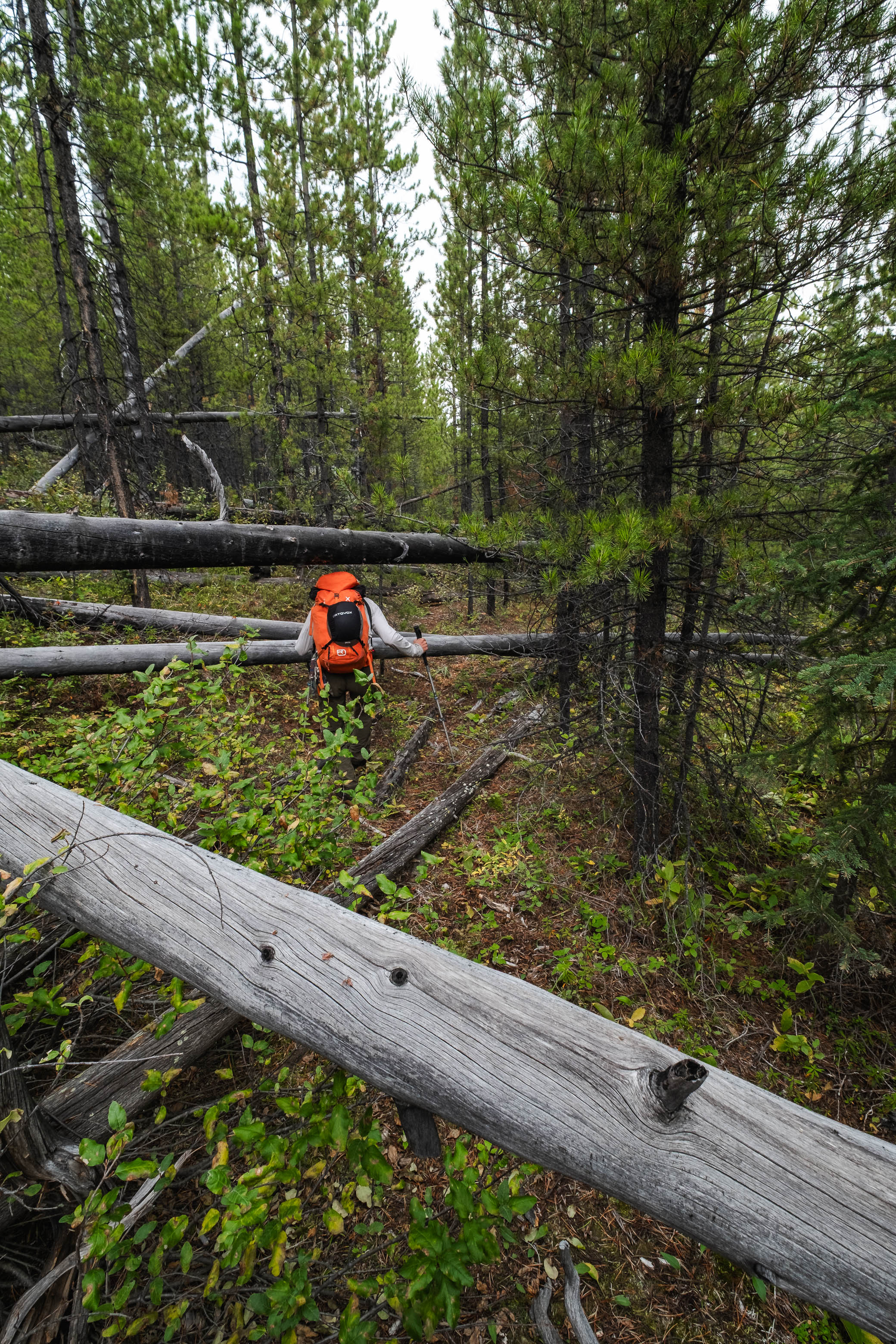
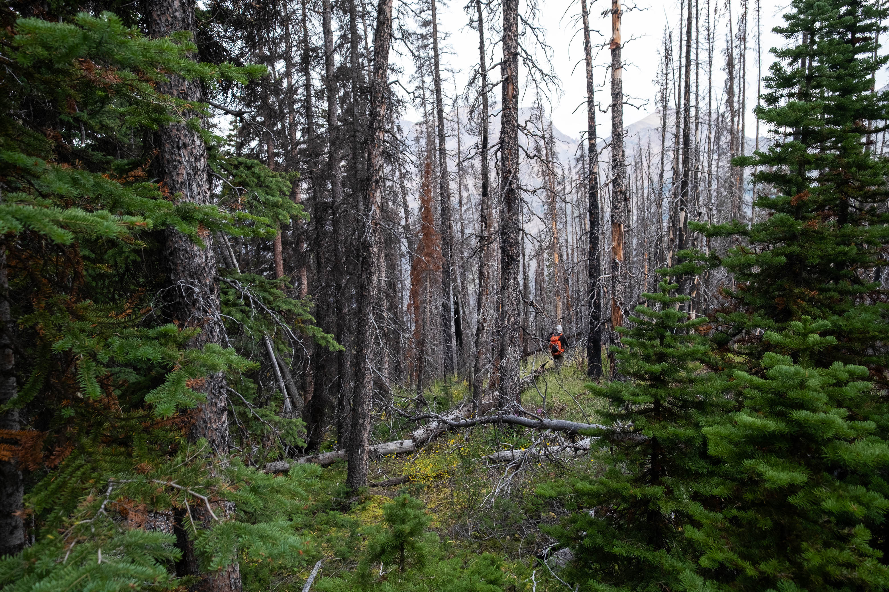
With all the aquatic extracurriculars now behind us, all that was left was a lengthy "trail-shwack" (a term I've come up with to describe a trail, so overgrown that it's practically become full-on bushwhacking), that I can't say either of us were particularly looking forward to...
Let the "trail-shwacking" begin!
Sometimes the cutline is obvious and easy to follow...
...other times, not so much!
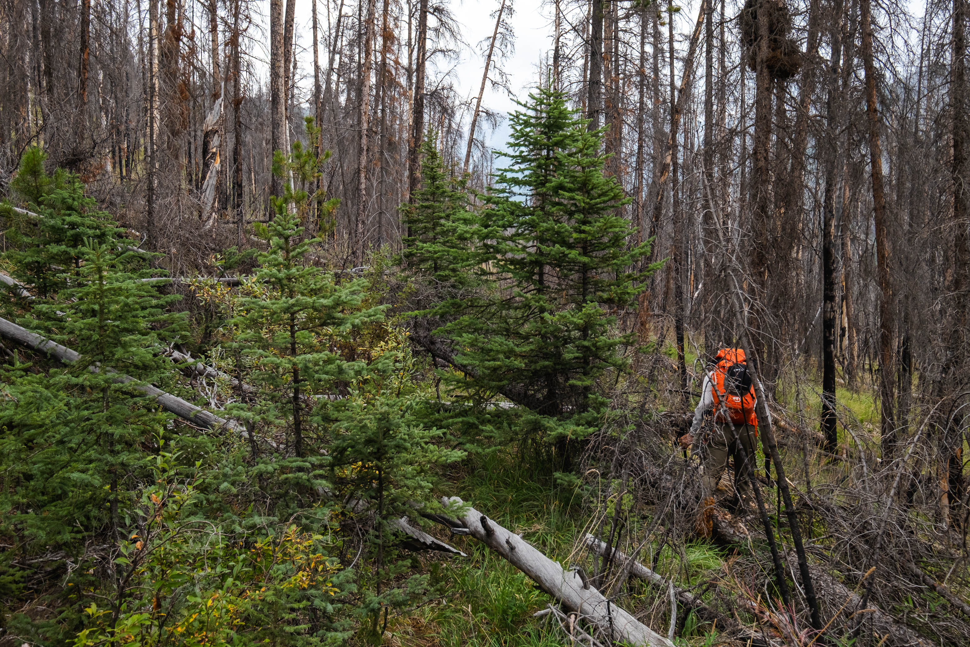
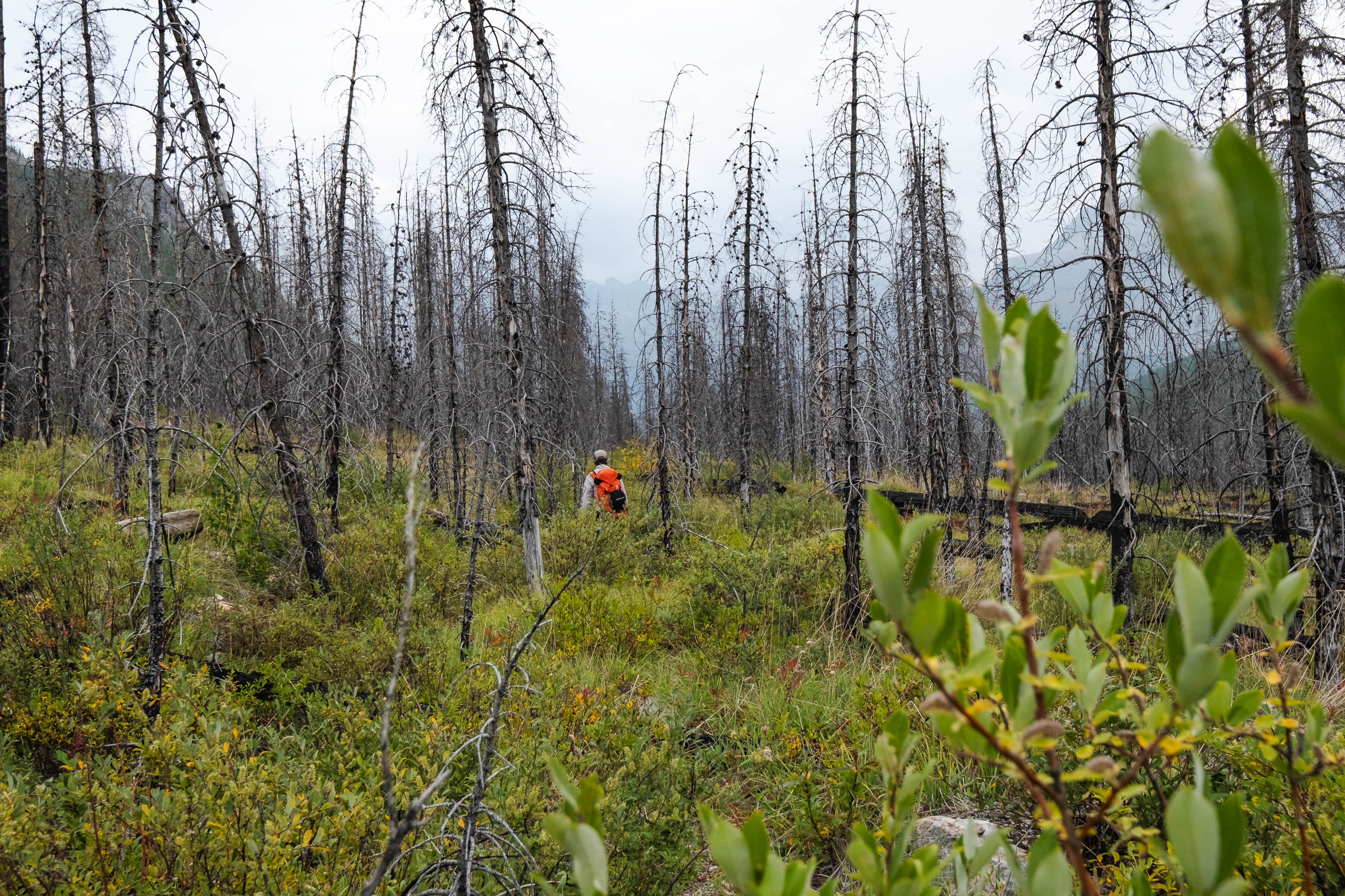
As the kilometers dragged on, our feet and shoulders became more and more achy (the cold water treatment wore off pretty fast), and we hiked in silence, each of us lost in our own thoughts. It took every ounce of energy we had left in the tank to drag our tired bodies through the maze of deadfall, but we knew there was no avoiding it, so we accepted the task at hand and did our best to settle in to a rhythm, marching slowly, steadily onwards.
No, this isn't just a short "crux"...this goes on for multiple kilometers.
Dense forest and deadfall - that's the Siffleur River "Trail" for ya!
Over, under, over, under...
I guess we became a little bit too lost in our thoughts, because neither of us noticed when our cutline changed trajectory from NE to due N, and ended up hiking a few hundred meters in the wrong direction before realizing something was off. Dang it!
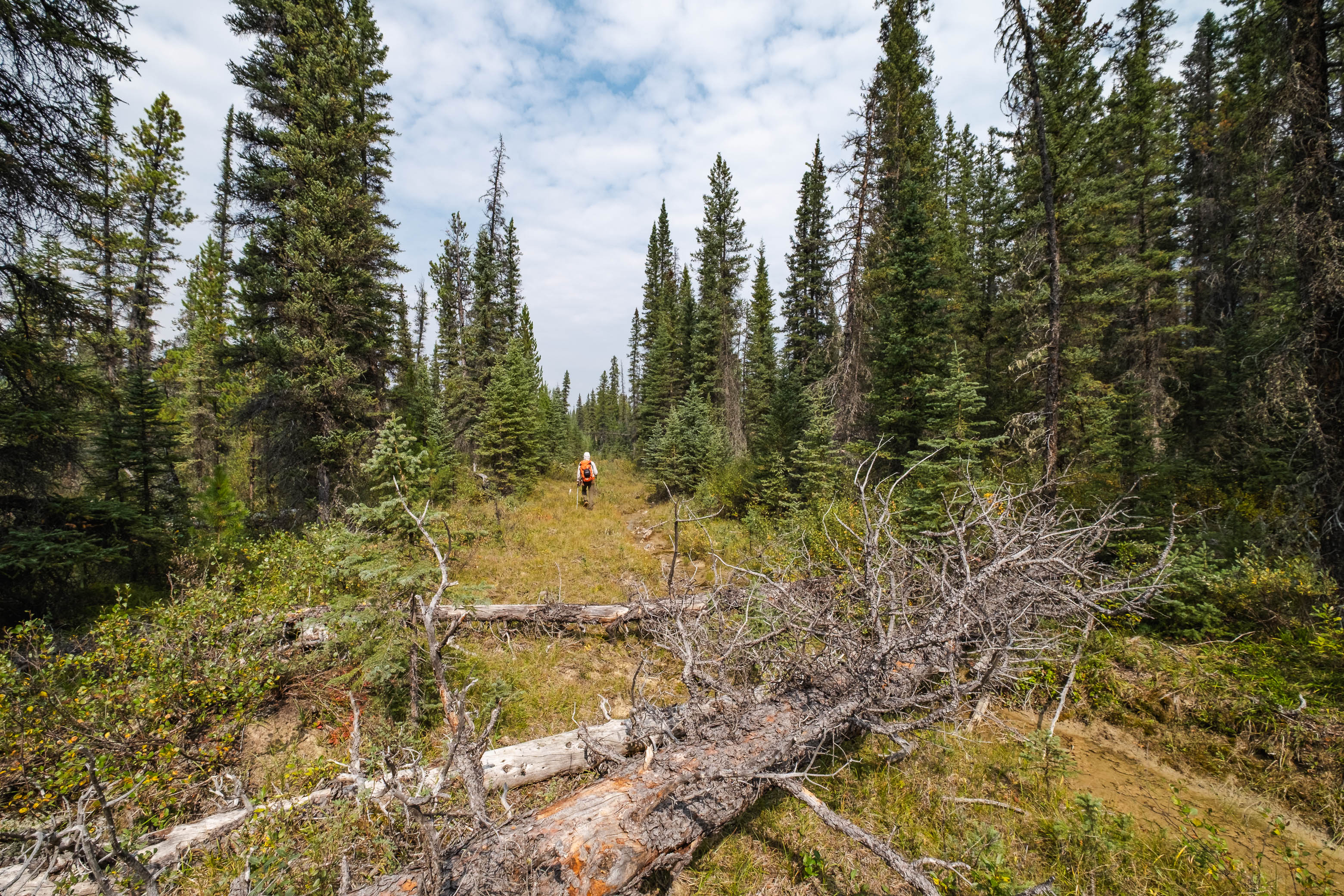
Eventually, after hours of tiresome "trail-shwacking", the travel conditions finally started to improve, and with them so did our moods. As the sun came out and we enjoyed these final few kilometers of open cutline to the wilderness boundary, I even found myself already dreaming up a return trip to this wild place. Funny how quickly the mind can forget all the suffering. π
The cutline finally opens up again as we approach the wilderness boundary. This was a much needed change of pace after spending hours in the "forest jail".
Reunited with our bikes at the Siffleur Wilderness boundary, for an 8 km ride back to the parking lot!
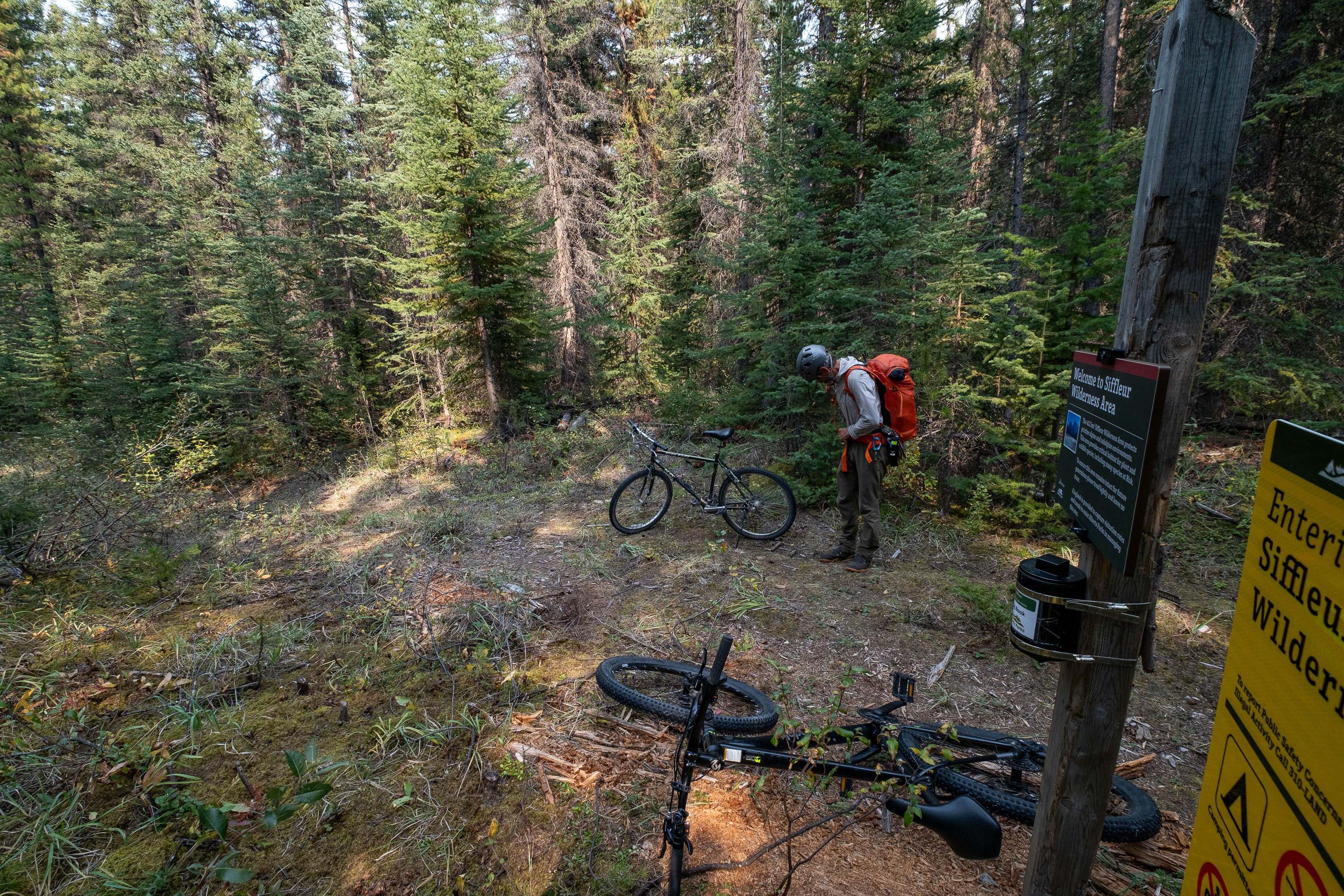
When we arrived back to our stashed bikes at the wilderness boundary, we opened up the recently installed log book to find one entry since Vern and Wietse's trip. It was some snarky comment about there being too many restrictions on the Siffleur Wilderness Area, and while we originally had no intention of writing anything in the log book, we simply couldn't resist adding a counter comment applauding Alberta Parks for how wild and beautiful the area has been kept and asking that it remains that way.
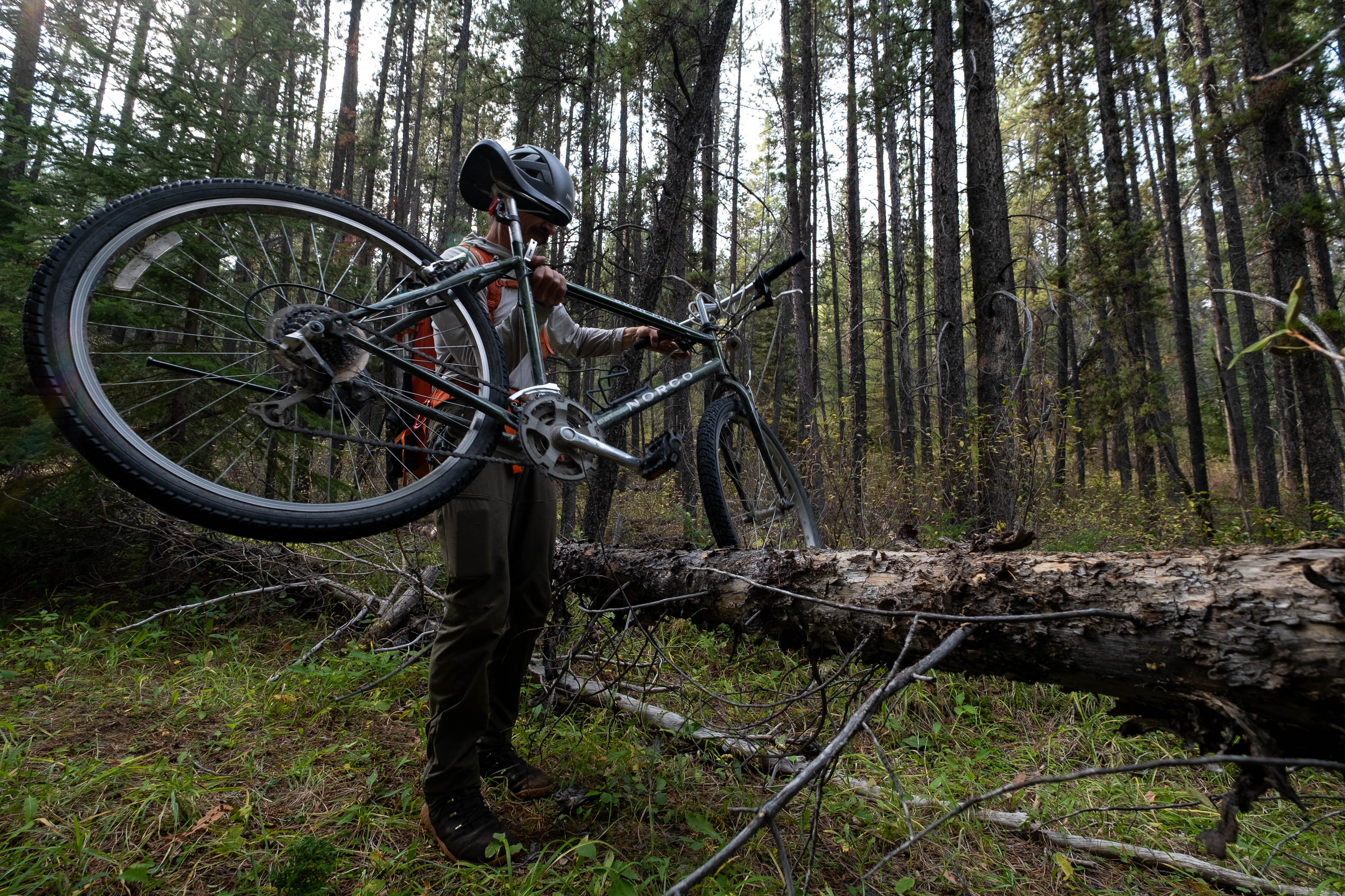
We were beyond grateful to have our bikes for the final 8 km peddle through the Kootenay Plains Ecological Reserve, and rolled up to the parking lot with a handful of families out enjoying the Siffleur Falls Trails on what had turned out to be a beautiful, albeit smokey afternoon.
Cruising down the final stretch of open road along the North Saskatchewan River. Gotta love bike approaches!
Easily taking the top spot as my highlight of the summer, our four day trip up the Siffleur River is not one that I'll soon forget. Venturing into the heart of the Siffleur Wilderness wasn't easy, that's for sure, but I don't think I want it to be. I'm sure there are plenty of people out there (like the dude in the log book...) that feel like there are too many restrictions on the Siffleur Wilderness, but I am definitely not one of them! I've never explored a part of the Rockies that felt as wild and remote, and there's something undeniably special about the feeling of being truly "out there", exploring a place where only a handful of other humans have set foot throughout history. It's places like this that draw me in and spark my curiosity in a way that popular, well-traveled routes never will, and I can't wait to come back and explore more of the wonders that the Siffleur Wilderness has to offer.
Photo Gallery
Sunrise from our bivy in Loudon's southern hanging valley. We descended the steep rubble/boulder slope, at center-right, in the dark the previous evening.
Gathering water from our "miracle spring" was a bit of a process...But we were beyond thankful to have it!
Navigating our way back through Loudon's massive boulder field as we set off from camp on day three.
Some of the boulders in this valley are HUGE!!
We took a higher line on the west side of the valley for our descent to avoid as much of the boulder maze as possible.
Views back to Loudon as we exit the valley. The true summit is at right, but I first had to ascend the false summit (left) to get to it.
An outlier of Quill towers over Porcupine Creek, with Noyes, Iceface, and Marmota rising over Porcupine Lake (distant right) as we exit Loudon's hanging valley.
Ah yes, the long, concrete traverse...What a perfect way to start the morning! 😂
Descending a lightly vegetated rib until a goat "trail" bailed us out and granted us access to the opposite side of the gully.
THANK YOU GOATS!!!
Looking back across the traverse. We started our traverse high above (just below the cliffs), but were forced to bail down the lightly vegetated rib at center. In hindsight, we probably should have just descended in the burn on the opposite side and then crossed at our current elevation where the drainage has narrowed significantly.
Easily retracing our steps down the open burn on Loudon's southern slopes.
Descending through the burn along Porcupine Creek.
Avoiding the nasty deadfall along the creek by staying high to skier's left.
Looking back up Porcupine Creek from the raised bench. This is the route you'll want to take if you value your sanity!
A fast flowing Porcupine Creek leads the way down to the Siffleur River.
A couple fallen trees provided convenient "bridges" for us to cross to the south side of Porcupine Creek.
A couple fallen trees provided convinient "bridges" for us to cross to the south side of Porcupine Creek.
The Siffleur River is looking pretty tame this late in the season. By wading downstream along a raised "ridge" of rocks (center) before cutting across a short section of deeper water, the water was never more than knee deep.
Easily crossing the Siffleur River.
We encountered quite a bit of deadfall after crossing to the east side of the Siffleur River, but luckily this was only along the edge of the forest, and travel conditions quickly improved.
Ascending yet another steep burn to access "Chortling Marmots Creek" Valley.
Views open up behind us as we enter the hanging valley of "Chortling Marmots Creek". Mount Loudon, along with its southern hanging valley where we started our morning, rise directly across the Siffleur River Valley (C-R).
Approaching treeline as we enter "Chortling Marmots Creek" Valley.
Hiking through peaceful, alpine meadows in "Chortling Marmots Creek" Valley.
Continuing up the valley alongside "Chortling Marmots Creek". What a luxury it is to have running water!
Loudon, an unnamed peak, and Siffleur rise from the mouth of "Chortling Marmots Creek" valley.
Wandering up the long, rubbly, "Chortling Marmots Creek" Valley. Fuhrer rises out of sight at left, with the distant col we're aiming for straight ahead (C-R).
Navigating some interesting, rolling terrain as we venture deeper up the valley.
Impressive cliffs line the southern half of Fuhrer's otherwise tame, western rubble slopes.
The angle starts to ramp up as we begin our ascent to the col.
Rubble slopes lead easily up to the col.
Looking back down the long, hanging valley we just ascended, with Loudon and Siffleur rising beyond.
An impressive, unnamed outlier towers over us as we near the col and start angling up scree slopes towards Fuhrer's southern summit ridge.
Ascending scree and shale slopes to Fuhrer's southern summit ridge.
Making a short detour to an outcrop near the Fuhrer-Abstruse col to hopefully get a view of the Fuhrer Lakes.
Stunning views await, as we top out on the outcrop! Fuhrer, Erudite, Kahl, and Abstruse (Perren), with all four Fuhrer Lakes visible below!
An incredible waterfall crashes down the cliffs below Abstruse's NE glacier to feed the Fuhrer Lakes!
A closer look at the melting glacier...
...and the waterfall it produces!
Looking back at the minor outcropping as we continue our ascent up Fuhrer's south ridge.
Easily hiking along Fuhrer's scenic summit ridge. Note my dad standing on the high point ahead. This is just one of many minor high points leading up to the summit, but they are so minor that there is no point in trying to bypass them. Besides, you get the best views by sticking to the ridge anyways!
Fuhrer's summit finally comes into view, rising dramatically over Erudite Peak.
Did I mention how scenic this ridge is?!!
Making the final steps to the summit of Mount Fuhrer over the incredible wall of rock that is its east face!
A small, dying glacier sits tucked away below Fuhrer's NE face, with Fuhrer's slightly lower NW summit, Mount Heinrich, and Erudite Peak rising over a couple colourful alpine tarns fed by said glacier.
Views back along Fuhrer's southern summit ridge include, Mamen, Icefall, Kahl, Harris, Recondite, and Abstruse, with two out of four Fuhrer Lakes still visible below.
Zooming-in to the intimidating form of Recondite Peak.
Icefall, Kahl, Harris, Antevs, Recondite, Profound and Abstruse (L to R).
Hazy views beyond Mount Heinrich to Elliot Peak, Abraham Lake, and the Siffleur Falls Staging Area, where we started our adventure three days ago!
Erudite Peak is briefly highlighted in beautiful evening light, with Cheshire Peak rising in the shadows beyond.
The sun slowly sets over a sea of peaks in Banff National Park.
Continuing down Fuhrer's NW ridge, before dropping down western rubble slopes back to "Chortling Marmots Creek".
The sun finally breaks through the clouds, illuminating the mountainside in beautiful evening light, as we descend a direct line back to camp.
Descending Fuhrer's western rubble slopes.
Picking our way down Fuhrer's western slopes. The target col we utilized on our ascent is visible at right.
Steep, rubble slopes lead back down to "Chortling Marmots Creek".
Home for the night!
Waking up to the peaceful trickle of "Chortling Marmots Creek" for our fourth and final day in the Siffleur Wilderness.
Exiting the hanging "Chortling Marmots Creek" valley, with Loudon and Siffleur rising across the much larger Siffleur River valley.
Descending burnt, western slopes down to the Siffleur River.
Hiking back down to the Siffleur River through burnt, open forest. Smooth sailing right now, but I can't imagine what this will be like when all these trees eventually topple over!
Exiting the burnt forest with a distant NE outlier of Quill, Loudon, and Siffleur rising across the Siffleur River.
Note how much deeper the water is on the right compared to the left. This is thanks to the added flow from Porcupine Creek (center), which we avoided by angling upstream to cross the Siffleur, before tackling Porcupine Creek separately.
Looking back across the Siffleur River as my dad makes his crossing. The hanging "Chortling Marmots Creek" valley lies between the two peaks at right.
Another look at how much deeper the Siffleur River is after its merging with Porcupine Creek! Crossing to the south side of Porcupine Creek makes fording the Siffleur significantly safer!
Starting the long exit along the Siffleur River.
This minor drainage led us back to the Siffleur River cutline, minimizing the amount of bushwhacking we had to do to get there.
Let the "trail-shwacking" begin!
Sometimes the cutline is obvious and easy to follow...
...other times, not so much!
No, this isn't just a short "crux"...this goes on for multiple kilometers.
Dense forest and deadfall - that's the Siffleur River "Trail" for ya!
Over, under, over, under...
The cutline finally opens up again as we approach the wilderness boundary. This was a much needed change of pace after spending hours in the "forest jail".
...Don't get me wrong, there are still sections of "forest jail", but it's a LOT better than it was!
Reunited with our bikes at the Siffleur Wilderness boundary, for an 8 km ride back to the parking lot!
We're not home free just yet! Still gotta deal with our fair share of this before it's "smooth sailing" back to the parking lot.
Cruising down the final stretch of open road along the North Saskatchewan River.