Date: May 16, 2023
Location/Route Map: Canmore
Elevation: 2636 m
Elevation Gain: 1200 m (including minor exploration to the south)
Distance: 8 km
Rating: Class 2/3 - Easy/Moderate
Notes: A short, loose, low-moderate gully on the summit block is all that keeps this from being a simple walk to the top.
GPS Track: Download
After badly spraining my thumb (I lost a fight with a plastic bag...A really tough one...I swear!), I found myself pretty much barred off from doing anything fun. I spent almost a month impatiently waiting to recover - taunted by my friends constantly asking me to go rock climbing - before I had finally healed up enough to do most everyday tasks without any pain! So guess where I found myself during the third week of May? 😂 A lot had happened in the four weeks I was away and with unusually warm temps for this time of year, it almost felt like we skipped Spring and jumped straight into Summer! I was excited to scramble on dry rock again and thought Ship's Prow Mountain would make for a good early season starter, to see what conditions were really like up in the hills. Unfortunately, with the absence of rain to go along with the heat, Alberta was on fire (literally!), and with fire comes smoke - which inconveniently decided to blow into Kananaskis the very day I came back from my month-long absence...
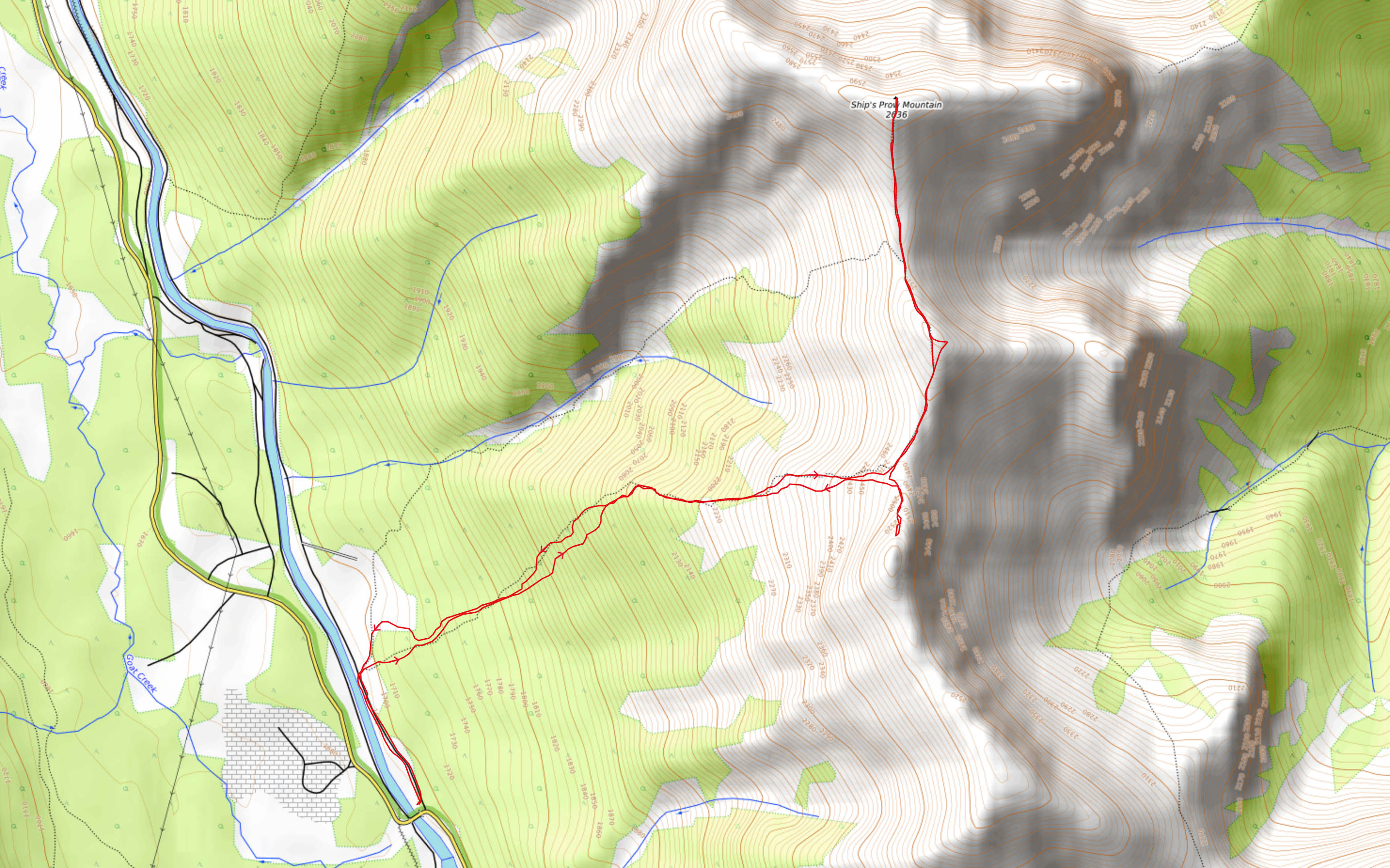
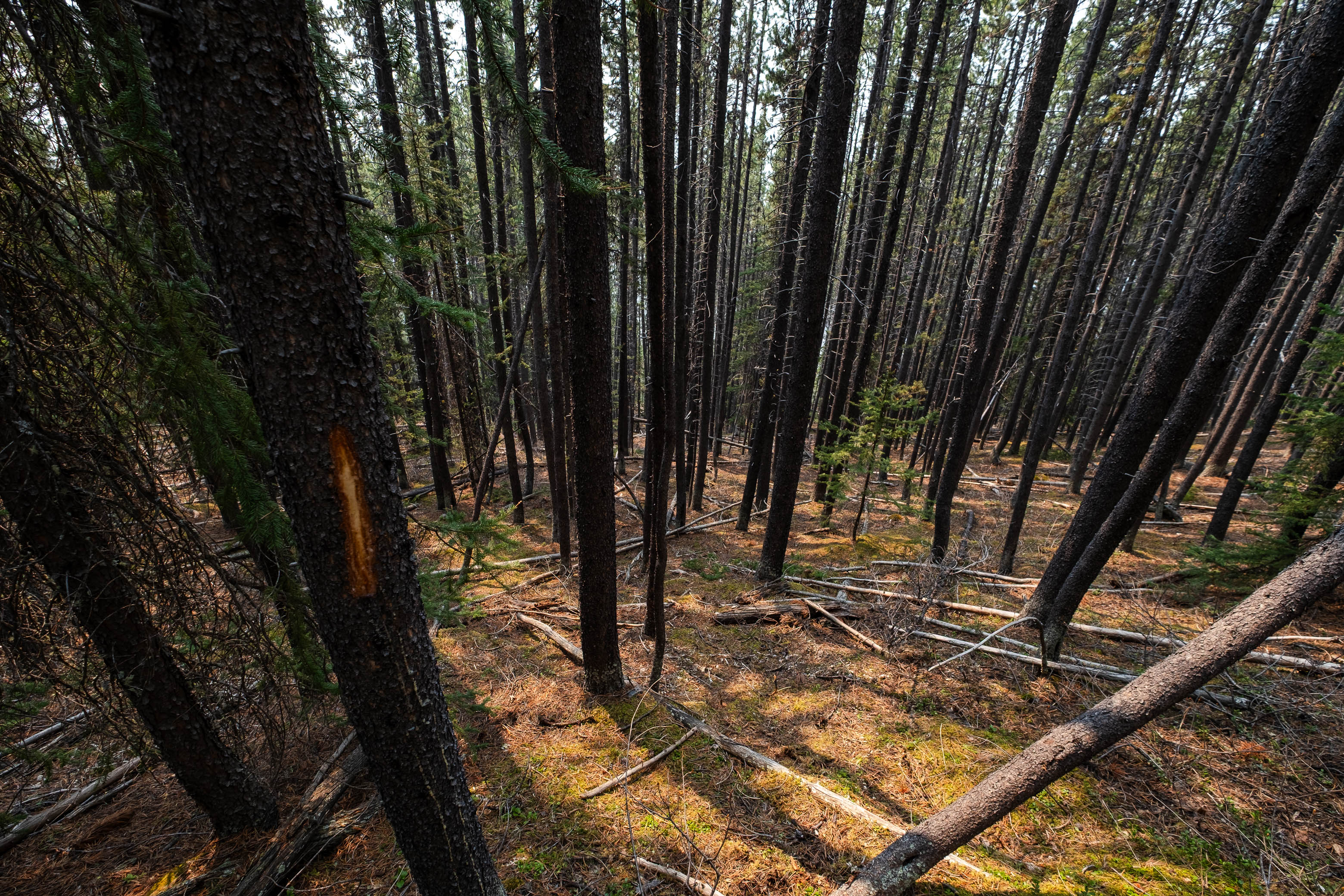
We started our ascent from a small "parking lot" on the east side of a short bridge that crosses the outlet of Goat Pond. From here, we followed a road along the east side of the canal for about 500 m, before turning our attention uphill and spotting a couple ribbons marking the start of the trail up Ship's Prow's lower, forested slopes. If you arrive at a big gravel pit, you've gone too far.
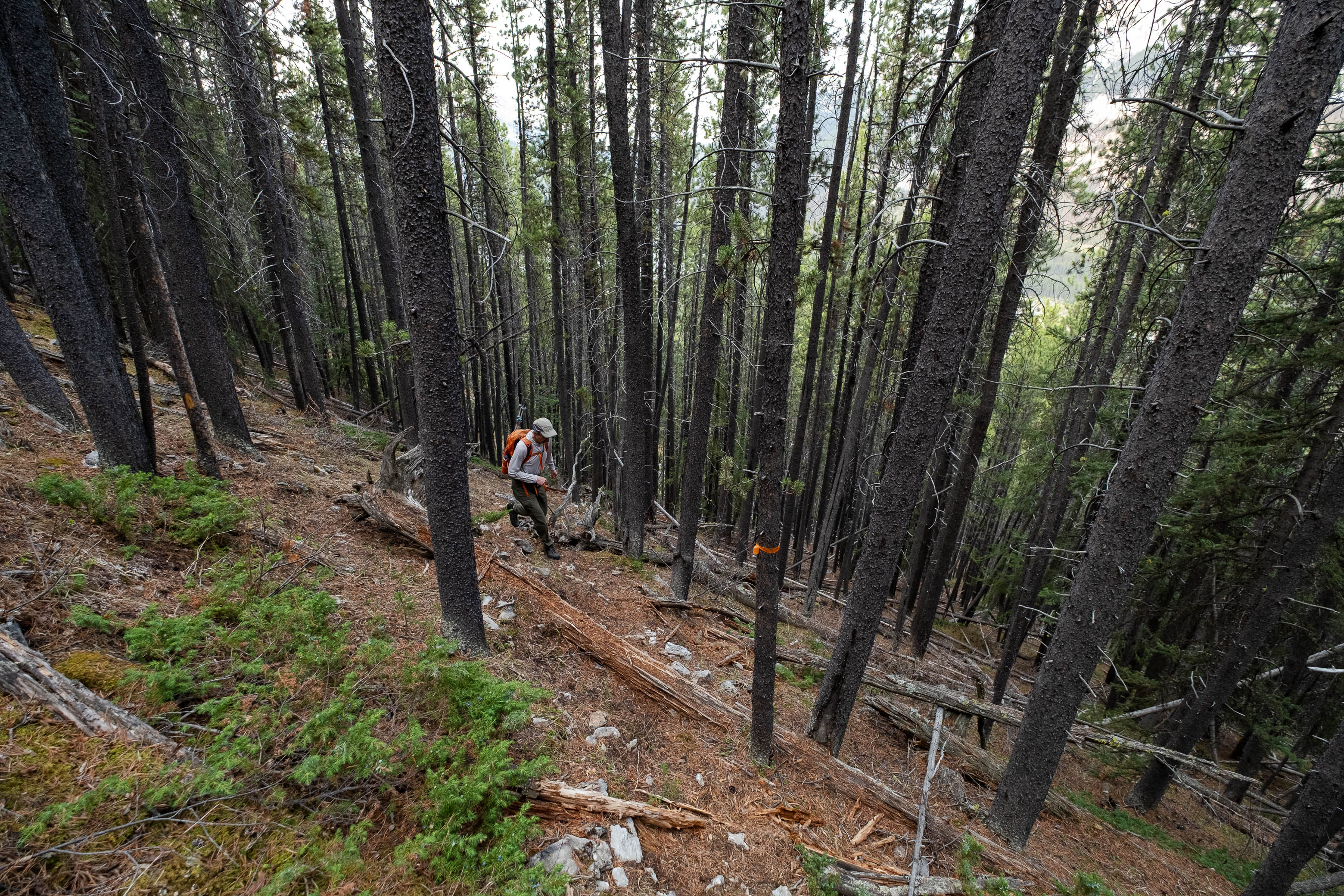
Although not beaten down like the more popular ascents in the area (i.e Ha Ling and EEOR), a solid trail (complete with ribbons) leads the way up Ship's Prow's steep western ascent slopes. The morning started off cool, but we were soon working up a sweat as we powered our way up the steep, dirt trail, feeling so light after ditching all the winter gear we've been lugging around for the past six months!
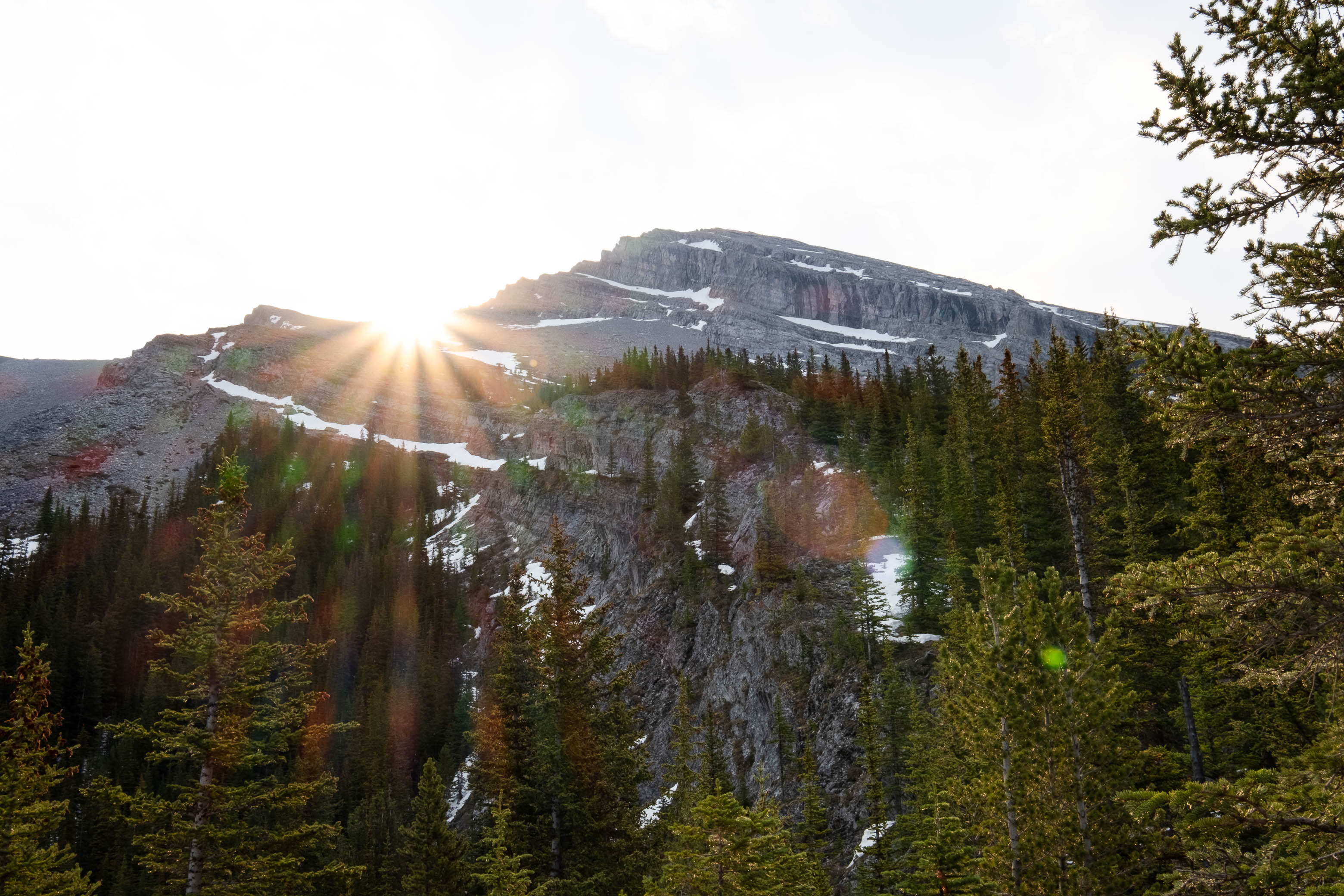
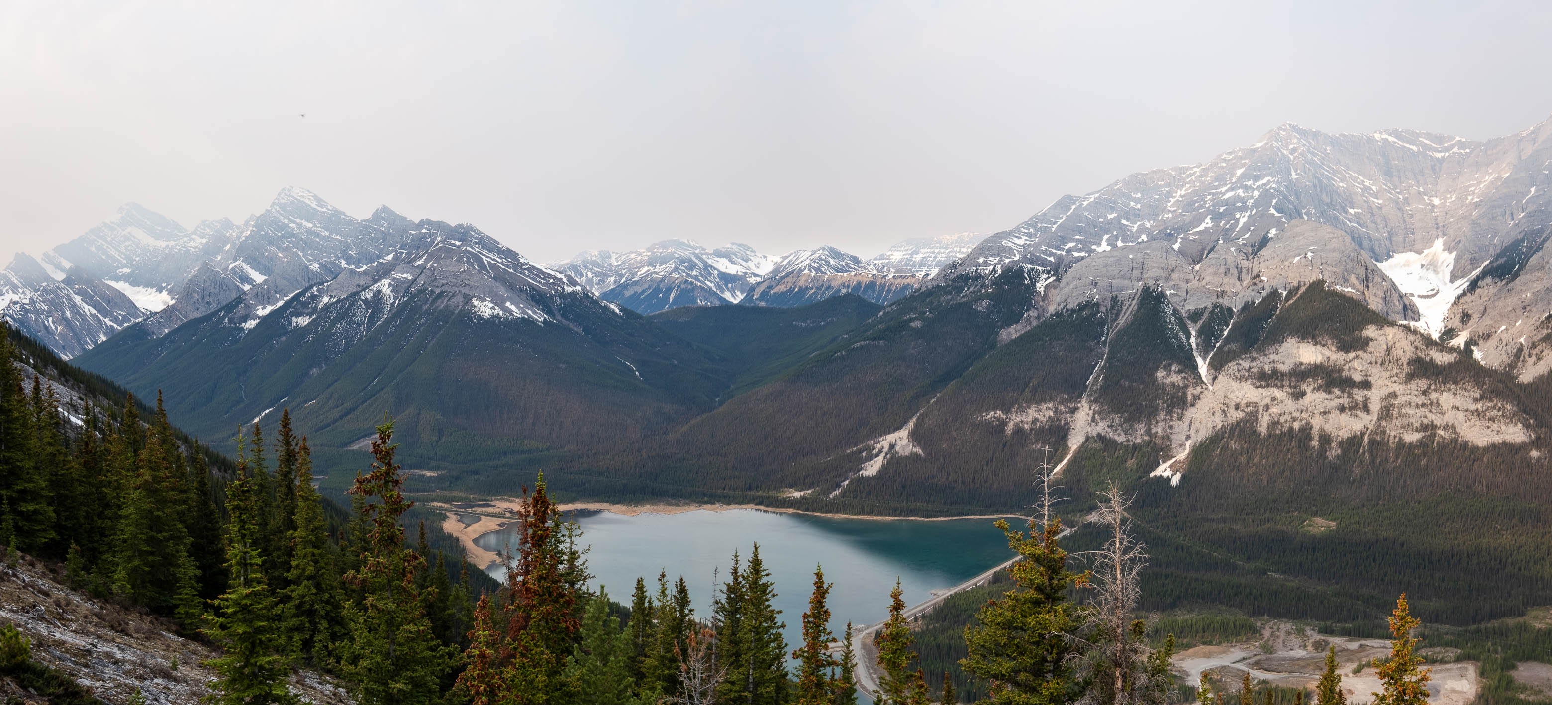
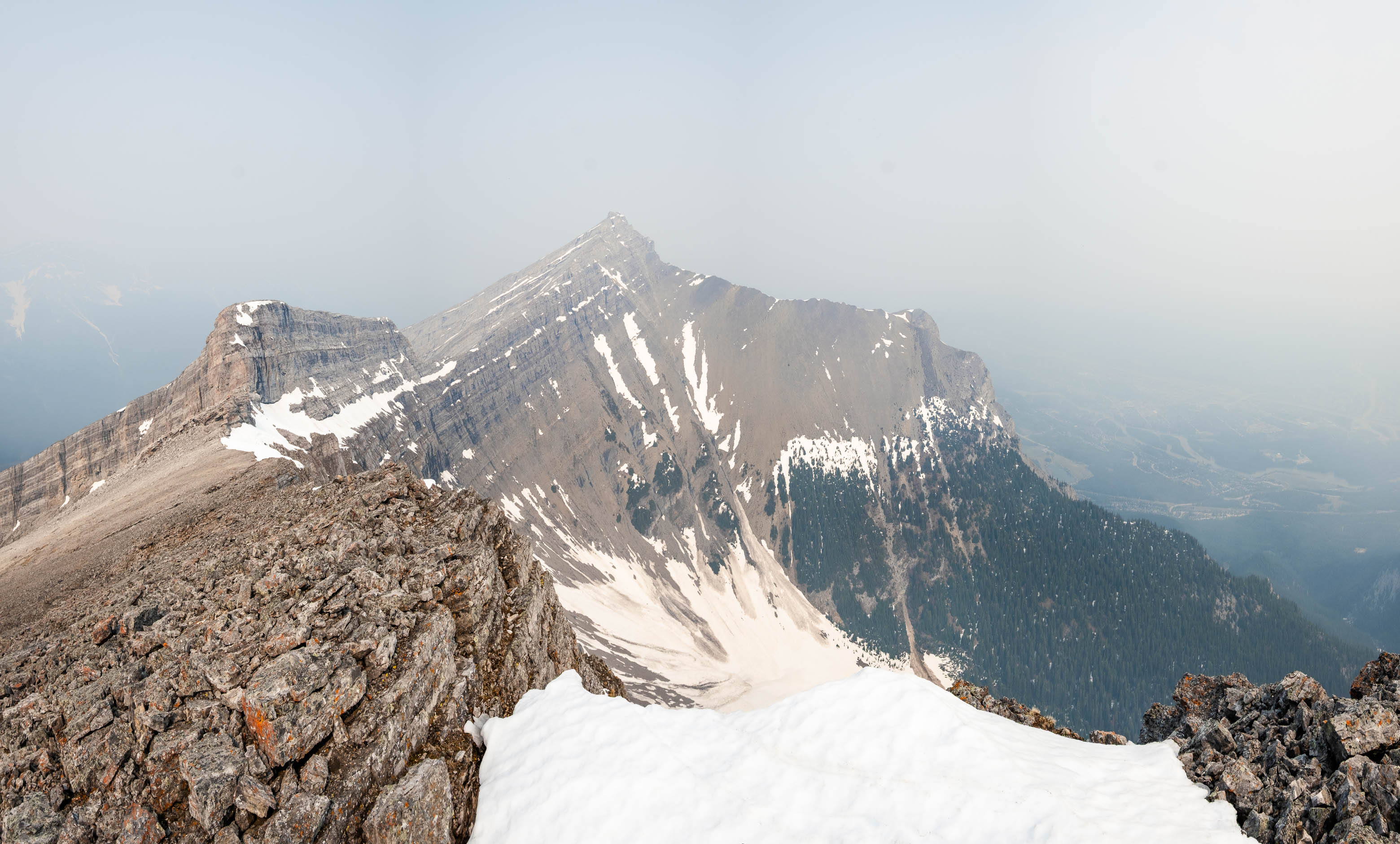
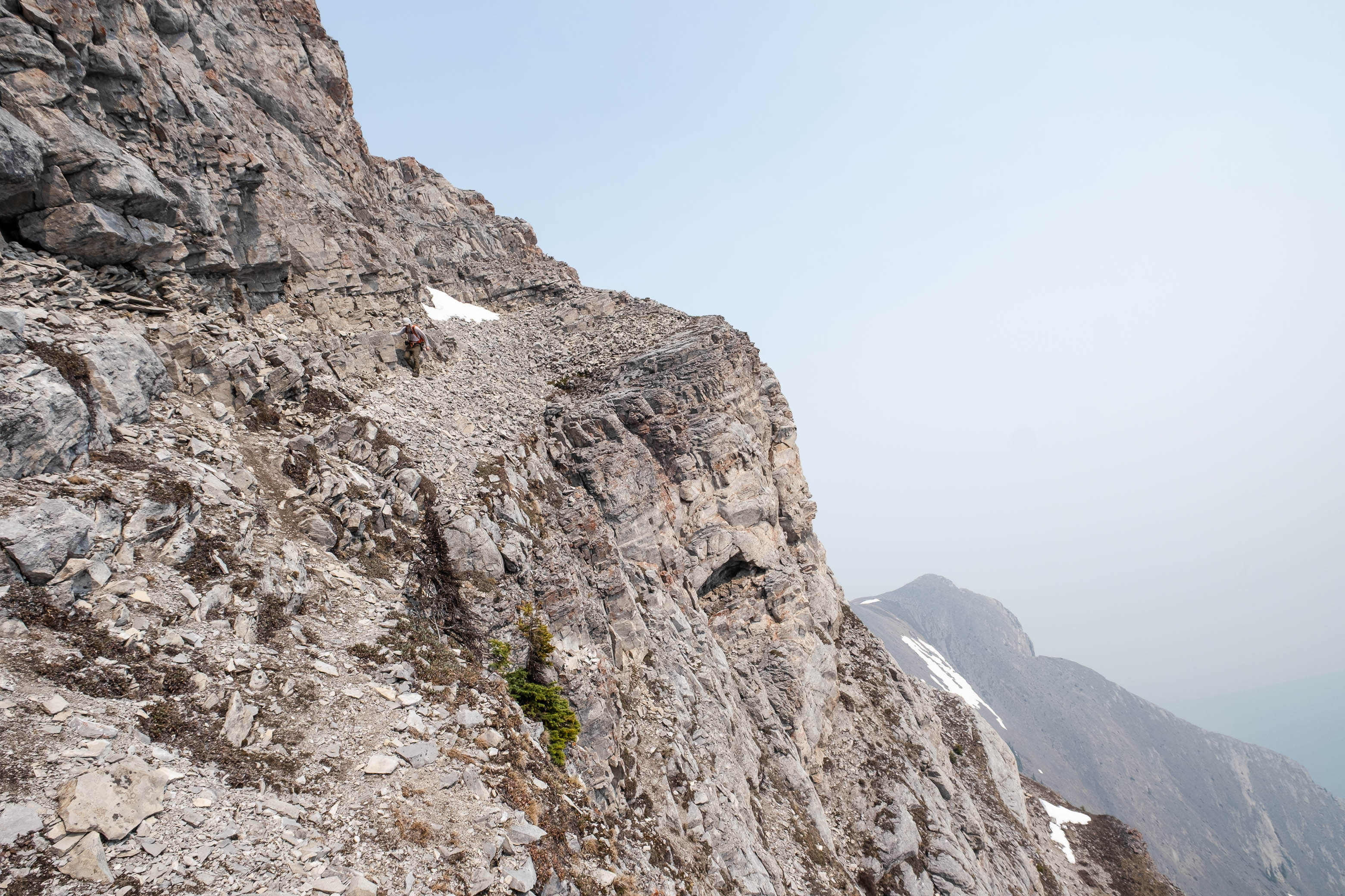
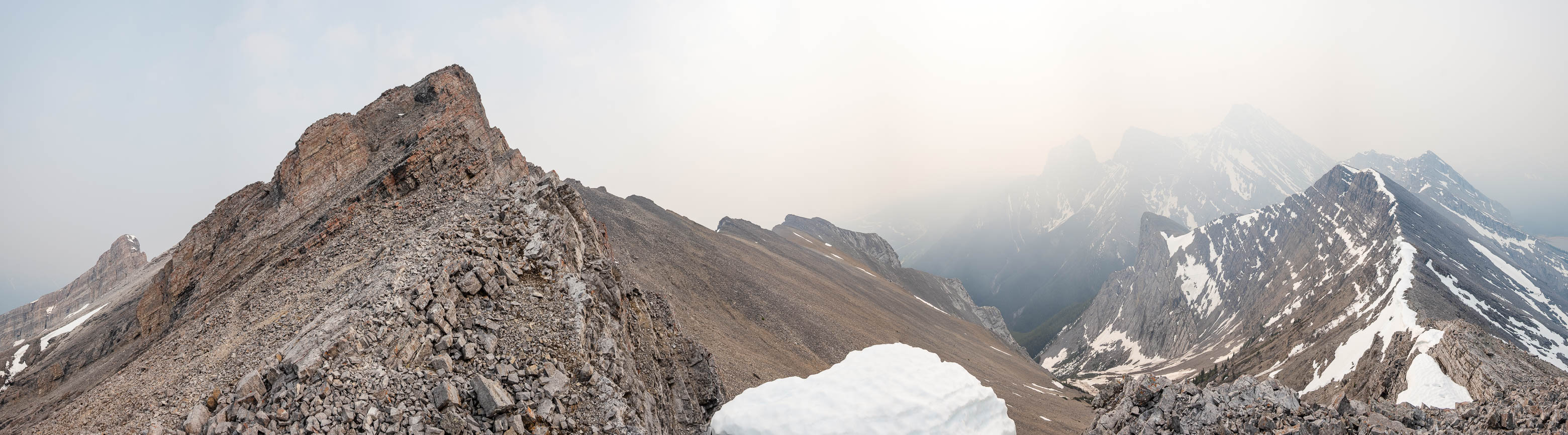
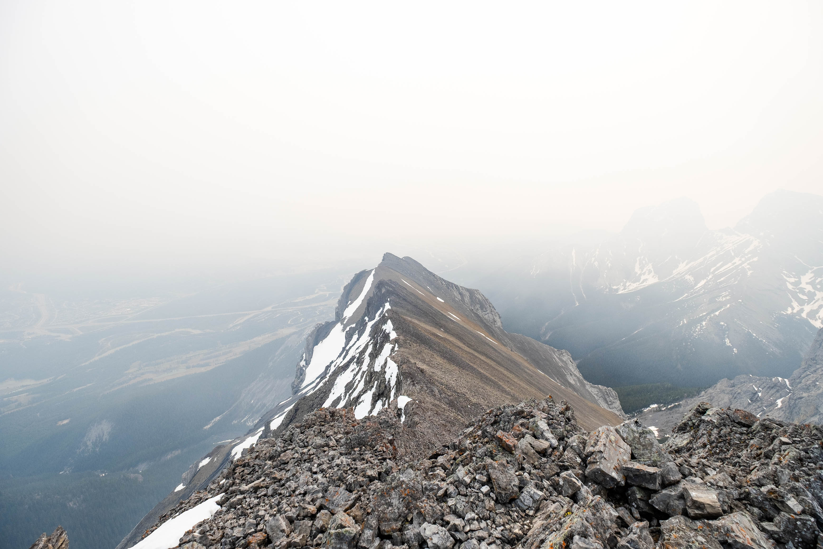
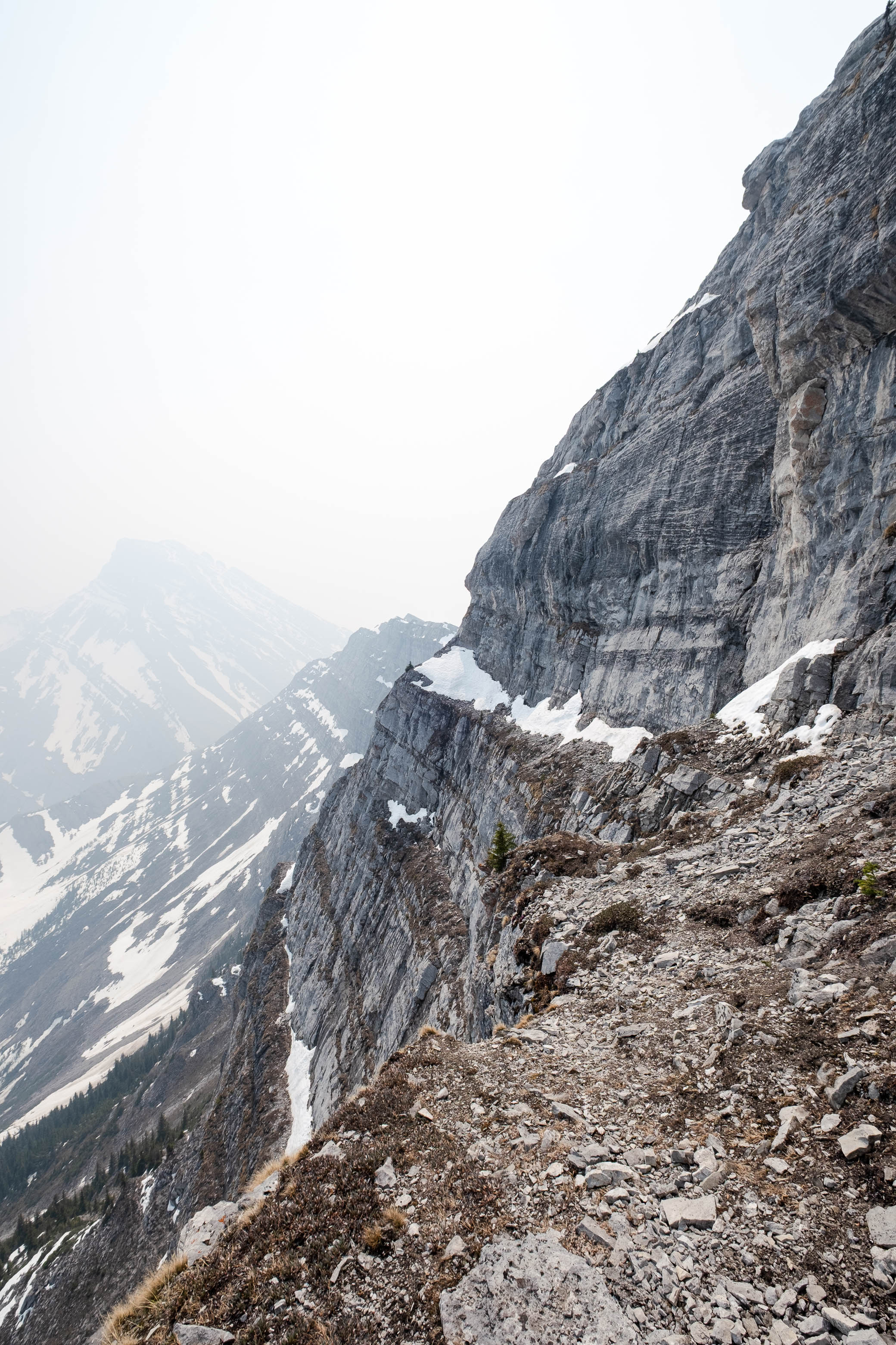
It wasn't long before we were on more ridge-like terrain, looking out across Ship's Prow's main SW drainage gully, with our summit rising high above, still a ways off. Although hazy, visibility was still decent at this point, and as the trees thinned we were granted a nice view back down to Goat Pond, where we started our day.
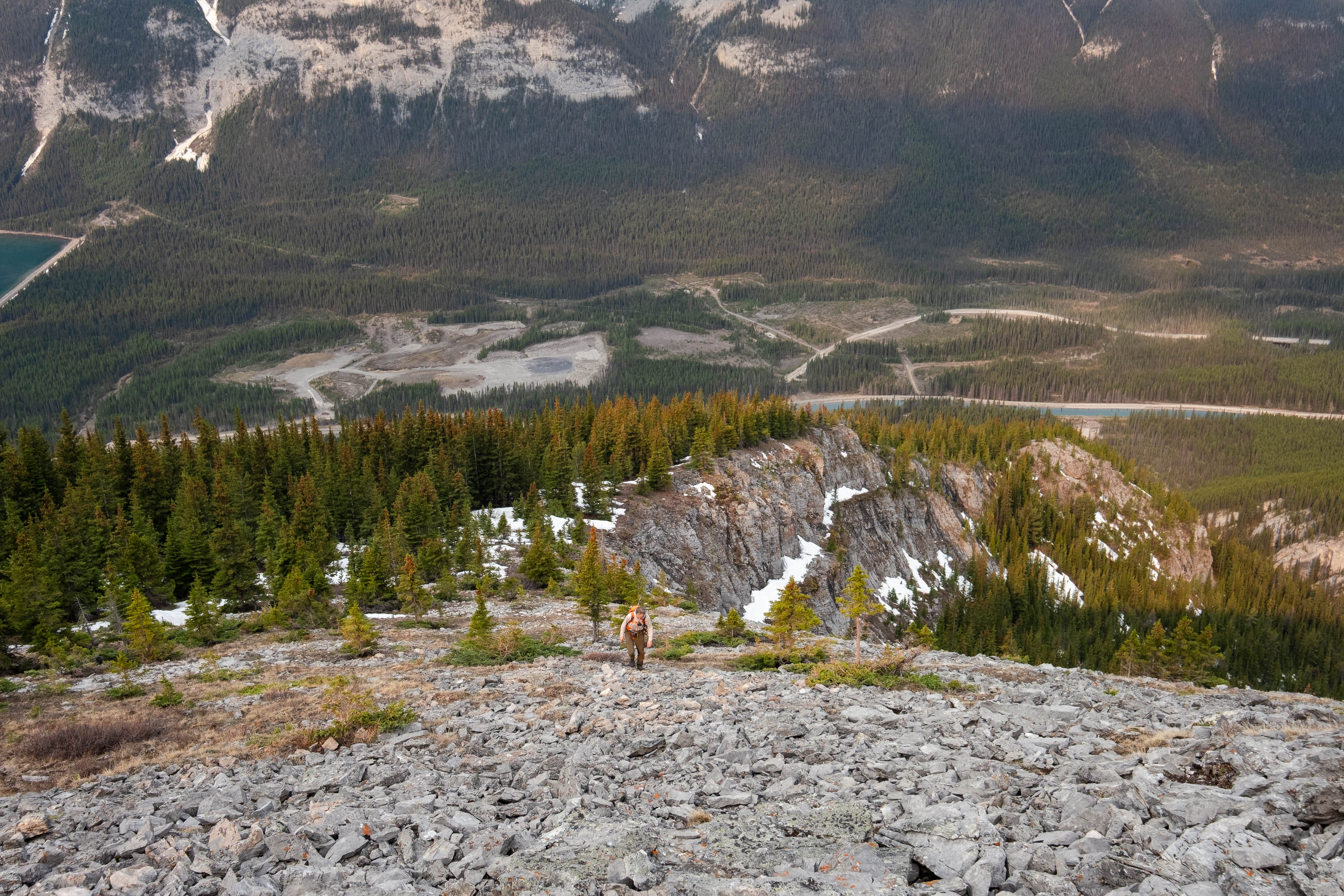
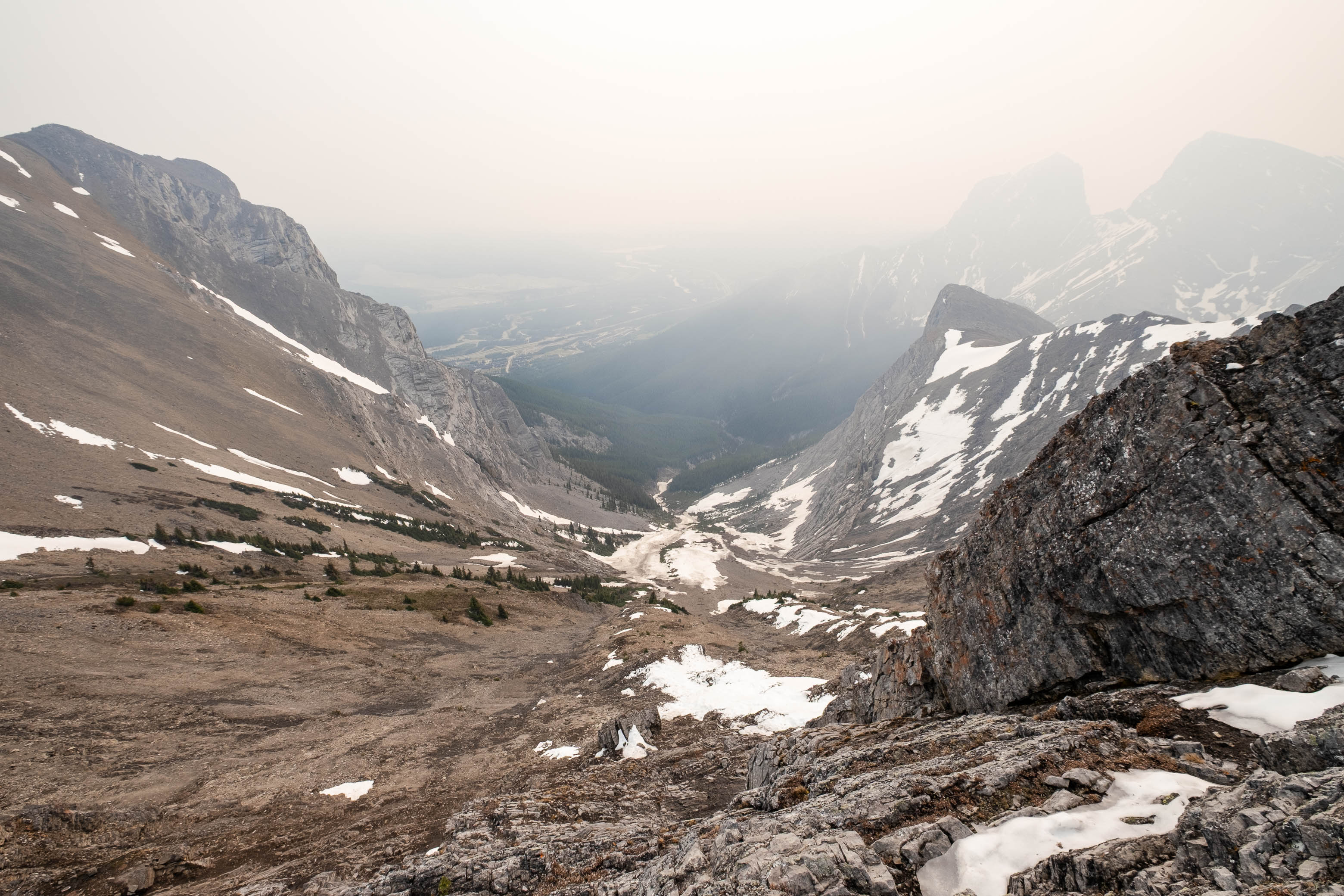
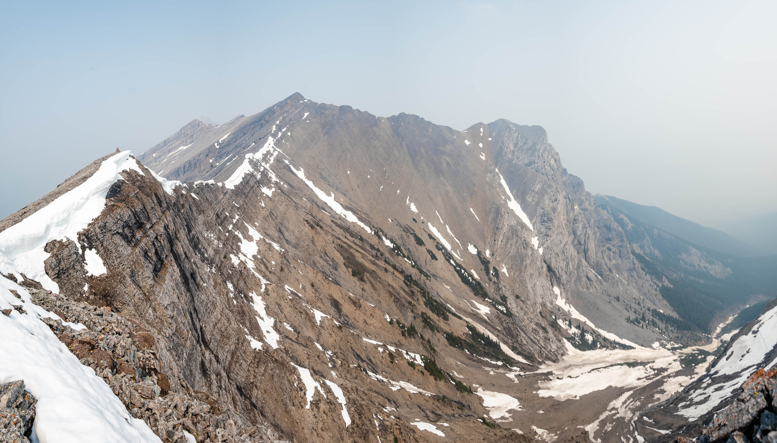
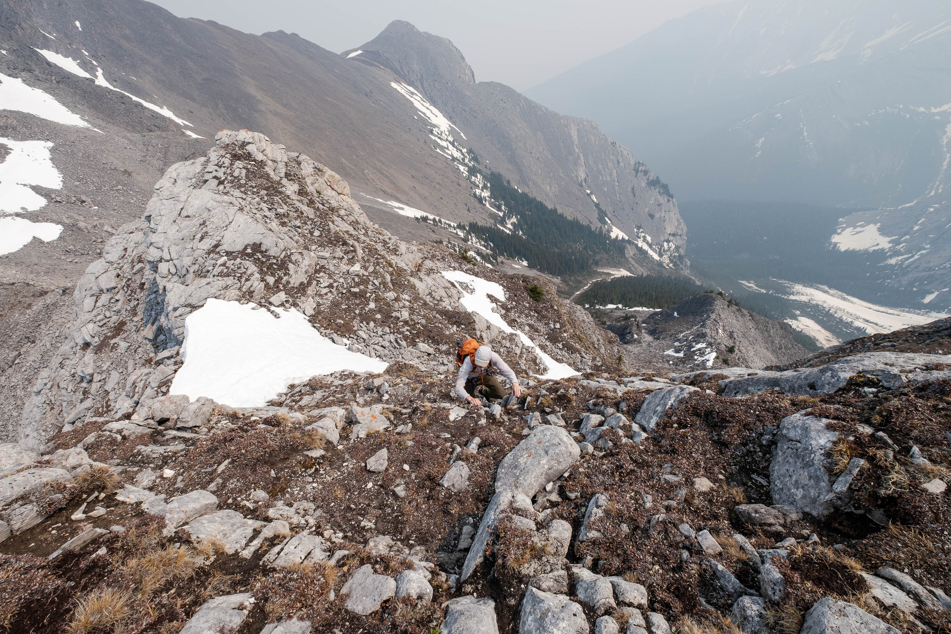
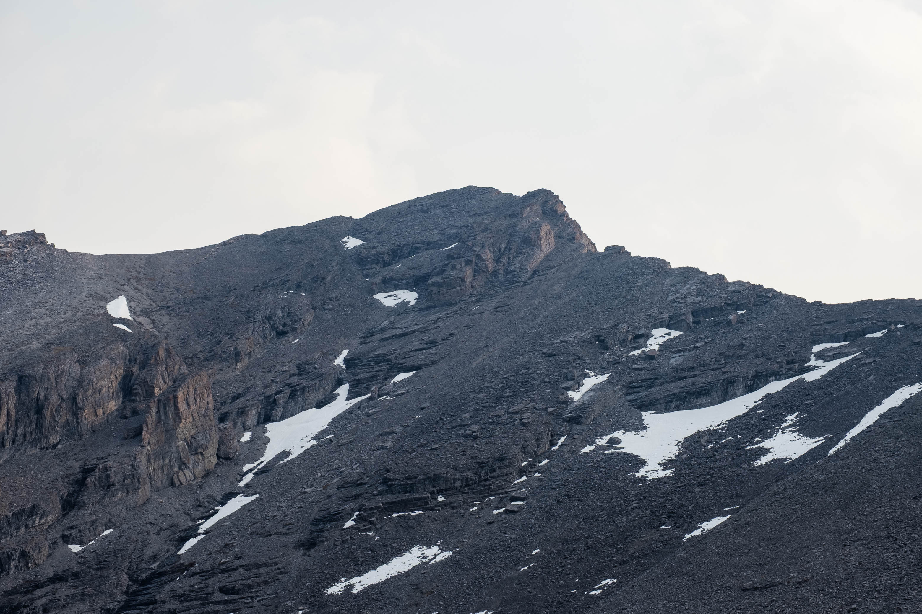
Continuing on, dirt trail soon gave way to rubble and we followed the relatively gentle slope up the final 200 vertical meters to the col between Ship's Prow's false summit and an impressive, but unnamed, outlier to the south. Much to my dismay, the smoke was only getting thicker as the day went on, rapidly engulfing each and every mountain surrounding us! By the time we topped out at the col, Goatview had completely vanished from sight.
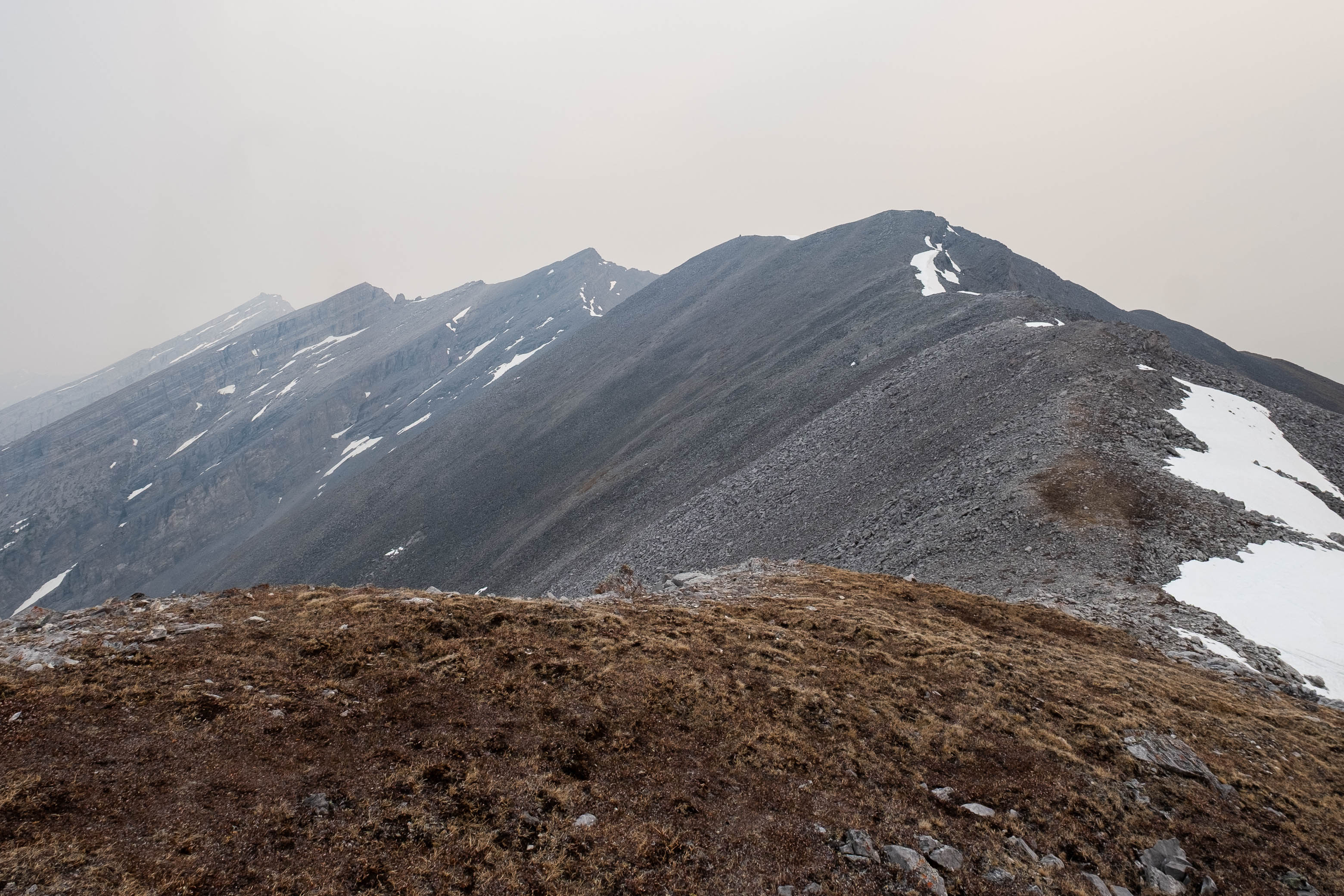
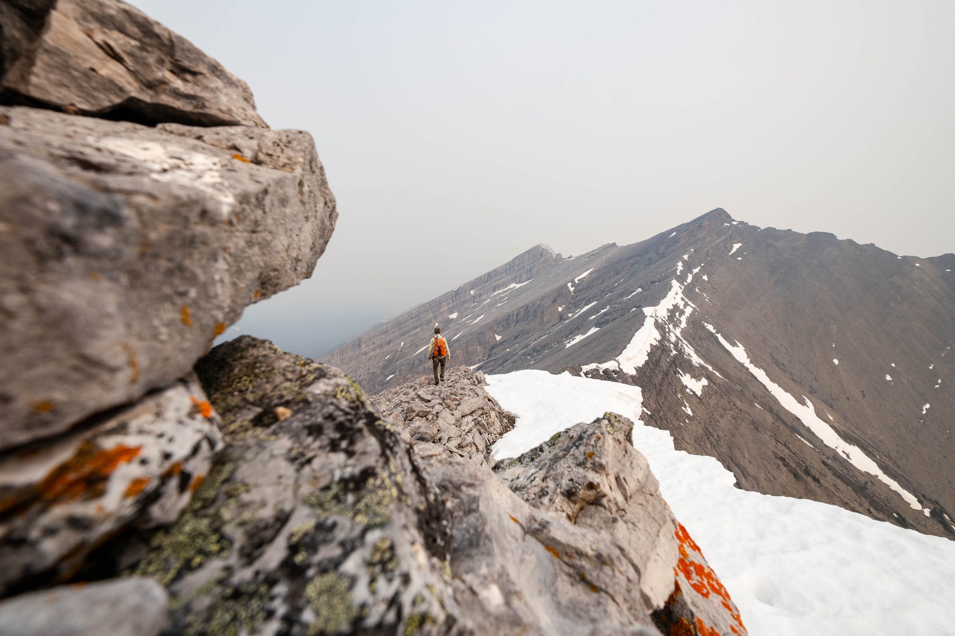
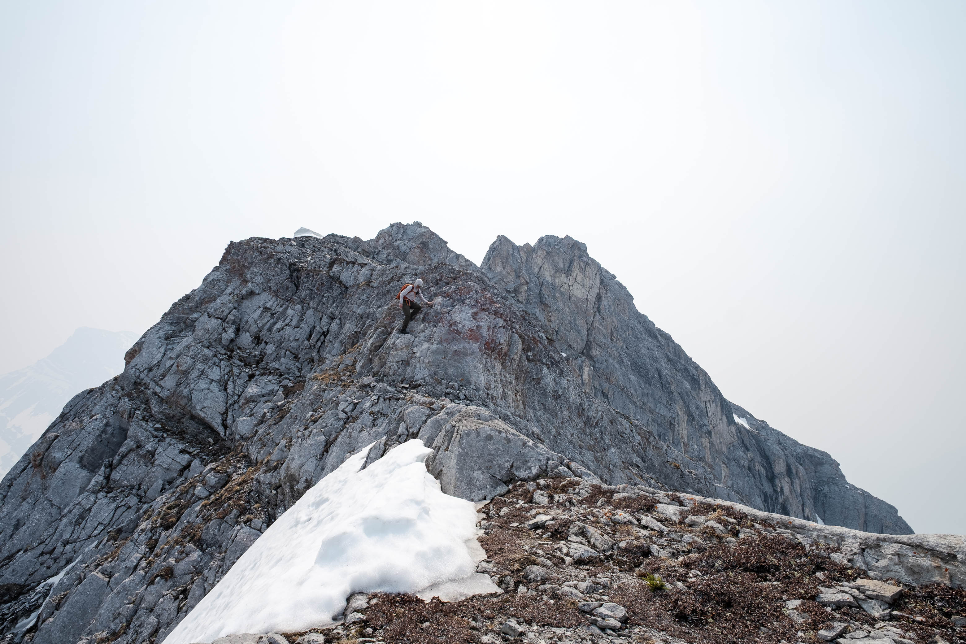
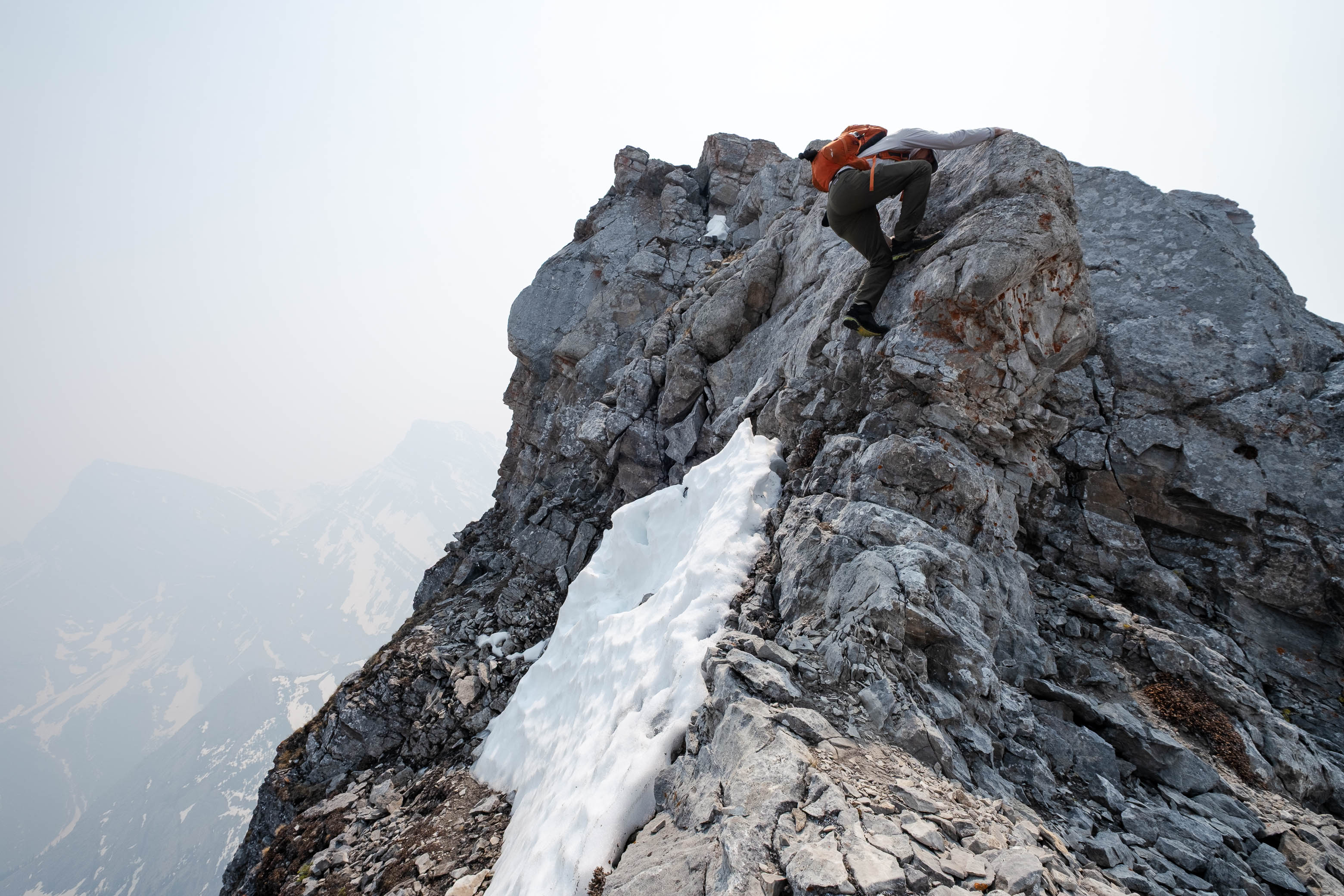
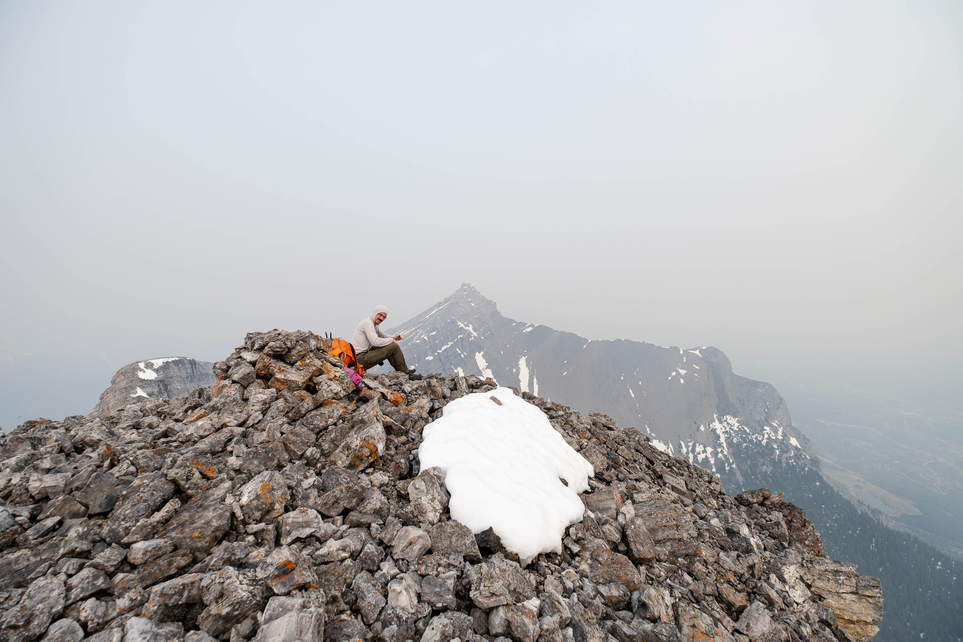
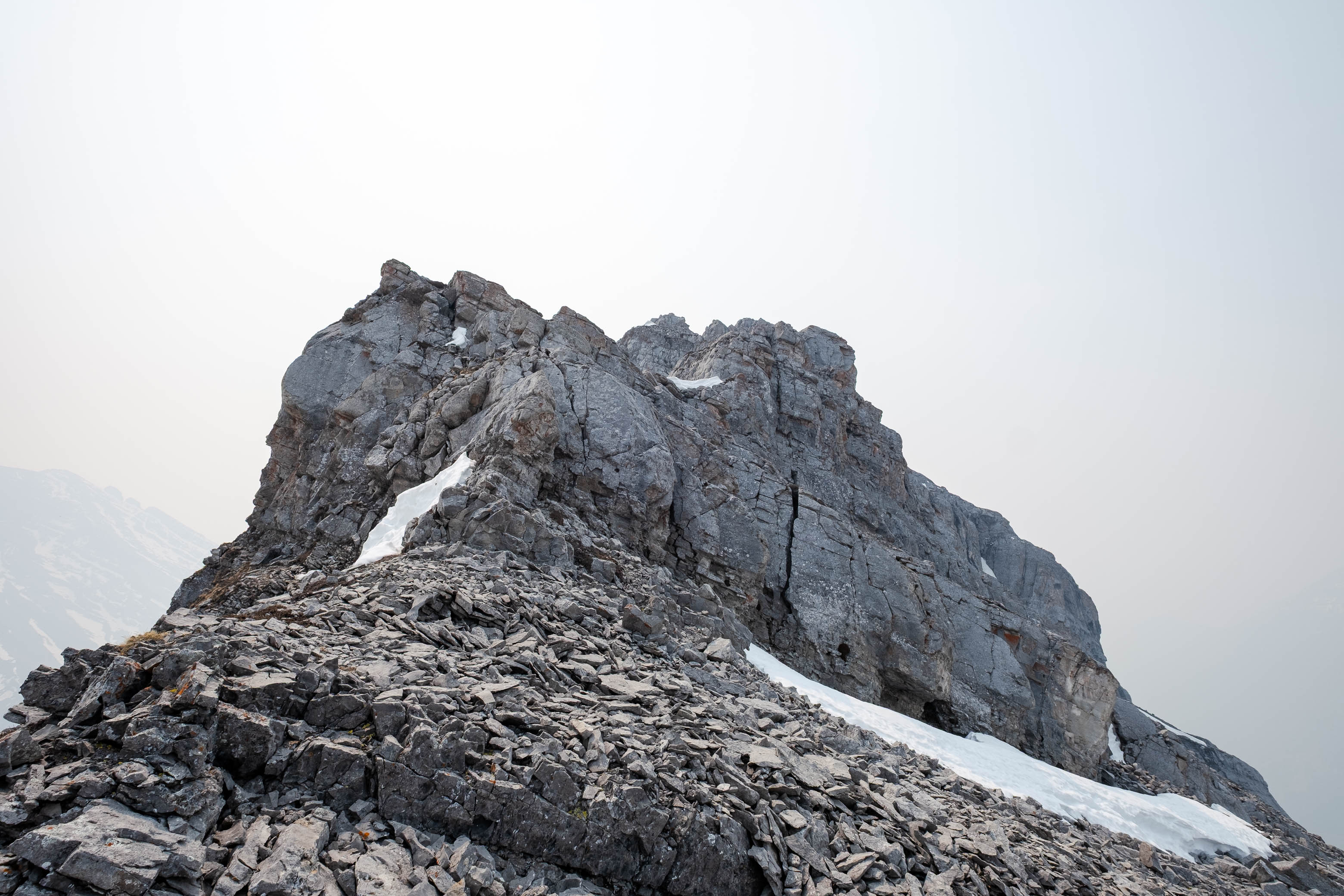
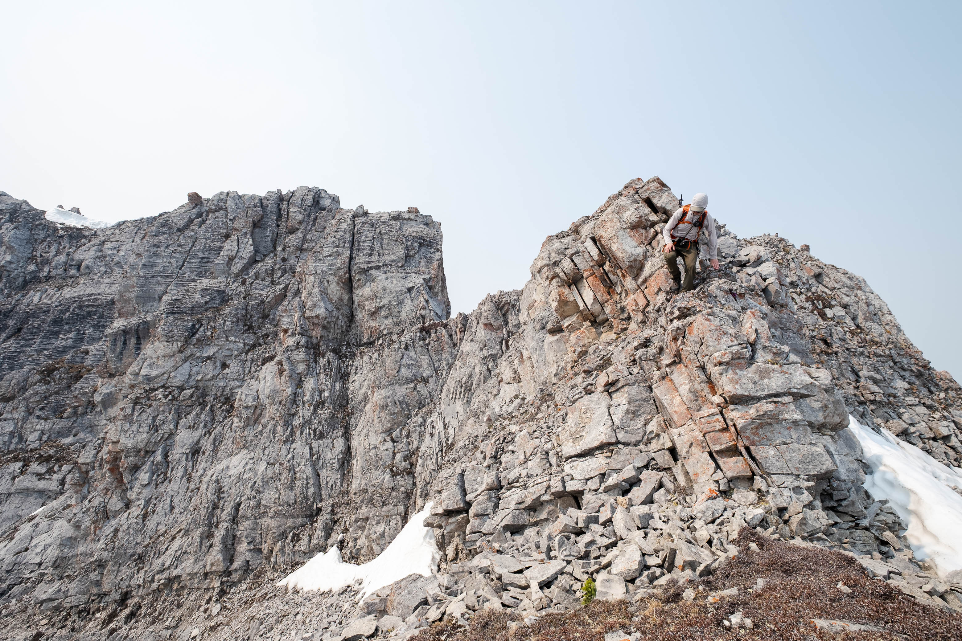
A short hike north from the col took us to the false summit, where we found a surprisingly large summit cairn - larger than that on the true summit! I wonder if this is thanks to numerous winter attempts made by parties who chose to forgo the summit ridge due to unsafe avalanche conditions...Because while the summit ridge presented no problems for us on dry rock, I can definitely see it becoming a little dicey if snowloaded!
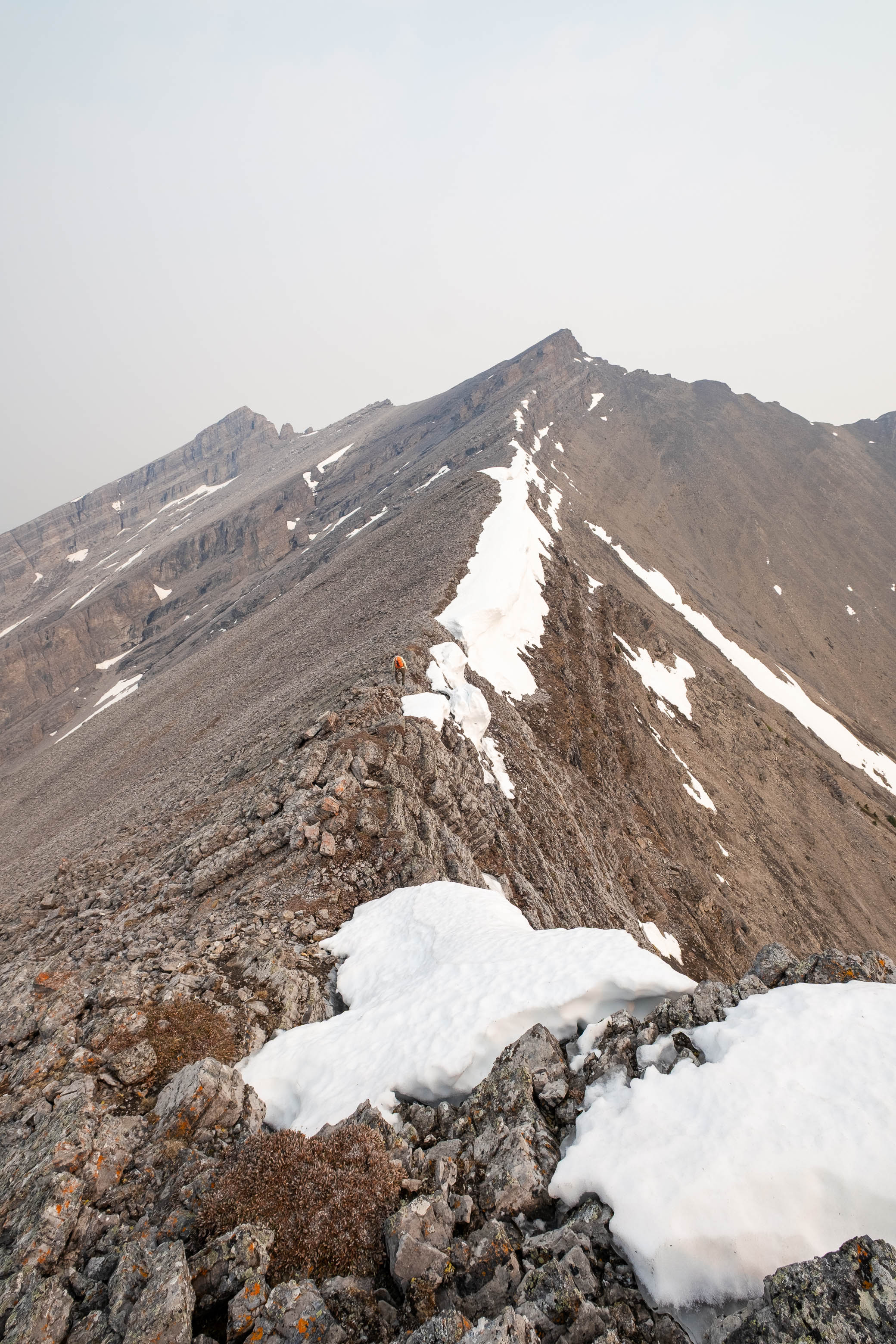
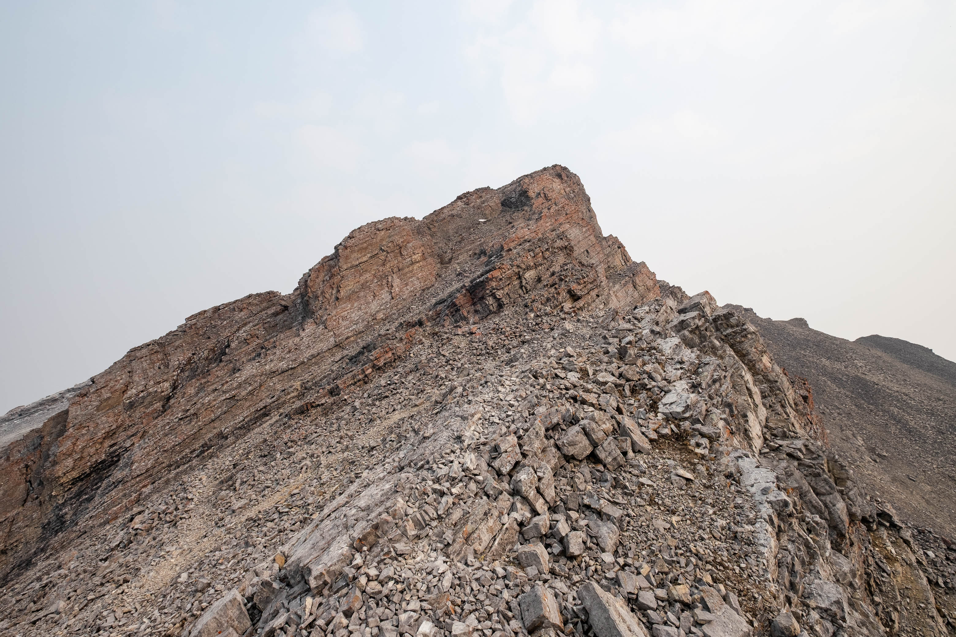
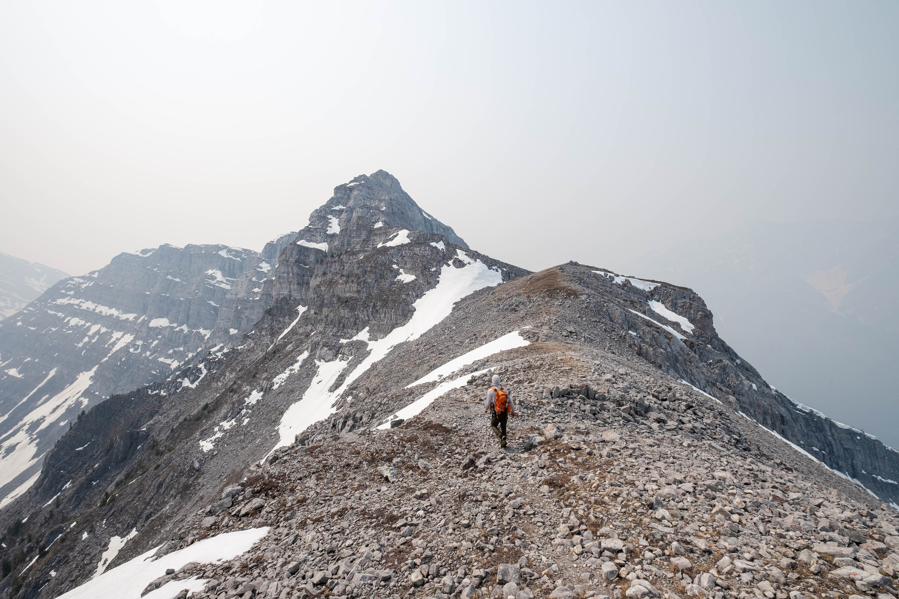
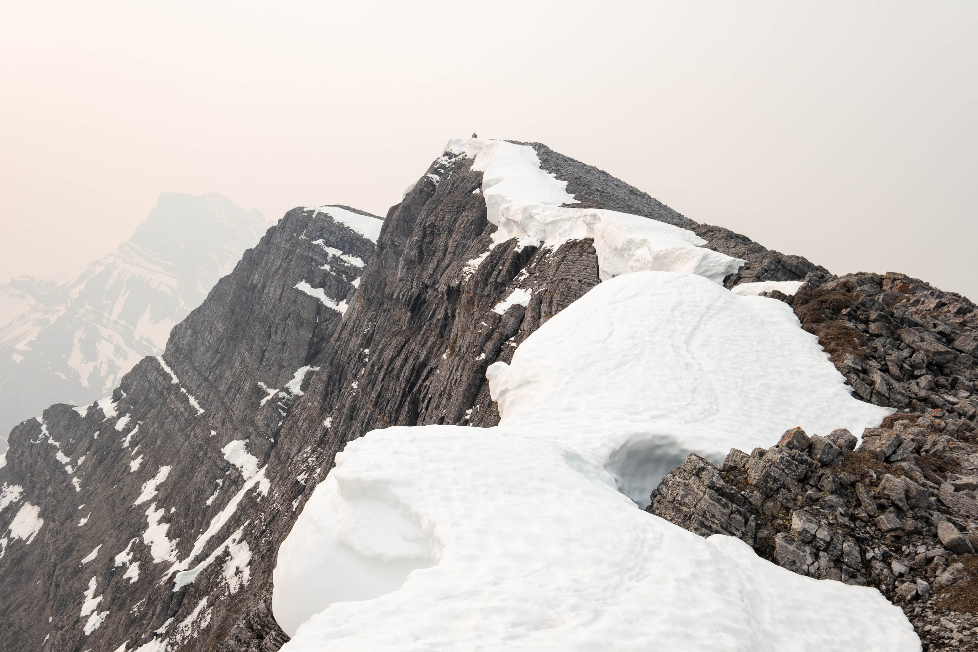
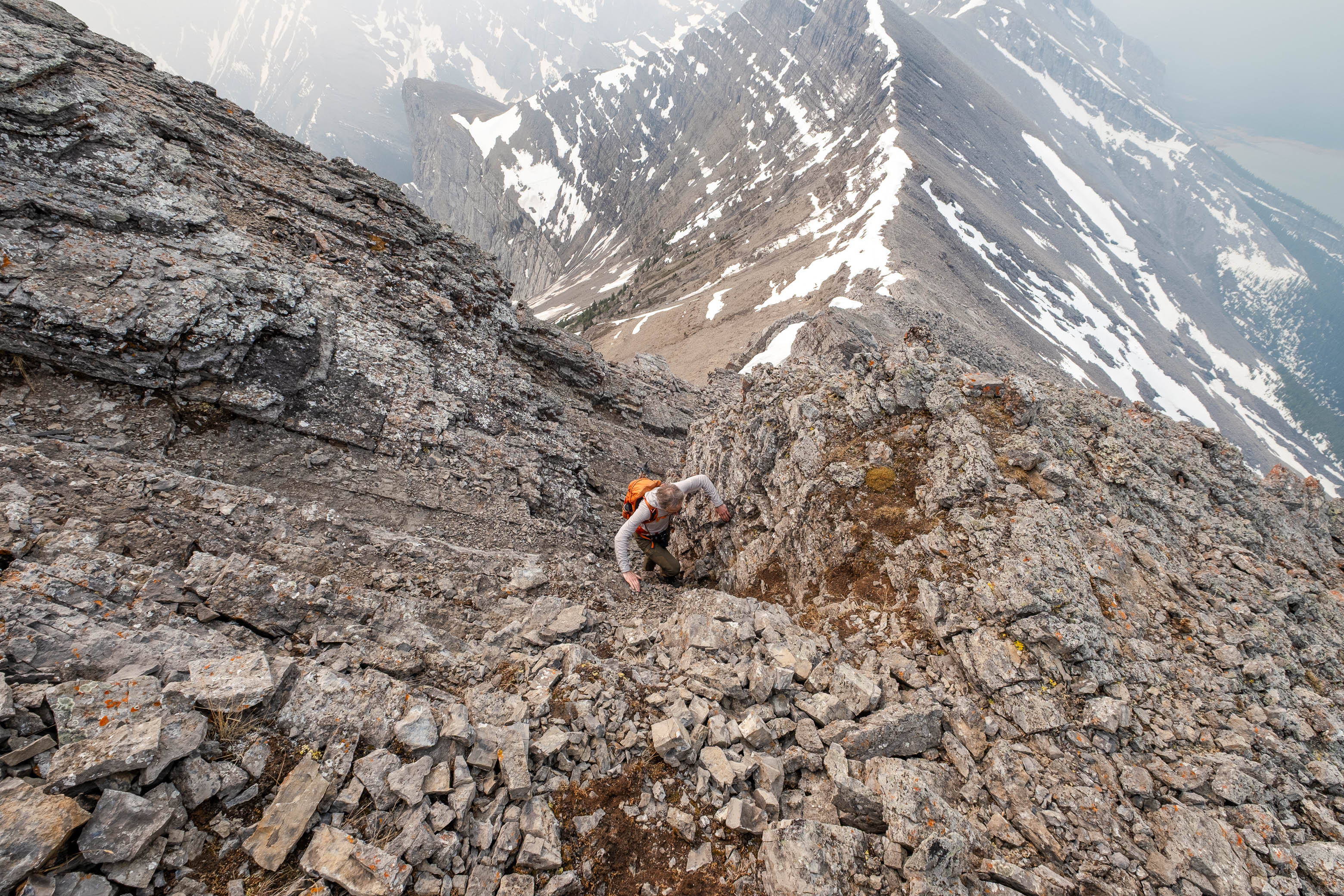
Shortly after leaving the false summit, we had crossed the connecting ridge, and were picking our way up the short, loose access gully, finished off with a narrow chimney from which the summit was just a few steps away!
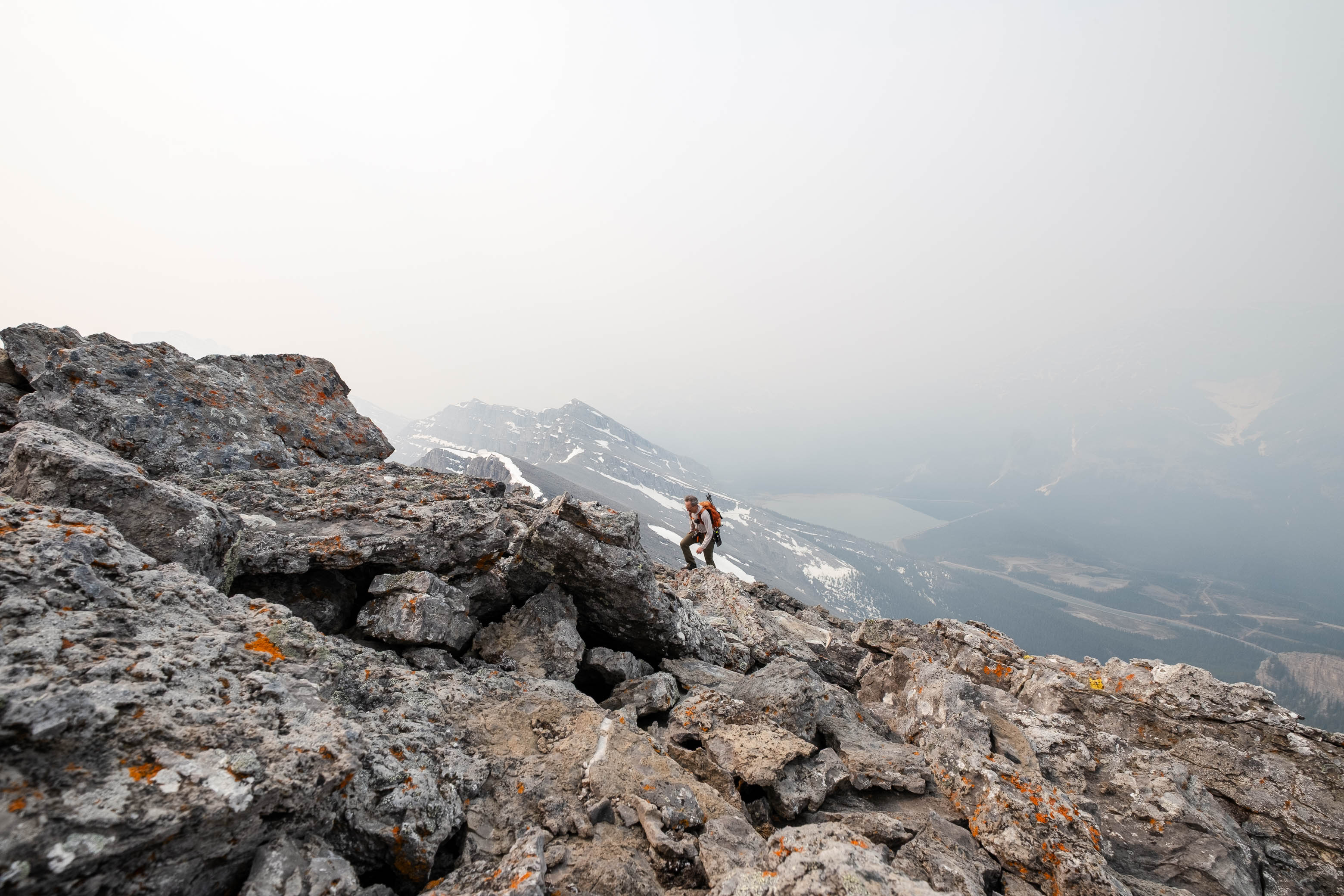
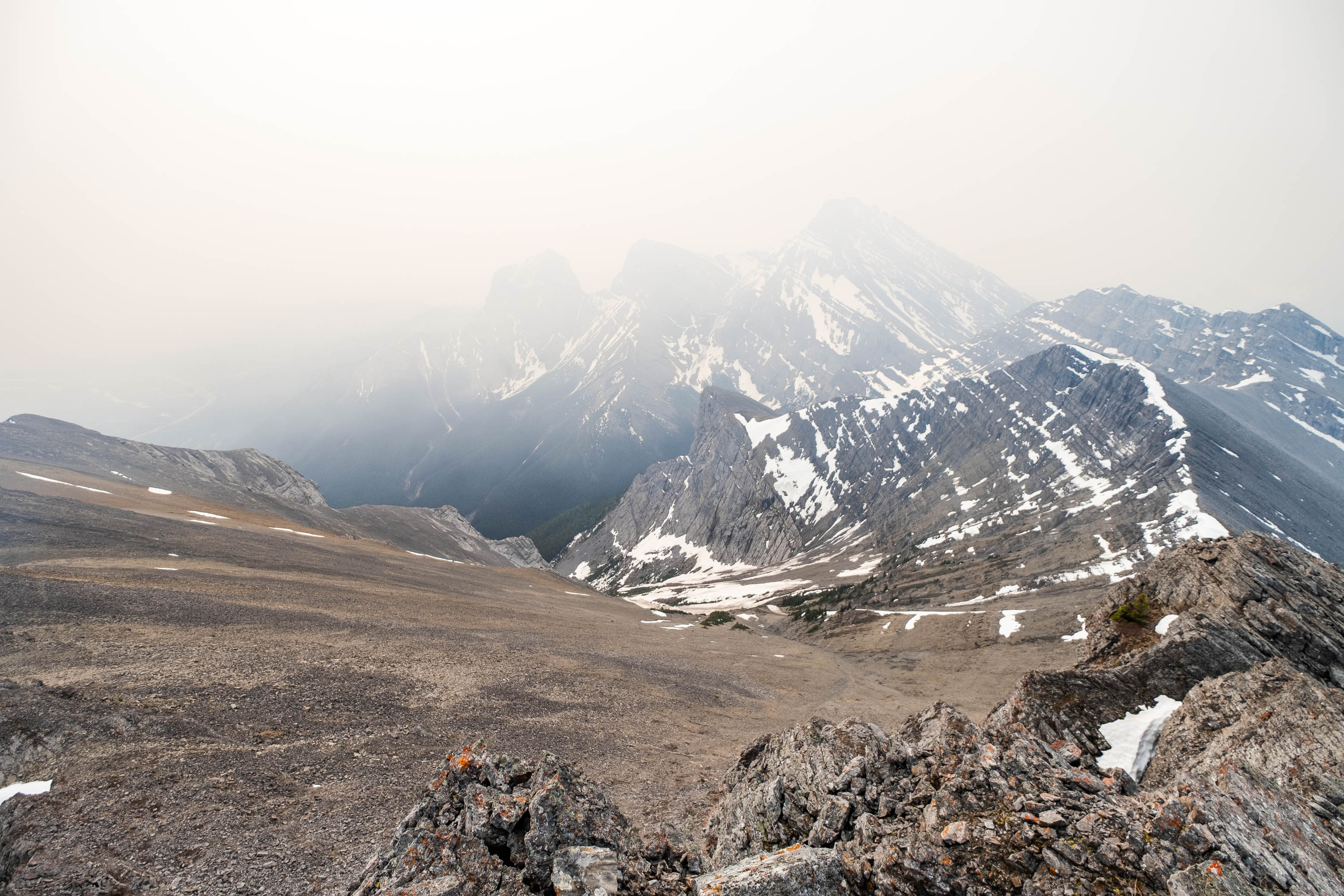
Views were unable to impress in the slightest, but with The Three Sisters rising immediately to the south and Mount Lawrence Grassi to the north, I'm sure that the close up views you'd get of both would be more than worth your effort on a clear day! All we got, was grey, holographic outlines, barely distinguishable from the bleak sky.
Even without any views to admire, the weather was pleasant, with a slight breeze to keep us from overheating, and we spent some time relaxing on the summit before starting back down.
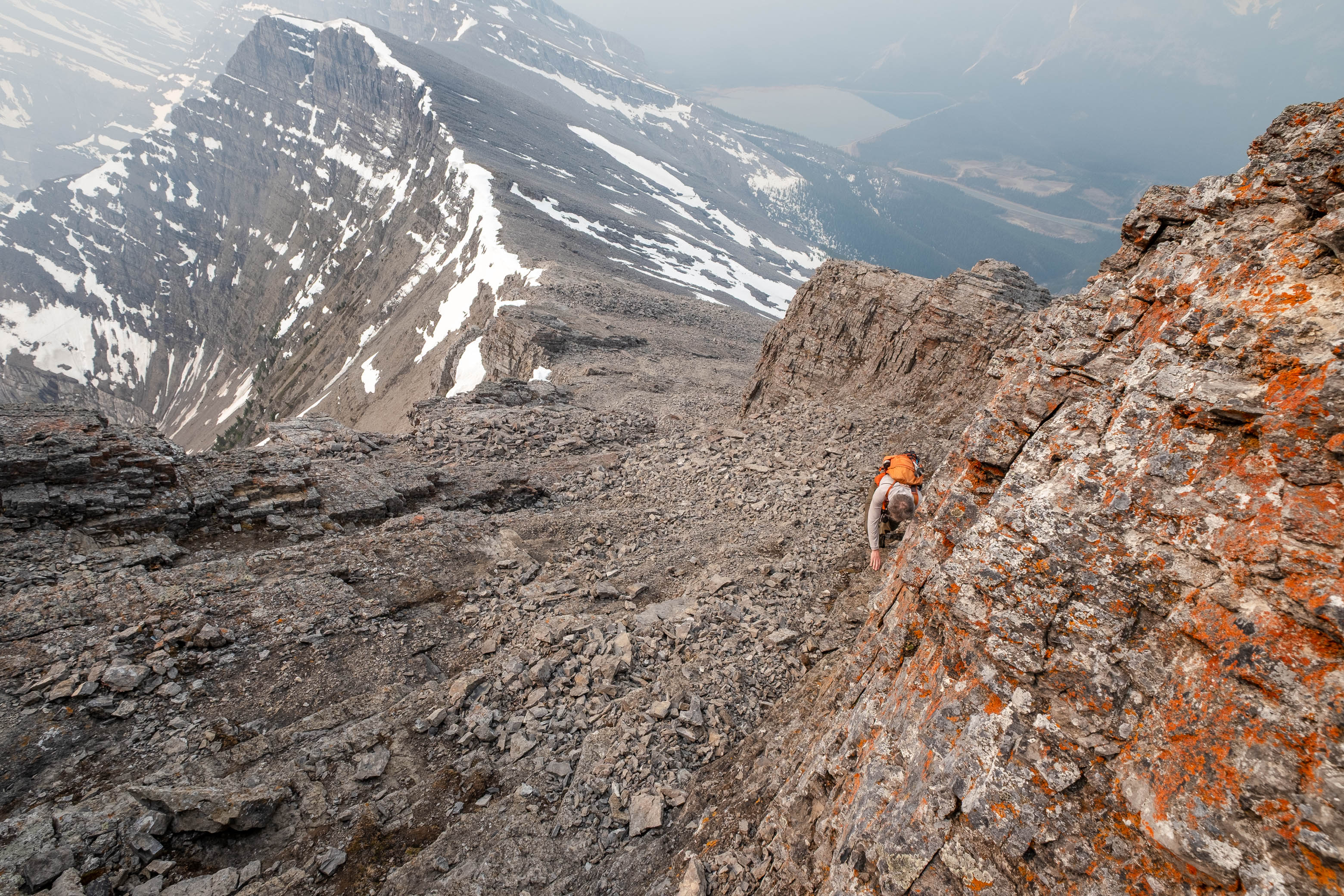
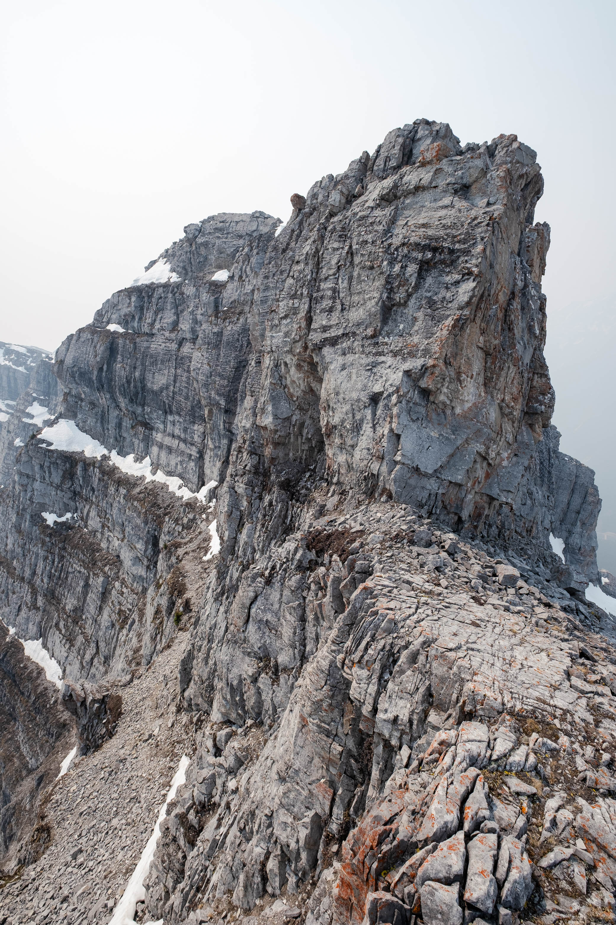
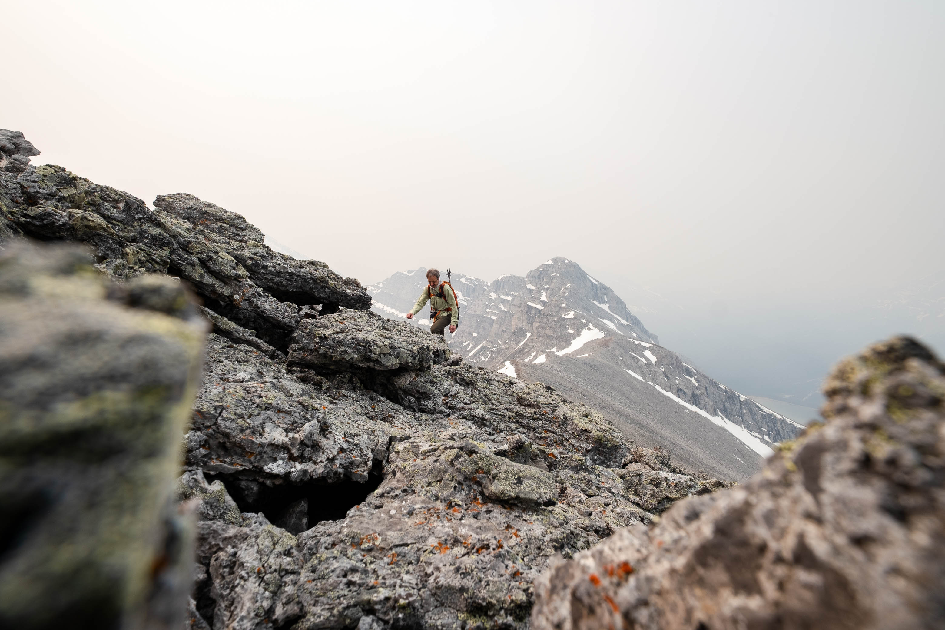
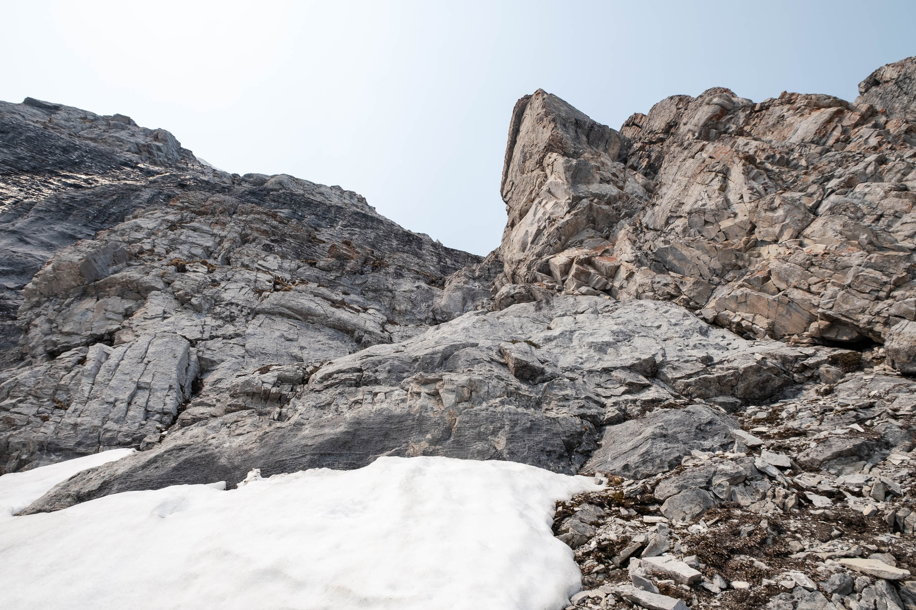
The day was still young when we arrived back at the col, so we decided to go on a bit of an exploration to fill some time! The unnamed outlier to the south captured my attention (probably because it was one of the very few peaks that we could see 😂), and although it appeared to be beyond the realm of scrambling, we decided to stick our noses in and get our hands a little dirty after a very tame ascent of Ship's Prow.
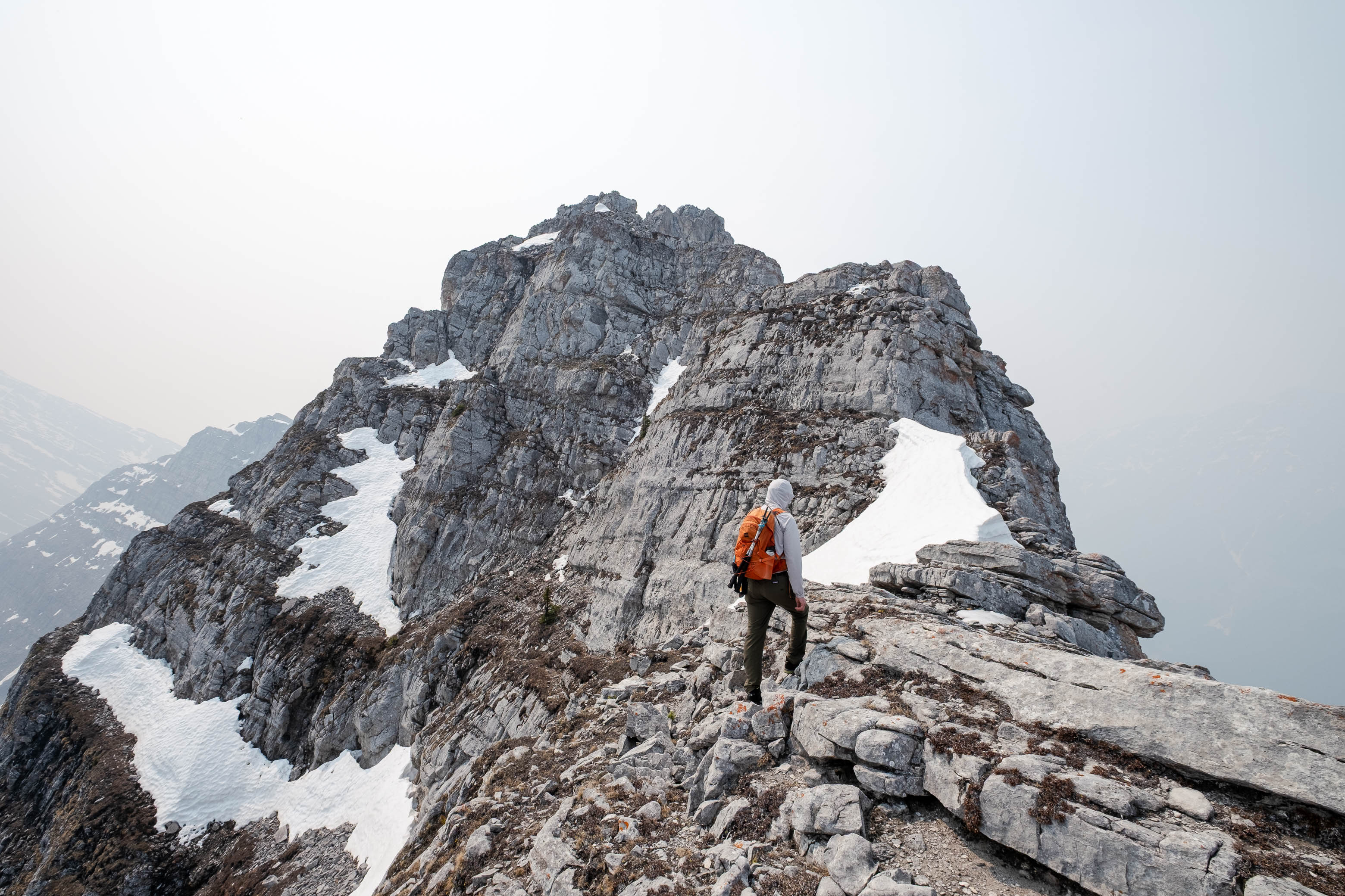
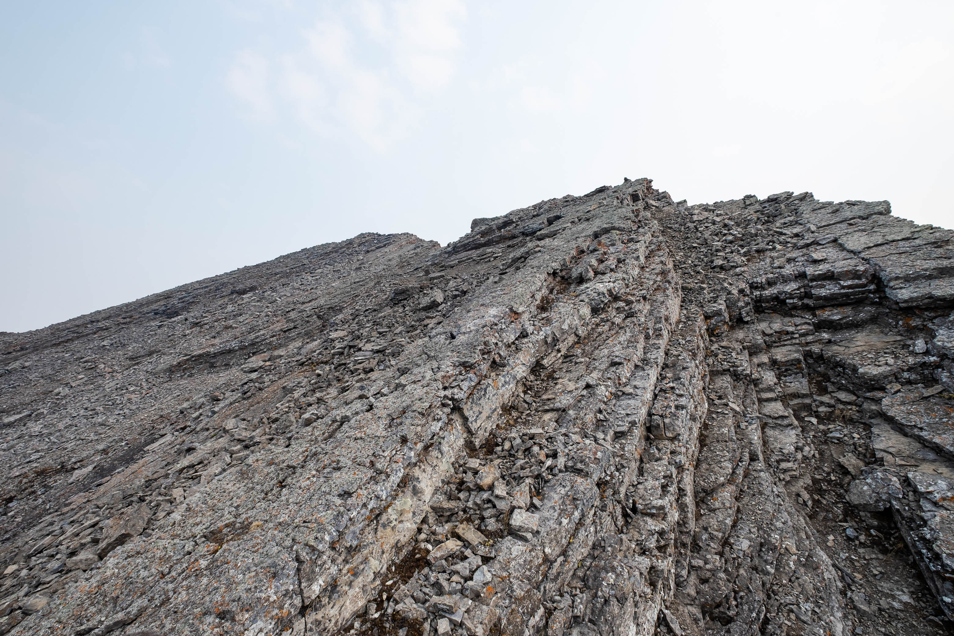
The ridge consisted of a series of big "steps" which made for some enjoyable hands-on scrambling, but unfortunately the fun soon came to an end when we arrived at the final "step" - an exposed ~ 10 m wall of vertical rock.
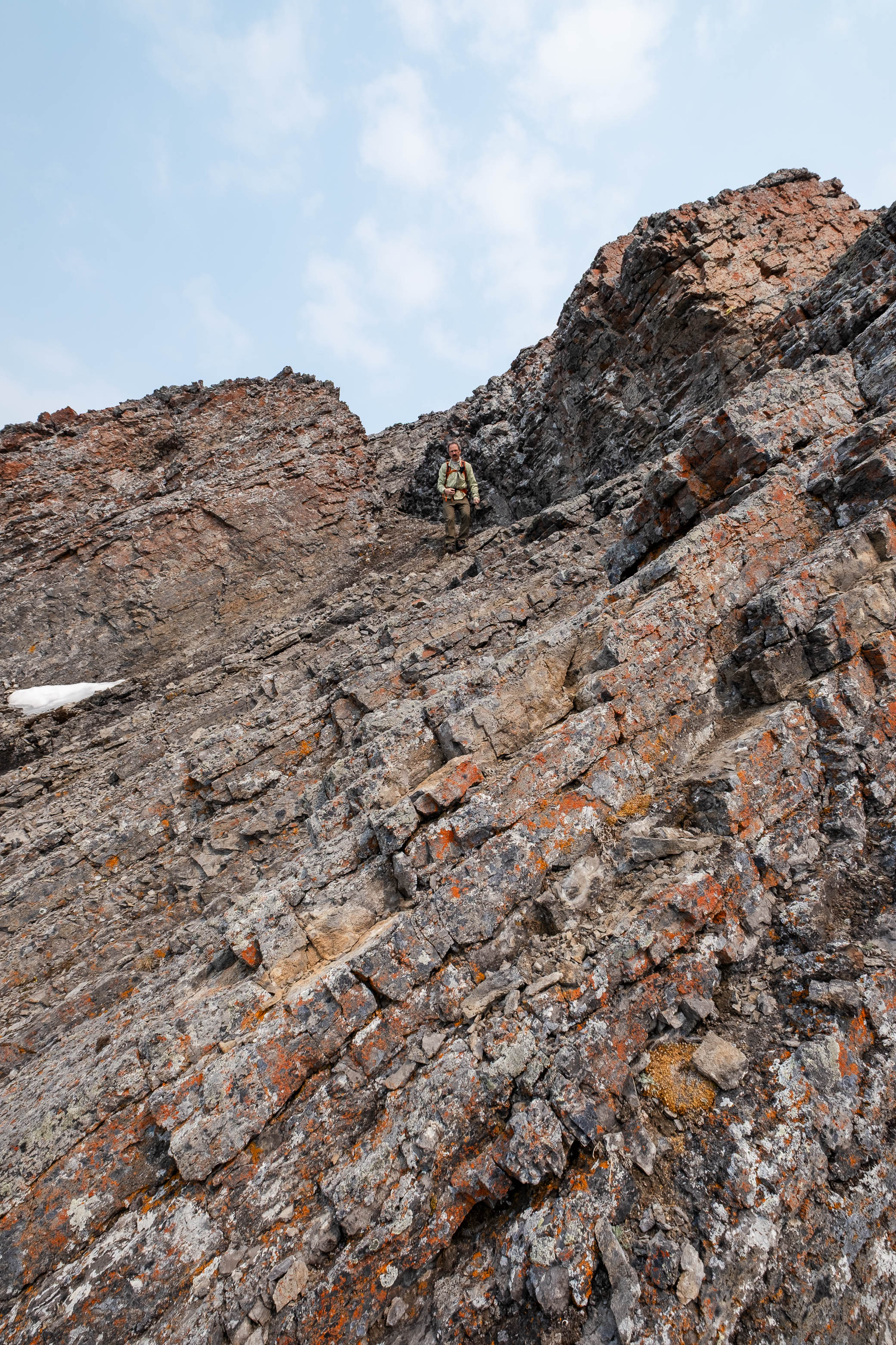
I knew that this was likely the end of the road for us, but ventured along a scree ledge on the east side of the mountain just for the sake of it. To my surprise a hidden gully revealed itself, breaking through the daunting wall that loomed over us, and while much less intense than the sheer faces of rock on either side, this gully was by no means a walk in the park! The first step was a short slab problem, and although the first few moves were easy enough, the exit consisted of a blank slab with no real hand holds to pull up on. I was slowly able to overcome this step, but a fall would not have been pleasant, and my dad couldn't bring himself to commit to the final friction move.
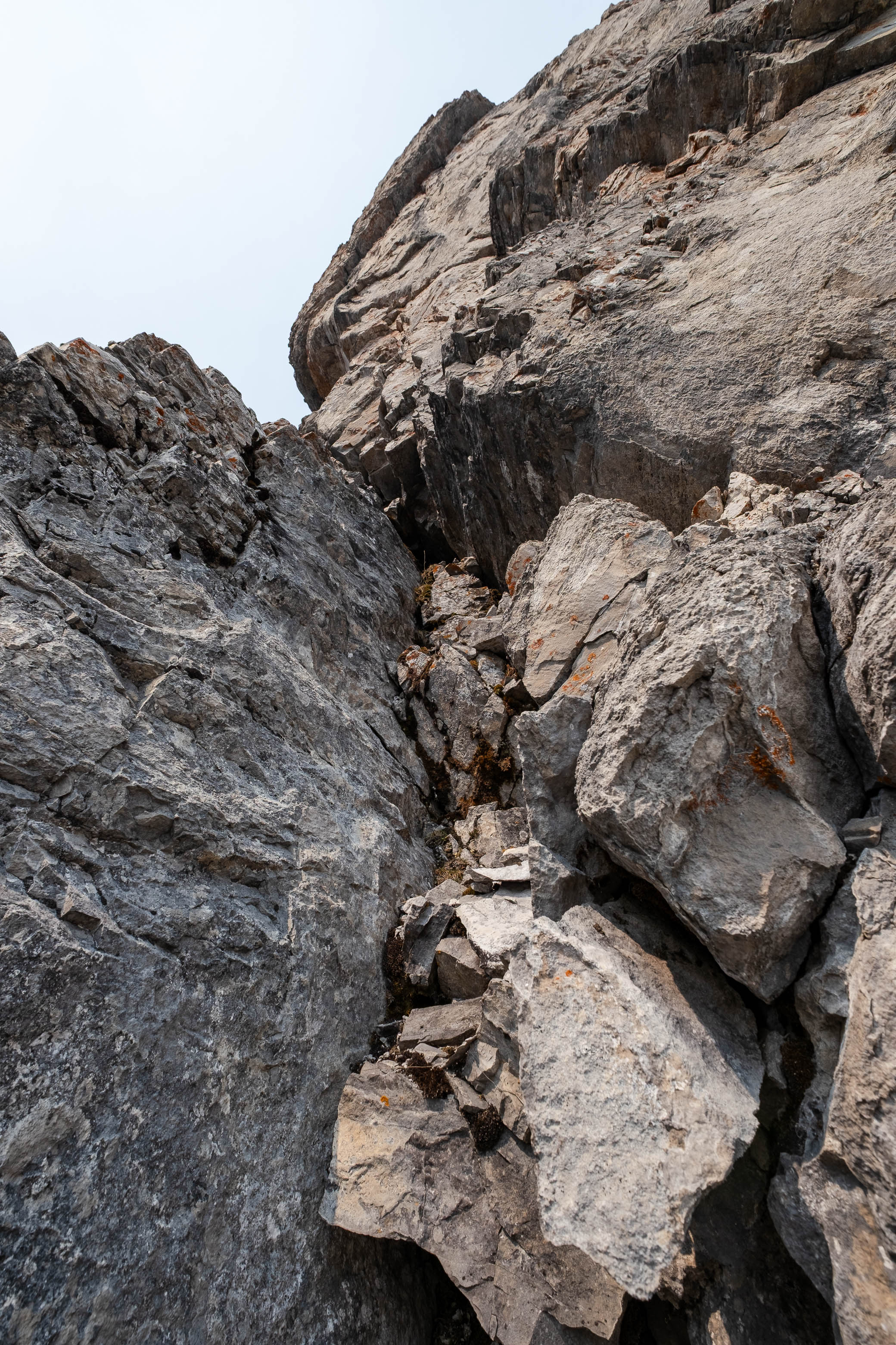
What didn't help was how vulnerable we felt in our current position...Neither of us brought a helmet, and we could hear water - from the rapidly melting snow - trickling down the rock faces that towered over us. With flash-backs of our near miss on Noseeum Peak a couple summers back, we knew that rock fall was a real concern here and that this was not a place to linger!
Before retreating to safety, I quickly went to check out the next obstacle up the gully to see if a return trip might be worth it some day. My first thought was to ascend a narrow chimney-like feature on the right side of the gully, but this was filled with a collection of precarious blocks that shifted as soon as I tested a hold...NOPE! Slowly pushing the block back into place, I carefully crossed the gully (the middle was just blank slab) to assess the opposite side. The rock on this side was much more solid, but also much more exposed. After testing a few holds and analyzing the route, I decided that I didn't feel comfortable traversing a narrow, moss covered ledge in my current state (I was feeling super tense and found myself repeatedly glancing nervously up at the cliffs), and turned my back on the gully to follow my dad back along the scree ledge and out of the potential "fire zone".
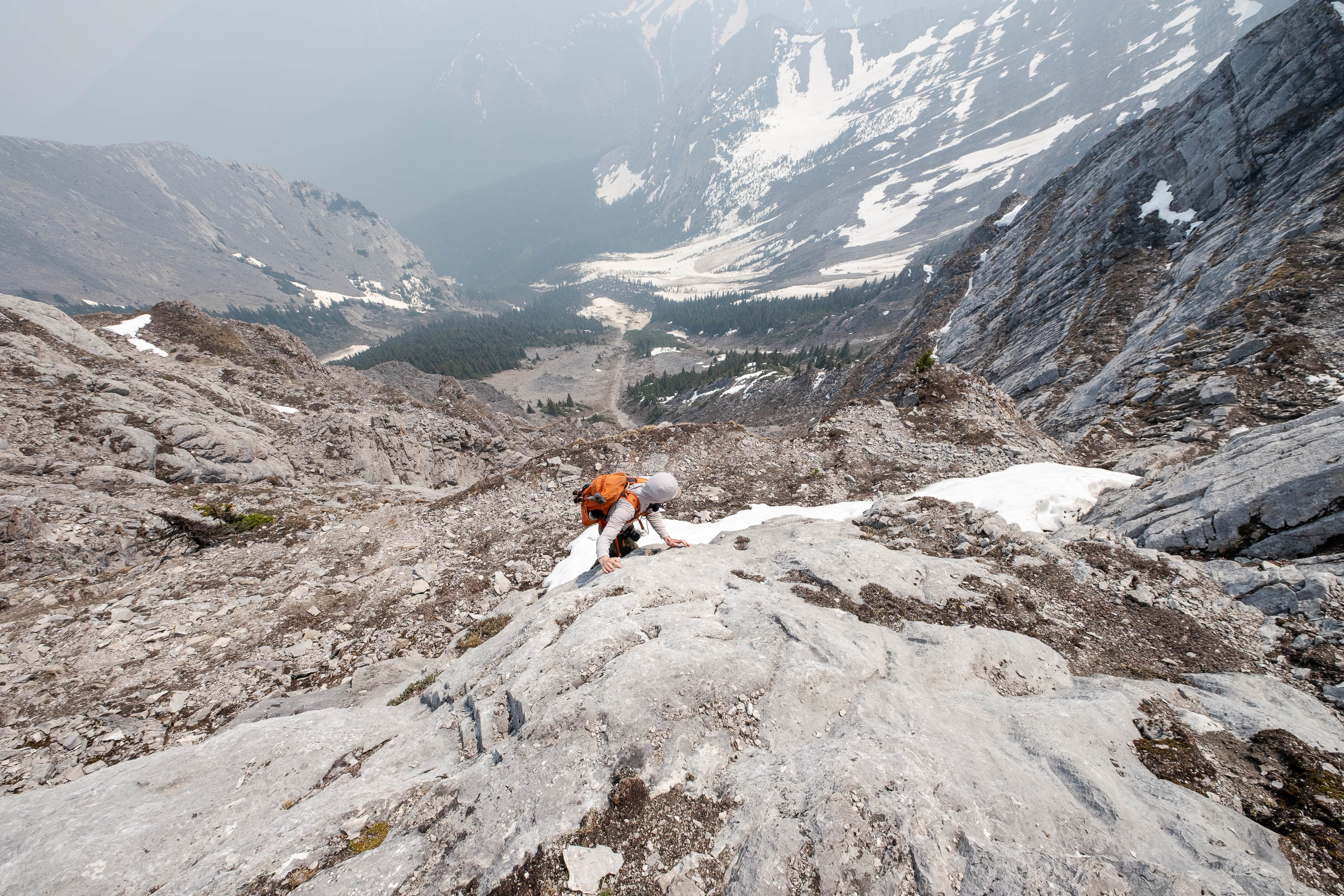
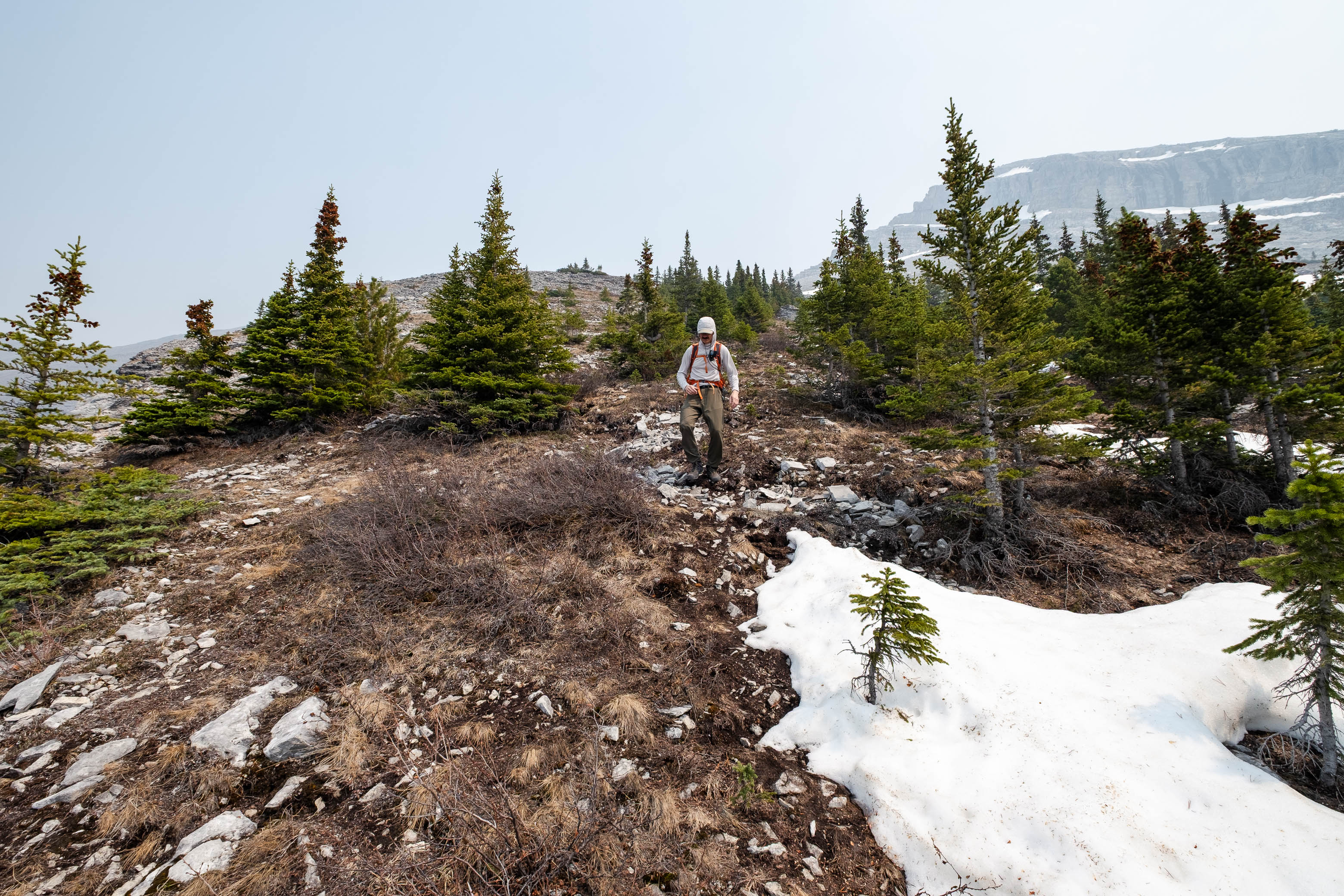
Together, we then retraced our steps down the ridge and onto the rubble slopes, easily leading back down to treeline. It turns out that there is more than one trail leading up Ship's Prow's lower, forested slopes, and on our way down, we found ourselves on a trail marked by scratched tree bark instead of the ribbons we'd followed on ascent...This trail worked out just fine, but was noticeably less travelled and we did end up losing it near the end, rediscovering the ribbon route and following it the remainder of the way down. Strange thing, is that we ended up emerging at the big gravel pit that I mentioned earlier...So I guess you can access the trail from here as well, but if I were you, I'd just keep things simple and follow our ascent route. It's the best one IMO.
There you have it! Ship's Prow makes for a nice quick 'n easy outing when the rock is dry - great as an early season warm-up to get your scrambling feet back under you again! If you want to spice it up, give 'er a go in winter, but know that snow changes the complexion of a route dramatically and you might have to forgo the summit if avalanche conditions aren't in your favour.
Although it was a bit of a bummer to fall short on our little "side quest", sometimes you just gotta know when to call it a day, and I feel like this was one of those times...And who knows, maybe someday, if I'm bored, I'll be back. But next time with a brain-bucket! 😉
Photo Gallery
Disclaimer