Date: April 18, 2023
Location/Route Map: Kananaskis Valley
Elevation: 2215 m
Elevation Gain: 1000 m
Distance: 20 km
Rating: Class 3 - Moderate
Notes: While some exposure near the summit will keep you on your toes, the real challenge is honestly just getting to the base of this mountain. Unless, of course, you time it perfectly like we did. 😉
GPS Track: Download
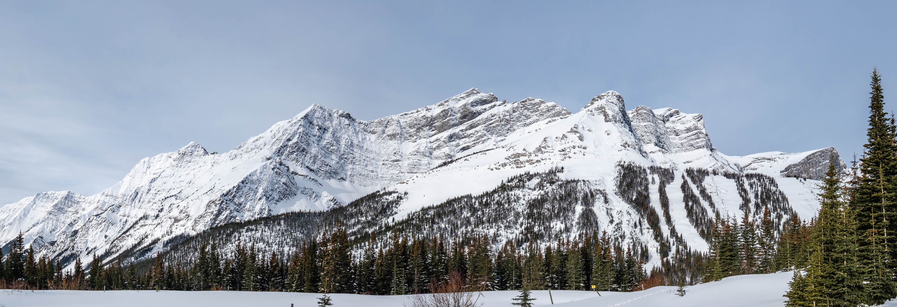
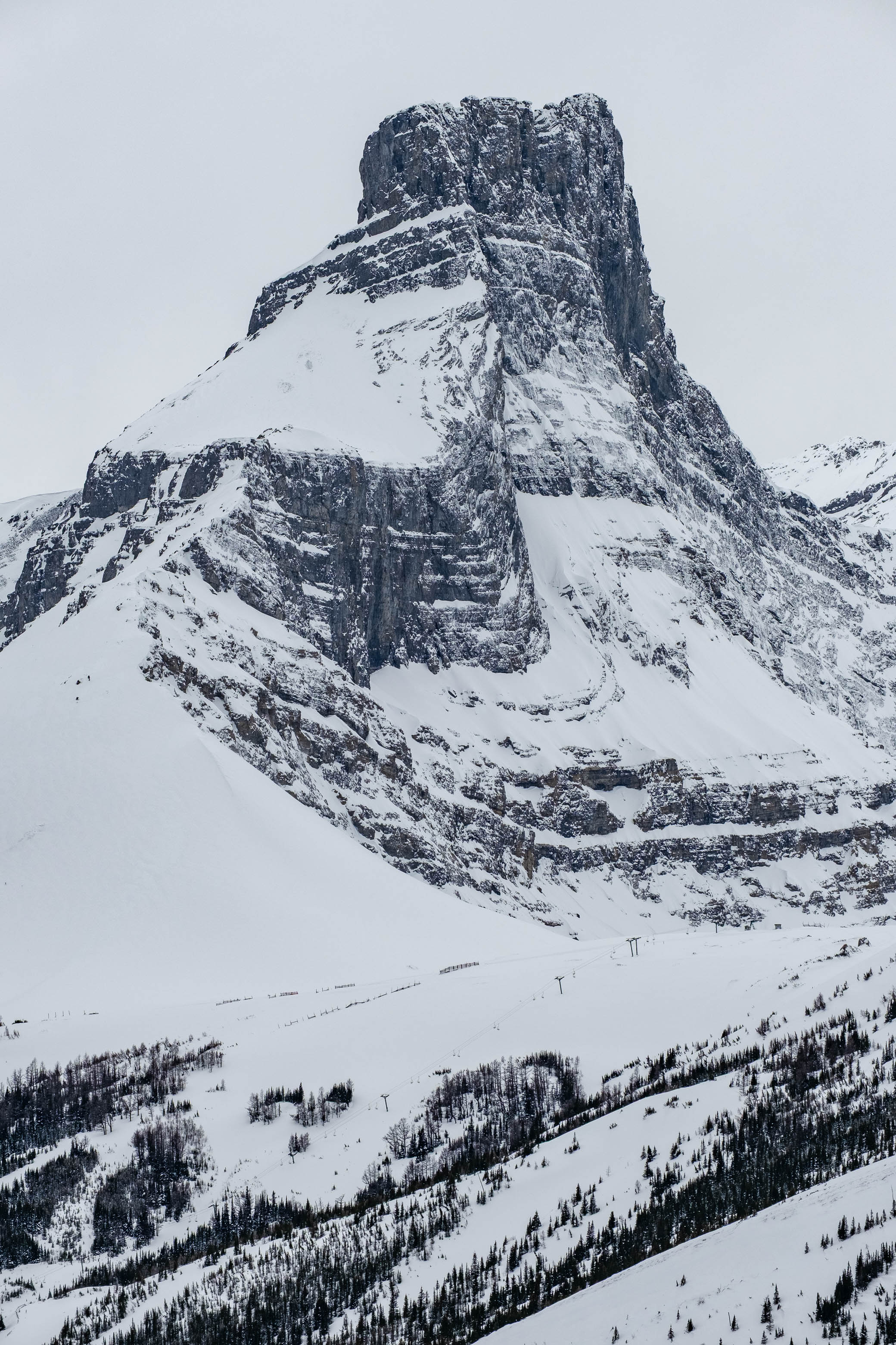
Although unofficial, the name "Spoon Needle" has got to be one of the most fitting names given to a mountain IMO! I remember the first time I noticed this peak as we drove north, down Highway 40, on our way out of Kananaskis a couple years ago. My immediate reaction was something like, "WOAH! What is that?!!". Sharply piercing up towards the sky - like a "needle" - it may have been smaller than many of the surrounding peaks, but boy was it impressive! As we continued down the highway, however, it briefly drifted out of view, and I got distracted with other things...By the time I tried to look for the "needle" again, it had vanished! Rising directly above us, where I was certain that the needle I saw just moments ago should have been, was a broad, oval face - like the back of a spoon - showing no resemblance to a needle whatsoever! The mountain had completely transformed! Intrigued, I was quick to look for it on a map, and was honestly a little bit disappointed when I found it to be unnamed. It wasn't until a few months later, while perusing the web, that I came across Vern's trip report of a peak he referred to as "Spoon Needle", and my mind immediately jumped to that "transforming" peak I saw not too long ago! After reading the report, my suspicions were confirmed, and in learning that this peak was indeed "scramble-able", my interest was sparked all over again! Even so, it would still be a long time before I set off to bag this one. The lack of bridges over the Kananaskis River necessitates a long approach, starting all the way down at the Fortress Road, unless, of course, you're brave enough to wade through those frigid waters...Personally, I liked Vern and Steven's idea of skiing the long approach - allowing for a speedy descent of the final 6.5 km down the Fortress Road on return - but since my ski boots don't have even close to the mobility that I'd like, I wasn't sure I wanted to be traversing an exposed, rocky ridge in them, and because I wasn't ready to be dumping money on a new pair of touring boots, Spoon Needle was once again (sort of) forgotten...Until this past week! Three days before my dad and I were heading off for the mountains, Carlos (who we met scrambling both Temple and Eiffel the same day as us) posted about a successful snowshoe ascent via the Fortress Road, along with a couple videos of some absolutely gnarly-looking trail-breaking! Not wanting Carlos' hard work to go to waste 😉, I was quick to throw my ski plans aside (who knows when I'll get new boots anyways), and jumped on a very rare opportunity, not having to break new trail on this infrequently visited peak!
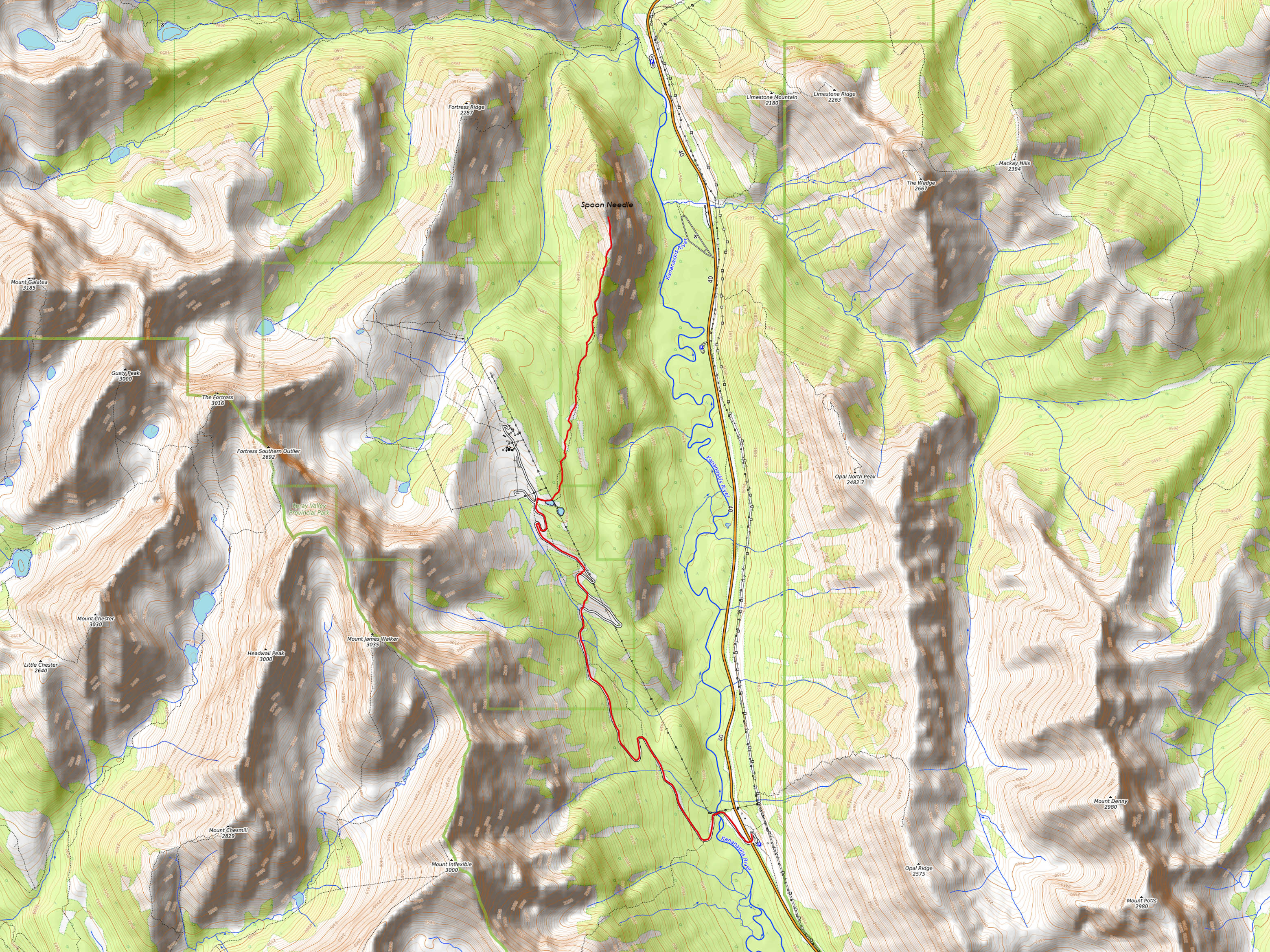
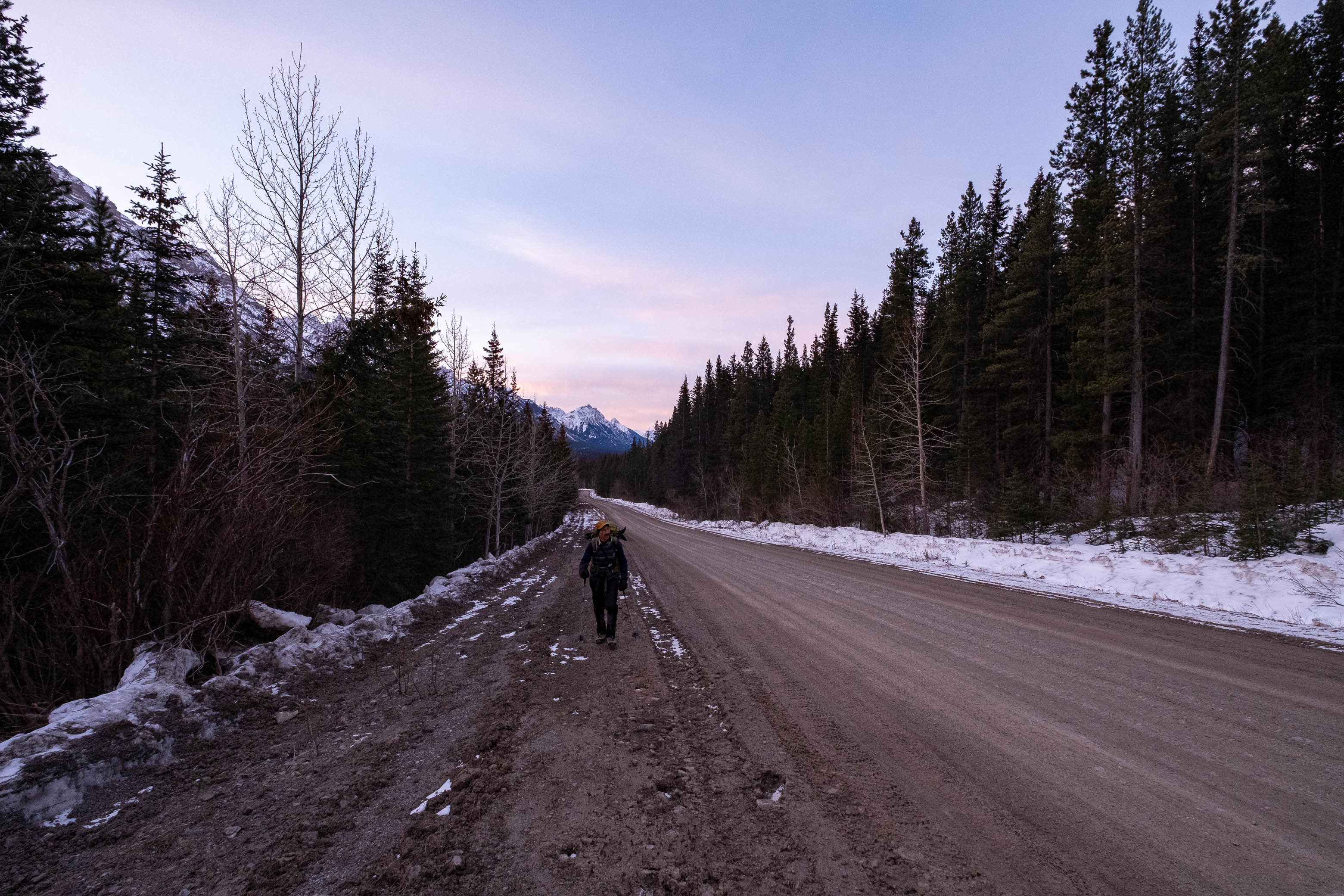
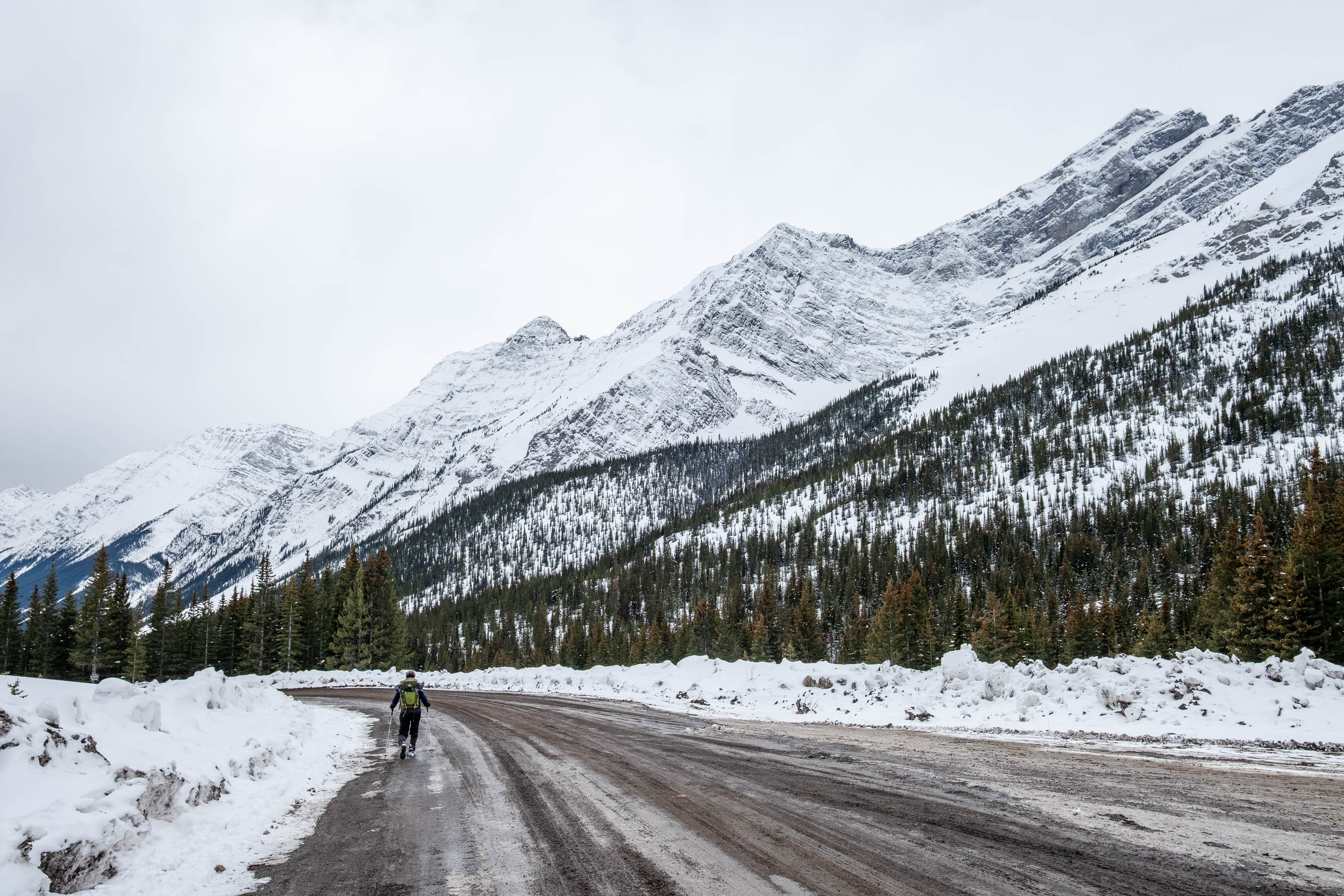
With the forecast predicting a nice weather window in the morning (clouding over by noon), I wanted to get an early start, knowing that we had a lot of distance to cover before we climbed out of the trees. We pulled up to the Fortress Road gate in darkness and were extremely surprised to find two cars already stopped there...A man stepped out and came to our window, informing us that they were filming a movie up at the ski hill and that we couldn't park there. We told him we were just going for a hike, and he suggested we try parking at the Centex across the highway. After gearing up for the day, we headed over to the Fortress Road once again (this time on foot) finding the same guy, now parked in front of the gate with "SECURITY" written across the windshield of his Jeep. I was seriously worried that we wouldn't be allowed past, but luckily, after describing our intentions, agreeing not to go to the resort, and being warned about big trucks on the road, we were allowed to continue on our way. What a relief!!
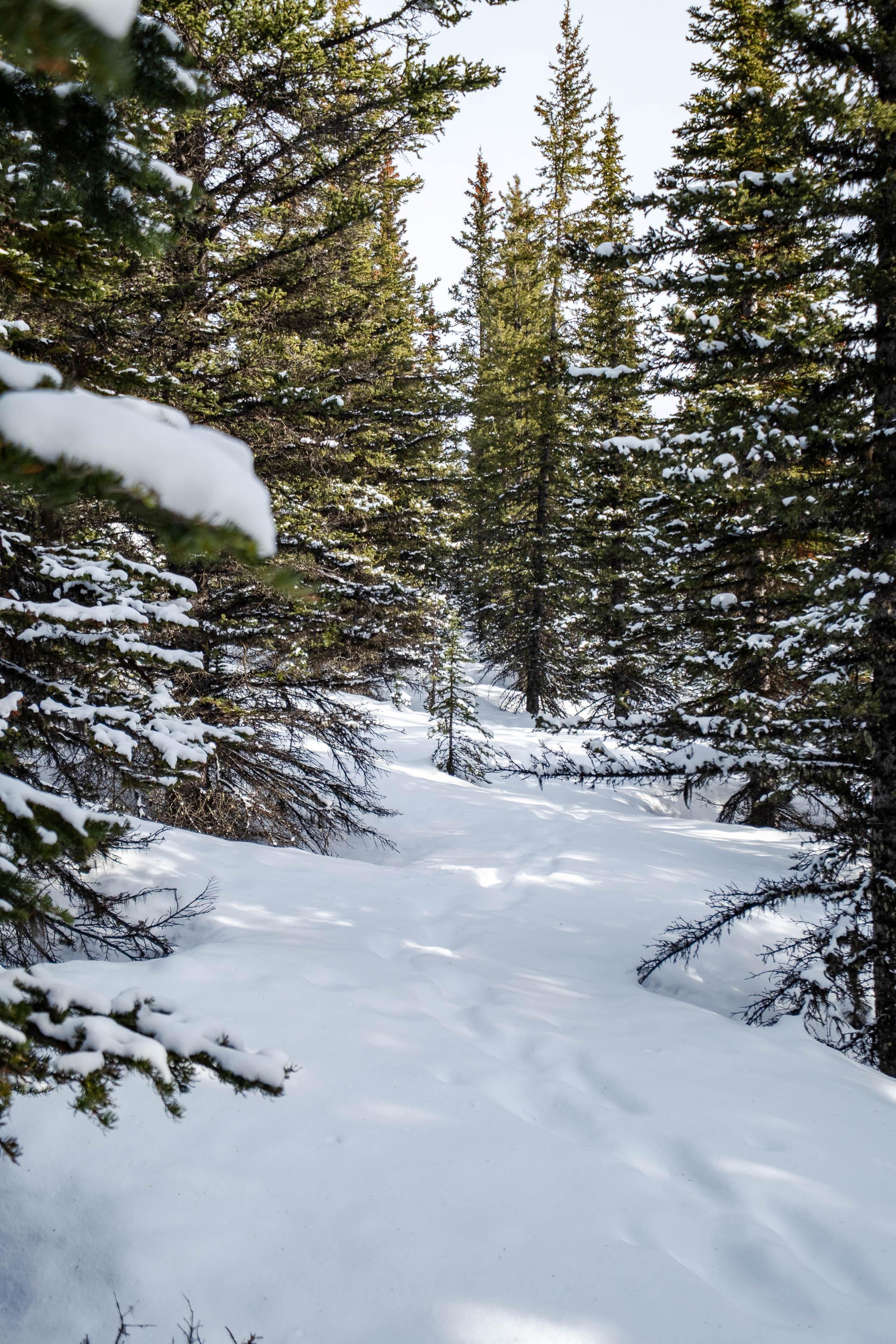
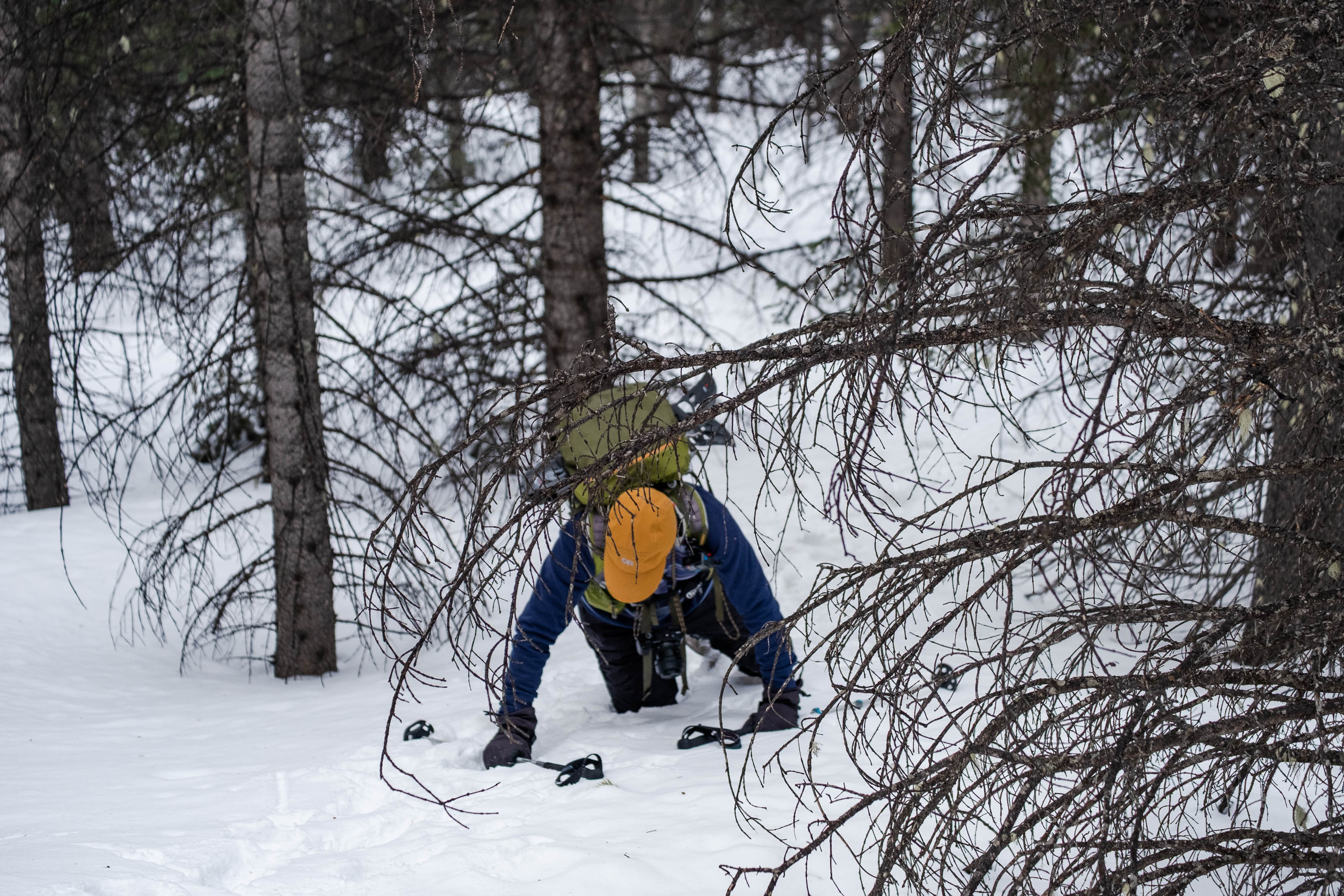
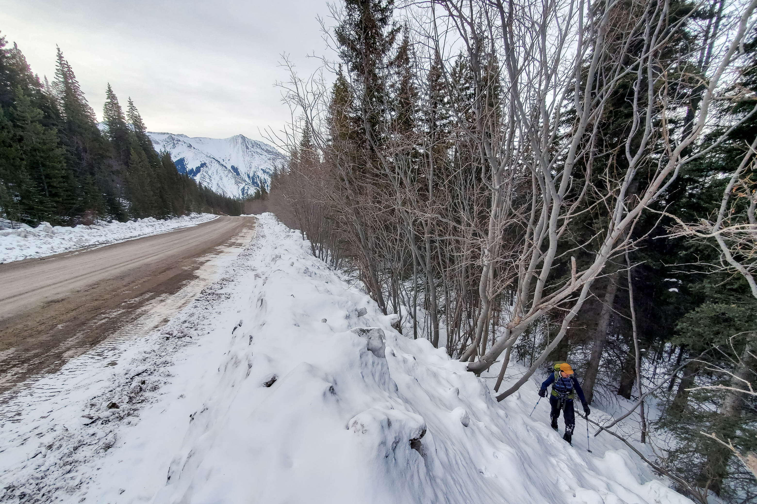
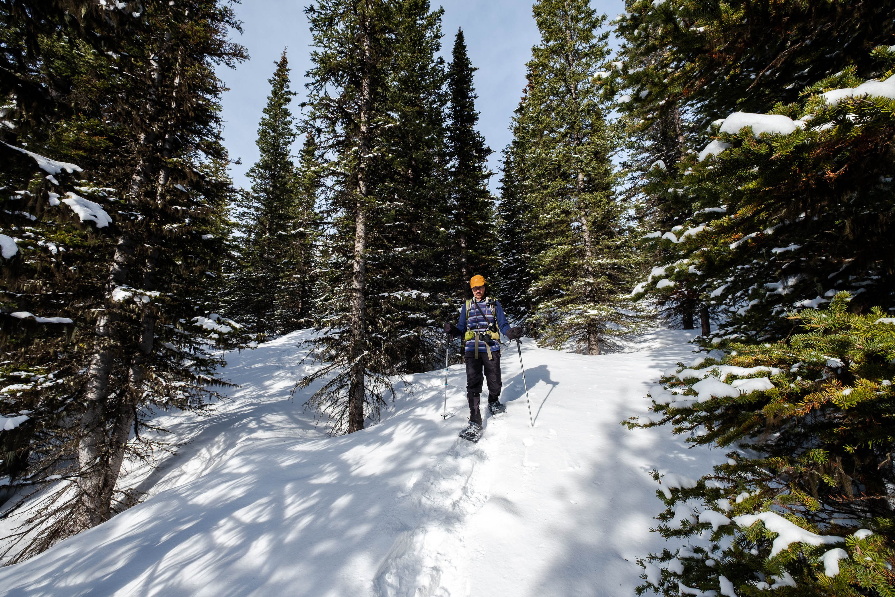
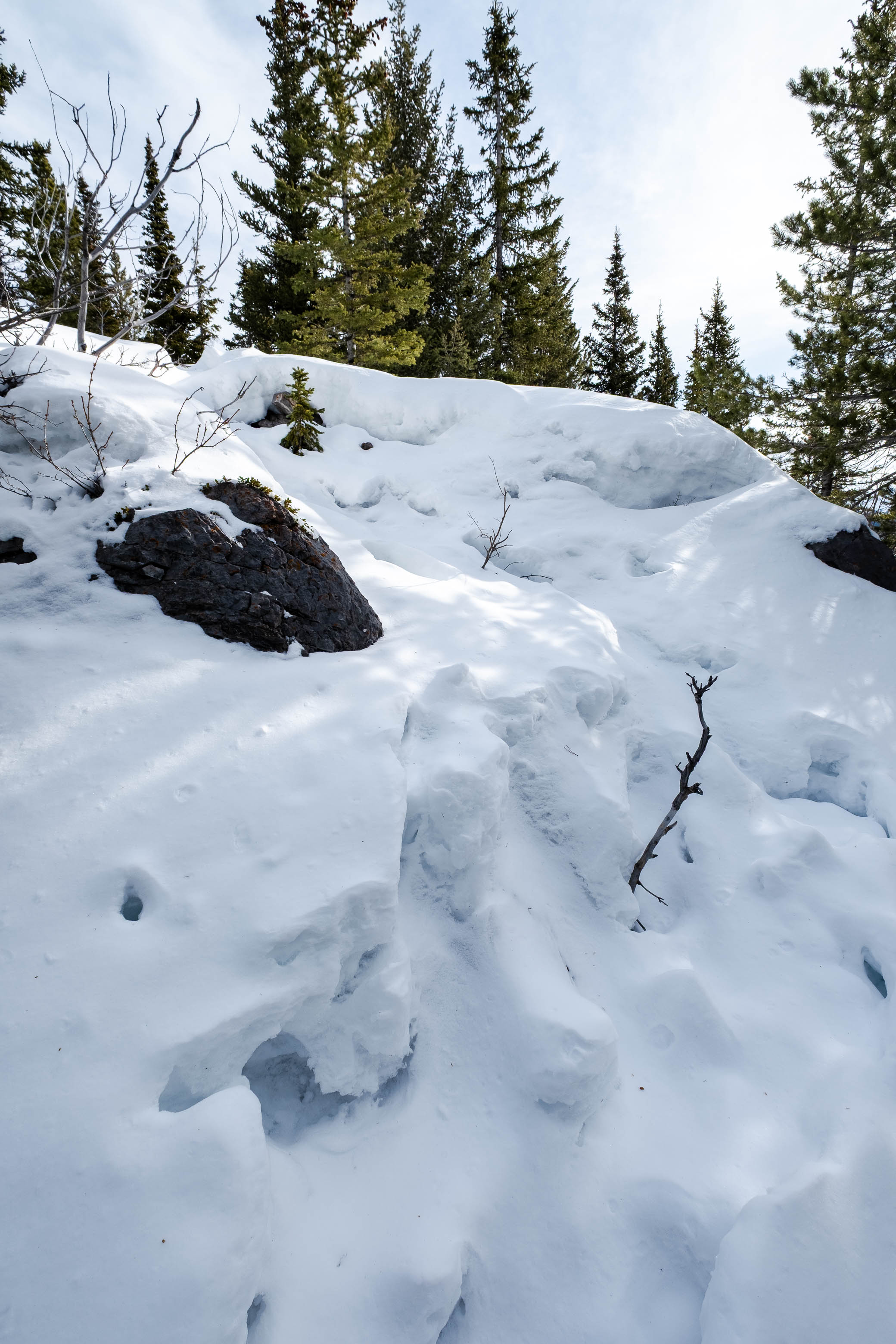
The gravel road had been plowed clean (good thing we weren't planning on skiing it!), and although long and boring, we were able to cover a good chunk of the approach in a relatively short amount of time - so that was nice! The road makes a couple sharp switchbacks higher up, and we tried to add some variety to our morning by shortcutting straight through the trees...Unlike the road, however, the trees were not plowed, and we soon found ourselves breaking through the upper sun-crust and postholing down to our waists in unconsolidated sugar! I quickly gave up on walking, and tried to distribute my weight by getting down on all fours and crawling the final 100 m to the road above. 😂 I honestly don't think we saved any time in the end...
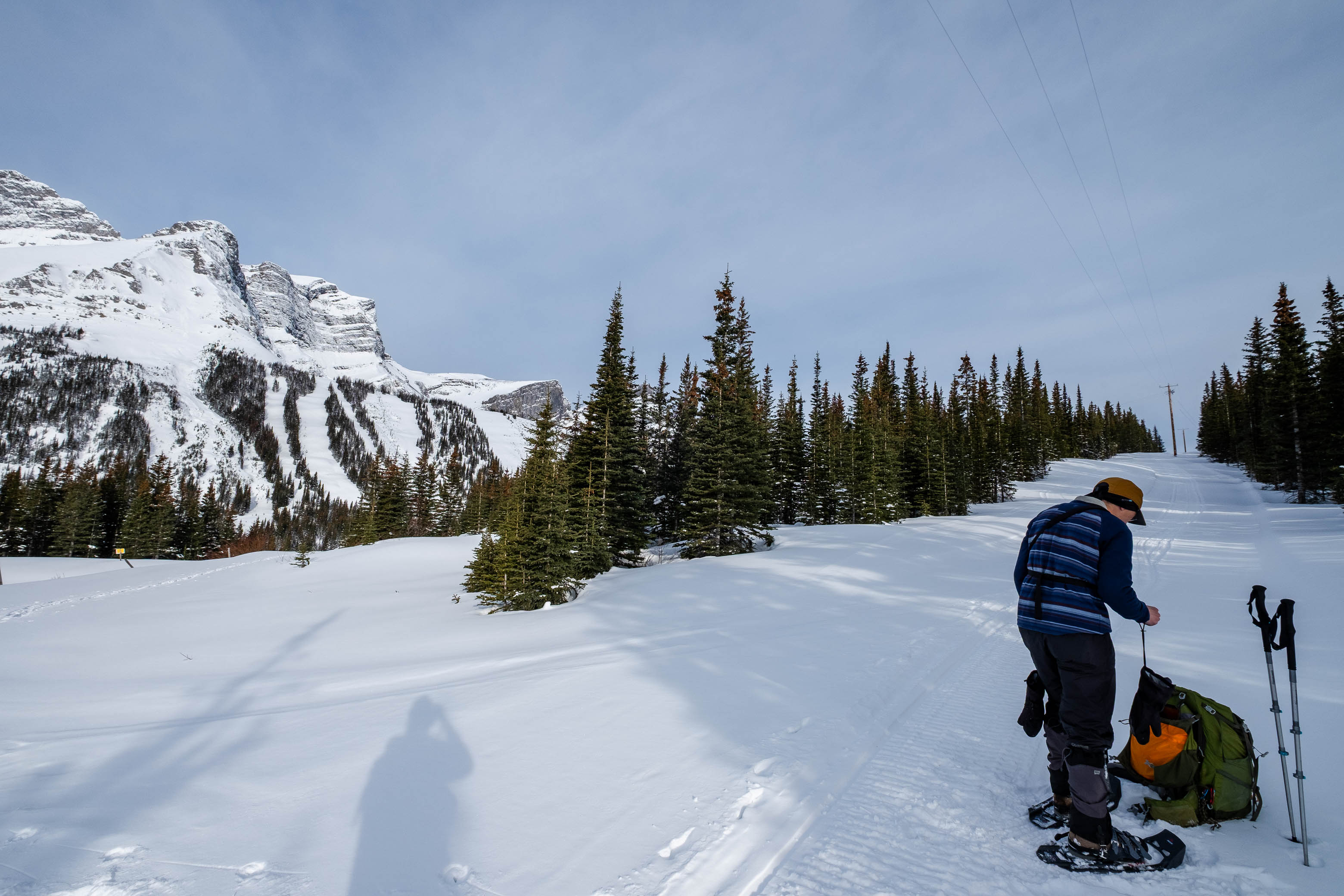
As we neared the first chairlift at the decommissioned Fortress Mountain ski resort, we found a snow-covered road branching off to our right, and started up it. I was hoping to find Carlos' tracks around this point, but it appeared to have snowed within the past three days, and if this was indeed the route that Carlos took, there were no signs hinting at it! We carried on up the road nonetheless - past some fenced off areas with "EXPLOSIVES, NO TRESPASSING" signs - and strapped on the 'shoes, at the edge of the forest at the point where our "side road" intersected with a cutline (about 200 m east of the main Fortress road), for part 2 of the lengthy approach.
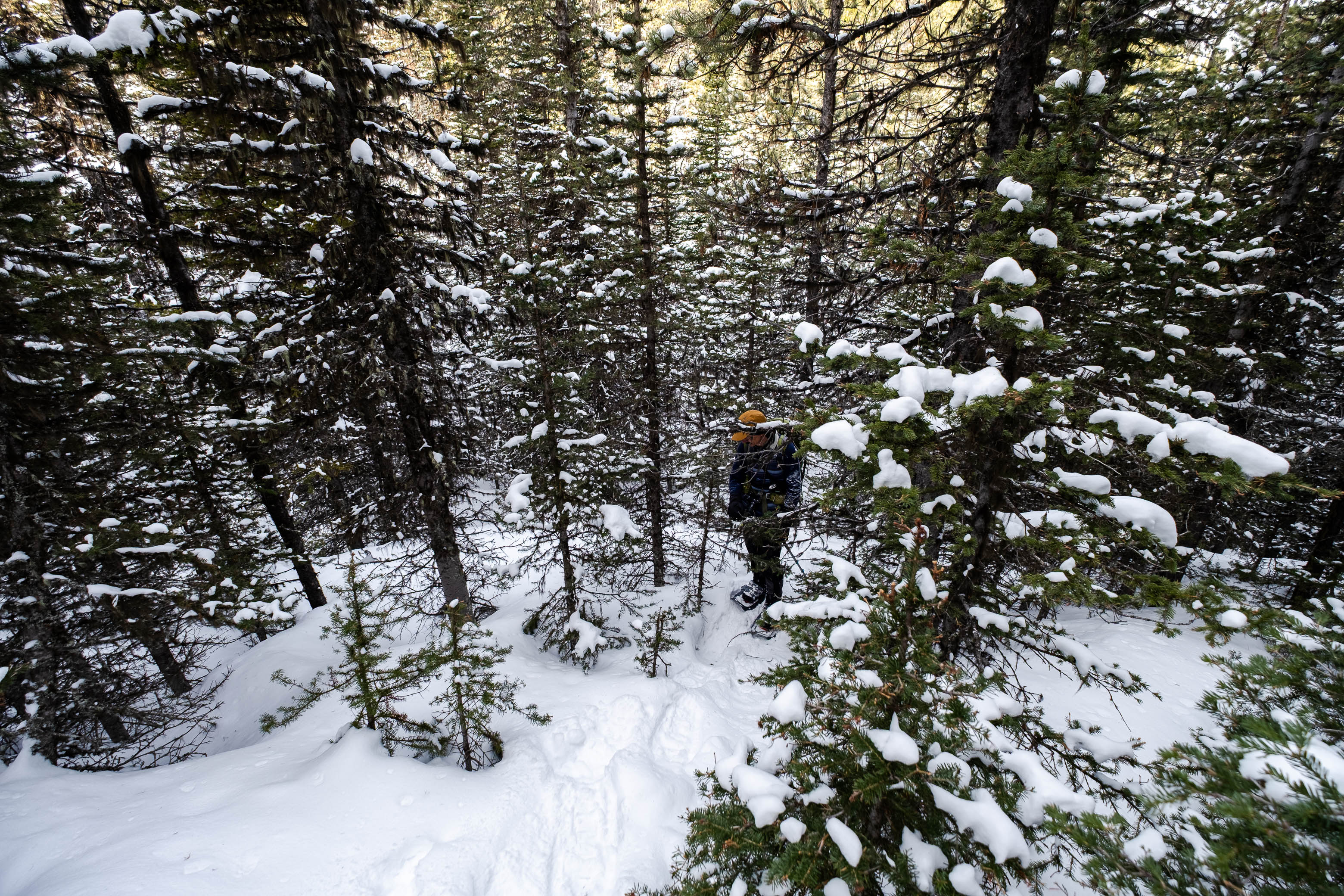
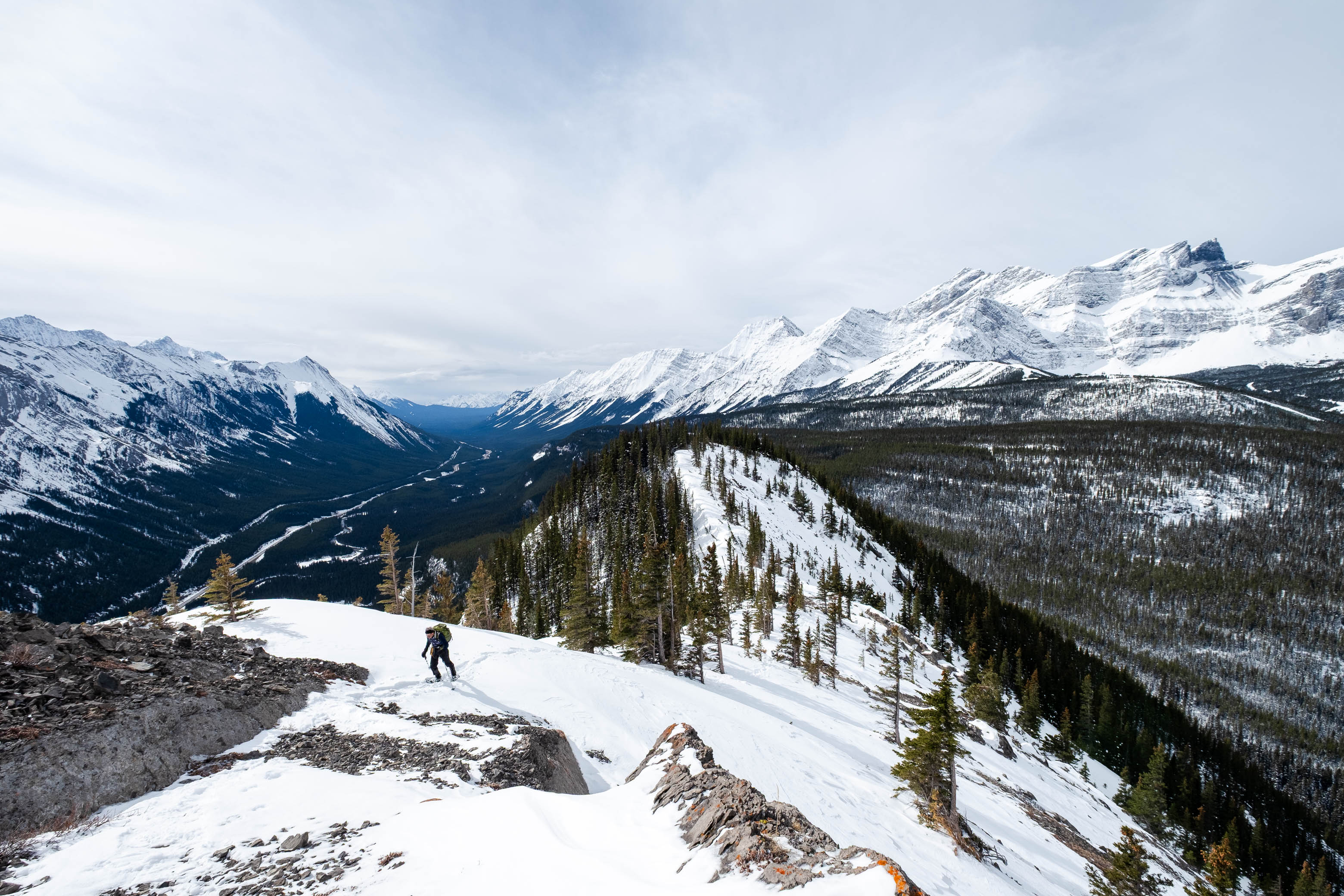
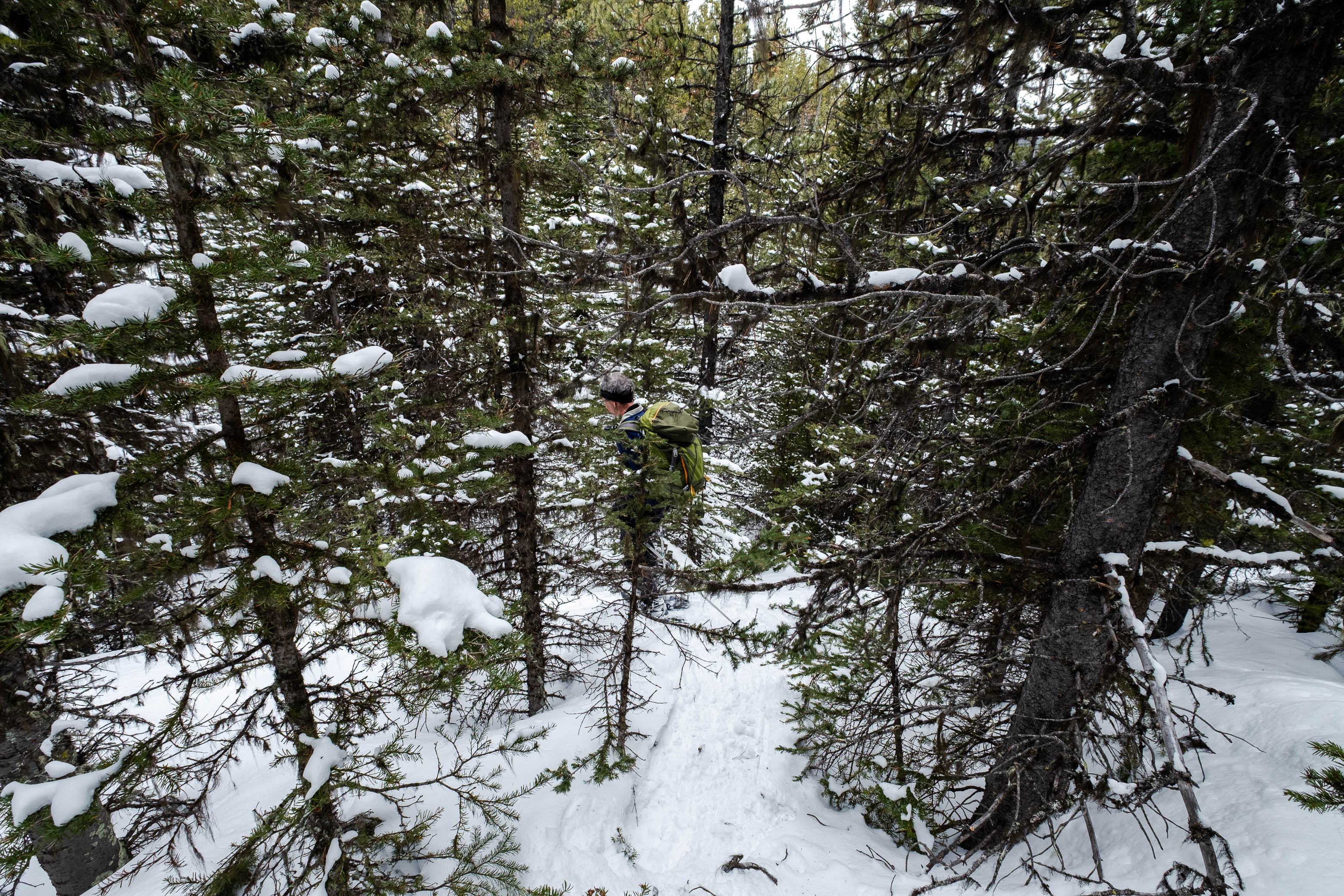
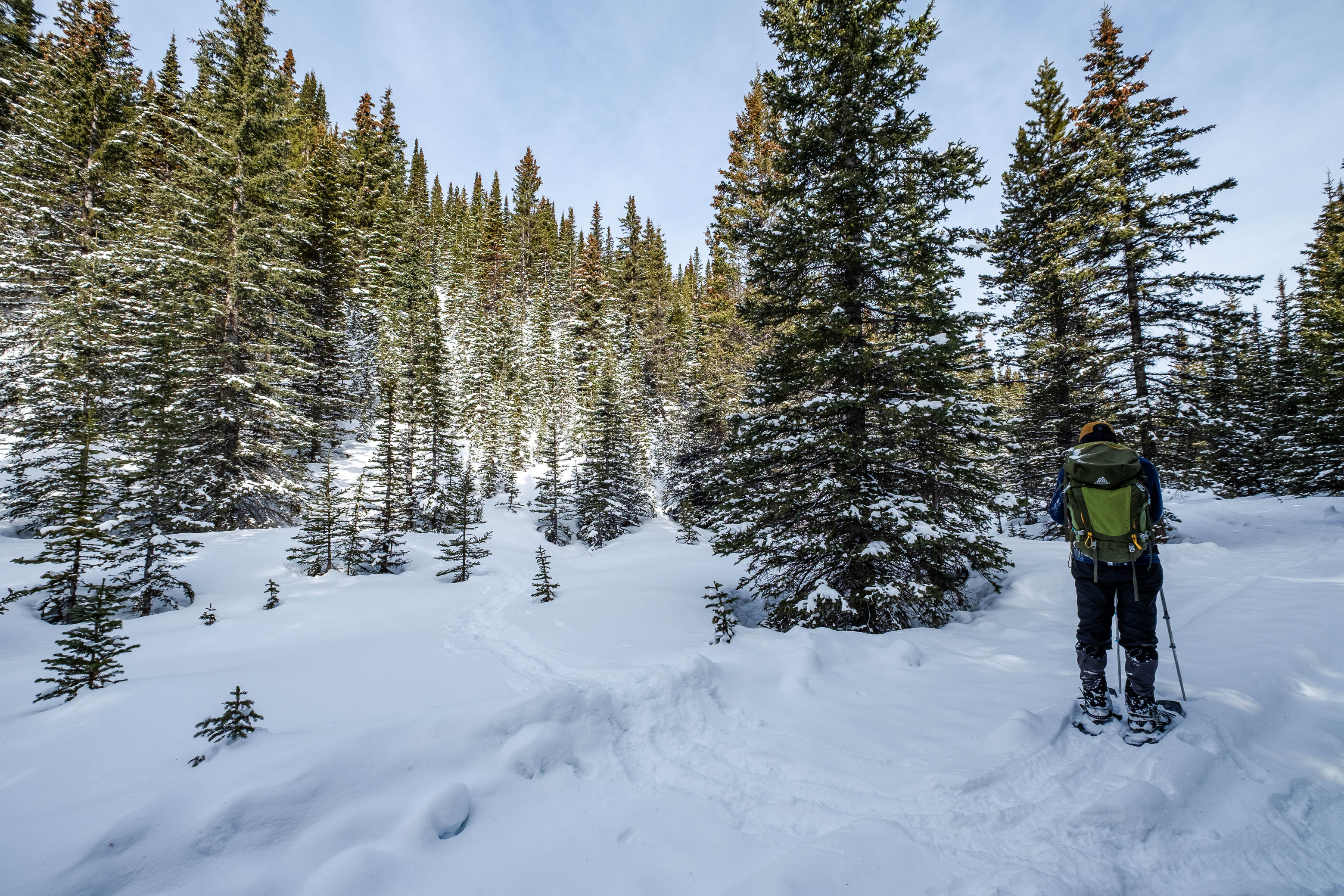
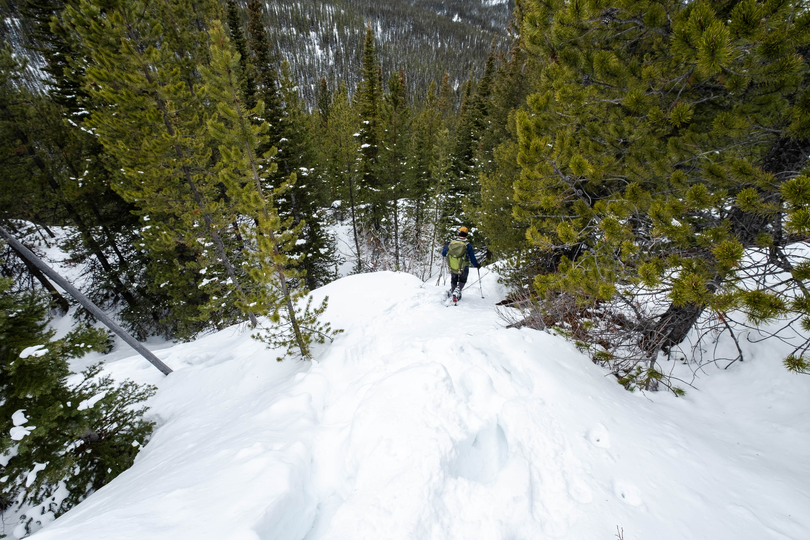
Still seeing no signs of Carlos' trail, we started through the initially generously spaced trees in a NE direction, knowing we'd have to lose some elevation and bushwhack for a few kilometers before reaching the base of Spoon Needle's south ridge. As we broke new trail through a fresh layer of snow, I continued to scan the forest floor for old tracks, and just as I was beginning to lose hope - accepting that the trail Carlos conveniently made just a few days prior had inconveniently been erased by a recent storm - I spotted an unmistakable set of indents in the snow ahead of us!
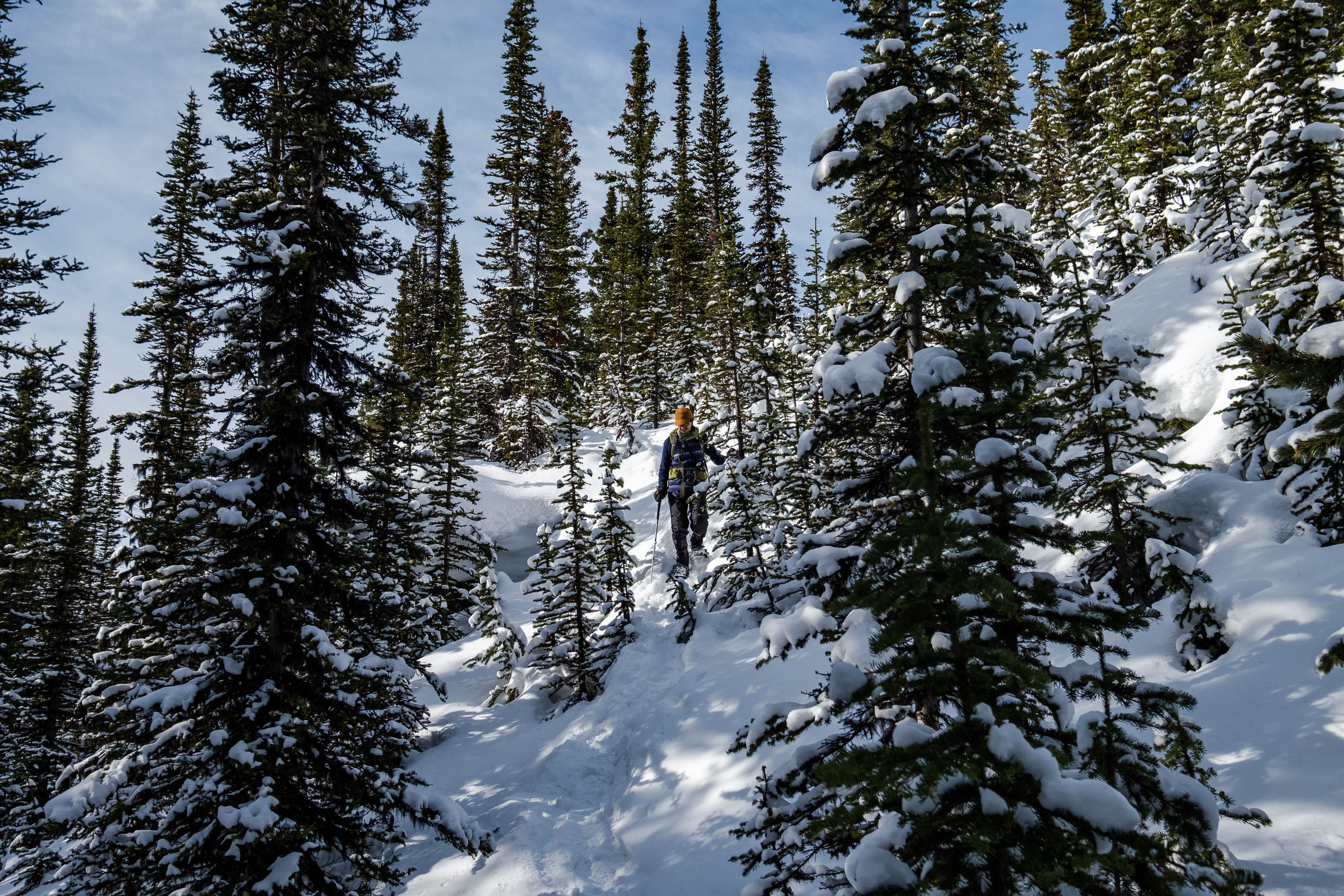
Although covered by a light layer of fresh snow, the shelter of the trees was enough to preserve the tracks, and we easily followed in Carlos' footsteps (literally 😉), first down a couple steep slopes, and then north, up rolling terrian towards our objective! The snowpack had solidified significantly since Carlos' group came through, and we passed a few sections were it was obvious that they were tirelessly fighting through waist-deep, unconsolidated snow, while we simply walked around the "crevasses" they created on a supportive crust. 😂 So while I can't say their tracks benefited us much where trail-breaking is concerned, they were invaluable in terms of routefinding, completely taking it out of the equation, and saving us many minutes that would otherwise have been spent trying to orient ourselves in what could be a very disorienting forest!
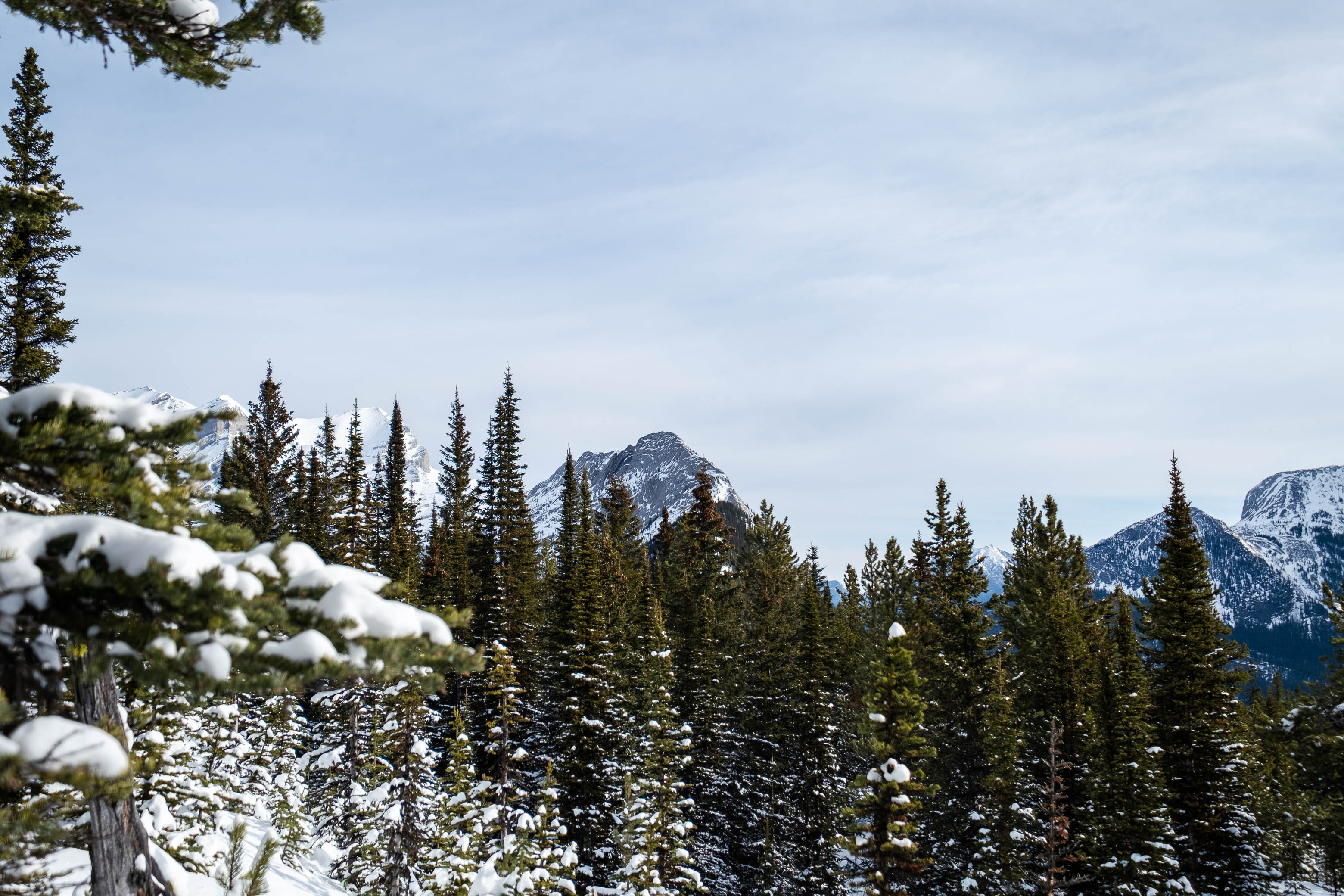
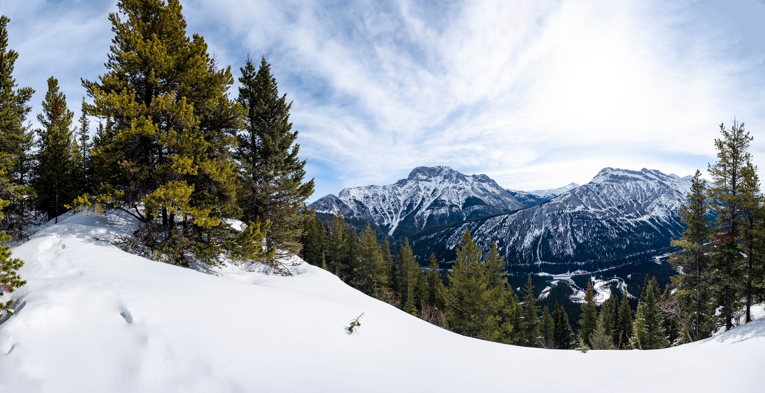
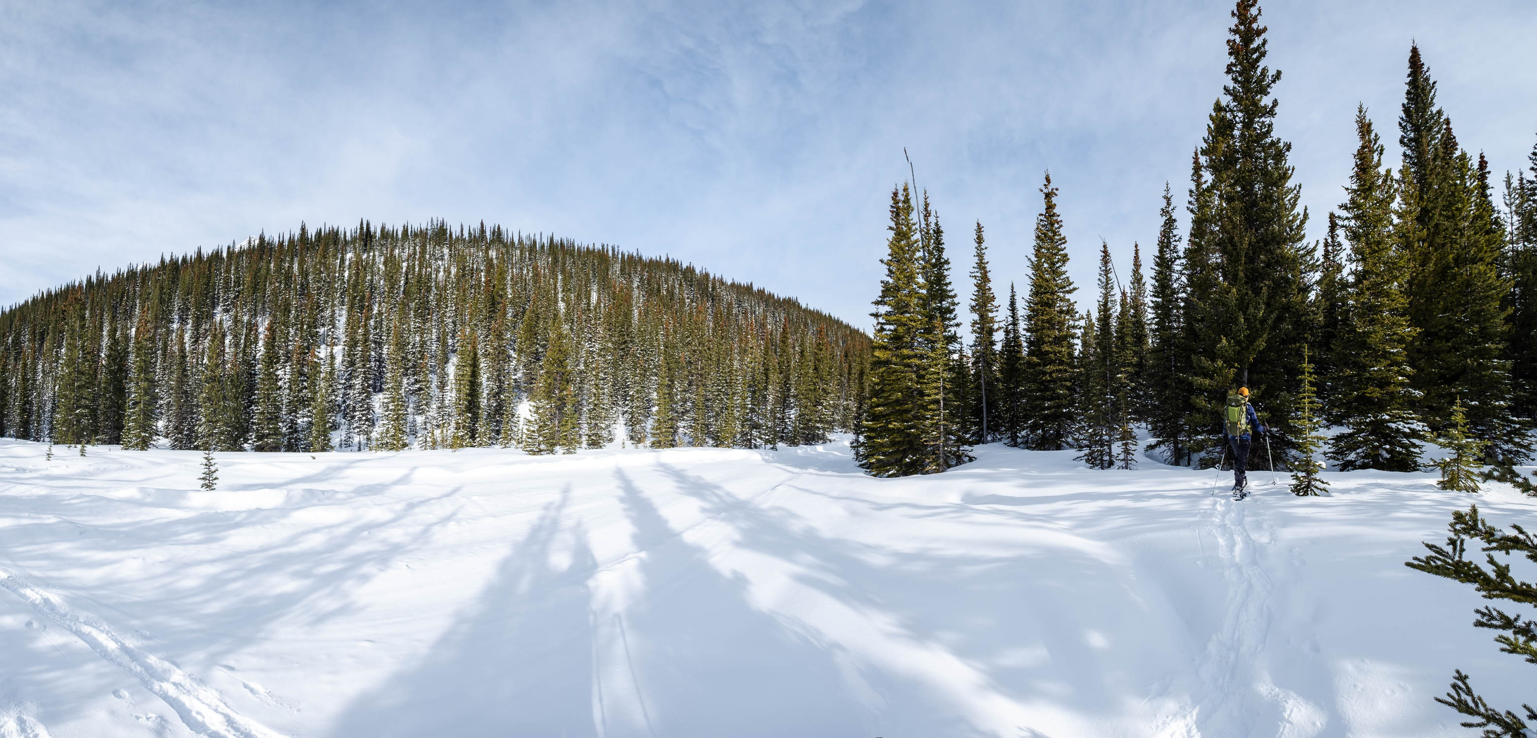
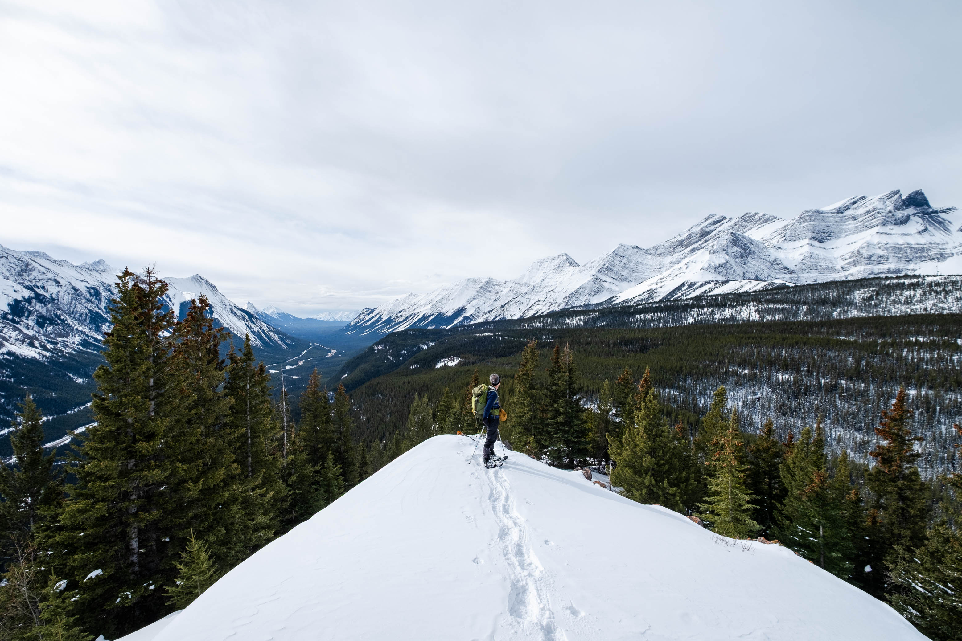
Albeit a few ups and downs and a couple short sections of thicker bush, travel was generally a breeze and it wasn't long before the terrain became more ridge-like, and we were finally rewarded with some views!
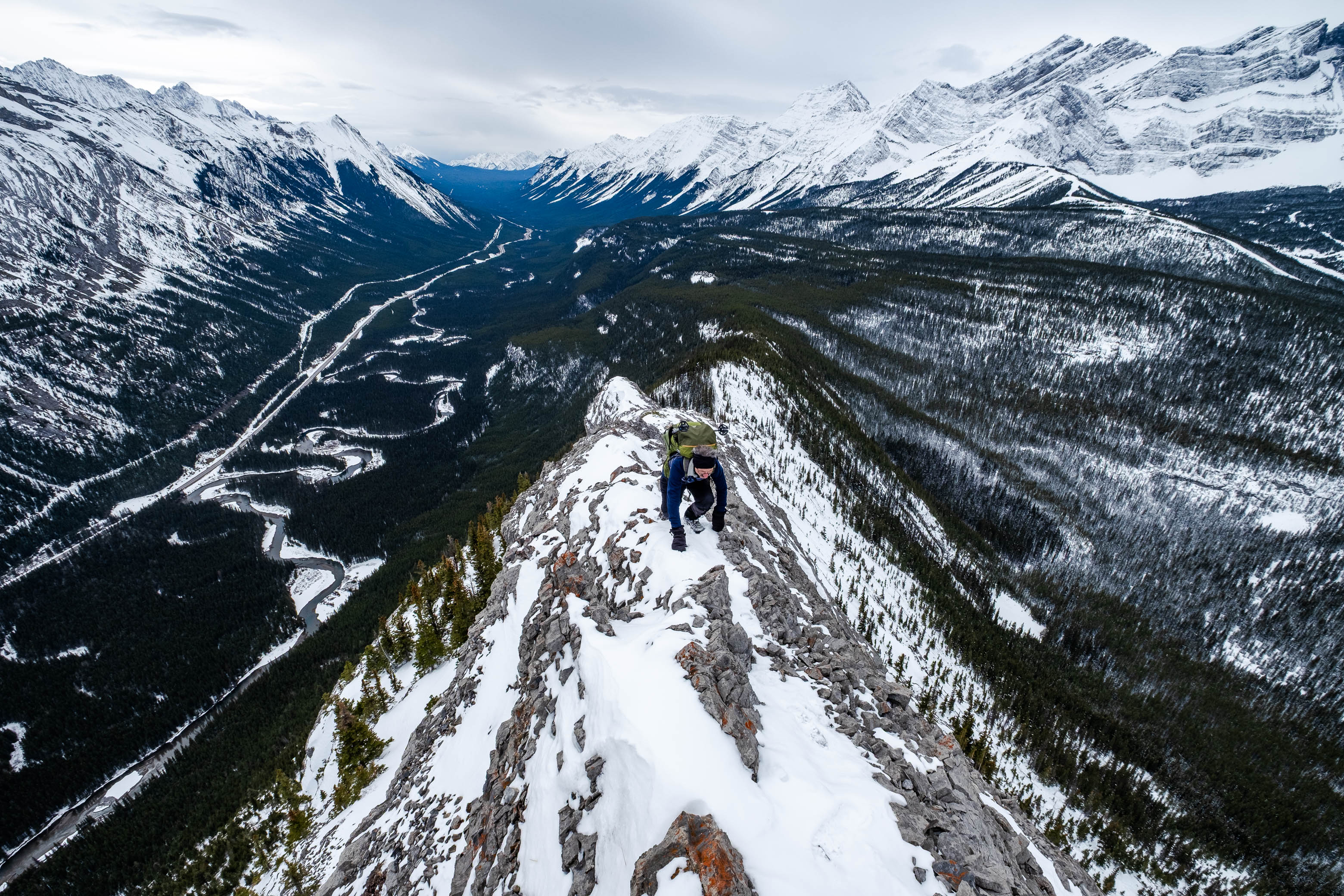
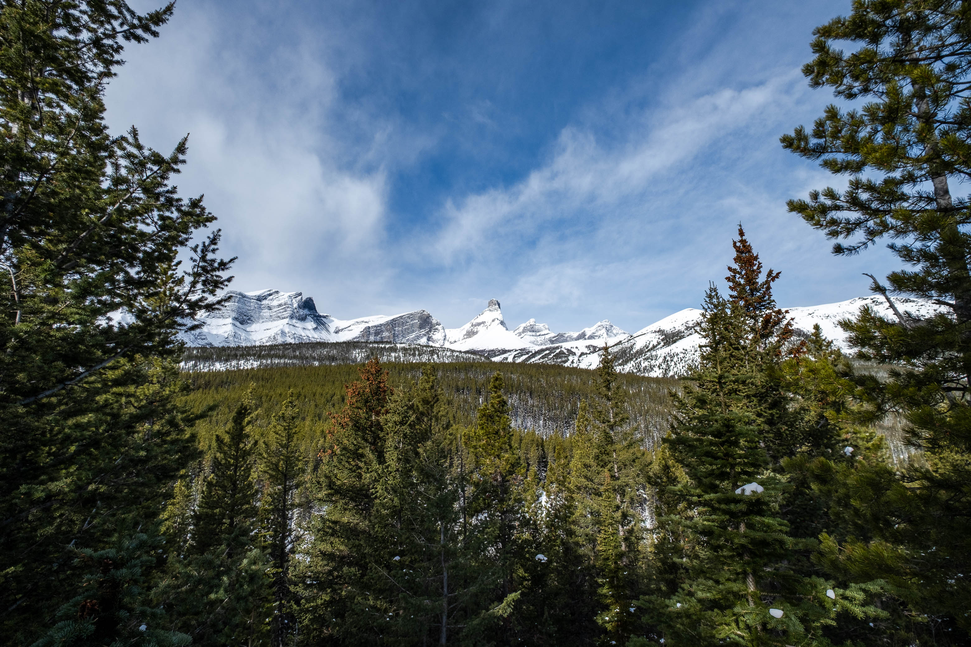
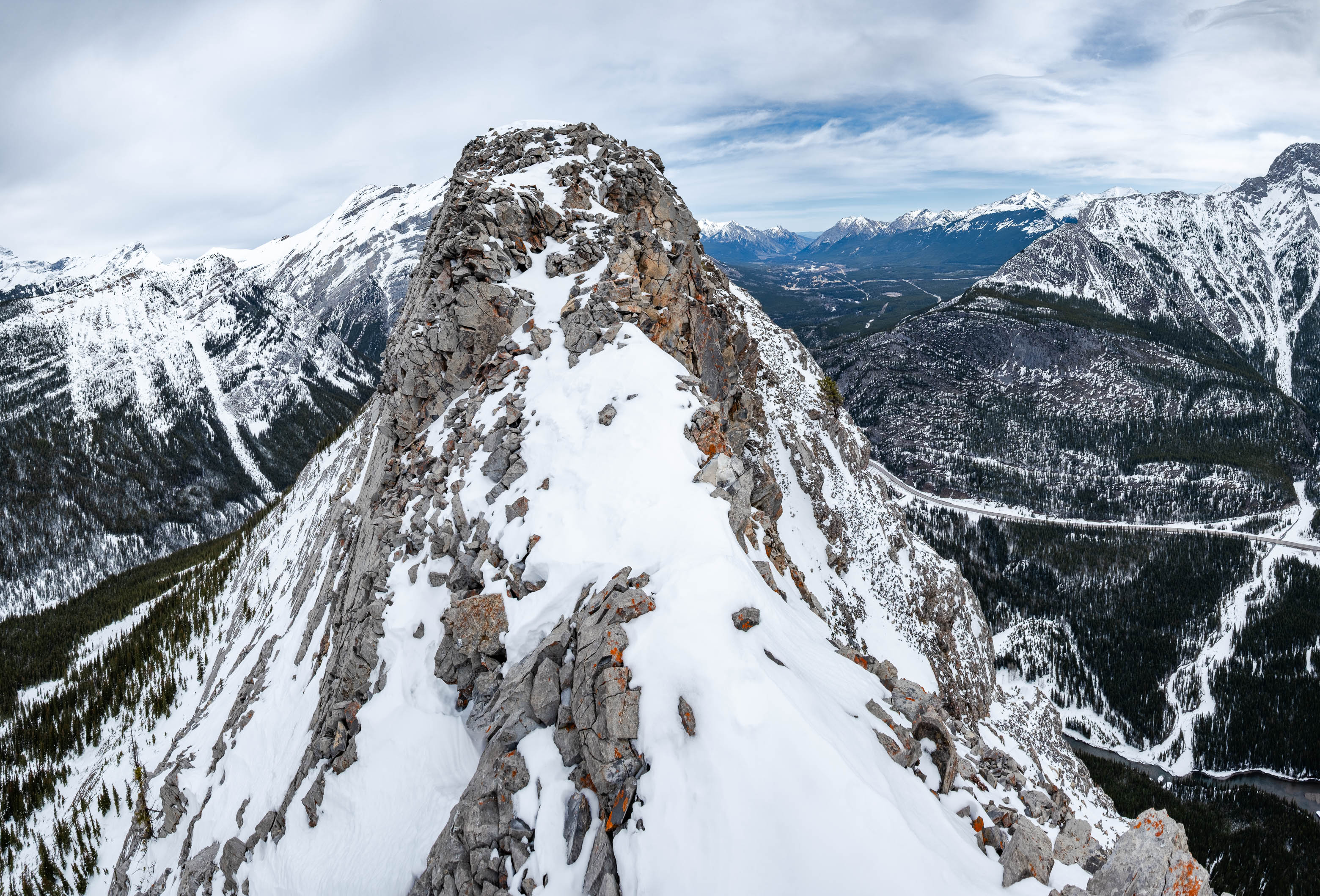
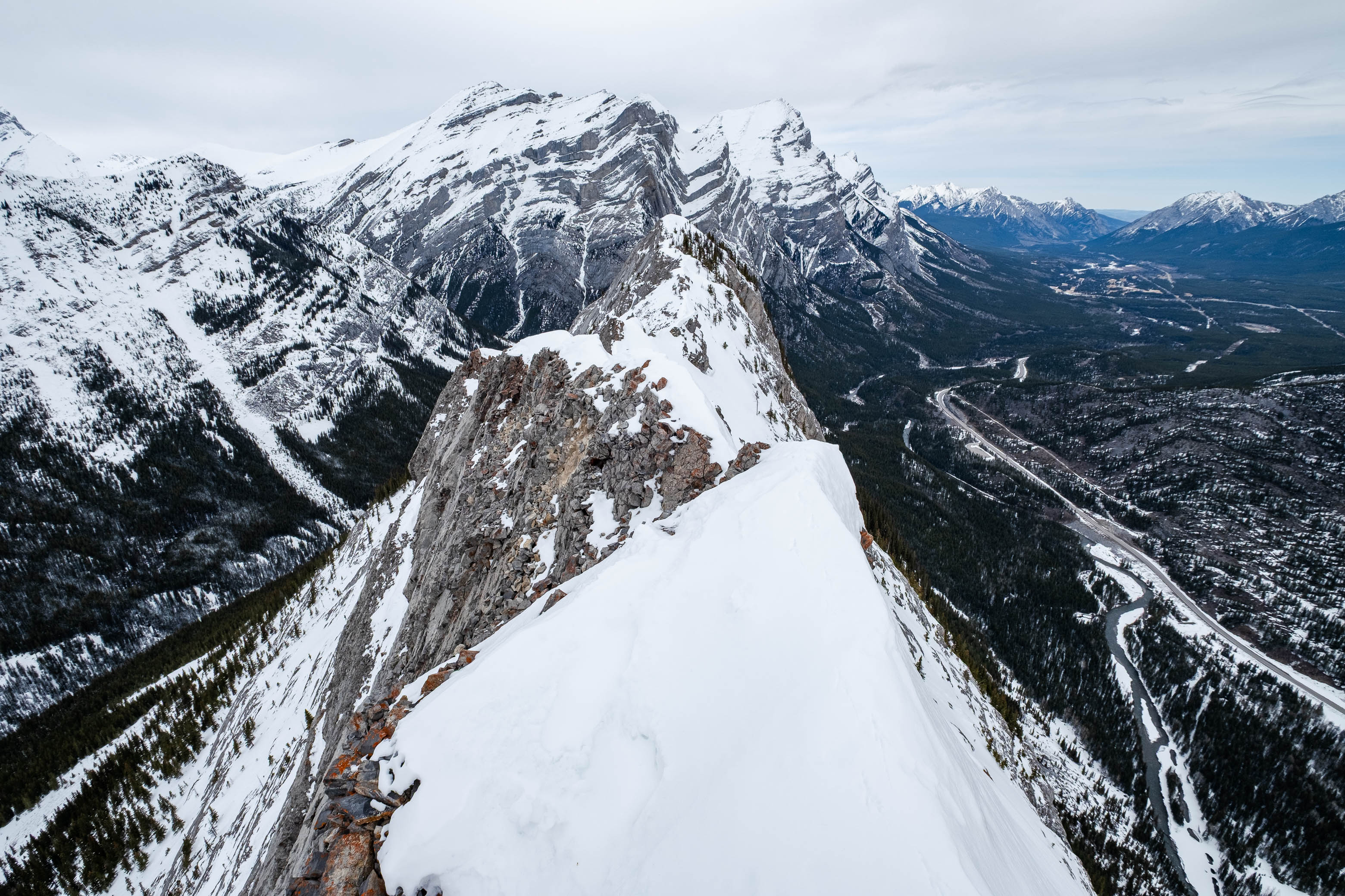
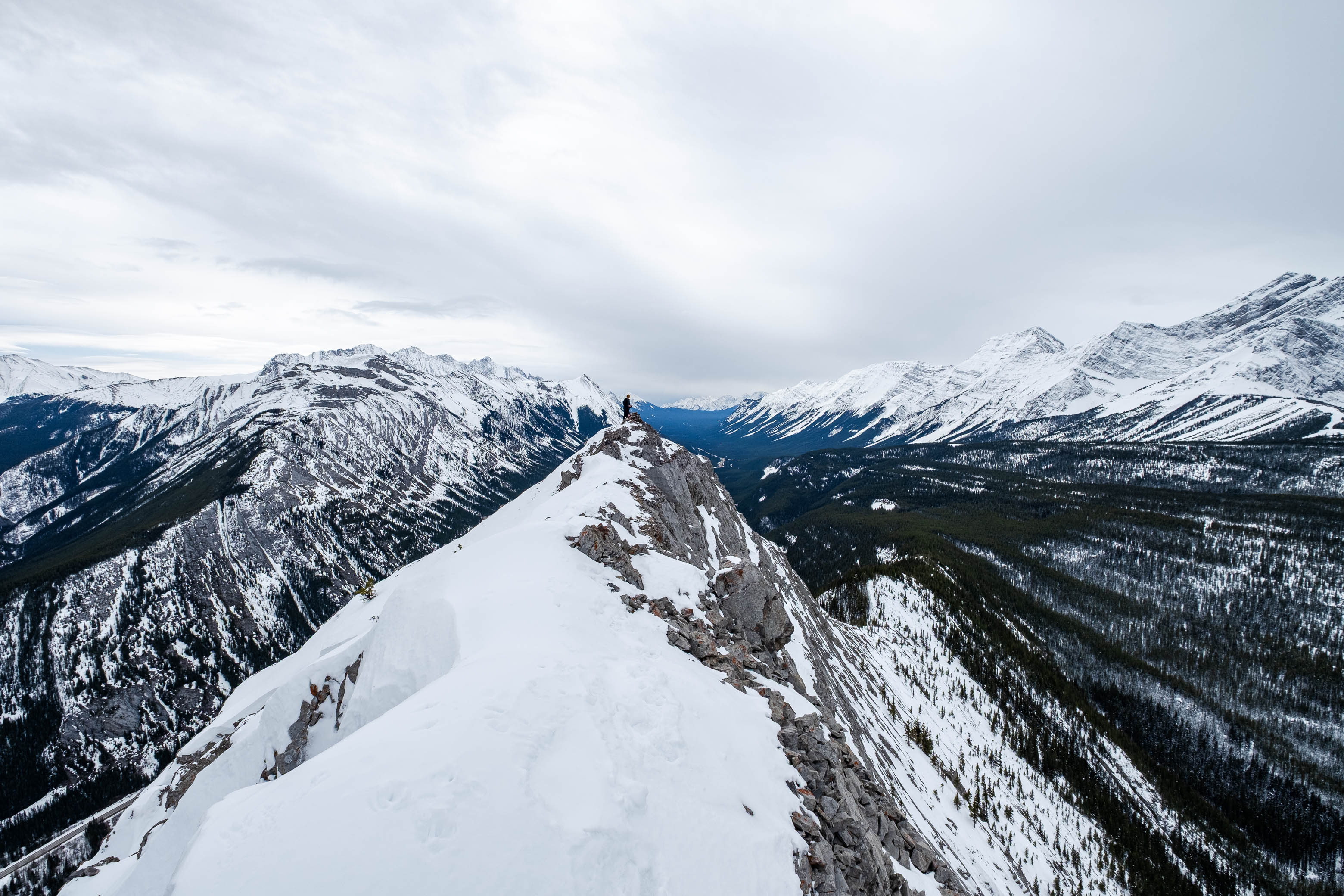
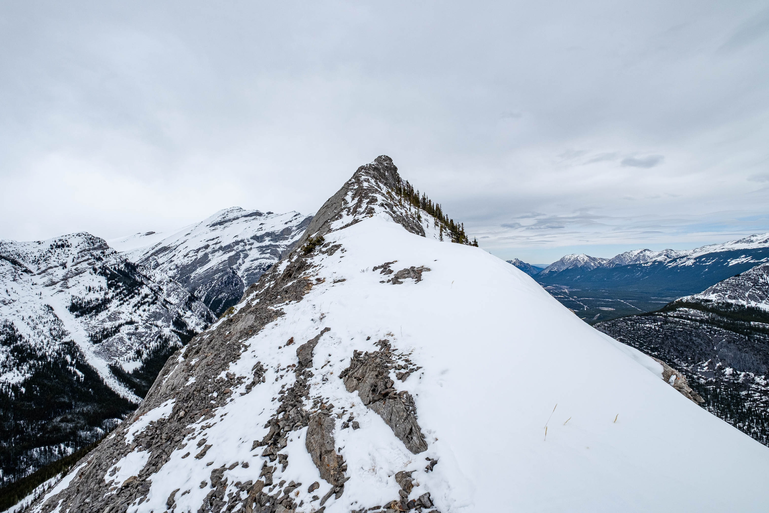
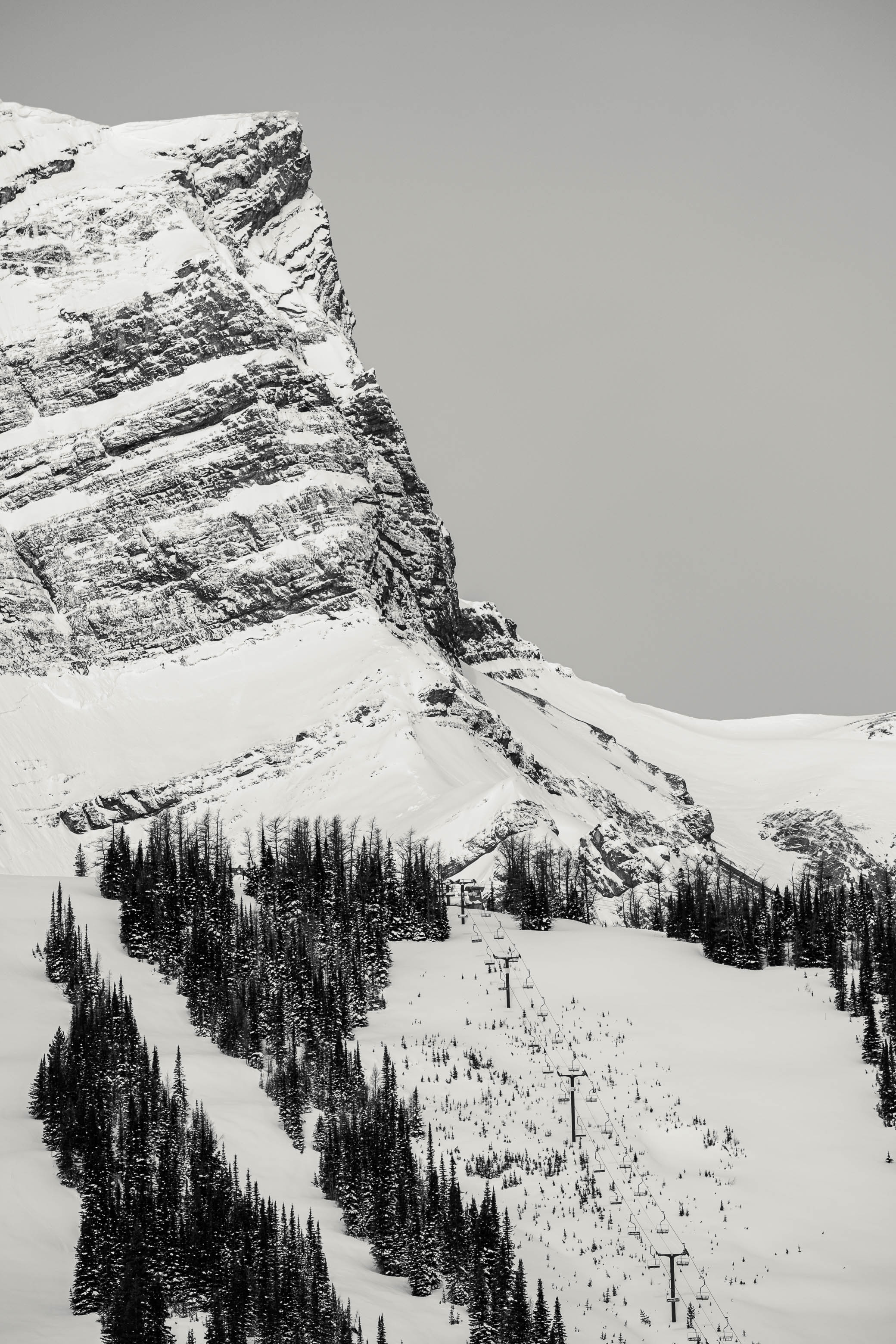
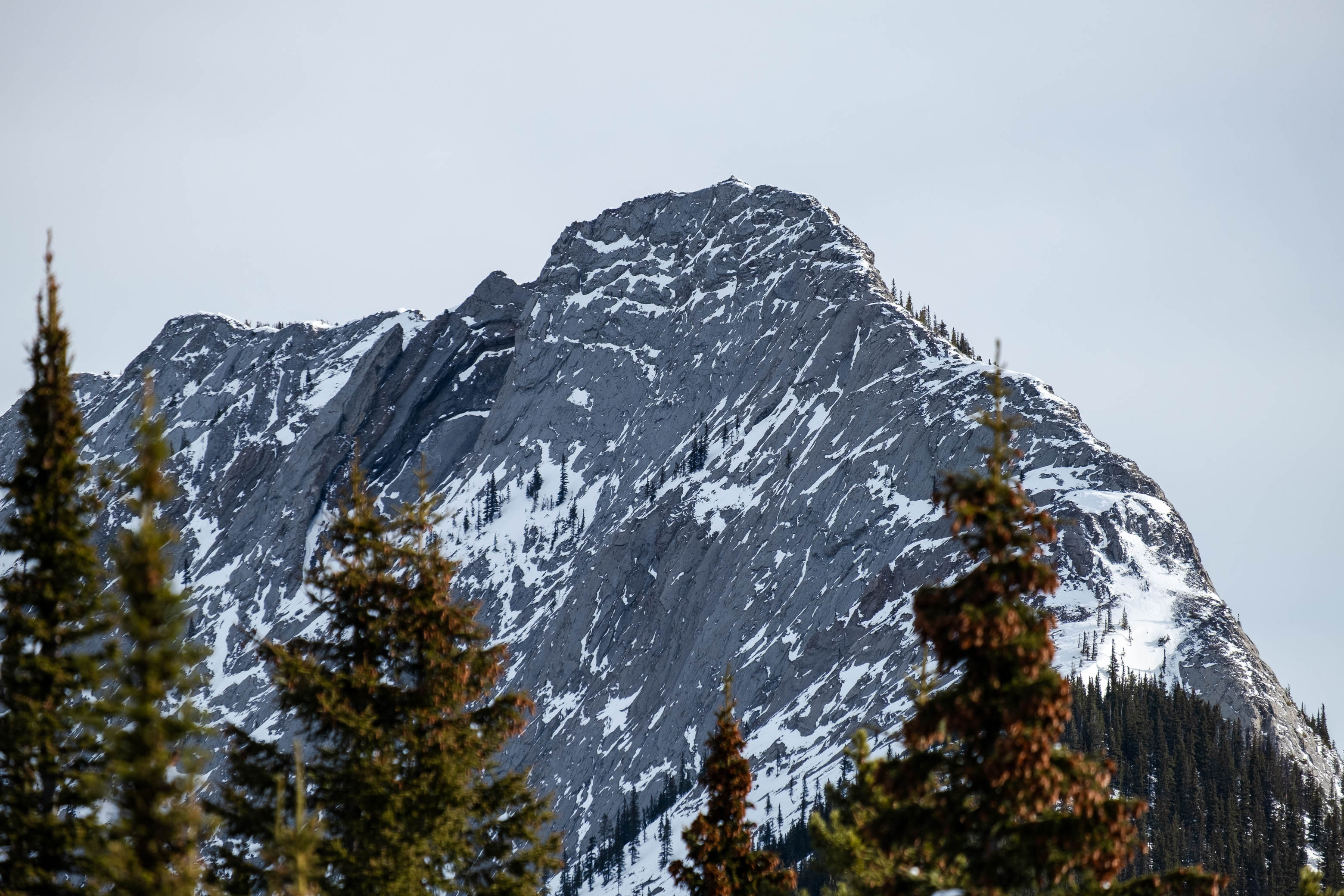
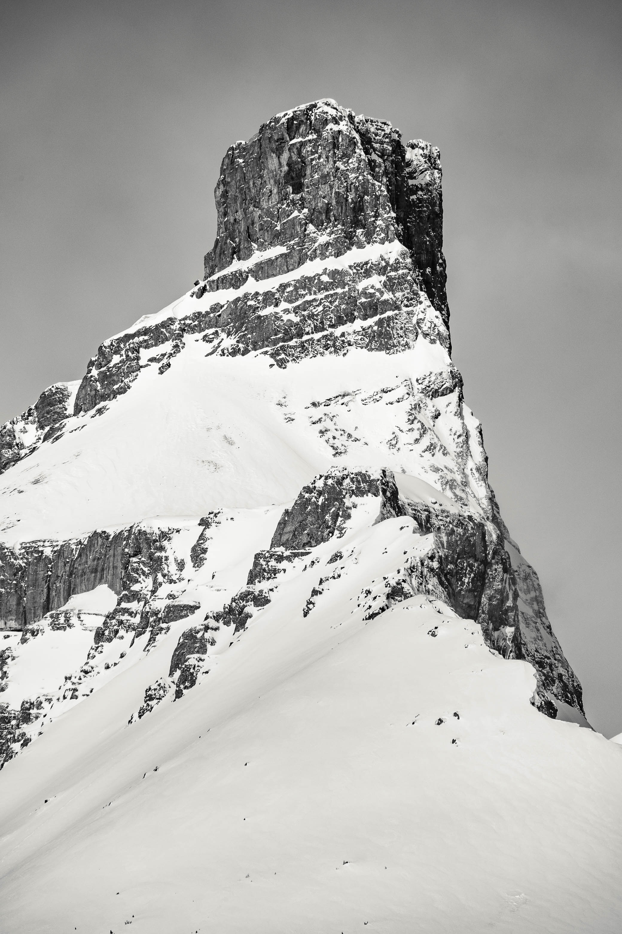
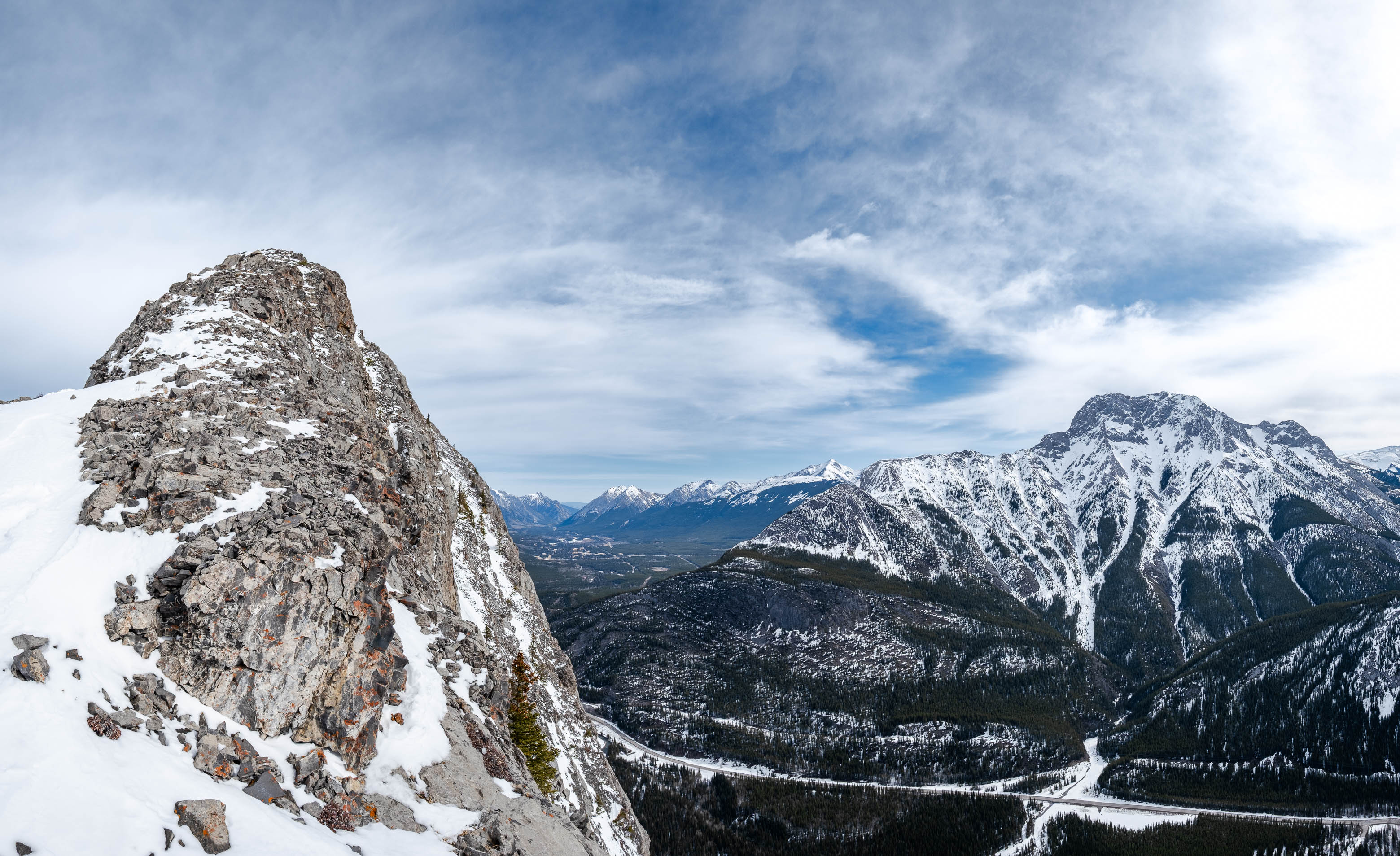
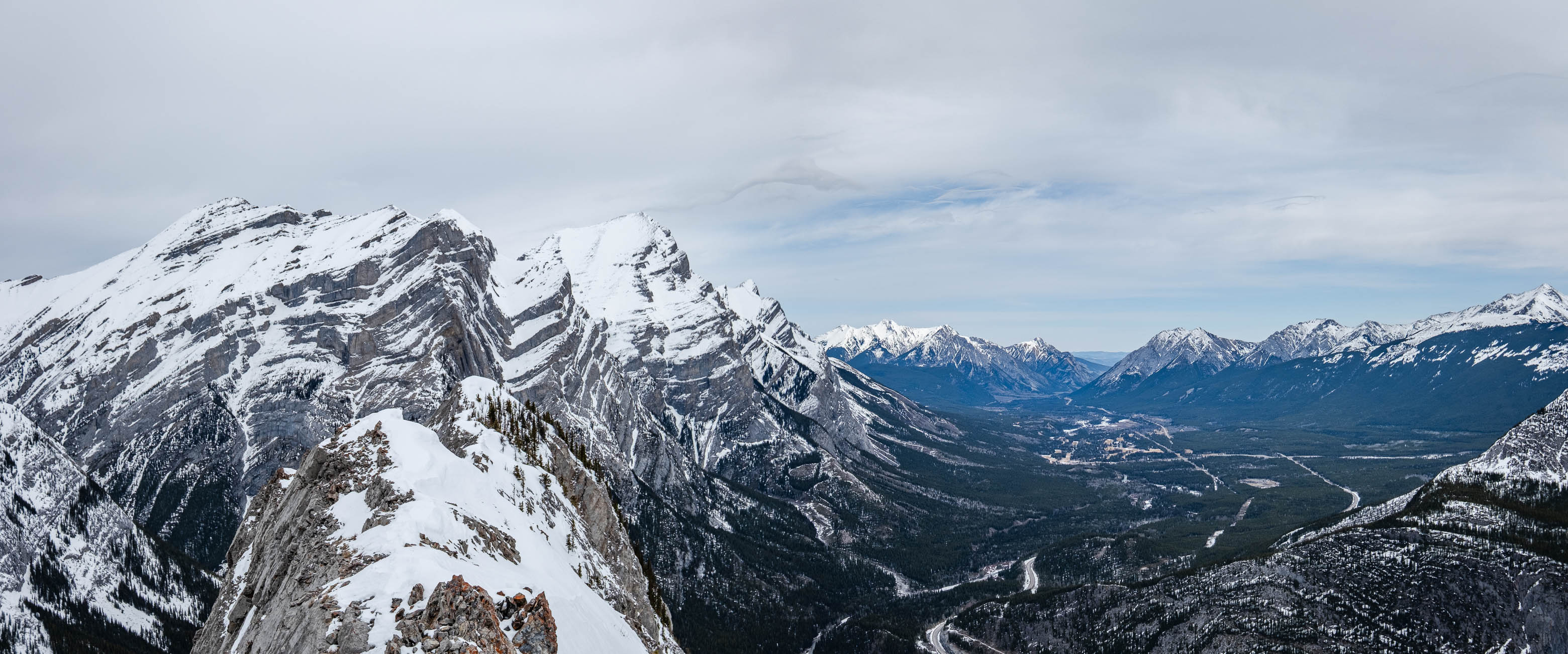
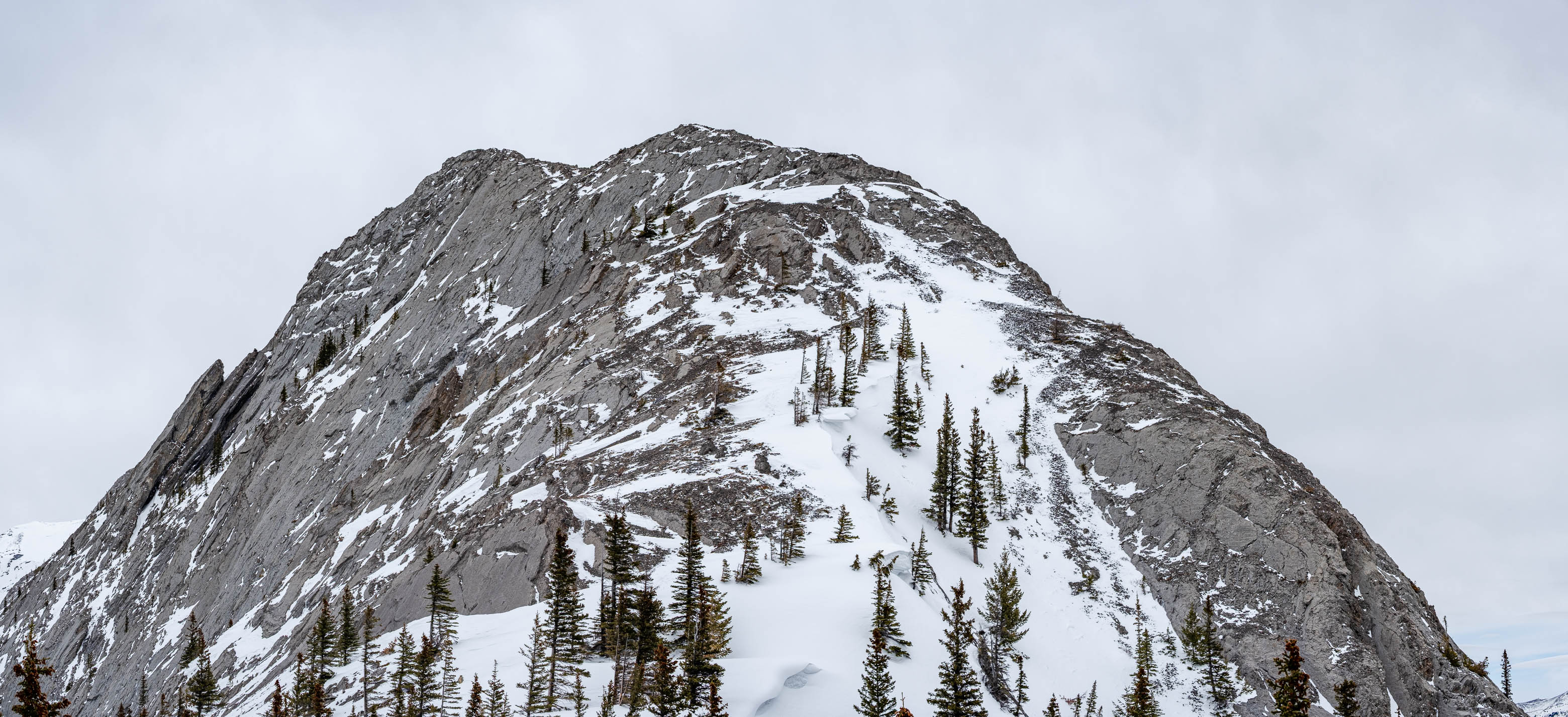
Once on the ridge, the route couldn't be more obvious, and after almost 9.5 km spent in the trees, we finally reached treeline and were granted our first unobstructed view of Spoon Needle's slabby summit ridge! Although somewhat imposing - with its near-vertical west face leading straight to the valley floor - it was a relief to see that the scramble route looked doable even with the fresh snow.
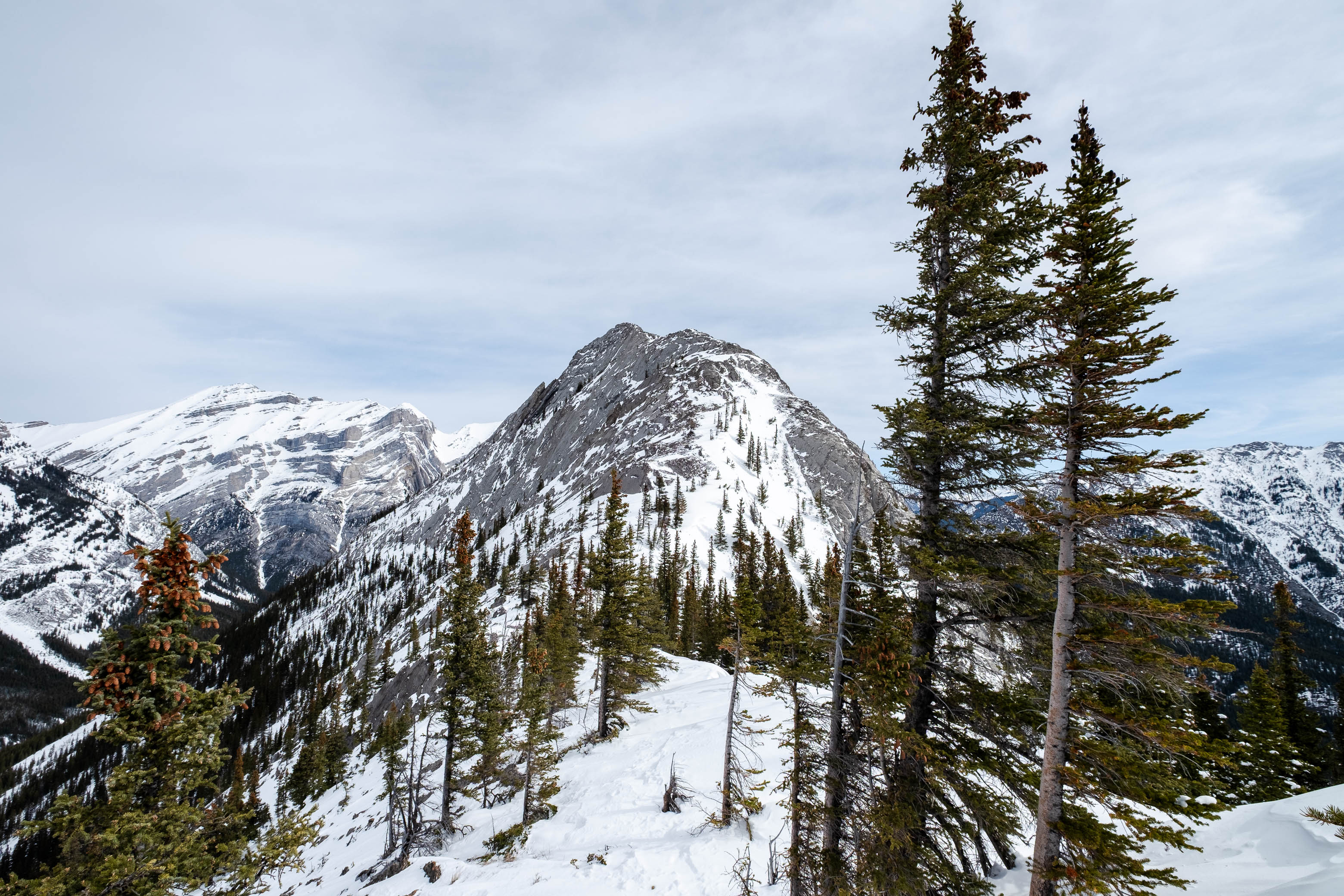
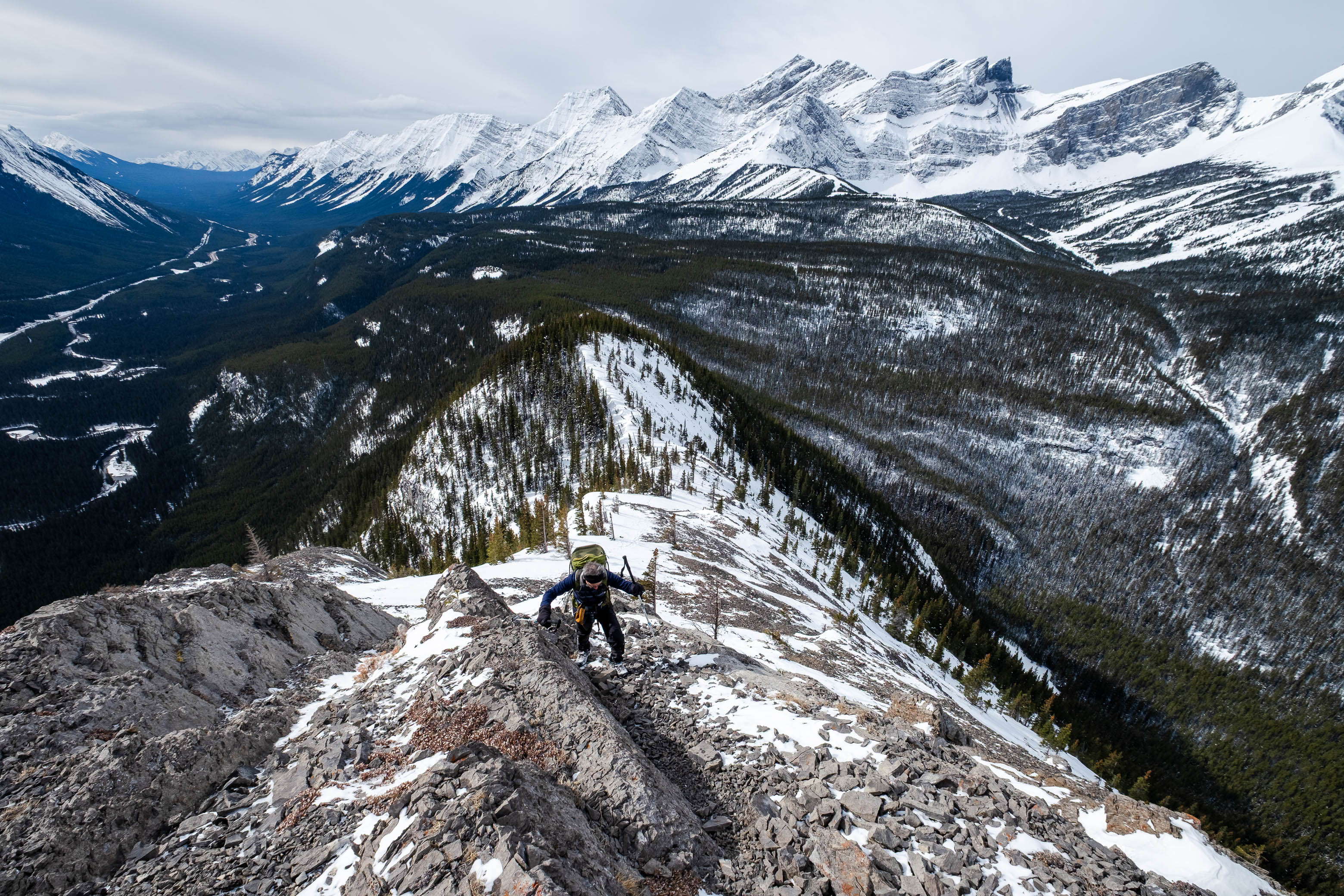
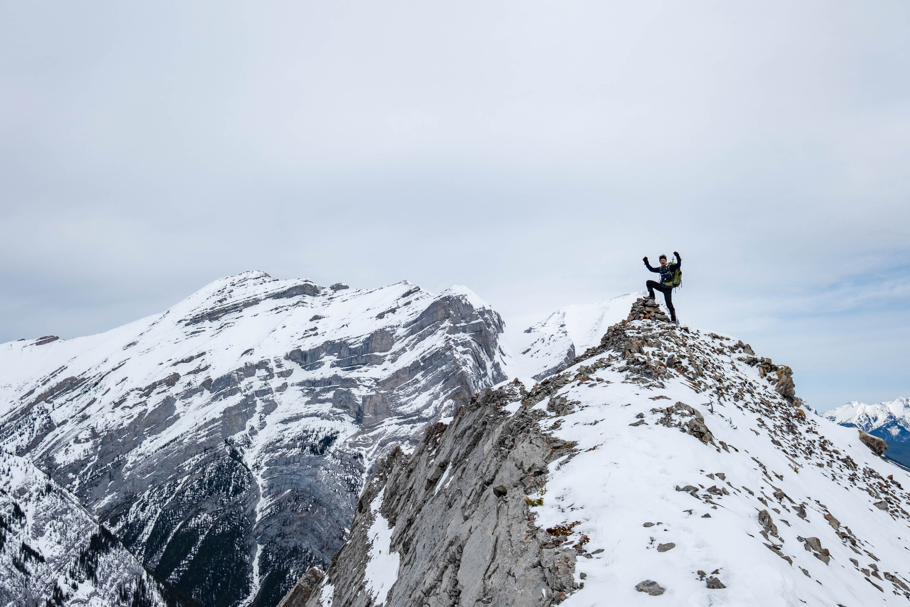
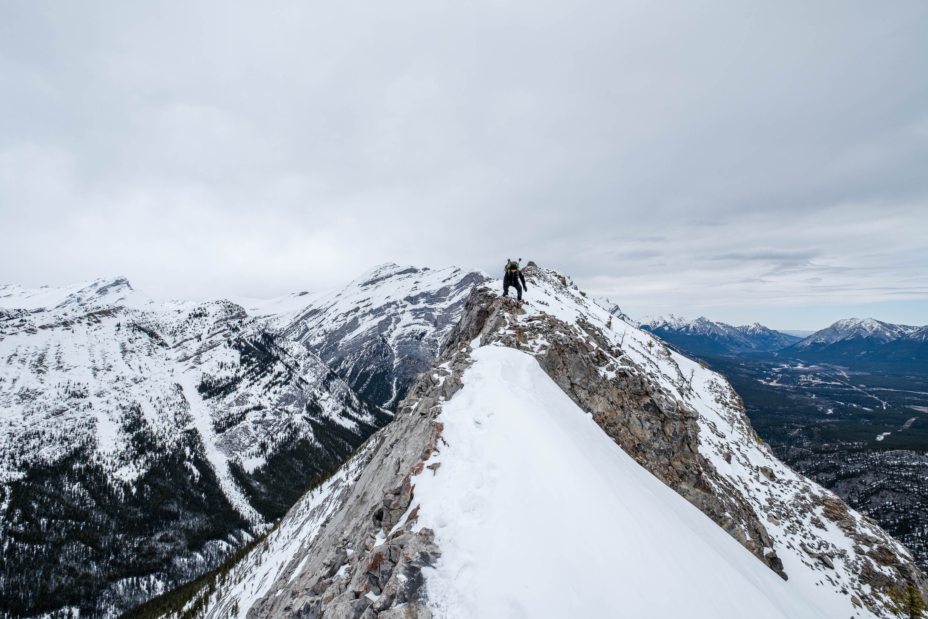
After stashing our snowshoes near the base of the scree slope, we started up the initially broad ridge...While the scrambling is largely quite easy, the ridge does narrow significantly for a couple sections just before the summit, and the exposure is definitely noticeable! A slip on either side would result in a quick trip to the valley floor, and with the fresh dusting of snow, we were sure to choose each step carefully!
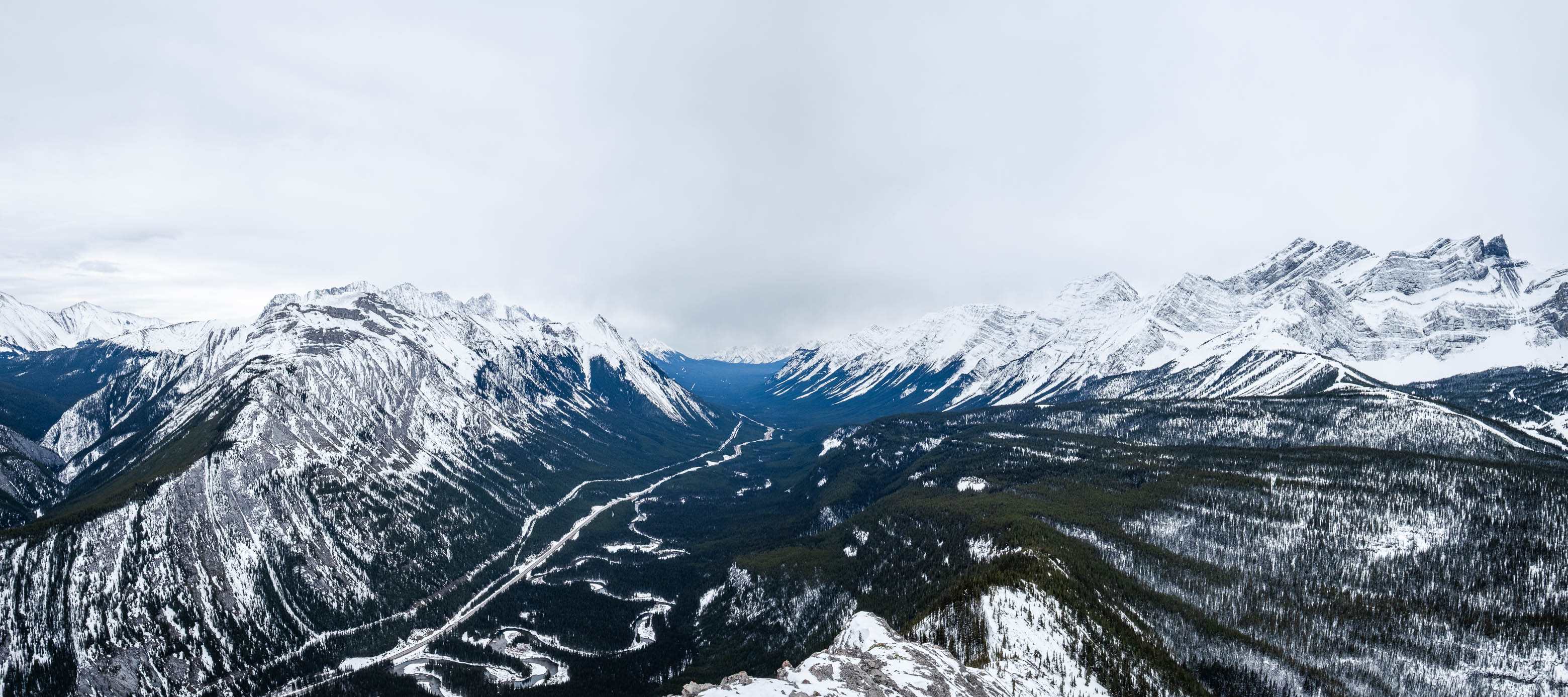
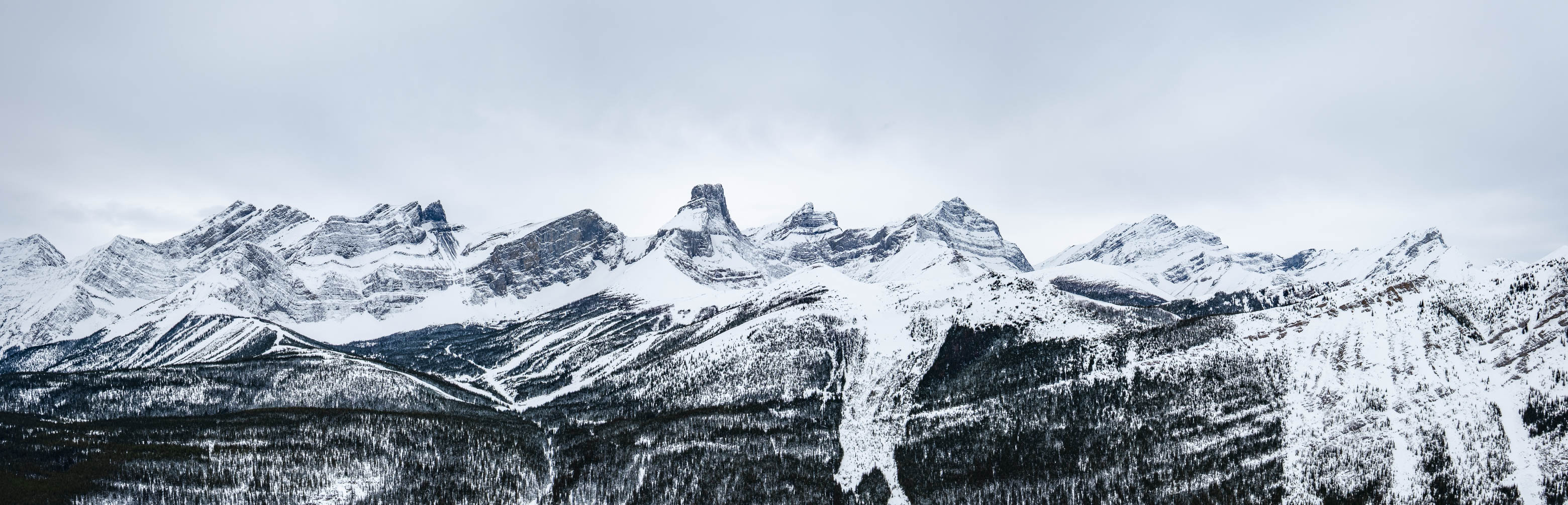
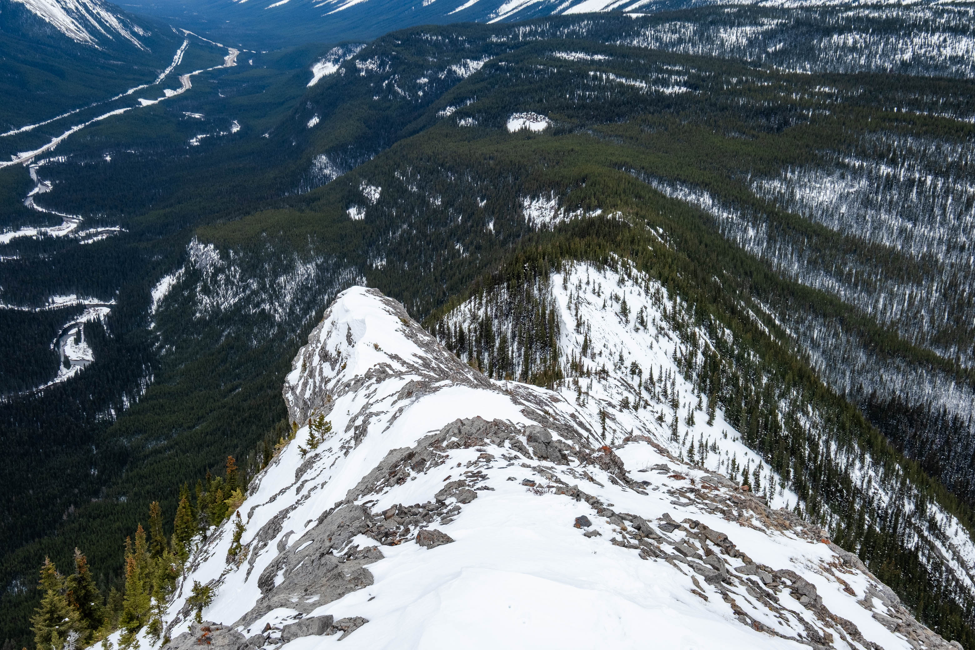
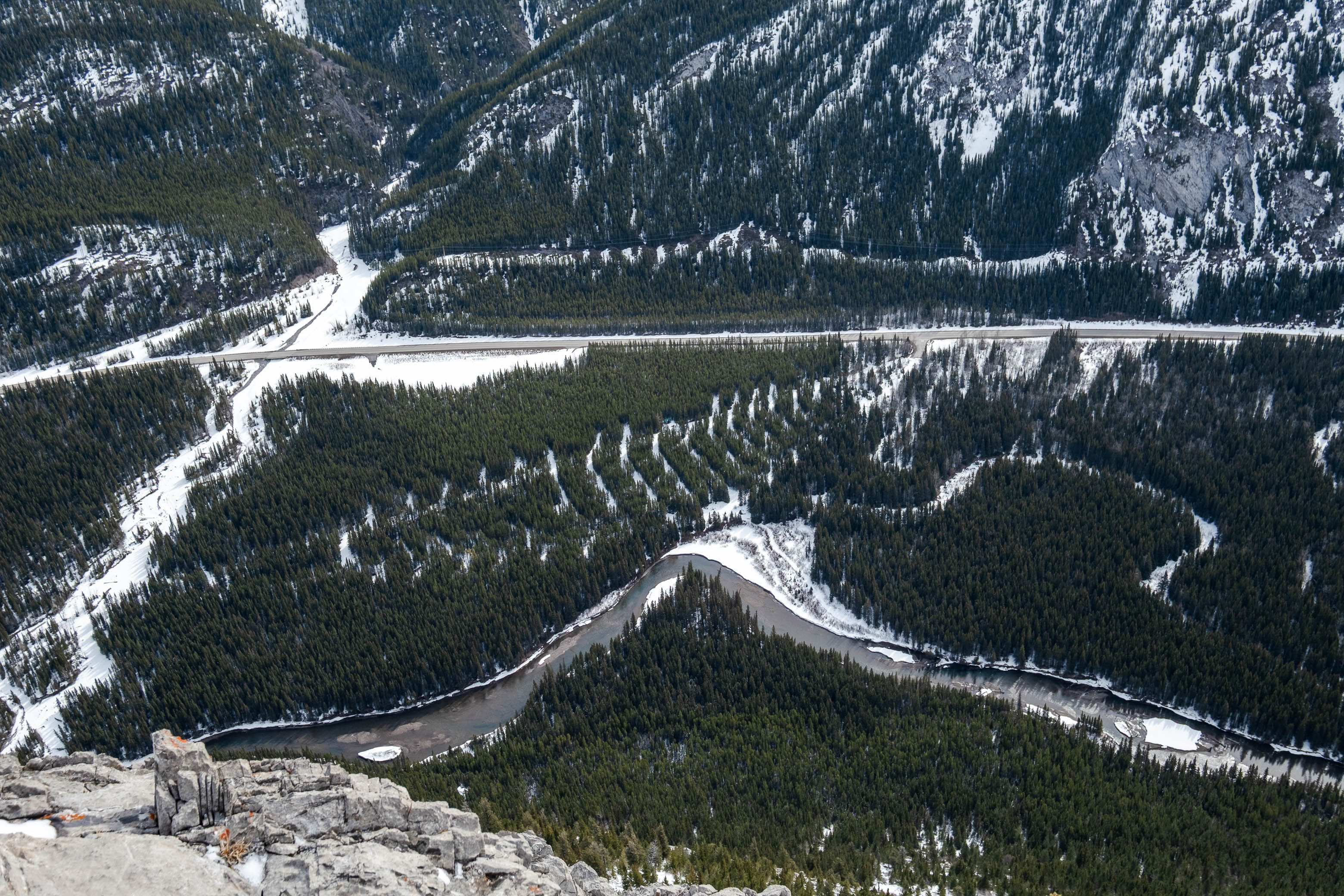
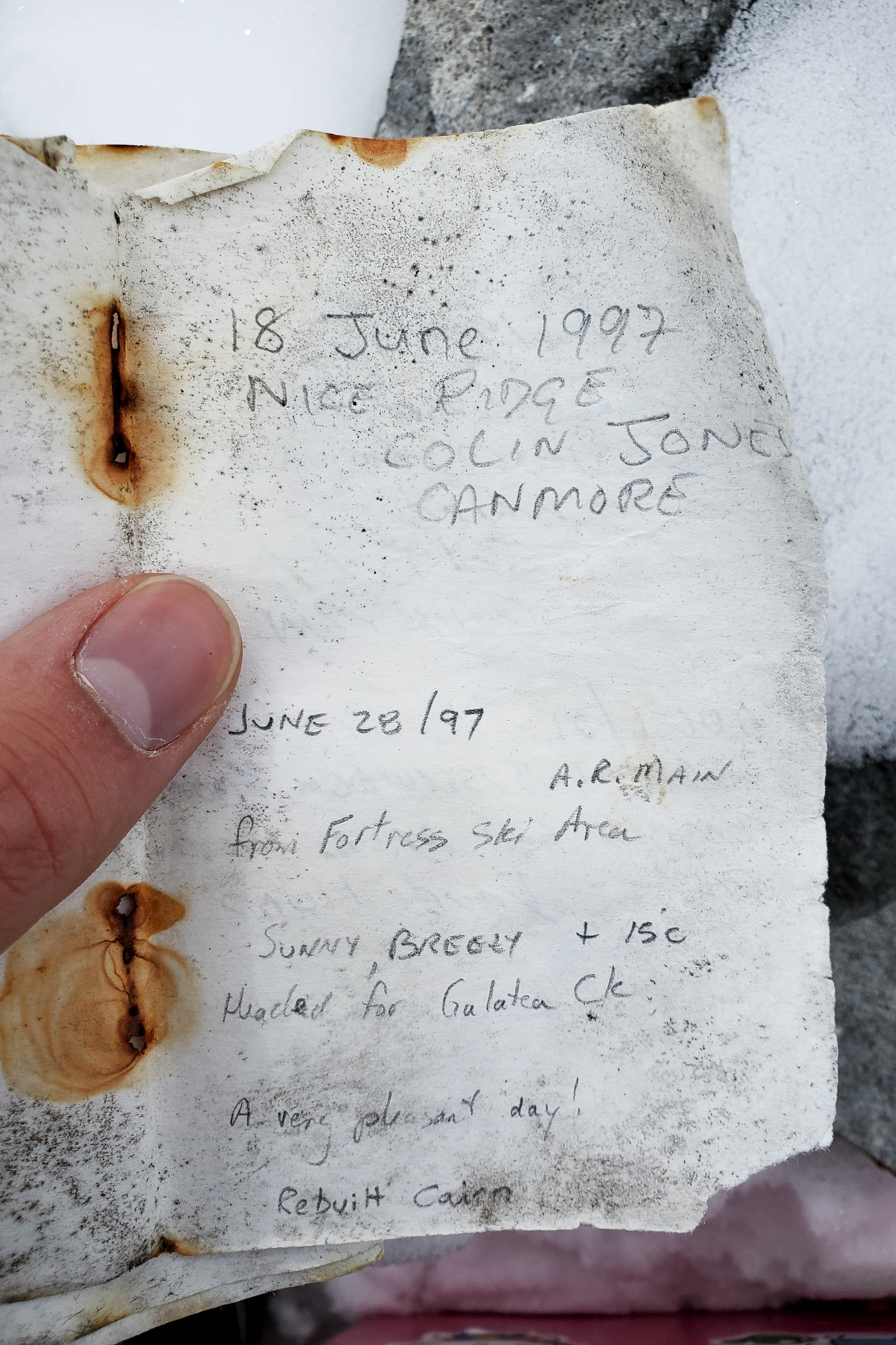
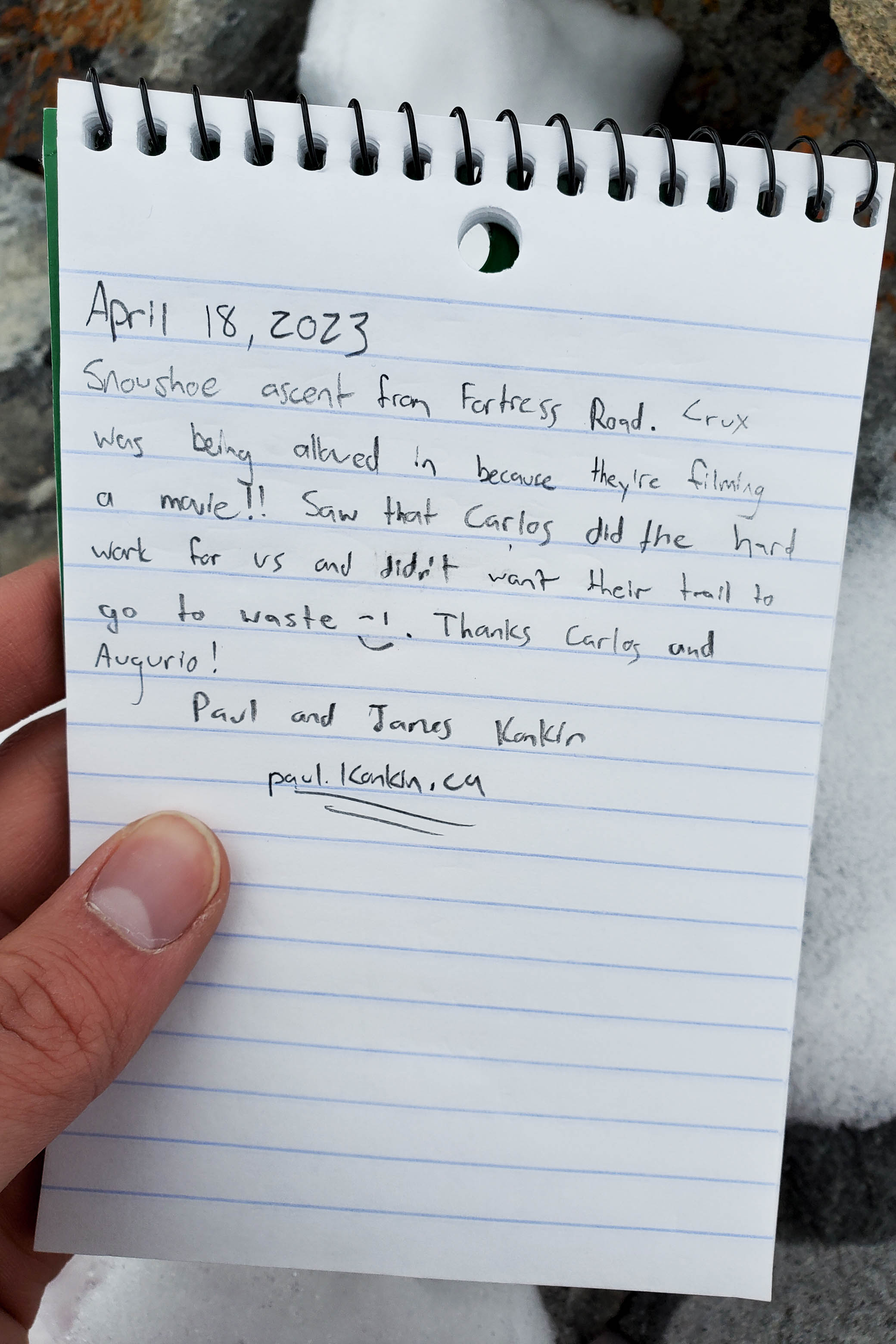
Unfortunately the sky completely clouded over by the time we stepped foot on the summit, sucking all the contrast out of our views, but even this couldn't snuf out my stoke to finally stand up here! It was really neat to look down the shark fin ridge to the north, and Fortress' unique form was impossible to miss, standing out from the pack to the west! A cool breeze quickly had us chilled as we sat on the summit, however, and after taking a few pictures and signing the register, we started back the long way we came.
The "deproach" went without difficulties. We carefully retraced our steps along the ridge and followed our tracks back down and across the valley, before regaining the elevation we lost earlier, back up to the Fortress Road. All that then remained was finishing off an uneventful 6.5 km trek back to the same security guard, still sitting in his Jeep at the gate...And we thought hiking along this road was boring! 😂
Did we ever get lucky on this one! Being able to sneak through a "restricted" area, having absolutely bomber snowshoeing conditions, and finding a nice little "bread crumb" trail leading exactly where we needed to go - you'd be hard-pressed to find better conditions to approach this mountain in! While I'd have a hard time recommending this mountain for anyone other than a serious peakbagger, if you persevere for almost 10 uneventful kilometers, you'll be rewarded with a fun 100 m scramble, some unique views down Kananaskis Valley, and have bagged an interesting peak with a relatively sparse summit register.
Photo Gallery
Disclaimer