Date: Feburary 6, 2024
Location/Route Map: Icefields Parkway (South)
Elevation: 2470 m
Elevation Gain: 1060 m (including 4 upper laps)
Distance: 10.5 km
Rating: Class 2 - Easy
Notes: A nice low-hazard, low-traffic alternative to escape the hordes at Bow Summit.
GPS Track: Download
It's been a long, painful start to the winter...At least for all the skiers out there! The start of 2024 has cursed the Alberta Rockies with absolutely pitiful amounts of snowfall and has left us backcountry skiers in a little bit of a pickle. We either risk trashing our prized ski touring setups on a very shallow, unsupportive snowpack, or slowly lose our sanity as we stay cooped up inside, waiting for something that may never come - MORE SNOW! Having personally experienced what a shallow snowpack can do to your skis early last season, I've been a little bit more hesitant to "get after it" this year and haven't been out since my redemtion tour up Quartz Hill back in December. Needless to say I was going a little bit stir crazy! When February came around, winter finally decided to show up (sort of), and with a fresh dump forcast for Monday night I eagerly packed up the car for some much needed "mountain therapy".

It was already past 10:00 by the time we were pulling in to the Peyto Lake parking lot (Bow Summit is a long drive from Edmonton!), but the late start wasn't an issue for us on this particular day. With the storm from the previous night forcast to continue throughout the day, we weren't about to set out on any big objectives and were content to simply enjoy the freshly fallen snow with some chill powder laps as we waited for the storm to clear.
I assumed most - probably all - the cars in the parking lot were from folks already tracking out the classic Bow Summit runs, and decided we'd have better luck making fresh tracks on the opposite side of the highway. Having recently spent some time perusing through Marcus Baranow's "Confessions of a Ski Bum: The Icefields Parkway" guidebook, I was intrigued by the amount of ski-able terrain on the Observation massif and thought the "Roadside Glades" on the mellow, lower SW slopes of Observation Peak might make for some nice low hazard storm laps.
Shortly after leaving the parking lot and starting back down the road to cross to the opposite side of the highway, my dad realized he forgot his lunch and headed back to the car while I slowly continued on. Now you may be thinking, "this seems like a silly thing to mention in a trip report", and you'd be right, but when he finally caught up to me, the first thing he said was, "Hey, have you ever heard of the Confessions of a Ski Bum books? I just met the author!". NO WAY! I couldn't believe I just missed meeting this legend from the ski community - the guy whose book literally provided the inspiration for where we were about to go! - and even briefly considered heading back to chat with him, before telling myself that that would be weird and carrying on. 😂


Immediately after crossing the highway, we dropped down to an open, flat field, headed due east across it, and were soon joining with an old skin track, entering the forest on the opposite side. With only a light layer of fluffy snow to break trail though, following this old track was a breeze, and it wasn't long before the dense trees began to thin and an undisturbed slope of open glades and mellow alpine runs opened up before us.


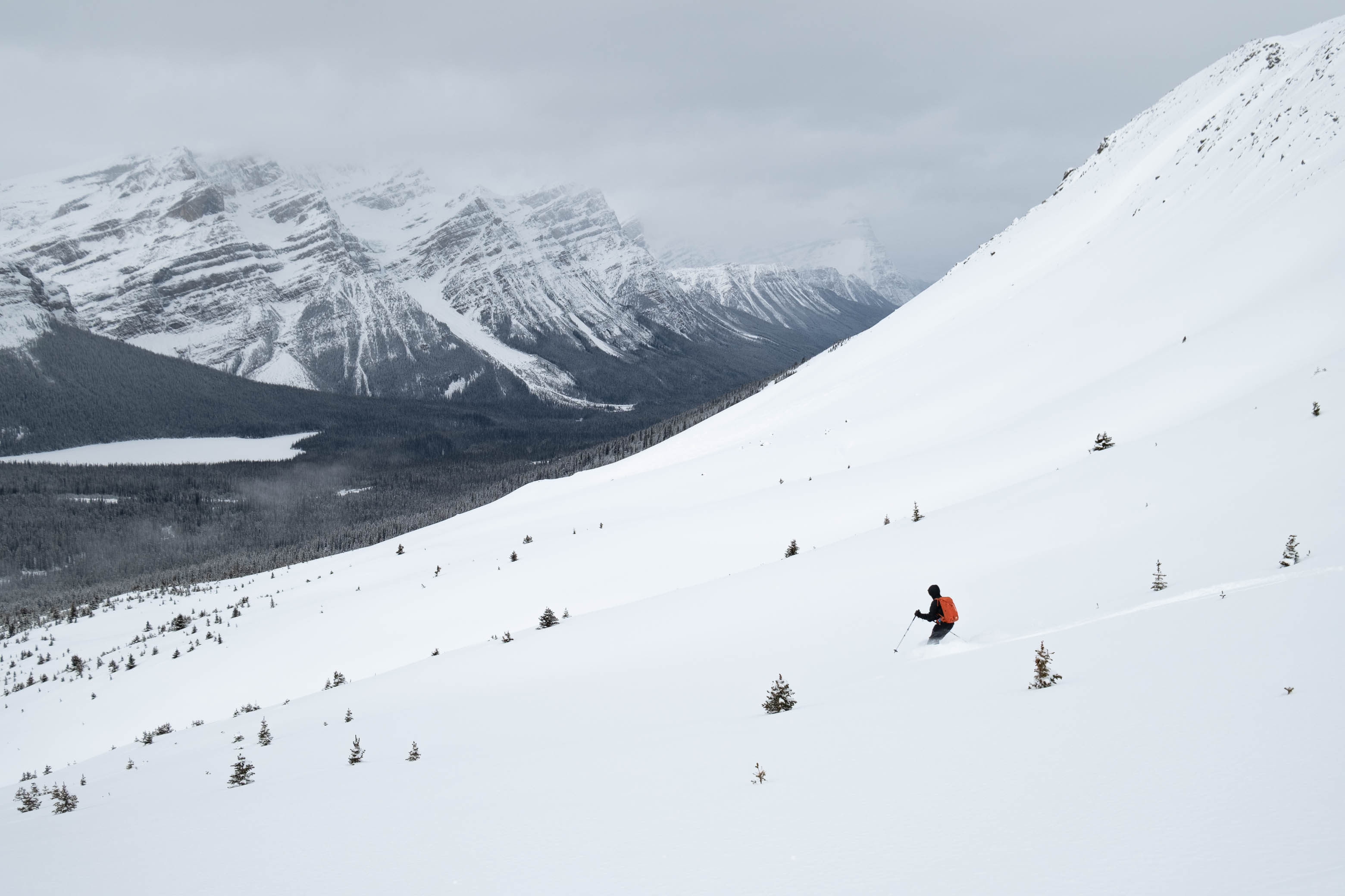
As we climbed past treeline, we crossed over a minor drainage and up onto a broad ridge to climber's right, paralleling the major drainage between Observation and its sub peaks to the southeast. Now out of the trees, the skin track we'd been following had been erased by the storm, and we simply continued up this gentle ridge, transitioning for our ride back down as soon as the slope started to steepen considerably, and we noticed obvious wind slabs starting to form.


We chose our runs to skier's right of the ridge - where the snow was less wind affected - and enjoyed 4 laps of stellar ski conditions as the storm moved in and out around us, constantly changing what views we could and (mostly) couldn't see. We skied until we hit the obvious "tree wall", when it wouldn't really be "skiing" anymore, before putting the human powered ski lift (ie. our legs) back to work and climbing back up our skin track, resulting in ~ 250 m runs. Pretty solid, considering the "lap-able" runs across the highway are only about 120 m!


The ski back down to the highway was interesting as always - just typical Rockies survival skiing for ya 😉 - and we made it back to a now completely empty Peyto Lake parking lot around 18:00 with darkness fast approaching.


I have to say that I quite enjoyed the "Roadside Glades" on Observation Peak! Sure, the approach is a little bit longer than that of Bow Summit, but this also means that this side of the highway receives a lot less traffic and will likely be found sitting pretty with an blank white canvas long after the runs at Bow Summit have been completely tracked out.
Photo Gallery


Disclaimer