Date: May 17, 2023
Location/Route Map: Kananaskis Valley
Elevation: 2419 m
Elevation Gain: 1100 m
Distance: 8 km
Rating: Class 3 - Moderate
Notes: A true "choose your own adventure" mountain, with at least 4 different scramble routes of varying difficulty and options to combine it with any of its neighbouring peaks.
GPS Track: Download
Following a completely smoked-out ascent of Ship's Prow Mountain, we were seriously considering heading home a day early. After some thought, however, we decided to stay the night, crossing our fingers and hoping the skies might magically clear up by the next morning...Spoiler Alert! - They didn't. Waking up to even more smoke than the day previous (no idea how this is even possible...), our options were to either climb a mountain and not get many (if any!) views, or go home and climb it another time when the smoke had dissipated. Personaly (although most of you will probably think I'm weird 😂), the first option appealed to me more. At least this way I had another peak in the bag, got some good exercise, spent a day in the mountains rather than in Edmonton, but still had the option to repeat it in the future if I felt so inclined. Kananaskis Peak would be the smokey mountain of choice for Wednesday May 17, largely because it has four unique scrambling routes leading to its summit! So, if someday I do decide to return, at least it'll feel like a different mountain. 😉
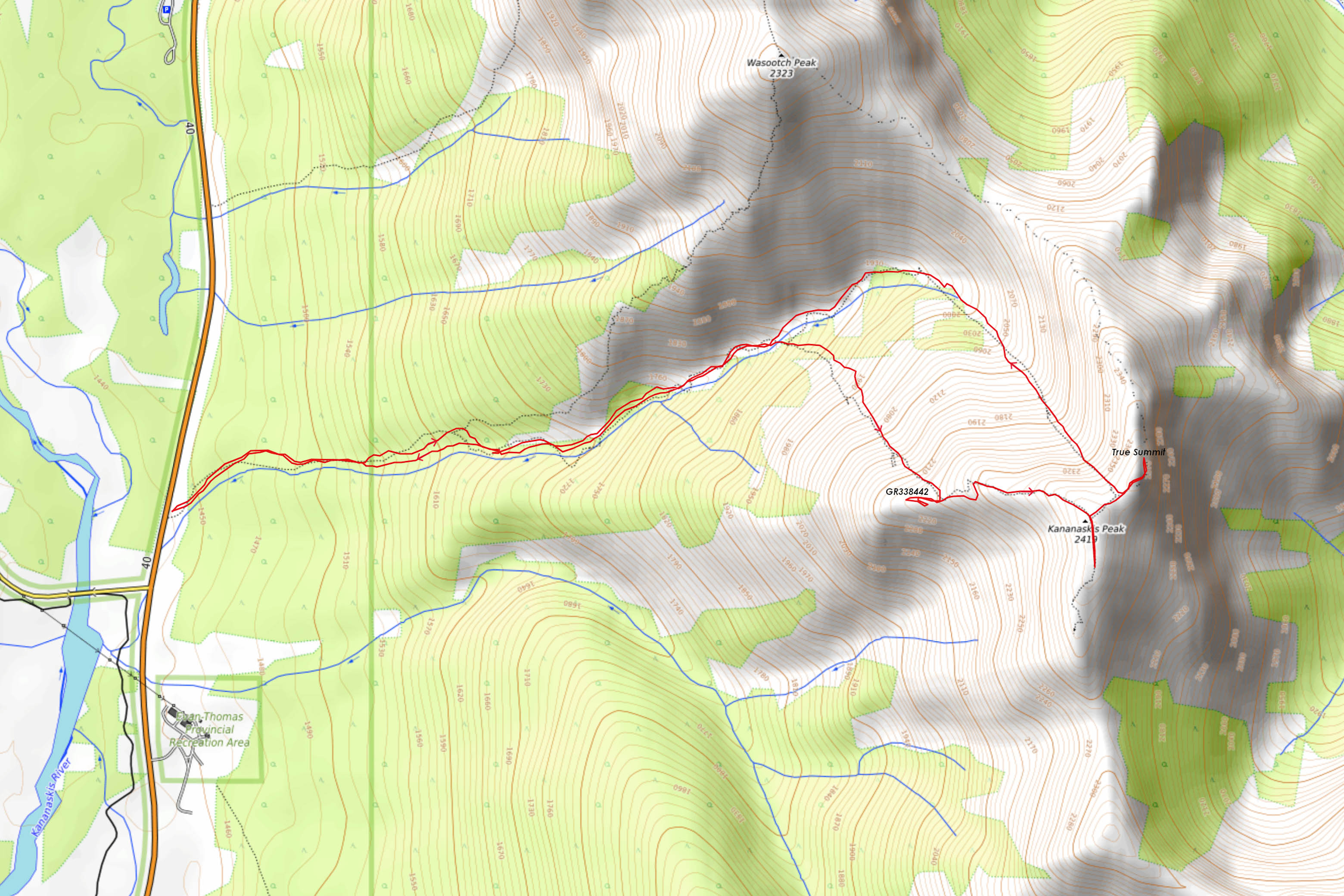
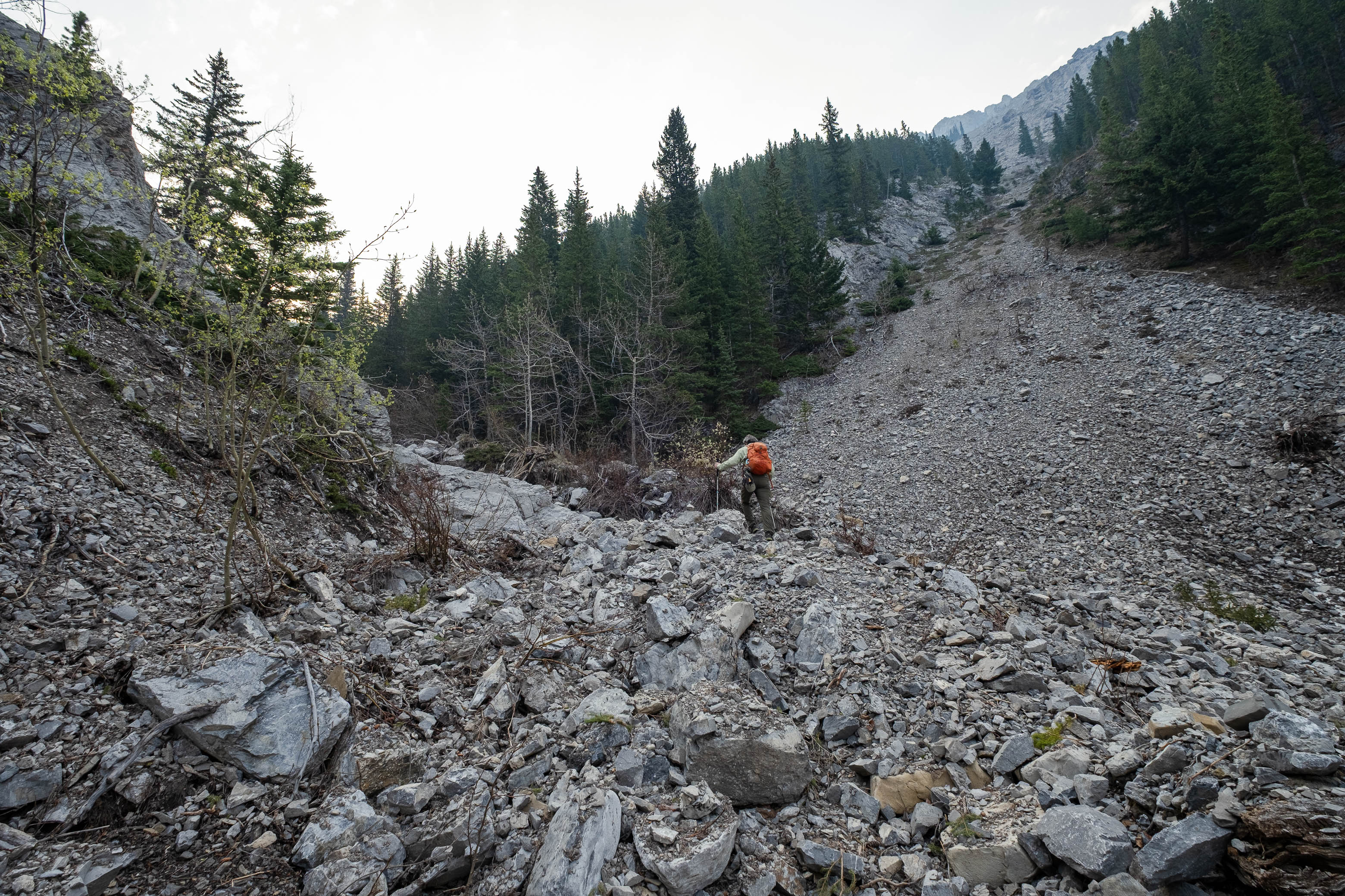
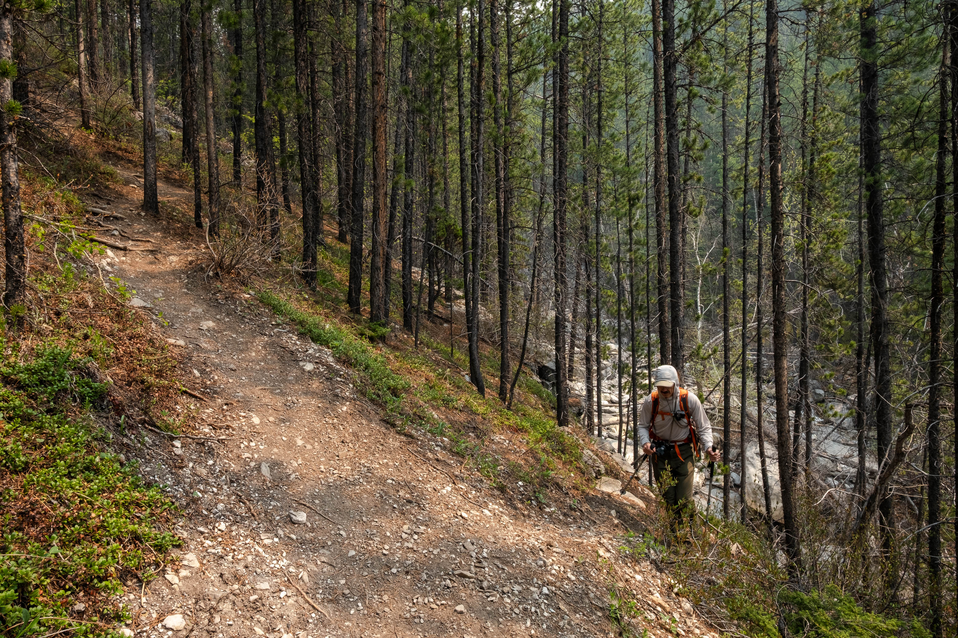
The approach begins the exact same as for Wasootch Peak (which we hiked around this time back in 2021). Park at the gravel outwash a mere 200 m north of the Kananaskis Village turn-off, and follow up the broad creek bed until a nice trail starts to form in the trees to the left. As soon as this trail begins gaining significant elevation, however - leading up to Wasootch Peak - you'll want to turn your attention back down to the creek, where you'll find a far less travelled - but still solid - trail continuing immediately along its left bank. If you find yourself high above the creek, you've gone too far! Unfortunately we learnt this the hard way...
Missing the cues to head back down to the creek, we continued up the Wasootch Peak Trail and were soon high above the creek, with significant cliffs forming below us! I was very quickly starting to feel like we missed something, but the route on our map showed "the branch" to be further up the trail...so further up the trail we went!
When we arrived at "the branch", which (as I suspected) didn't actually exist, I peered over the 20 ft cliff between us and the creek wondering why in the world I let myself trust the map over my gut 🤦♂️. Refusing to accept that we would now have to retreat all the way back down the trail, we did the complete opposite, and kept going up! 😂 It was quite a stab in the dark, but we optimistically hoped a break in the cliffs would eventually present itself, and wouldn't you know it, just a couple minutes later we were picking our way down some steep, mossy ledges, descending back down to the creek and discovering the trail that we should have been on the whole time!
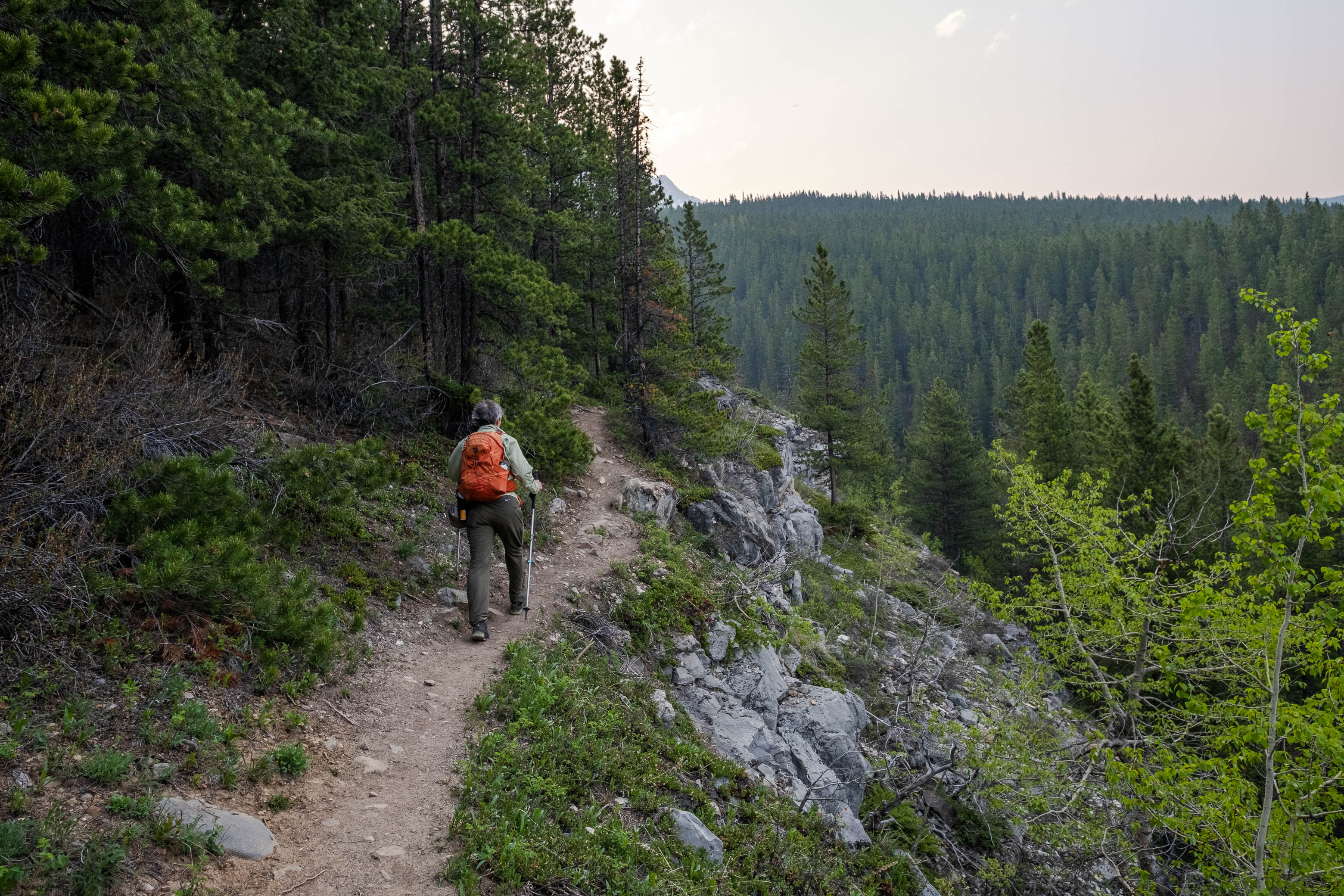
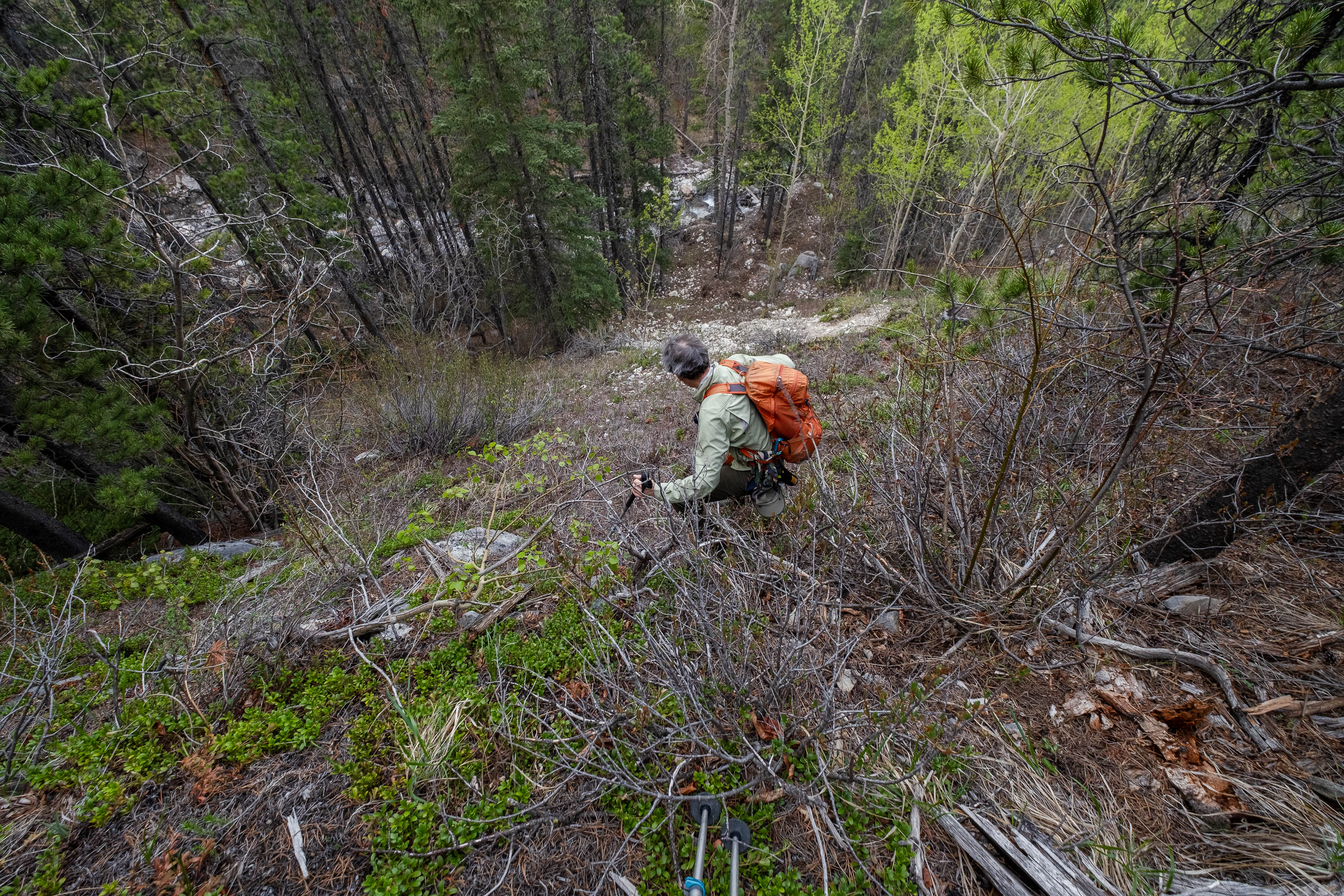
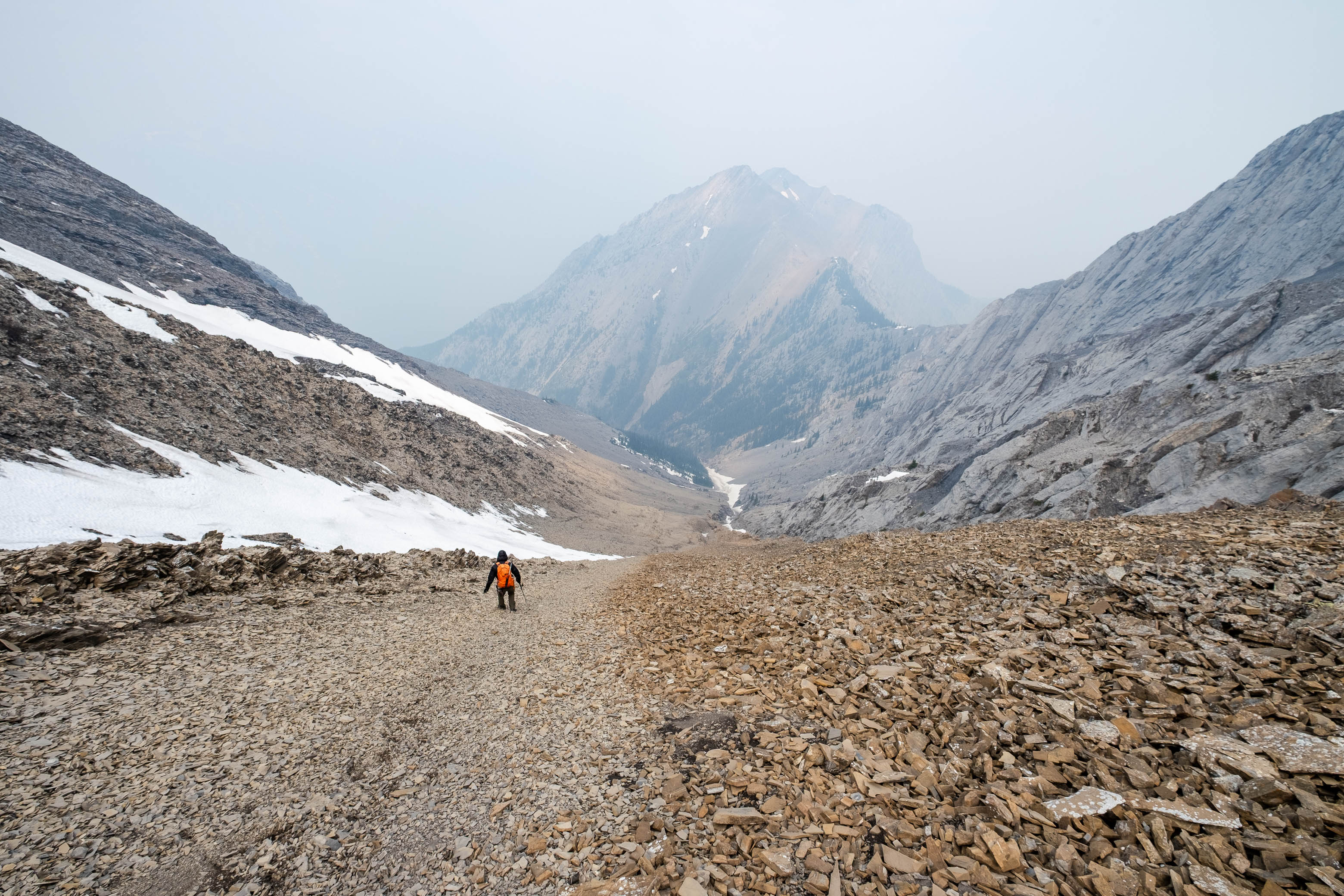
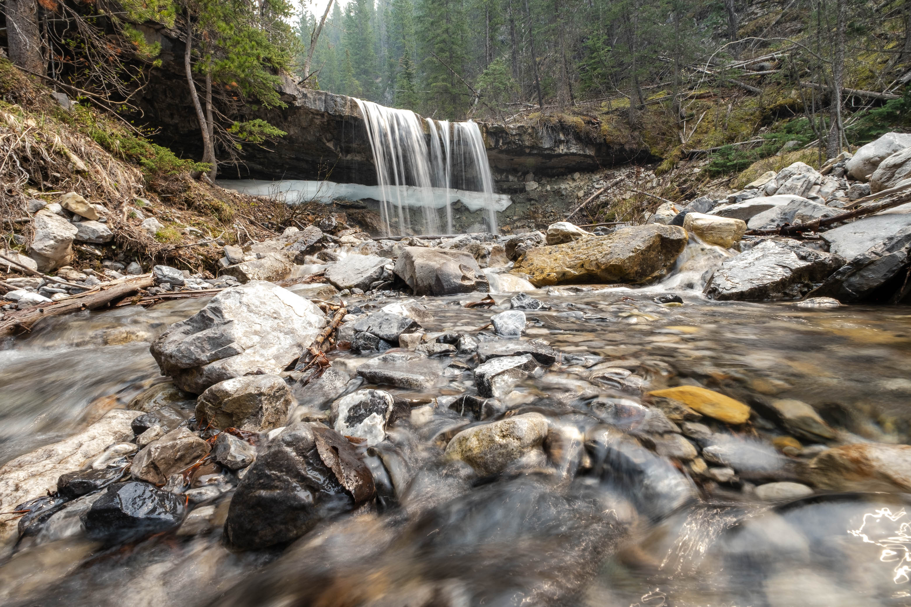
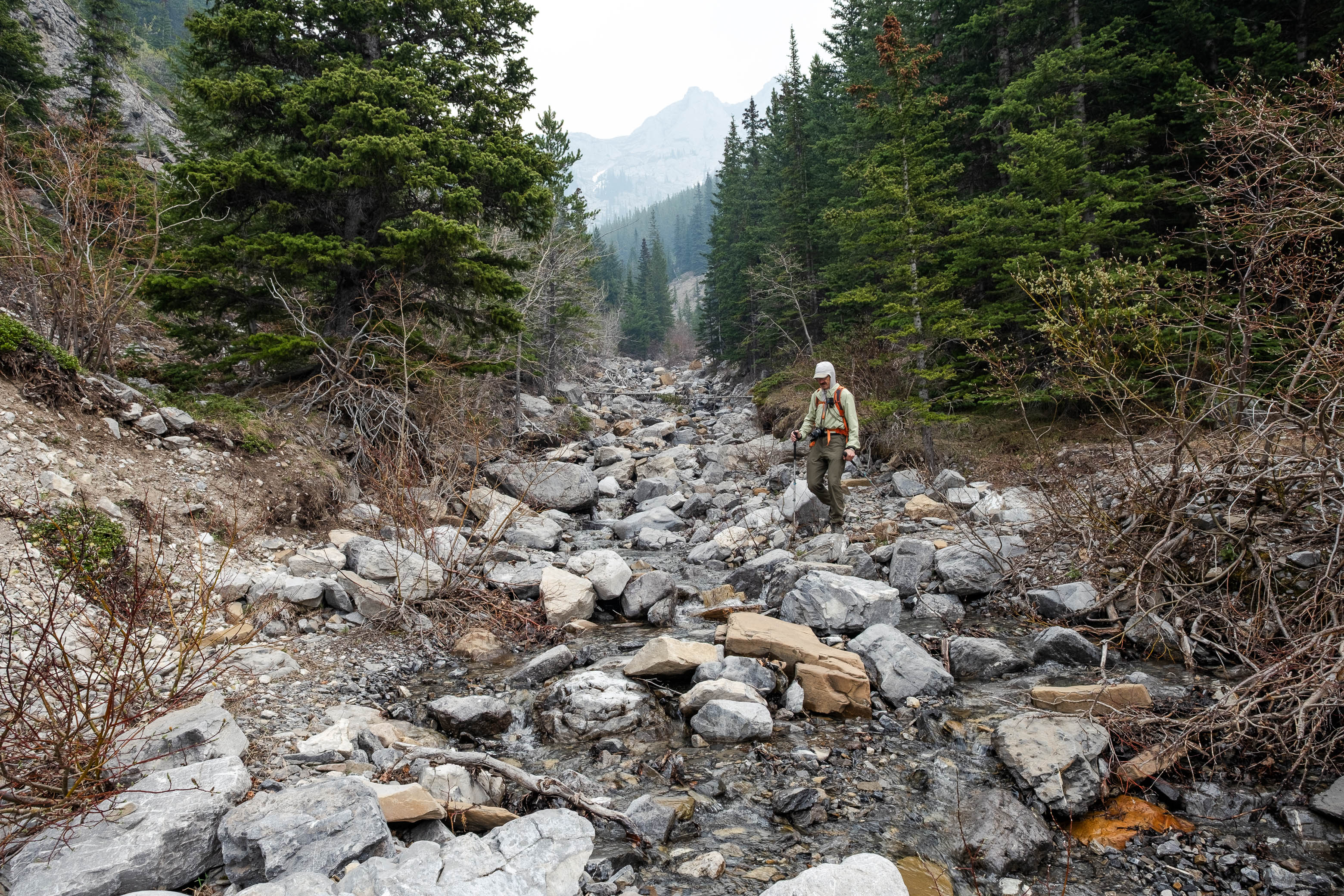
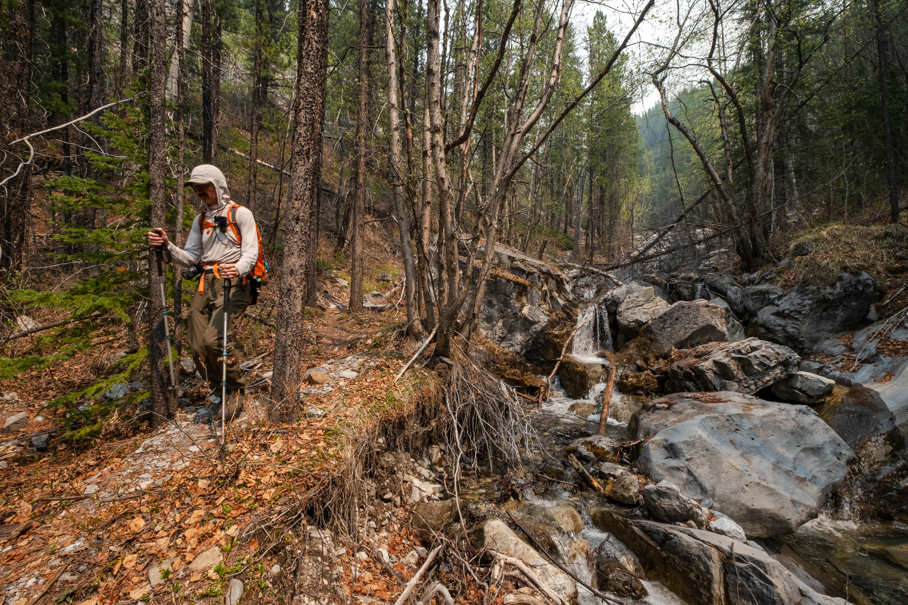
The approach was smooth sailing from this point forward, and we quickly made our way up the remainder of the creek (well, aside from a lengthy stop at a super neat waterfall - I've always wanted to walk behind one!), spending most of our time on its north side, but crossing back and forth every now and then when the terrain required it.
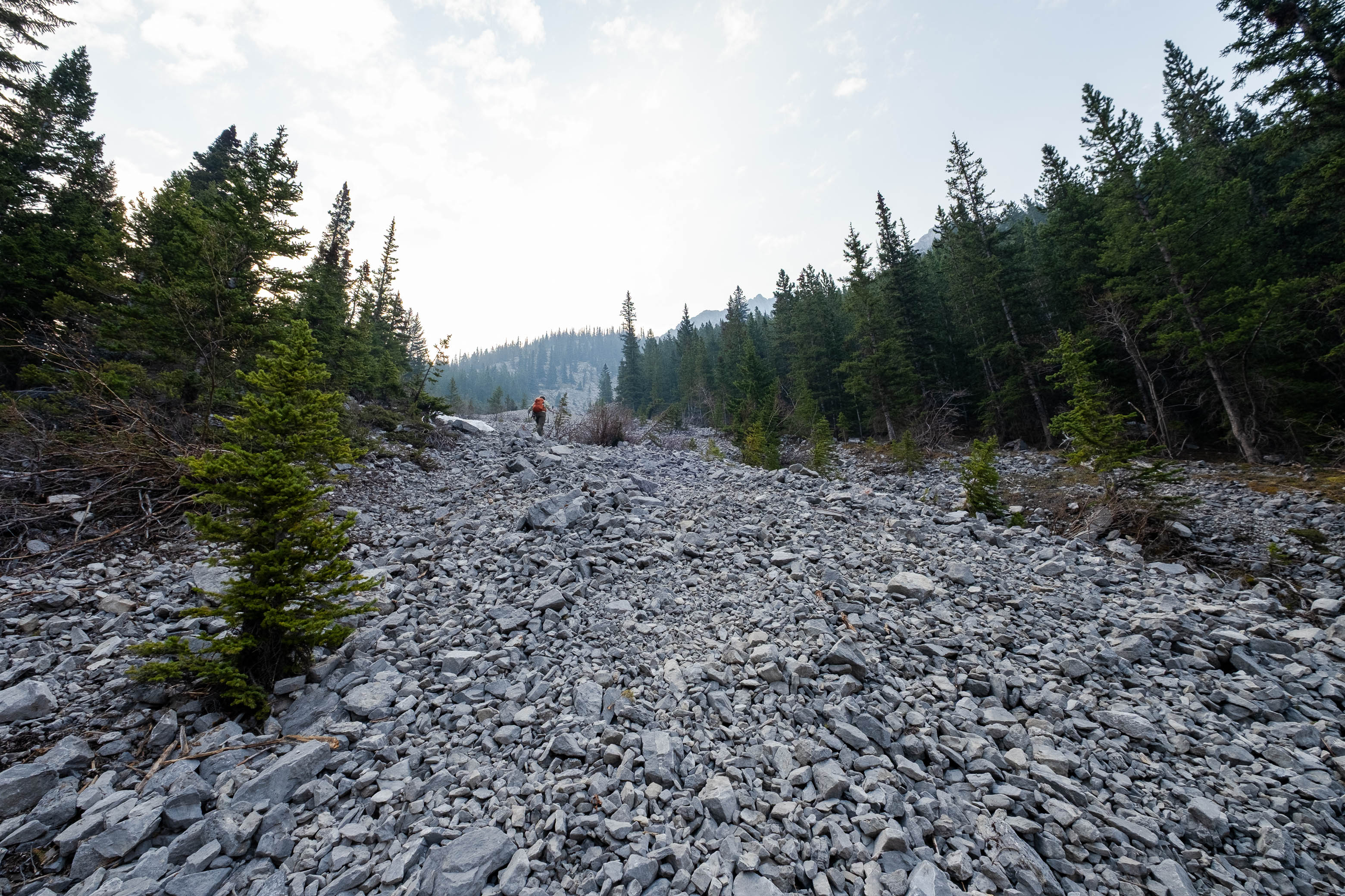
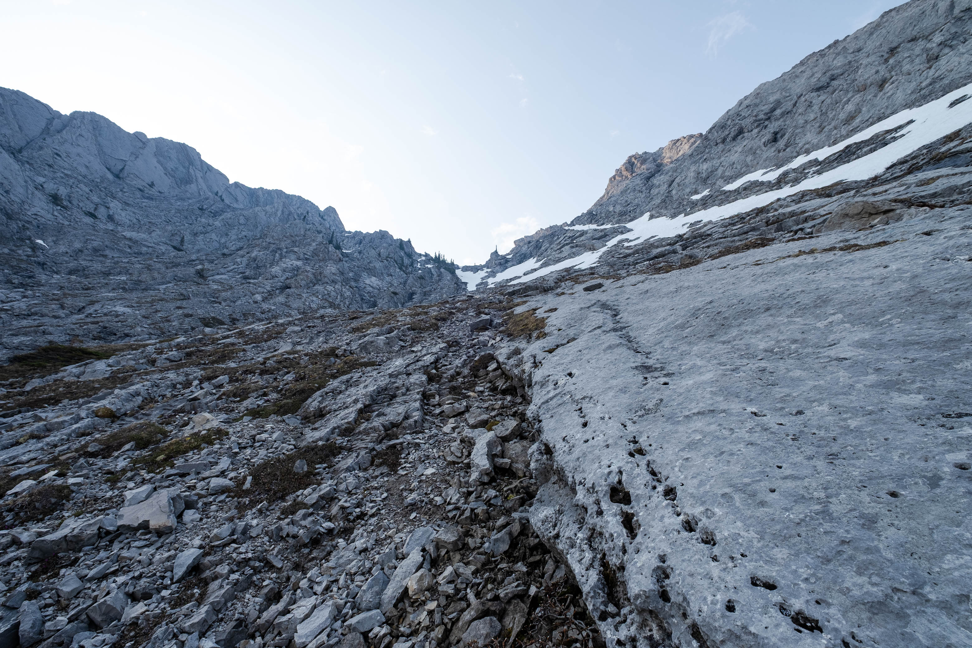
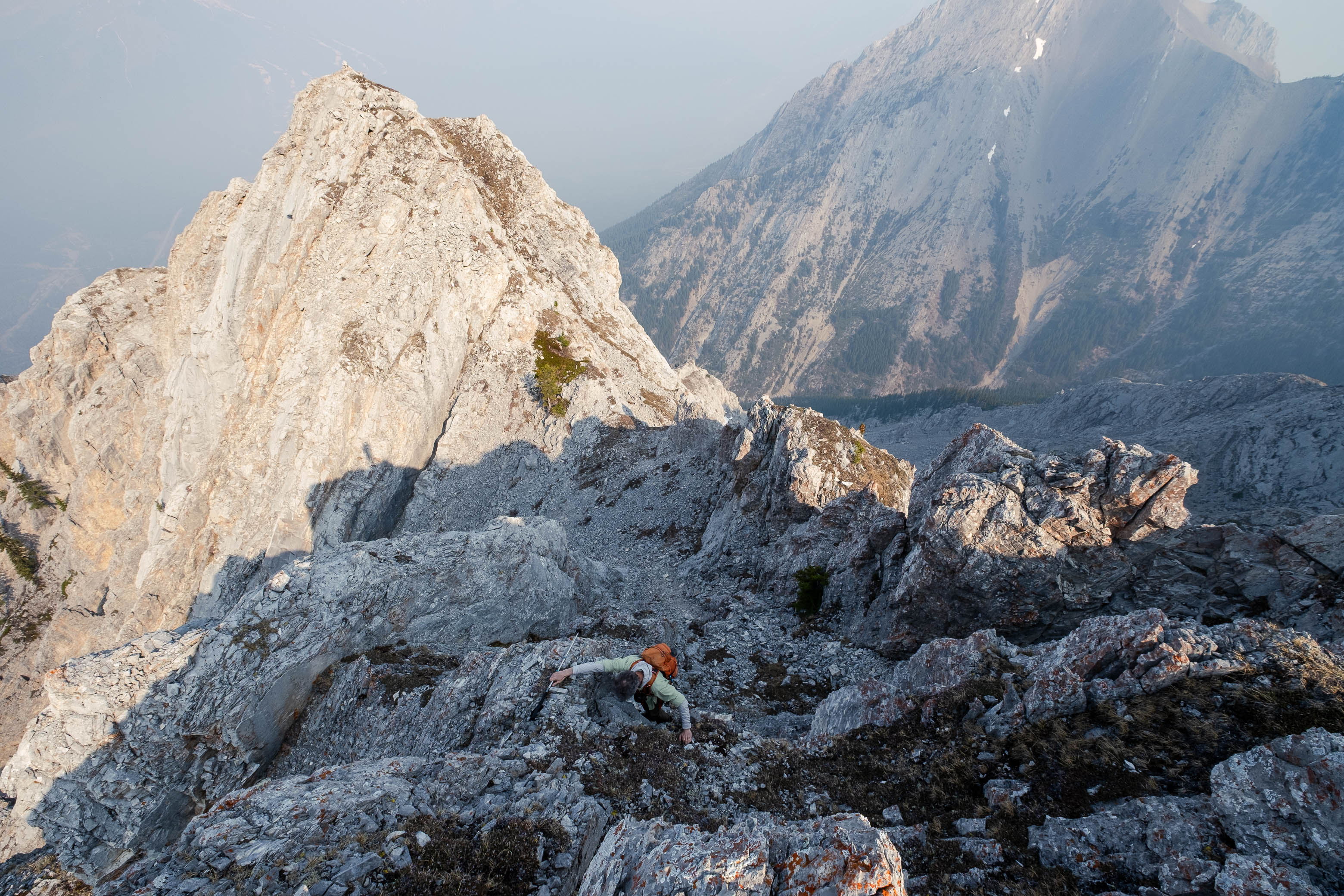
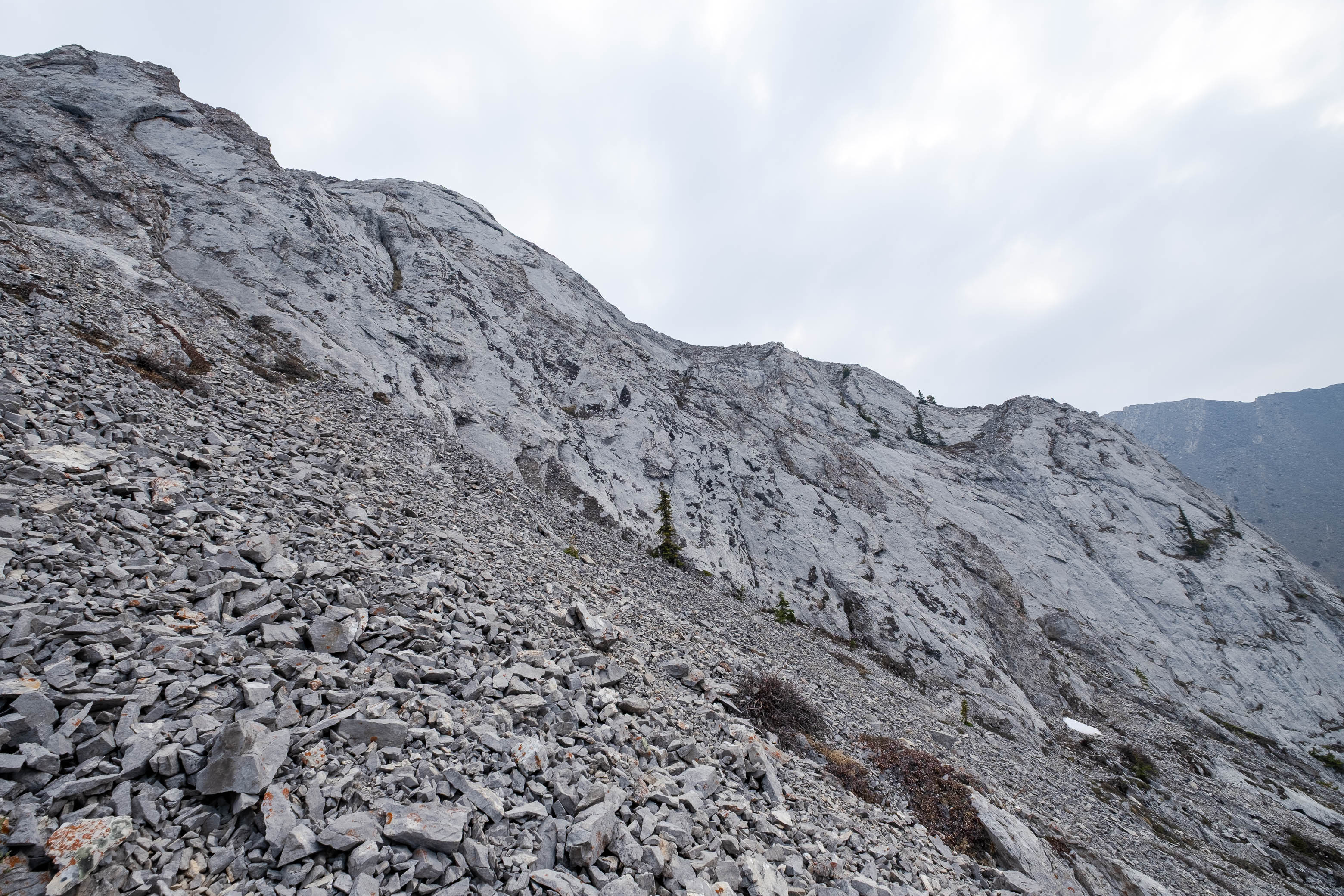
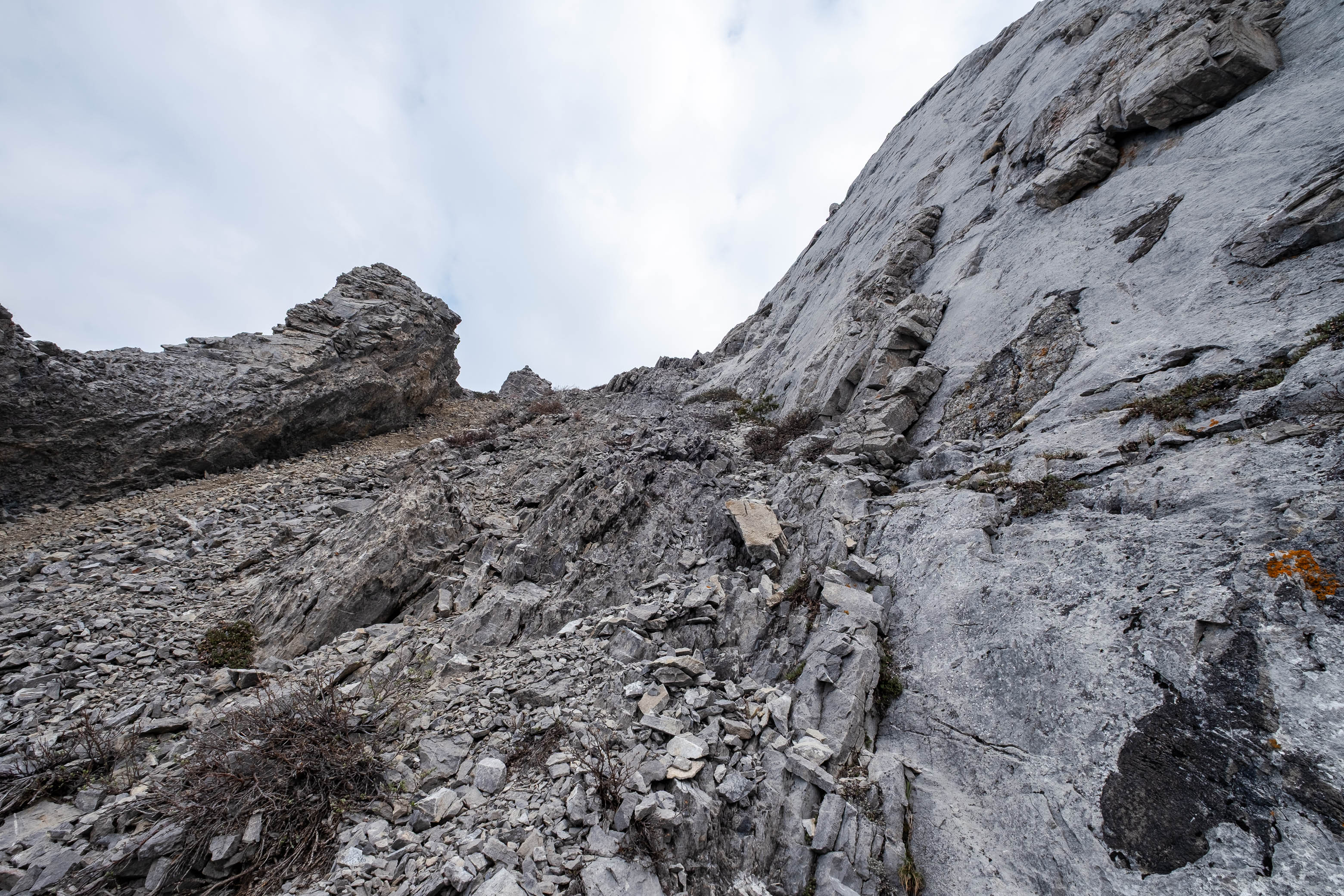
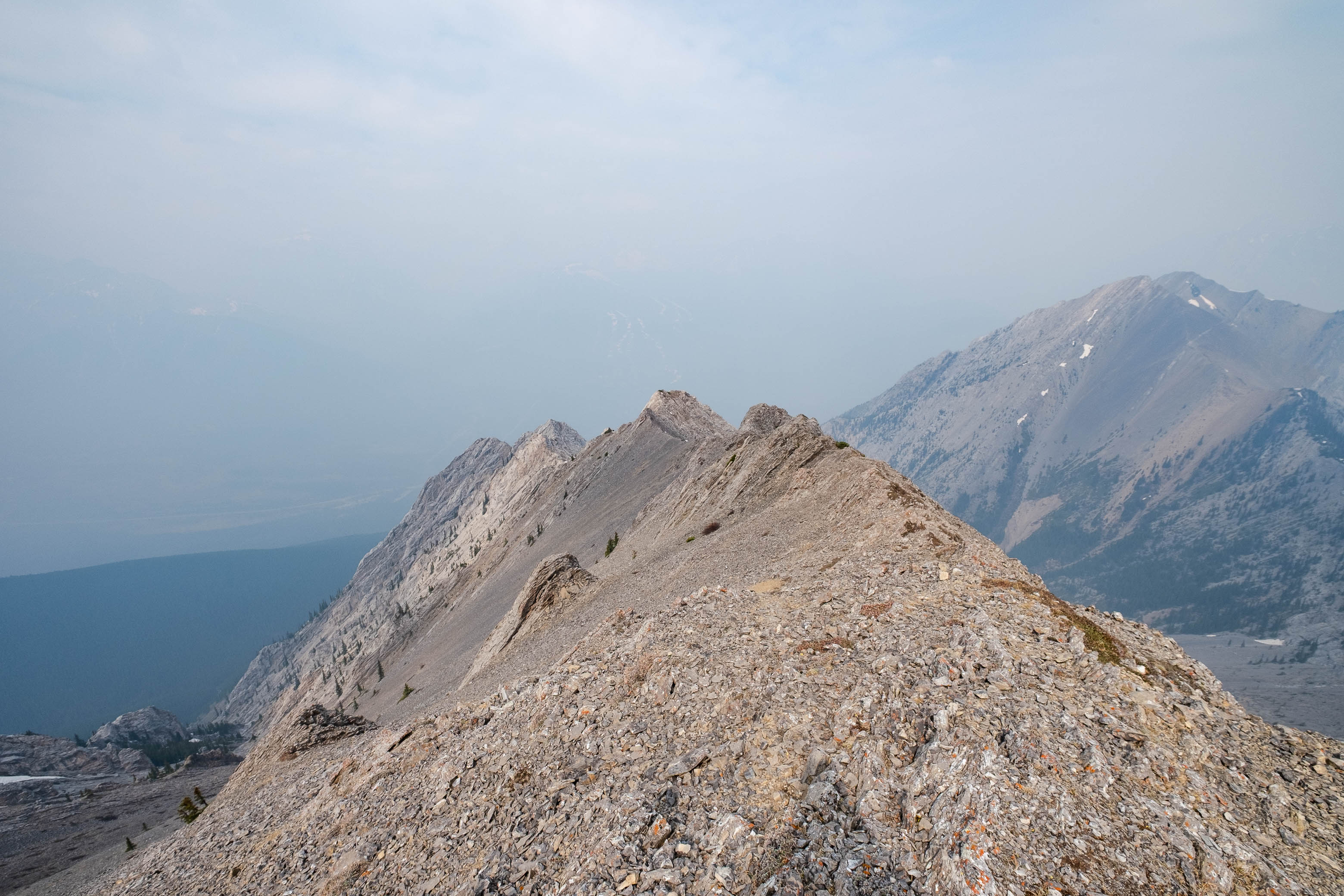
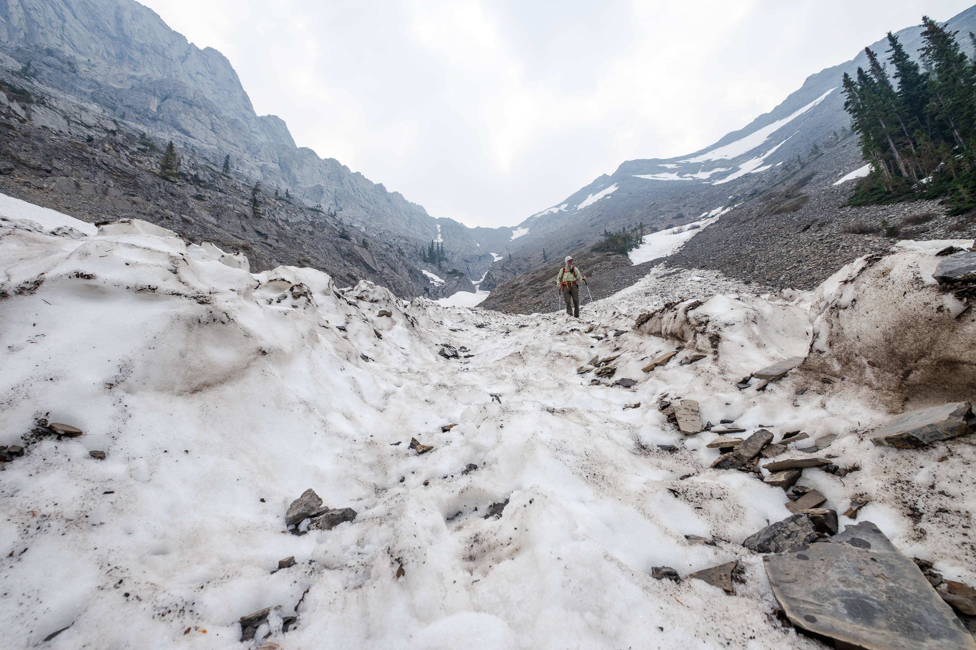
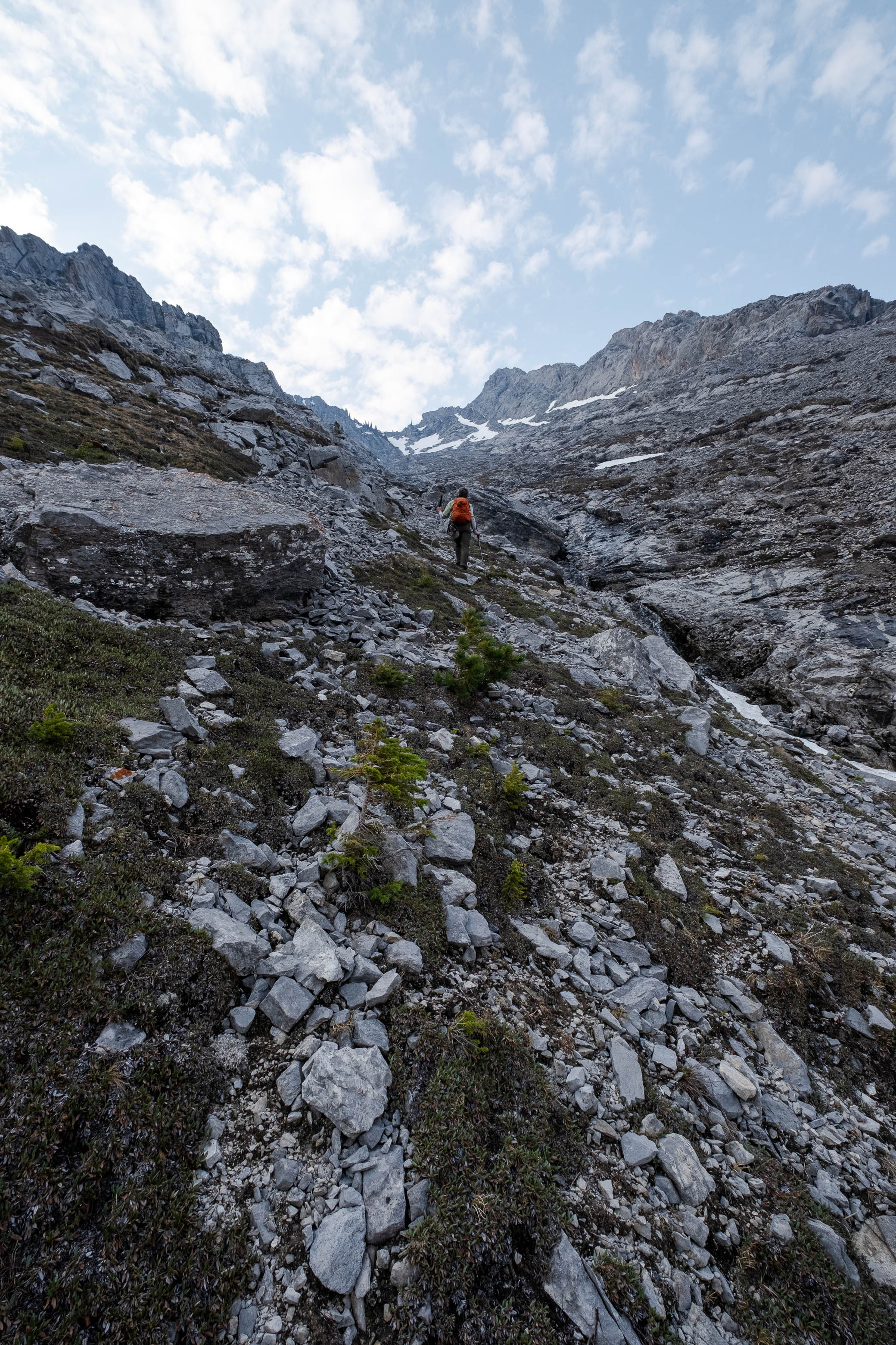
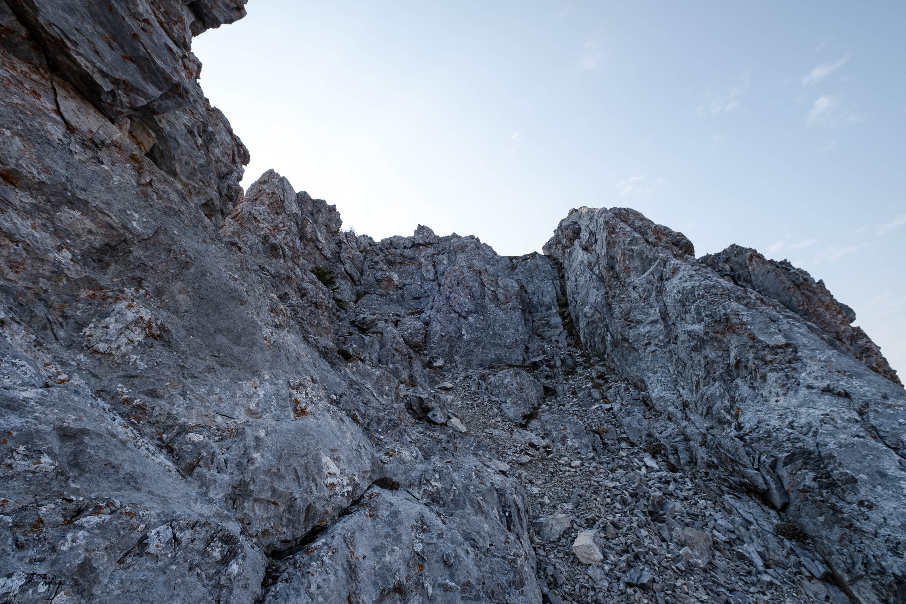
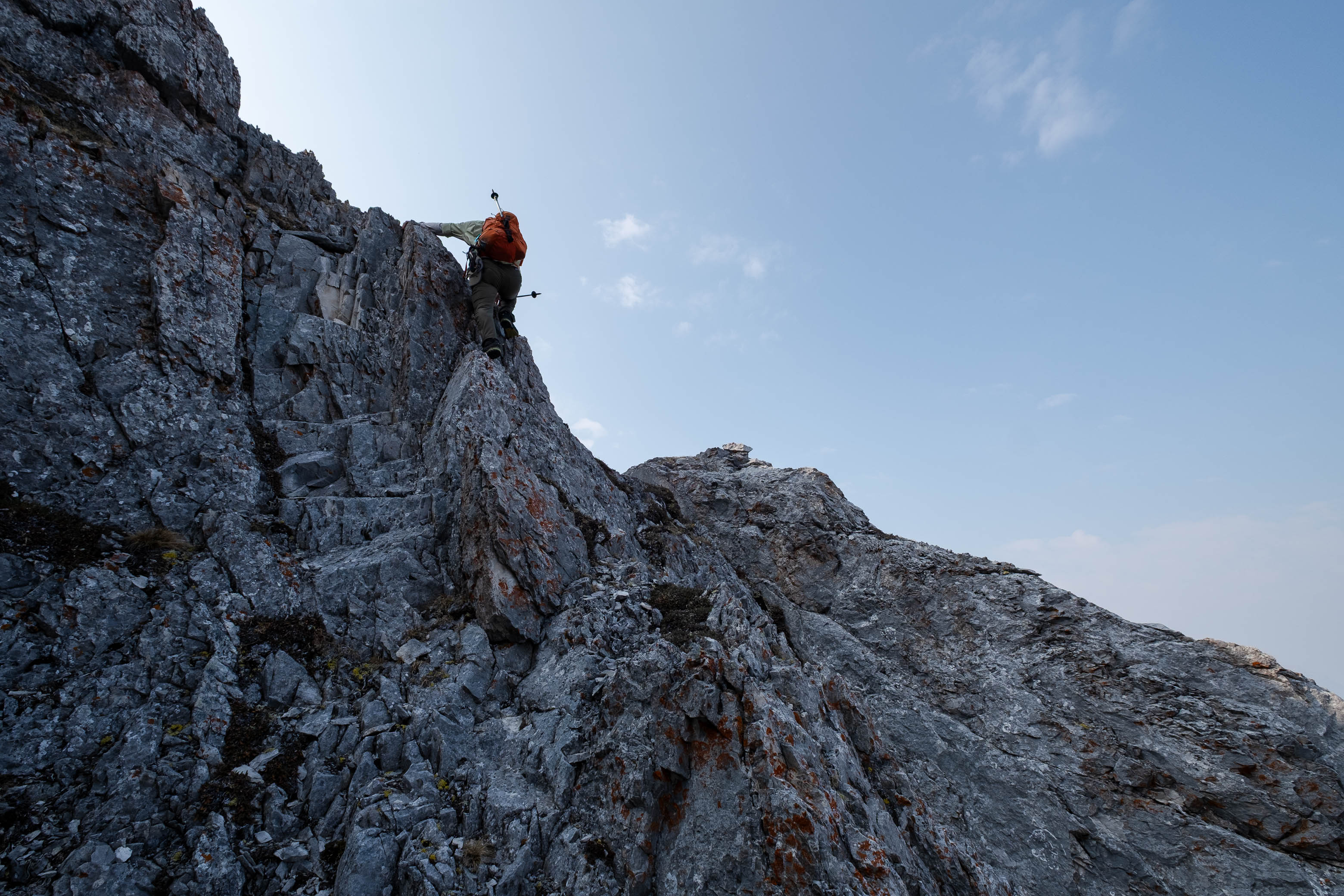
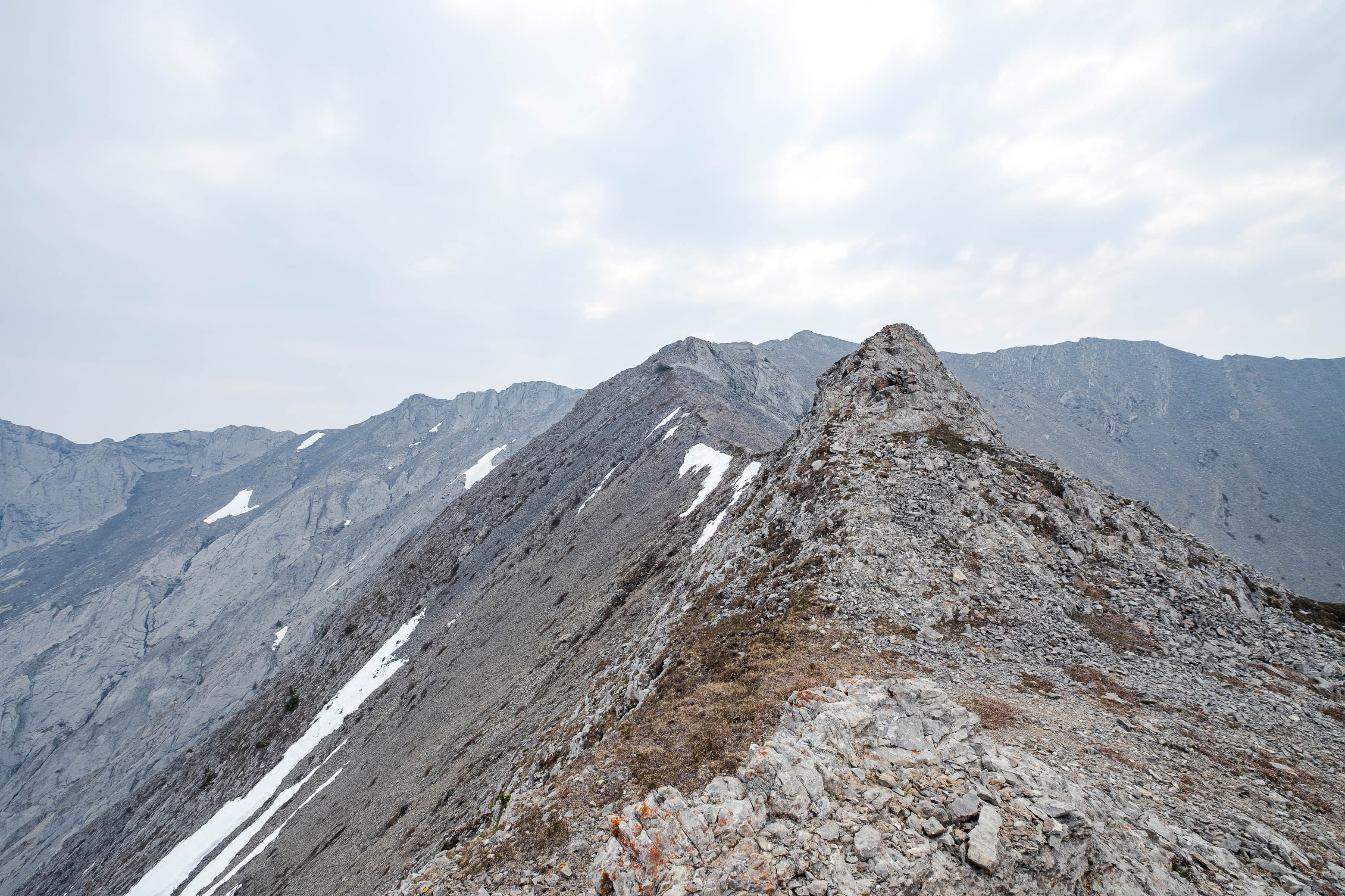
We soon passed the first major gully, coming down from the right, and continued up the creek for another 200 or so meters, before arriving at the second gully. You'll know you're in the right one if it starts by angling up to looker's left, before curving to the right and pointing straight up the mountain. Once in the correct (second) gully, there really isn't much to it - Pick a line and up you go! I found that the slabs and small patches of grass/moss between the rubble offered the best footing, but any route will suffice. A large patch of lingering snow near the top of the gully (not supportive enough to kick step) forced us up onto the left side, where we finally got our hands a bit dirty, scrambling up a few little rock ribs before topping out on the ridge.
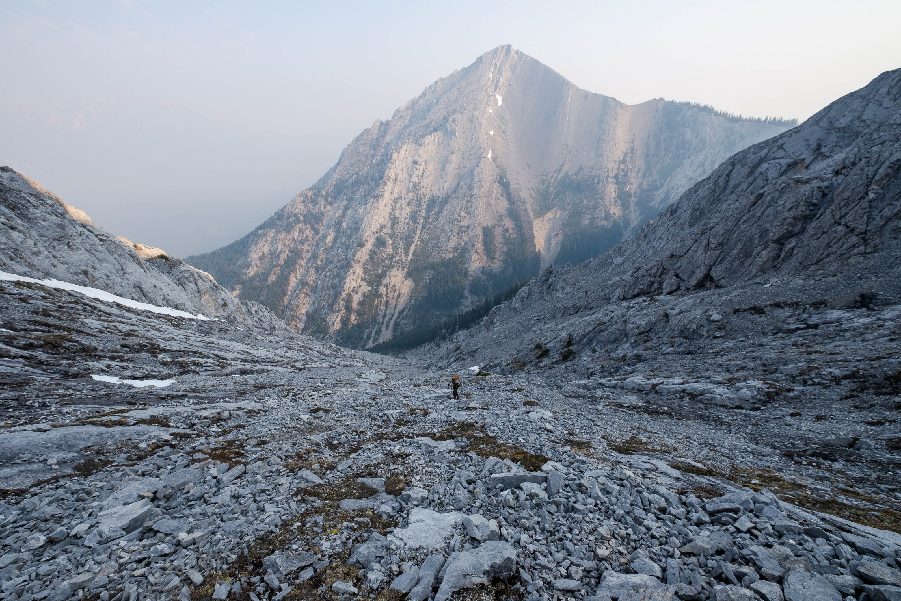
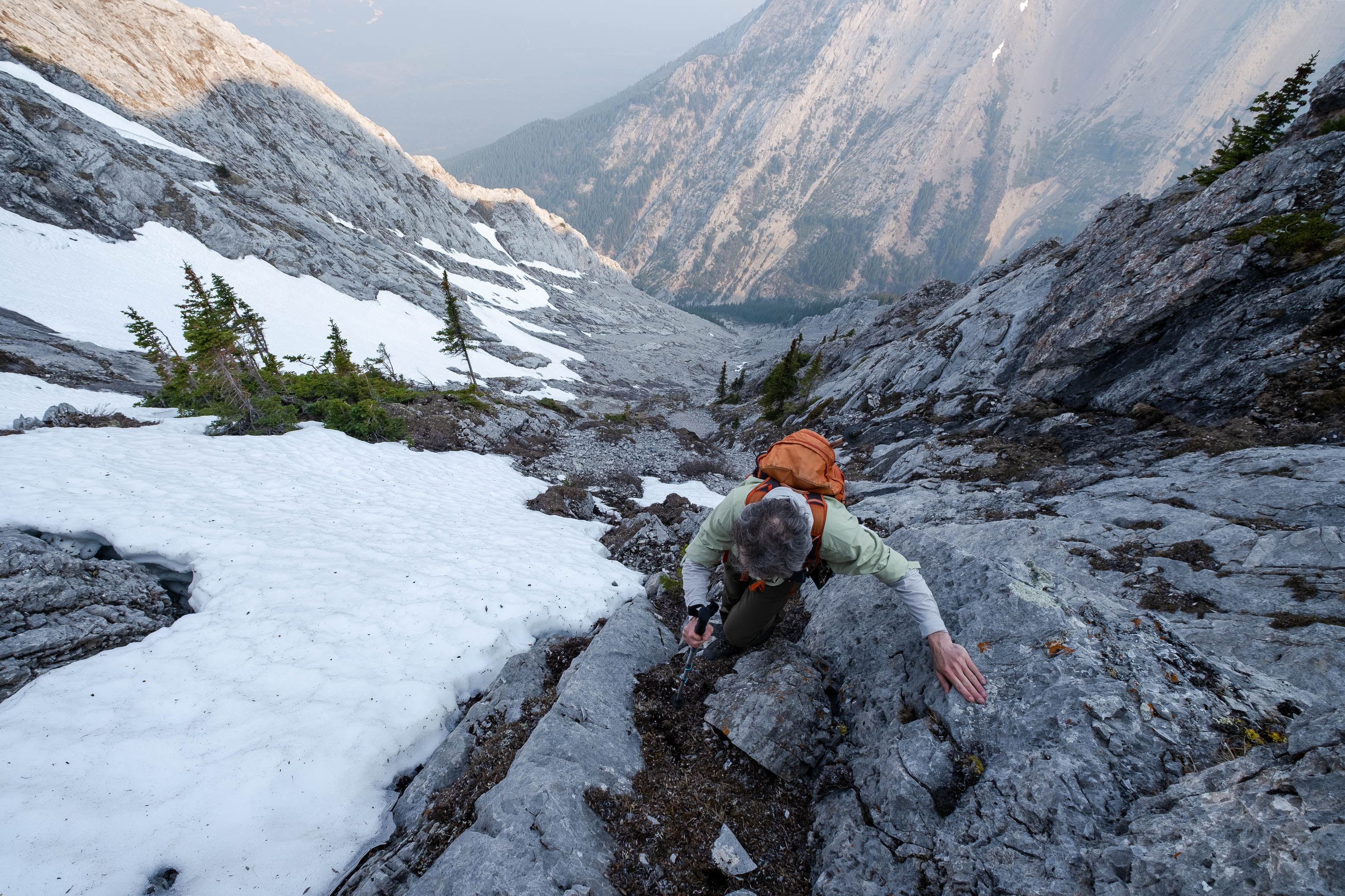
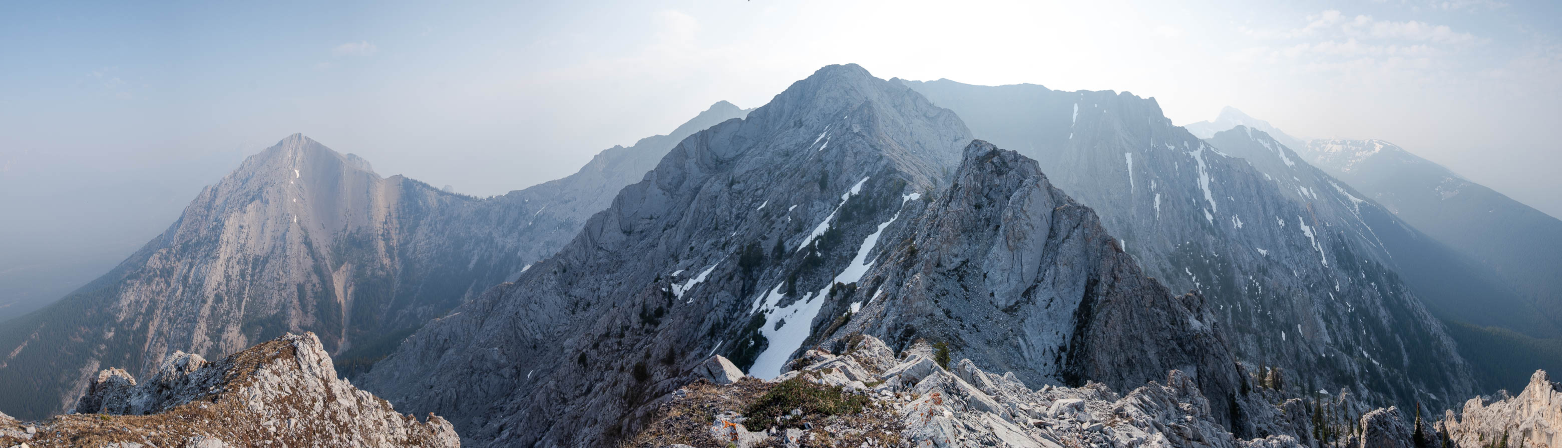
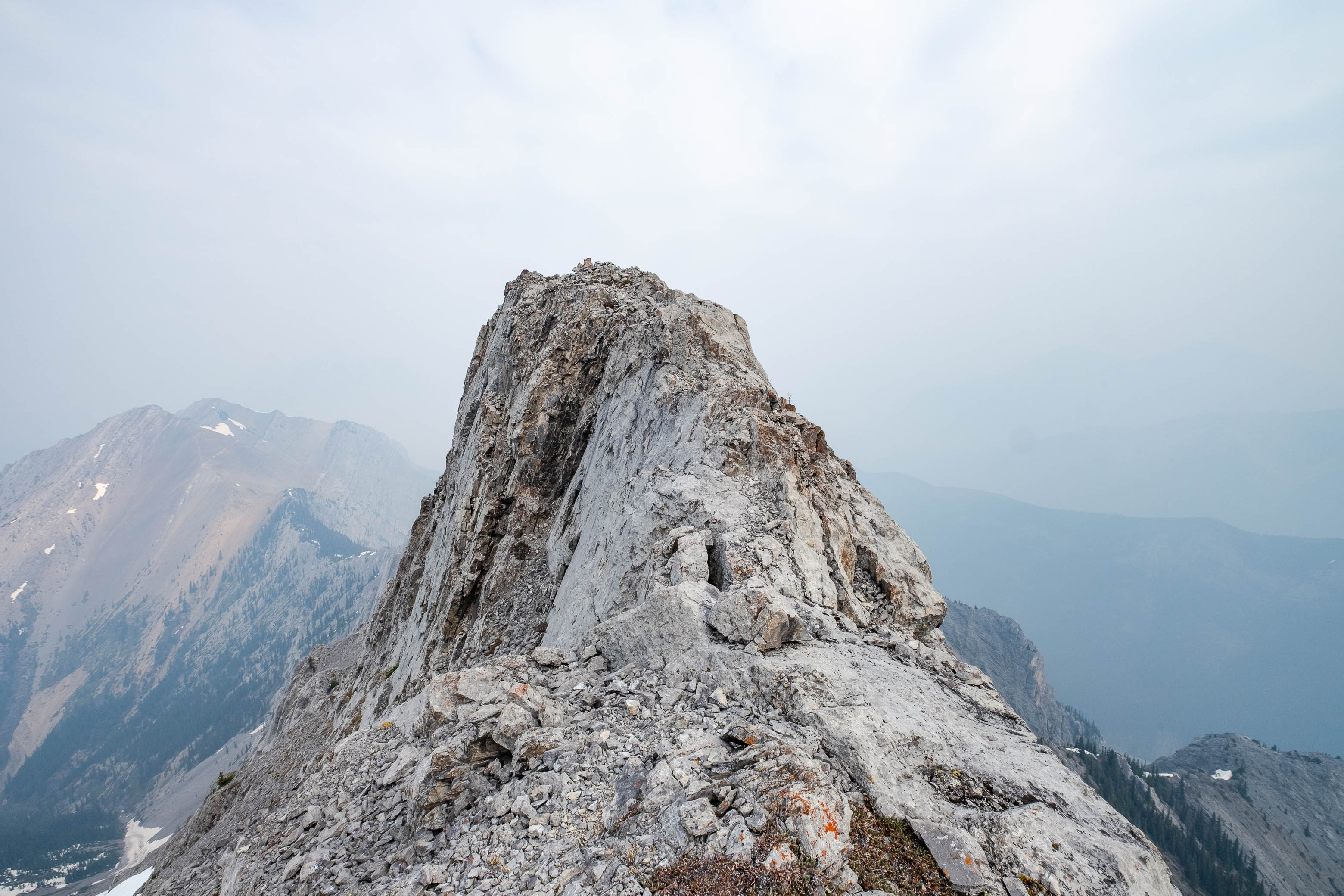
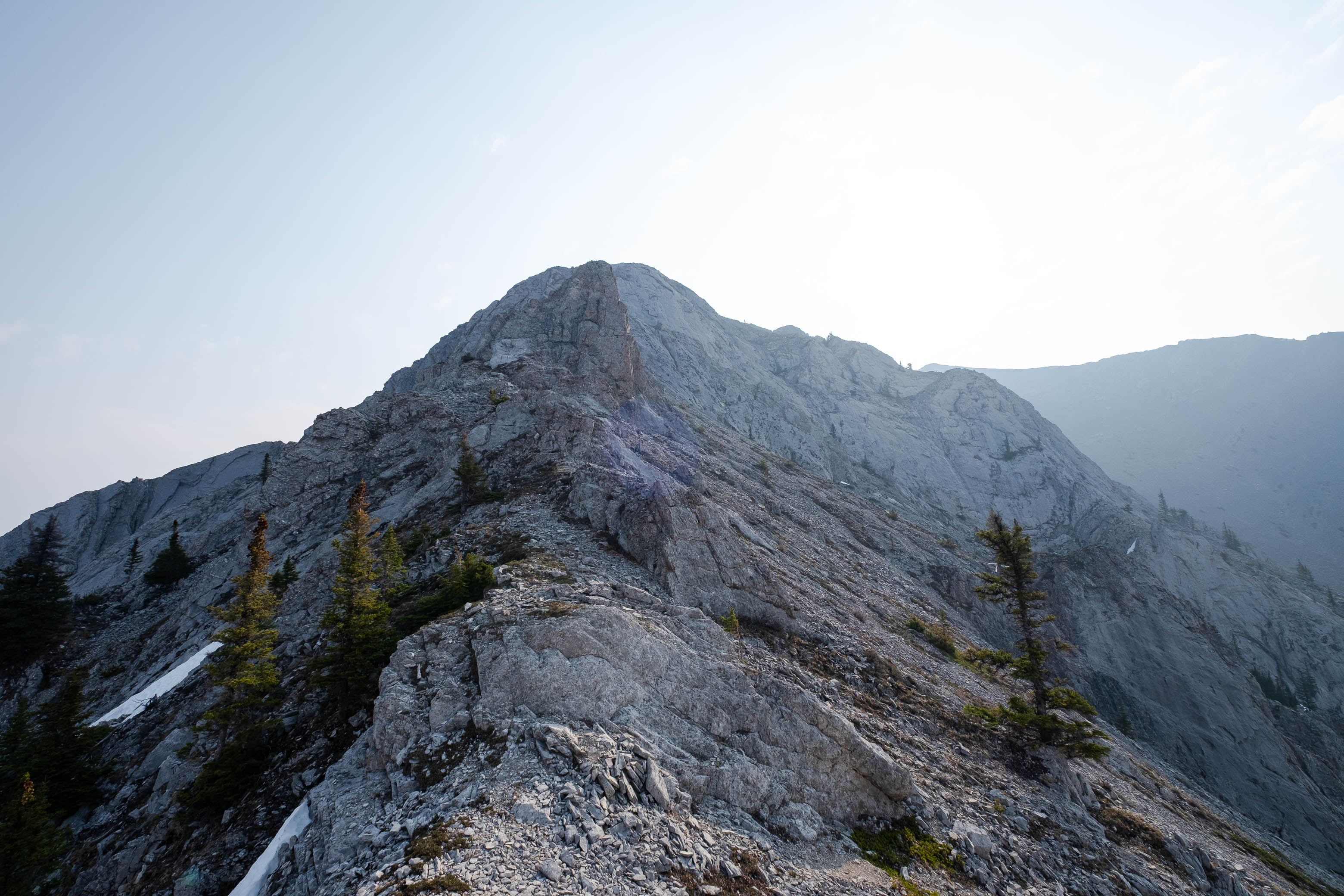
Views at a distance simply didn't exist, but a couple "towers" - immediately west of the col - were lit up in the morning sun and calling to be climbed! Although unnamed, one of them (I believe the one further west) does find itself in Nugara's More Scrambles Guide, named by its grid reference - GR338442. Since Nugara's list is one I hope to someday complete, I was more than happy to tag this "peak" before continuing up the ridge to Kananaskis to make it a two summit day! 😉
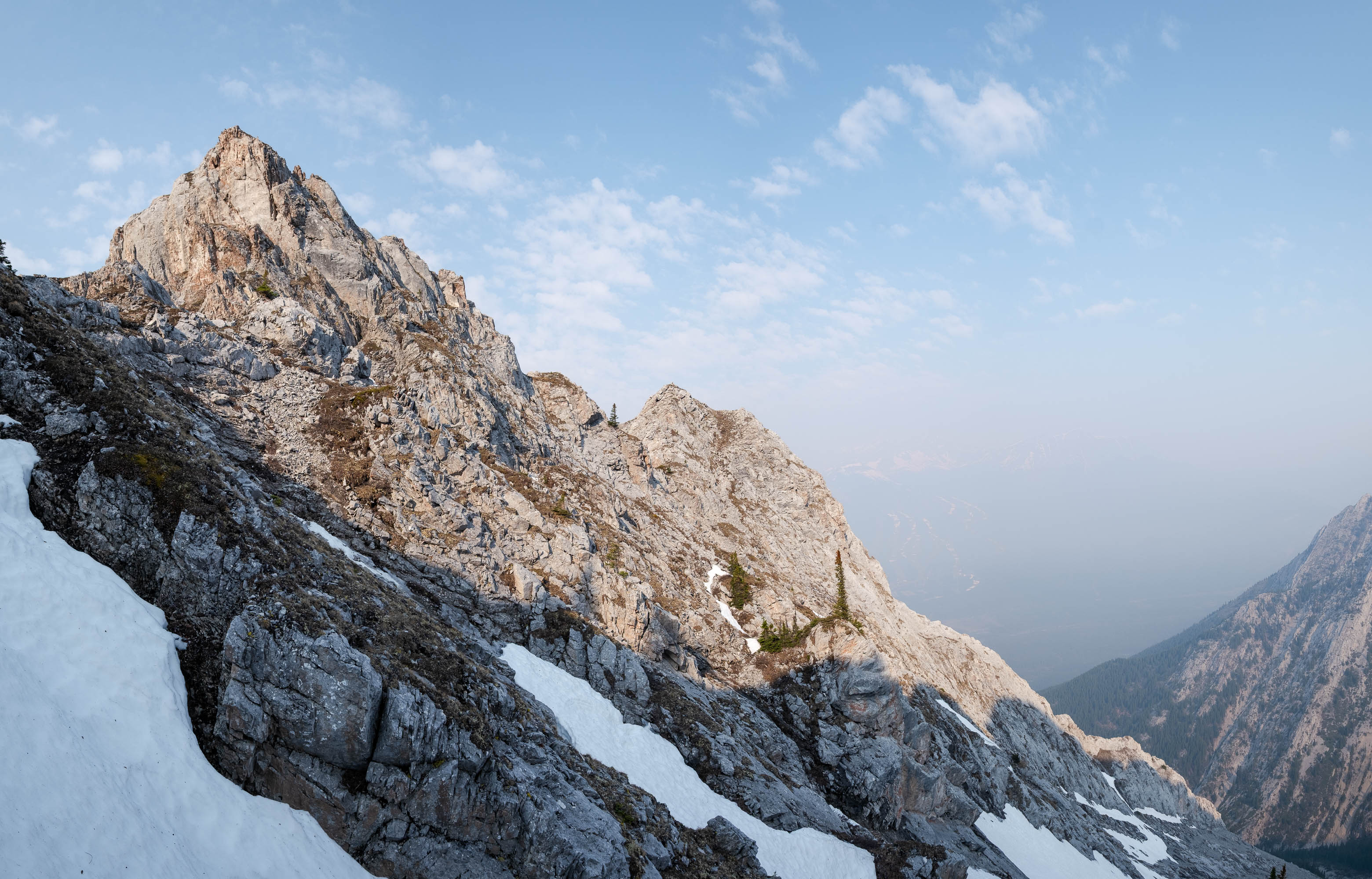
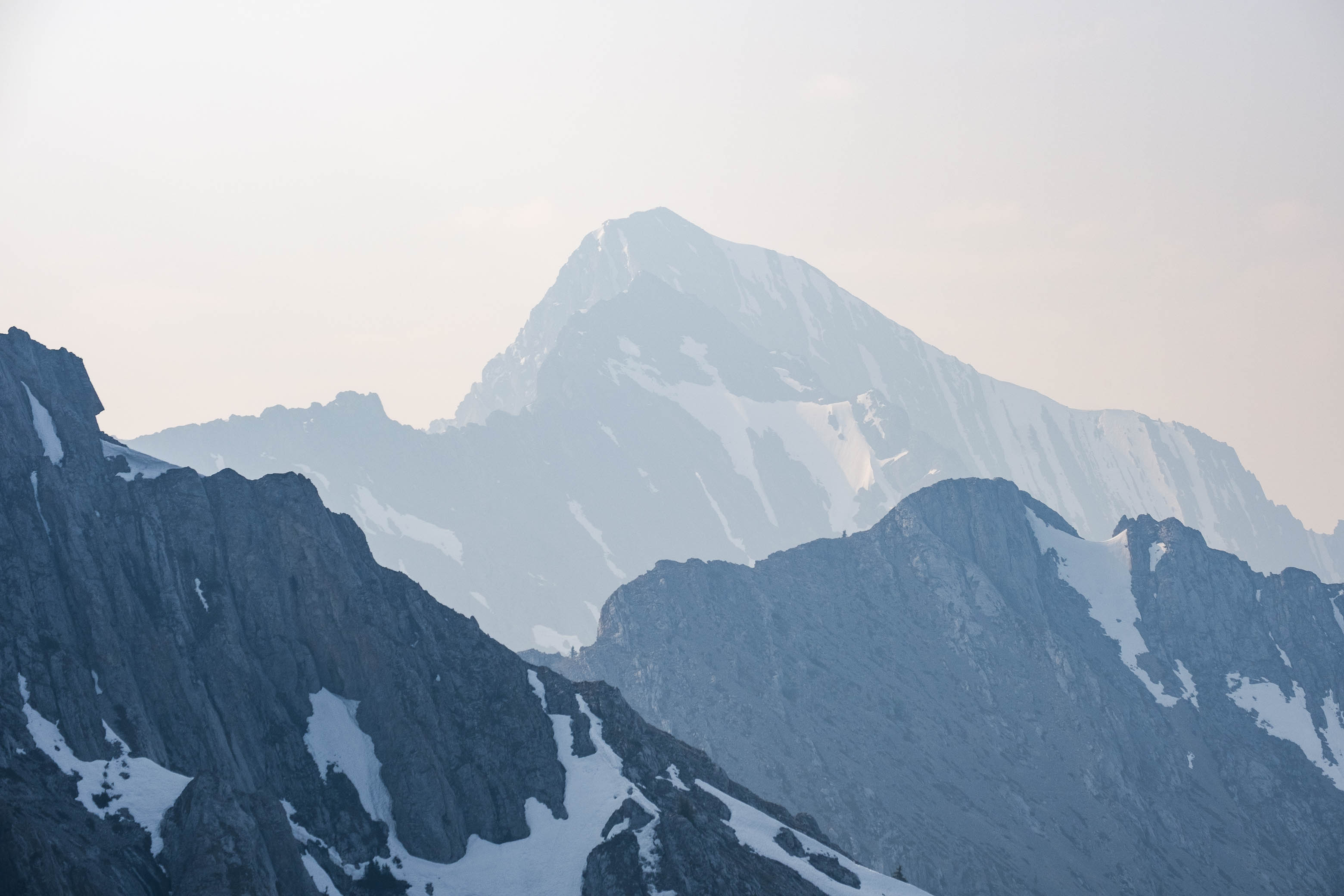
The east tower rises abruptly from the col - its vertical wall of rock not offering much in terms of scramble routes - so we went for the west tower first. Traversing mossy ledges on the east tower's north side, we quickly arrived at the second tower, easily scampered up a short scree gully, and just like that were standing at its summit cairn! Looking up and down the mountain range, we could pick out faint outlines of Wasootch Peak to the north and Old Baldy to the south, but anything further (including everything across Highway 40) was completely lost to the smoke.
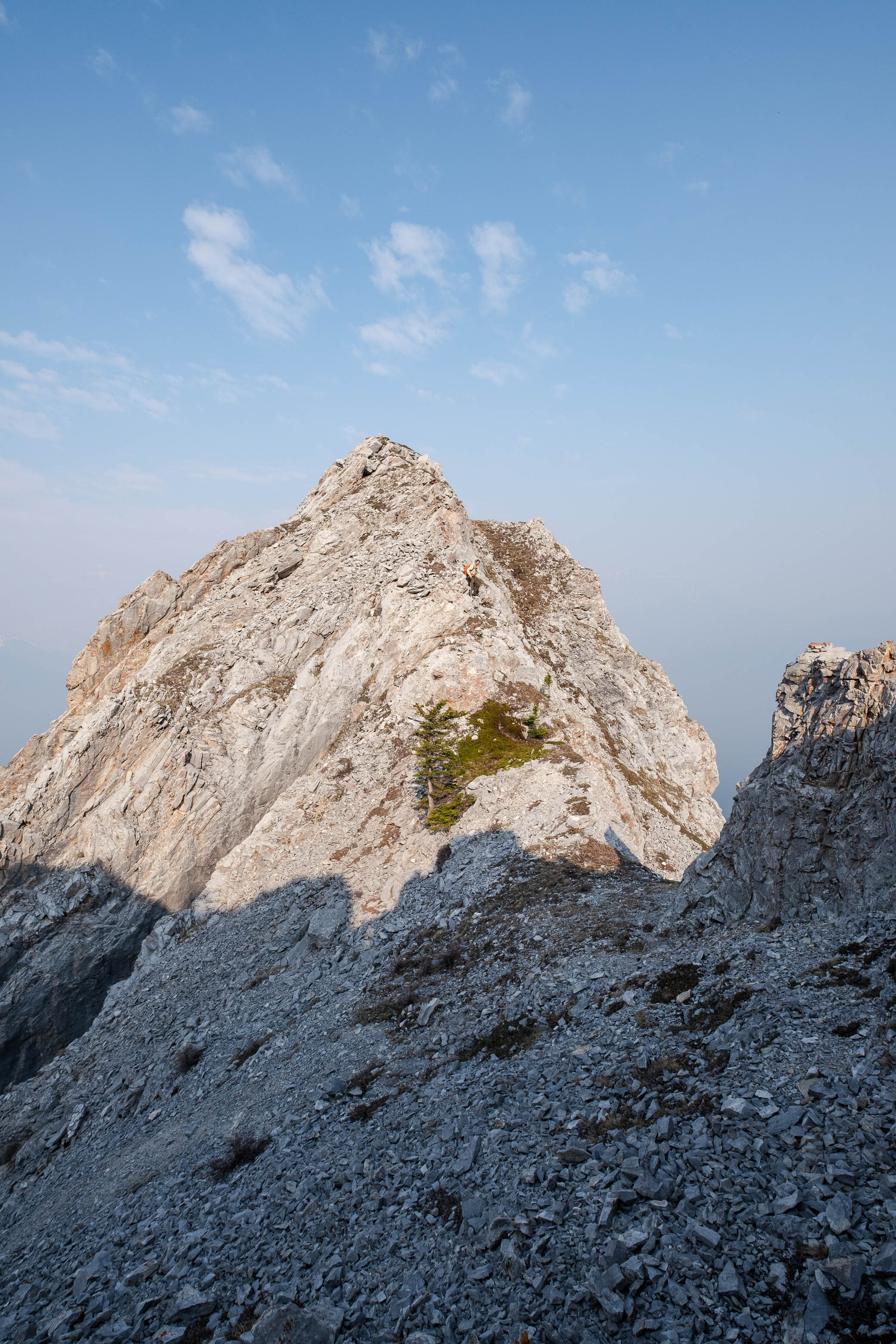
Studying the east tower's "backside", I was happy to note that it actually looked manageable! We followed the ridge to the low point between the two peaks and then scrambled up a rubbly gully, with a short moderate step at the top. Views were basically identical - i.e. there weren't many - but my GPS did read a few meters higher despite the fact that the western tower is considered the "summit"...Meh, doesn't matter to me. I tagged both cairns, so I'm happy! 😉
We returned to the low point between the two peaks, but rather than reascend the western tower, we were then able to pick out an easy line directly down to the moss-ledge traverse and back to the col.
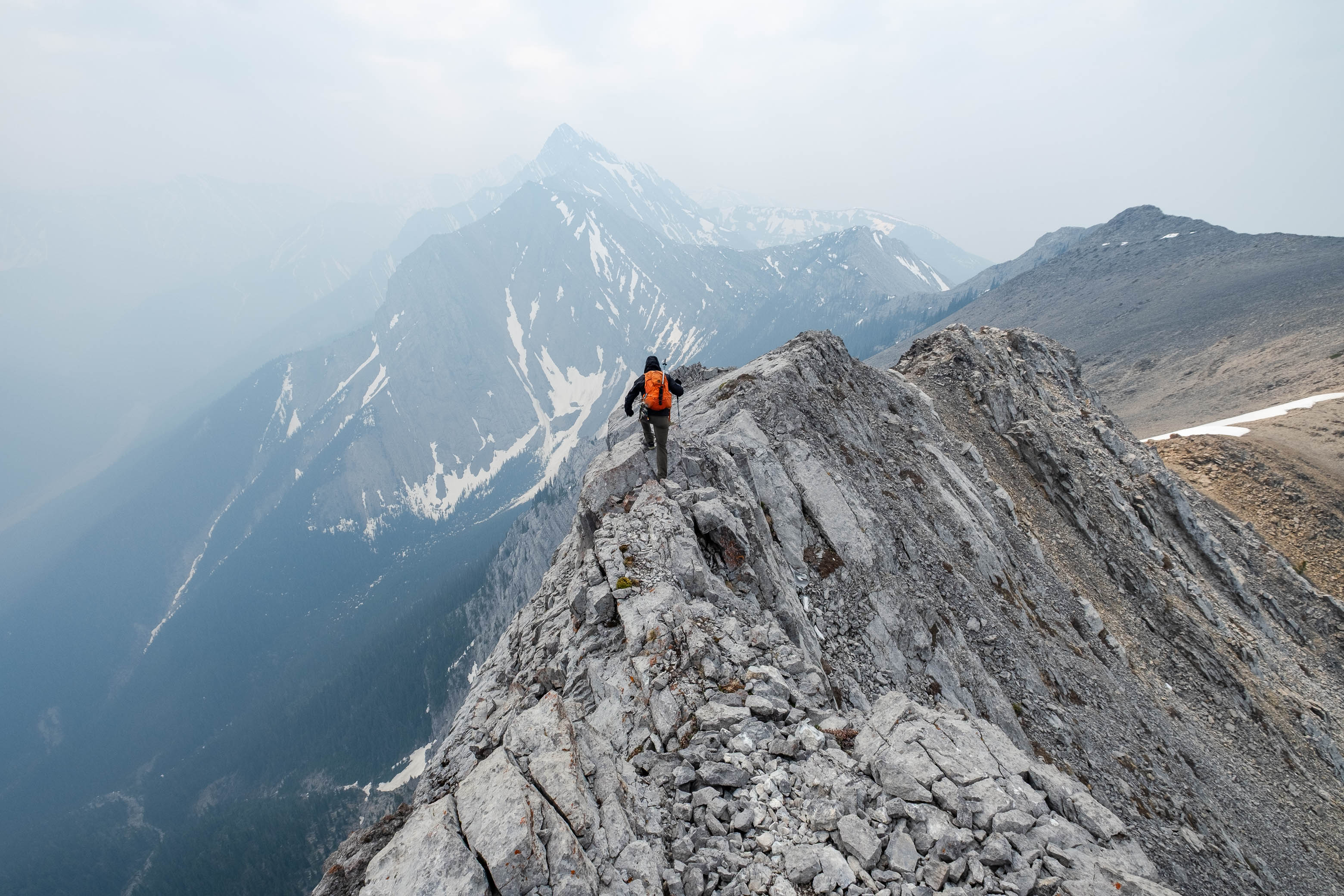
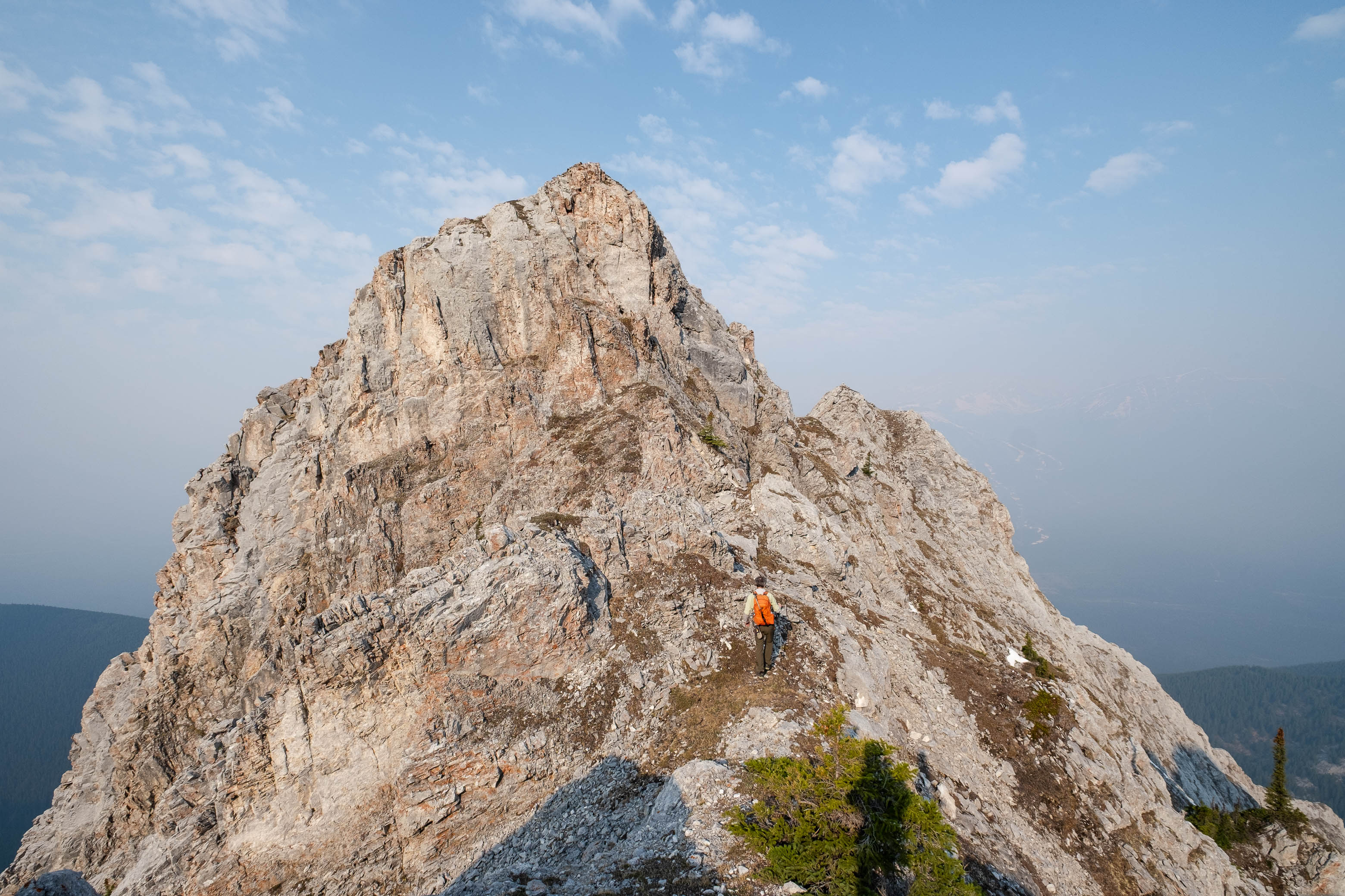
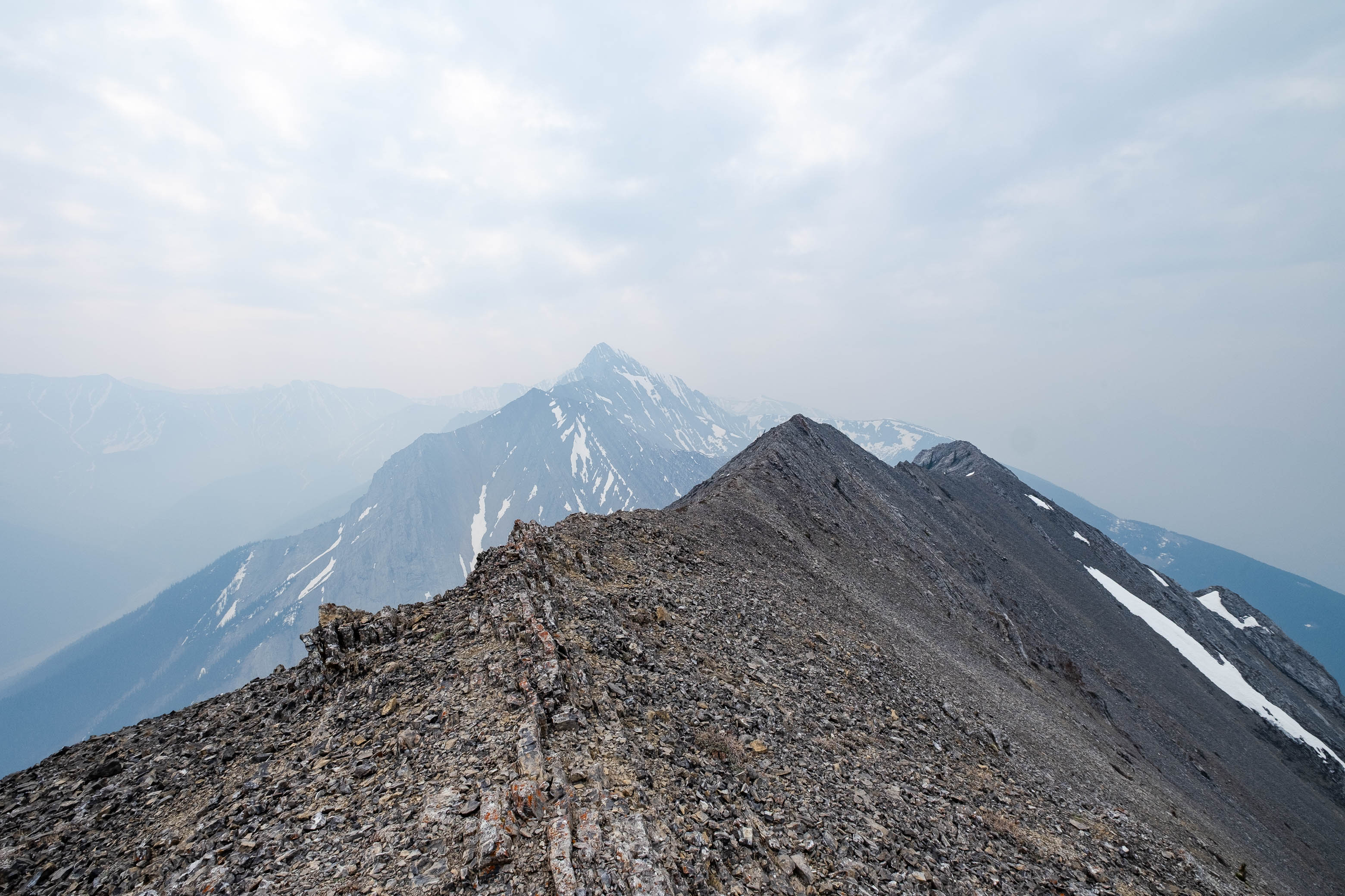
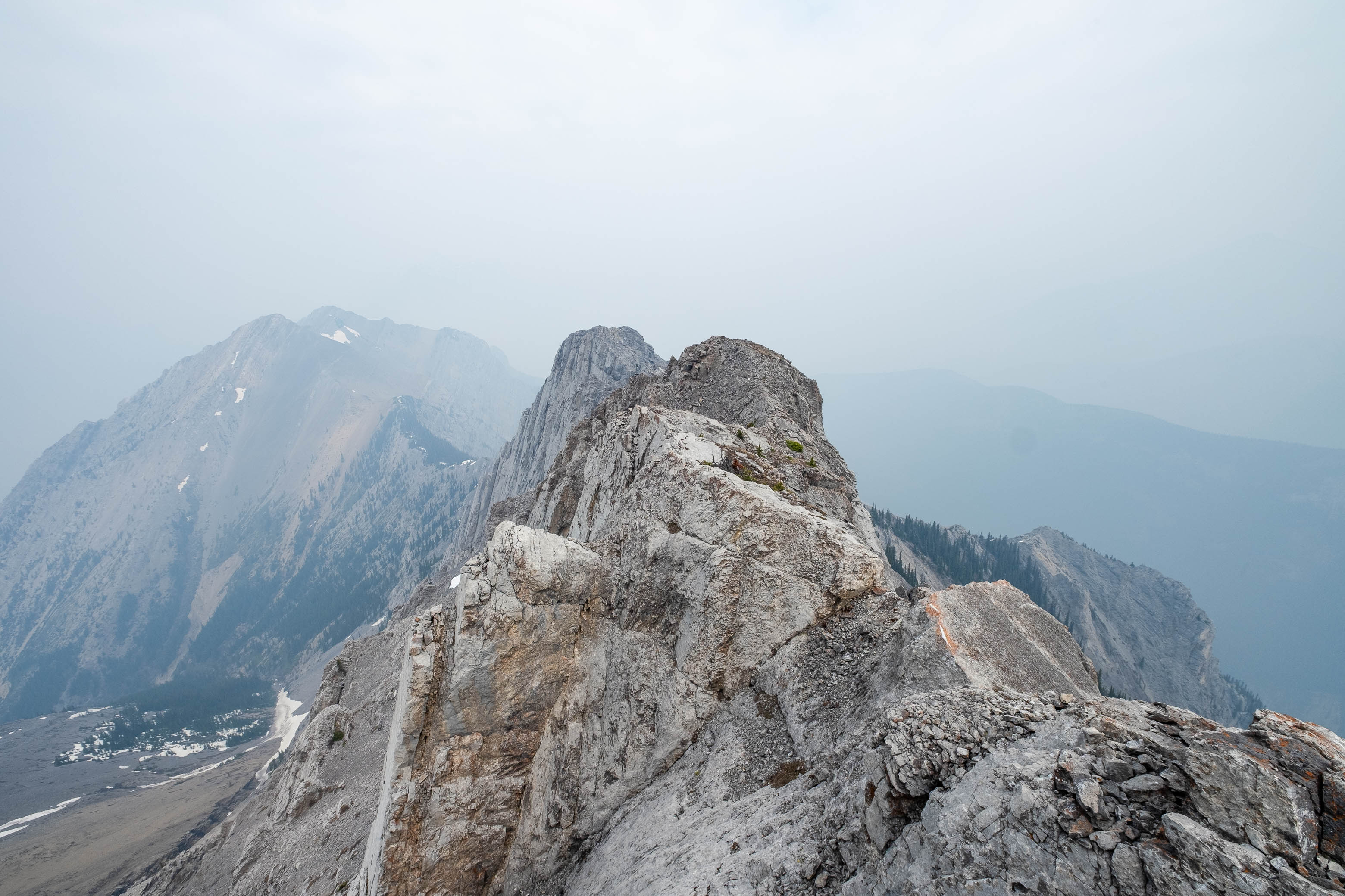
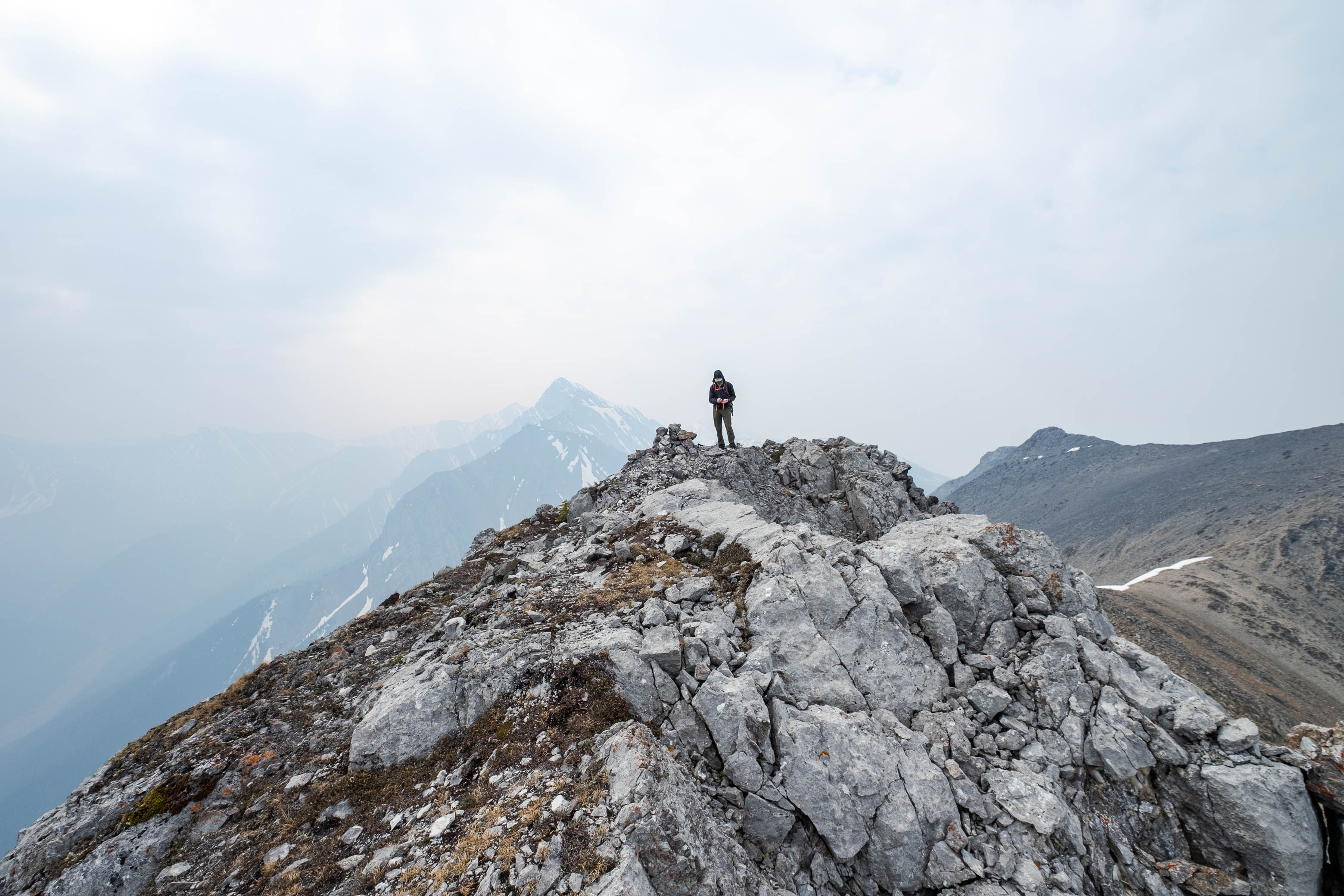
The ridge to Kananaskis Peak looks pretty daunting from the col, but don't worry, it's waaay easier than it appears! Rather than heading straight up the ridge crest (an obvious rock outcropping blocks the way), we started traversing along a scree trail on the south side. Once around the rock outcropping, a near-vertical wall of slab takes its turn at blocking the way, but this is also easily circumvented. Simply continue on the faint scree trail as it heads down to where the slabs peter out, then turn your attention uphill, and scramble up a short gully, taking you right back up to the ridge. It's that easy!
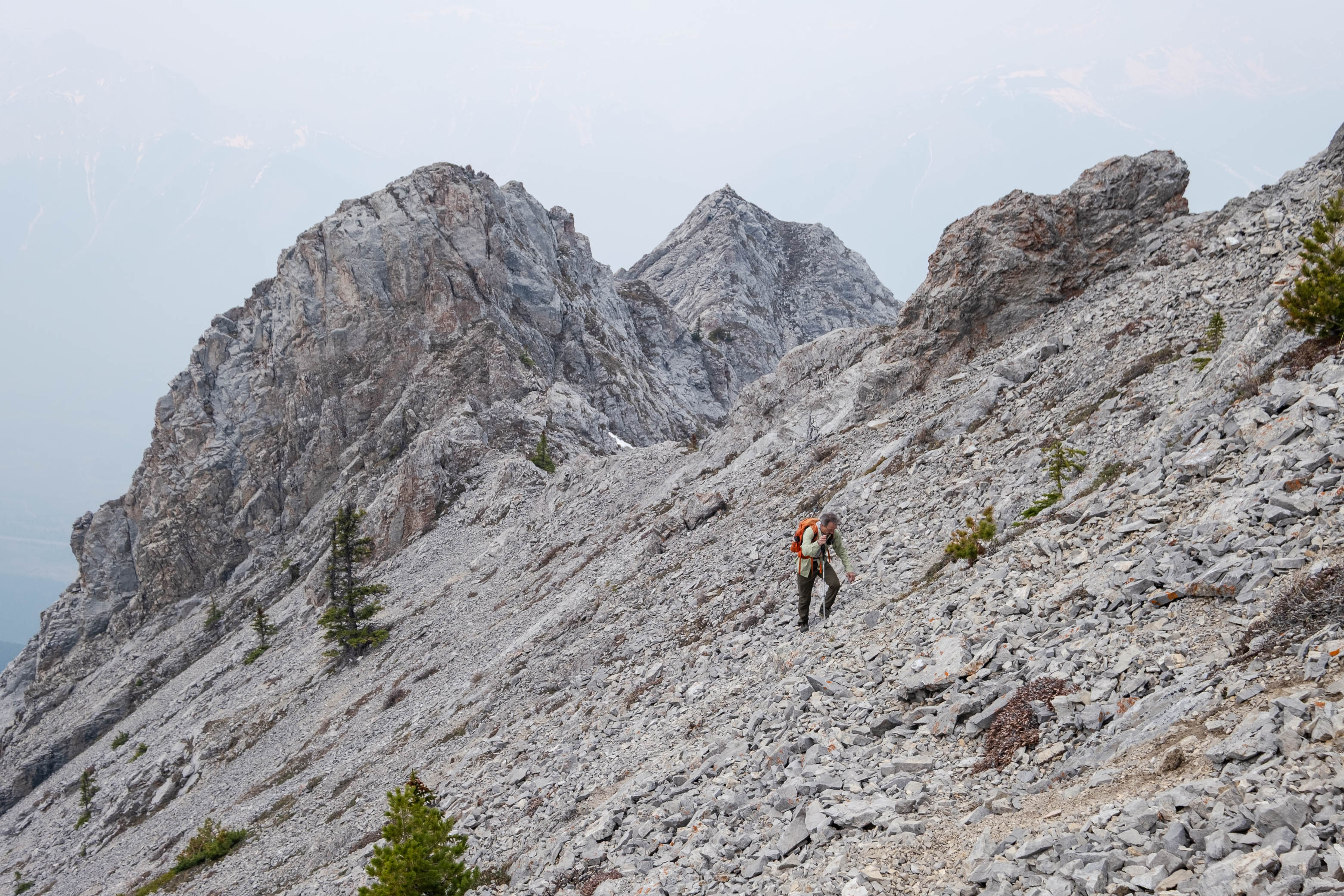
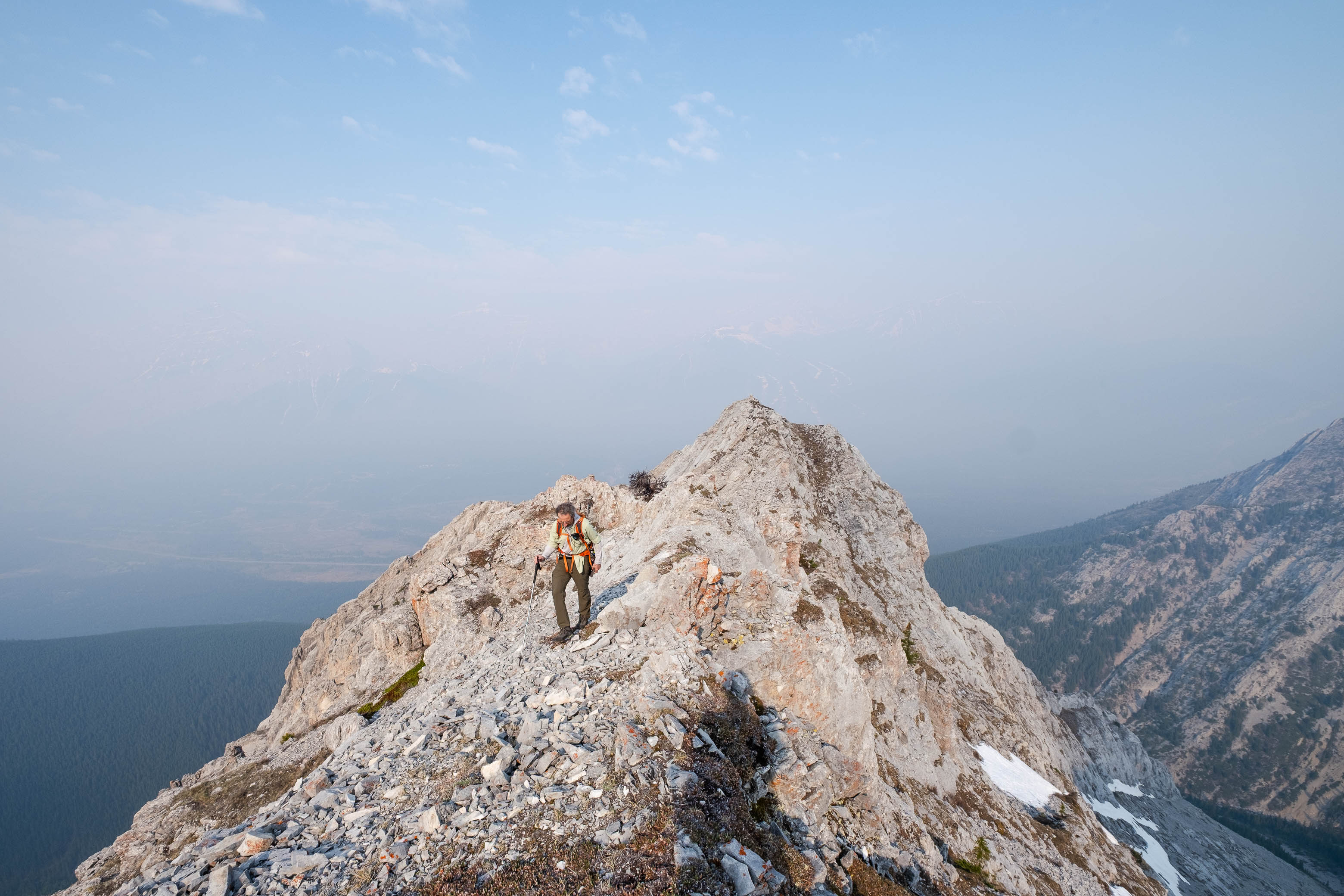
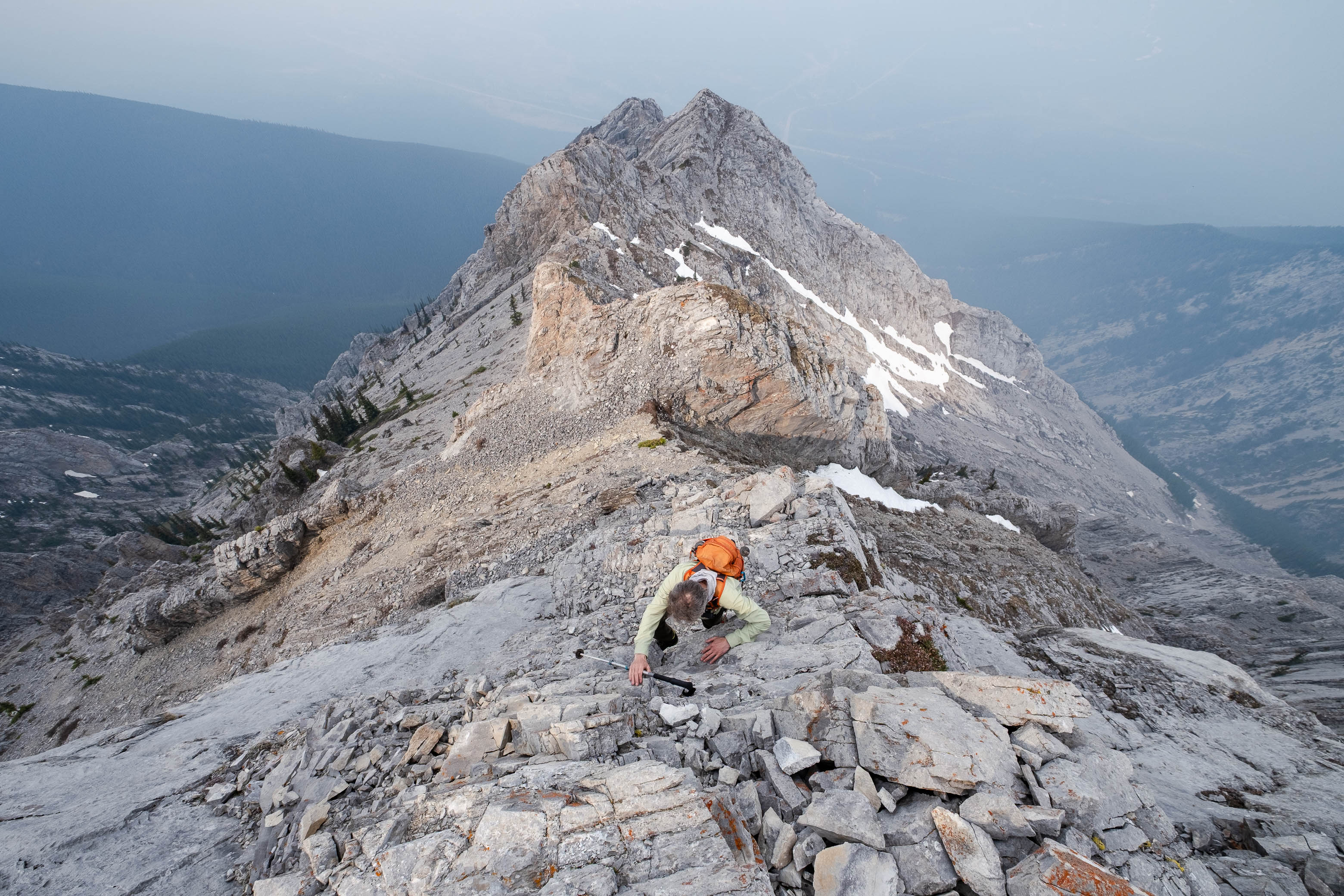
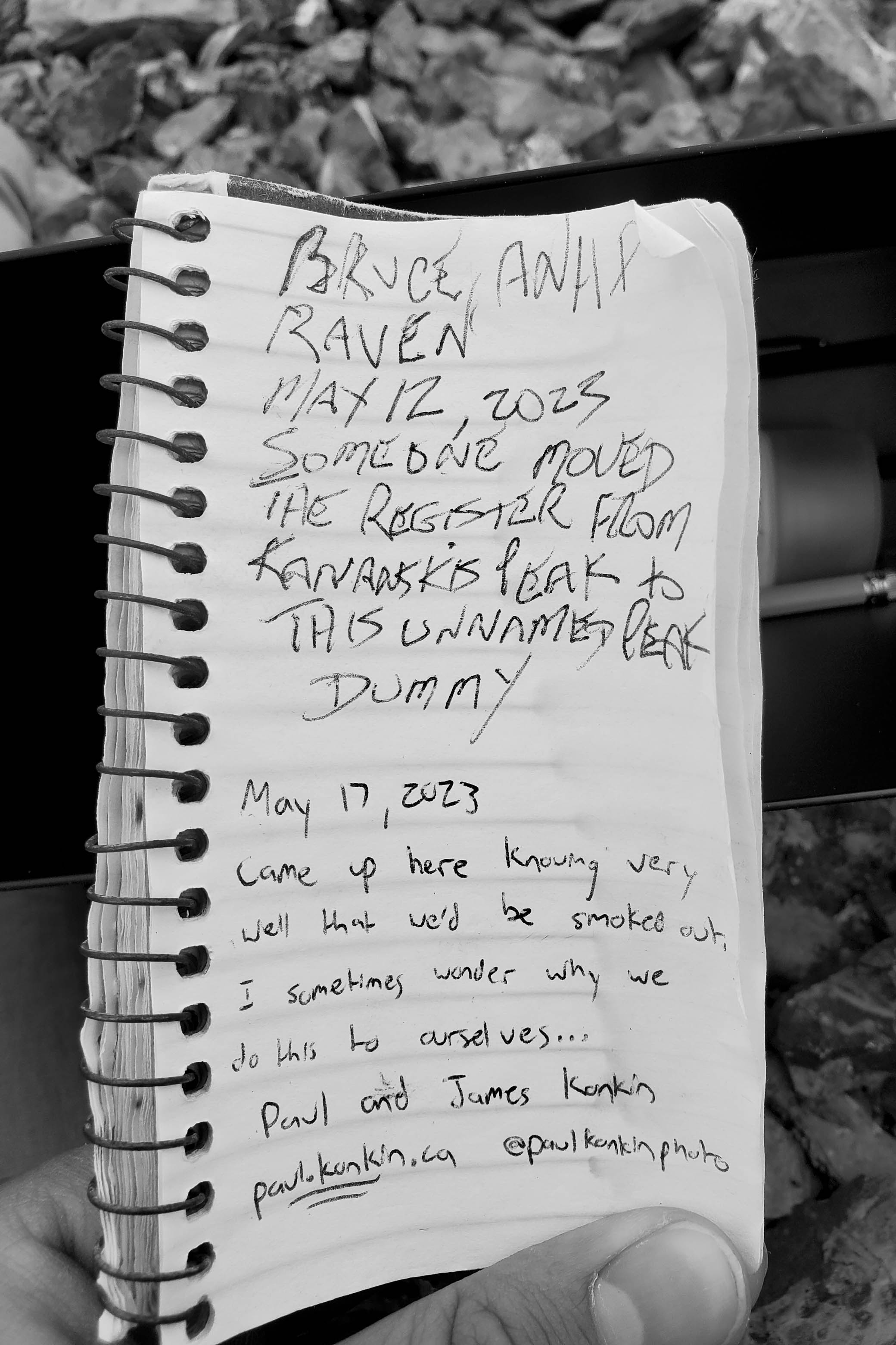
The rest of the route couldn't be much more straightforward - follow the ridge until you reach a small pile of rocks (i.e. the summit cairn)! I vaguely recalled reading a couple reports that made mention of a trickier, exposed section that can cause some trouble in winter, but we were soon standing at the summit cairn (complete with a register), not having encountered any such thing...I was pretty sure that Nugara's Guide Book marked the next highpoint to the east as the true summit, however, so maybe the register was improperly placed and that section was still ahead of us?? 🤷♂️
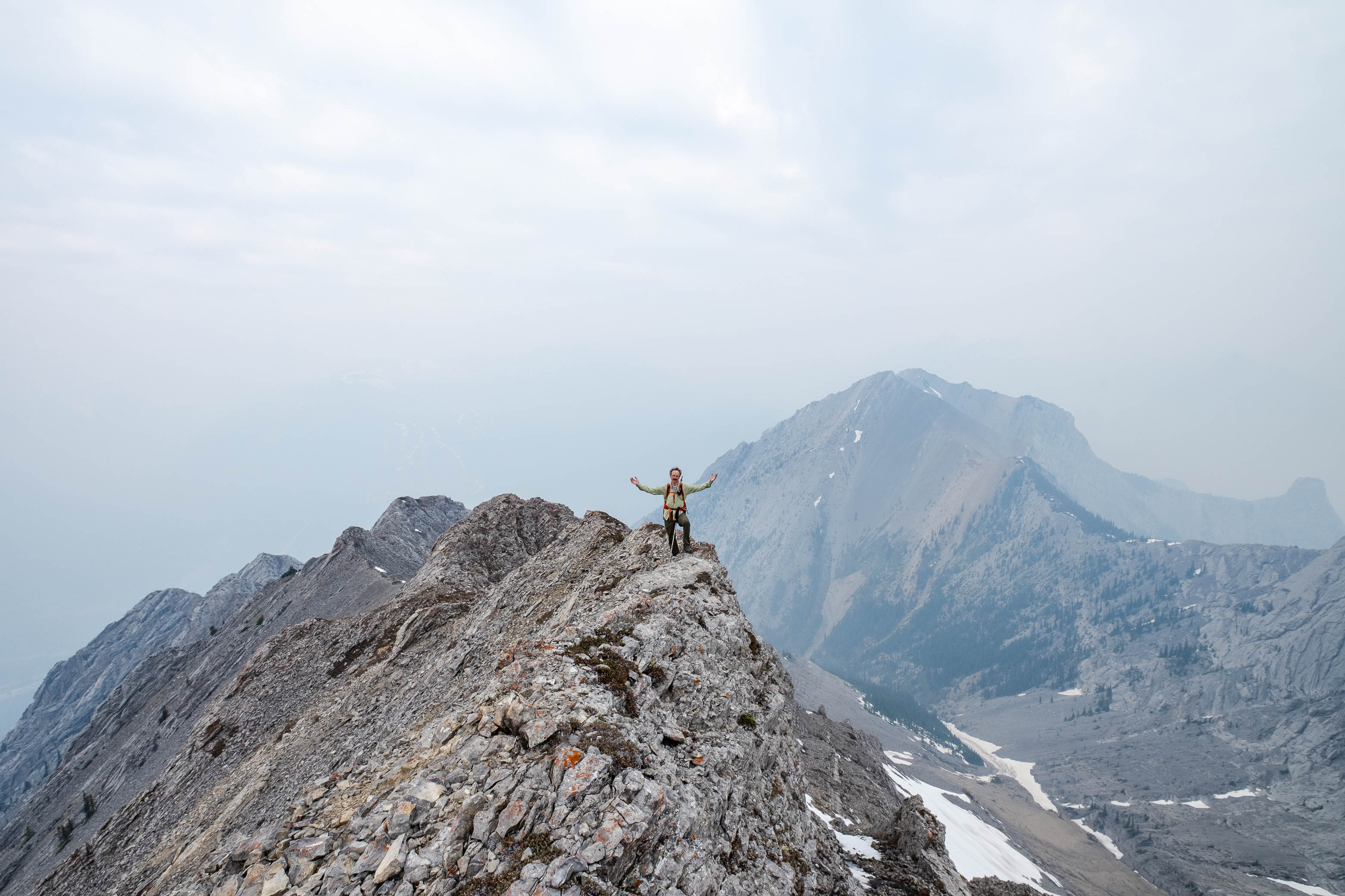
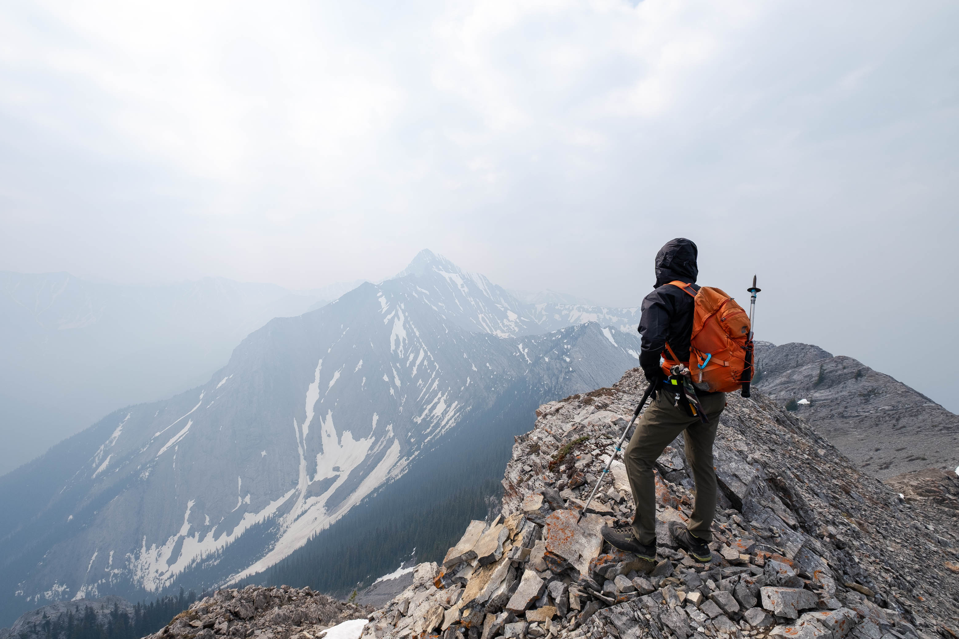
Views were more of the same - smoke, smoke, and more smoke - but I still took a few pictures before signing the register...In which the entry prior to ours read, "Someone moved the register from Kananaskis Peak to this unnamed peak. Dummy". LOL. Looks like we've got some real confusion going on here! 😂
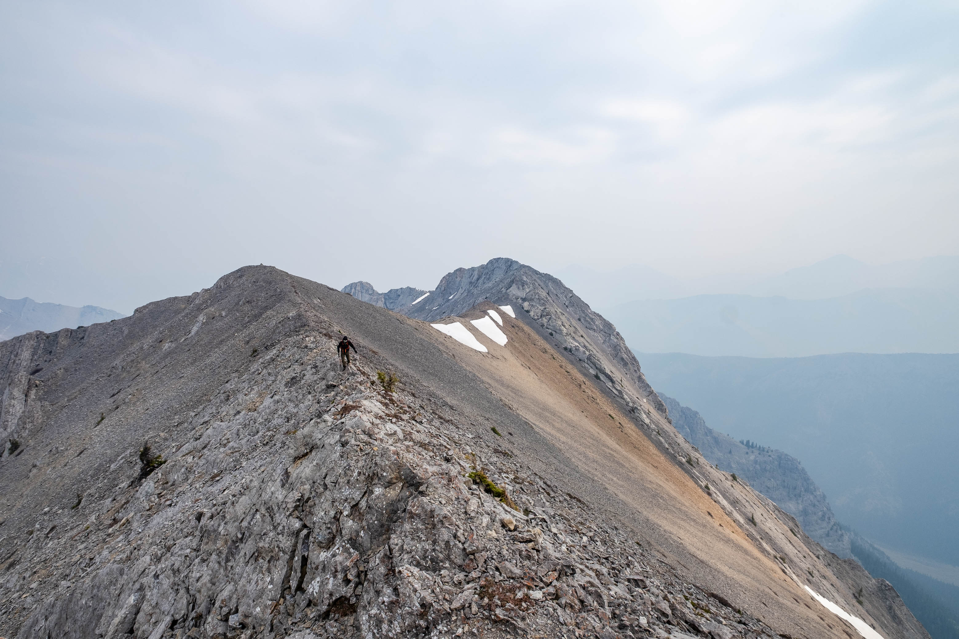
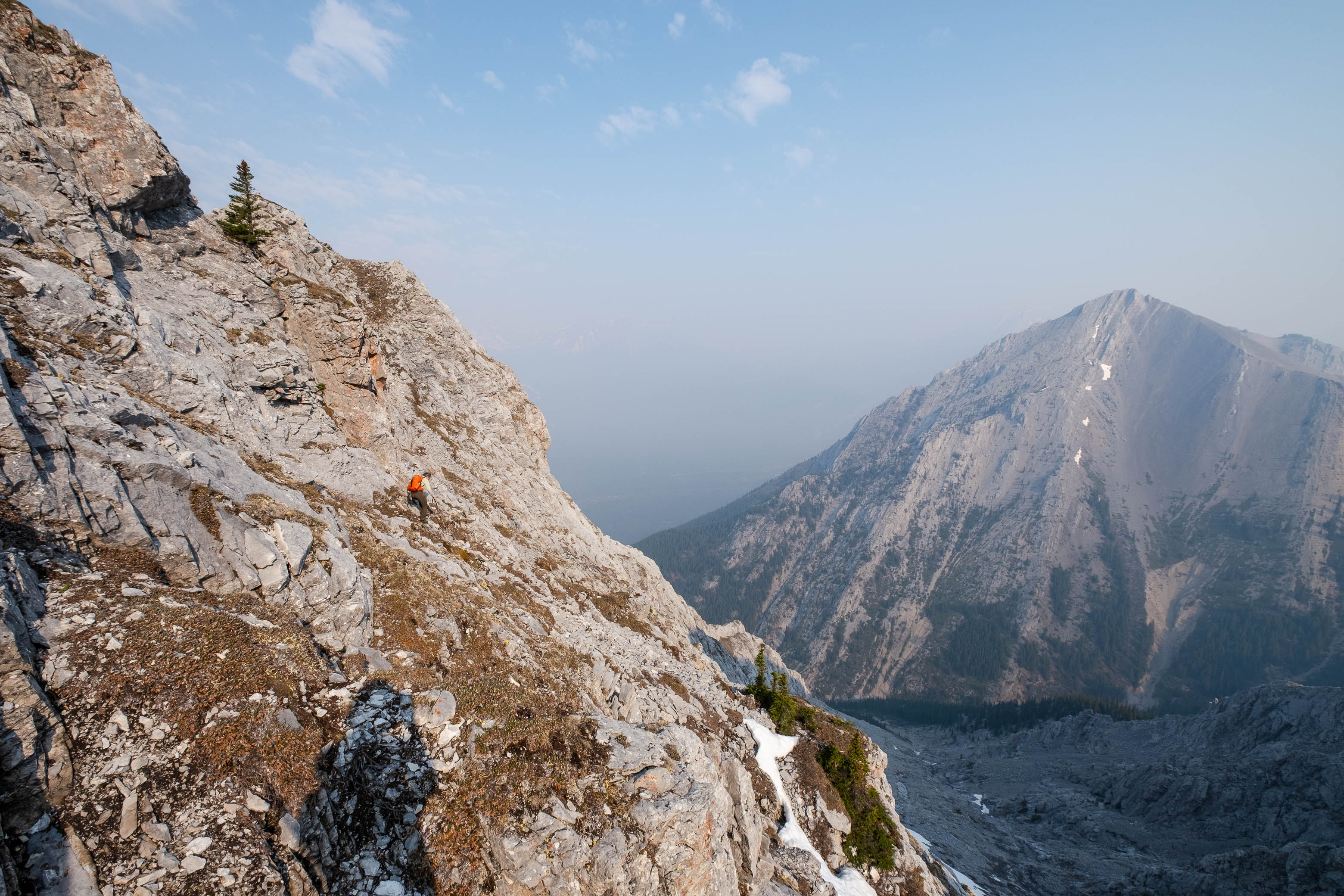
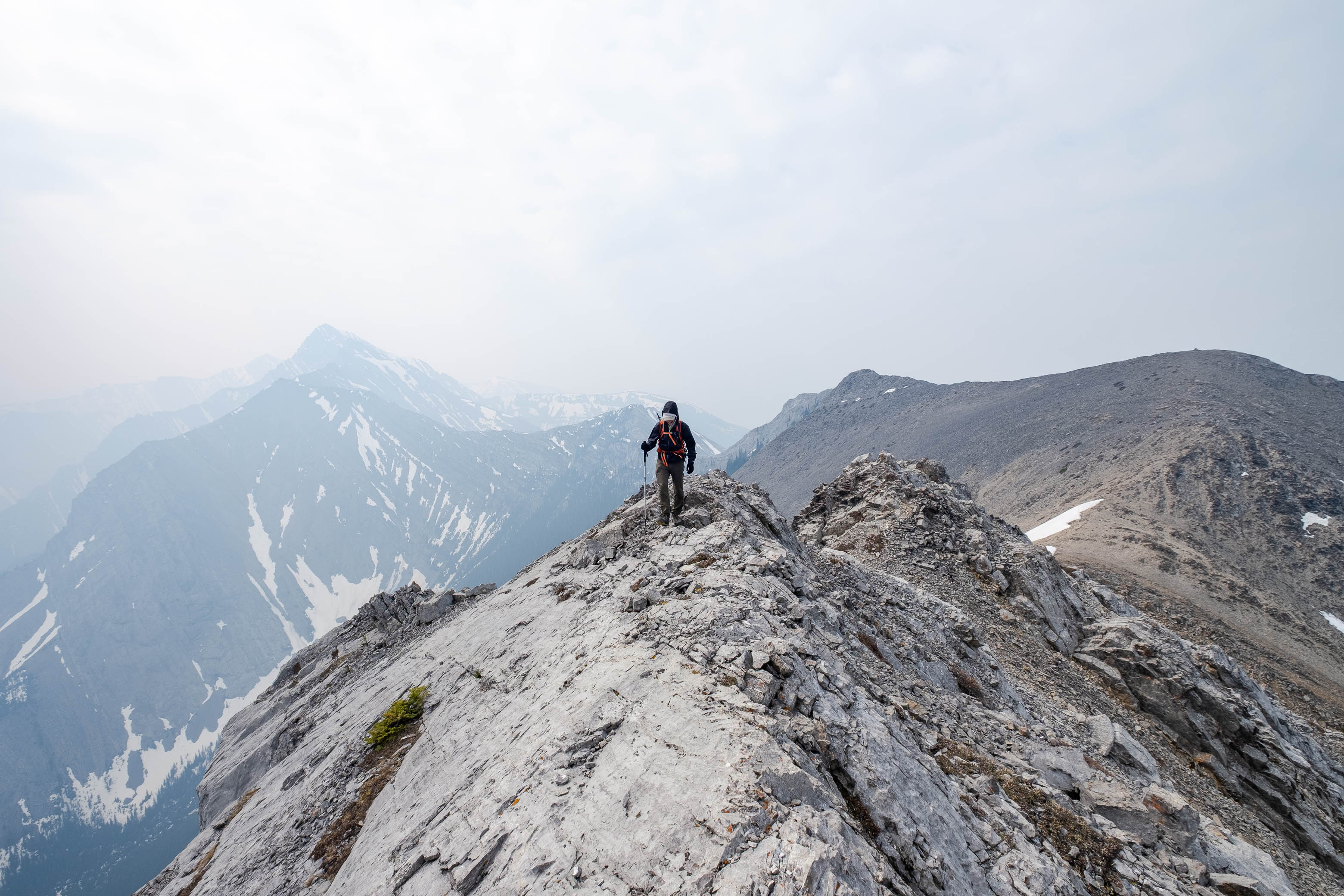
Wanting to make sure we hit the actual summit, we had some testing to do! After first making a short traverse to the next highpoint down the ridge to the south (same height), we then dropped down to the col to the east and easily scrambled up the highpoint on the opposite side, where we finally found that short exposed step that I mentioned! Being dry, it didn't cause us any problems, but I can definitely see it becoming a bit of a doozy to cross when it's covered with snow!
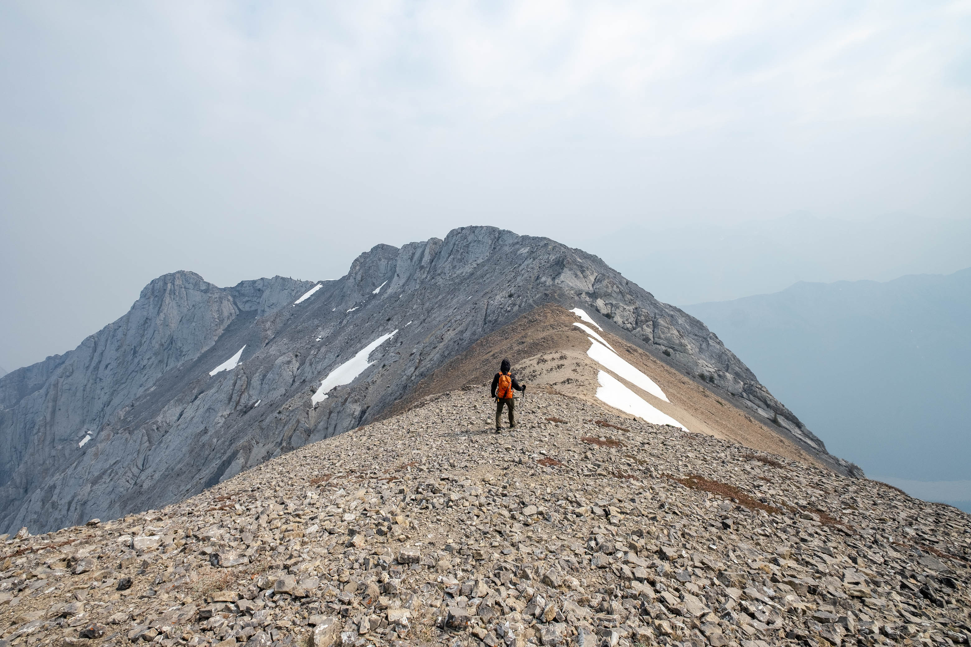
This peak read 6 meters higher than the other two, which means that it is indeed the true summit of Kananaskis Peak, and that some "dummy" did move the register from Kananaskis Peak to an unnamed peak! 😂
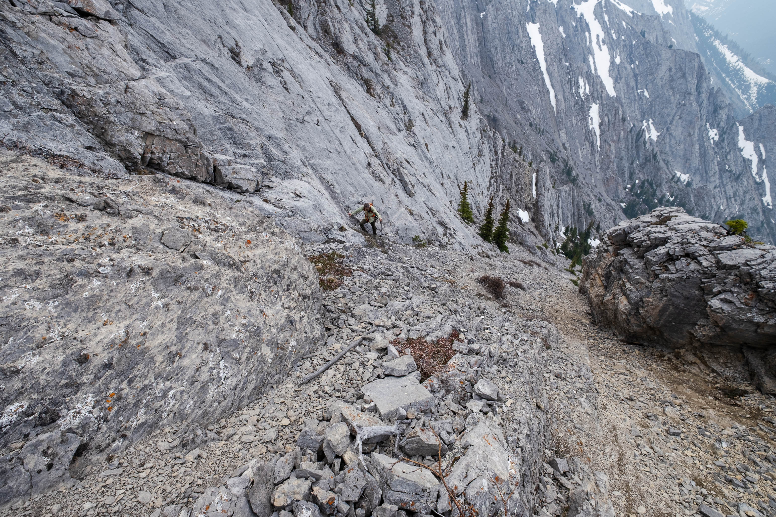
With that settled (although the GPS on my phone is nowhere near military grade, so who really knows...), we dropped back down to the col to take a different one of Kananaskis Peak's many routes down! A wide scree gully leads directly from the col right back down to the creek, and is probably the best route off the mountain. Most of the scree is great for scree skiing, and we were back down, and boulder hopping our way down the creek in no time, soon rejoining with familiar terrain and retracing our steps back down to the highway (well, aside from our convoluted approach route that is...).
While I can't speak to the views on this one, it's a fun little scramble even without them! Whichever route you take, I'd highly recommend doing some form of a traverse and taking a different route down to add some variety to your day and experience all this mountain has to offer!
Photo Gallery
Disclaimer