Date: July 27, 2022
Location/Route Map: Yoho
Elevation: 1894 m
Elevation Gain: 370 m
Distance: 8.4 km
Rating: Class 4 - Difficult
Notes: If on route, Narao Peak should only be a moderate scramble. Take this report as what not to do!
GPS Track: Download
After a relatively big adventure the previous day - completing a loop of Redoubt Mountain, followed by ascending Wolverine Ridge's southwest face in search of my dad's lost ski - I made the ill-advised decision to take my dad up Narao Peak the next morning...While the ascent could have likely still been a success, we were lured into taking a dangerous short-cut that didn't pan out. The mental strain from this difficult terrain, along with the thousands of blood-thirsty mosquitoes, constantly buzzing around our heads, ultimately pushed my dad a little too far, and he started back down the mountain :(.
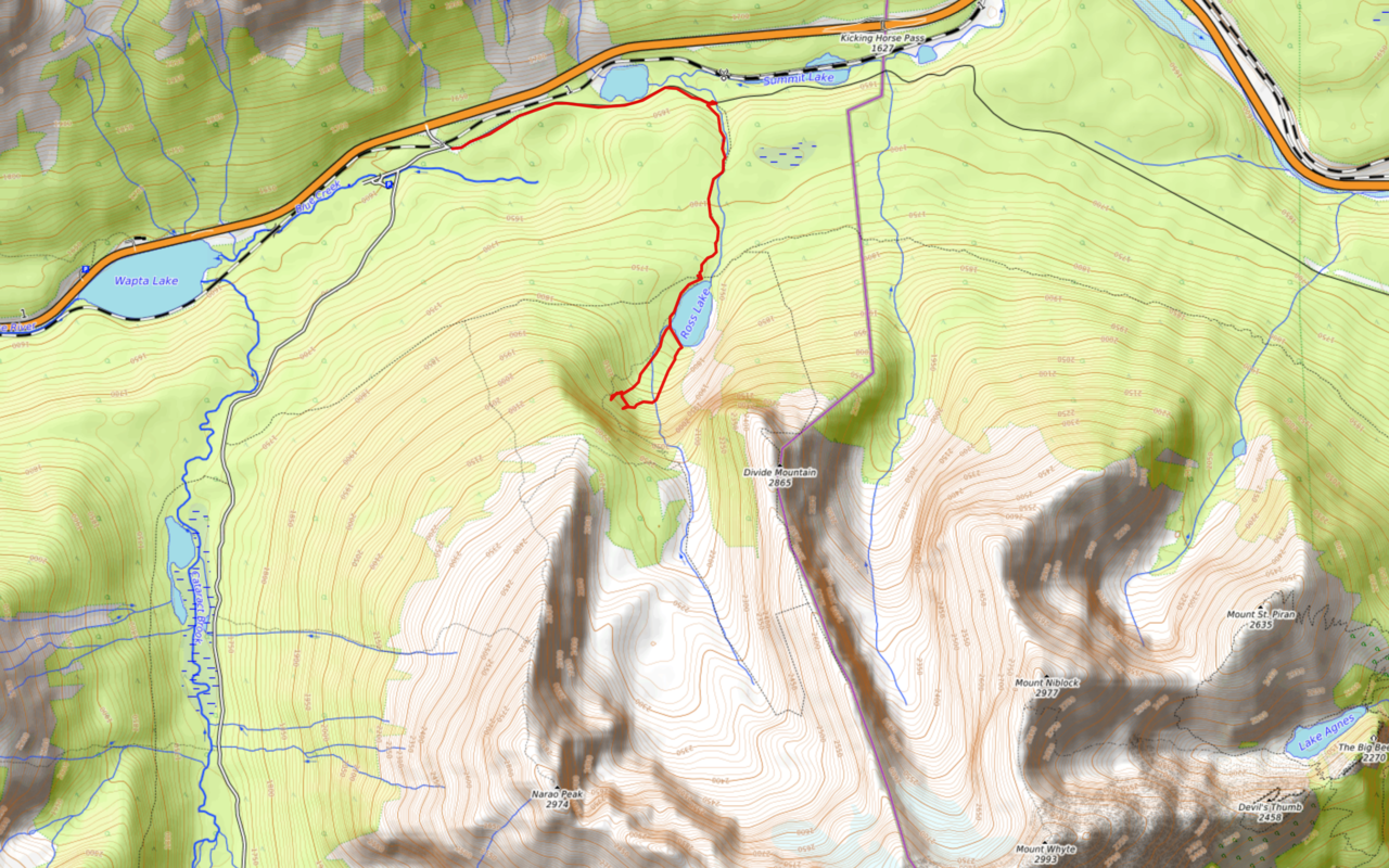
Narao Peak Attempt Route Map (see link in desciption - or click here - for interactive version).
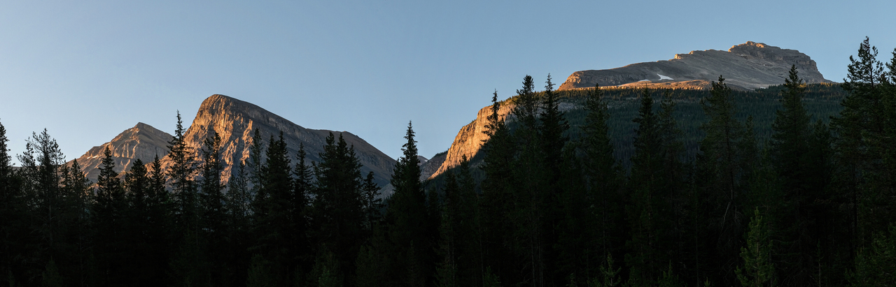
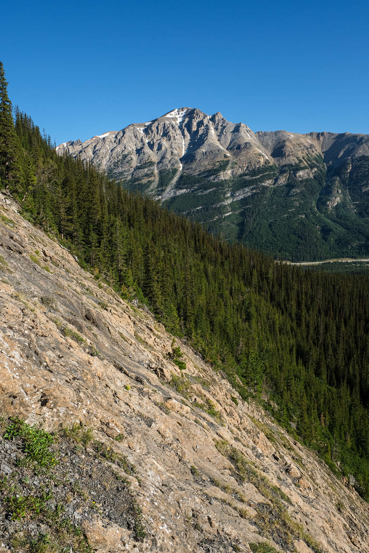
Morning view of Niblock, Divide, and our objective, Narao Peak, from the blockade (closing off the Old Highway 1A), where we parked.
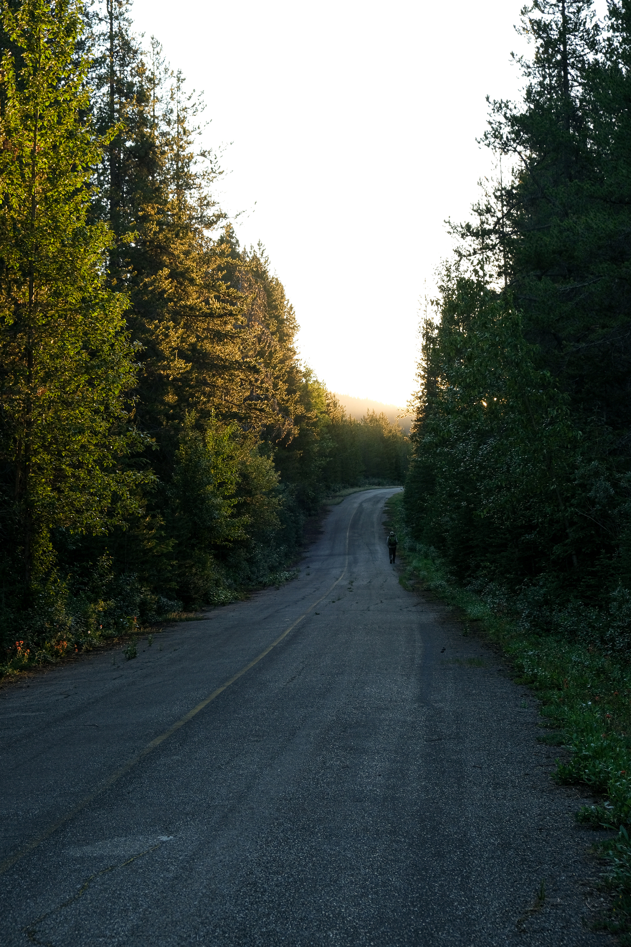
Starting down the old Highway 1A for about 1.8km to the Ross Lake trailhead.

Nature is taking over!
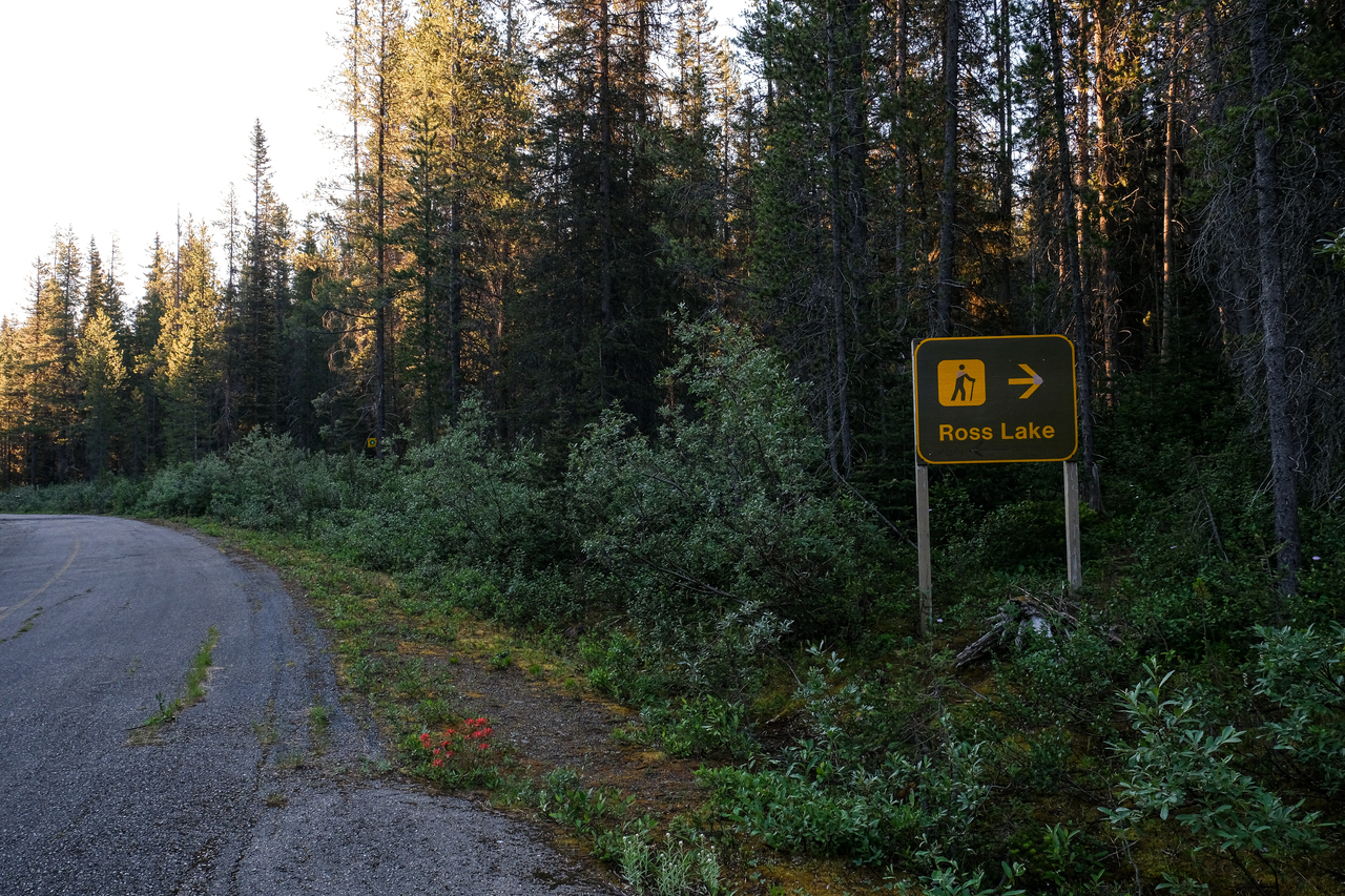
Ross Lake, next exit! These closed off highways have such a weird feeling to them. All the signs of human interference are still present, but with them there's this eerie feeling of desertedness...Going off Kane's description to "follow the signed hiking trail up to Ross Lake, just moments past a large billboard-sized sign", we passed this sign, and immediately started looking for a trail leading into the forest.
Obviously Kane's and my description of "moments" don't quite match, and after peering into the forest, looking for any signs of a trail, we eventually found ourselves back at the billboard-sized sign, starting up a minor "trail" immediately beside it. It turns out that this "trail" was likely made by others, confused like us, and barely took us 50 meters before we were on our own in the bush...(As we found out on return, the trailhead is extremely obvious, and you just have to continue down the road until you reach it...oops)

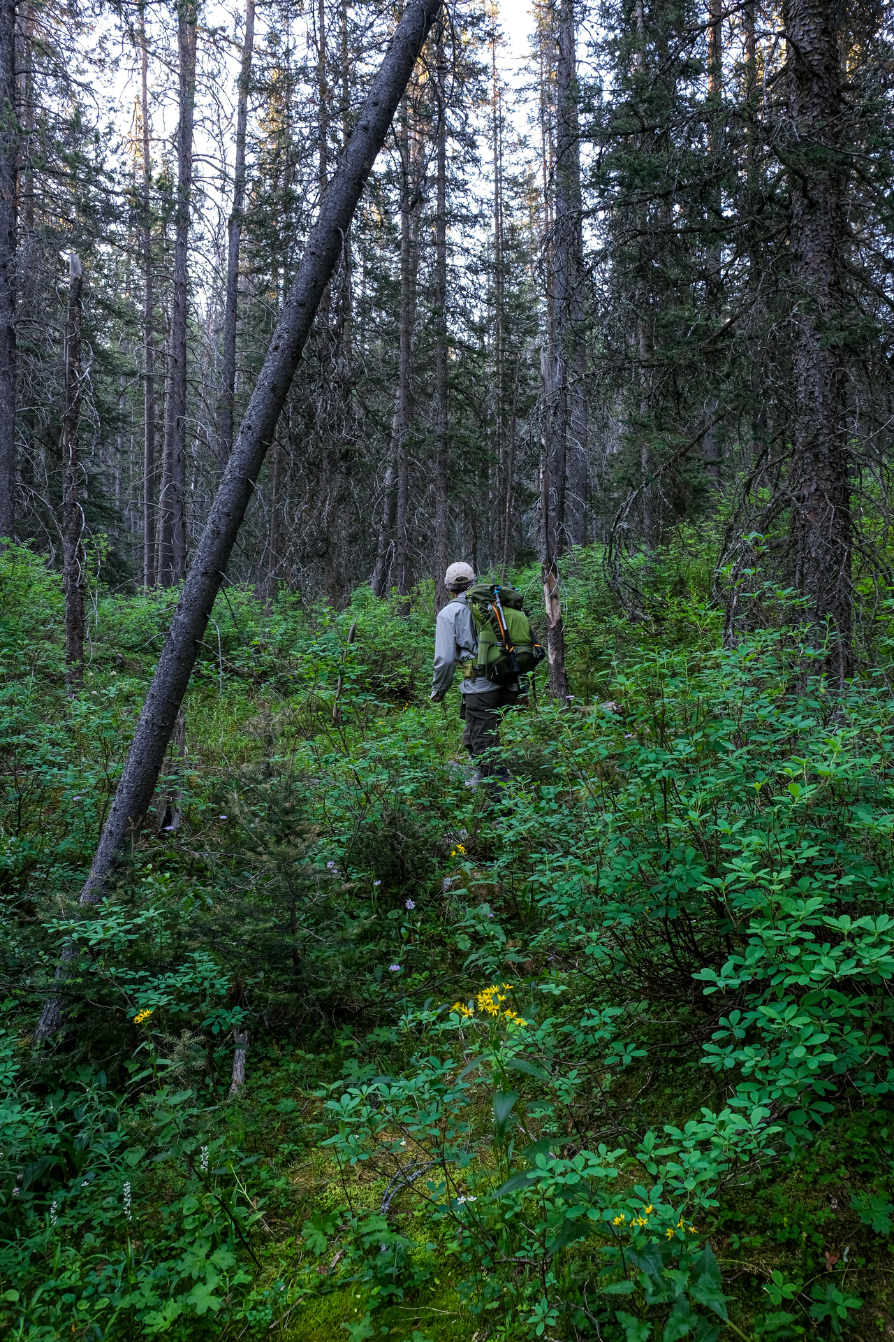
Being the geniuses that we are, we simply accepted that maybe with the road being closed (and with nature starting to take over), that the trail that once existed was also no more. That theory was soon scrapped however, as after bushwhacking for about 400m on the right side of the creek, we noticed an extremely welcoming trail on the opposite side...🤦♂️
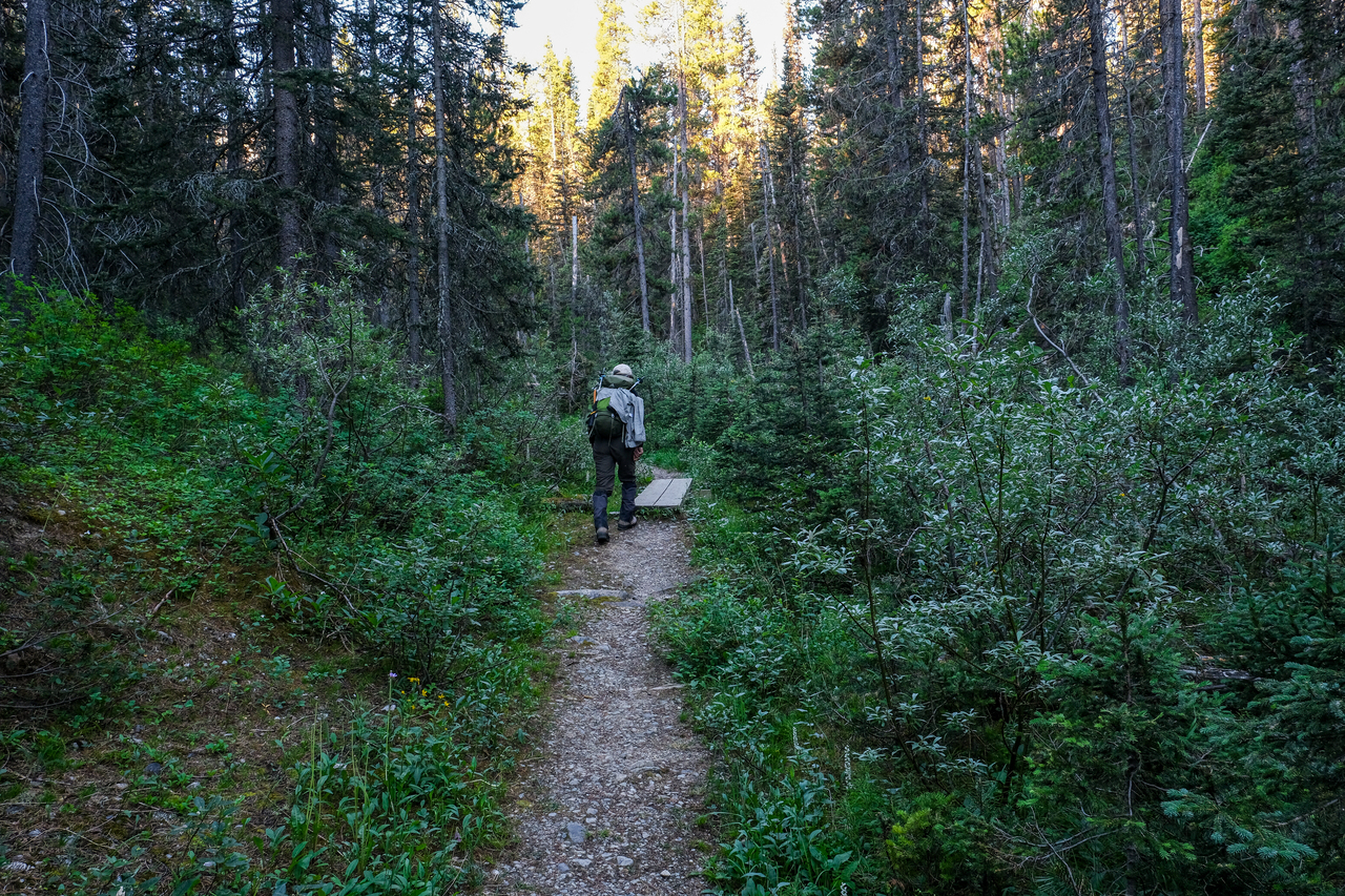
What a nice trail! Would be a shame if we didn't use it 😂.
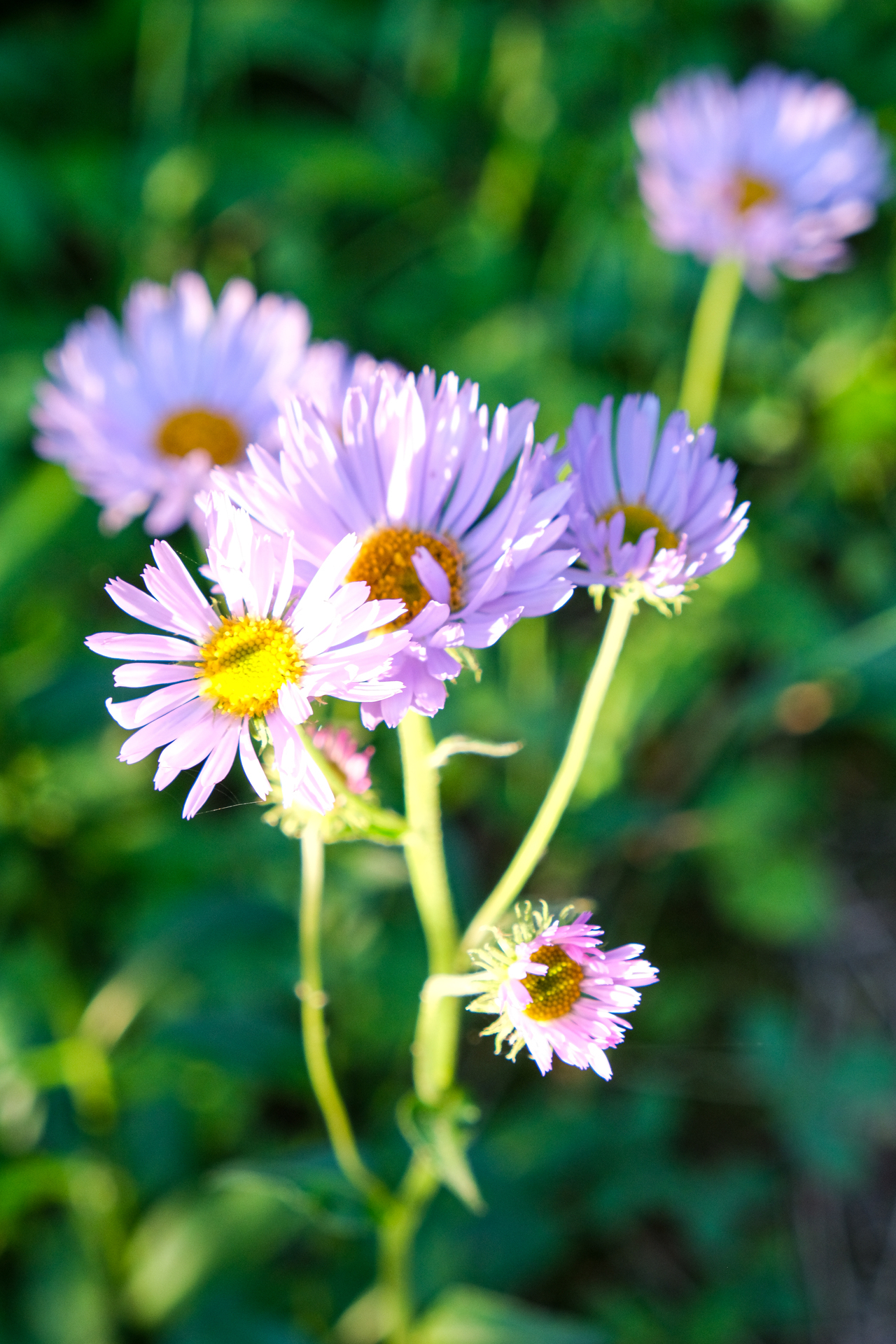
Beautiful morning sunlight illuminates some wild, purple daisies as we near the shores of Ross Lake.
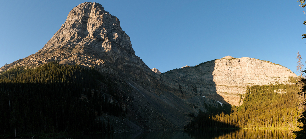
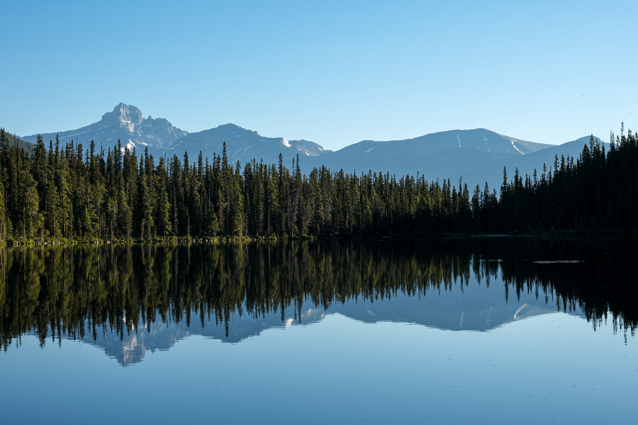
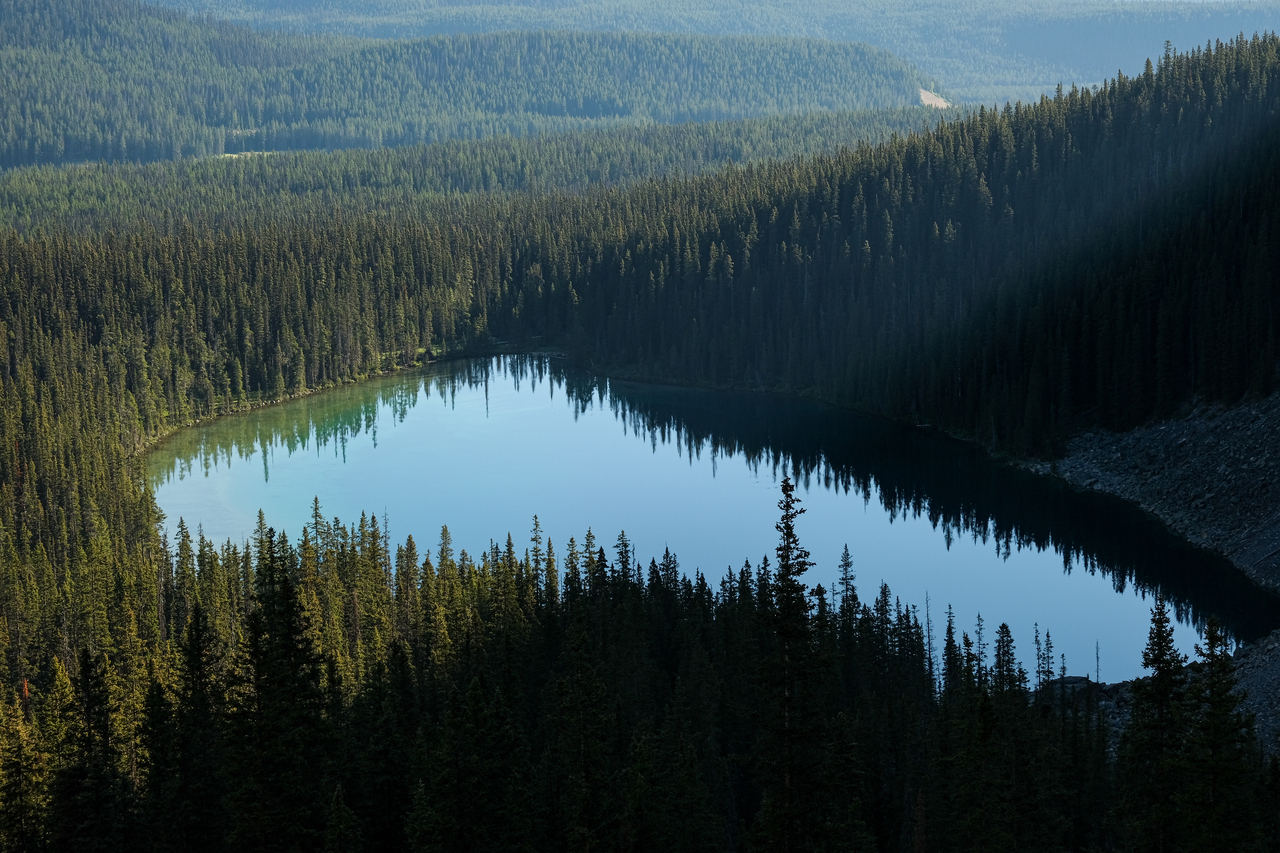
Divide Mountain towers over the eastern shores of Ross Lake, with the headwall we'll have to ascend rising beyond the far southern end.
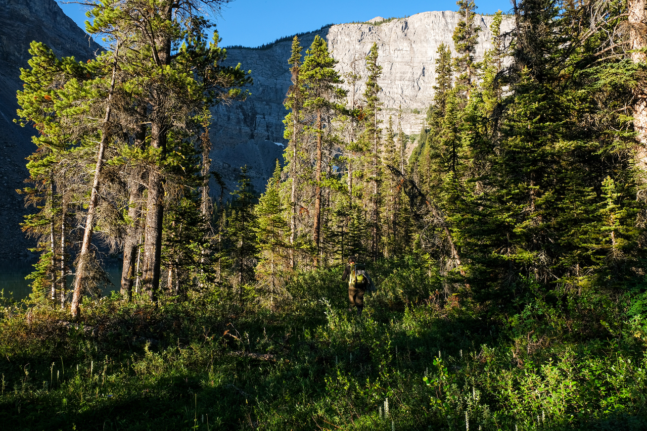
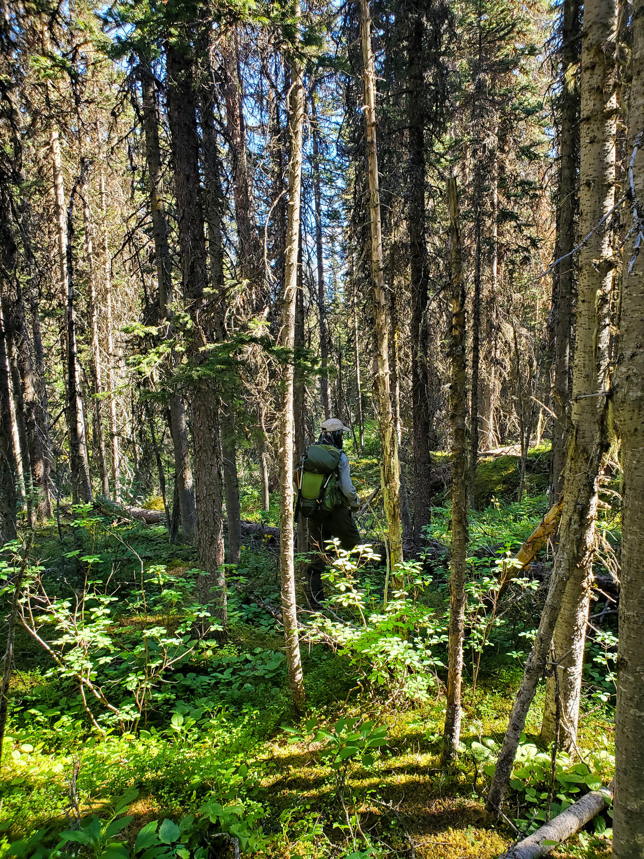
Starting through the bushy marshland on the western shores of Ross Lake. We found a couple animal trails here and there that made travel easier, but the main battle was against the vicious swarms of mosquitoes that wouldn't ease off until we were back down to the old Highway 1A a few hours later...
Nope, that's not a dirty lens...All those dots are freaking mosquitoes!
Another look up to Divide Mountain, as we come around to the far side of the lake.
Same lake, opposite side :)!

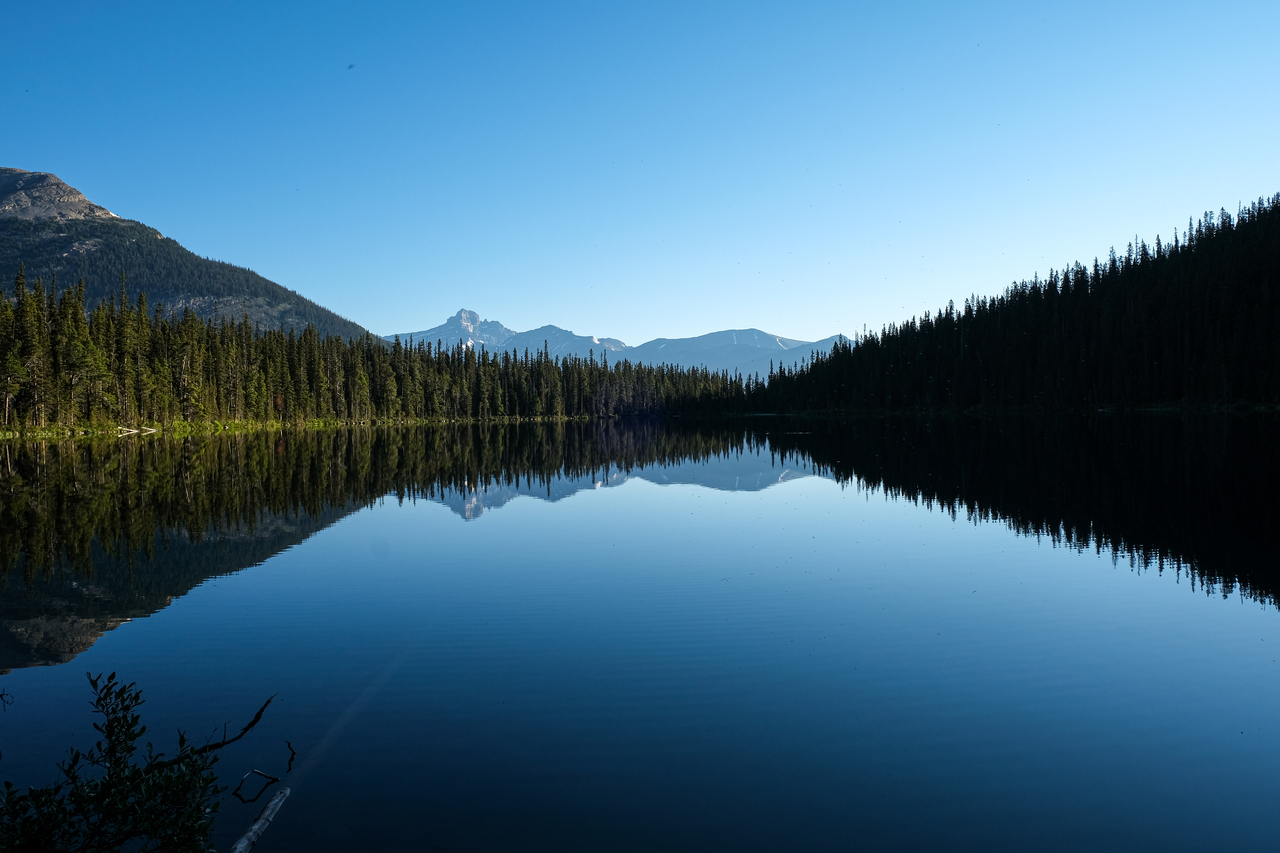
Mount Hector sees its reflection in the calm waters.
Mount Hector, Hector South Peak, and Hector South Ridge. All ski objectives, but their difficulty varies significantly!
We continued around the lake until we reached a bouldery drainage that helped to minimize the whacking of bushes.
The terrain soon opened up.
Not wanting to gain elevation that we'd only have to lose, we thought we'd make a diagonal traverse straight to the far-right side of the headwall...Bad idea! We soon encountered some extremely dense bush, and this, combined with the constant pestering of mosquitoes while on non-ankle-friendly terrain quickly started to take it's toll. We soon reached our sufferfest limit, and ended up ascending straight up to the base of the headwall after all. (Should've just done that in the first place!)
Looking back to Ross Lake.
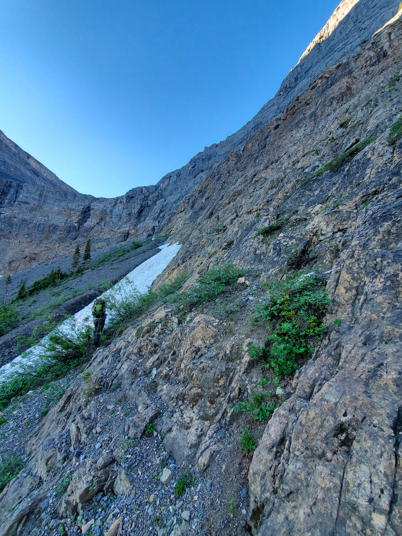
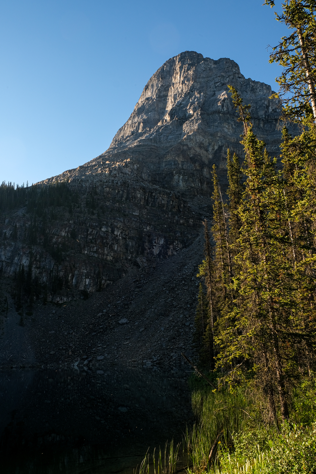
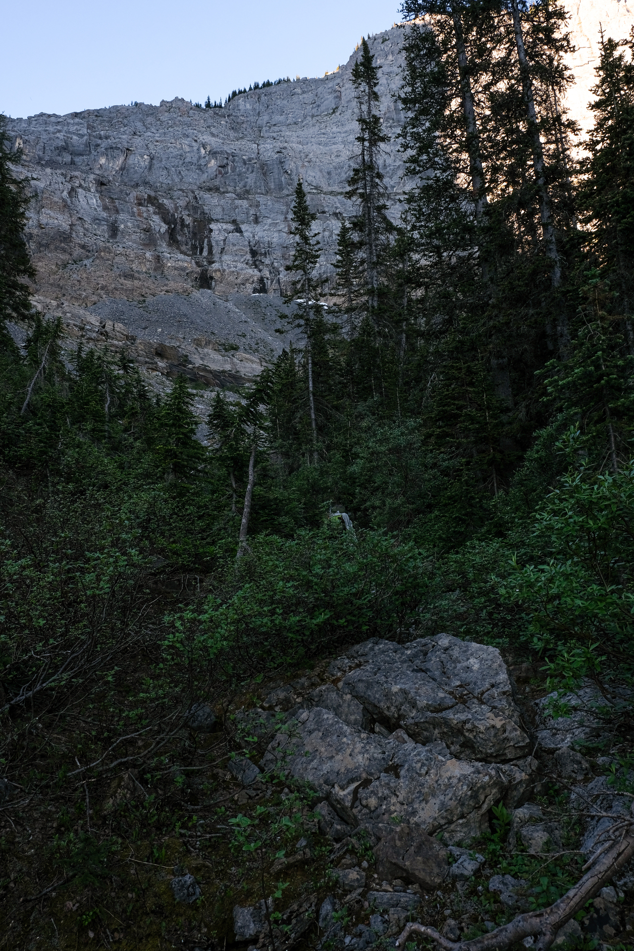
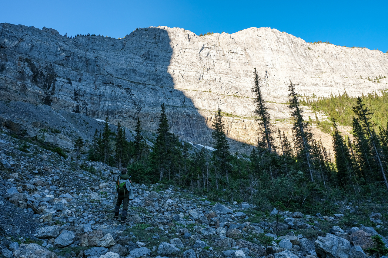
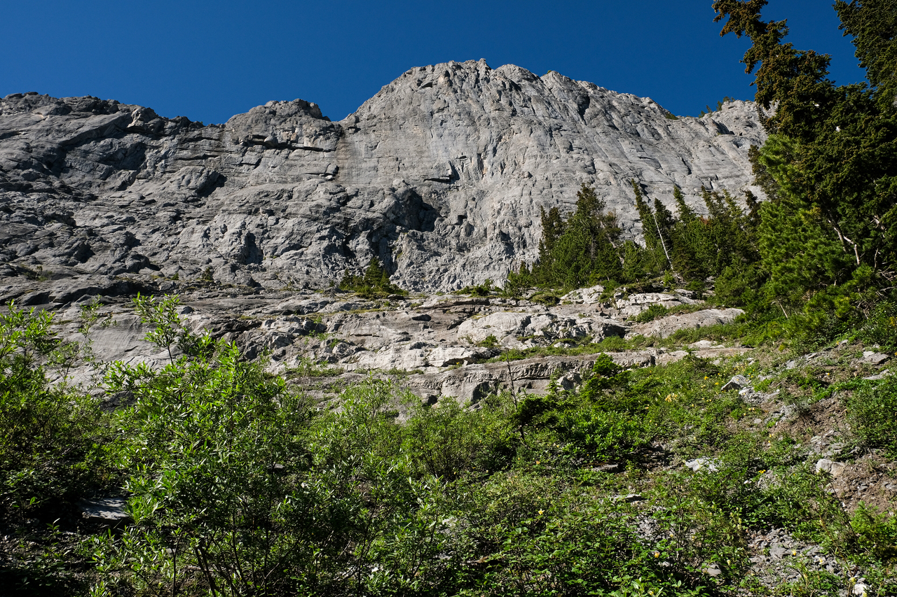
Once we arrived at the headwall, we'd both already had our fill of sidehilling. (Mosquitoes tend to decrease one's tolerance for such things...) We stared up at the rock face, noting multiple ledges and big holds, and wondered why we couldn't just scramble straight up here! While the only beta I had, was of a route on the far side of the headwall, the mosquitoes were enough to drive one insane, so we started up the face with the logic that we'd escape the mosquitoes faster if we just started climbing (Spoiler alert: this did not work 😑).

Starting up the initially enjoyable face...
A new angle across to Divide Mountain, as we quickly gained elevation.
The valley drops out from below us, as we continue up the ever-steepening face.
Looking across the slope. Mount Bosworth rises in the distance.
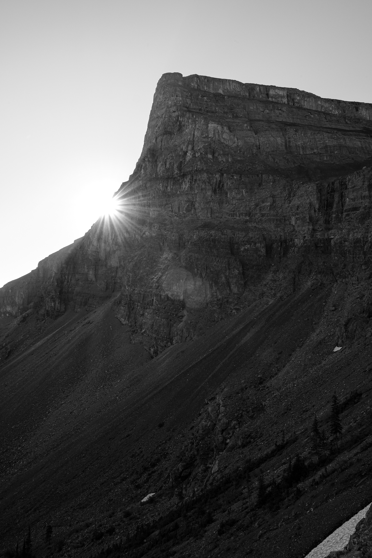
Woah, hello sun :).
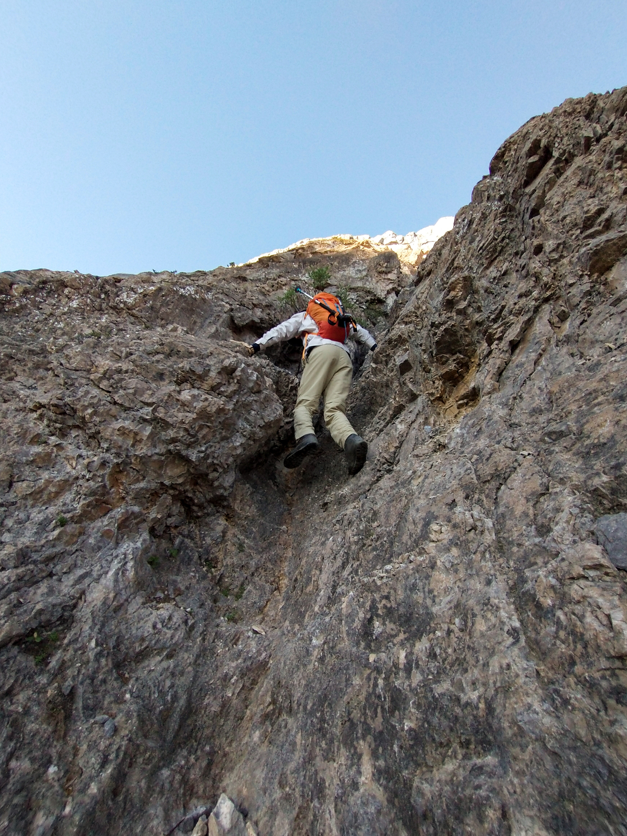
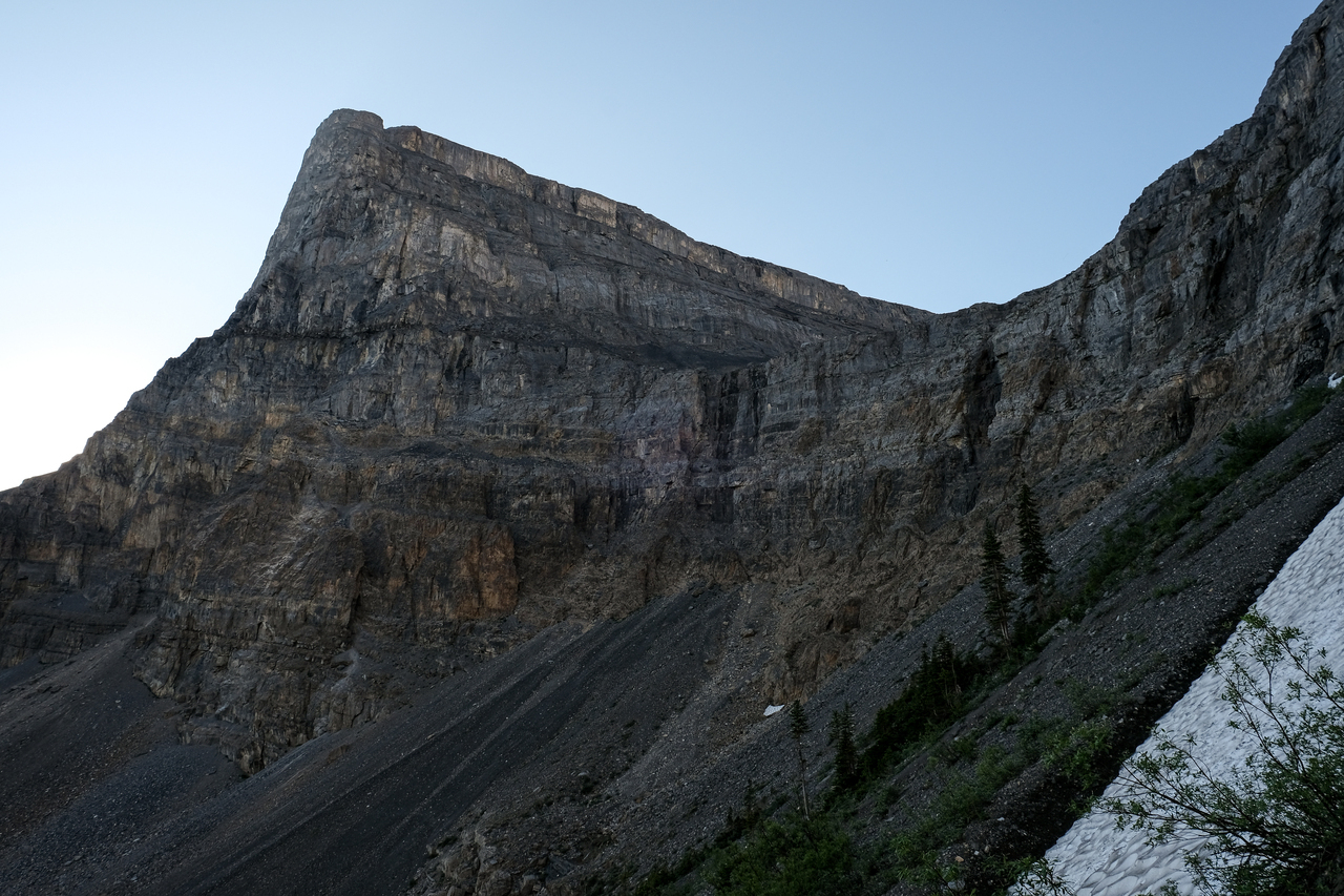
While the face appeared to be a nice, moderate scramble from below (and it did start out that way!), the terrain became increasingly technical as we climbed, with moves that required full commitment and left no room for error...Route-finding was definitely a challenge, and we were often forced to back off from certain routes (like the one I attempt here), and re-evaluate. Photo credit: Dad
Steep, slabby stuff! Even if this angle doesn't do it justice ¯\_(ツ)_/¯.
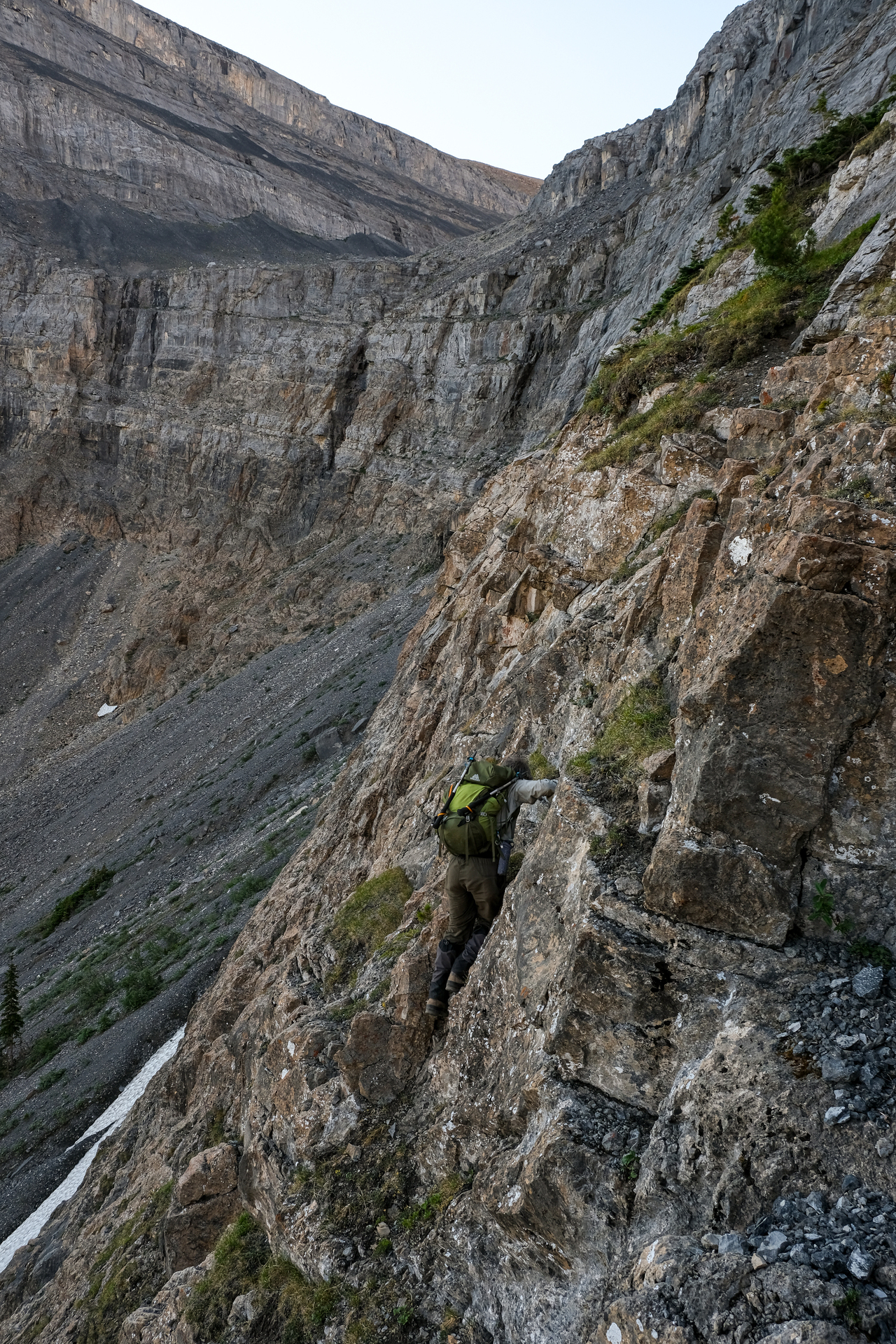
YIKES! An accurate representation of the severity of the terrain we got ourselves into! At this point we were only about 10 meters below a broad ledge, from which we could then (hopefully) traverse to where we were supposed to be. Being so close actually turned out to be a bad thing, because with "up" being the shortest distance to safer ground, we were lured into climbing some risky steps, just wanting to get off the face ASAP! My dad and I were on slightly different routes at this point, both of which would hit a dead end...For my route, I remember thinking that the ledge was within my grasp, as I made the dumb descision to climb up a step that would have been downright terrifying to downclimb, only to arrive at a blank, 3m high slab right at the cusp of the ledge. There was no route through whatsoever 😐. My dad, on the other hand, appeared as if he was going to make it, but was foiled by a loose gully providing nothing in terms of solid footing. I watched as he put a bit of weight on it, only to see dozens of rocks come cascading down the face. We had no choice but to downclimb everything we just came up 😔.
While I massively lucked out, and was able to find an easier (but still difficult) route down the final step I climbed, the descent was even more mentally taxing than the climb, and it was a relief when we finally got off that face once and for all! You know the terrain is difficult when taking pictures is the absolute last thing on your mind! (It's worth noting that the mosquitoes were by our side for the entirety of this endeavour...)
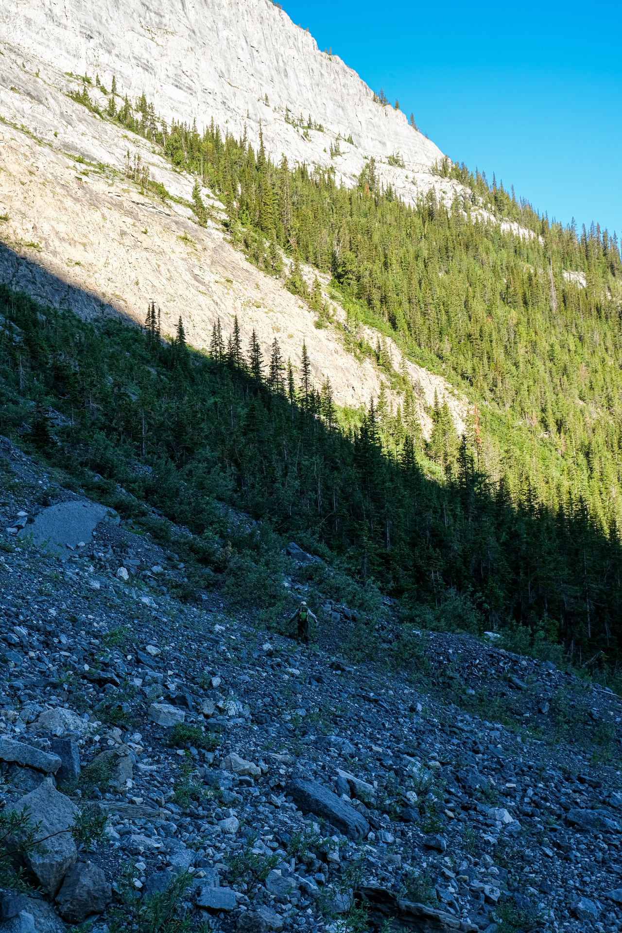
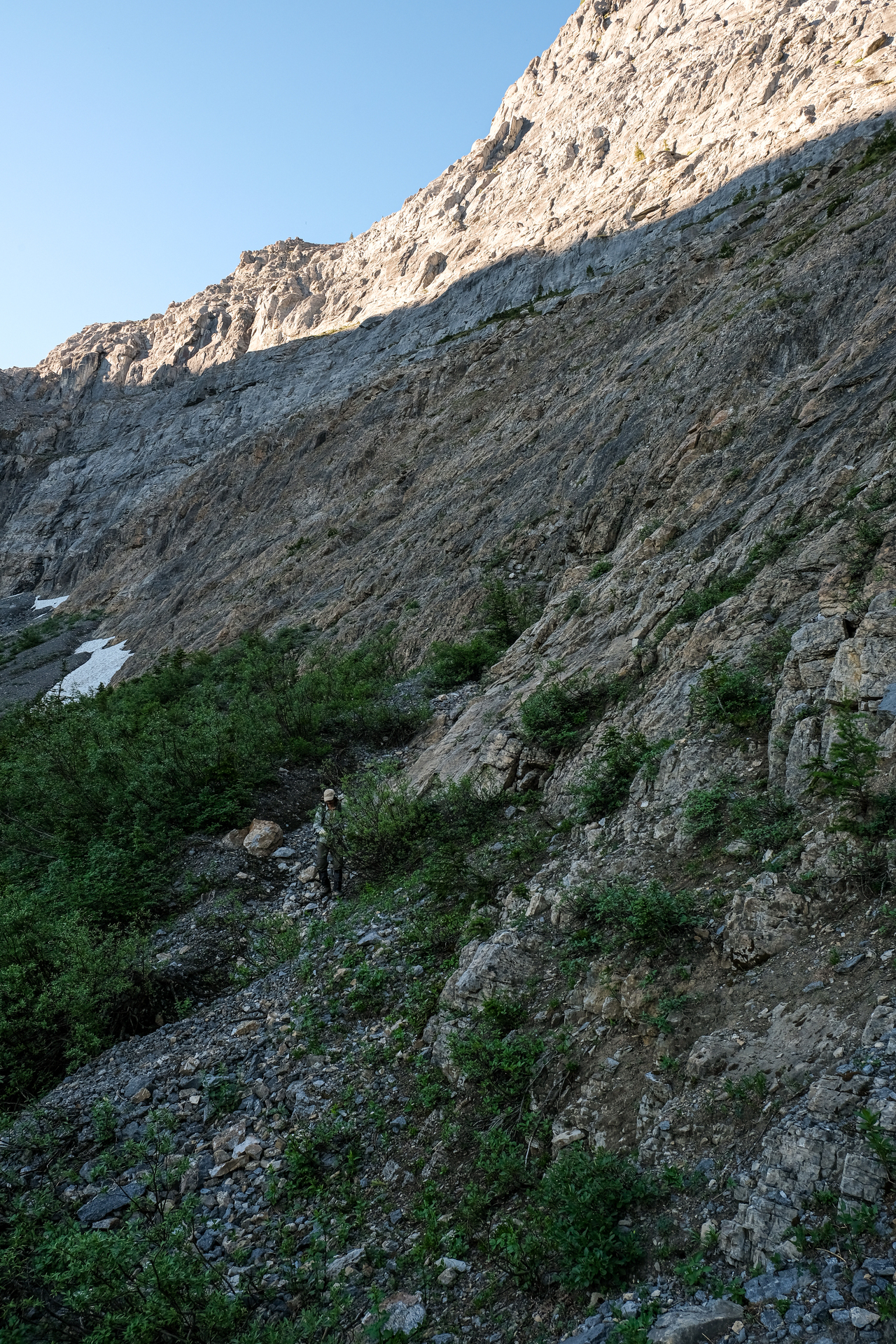
While it was extremely deflating to have wasted over an hour, with nothing to show for it, I was able to put that behind me (kind of) and led the traverse along the base of the headwall. It didn't take long to arrive at far-easier terrain along the treeline, and I immediately regretted not just sticking to this route in the first place.
It quickly became apparent that my dad was not nearly as game to continue the ascent as I was, falling far behind, and muttering angrily about the constant buzzing around his head. While I tried to urge him to continue, hoping that reaching the beautiful upper valley would lift his spirits, his frustration eventually boiled over, and he stormed back down the mountain.
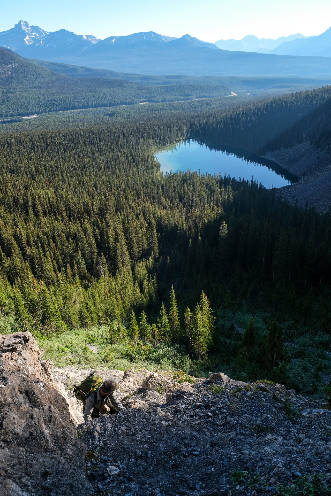
Looking up from where my dad called it a day. We were almost at the ledge. While it was extremely difficult to bring myself to follow him back down (after now ascending this "section" twice!!), I didn't really have much of a choice :(. He later explained that it was a combination of mental fatigue, the relentless mosquitoes, and sore feet from the previous day, that were collectively just too much to handle while scrambling up a mountain.
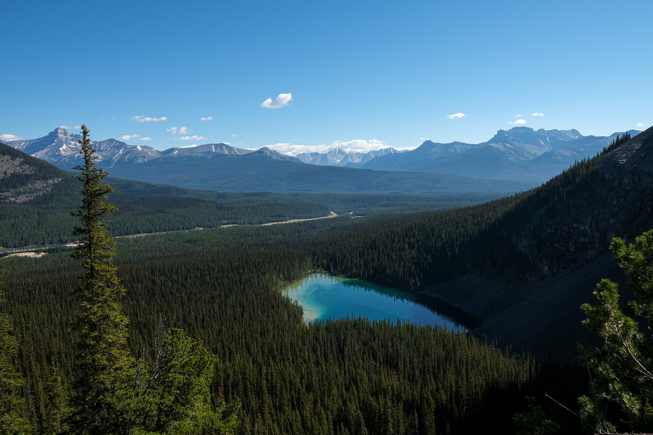
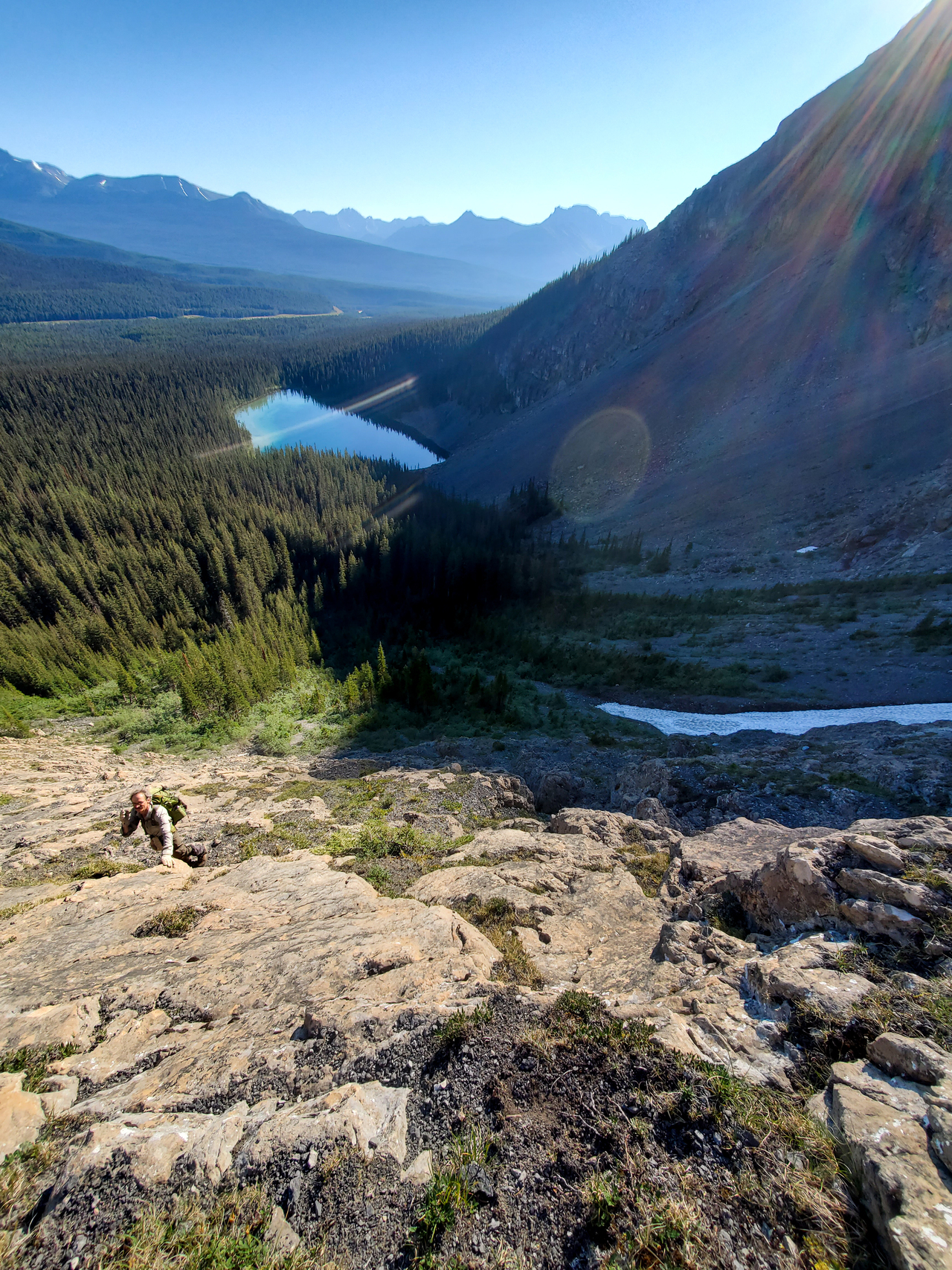
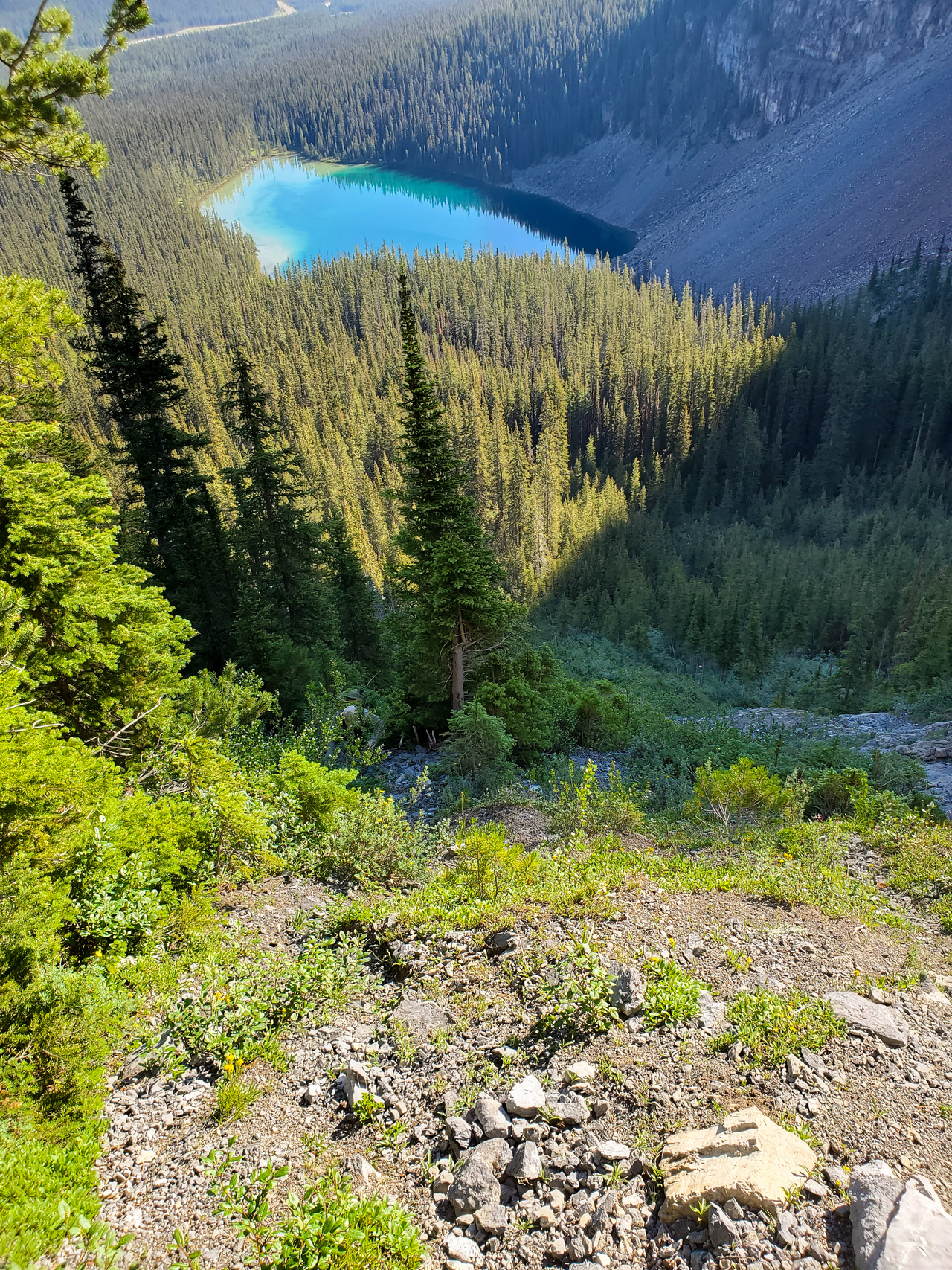
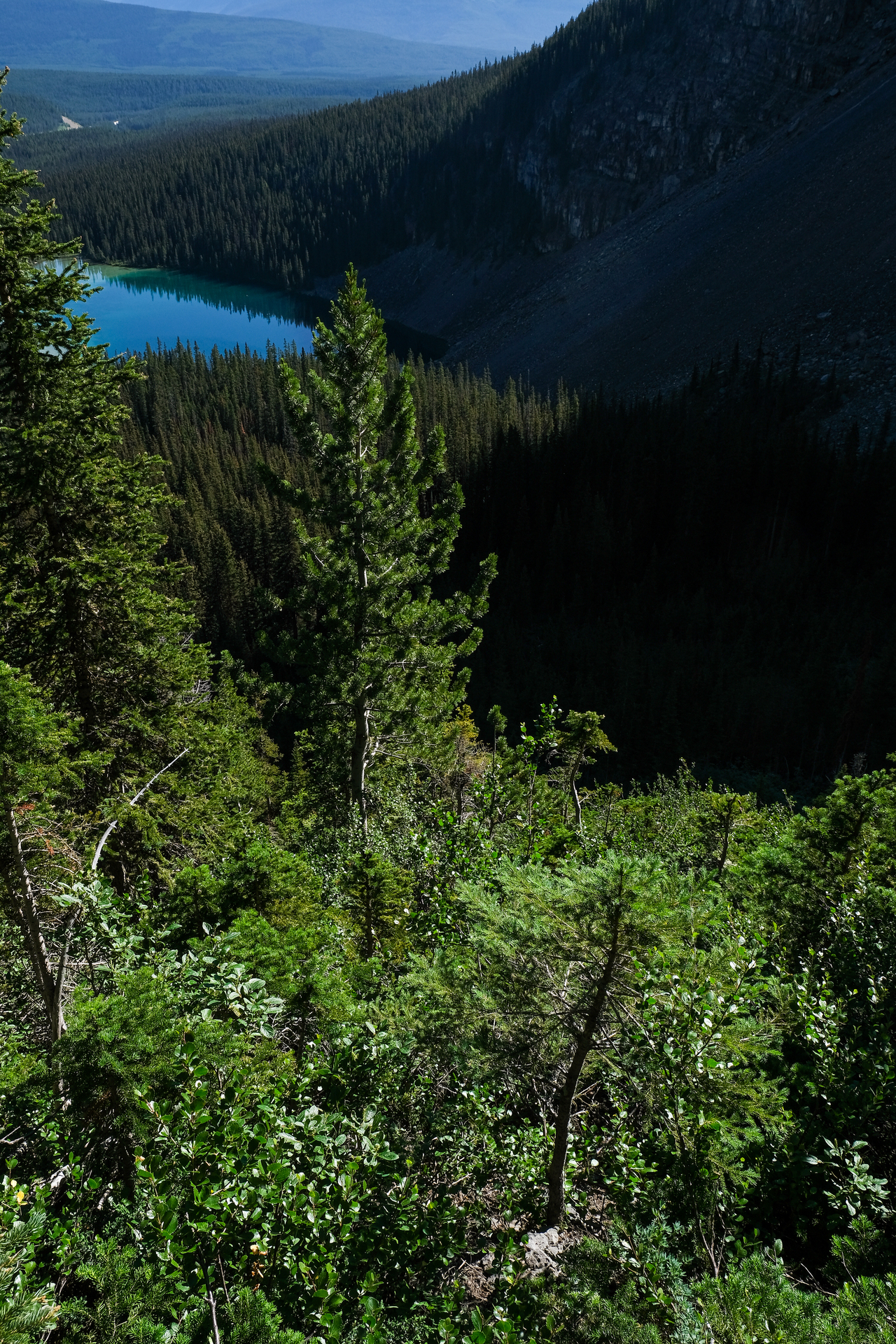
Views from the highest point we would reach on this day: 1894 m.
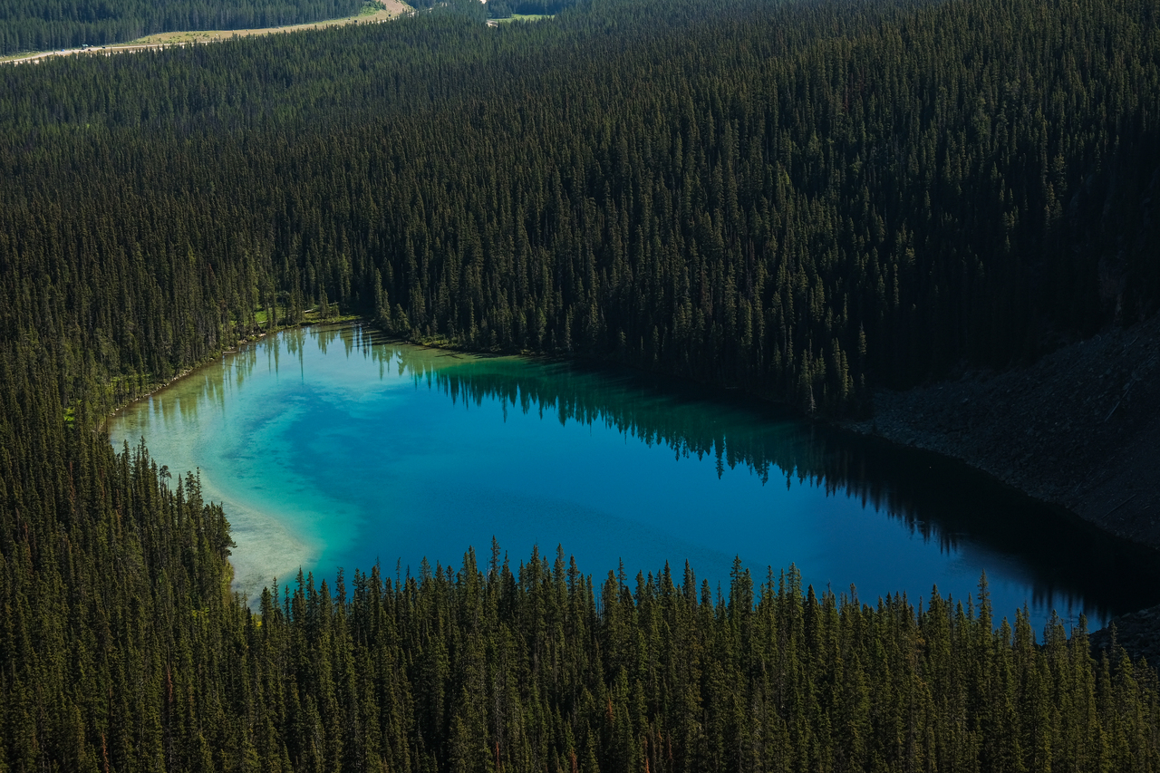
Zooming-in to the beautiful shades of blue in Ross Lake, now far below.
To make matters worse, my dad also lost his bear spray (which we realized later), probably while forcing his way through this thick bush!
Neither of us were in the mood for talking, so we made the descent to the lake in silence. My dad led the way, and chose to take a direct line straight down to the lake, avoiding all the sidehilling. We started down a narrow drainage, directly below the headwall's correct ascent route, which soon gave way to bush. The bushwhacking was honestly not that bad, and I will probably take this route when I make a second attempt of this mountain.
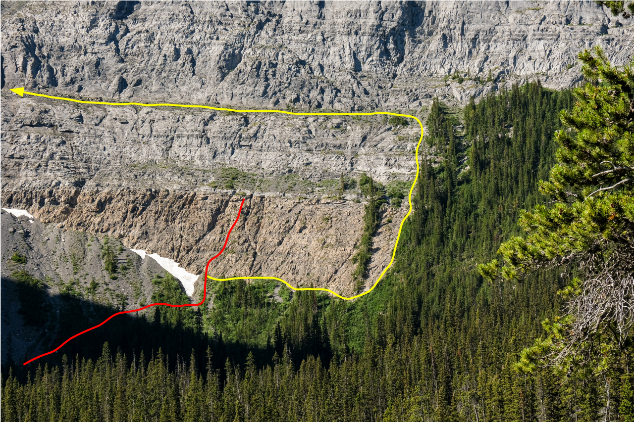
Looking back to our dumb route (red - approximate) and the correct route (yellow) up the headwall.
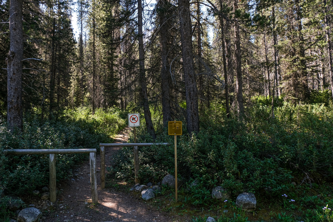
In case you were wondering, here's the super obvious trailhead for Ross Lake, as seen from the old Highway 1A...Don't randomly bushwhack like we did! 🤦♂️
Back to our car by 11am and on the road home. Now that's a lot of excitement in one morning! While this was nowhere near an ideal day in the mountains, it's important to take some positives away from the experience :). We spent the morning outdoors in the mountains (way better than being stuck in Edmonton!), got to visit the beautiful Ross Lake, and got some good practice route-finding in difficult terrain! While we made some mistakes (quite a few actually 😂), and a day never feels complete without reaching the summit, I am grateful for the experience and lessons learned and will definitely be back for take 2!
Disclaimer