Date: July 26, 2022
Location/Route Map: Skoki
Elevation: 2902 m
Elevation Gain: 1230 m (add 150 m for descending Kane's northwest ridge route)
Distance: 23.1 km (round trip including Wolverine Ridge)
Rating: Class 3 - Moderate
Notes: An easy to moderate ascent via the southwestern bowl. Completing a loop down Redoubt's north ridge requires some moderate downclimbing on solid rock.
GPS Track: Download
After a couple fun-filled weeks visiting my sister and exploring Vancouver Island, it was extremely hard to go back to pushing carts day after day after day after day at Superstore. After almost two years at the job, it was past the point of being monotonous, and I found myself in a very grouchy state...I didn't like where I was at and was feeling extremely unmotivated. It wasn't fun, so I decided to do something about it! I wanted to spend my days doing something I was actually passionate about, and was super excited when I came across a job posting at MEC! I put some time into applying, and got the job :)!! It's sooo refreshing to work with others who love the mountains as I do, and although it's a longer commute (30-40 minute bike vs 10 minute walk), it's well worth it! Anyways, a month passed, as I settled in, before we were able to venture to my beloved Rockies again. And when we did, it was a trip with a purpose (obviously to bag some peaks, but also to retrieve a lost ski!!). That's right! Back at the beginning of January, my dad lost his ski off the south face of Wolverine Ridge (see trip report here for the details...), and since avalanches were no longer a concern, it was time to launch a search and rescue mission! We're coming ski!! With that being said, there was no way I was trekking up that approach road for the third time without nabbing a new summit while in the area...So Redoubt Mountain it was ;)!
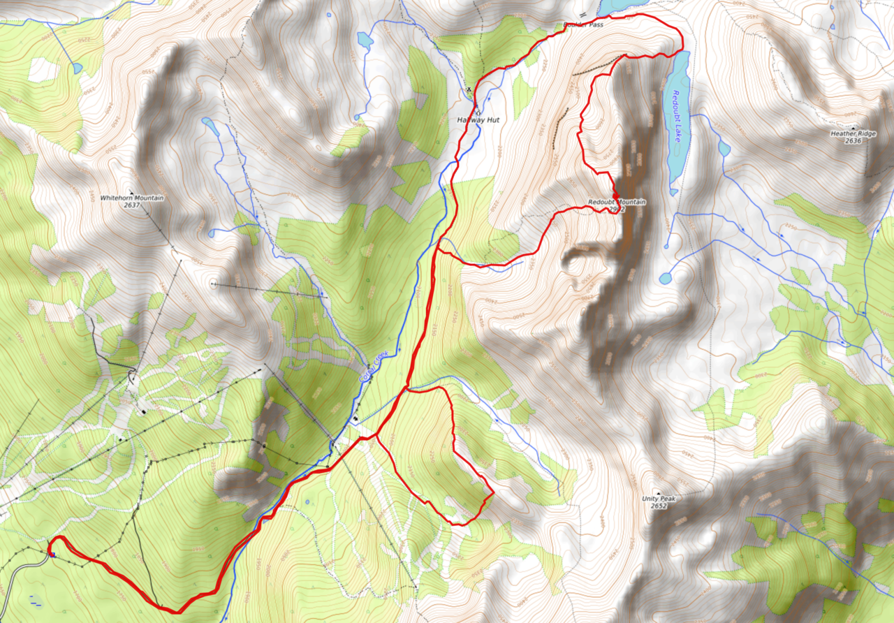
Redoubt Mountain Route Map (see link in desciption - or click here - for interactive version).
Yup, the Temple Lodge access road is just as long and boring as the last two times! I passed the time by searching for wildflowers :).
Wowie! Haven't seen these before.
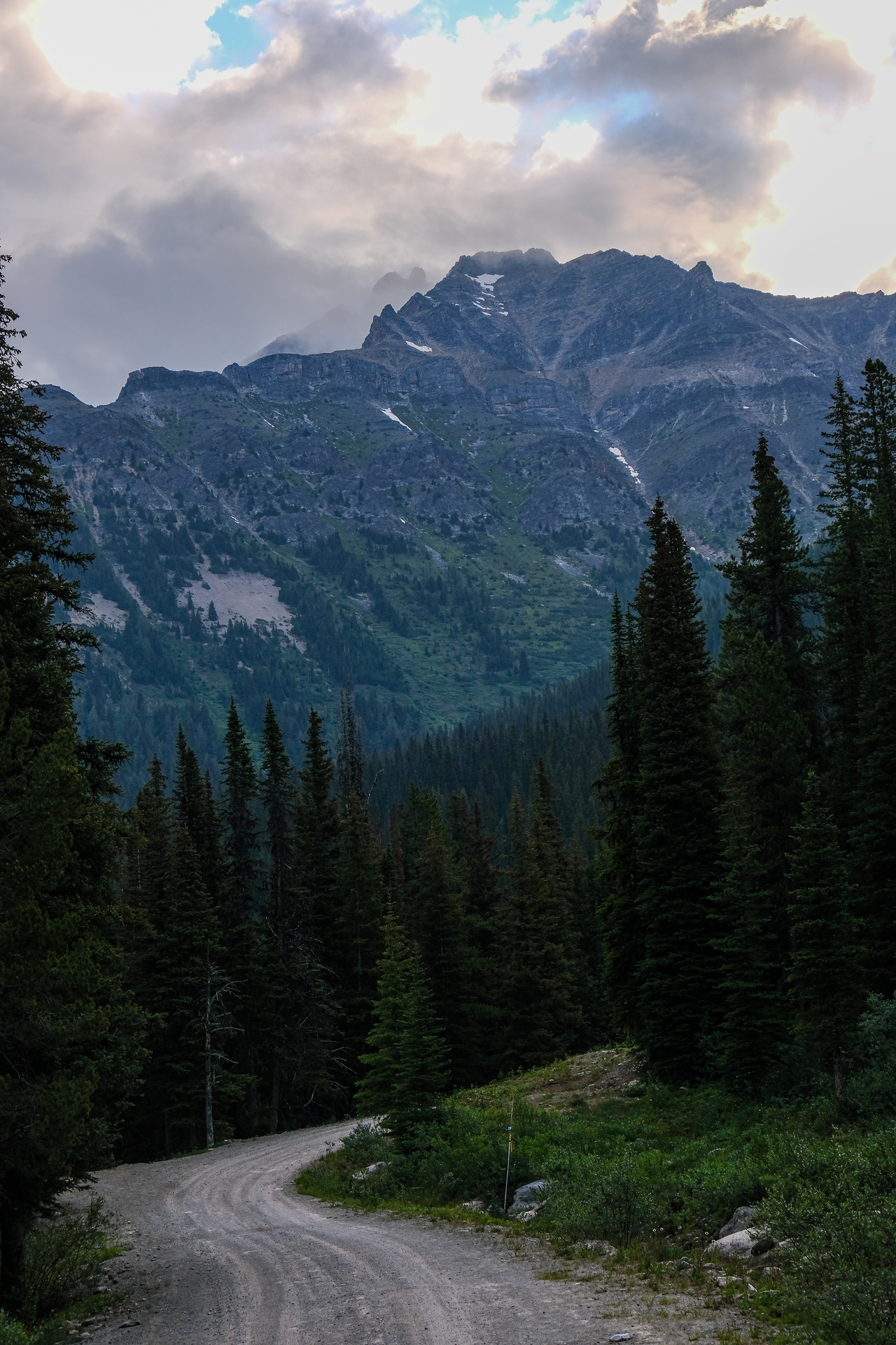
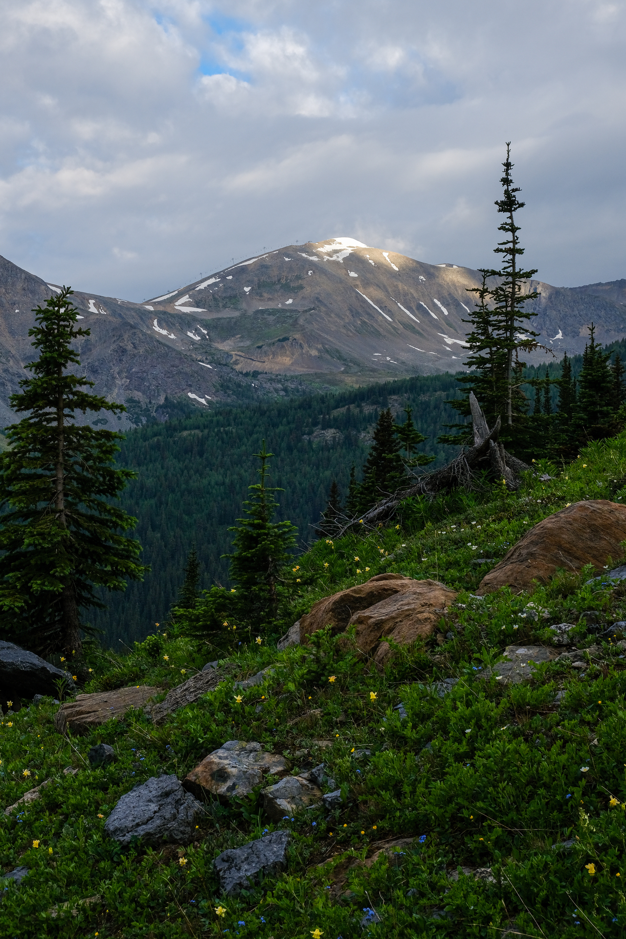
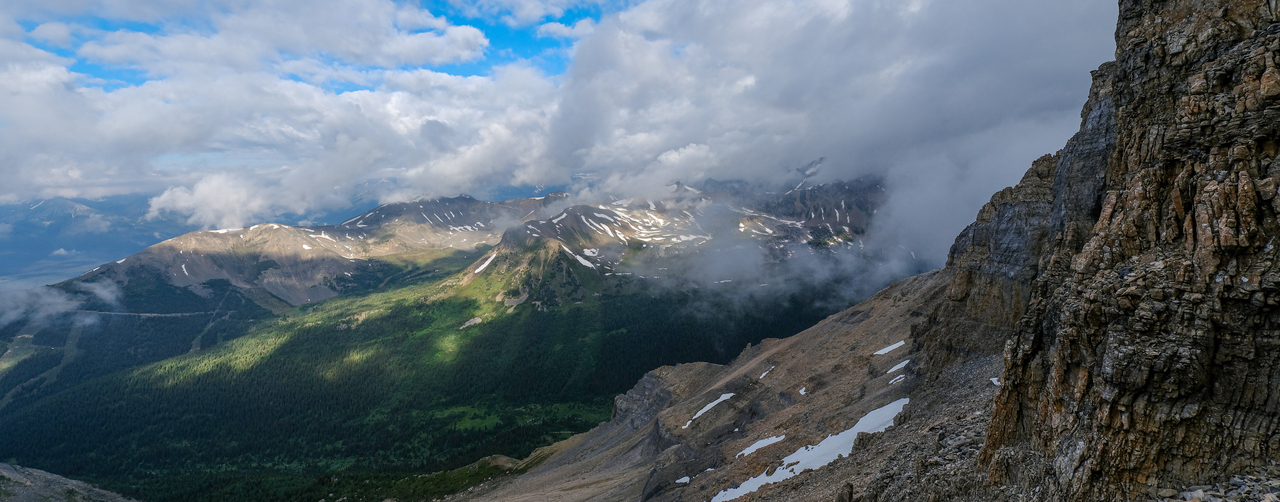
Eventually, we approached the Larch Express Chair, with our first objective, Redoubt Mountain, rising ahead.
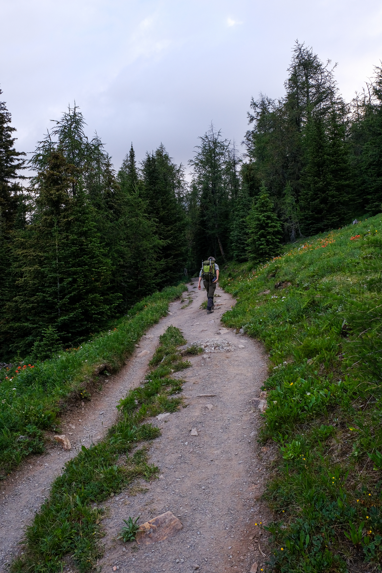
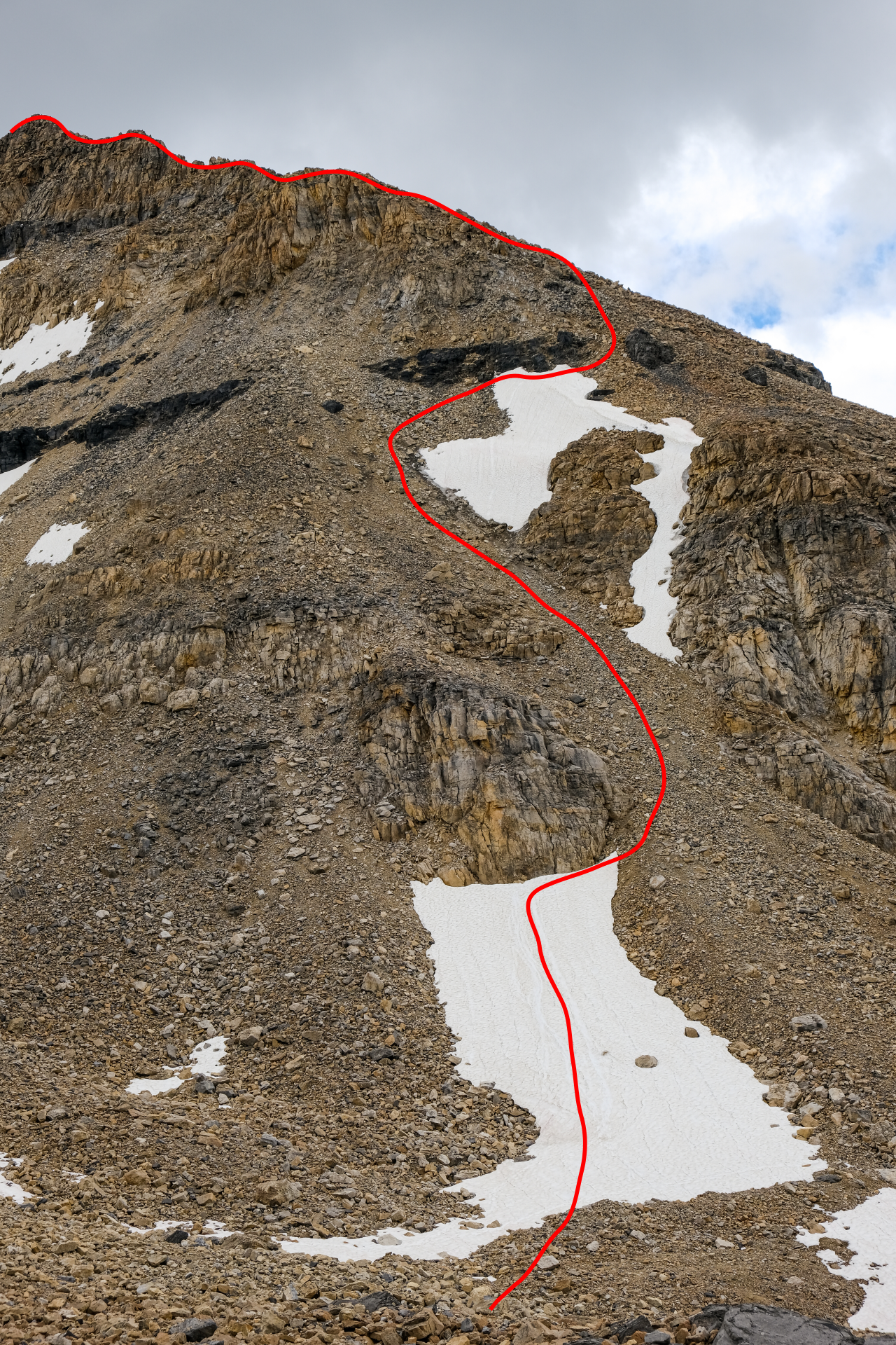
We continued up the trail towards Skoki for about 2.1km past the chairlift, at which point we left the trail, and "bushwhacked" alongside (on climber's right of) a minor drainage coming down from the east. While Kane's book only reports a route via Redoubt's northwest ridge, I came across some trip reports online (thanks to Bob Spirko and Matthew Hobbs), describing successful ascents via the more direct, western slopes. My hope was to combine the two routes and make a loop :)!
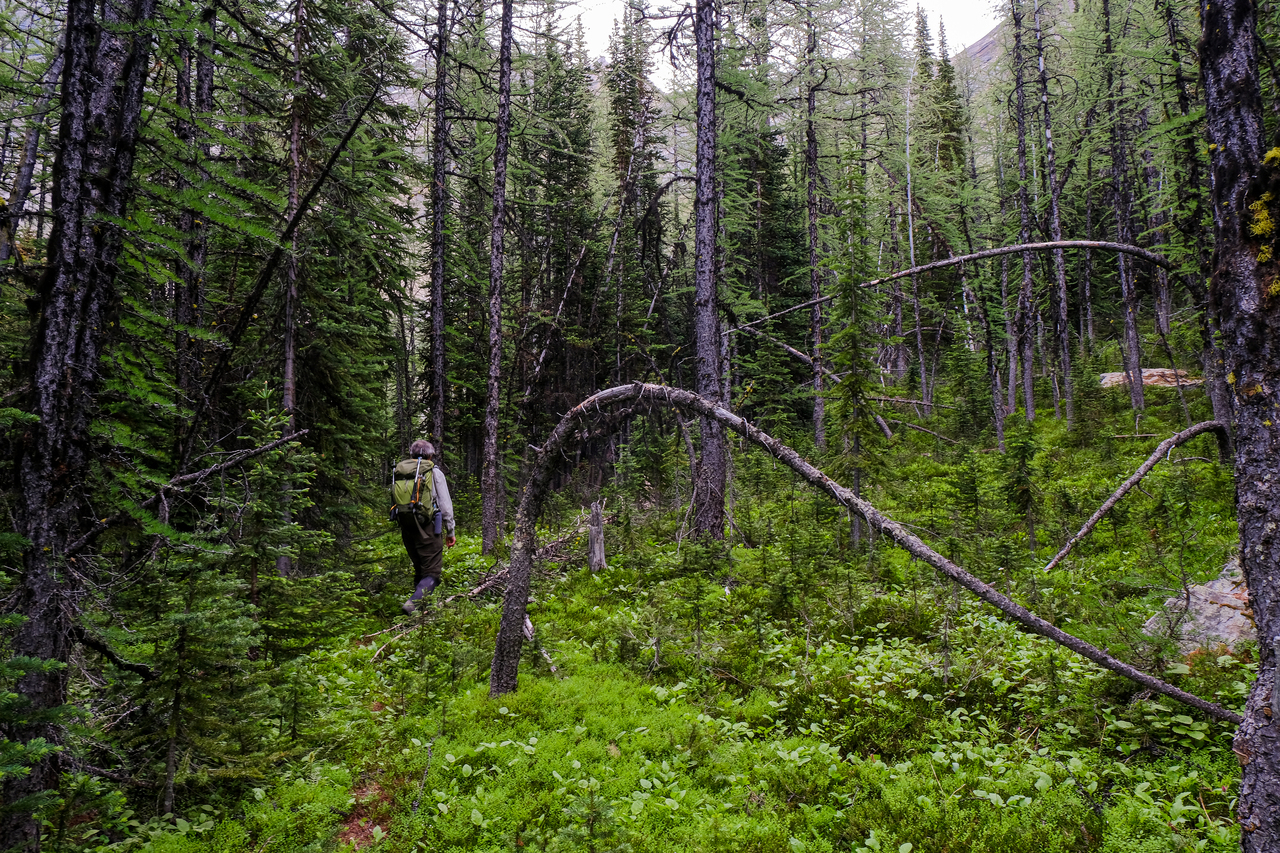
Though initially steep, the slope soon eased off, and we easily followed animal trails through the generously spaced larches (unfortunately not in season...).
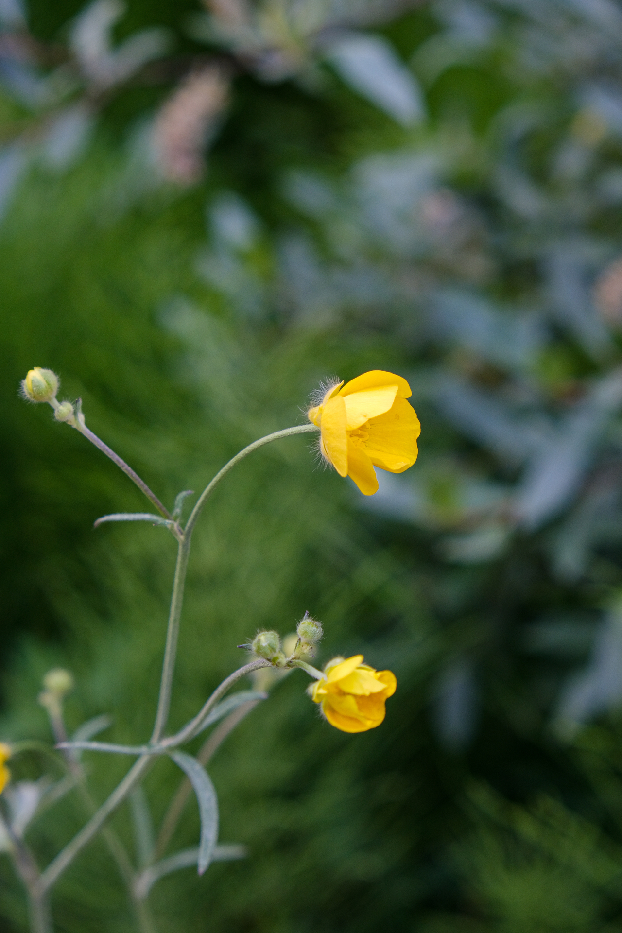
...But you know what is in season? Wildflowers!! We soon emerged to the beautiful cirque below Redoubt, complete with hundreds of bright yellow alpine flowers!
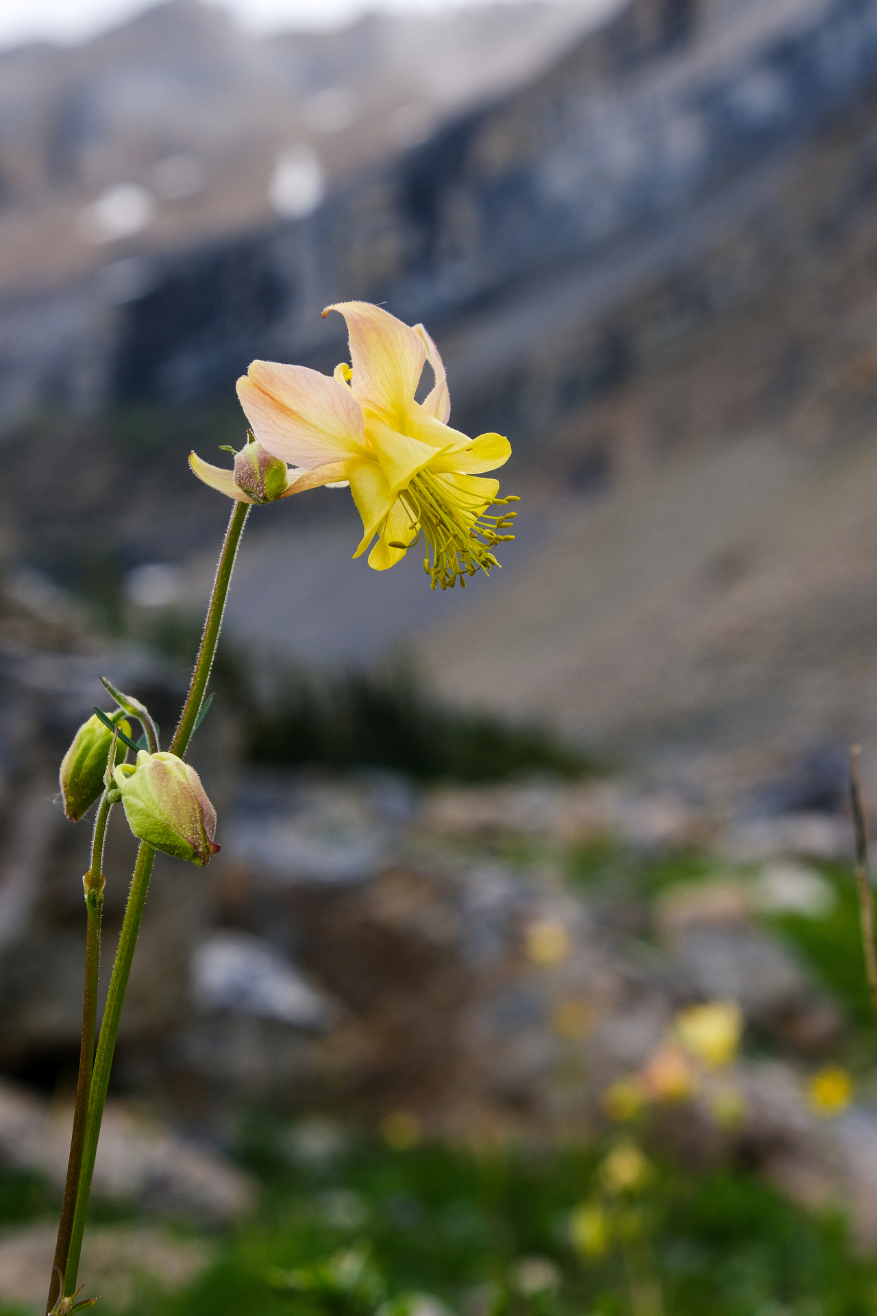
A closer look at one of those flowers :).
Whitehorn Mountain is spotlit in the distance.
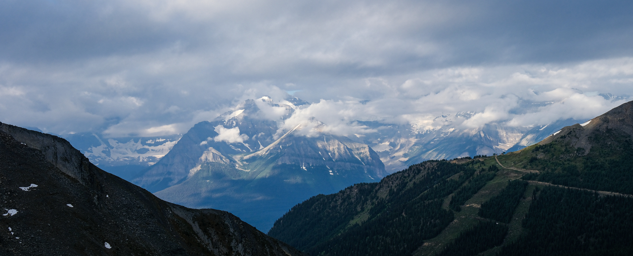
A couple peaks from the Lake Louise group poke out from low, scattered cloud.
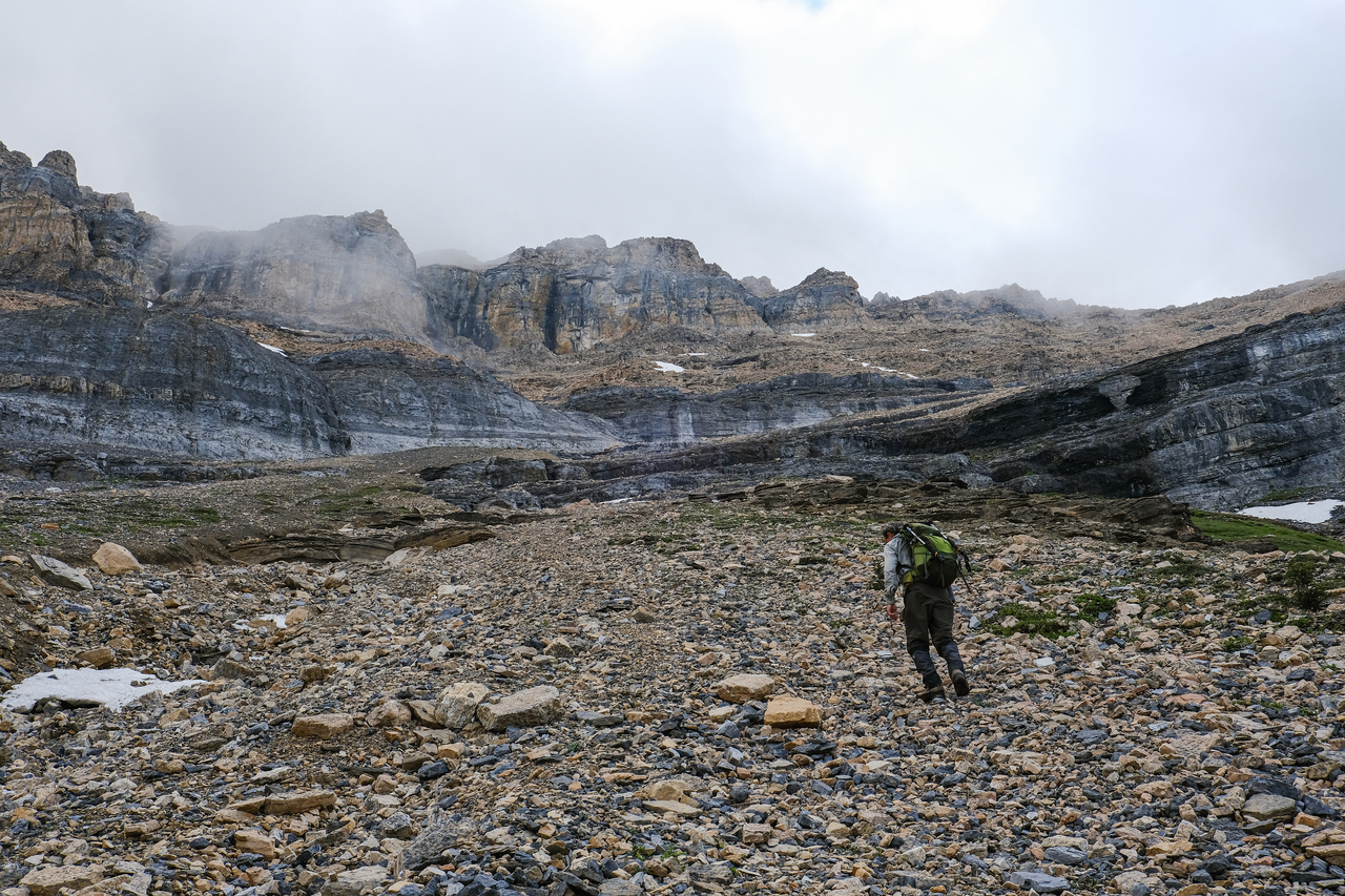
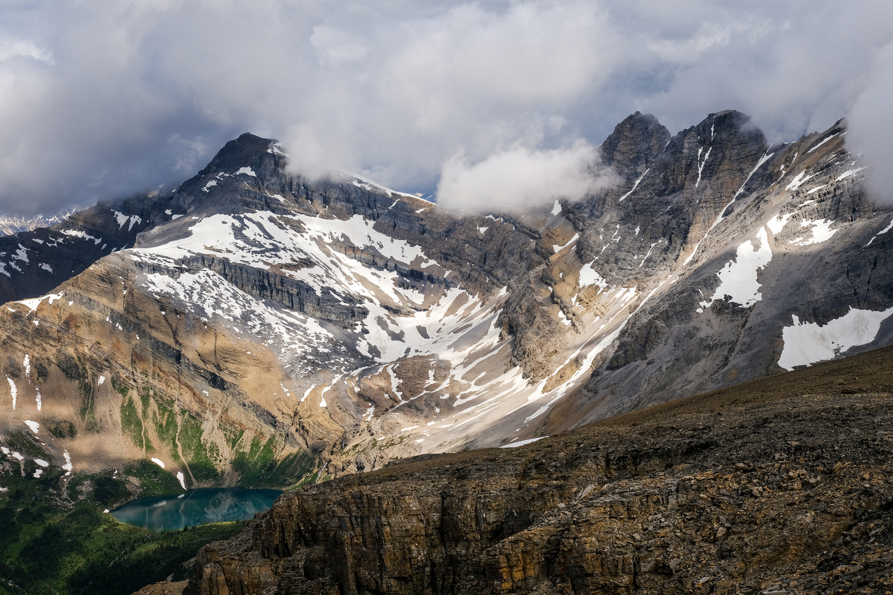
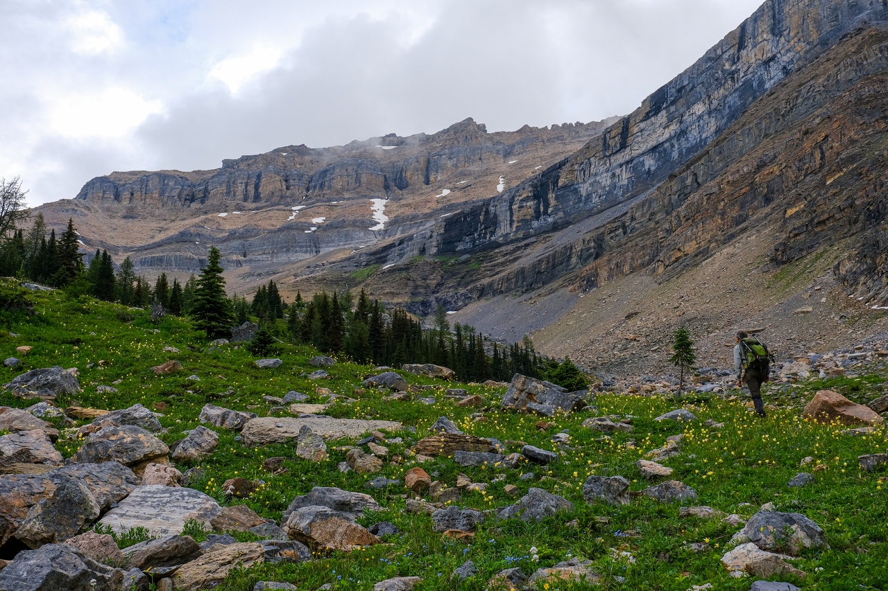
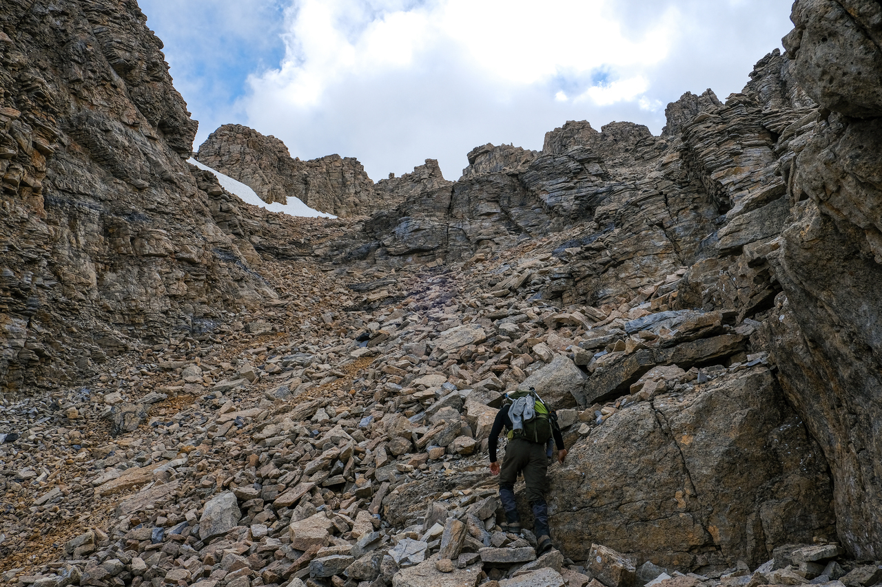
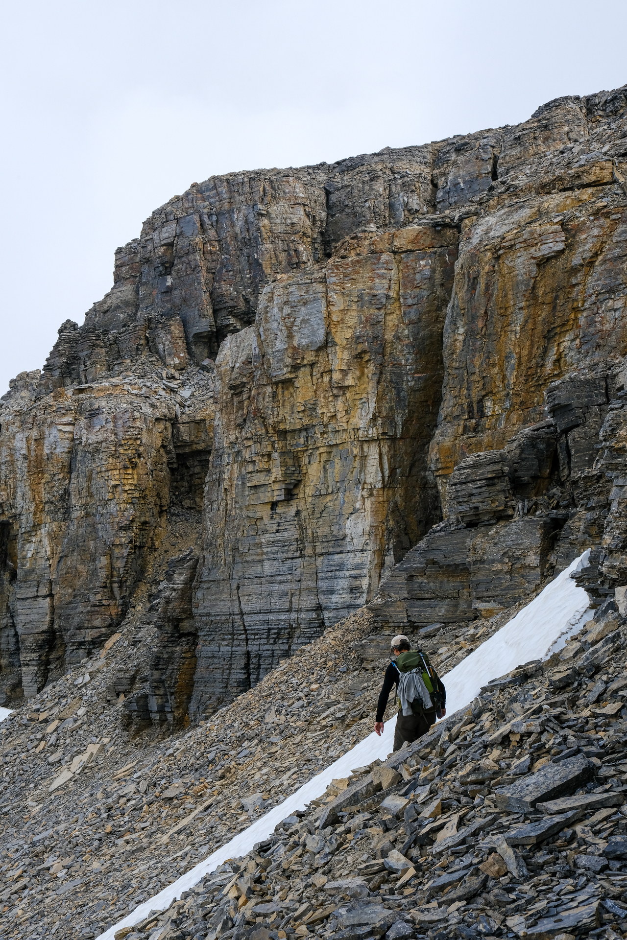
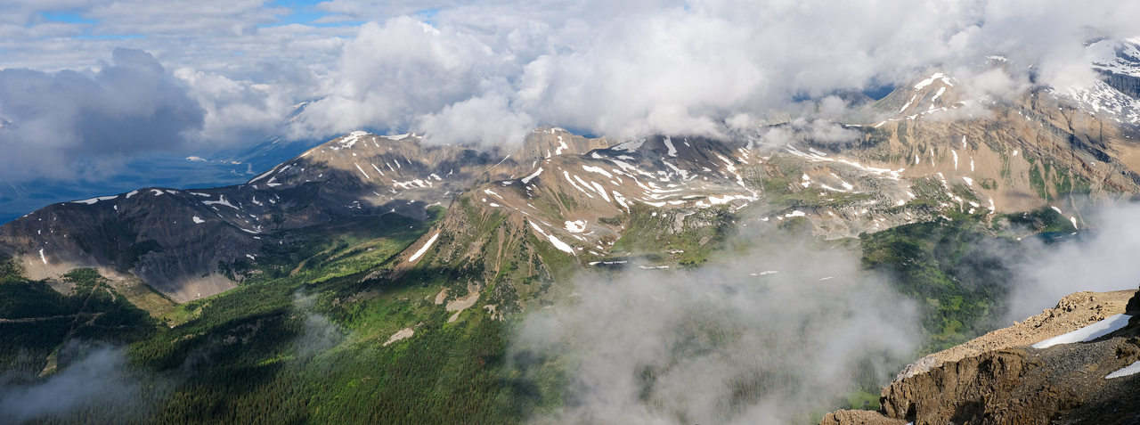
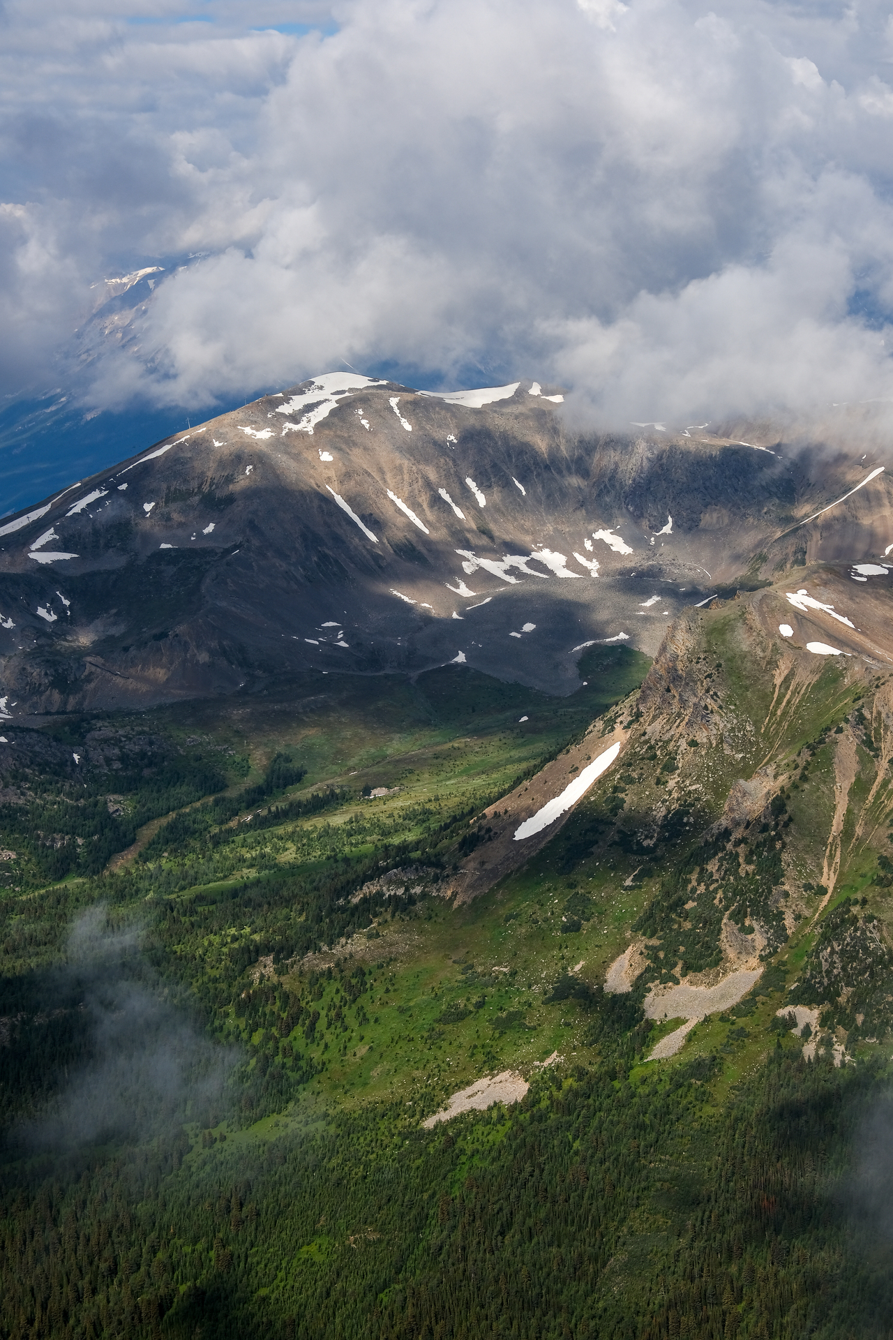
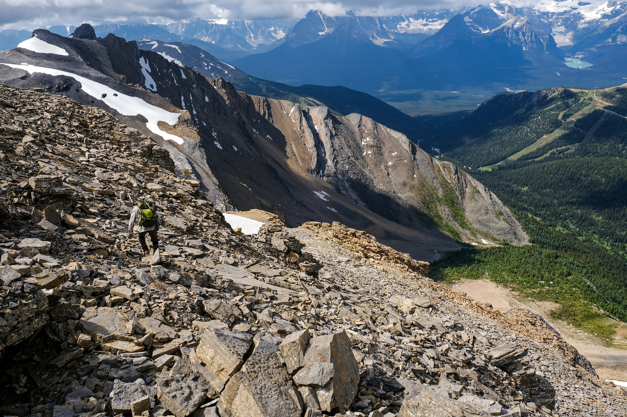
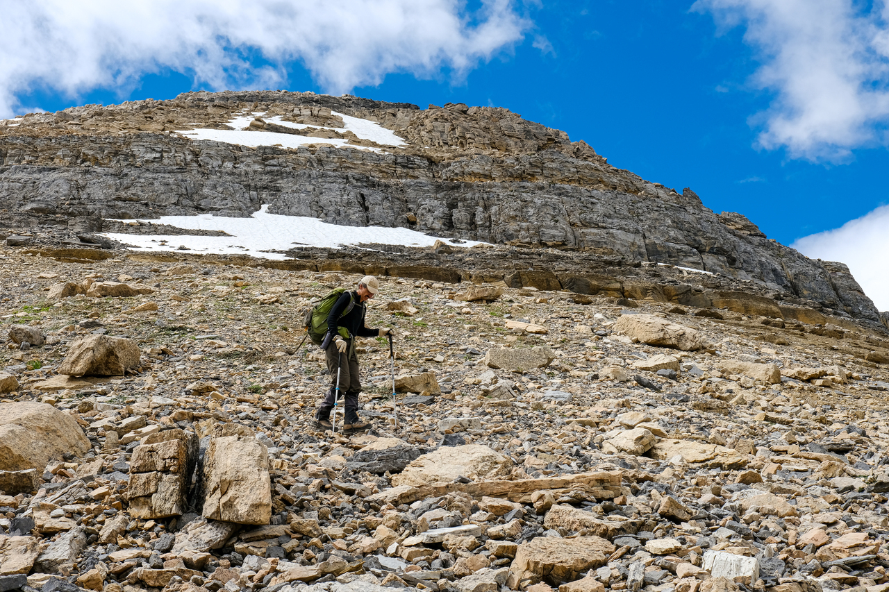
We soon reached the end of the cirque, and started up rubble slopes in Redoubt's west "bowl".
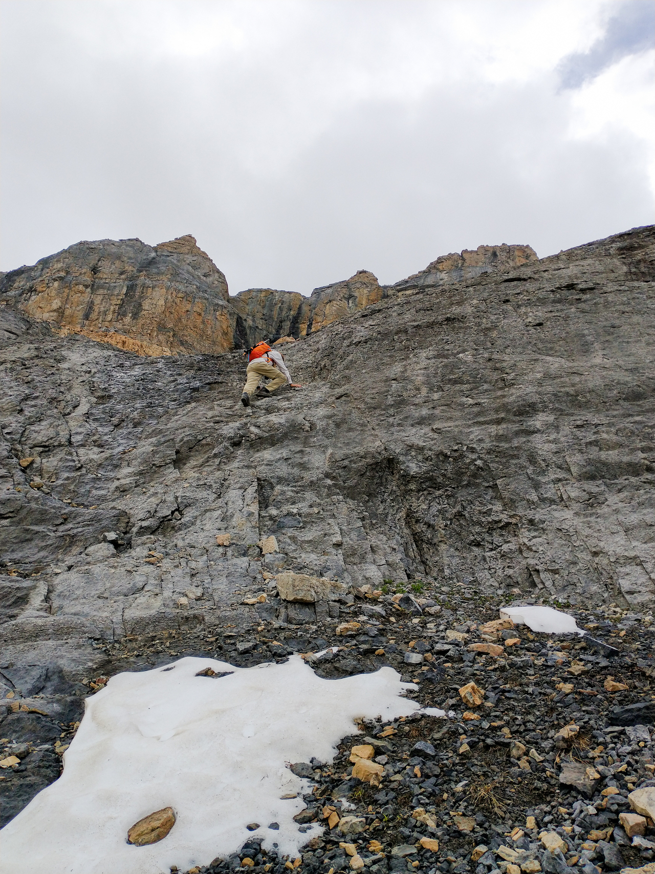
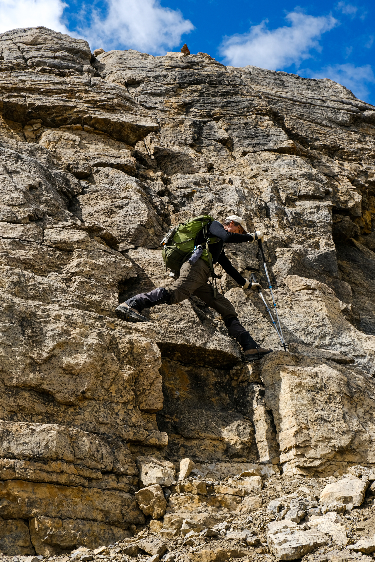
Having some fun, scrambling up some steep, completely optional, slabs ;). Photo credit: Dad
Looking back down the slabs. My dad traversed to climber's right, and easily continued up the rubble.
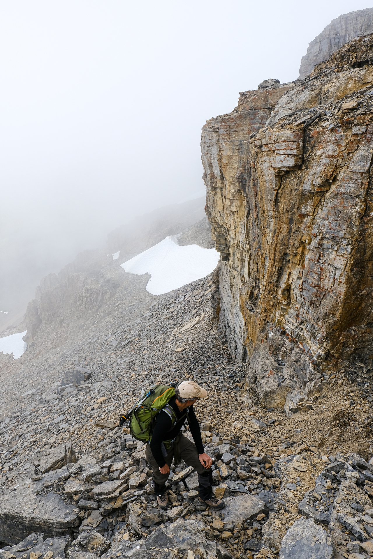
Continuing up Redoubt's western slopes. Although loose, ascending this slope wasn't as bad as I expected, and it felt like no time before we were looking far down to the cirque below.
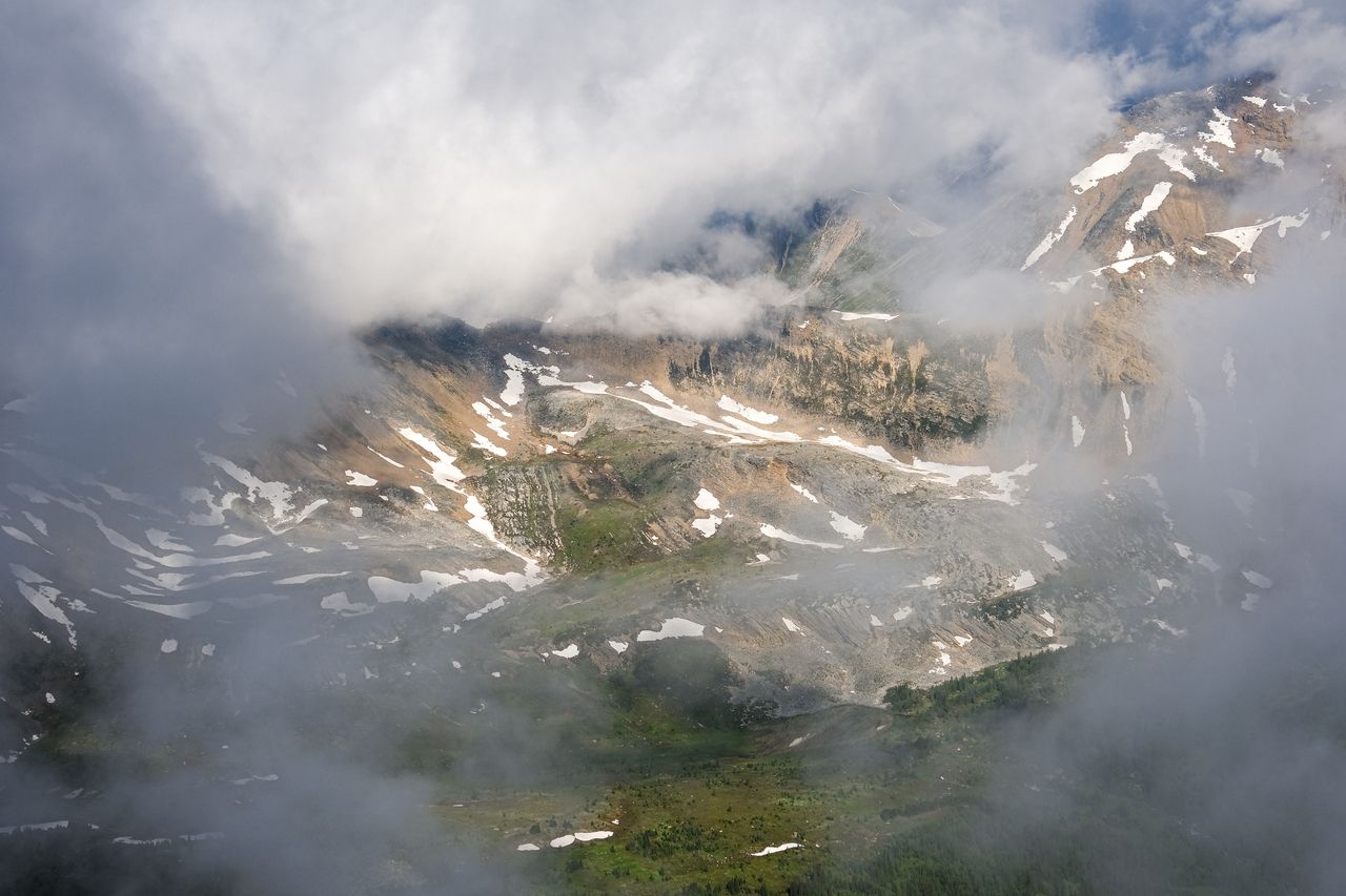
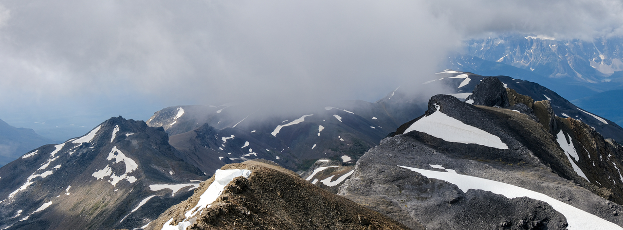
Can't see much...I guess we just keep going up ¯\_(ツ)_/¯!
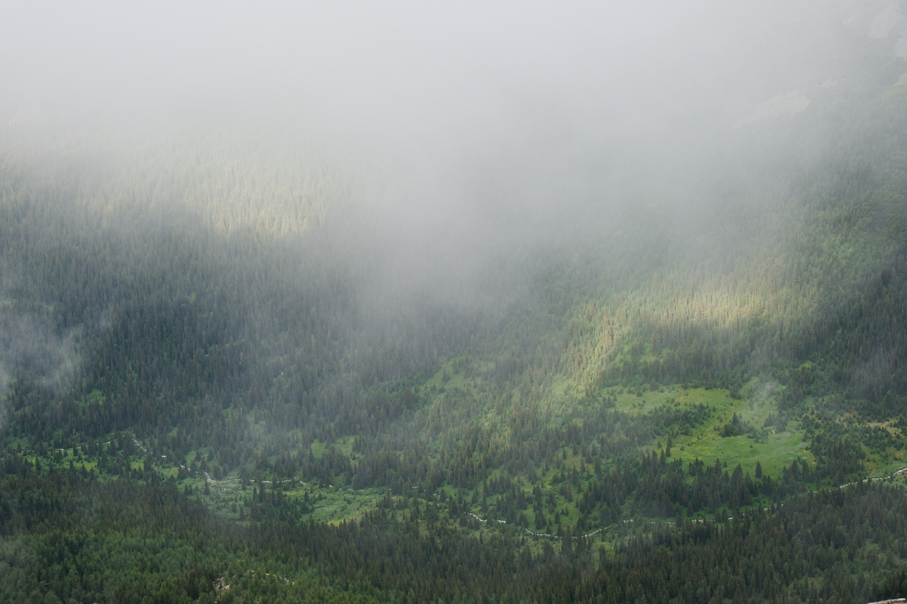
It wasn't long before the clouds passed and we were looking back to beautiful views of the lush, green valley below! Note the cliffs on the right side of the frame. When we reached the base of them, we simply traversed to climber's right until we arrived at an obvious, broad gully.
Starting up said gully.
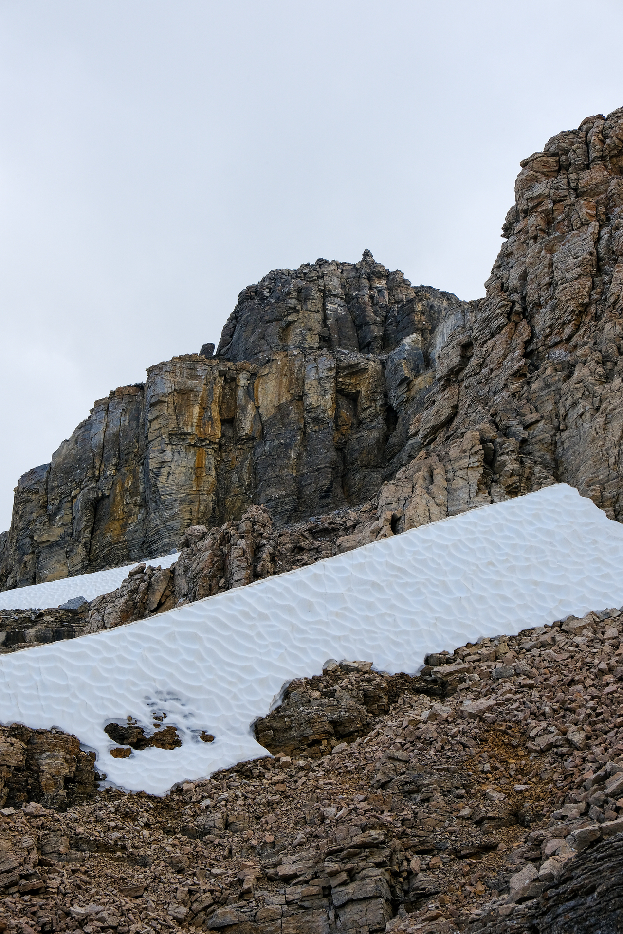
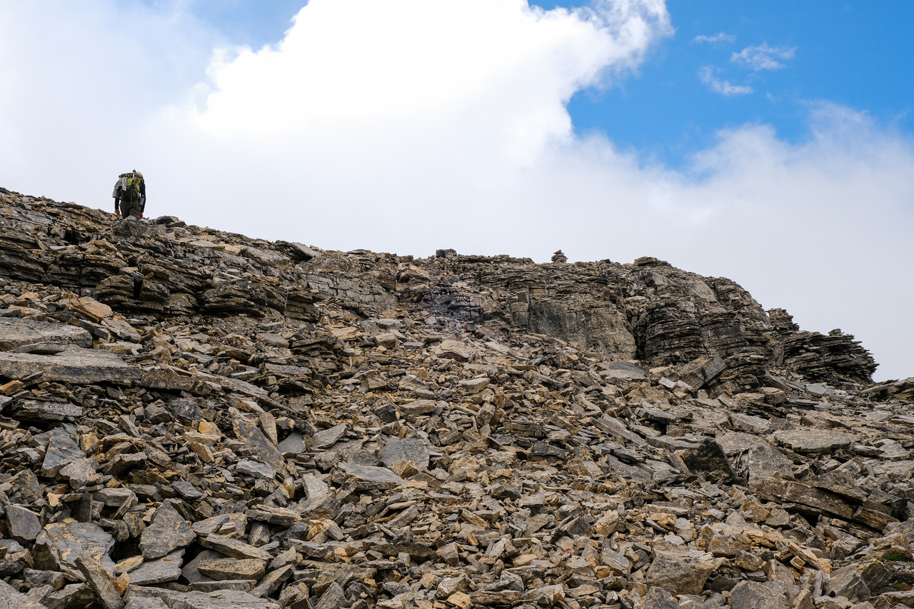
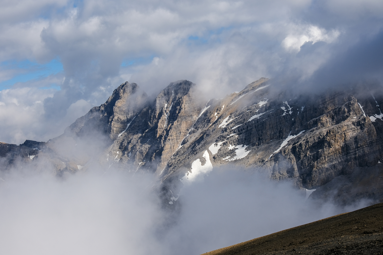
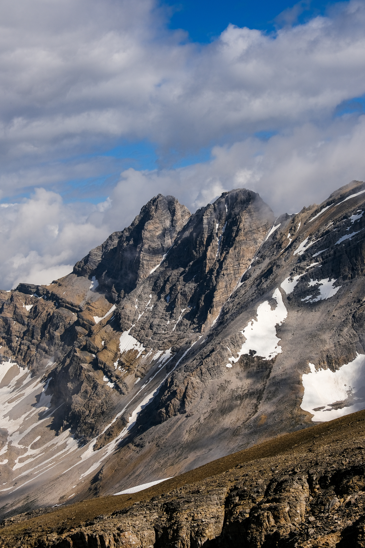
Redoubt's summit block comes into view. Hard to miss with that big cairn on top!
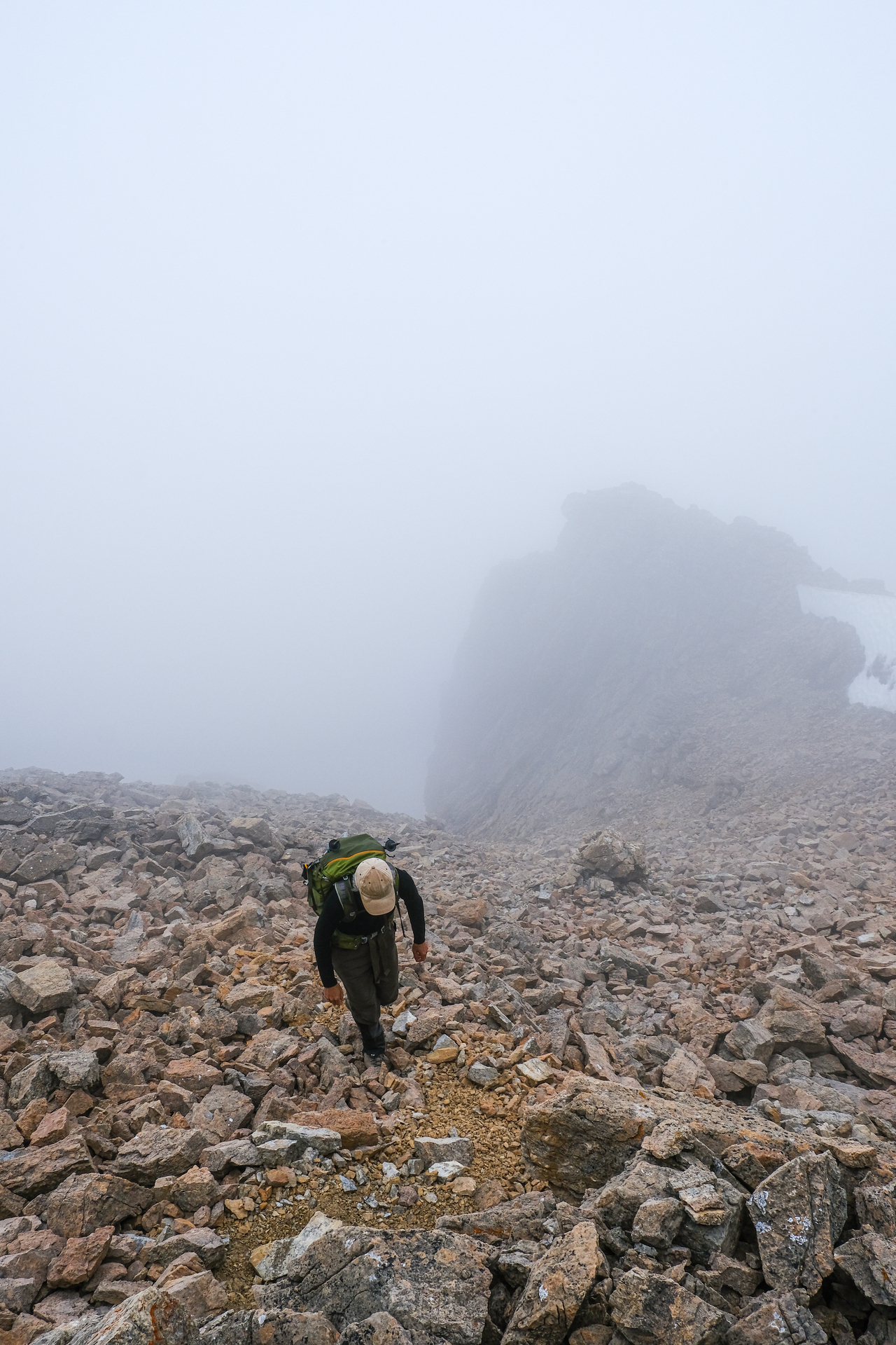
Exiting the gully, stuck inside a cloud once again.
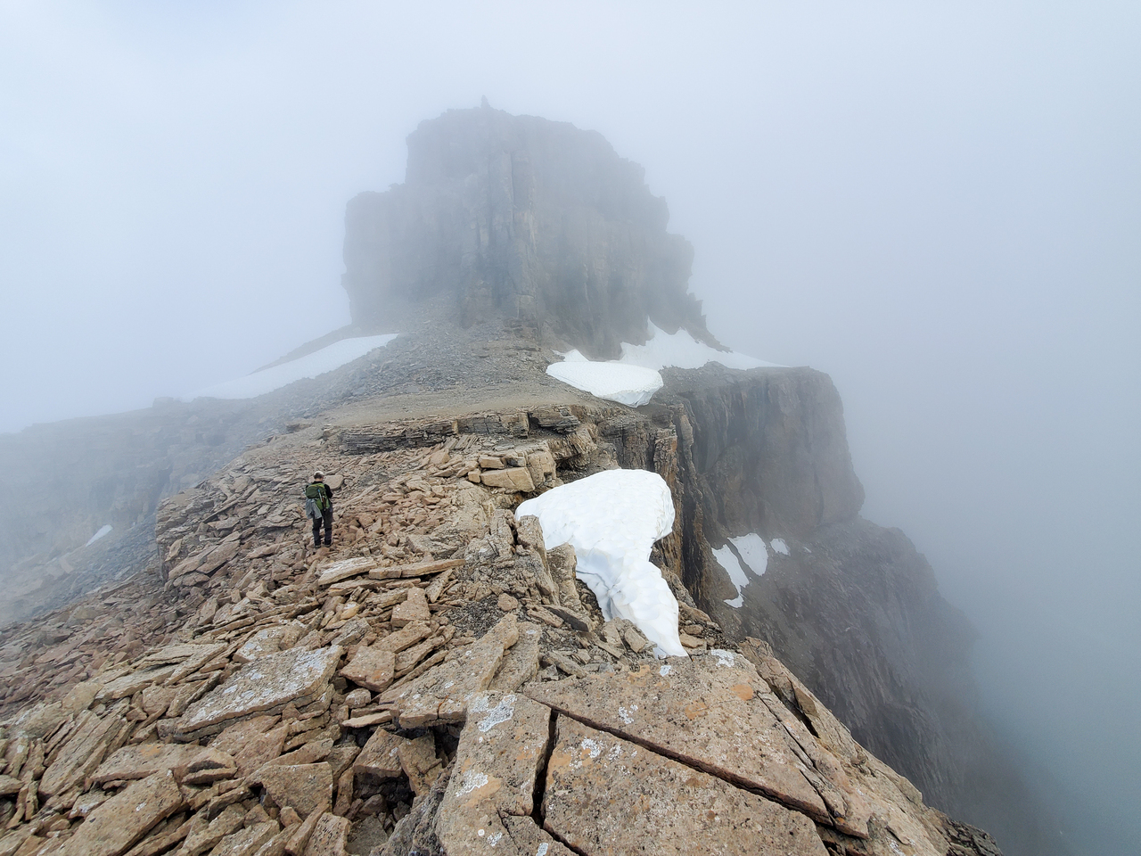
Once out of the gully, we simply followed the ridge towards the summit block.
So much green!!
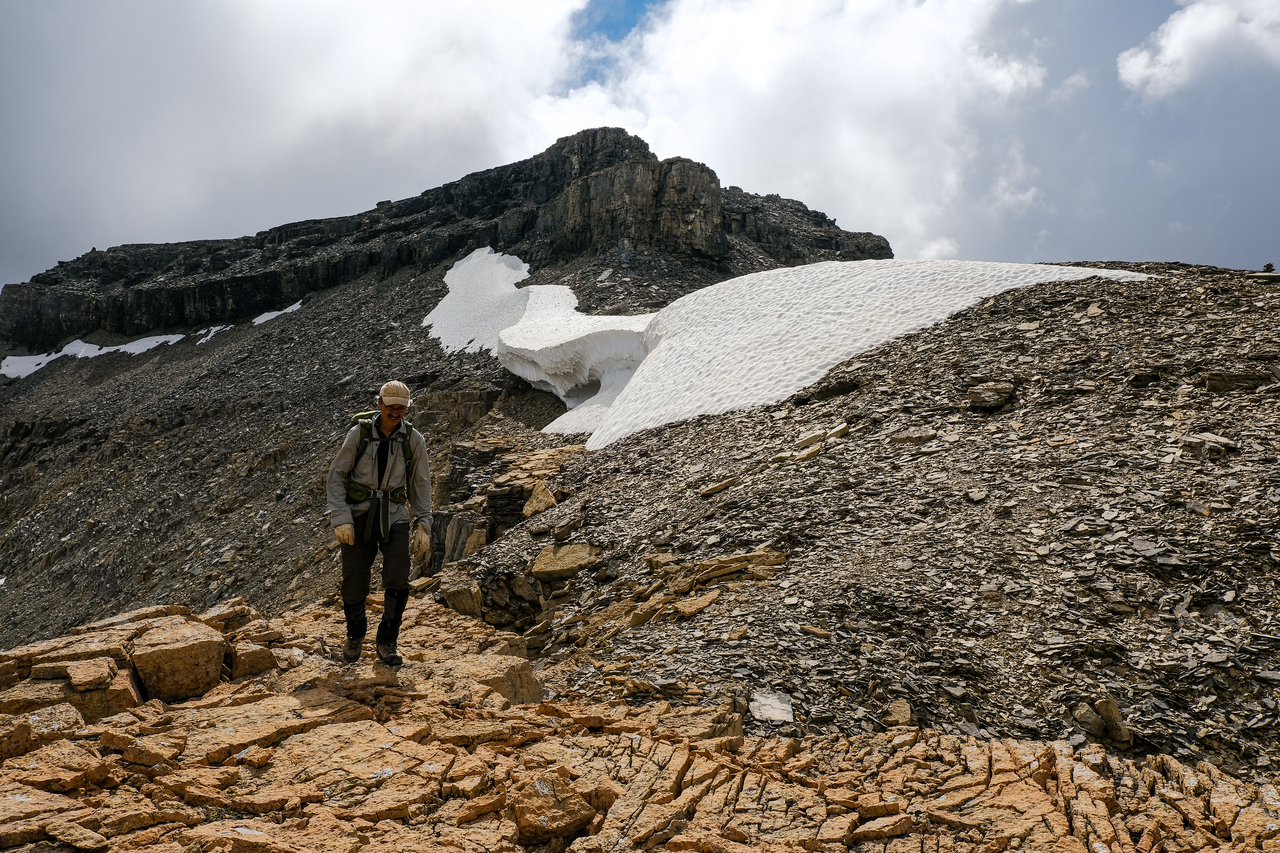
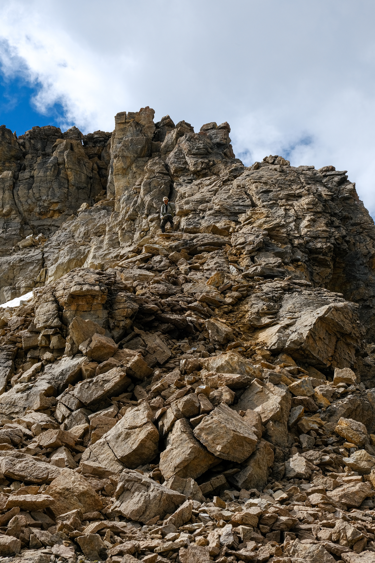
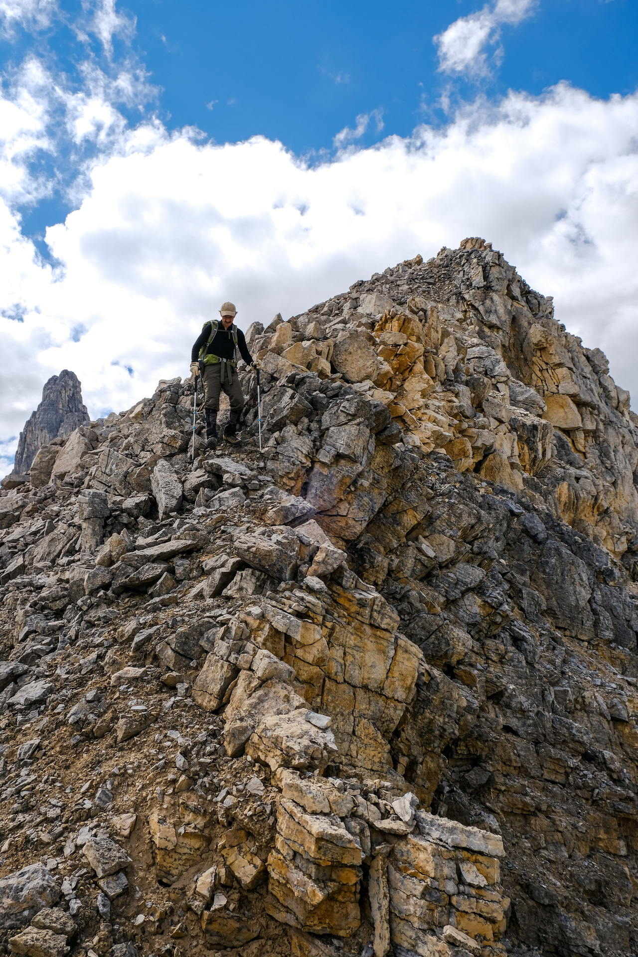
Traversing around the summit block, on climber's left, until we find a weakness.
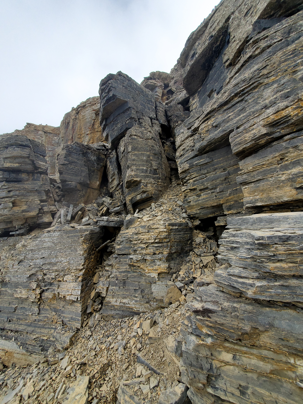
There's one!
Looks like my dad found an even easier weakness, by traversing just a few meters further than I did! It's crazy to think it, but for a scramble that's rated "moderate/difficult" via Kane's route, I would honestly be tempted to rate it "easy" (*with good route finding*) via the western slopes!...With options for moderate scrambling of course ;).
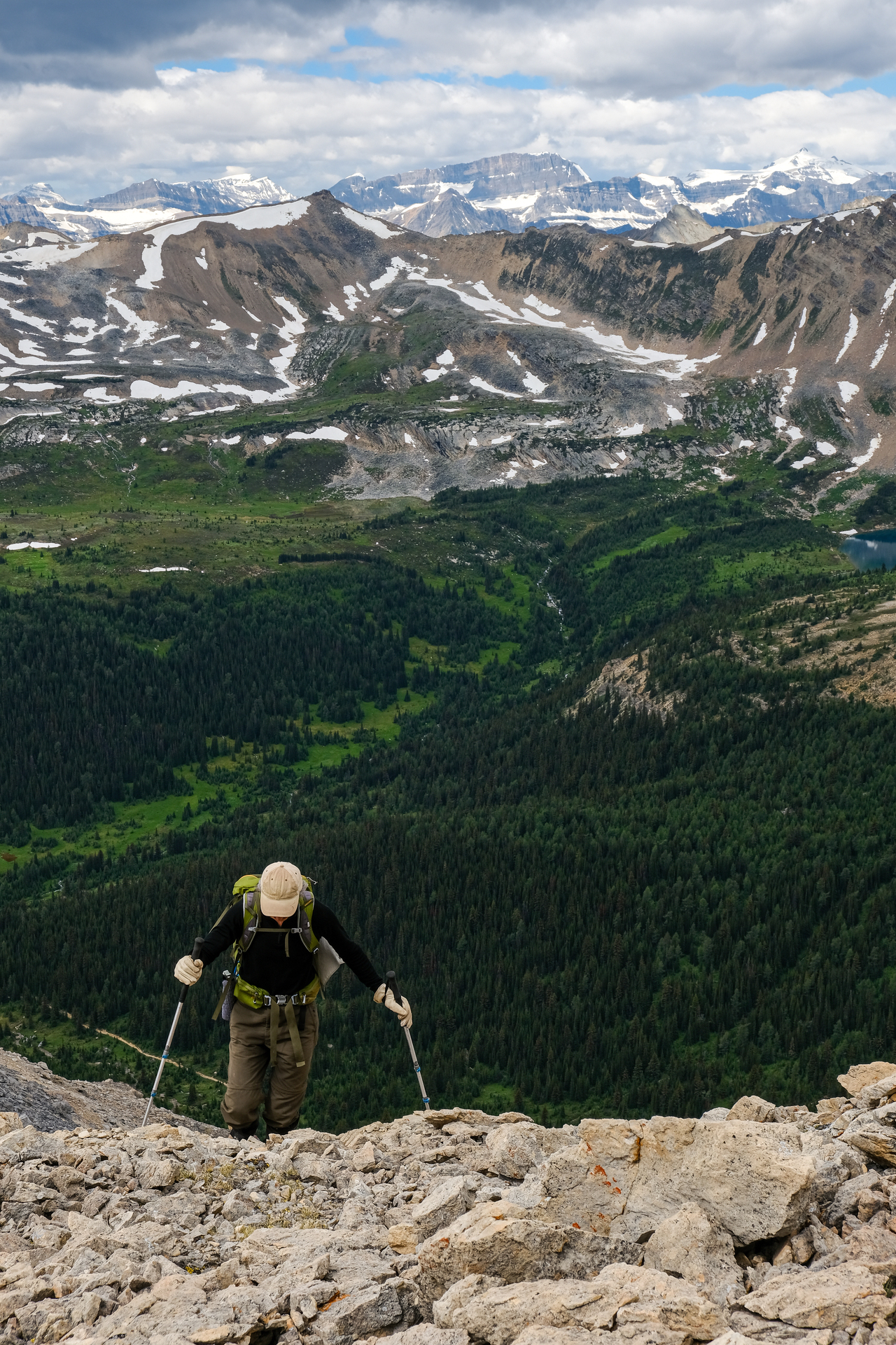
Once through the weakness, we turned right, and followed gentle slopes right to the summit.
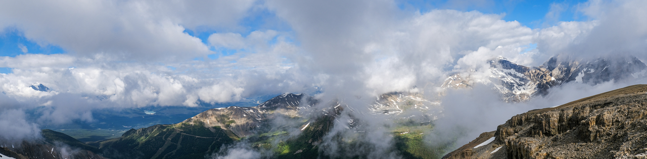
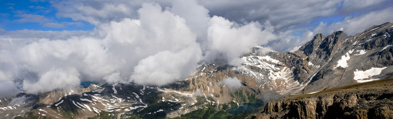
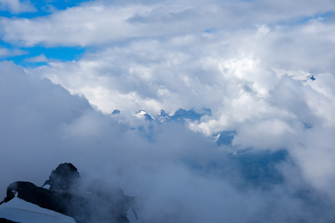
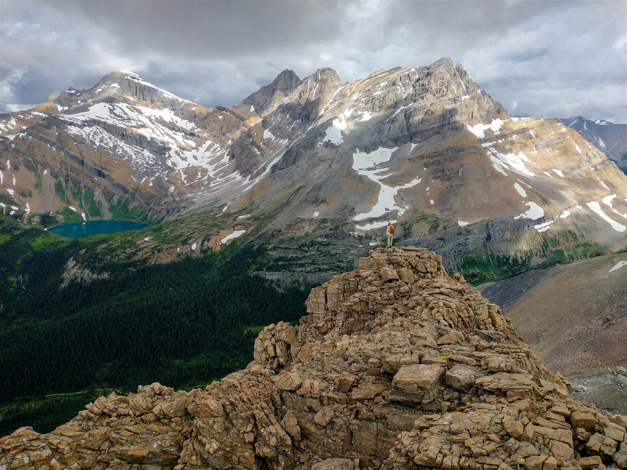
After about 20 minutes of being stuck in a cloud on Redoubt's summit, it slowly began to break up, and one incredible view after another was revealed!
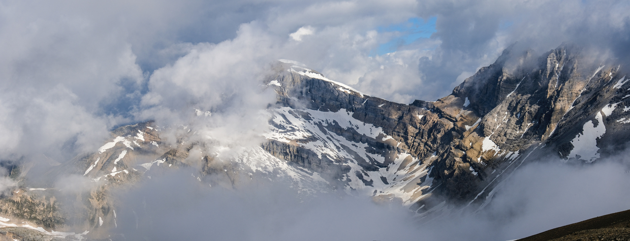
Stunning view of Mount Richardson, rising among the clouds.
A "cloud window" reveals the valley far below.
Pika Peak (left), an outlier (center), and Ptarmigan Peak (in the clouds, right) make an appearance to the right of Richardson!
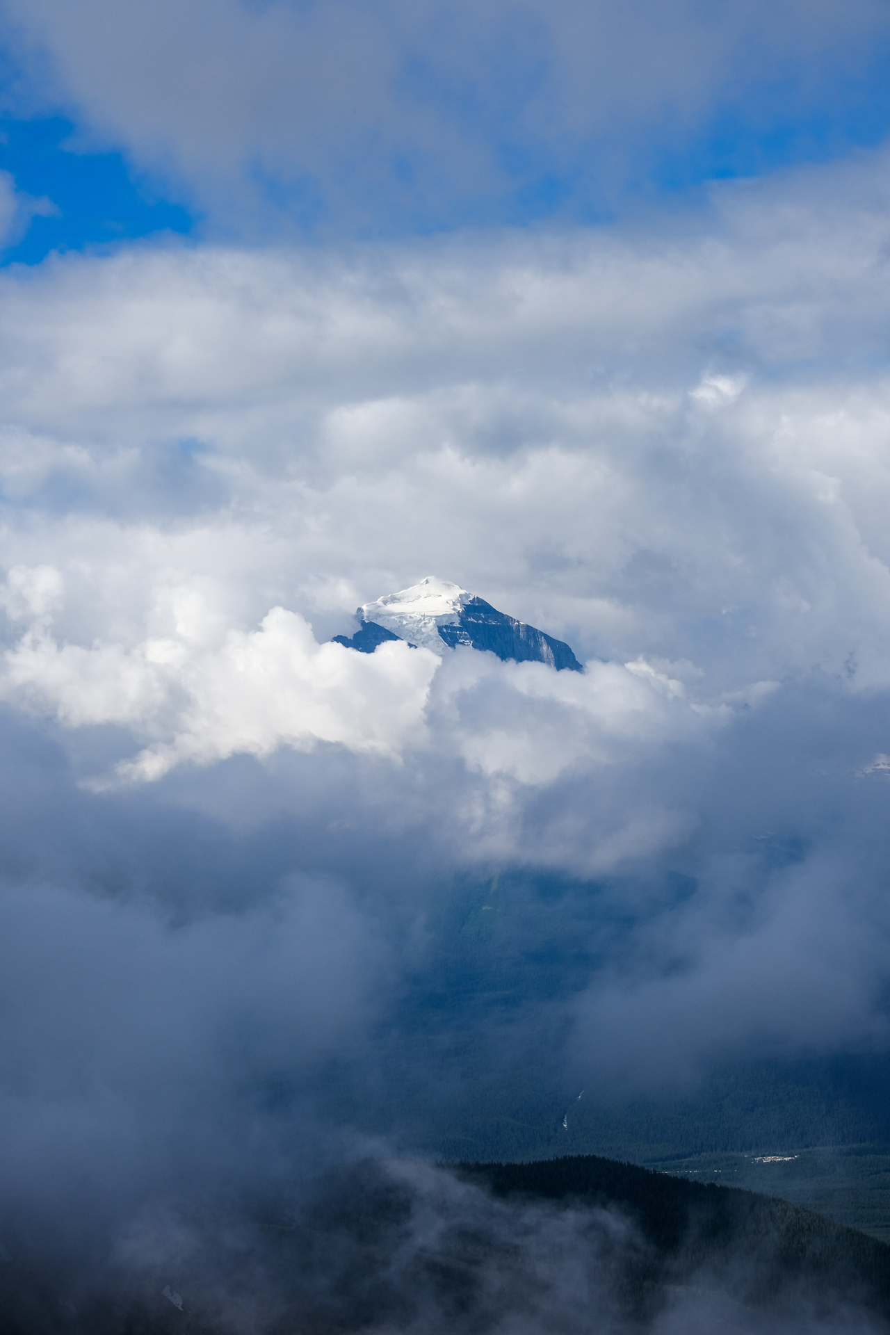
Mount Temple's 3544m summit glacier breaks through the clouds! There's a mountain that's been on my list for waaay too long!! Maybe this year 🤞!
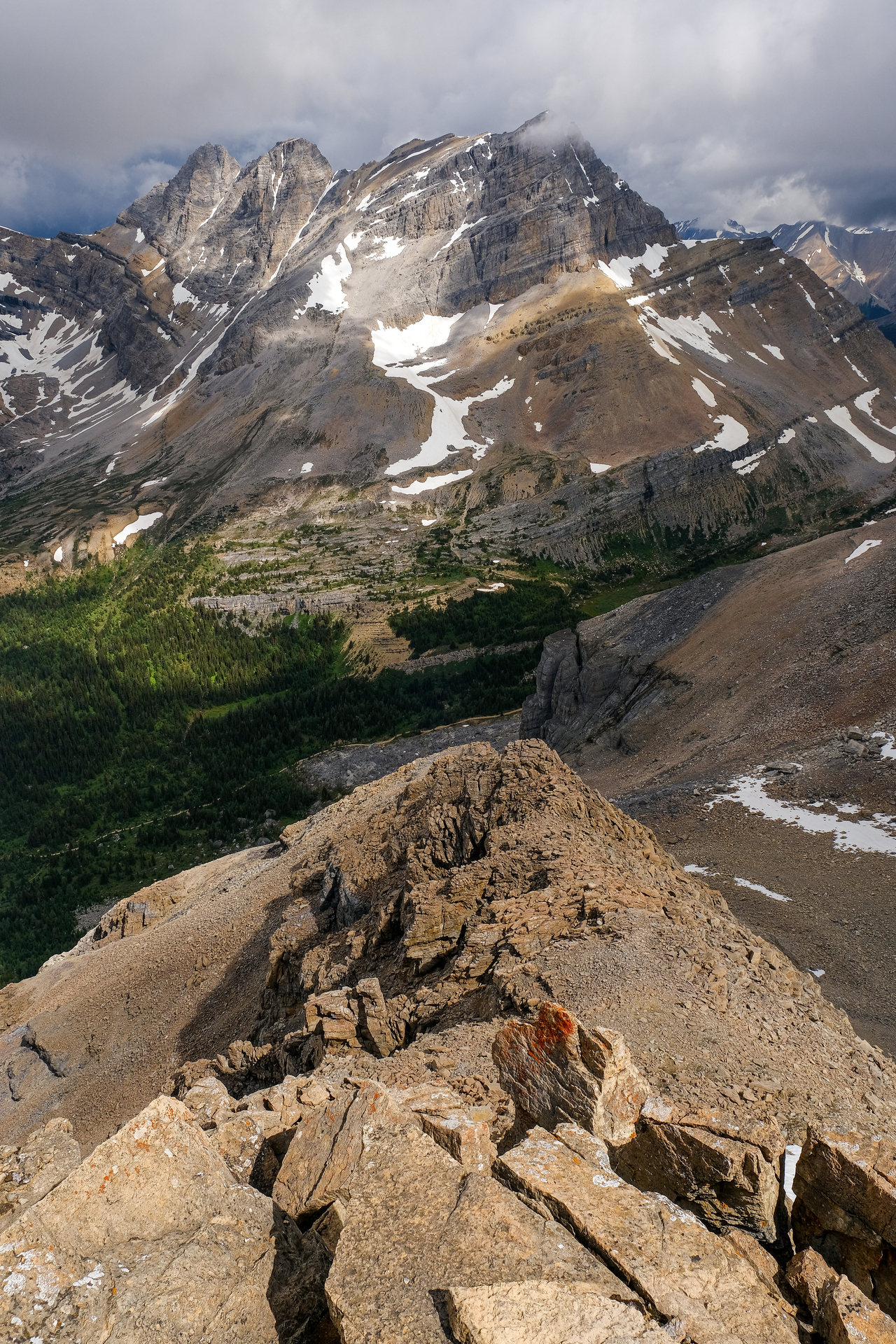
Views down Redoubt's south ridge.
The clouds continue to break up in the vibrant valley below!
Hidden Lake is hidden no more ;)!
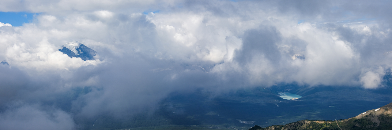
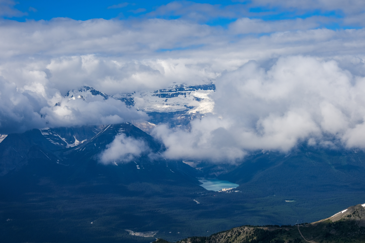
Tiny Chateau Lake Louise gives some perspective to the size of these unreal clouds...and Mount Temple rising through those clouds!
Another look at the ever-changing views to the northwest.
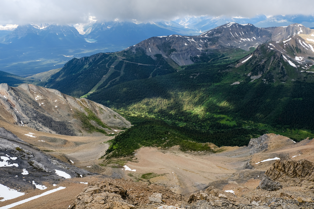
Whitehorn Mountain (the highest point of the Lake Louise Ski Resort), rises gently at the end of the green valley to the west.
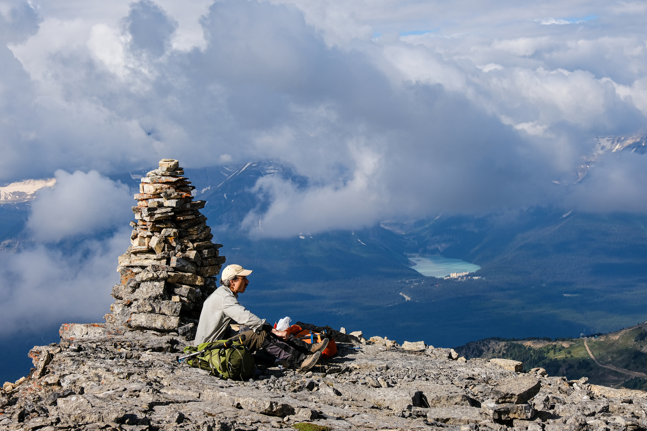
My dad has some lunch beside the human-sized summit cairn!
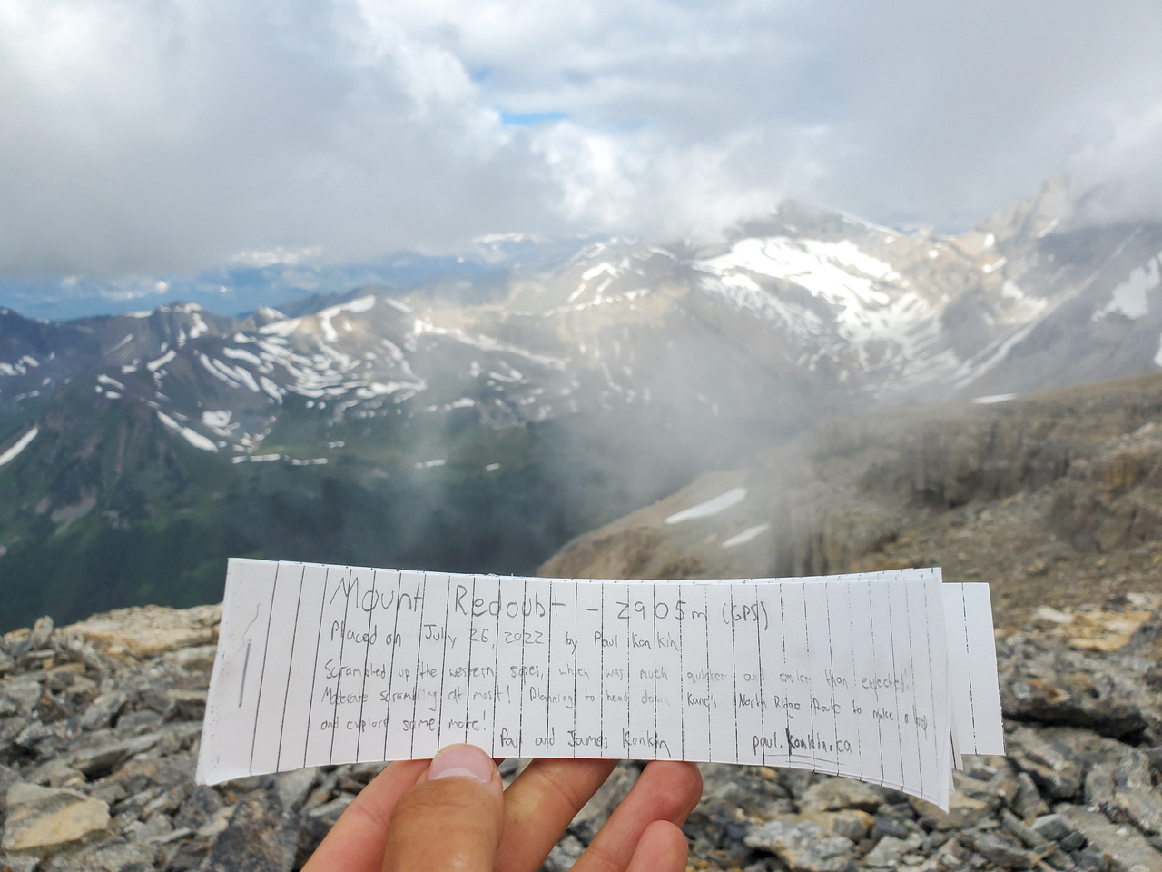
Massive cairn, but no register!? Good thing I brought one along ;)!
A few of the famous Ten Peaks peek out in the distance. Note Temple, waaaaay above on the right! 😮
Impressive Pika Peak shakes all remaining cloud-cover (left).
Mount Victoria's iconic east face is revealed beyond turquoise Lake Louise.
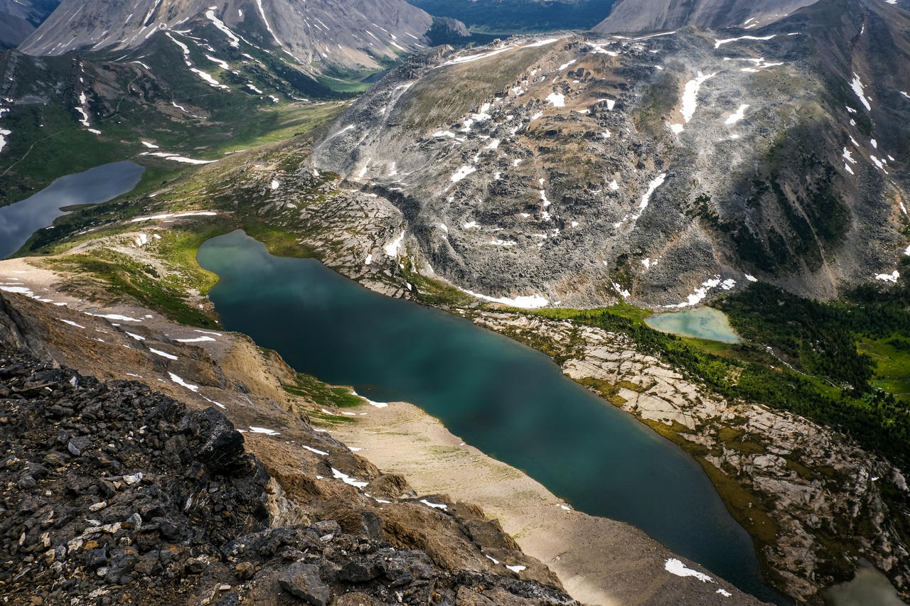
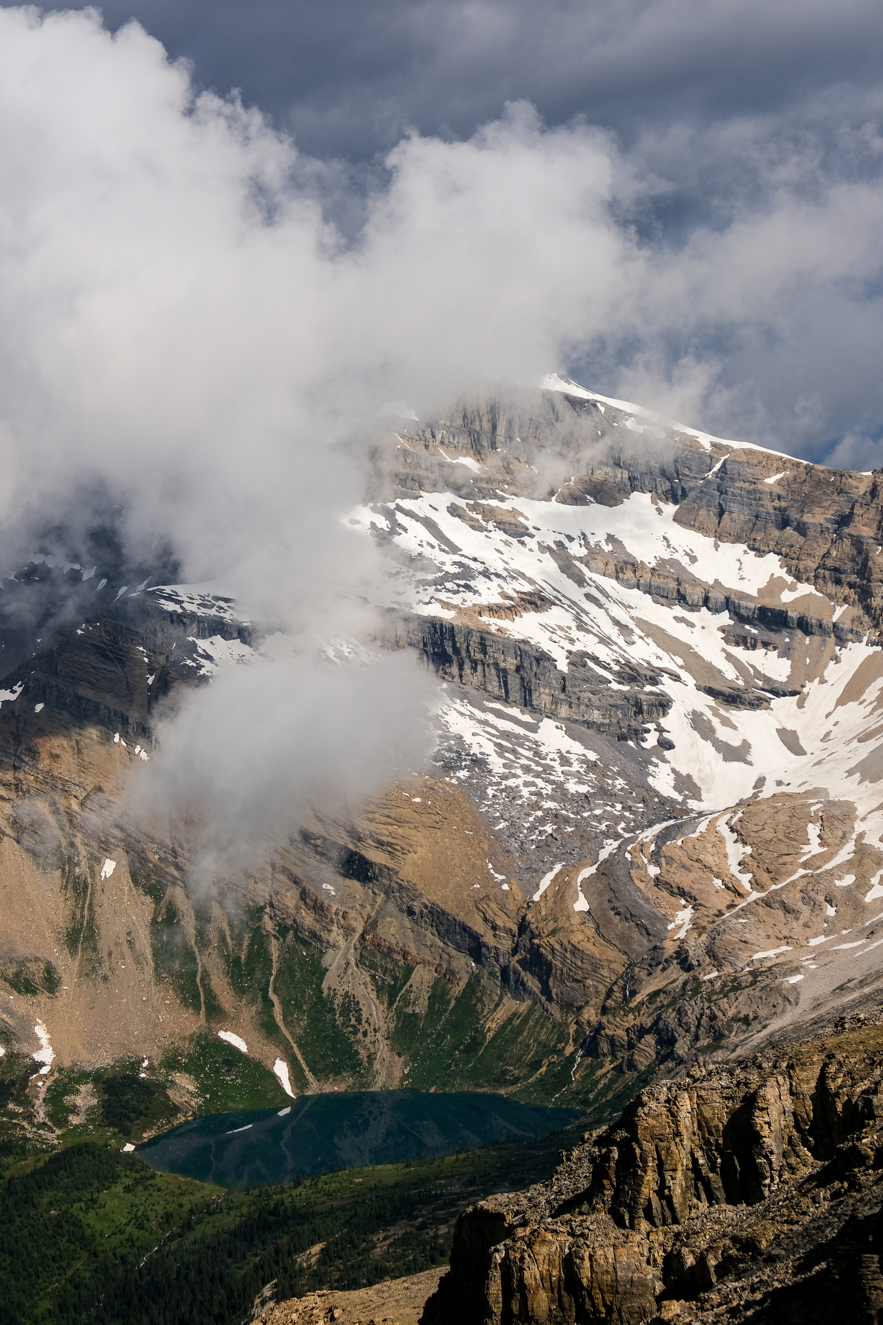
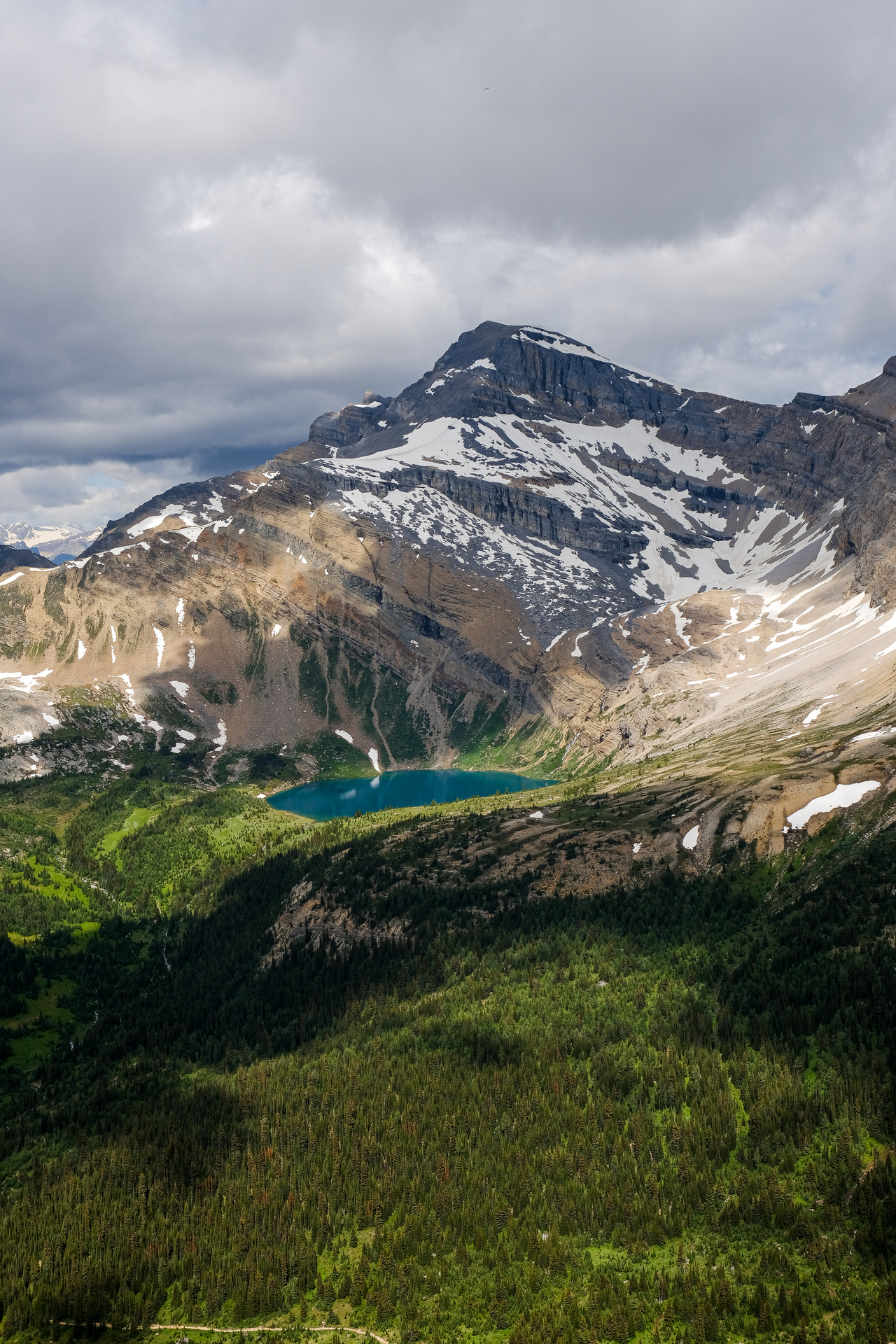
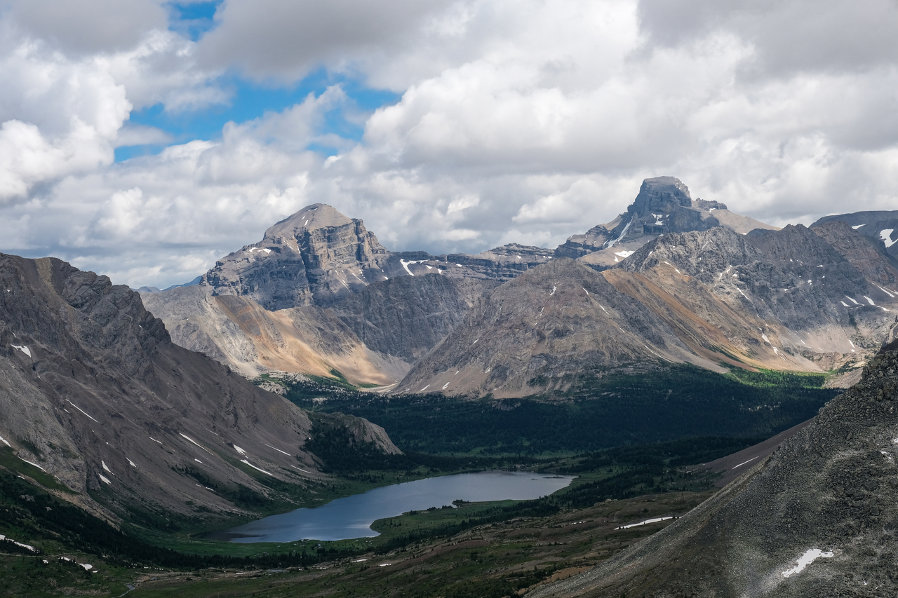
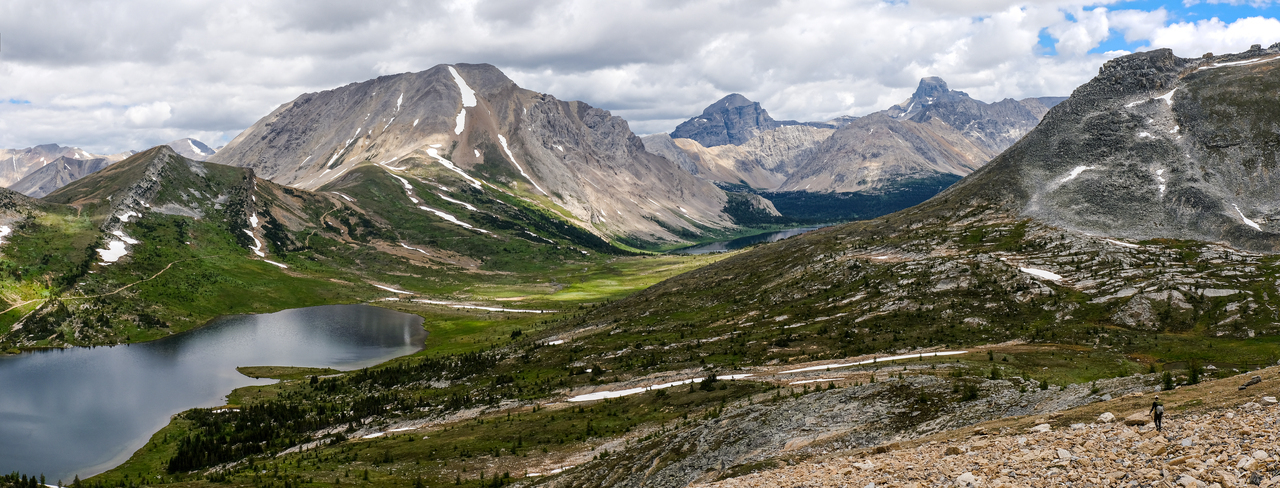
500 vertical meters below, Redoubt Lake stretches out at the base of Redoubt Mountain's impressive east face.
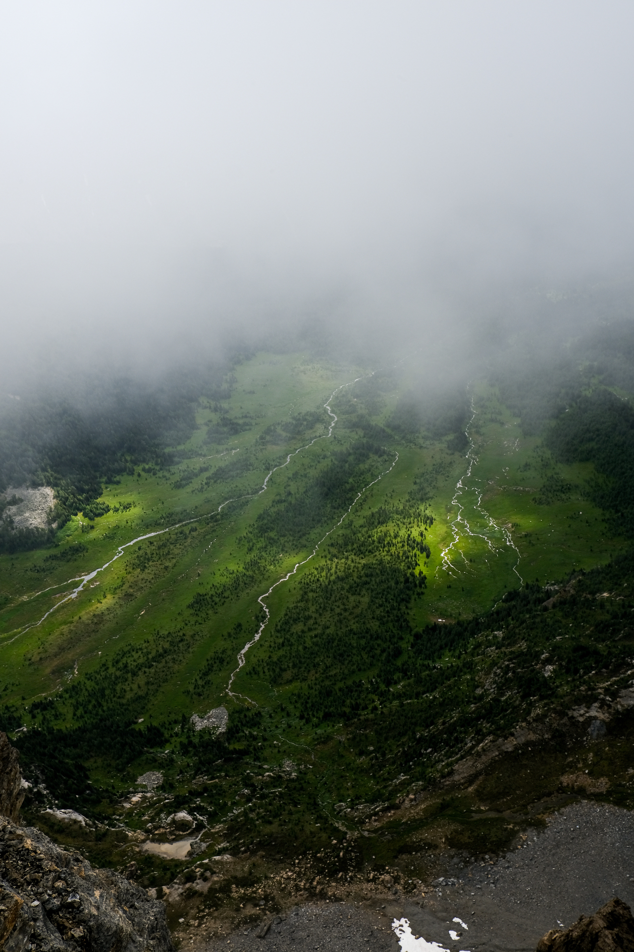
Three distinct streams form a water network (as if earth's veins), in the rich, green valley directly down to the south.
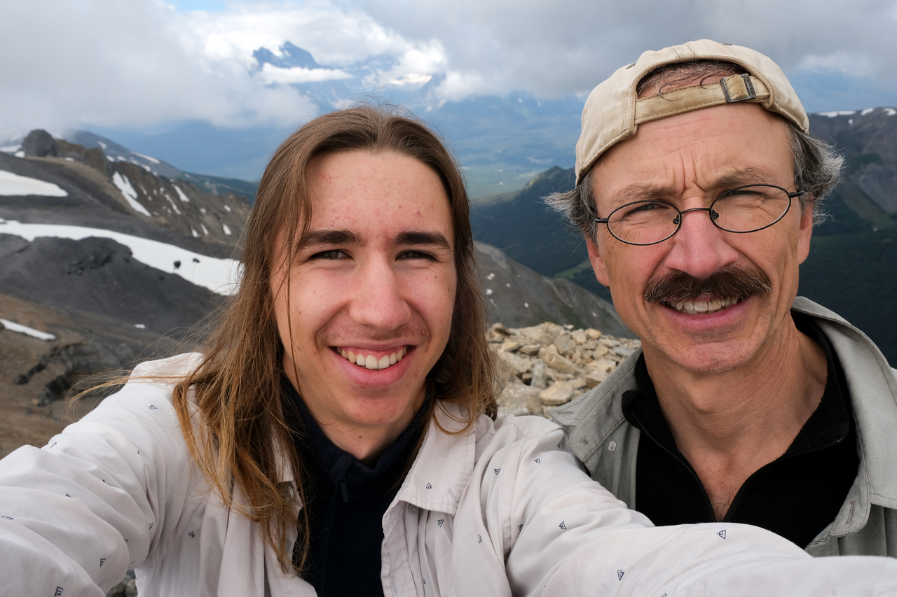
Summit selfie!
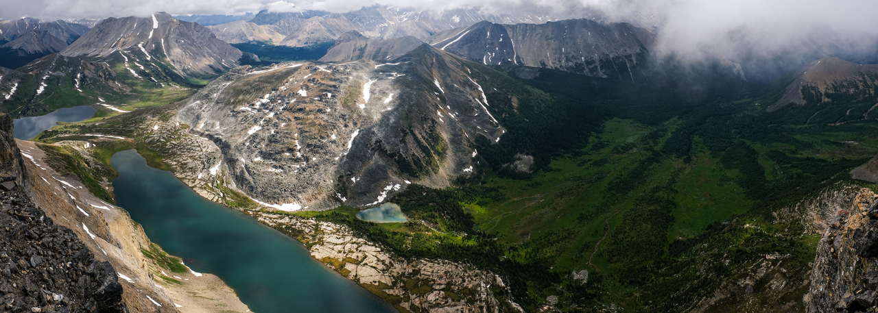
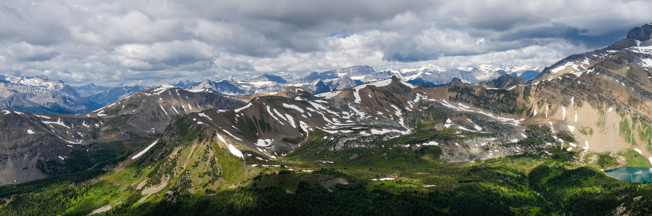
Some of the other Skoki scrambles: Fossil Mountain, Heather Ridge, Brachiopod Mountain, and Anthozoan Mountain rise beyond the beautiful, deep blue shades of Ptarmigan Lake, Redoubt Lake, and a small unnamed tarn.
So many colours!
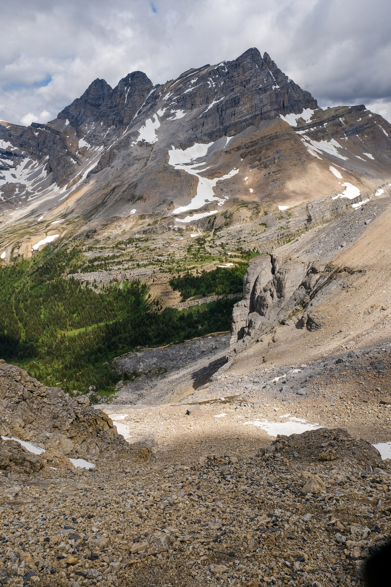
Looking down the western slopes/bowl that made for a straightforward ascent route.
Unity Peak (left) and Lipalian Mountain (right) make a brief appearance far below.
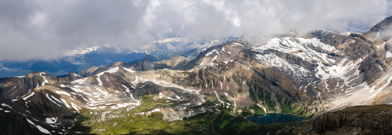
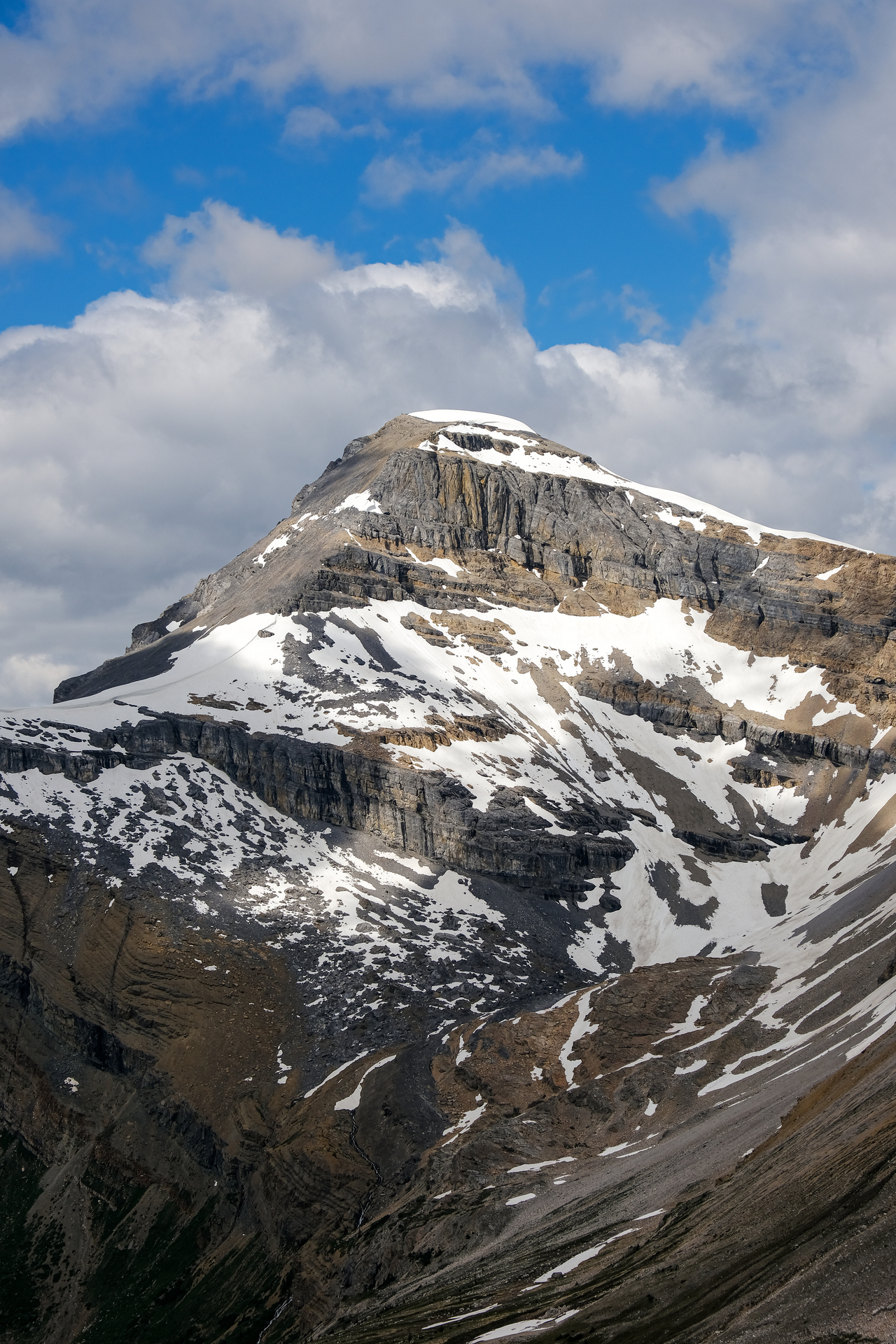
Beautiful lighting on a "three-peaker" that has rocketed up on my to-do list after today!
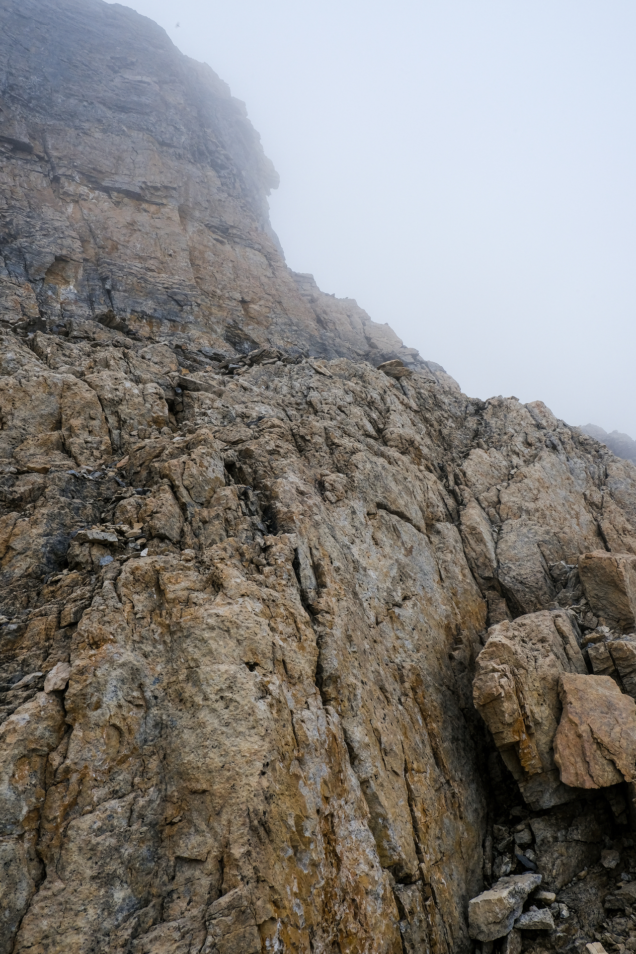
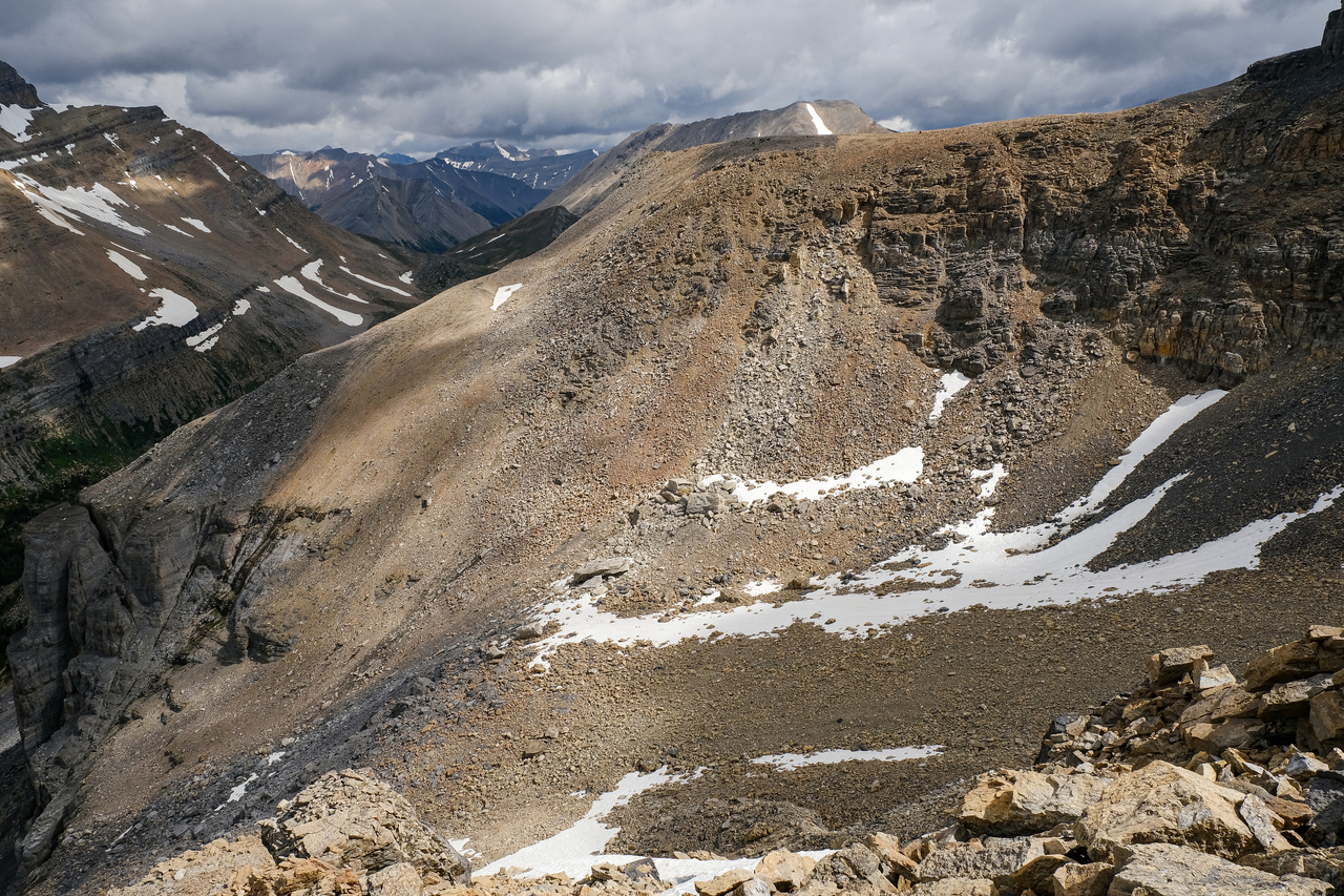
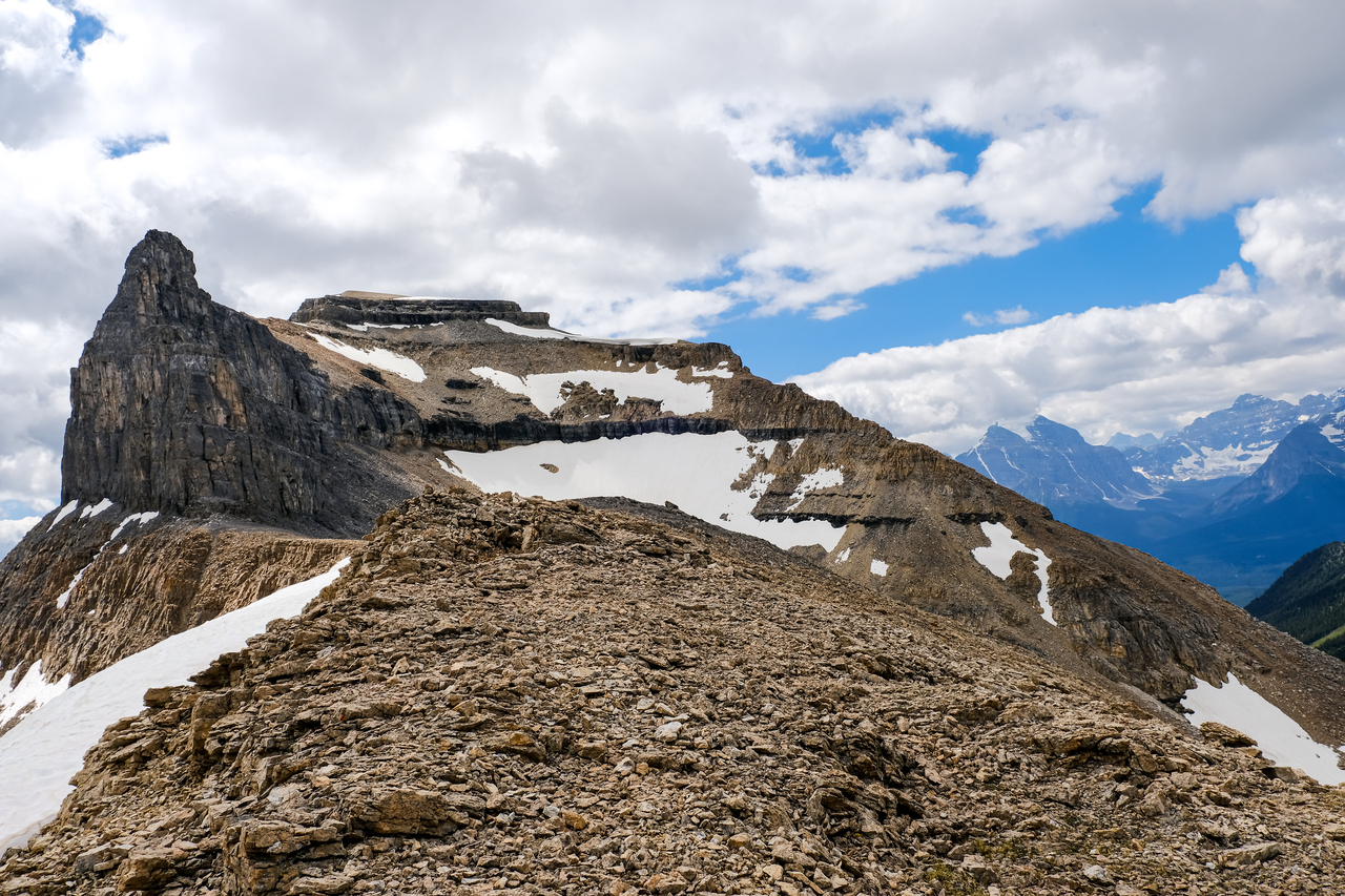
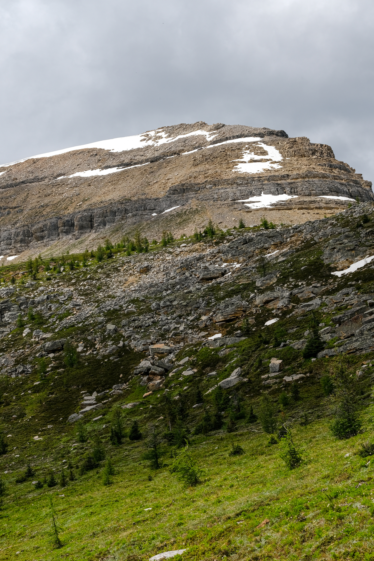
After an absolutely mind-blowing summit stay, it came time to start down Redoubt's northwest ridge, and check out Kane's route. The ridge starts out gentle, but soon cliffs out, at which point a short scree gully can be found, leading down to skier's left.
Looking back up to the cliff band.
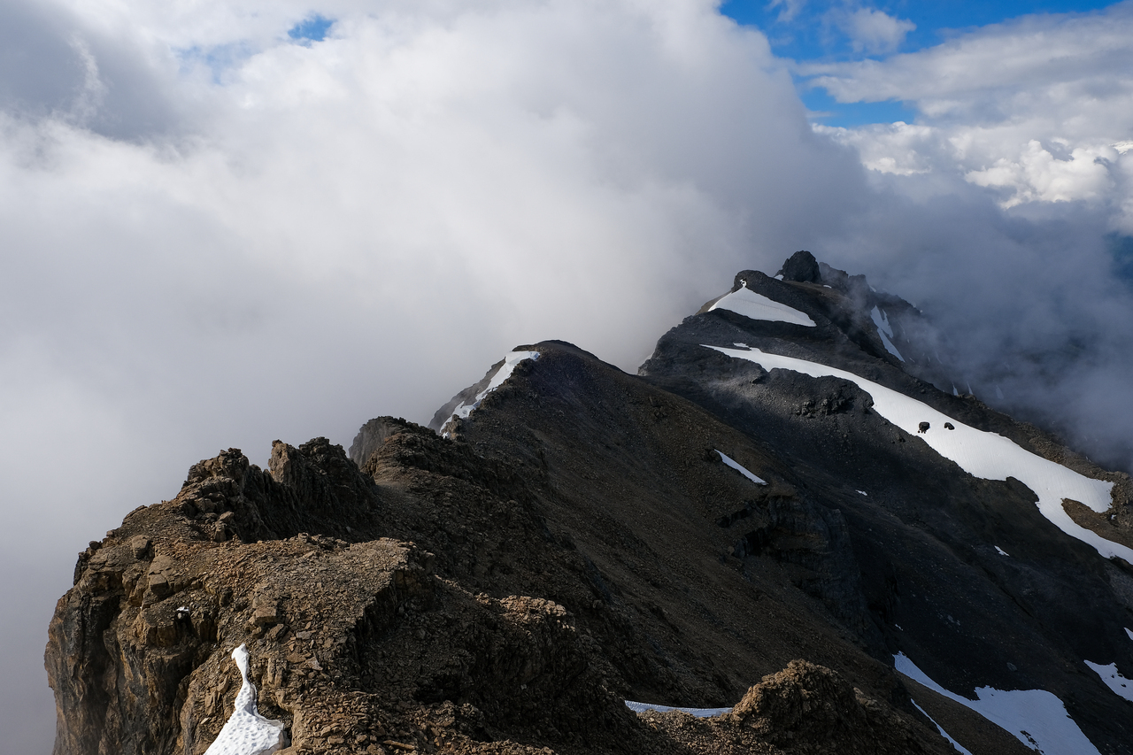
Soon thereafter, the ridge narrows (but never so much to feel exposed), and we enjoyed some hands-on scrambling on solid rock.
My dad follows me down the very enjoyable ridge.
Pausing to admire the view. Photo credit: Dad
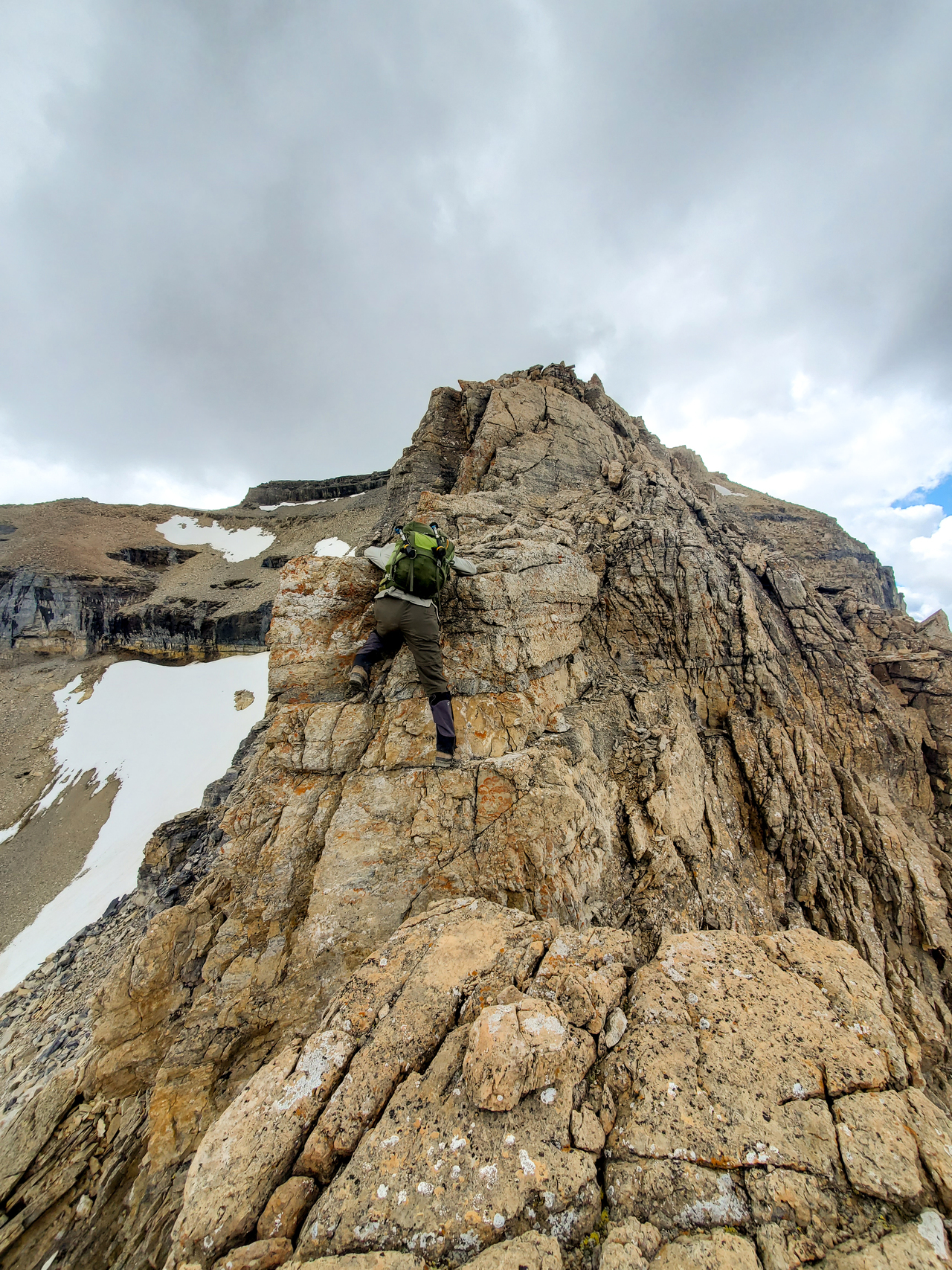
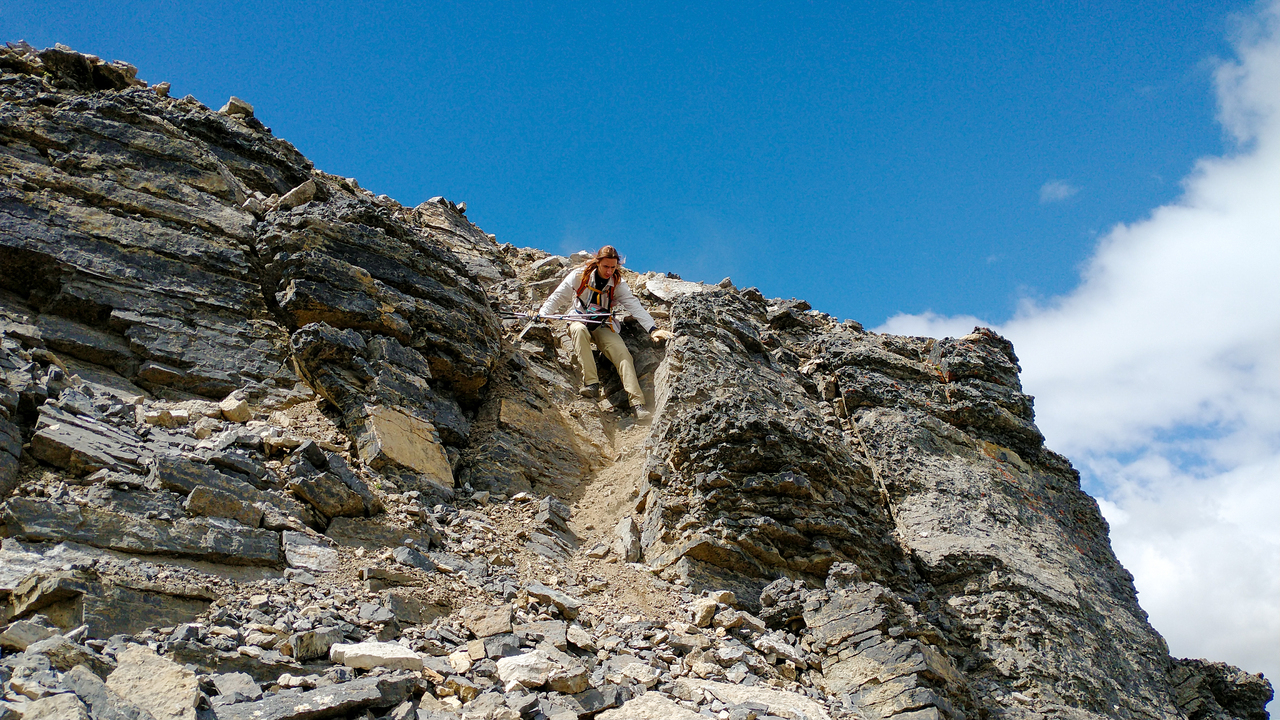
My dad downclimbs a narrower section that I might consider the crux...To be honest, Kane's "moderate/difficult" rating has me a little confused. Definitely moderate, but maybe I was just enjoying myself too much on the solid rock to notice the difficulties ¯\_(ツ)_/¯.
Leaving Redoubt's delightful upper ridge behind.
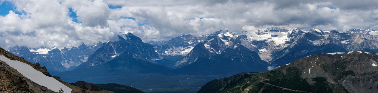
The Louise group is finally revealed! Visible are: seven of the Ten Peaks (Fay, Little, Bowlen, Tonsa, Perren, Allen, Tuzo), Temple, Hungabee, Lefroy (above Aberdeen, Haddo, Sheol, and Fairview), and finally, Mount Victoria!
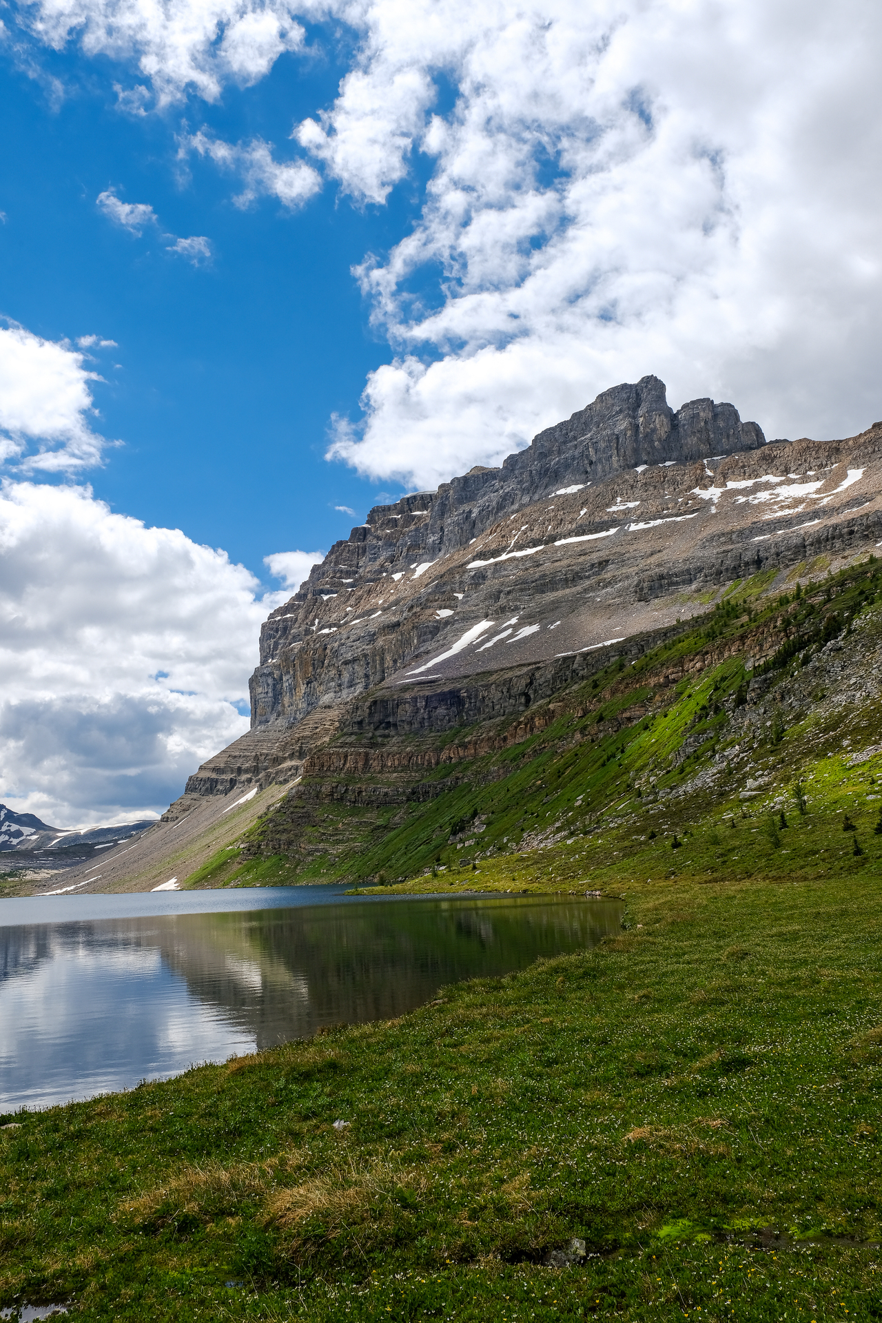
Another look at the now completely cleared off Mount Richardson, towering over the calm waters of Hidden Lake.
The clouds lift from the distant peaks on, and surrounding, the Wapta Icefield, with the most prominent being: Carnarvon, The President, Daly, and Balfour (all center, left to right).
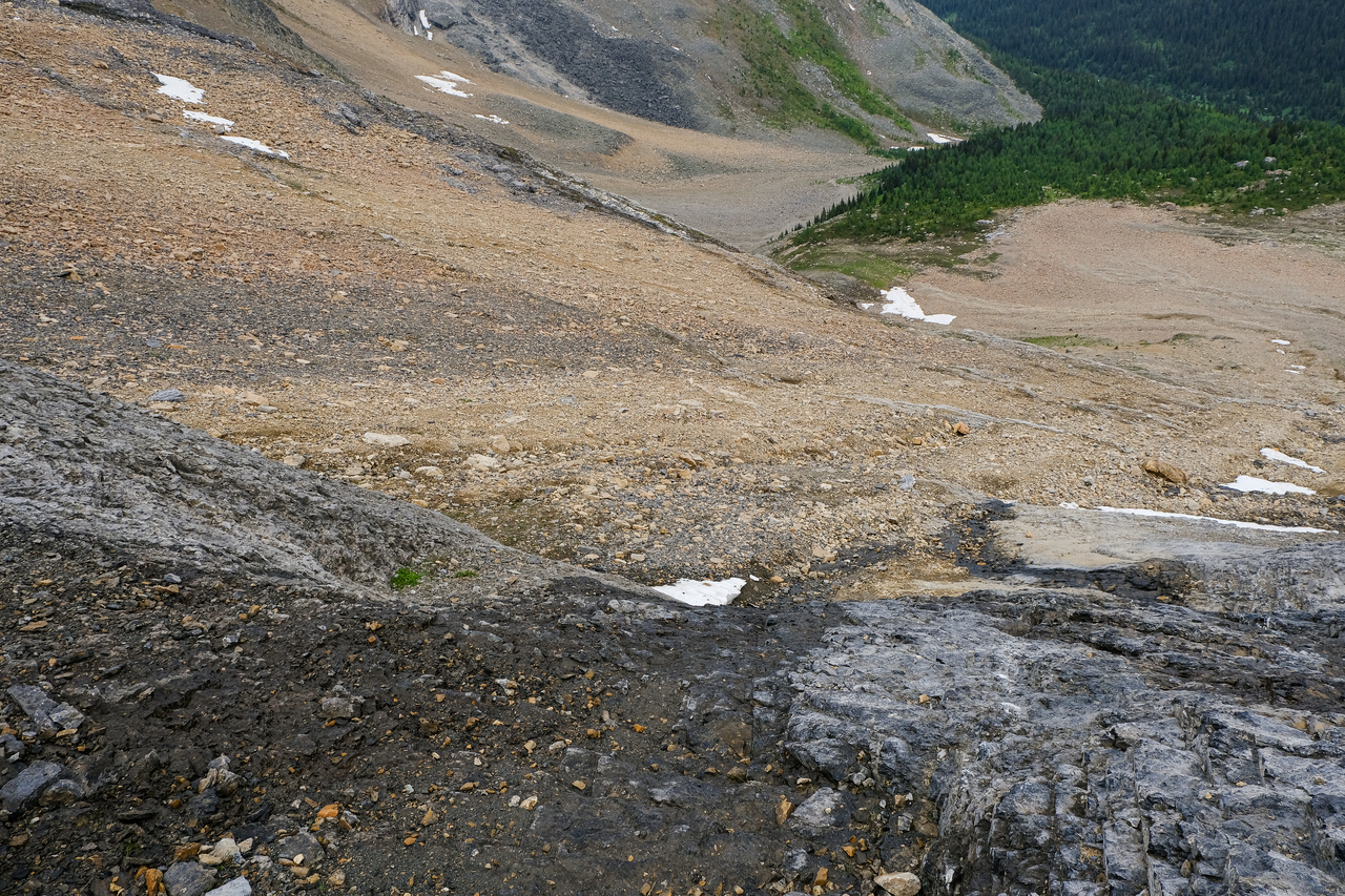
The one downfall of Kane's route...We soon reached the end of the lovely northwest ridge, and had to lose 150m down to a rubbly basin, before regaining all that elevation on the opposite side! Even so, I'd still recommend doing Redoubt as a loop. Why? Because for me, the solid rock scrambling on the upper ridge, combined with the amazing views across to Hidden Lake and its surroundings the whole way down (plus visiting two absolutely beautiful lakes - don't worry we're still getting to that ;)), easily makes up for the extra effort required for this minor inconvenience.
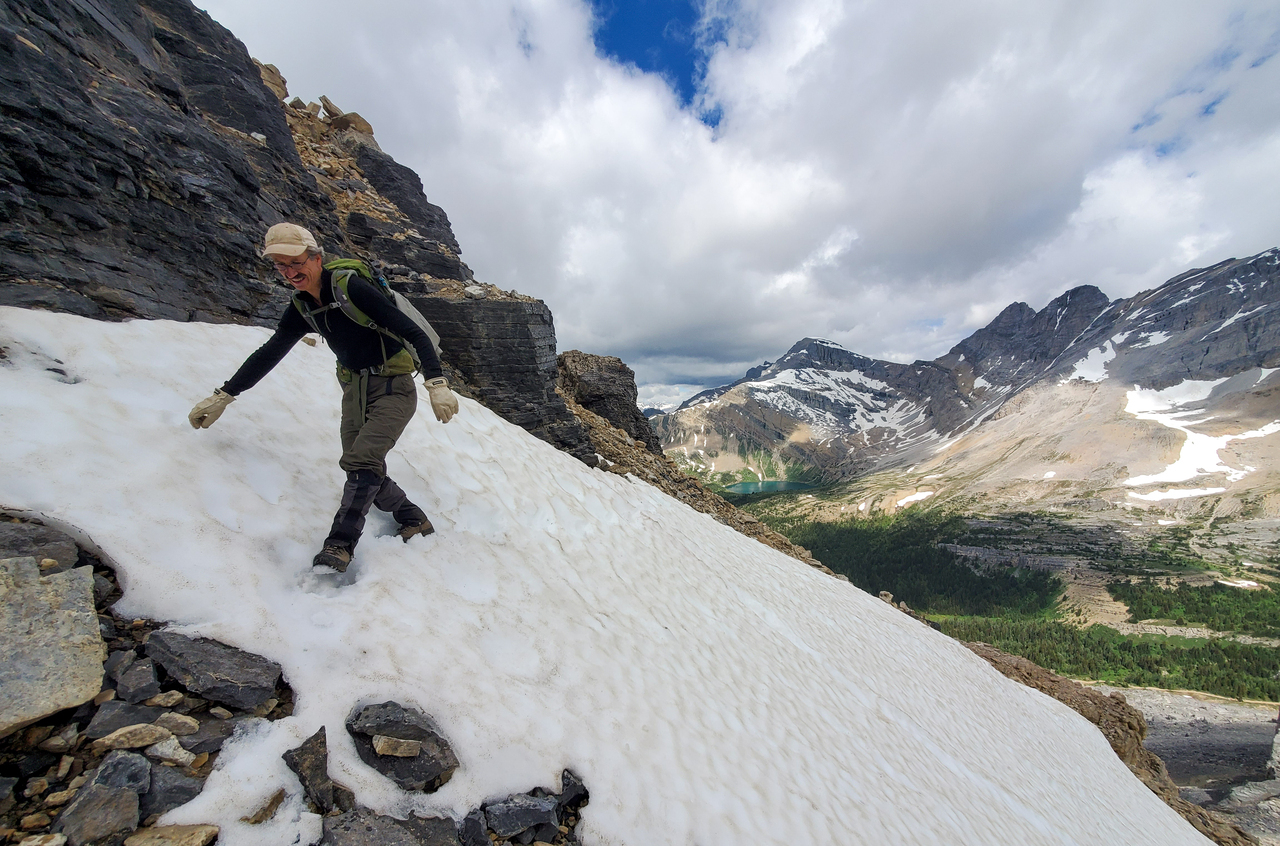
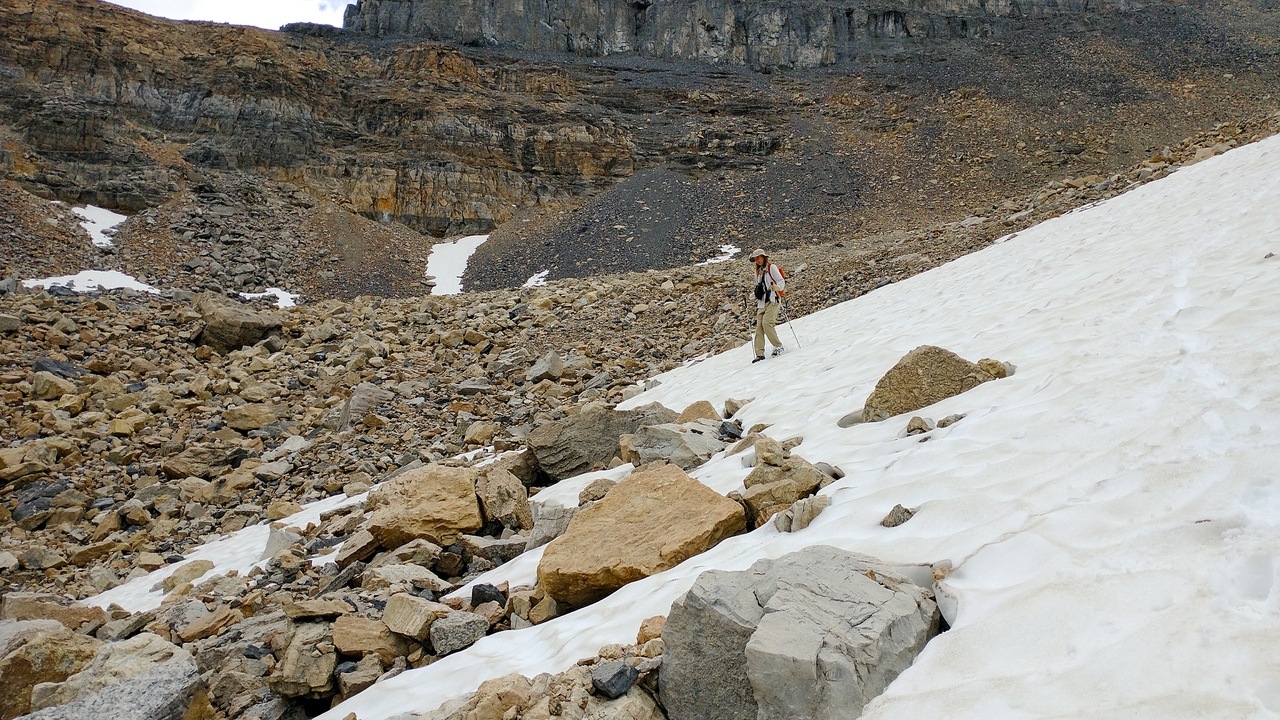
As we started down the loose, rubble slopes down to the basin, we encountered a steep patch of snow that we had to traverse (luckily it was soft, and step-kicking wasn't a problem) to gain access to a gully that would lead all the way down...
...This one!
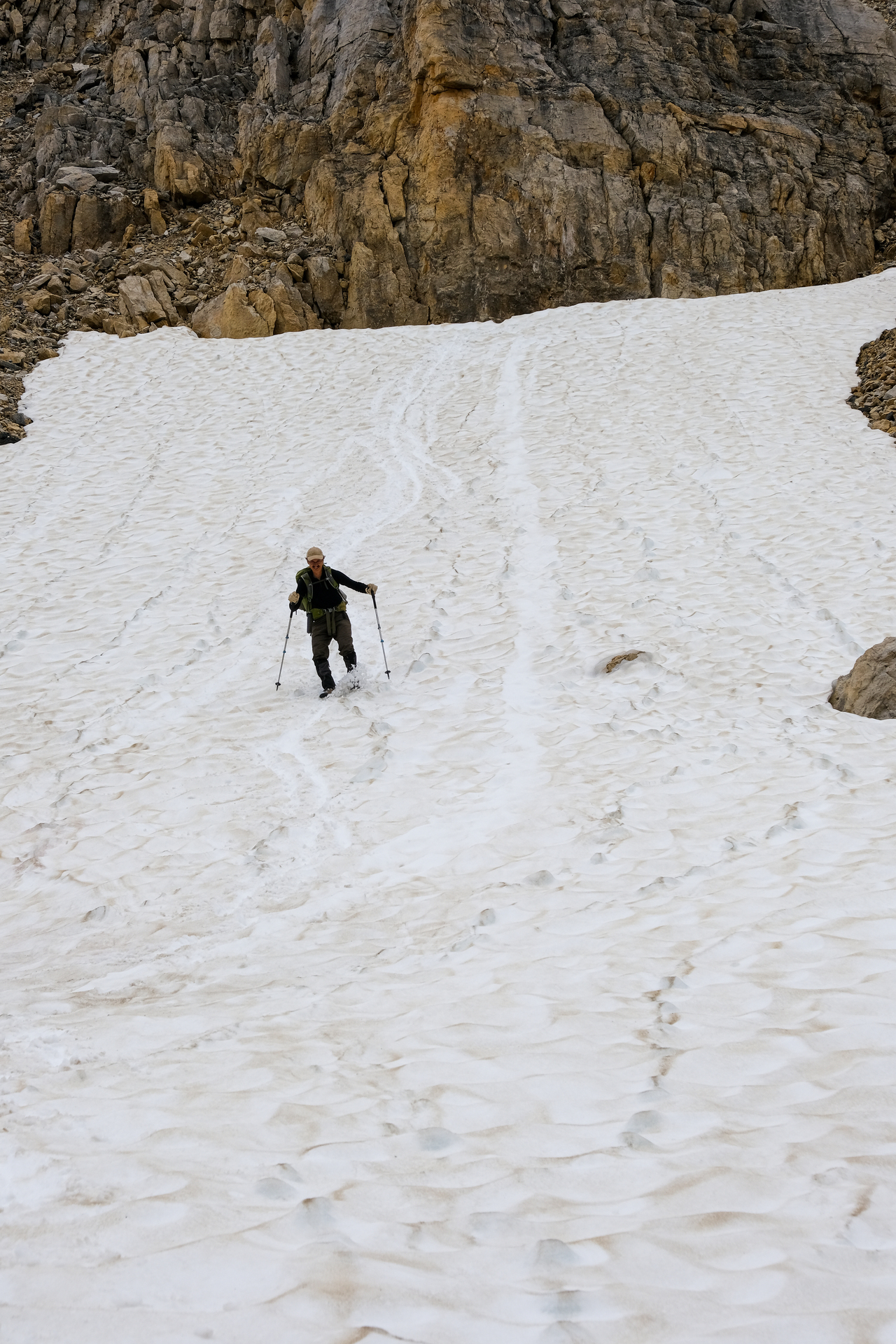
About halfway down the gully, we encountered another patch of snow. Lucky for us, this one was safe enough for a rapid "boot skiing" descent!!
Cruisin' to the base of the basin ;). Photo credit: Dad
A look back up to Redoubt's northwest ridge, along with the approximate route we took down to the basin.
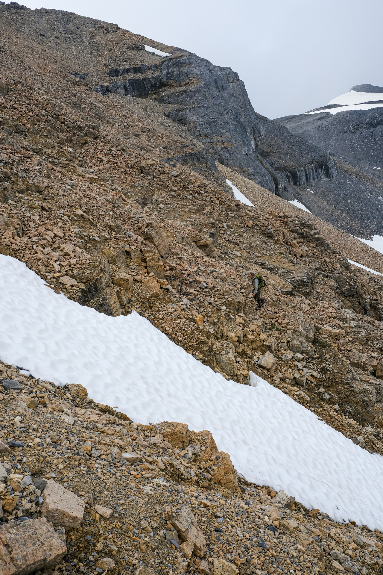
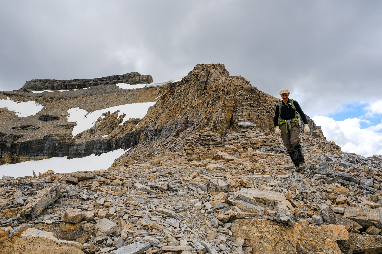
Back up we go!
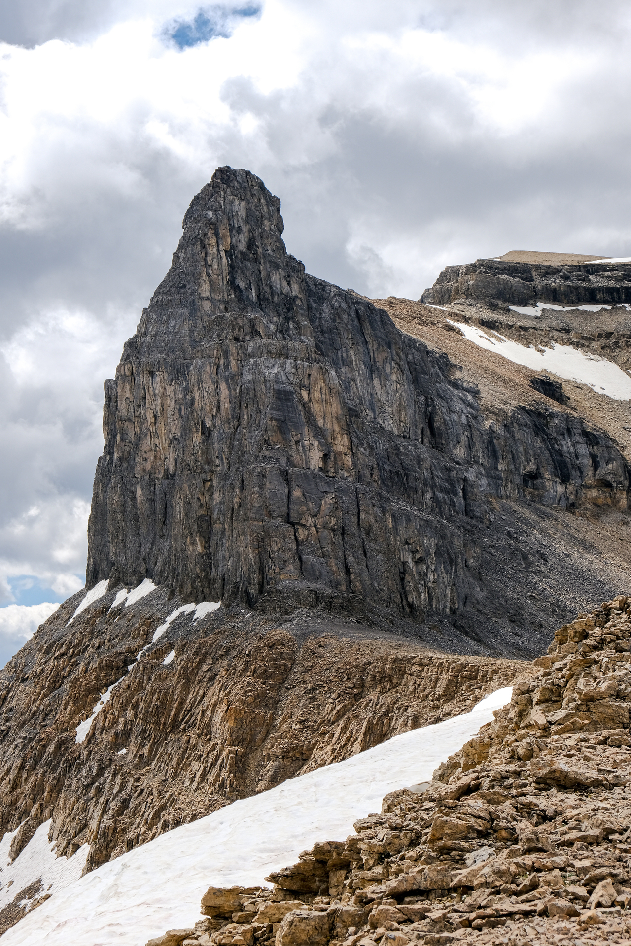
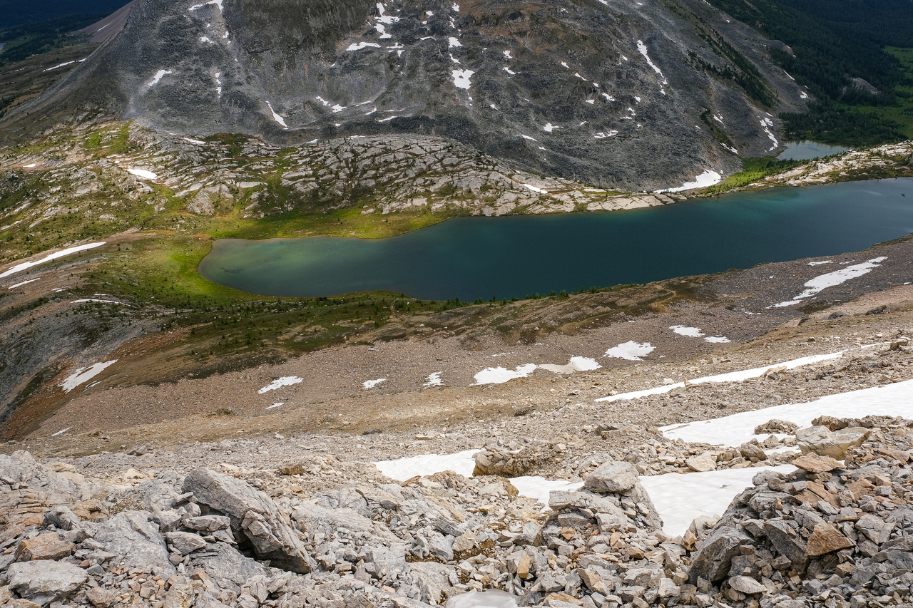
The rubble up the eastern side of the basin was relatively stable, and we were soon up on the ridge, gazing up at this impressive, spire-like rock formation up Redoubt's north ridge!
Richardson basks in the warm, afternoon sun.
The unmistakable Mount Douglas and St. Bride rise in the distance, beyond Baker Lake.
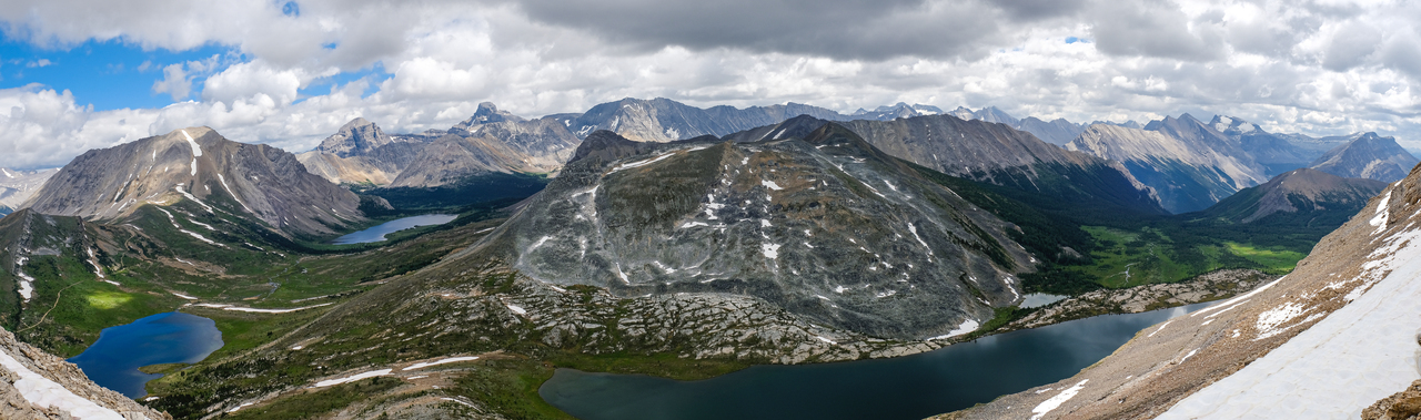
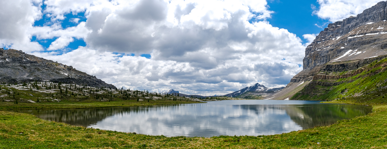
Three beautiful lakes in one picture! Ptarmigan, Baker, and Redoubt, from left to right.
Last view back to Redoubt, before descending the eastern slopes, to the shores of Redoubt Lake.
Up 'n down 'n up 'n down.
We initially stuck to skier's left, finding better footing on ridge-like terrain near the edge. Eventually this cliffed out however, so we continued down just right of the edge.
While it simply looked like a big, scree slope from above, there turned out to be a few minor rock steps to navigate, which actually helped to break up the downward plod. Photo credit: Dad
BIG step!
Looking back up to the various rock steps, now on to just scree that will easily lead down to the lake.
I can't wait to explore Skoki more! This is such a beautiful place! (Note my dad, descending bottom-right)
We soon reached the buggy shores of Redoubt Lake, looking back up to Redoubt's sheer, east face, which we stared down from just hours ago!
If it weren't for the swarms of bugs, we would have spent more time at this peaceful lake. It felt more secluded than some of the other lakes in Skoki, and we were the only ones around. (We would only start seeing people when we reached Ptarmigan Lake.)
Looking up the final descent slope, that required a couple moderate steps to get through the obvious rock bands.
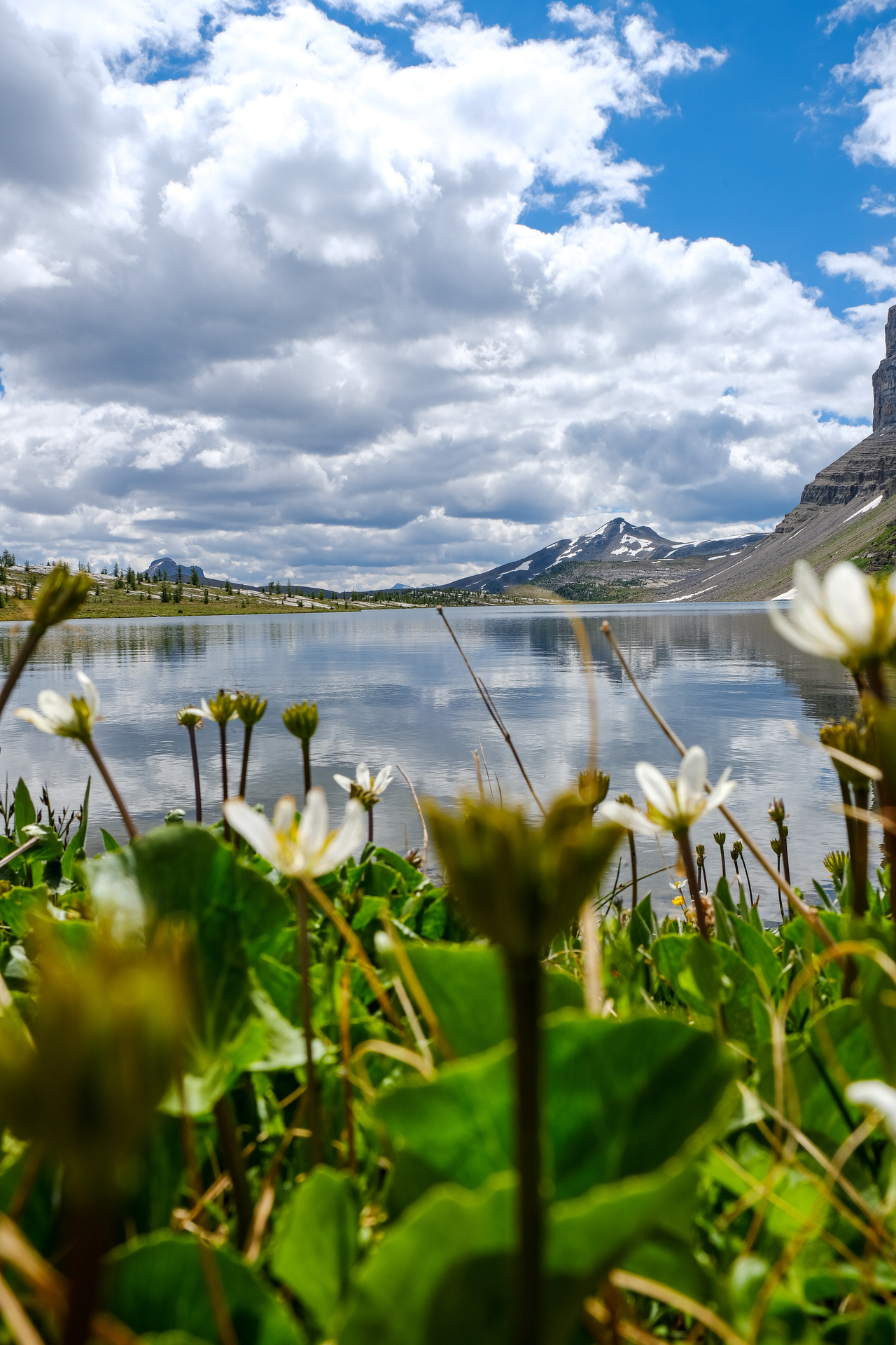
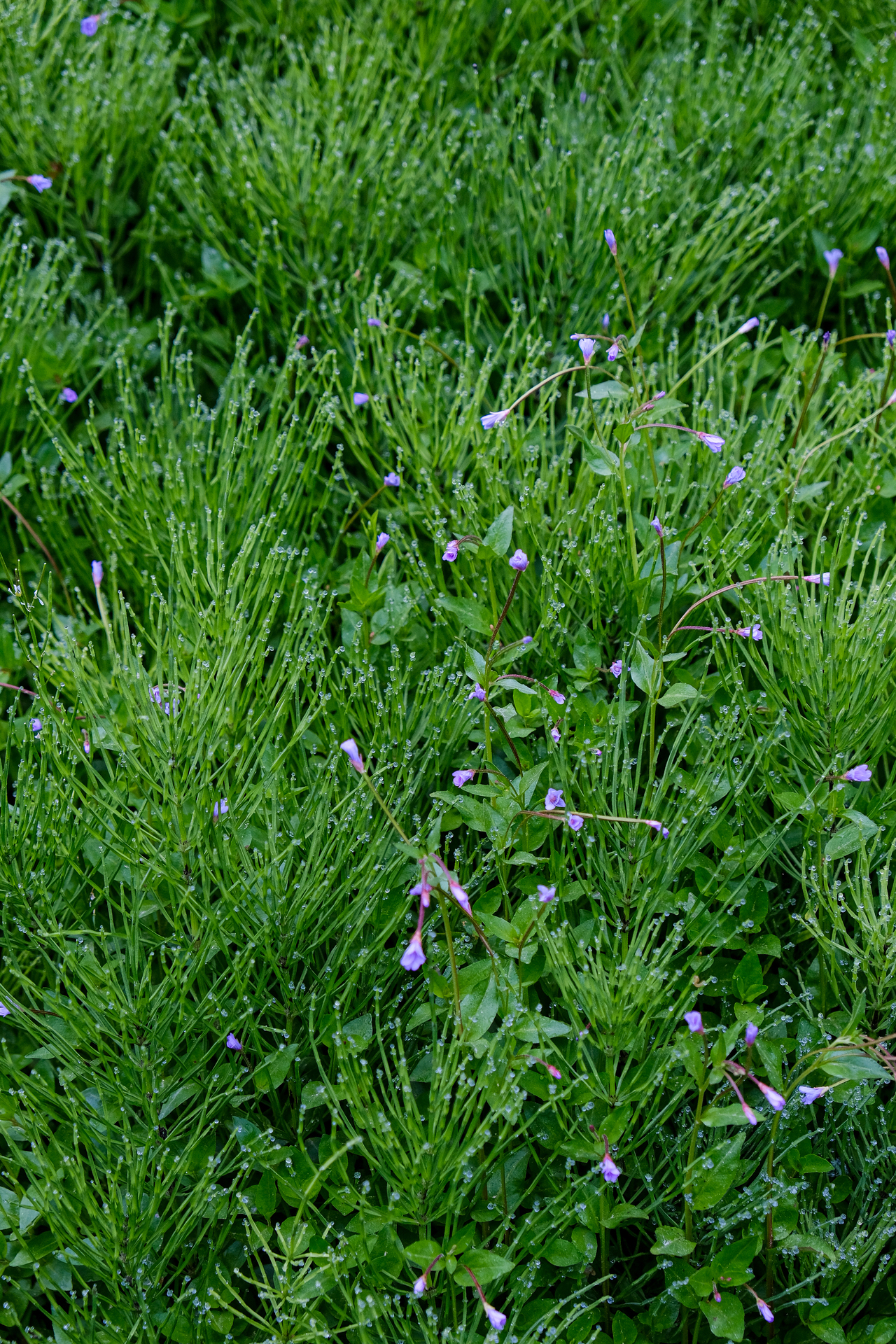
Lakeside flowers :). Unity Peak rises past the distant end of the lake.
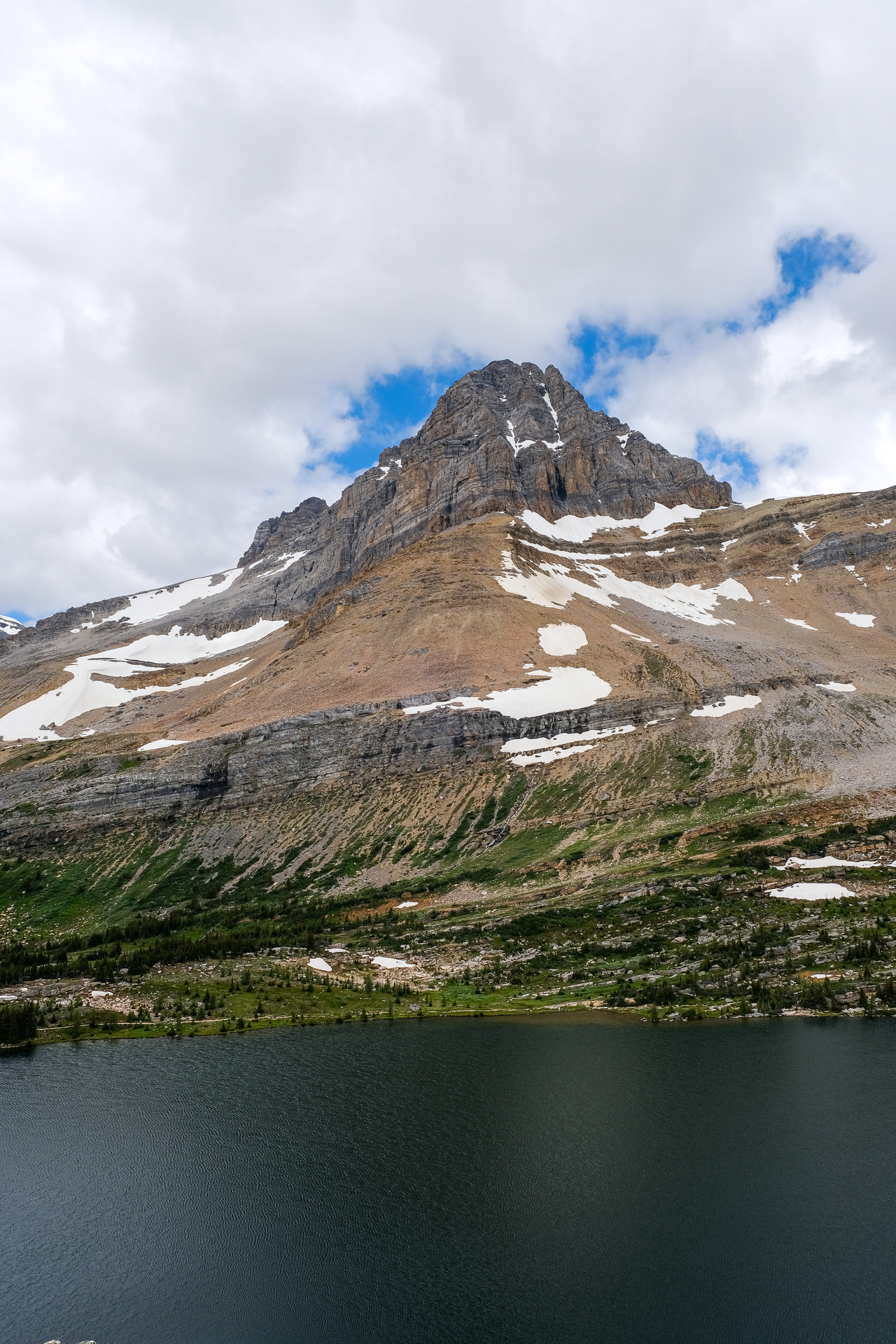
It's not often that you have two lakes of such significance so close together! Just 500m from the shores of Redoubt Lake, lies the equally beautiful Ptarmigan Lake! Ptarmigan Peak rises above, reminding me of the straight-on highway angle of Mount Chephren's northeast face.

Fossil Mountain rises at the base of Ptarmigan Lake, as we make our way along the south shores, to join with the popular backcountry trail back to Halfway Hut.
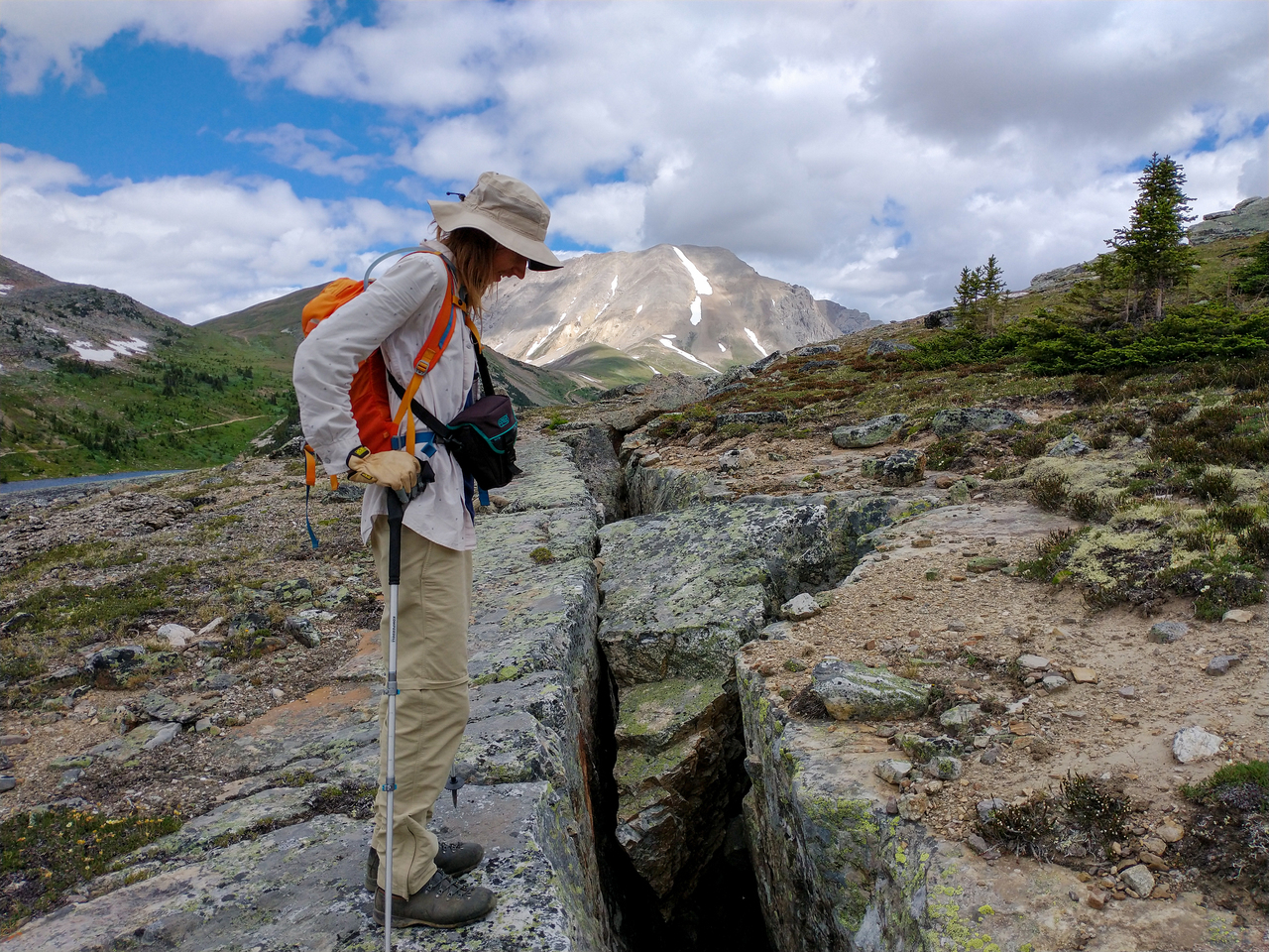
Woah! That's a big crack! Photo credit: Dad
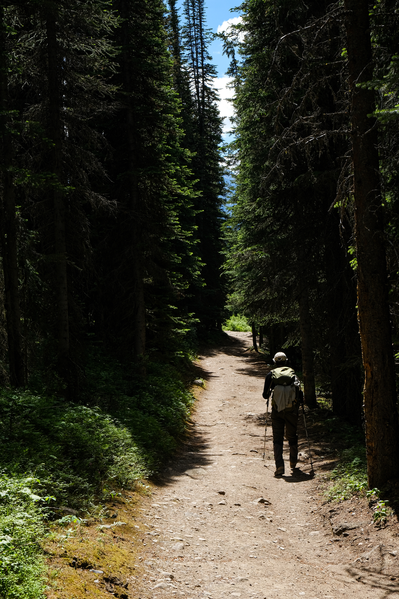
Beautiful way to end a beautiful day! Warm sunlight breaks through the forest, lighting up the trail back towards the ski resort...But wait! We're not done yet...We've still got a ski to rescue!
Disclaimer