Date: August 2, 2022
Location/Route Map: Kananaskis Valley
Elevation: 2423 m
Elevation Gain: 750 m (1440 m including Mount Hood)
Distance: 10.7 km (including Mount Hood)
Rating: Class 2 - Easy
Notes: Almost entirely an on-trail hike with a very minor "scramble-ish" step to reach the true, north summit.
GPS Track: Download
For the second day of my three-day birthday trip, I chose a scramble I've been wanting to do for quite some time now, and was just waiting for the perfect day to do it...And that scramble was the mighty King Creek Ridge! Haha, I'm just kidding 😂. Mount Hood was the mountain I had my eyes on - one of few peaks from the impressively jagged Opal Range that actually sports a scramble route to its summit! But you know what's better than reaching one summit? Reaching two(!), and with King Creek Ridge (KCR) being right "on the way", it made for the perfect addition for a two peak day!

The trailhead for KCR begins almost directly across Highway 40 from the Kananaskis Lakes turn-off. There's a short road leading down to a parking lot, but depending on the time of year there might be a gate blocking it off. If this is the case you can just pull off on the side of the highway.
After immediately crossing over King Creek, the trail leaves the highway and quickly gains elevation up to KCR's southern end. There were lots of crisscrossing and interweaving trails, all of which should eventually lead to the same place. Thanks to the steepness of the trail, it wasn't long before we were already enjoying beautiful morning views across to Mount Lawson to the north and the Kananaskis Lakes to the south.


We quickly gained elevation up the trail, weaving our way through the pretty wildflower-covered slopes, and soon reached the ridge, at which point the slope eased off significantly and we started the traverse to the summit, still a couple kilometers away.


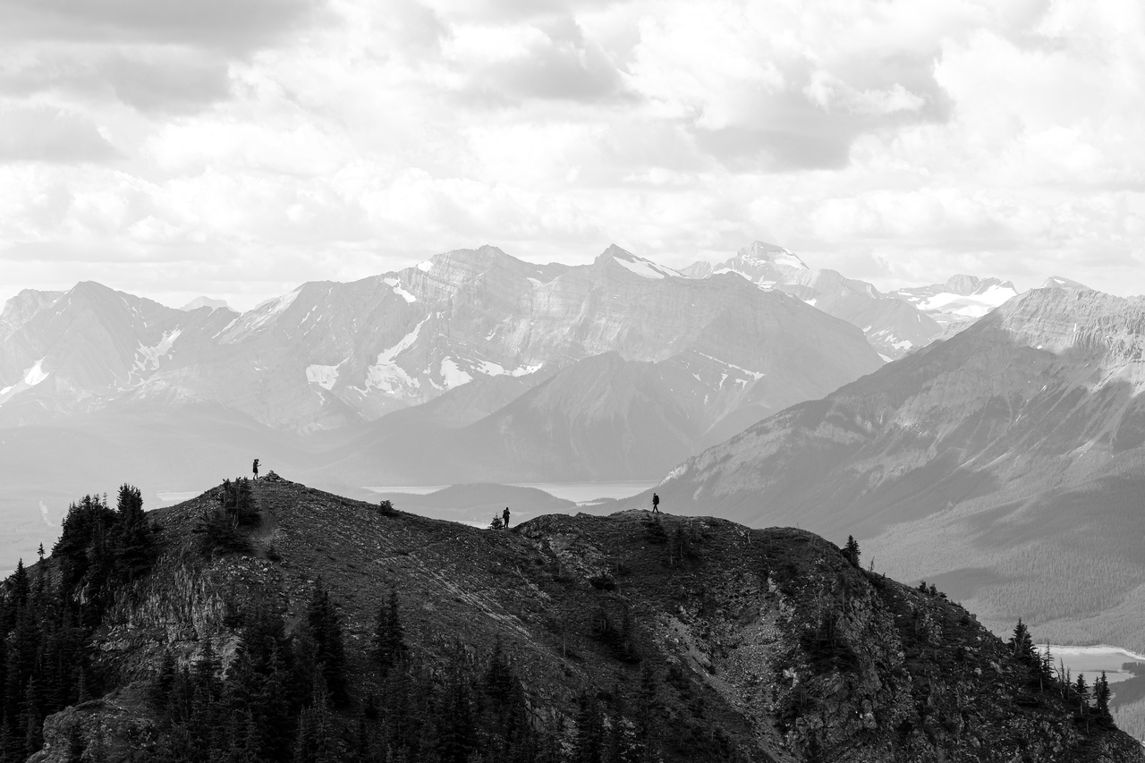
Having already done most of the work - gaining the majority of the elevation in the first 1.5 km - we took our time easily strolling up the ridge, soaking in the absolutely stunning views around us. The view back to Mount Wintour was absolutely incredible throughout the traverse, but equally impressive was the scene across the vibrant, hidden valley to the east with the jagged Opal Range rearing up on the opposite side!
Before long we arrived at the false summit where we took some more time to admire that beautiful K-Country scenery before continuing along the final short traverse to the ever-so-slightly higher true summit.


As one would expect, views from the true summit were nearly identical to those from the false summit, and after signing the register we promptly started back down the ridge in search of a route down to the saddle to climb peak #2!
Photo Gallery


Disclaimer